
Map of Tiris Zemmour
Tiris Zemmour is a first-level division of Mauritania. Its largest mapped city is Zouirat, with about 56,345 people in the metropolitan area. The interactive map below is centred on Tiris Zemmour, and the tables list its 4 mapped cities.
- Cities Mapped
- 4
- Largest City
- Zouirat
- Country
- Mauritania
Interactive Map of Tiris Zemmour
About Tiris Zemmour
Tiris Zemmour (Arabic: ولاية تيرس زمور, romanized: Wilāyat Tiris Zemmour) is the northernmost region of Mauritania. Its capital is Zouérat. Other major cities/towns include F'dérik and Bir Moghrein. The region borders Algeria to the north-east, Mali to east, the Mauritanian region of Adrar to the south and Western Sahara to west and north-west.
As of 2013, the population of the region was 53,261, compared to 49,842 in 2011. As of 2008, the activity rate was 50.80 and economic dependency ratio was 0.71. As of 2008, the literacy rate for people aged 15 years and over was 81.00.
Summary adapted from Wikipedia: Tiris Zemmour region (CC BY-SA 4.0).
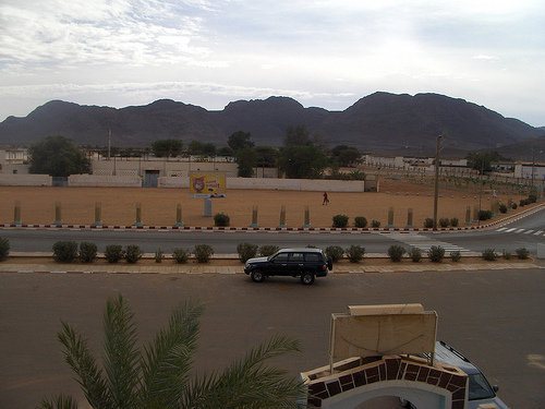
Tiris Zemmour in Depth
Geography
Mauritania is mostly covered with desert, with only its western regions around the coast of Atlantic Ocean having some vegetation. There are some oasis in the desert regions. Since it is a desert, there are large shifting dunes forming temporary ranges. The average elevation is around 460 m (1,510 ft) above the mean sea level. The rainfall in the northern regions closer to the Tropic of Cancer is around 100 mm (3.9 in) annually, compared to the southern portions that receives around 660 mm (26 in). The average temperature is 37.8 °C (100.0 °F), while during the night it reaches 0 °C (32 °F).
Due to the geography, the inhabitants historically, have been nomadic. In modern times, people have migrated to urban centres during the drought in the 1970s and the early 1980s.
Economy
As of 2008, the activity rate was 50.80 and economic dependency ratio was 0.71. The fraction of people working in government was 23.10%, individual / household private was 5.80%, other was 33.60%, para-public was 20.20%, and private enterprise was 17.30%. The Grand Total as of 2008 was 943.01. As of 2013, the coverage rate of DPT3 Children From 0 to 11 Months in the region was 74.80%, BGC vaccination was 78.20% and polio vaccination coverage was 74.50%. As of 2007, the number of tourist establishments in the region was 4. As of 2008, the literacy rate for people aged 15 years and over was 81.00%. The net enrollment ratio of girls for secondary level was 36.90%, net enrollment ratio of boys for secondary level was 23.30%, and total net enrolment ratio at secondary level was 30.20%.
Demographics
As of 2013, the population of the region was 53,261, compared to 49,842 in 2011. 55.61% of the population were females and 44.39% were males.
As of 2008, the percentage of households confirming the existence of public telephone in their neighbourhood or village was 96.75%, the percentage of households benefiting from electricity in their neighbourhood was 4.06%, the percentage of households benefiting from health center or health post in their neighbourhood was 1.72%, and the percentage of households benefiting from sanitary services was 0.51%.
Sections adapted from Wikipedia: Tiris Zemmour region (CC BY-SA 4.0).
Tiris Zemmour: Key Facts
| Population | 79,129 (2023) |
|---|---|
| Area | 252,900 km² |
| Capital | Zouérat |
Facts from Wikidata Q859567 (CC0).
History of Tiris Zemmour: Empires and States
The atlas records 6 polities whose mapped territory included part of Tiris Zemmour, from Almoravid Dynasty in 1056 CE to 2024 CE. They are listed in the order they first appear.
| Polity | Period here |
|---|---|
| Almoravid Dynasty | 1056–1138 CE |
| French Third Republic | 1905–1939 CE |
| French Africa | 1905–1957 CE |
| The French Colonial Empire | 1905–1957 CE |
| French Fourth Republic | 1945–1957 CE |
| Mauritania | 1961–2024 CE |
Historical Maps of Tiris Zemmour
Tiris Zemmour on the world map in each year one of these states held it:
Derived by testing mapped cities against dated territorial polygons. Dates are when the polygons cover this place, not the polity's whole lifespan, and polities absent from the source dataset are not listed.
Largest Cities in Tiris Zemmour
4 cities mapped. Ranked by metropolitan population. A port city's harbour is written up on the page of its sea.
| # | Name | Population | Region | Role |
|---|---|---|---|---|
| 1 | Zouirat | 56,345 | Tiris Zemmour | Populated place |
| 2 | Fderik | 5,760 | Tiris Zemmour | Admin-1 capital |
| 3 | Chegga | 10 | Tiris Zemmour | Populated place |
| 4 | Bir Mogrein | 10 | Tiris Zemmour | Populated place |
Tiris Zemmour: Quick Answers
- Where is Tiris Zemmour?
- Tiris Zemmour is a first-level division of Mauritania, in Africa. Its mapped cities centre on 24.0058° N, 10.6397° W.
- What is the largest city in Tiris Zemmour?
- Zouirat is the largest city mapped in Tiris Zemmour, with a metropolitan population of about 56,345.
- How many cities are in Tiris Zemmour?
- YearMaps maps 4 cities and towns in Tiris Zemmour, with a combined metropolitan population of about 62,125. This counts mapped settlements, not every municipality.