Skip to content
YearMaps
MARITIME SEA-LANE15,000 km Total NetworkActive: 2000 BCE – 1700 CE

Maritime Spice & Incense Routes

The oceanic trade network across the Indian Ocean and Arabian Sea propelled by monsoon winds, linking Southeast Asia’s Spice Islands with Rome, Cairo, and Venice.

4.0
Type: maritime-sea-laneMap centre: [75.7804°, 11.2588°]Line: YearMaps schematic line drawn between the documented stations.

Places Along the Maritime Spice & Incense Routes

Commercial Genesis & Spatial Network

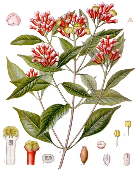
Long before European caravels rounded the Cape of Good Hope, Arab, Indian, Persian, and Austronesian mariners navigated the Indian Ocean using lateen-rigged dhows and the predictable seasonal monsoon winds (Hippalus winds). Ships sailed eastward in summer on the southwest monsoon and returned westward in winter on the northeast monsoon. Cloves and nutmeg from the remote Maluku (Spice) Islands commanded prices exceeding gold by weight in imperial Rome and Renaissance Europe.

Economic Impact & Cultural Diffusion

Generated immense tax wealth for coastal kingdoms (Srivijaya, Malacca Sultanate, Venetian Republic) and fueled the European Age of Discovery as navigators sought direct sea access.

Caravanserais and Halting Places on This Route

12 caravanserais recorded within 40 km of the mapped line. A caravanserai is a roadside inn; a halting place is a named camping ground with no permanent building. How caravans travelled and how a caravanserai worked.

Wikala and Sabil-Kuttab of Sultan Qaytbay, Egypt

Wikala and Sabil-Kuttab of Sultan Qaytbay

Caravanserai · Egypt · 30.0452° N, 31.2624° E

The Wikala and Sabil-Kuttab of Sultan Qaytbay is a complex of monuments built by the Mamluk sultan Al-Ashraf Abu Al-Nasr Qaitbay in 1477 CE (882 AH) in Islamic Cairo, the historic medieval district of Cairo, Egypt. The complex consists of an urban caravanserai (wikala, also spelled wakala), a water dispensary (sabil), a water trough (hod), and a school (kuttab). It is located just south of Al-Azhar Mosque.

Text from Wikipedia (CC BY-SA 4.0). Photo via Wikimedia Commons

Wikala of al-Ghuri, Egypt

Wikala of al-Ghuri

Caravanserai · Egypt · 30.0457° N, 31.2609° E

The Wikala of Sultan Qansuh al-Ghuri (or Wikalat al-Ghuri, among other variations) is a caravanserai in medieval Cairo, Egypt. It was built in 1504–1505 and is considered today one of the most impressive and best-preserved examples of this type of building in Cairo.

Text from Wikipedia (CC BY-SA 4.0). Photo via Wikimedia Commons

Wikala of Bazar'a, Egypt

Wikala of Bazar'a

Caravanserai · Egypt · 30.0506° N, 31.2628° E

The Wikala of Bazar'a (Egyptian Arabic: وكالة بازرعة) or Wikala of Al-Kikhiya (وكالة الكيخيا) is located on El-Tambakshia Street in El-Gamaleya area, in the Al-Azhar neighborhood in Cairo. It is one of the most famous archaeological wikalat built in Egypt during the period of Ottoman rule in the 11th century AH (17th century AD). The wikala was previously known as Wikala of Al-Kikhiya, after Hassan Katkhuda, nicknamed “Al-Kikhiya,” and it was intended to sell timber. It remained known by this name until the late 19th century, when it was bought by Muhammad Bazar'a, a merchant of Hadrami origin. Then he called it “Wikala of Bazar'a” and devoted it to selling Nabulsi soap and Yemeni coffee.

Text from Wikipedia (CC BY-SA 4.0). Photo via Wikimedia Commons

Wikala of Qawsun, Egypt

Wikala of Qawsun

Caravanserai · Egypt · 30.0531° N, 31.2640° E

The Wikala of Qawsun (Egyptian Arabic: وكالة قوصون) or Khan of the prince (Egyptian Arabic: خان الأمير, romanized: Khan al-Amir). It was established by the Bahri Mamluk Emir (prince) Qawsun as-Saqi al-Nasiri, in the year 742 AH/1341 AD. It is located on Bab al-Nasr Street behind the Al-Hakim Mosque in the central Cairo neighborhood. This wikala has disappeared and nothing remains of its archaeological building except its main entrance, which preserves the founding text that includes the name of Prince Qawsun and his rank (رنك) which is the symbol of as-Saqi (cupbearer), and its symbol is the cup.

Text from Wikipedia (CC BY-SA 4.0). Photo via Wikimedia Commons

All Recorded Stopping Places

NameTypeCountryCoordinates
Wikala and Sabil-Kuttab of Sultan QaytbayCaravanseraiEgypt30.0452° N, 31.2624° E
Wikala of al-GhuriCaravanseraiEgypt30.0457° N, 31.2609° E
Wikala of Bazar'aCaravanseraiEgypt30.0506° N, 31.2628° E
Wikala of QawsunCaravanseraiEgypt30.0531° N, 31.2640° E
Khan al-ZarakishaCaravanseraiEgypt30.0461° N, 31.2616° E
Wikala and sabil al-HaramaynCaravanseraiEgypt30.0486° N, 31.2623° E
Wikala and Sabil of Abbas AghaCaravanseraiEgypt30.0511° N, 31.2627° E
Wikala and sabil-kuttab of Jamal al-Din al-DhahabiCaravanseraiEgypt30.0484° N, 31.2601° E
Wikala of Badawiyya ShahinCaravanseraiEgypt30.0483° N, 31.2610° E
Wikala of Nafisa al-BaydaCaravanseraiEgypt30.0433° N, 31.2581° E
Wikala of Taghri BardiCaravanseraiEgypt30.0486° N, 31.2602° E
Wikalat al-GhuriCaravanseraiEgypt30.0479° N, 31.2622° E

Sources: Wikidata (caravanserais, CC0) and the OWTRAD project (halting places). All caravanserais and halting places

Logistics, Caravanserais & Overland Hazards

  • ▲Strict adherence to seasonal monsoon wind shifts; missing a wind window stranded ships for 6 months
  • ▲Piracy choke points in the Strait of Malacca, Bab-el-Mandeb, and Strait of Hormuz
  • ▲Perishable spice spoilage from tropical moisture and wooden hull rot
  • ▲Monopoly secrecy guarded by Arab and Venetians concerning the precise geographic origins of spices