Lake Eyre North
Alkaline Lake · 8,144 km²
Lake Eyre North is a alkaline lake in Australia, with a mapped surface area of about 8,144 km². Largest lake in Australia.
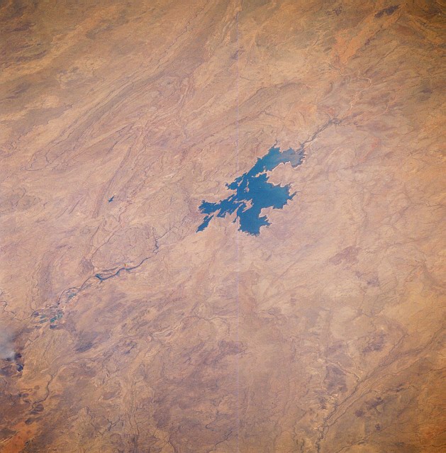
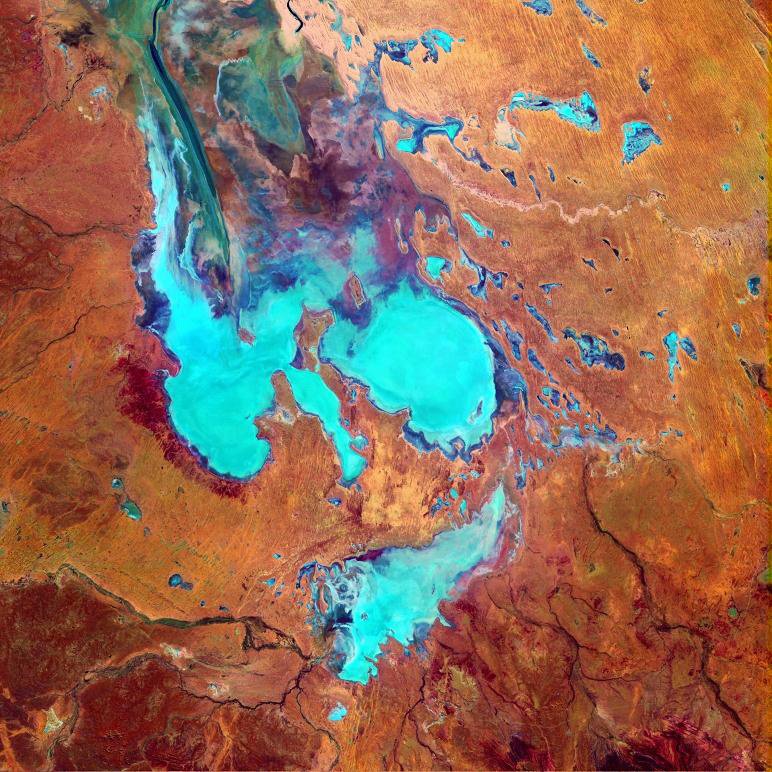
Lake Eyre ( AIR), officially known as Kati Thanda–Lake Eyre, is an endorheic lake in the east-central part of the Far North region of South Australia, some 700 km (430 mi) north of Adelaide. It is the largest ephemeral endorheic lake on the Australian continent, covering over 9,000 km2 (3,500 sq mi). The shallow lake is the depocentre of the vast endorheic Lake Eyre basin, and contains the lowest natural point in Australia, at approximately 15 m (49 ft) below sea level. The lake is most often empty, filling mostly when flooding occurs upstream in Channel Country, but almost always partially. On the rare occasions that it fills completely (only three times between 1860 and 2025), it is the largest lake in Australia, covering an area of up to 9,500 km2 (3,668 sq mi). When the lake is full, it has the same salinity as seawater, but becomes hypersaline as the lake dries up and the water evaporates. To the north of the lake is the Simpson Desert.
The lake was named in honour of Edward John Eyre, the first European to see it in 1840. It was officially renamed in December 2012 to include its Aboriginal name in the Arabana language, Kati Thanda, in accordance with a policy of dual naming.
Adapted from Wikipedia: Kati Thanda–Lake Eyre (CC BY-SA 4.0).
- Surface area
- 8,144 km²
- Area rank
- #24 of 756 indexed
- Type
- Alkaline Lake
- Country
- Australia
- Coordinates
- -28.3880°, 137.2937°
Among the 756 water bodies with a mapped extent in YearMaps, Lake Eyre North ranks #24 by surface area, after Lago de Nicaragua (8,172 km²) and ahead of Lago Titicaca (8,135 km²). Areas are computed from the mapped outline and are approximate.
- Settlements on the shore:
- Whyalla (516 km), Alice Springs (623 km), Adelaide (738 km)
- Other water nearby:
- Lake Torrens (5,158 km²), Lake Everard (1,267 km²)
More about Lake Eyre North
Geography
Kati Thanda–Lake Eyre is in the deserts of central Australia, in northern South Australia. It is located around 700 km (430 mi) north of Adelaide, and 400 km (250 mi) from the nearest point of the South Australian coastline. Marree is located at the northern end of The Outback Highway at the junction of the Oodnadatta and Birdsville Tracks. William Creek, the closest town to the lake, is 200 km (120 mi) away along the unsealed Oodnadatta Track, and still over 60 km (37 mi) from the edge of the lake. Halligan Bay is one of only a few public lookouts. The lake covers over 9,000 km2 (3,500 sq mi).
History
The lake lies mostly within the traditional lands of the Arabana people, for whom it holds deep spiritual significance in their Dreaming stories. The Dieri people have long ties to the eastern portion of the lake. Kuyani are the Traditional Owners of the Southern end of Lake Eyre and surroundings and also hold significant song and story lines on their Land.
In the 1860s, explorer Peter Egerton-Warburton wrote that the lake was dry, and "terrible in its death-like stillness and the vast expanse of its unbroken sterility". British geologist John Walter Gregory wrote in his 1906 book on central Australia that while the lake was sometimes described as "a fertile land of lakes", others called it a "desert of the worst type".
Sections adapted from Wikipedia: Kati Thanda–Lake Eyre (CC BY-SA 4.0).
Lake Eyre North: Key Facts
| Surface area | 9,300 km² |
|---|---|
| Maximum depth | 6 m |
| Volume | 30.1 km³ |
| Surface elevation | -15 m |
| Inflows | Diamantina River, Warburton River, Cooper Creek, Georgina River, Frome River |
| Drainage system | Lake Eyre basin |
Facts from Wikidata Q179970 (CC0).