Skip to content
YearMaps
Chad · Landforms

Mountain Ranges, Deserts and Landforms of Chad

Africa is the largest of the 9 mountain ranges, deserts and other landforms recorded for Chad, at 29.41M km², ahead of Sahara at 4.73M km². The full list follows.

How this list is built: Ranked by mapped area. Covers mountain ranges, deserts, plateaus, named glaciers, plains, basins, peninsulas and capes. One that crosses a border is listed under every country it lies in, with the area of the whole feature. It covers the mountain ranges, deserts and other landforms indexed in YearMaps, drawn from open geospatial data, and is not an exhaustive national register.

Landforms Listed
9
Top Ranked
29.41M km²
Africa
Second
4.73M km²
Sahara
Profiled Below
4
Photo, encyclopedia text and figures
Mountain Ranges, Deserts and Landforms of Chad
#NameArea
1Africa29.41M km²
2Sahara4.73M km²
3Sahel1.02M km²
4Ténéré348,246 km²
5TIBESTI Mountains123,521 km²
6Chaîne des Mongos88,668 km²
7Bodélé Depression75,419 km²
8Ennedi Plat58,024 km²
9Mbang Mountains95 km²

The Landforms of Chad in Detail

The 4 mountain ranges, deserts and other landforms above that have an encyclopedia article, in the same order, each with its photograph, figures and the places around it.

Sahara
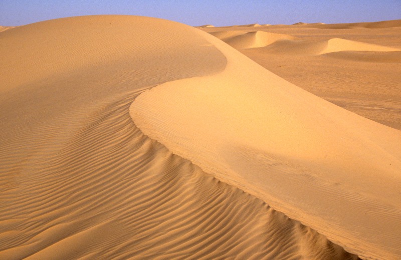
Image via Wikimedia Commons (author and licence on the file page).

Sahara

Desert · 4.73M km²

Sahara is a desert in Africa, covering an estimated 4.73M km². It extends across Sudan, Libya, Egypt, Chad, Mali, Niger, Algeria, Mauritania, Morocco and Tunisia. It is the largest of the 58 deserts with a mapped extent in YearMaps.

The Sahara (, ) is a desert spanning North Africa. With an area of 9,200,000 square kilometres (3,600,000 sq mi), it is the largest hot desert in the world and the third-largest desert overall, smaller only than the deserts of Antarctica and the northern Arctic.

The desert covers much of North Africa, excluding the fertile region on the Mediterranean Sea coast, the Atlas Mountains of the Maghreb, and the Nile Valley in Egypt and the Sudan.

It stretches from the Red Sea in the east and the Mediterranean in the north to the Atlantic Ocean in the west, where the landscape gradually changes from desert to coastal plains. To the south it is bounded by the Sahel, a belt of semi-arid tropical savanna around the Niger River valley and the Sudan region of sub-Saharan Africa. The Sahara can be divided into several regions, including the western Sahara, the central Ahaggar Mountains, the Tibesti Mountains, the Aïr Mountains, the Ténéré desert, and the Libyan Desert.

Adapted from Wikipedia: Sahara (CC BY-SA 4.0).

Feature class
Desert
Mapped extent
4.73M km²
Size rank
#1 of 58 deserts
Region
Africa
Countries
Sudan, Libya, Egypt, Chad, Mali, Niger, Algeria, Mauritania, Morocco, Tunisia
Coordinates
27.0430°, 22.0108°
Summits:
Emi Koussi (3,415 m)
Ranges:
Marrah Mountains (Africa), Ruwenzori Range (Africa)
Settlements:
Abéché (142 km), Ati (226 km), Mongo (300 km)

View on the live map

More about Sahara

Geography

The Sahara covers large parts of Algeria, Chad, Egypt, Libya, Mali, Mauritania, Niger, Western Sahara and Sudan, and parts of southern Morocco and Tunisia. It covers 9 million square kilometres (3,500,000 sq mi), 31% of the African continent. If all areas with a mean annual precipitation of less than 250 mm (9.8 in) were included, the Sahara would be 11 million square kilometres (4,200,000 sq mi). It is one of three distinct physiographic provinces of the African massive physiographic division. The Sahara is so large and bright that, in theory, it could be detected from other stars as a surface feature of Earth, with near-current technology.

Climate

The Sahara is the world's largest hot desert. It is located in the horse latitudes under the subtropical ridge, a significant belt of semi-permanent subtropical warm-core high pressure where the air from the upper troposphere usually descends, warming and drying the lower troposphere and preventing cloud formation.

The permanent absence of clouds allows unhindered light and thermal radiation. The stability of the atmosphere above the desert prevents any convective overturning, thus making rainfall virtually non-existent. As a consequence, the weather tends to be sunny, dry and stable with a minimal chance of rainfall. Subsiding, diverging, dry air masses associated with subtropical high-pressure systems are extremely unfavorable for the development of convectional showers.

History

Scientists have identified more than 230 humid periods in North Africa over the past eight million years, recurring at intervals of approximately 21,000 years.

A modern laboratory examination of the Uan Muhuggiag child mummy and Tin Hanakaten child have suggested that the Central Saharan peoples from the Epipaleolithic, Mesolithic, and Pastoral periods possessed dark skin complexions. The creators of the Round Head rock art possessed dark skin.

A 2025 study sequenced individuals from Takarkori (7,000 YBP) and discovered that most of their ancestry was from an unknown ancestral North African lineage, related to the African admixture component found in Iberomaurusians.

Sections adapted from Wikipedia: Sahara (CC BY-SA 4.0).

Sahara: Key Facts

Key facts about Sahara
Area9,200,000 km²
Highest pointEmi Koussi

Facts from Wikidata Q6583 (CC0).

Sahel
Image via Wikimedia Commons (author and licence on the file page).

Sahel

Plain · 1.02M km²

Sahel is a plain in Africa, covering an estimated 1.02M km². It extends across Mauritania, Sudan, Niger, Chad, Mali, Egypt, Senegal, South Sudan, Nigeria, Eritrea, the Central African Republic, Cameroon, Burkina Faso and Algeria. It is the 17th-largest of the 231 landforms with a mapped extent in YearMaps.

The Sahel region (; from Arabic ساحل sāḥil [ˈsaːħil], "coast, shore"), or Sahelian acacia savanna, is a biogeographical region in Africa. It is the transition zone between the more humid Sudanian savannas to its south and the drier Sahara to the north. The Sahel has a hot semi-arid climate and stretches across the southernmost latitudes of North Africa between the Atlantic Ocean and the Red Sea. Although geographically located in the tropics, the Sahel does not have a tropical climate.

The Sahel has one of the world's fastest-growing populations due to its high human birthrate, with approximately 80 million people in 2018. The western Sahel in particular has experienced frequent food and water shortages due to droughts caused by its semi-arid climate, as well as high levels of government corruption. Since the 2010s, various coups, insurgencies, terrorist incidents, and foreign interventions have taken place across the Sahel and Françafrique, leading to the region being called the Coup Belt. As a result, the Sahel is viewed as both an ecoregion and a geopolitical space shaped by internal instability and external strategic competition.

Adapted from Wikipedia: Sahel (CC BY-SA 4.0).

Feature class
Plain
Mapped extent
1.02M km²
Size rank
#17 of 231 landforms
Region
Africa
Countries
Mauritania, Sudan, Niger, Chad, Mali, Egypt, Senegal, South Sudan, Nigeria, Eritrea, Central African Republic, Cameroon, Burkina Faso, Algeria
Coordinates
15.5072°, 15.0064°
Summits:
Emi Koussi (3,415 m)
Ranges:
Marrah Mountains (Africa), Al Jabal al Akhdar (Africa)
Settlements:
Ati (292 km), Mongo (411 km), Ndjamena (418 km)

View on the live map

More about Sahel

Geography

The Sahel spans 5,900 km (3,670 mi) from the Atlantic Ocean in the west to the Red Sea in the east, in a belt several hundred to a thousand kilometers (c. 600 miles) wide. It covers an area of 3,053,200 square kilometers (1,178,850 sq mi).

Representing a climatic and ecological transition zone with hot semi-desert and steppe conditions, the region borders the more humid Sudanian savannas to its south and the dry Sahara desert to the north. This ecoregion is also called the Sahelian acacia savanna in honour of its most prominent and very drought tolerant genus of tree.

The topography is mainly flat; most of the region lies between 200 and 400 meters (660 and 1,310 ft) in elevation.

History

Around 4000 BC, the climate of the Sahara and the Sahel started to become drier at an exceedingly fast pace. This climate change caused lakes and rivers to shrink significantly and caused increasing desertification. This in turn decreased the amount of land conducive to settlements and caused migrations of farming communities to the more humid climate of West Africa.

The larger Sahelian kingdoms emerged from 750 AD and founded several large cities in the Niger valley region, including Timbuktu, Gao and Djenné.

The kingdom of Alodia was a Christian Nubian Kingdom in the eastern Sahel that reached its zenith from the 9th to 12th century. It was first mentioned in 569, its capital Soba located near modern-day Khartoum.

Sections adapted from Wikipedia: Sahel (CC BY-SA 4.0).

Ténéré
Image via Wikimedia Commons (author and licence on the file page).

Ténéré

Desert · 348,246 km²

Ténéré is a desert in Africa, covering an estimated 348,246 km². It extends across Niger, Algeria and Chad. It is the 6th-largest of the 58 deserts with a mapped extent in YearMaps.

The Ténéré (Tuareg: Tenere, literally: "desert") is a desert region in south central Sahara. It comprises a vast plain of sand stretching from northeastern Niger to western Chad, occupying an area of over 400,000 square kilometres (150,000 sq mi). It is bounded by the Aïr Mountains in the west, the Hoggar Mountains in the north, the Djado Plateau in the northeast, the Tibesti Mountains in the east, and the basin of Lake Chad in the south. The central part of the desert contains the Erg of Bilma, an area of sand dunes. The Neolithic Tenerian culture was centred on the region.

Adapted from Wikipedia: Ténéré (CC BY-SA 4.0).

Feature class
Desert
Mapped extent
348,246 km²
Size rank
#6 of 58 deserts
Region
Africa
Countries
Niger, Algeria, Chad
Coordinates
19.2157°, 13.9936°
Summits:
Emi Koussi (3,415 m)
Ranges:
Marrah Mountains (Africa), Al Jabal al Akhdar (Africa)
Settlements:
Ati (663 km), Ndjamena (739 km), Abéché (754 km)

View on the live map

More about Ténéré

Climate

The Ténéré has a hot desert climate (Köppen climate classification BWh), typical of the large Sahara Desert. The climate is hyper-arid, extremely hot, sunny and dry year-round and there is virtually no plant life. The average high temperatures are above 40 °C (104 °F) for about 5 months and more in the hottest regions, and record high temperatures as high as 50 °C (122 °F) are highly possible during summer. The annual average high temperature is around 35 °C (95 °F). During "winter" months, the average high temperatures stay above 25 °C (77 °F) and generally hover around 30 °C (86 °F).

History

During the Carboniferous period, the region was beneath the sea; later it was a tropical forest. A major dinosaur cemetery lies southeast of Agadez at Gadoufaoua; many fossils have been found there, having eroded out from the ground. An almost complete specimen of the crocodile-like reptile Sarcosuchus imperator, nicknamed the SuperCroc, was discovered there by paleontologists.

During early human history, this was a fertile land much more congenial to human life than it is now. The region was inhabited by modern humans as long ago as the Paleolithic period some 60,000 years ago. They hunted wild animals and left evidence of their presence in the form of stone tools including tiny, finely carved arrow heads.

Sections adapted from Wikipedia: Ténéré (CC BY-SA 4.0).

Ténéré: Key Facts

Key facts about Ténéré
Area400,000 km²

Facts from Wikidata Q272521 (CC0).

Bodélé Depression
Image via Wikimedia Commons (author and licence on the file page).

Bodélé Depression

Depression · 75,419 km²

Bodélé Depression is a depression in Africa, covering an estimated 75,419 km².

The Bodélé Depression (pronounced [bɔ.de.le]), located at the southern edge of the Sahara Desert in north central Africa, is the lowest point in Chad. It is 500 km long, 150 km wide and around 160 m deep. Its bottom lies about 155 meters above sea level. The dry endorheic basin is a major source of fertile dust essential for the Amazon rainforest, with some studies suggesting that it supplies over half of the nutrient-rich dust that supports the rainforest.

Dust storms from the Bodélé Depression occur on average about 100 days per year, one typical example being the massive dust storms that swept over West Africa and the Cape Verde Islands in February 2004. As the wind sweeps between the Tibesti and the Ennedi Mountains in Northern Chad, it is channeled across the depression. The dry bowl that forms the depression is marked by a series of ephemeral lakes, many of which were last filled during wetter periods of the Holocene.

Adapted from Wikipedia: Bodélé Depression (CC BY-SA 4.0).

Feature class
Depression
Mapped extent
75,419 km²
Size rank
#73 of 231 landforms
Region
Africa
Coordinates
17.8334°, 17.6635°
Summits:
Emi Koussi (3,415 m), Jabal Marrah (3,042 m), Dimlang (2,042 m)
Ranges:
Marrah Mountains (Africa), Al Jabal al Akhdar (Africa)
Settlements:
Ati (518 km), Abéché (558 km), Mongo (638 km)

View on the live map

More about Bodélé Depression

Bodélé Depression: Key Facts

Key facts about Bodélé Depression
Area35,000 km²

Facts from Wikidata Q619802 (CC0).

More on Chad

Quick Answers

What is the largest landform in Chad?
Africa, at 29.41M km². Sahara is second at 4.73M km². Rankings cover the mountain ranges, deserts and other landforms indexed in YearMaps.
How many mountain ranges, deserts and other landforms are there in Chad?
YearMaps lists 9 mountain ranges, deserts and other landforms for Chad. This is the number mapped in the atlas, not an official national count.