Skip to content
YearMaps
Russia · Mountains

Highest Mountains in Russia

Gora Elbrus is the highest of the 37 mountains recorded for Russia, at 5,642 m, ahead of Gora Shkhara at 5,200 m. The full list follows.

How this list is built: Ranked by summit elevation above sea level. A summit on a border is listed under both countries. It covers the mountains indexed in YearMaps, drawn from open geospatial data, and is not an exhaustive national register.

Mountains Listed
37
Top Ranked
5,642 m
Gora Elbrus
Second
5,200 m
Gora Shkhara
Profiled Below
12
Photo, encyclopedia text and figures
Highest Mountains in Russia
#NameElevation
1Gora Elbrus5,642 m
2Gora Shkhara5,200 m
3Klyuchevskaya Sopka4,750 m
4Belukha4,506 m
5Gora Tebulosmta4,494 m
6Bazar Dyuzi4,466 m
7Tavan Bogd Uul4,374 m
8Dombai-Ulgen4,038 m
9Gora Munku-Sardyk3,491 m
10Koryakskaya Sopka3,456 m
11Pik BAM3,072 m
12Gora Pobeda3,003 m
13Gora Mus-Khaya2,959 m
14Grandiozny Pk2,891 m
15Gora Chen2,690 m
16Inyaptuk Golets2,641 m
17Gora Khuvkhoitun2,616 m
18Gora Cherskoga2,588 m
19Pik Aborigen2,586 m
20Gora Burun-Shibertuy2,519 m
21Gora Golets-Oblachnyy2,482 m
22Skalistyy Golets2,467 m
23Gora Ledyanaya2,453 m
24Vulkan Alaid2,339 m
25Gora Tardoki-Yani2,090 m
26Gora Narodnaya1,895 m
27Gora Kamen1,701 m
28Gora Korolenko1,647 m
29Gora Yamantau1,638 m
30Gora Stokap1,634 m
31Gora Lopatina1,609 m
32Volna1,585 m
33Gora Konzhakovskiy Kamen1,569 m
34Gora Sedova1,549 m
35Vulkan Milna1,539 m
36Seraya1,162 m
37Lenina150 m

The Mountains of Russia in Detail

The 12 mountains above that have an encyclopedia article, in the same order, each with its photograph, figures and the places around it.

Gora Elbrus
Image via Wikimedia Commons (author and licence on the file page).

Gora Elbrus

Mountain · 5,642 m

Gora Elbrus is a mountain rising to 5,642 metres (18,510 ft) in Russia, in the Europe region. Highest point in Europe.

Mount Elbrus is the highest mountain in Russia and Europe. It is a dormant stratovolcano rising 5,642 m (18,510 ft) above sea level, and is the highest volcano in Eurasia, as well as the tenth-most prominent peak in the world. It is situated in the southern Russian republic of Kabardino-Balkaria in the western extension of Ciscaucasia, and is the highest peak of the Caucasus Mountains.

Elbrus has two summits, both of which are dormant volcanic domes. The taller, western summit is 5,642 metres (18,510 ft); the eastern summit is 5,621 metres (18,442 ft). The earliest recorded ascent of the eastern summit was on 10 July 1829 by a Circassian man named Khillar Khashirov, and the western summit in 1874 by a British expedition led by F. Crauford Grove and including Frederick Gardiner, Horace Walker and the Swiss guide Peter Knubel.

Adapted from Wikipedia: Mount Elbrus (CC BY-SA 4.0).

Elevation
5,642 m (18,510 ft)
Global rank
#49 of 641 indexed
Region
Europe (#1)
Country
Russia
Coordinates
43.3552°, 42.4392°

Of the 641 named summits indexed in YearMaps, Gora Elbrus ranks #49 by elevation, below Pico Cristóbol Colón (5,775 m) and above Pico de Orizaba (5,636 m).

Ranges:
Pontic Mountains (Asia), Lesser Caucasus (Asia)
Neighbouring summits:
Dombai-Ulgen (4,038 m), Kackar Dagi (3,931 m), Mount Ararat (5,137 m)
Settlements below:
Kislovodsk (66 km), Pyatigorsk (96 km), Naltchik (97 km)

View on the live map

More about Gora Elbrus

Geography

Elbrus is situated in the northwest of the Caucasus, 100 kilometres from the Black Sea and 370 kilometres from the Caspian Sea, which is visible from Elbrus on exceptionally clear days. It rises 5,642 metres above the sea level. Located eleven kilometres north of the Greater Caucasus Watershed, marking the border with Georgia, it is on the border of the Russian republics of Kabardino-Balkaria and Karachay-Cherkessia. It is the highest peak in both Russia and Europe.

Elbrus is located 65 kilometres southwest of the city of Kislovodsk and 80 kilometers west-southwest of Nalchik. By road it is accessible from European route E50, known to Russians as either the M29 highway or the R217 highway.

History

In the Periplus of the Euxine Sea, written in Greek in c. AD 130, Arrian mentioned a summit in the Caucasus named Strobilos: "… as we turned from Astelphos toward Dioscurias, we saw the Caucasus range […] One peak of the Caucasus was pointed out—the name of the peak was Strobilos—where according to the story Prometheus was hanged by Hephaistos on Zeus' order". (In Greek mythology, the Titan Prometheus was chained in the Caucasus as a punishment for stealing fire from the gods and giving it to mankind.) Arrian's Strobilos, or Latinized Strobilus, was later identified as Elbrus by some writers such as Douglas Freshfield in The Exploration of the Caucasus (1896). Freshfield called Elbrus "pinecone-shaped" for the sake of etymology.

Eruptive history

Mount Elbrus was formed more than 2.5 million years ago. The volcano is currently considered dormant. Elbrus was active in the Holocene, and according to the Global Volcanism Program, the last eruption took place about AD 50. Evidence of recent volcanism includes several lava flows on the mountain, which look fresh, and roughly 260 square kilometres (100 sq mi) of volcanic debris. The longest flow extends 24 kilometres (15 mi) down the northeast summit, indicative of a large eruption. There are other signs of activity on the volcano, including solfataric activity and hot springs. The western summit has a well-preserved volcanic crater about 250 metres (820 ft) in diameter.

Sections adapted from Wikipedia: Mount Elbrus (CC BY-SA 4.0).

Gora Elbrus: Key Facts

Key facts about Gora Elbrus
Topographic prominence4,741 m
Mountain rangeBokovoy Range

Facts from Wikidata Q43105 (CC0).

Klyuchevskaya Sopka
Image via Wikimedia Commons (author and licence on the file page).

Klyuchevskaya Sopka

Mountain · 4,750 m

Klyuchevskaya Sopka is a mountain rising to 4,750 metres (15,584 ft) in Russia, in the Asia region.

Klyuchevskaya Sopka (Russian: Ключевская сопка; also known as Klyuchevskoi, Russian: Ключевской) is an active stratovolcano, the highest mountain of Siberia and the highest active volcano of Eurasia. Its steep, symmetrical cone rises roughly 100 kilometres (60 mi) inland from the Bering Sea. The volcano is part of the Volcanoes of Kamchatka UNESCO World Heritage Site. Klyuchevskaya Sopka is ranked 15th in the world by topographic isolation.

Klyuchevskaya appeared 7,000 years ago. Its first recorded eruption occurred in 1697, and it has been almost continuously active ever since, as have many of its neighboring volcanoes. It was first climbed in 1788 by Daniel Gauss and two other members of the Billings Expedition. No other ascents were recorded until 1931, when several climbers were killed by flying lava on the descent. As similar dangers still exist today, few ascents are made.

Adapted from Wikipedia: Klyuchevskaya Sopka (CC BY-SA 4.0).

Elevation
4,750 m (15,584 ft)
Global rank
#70 of 641 indexed
Region
Asia (#42)
Country
Russia
Coordinates
56.0560°, 160.6439°

Of the 641 named summits indexed in YearMaps, Klyuchevskaya Sopka ranks #70 by elevation, below Sikaram (4,755 m) and above Volcán Domuyo (4,709 m).

Ranges:
Kolyma Range (Asia), Suntar-Khayata Range (Asia)
Neighbouring summits:
Gora Khuvkhoitun (2,616 m), Koryakskaya Sopka (3,456 m), Vulkan Alaid (2,339 m)
Settlements below:
Petropavlovsk Kamchatskiy (357 km), Magadan (701 km), Palatka (727 km)

View on the live map

More about Klyuchevskaya Sopka

Klyuchevskaya Sopka: Key Facts

Key facts about Klyuchevskaya Sopka
Topographic prominence1,750 m
Mountain rangeKlyuchevskaya Volcanic Group

Facts from Wikidata Q210252 (CC0).

Belukha
Image via Wikimedia Commons (author and licence on the file page).

Belukha

Mountain · 4,506 m

Belukha is a mountain rising to 4,506 metres (14,783 ft) in Russia and Kazakhstan, in the Asia region. The summit stands on the border between them.

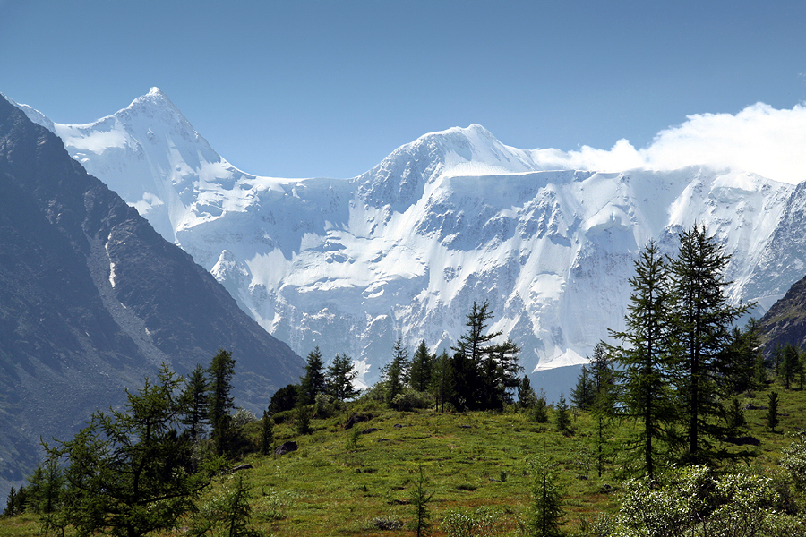
Belukha Mountain (; Russian: Белуха, IPA: [bʲɪˈɫuxə]) or Üç-Sümer (Altay: Ӱч-Сӱмер [ʏc͡ç sʏˈmer], which translates as "the three peaks") is the highest mountain of the Altai Mountains and the highest of the South Siberian Mountains system. It is part of the Golden Mountains of Altai World Heritage Site.

Adapted from Wikipedia: Belukha Mountain (CC BY-SA 4.0).

Elevation
4,506 m (14,783 ft)
Global rank
#80 of 641 indexed
Region
Asia (#45)
Countries
Russia, Kazakhstan
Coordinates
49.8071°, 86.6063°

Of the 641 named summits indexed in YearMaps, Belukha ranks #80 by elevation, below Mount Wilhelm (4,509 m) and above Laotzyunshan (4,500 m).

Ranges:
Altay Mountains (Asia), Tannu-Ola Range (Asia)
Neighbouring summits:
Tavan Bogd Uul (4,374 m), Gora Munku-Sardyk (3,491 m), Pik BAM (3,072 m)
Settlements below:
Gorno Altaysk (244 km), Biysk (319 km), Tashtagol (343 km)

View on the live map

More about Belukha

Geography

Belukha is a multi-peaked massif that rises along the border of Russia (specifically the Altai Republic) and Kazakhstan (specifically the East Kazakhstan Region), just a few dozen miles north of the China-Kazakhstan-Russia tripoint. There are several small glaciers on the massif, including Belukha Glacier. The highest peaks of the Belukha massif range from about 4,350 meters to just over 4,500 meters in elevation.

History

Belukha was first climbed in 1914 by the Tronov brothers. Most ascents of the eastern peak follow the same southern route as that taken in the first ascent. Though the Altai is lower in elevation than other Asian mountain groups, it is very remote, and much time and planning are required for its approach.

In the summer of 2001, a team of scientists traveled to the remote Belukha Glacier to assess the feasibility of extracting ice cores at the site. Research was carried out from 2001 to 2003: both shallow cores and cores to bedrock were extracted and analyzed (Olivier and others, 2003; Fujita and others, 2004). Based on tritium dating techniques, the deeper cores may contain as much as 3,000–5,000 years of climatic and environmental records. A Swiss-Russian team also studied the glacier.

Sections adapted from Wikipedia: Belukha Mountain (CC BY-SA 4.0).

Belukha: Key Facts

Key facts about Belukha
Topographic prominence3,343 m
Mountain rangeKatun Range

Facts from Wikidata Q724367 (CC0).

Tavan Bogd Uul
Image via Wikimedia Commons (author and licence on the file page).

Tavan Bogd Uul

Mountain · 4,374 m

Tavan Bogd Uul is a mountain rising to 4,374 metres (14,350 ft) in Mongolia, China and Russia, in the Asia region. The summit stands on the borders between them. From PeakBagger.com, with kind permission..

The Five Saints, known in Mongolian as the Tabhan Bogd (; Таван богд [ˈtʰaw̜əɴ pɔxt]), is a mountain massif in Mongolia, near the triple border with China and Russia. Its highest peak, the Khüiten Peak (formerly also known as Nairamdal Peak), is the highest point of Mongolia at 4374 meters above sea level.

The Tavan Bogd massif is located mostly within the Bayan-Ölgii Province of Mongolia; its northern slopes are in Russia's Altai Republic, and western, in China's Burqin County.

Besides the Khüiten Peak, the Tavan Bogd massif includes four other peaks: Nairamdal, Malchin, Bürged (eagle) and Ölgii (motherland).

Adapted from Wikipedia: Tavan Bogd (CC BY-SA 4.0).

Elevation
4,374 m (14,350 ft)
Global rank
#92 of 641 indexed
Region
Asia (#50)
Countries
Mongolia, China, Russia
Coordinates
49.1499°, 87.8199°

Of the 641 named summits indexed in YearMaps, Tavan Bogd Uul ranks #92 by elevation, below Mount Rainier (4,392 m) and above Uncompahgre Pk (4,361 m).

Ranges:
Altay Mountains (Asia), Tannu-Ola Range (Asia)
Neighbouring summits:
Belukha (4,506 m), Gora Munku-Sardyk (3,491 m), Pik BAM (3,072 m)
Settlements below:
Gorno Altaysk (339 km), Tashtagol (405 km), Biysk (419 km)

View on the live map

More about Tavan Bogd Uul

Tavan Bogd Uul: Key Facts

Key facts about Tavan Bogd Uul
Topographic prominence2,342 m
Mountain rangeAltai Mountains

Facts from Wikidata Q143008 (CC0).

Dombai-Ulgen
Image via Wikimedia Commons (author and licence on the file page).

Dombai-Ulgen

Mountain · 4,038 m

Dombai-Ulgen is a mountain rising to 4,038 metres (13,248 ft) in Georgia and Russia, in the Europe region. The summit stands on the border between them. From PeakBagger.com, with kind permission..

Dombai-Ulgen or Dombay-Ulgen (Georgian: დომბაი-ულგენი; Russian: Домбай-Ульген, Karachay-Balkar: Доммай ёлген) is a 4,046-metre-high (13,274 ft) mountain of the Greater Caucasus and the highest point of Abkhazia, a state with limited international recognition otherwise seen to be part of Georgia. It is located on the border with Karachay–Cherkessia, an autonomous republic of Russia.

The mountain is composed of gneiss, crystalline schist, and granite. The top is covered by snow and glaciers at all times of the year.

Adapted from Wikipedia: Dombay-Ulgen (CC BY-SA 4.0).

Elevation
4,038 m (13,248 ft)
Global rank
#122 of 641 indexed
Region
Europe (#9)
Countries
Georgia, Russia
Coordinates
43.2300°, 41.7400°

Of the 641 named summits indexed in YearMaps, Dombai-Ulgen ranks #122 by elevation, below Mont Cameroun (4,040 m) and above Mount Victoria (4,038 m).

Ranges:
Pontic Mountains (Asia), Lesser Caucasus (Asia)
Neighbouring summits:
Gora Elbrus (5,642 m), Gora Narodnaya (1,895 m), Belukha (4,506 m)
Settlements below:
Kislovodsk (109 km), Cherkessk (121 km), Pyatigorsk (144 km)

View on the live map

More about Dombai-Ulgen

Dombai-Ulgen: Key Facts

Key facts about Dombai-Ulgen
Topographic prominence1,237 m
Mountain rangeWestern Caucasus

Facts from Wikidata Q768409 (CC0).

Gora Munku-Sardyk
Image via Wikimedia Commons (author and licence on the file page).

Gora Munku-Sardyk

Mountain · 3,491 m

Gora Munku-Sardyk is a mountain rising to 3,491 metres (11,453 ft) in Russia and Mongolia, in the Asia region. The summit stands on the border between them.

Mönkh Saridag (Buryat: Мүнхэ Һарьдаг, Mongolian: Мөнх сарьдаг, romanized: Mönkh saridag, lit. 'eternal aiguille'), also spelled as Munku-Sardyk (Russian: Мунку-Сардык), is the highest mountain in the Sayan Mountains of Asia. It is 3,491 metres (11,453 ft) tall and is on the international border between Mongolia and Russia. It is also the highest mountain in Buryatia and the highest mountain in Mongolia's Khövsgöl Province. On the southern side, the tree line is at 2000 meters, on the northern side at 2200 meters.

Adapted from Wikipedia: Mönkh Saridag (CC BY-SA 4.0).

Elevation
3,491 m (11,453 ft)
Global rank
#170 of 641 indexed
Region
Asia (#75)
Countries
Russia, Mongolia
Coordinates
51.7164°, 100.6166°

Of the 641 named summits indexed in YearMaps, Gora Munku-Sardyk ranks #170 by elevation, below Sierra El Viejo (3,500 m) and above Vostok Station (Rus.) (3,488 m).

Ranges:
Tannu-Ola Range (Asia), Altay Mountains (Asia)
Neighbouring summits:
Tavan Bogd Uul (4,374 m), Belukha (4,506 m), Pik BAM (3,072 m)
Settlements below:
Cheremkhovo (231 km), Usolye Sibirskoye (237 km), Angarsk (244 km)

View on the live map

More about Gora Munku-Sardyk

Gora Munku-Sardyk: Key Facts

Key facts about Gora Munku-Sardyk
Topographic prominence1,578 m
Mountain rangeSayan Mountains

Facts from Wikidata Q392246 (CC0).

Koryakskaya Sopka
Image via Wikimedia Commons (author and licence on the file page).

Koryakskaya Sopka

Mountain · 3,456 m

Koryakskaya Sopka is a mountain rising to 3,456 metres (11,339 ft) in Russia, in the Asia region.

Koryaksky or Koryakskaya Sopka (Russian: Коря́кская со́пка) is an active volcano on the Kamchatka Peninsula in the Russian Far East. It lies within sight of Kamchatka Krai's administrative center, Petropavlovsk-Kamchatsky. Together with neighbouring Avachinsky, it is considered a Decade Volcano, worthy of particular study in light of its history of explosive eruptions and proximity to populated areas.

Adapted from Wikipedia: Koryaksky (CC BY-SA 4.0).

Elevation
3,456 m (11,339 ft)
Global rank
#178 of 641 indexed
Region
Asia (#76)
Country
Russia
Coordinates
53.3349°, 158.7195°

Of the 641 named summits indexed in YearMaps, Koryakskaya Sopka ranks #178 by elevation, below Mount Takahe (3,460 m) and above Bulu Rantekombola (3,455 m).

Ranges:
Kolyma Range (Asia), Suntar-Khayata Range (Asia)
Neighbouring summits:
Klyuchevskaya Sopka (4,750 m), Vulkan Alaid (2,339 m), Gora Khuvkhoitun (2,616 m)
Settlements below:
Petropavlovsk Kamchatskiy (31 km), Magadan (846 km), Palatka (889 km)

View on the live map

More about Koryakskaya Sopka

Geological history

Koryaksky lies on the Pacific Ring of Fire, at a point where the Pacific Plate is sliding underneath the Eurasian Plate at about 80 mm (3 in) per year. A wedge of mantle material lying between the subducting Pacific Plate and the overlying Eurasian Plate is the source of dynamic volcanism over the whole Kamchatka Peninsula.

The volcano has probably been active for tens of thousands of years. Geological records indicate that there have been three major eruptions in the last 10,000 years, at 5500 BC, 1950 BC and 1550 BC. These three eruptions seem to have been mainly effusive, generating extensive lava flows.

Sections adapted from Wikipedia: Koryaksky (CC BY-SA 4.0).

Koryakskaya Sopka: Key Facts

Key facts about Koryakskaya Sopka
Topographic prominence2,999 m
Mountain rangeSredinny Range

Facts from Wikidata Q839630 (CC0).

Pik BAM
Image via Wikimedia Commons (author and licence on the file page).

Pik BAM

Mountain · 3,072 m

Pik BAM is a mountain rising to 3,072 metres (10,079 ft) in Russia, in the Asia region. From PeakBagger.com, with kind permission..

Pik BAM (Russian: Пик БАМ) is a mountain in Zabaykalsky Krai, Russia. It reaches 3,072 metres (10,079 ft) above sea level. It was named after the Baikal Amur Mainline railway, which passes south of it. It is the highest summit of the Kodar Range and the Stanovoy Highlands, as well as of Zabaykalsky Krai. The nearest town is Novaya Chara. Pik Martena rises 8 kilometers (5.0 mi) to the WSW of Pik BAM, beyond the Zabaykalsky Krai border.

Adapted from Wikipedia: BAM Peak (CC BY-SA 4.0).

Elevation
3,072 m (10,079 ft)
Global rank
#215 of 641 indexed
Region
Asia (#87)
Country
Russia
Coordinates
56.8600°, 117.5800°

Of the 641 named summits indexed in YearMaps, Pik BAM ranks #215 by elevation, below Gunung Ciremay (3,077 m) and above Kizlar Sivrisi (3,070 m).

Neighbouring summits:
Gora Munku-Sardyk (3,491 m), Gora Chen (2,690 m), Otgon Tenger (4,000 m)
Settlements below:
Neryungri (435 km), Lensk (456 km), Tynda (481 km)

View on the live map

More about Pik BAM

Pik BAM: Key Facts

Key facts about Pik BAM
Topographic prominence2,230 m
Mountain rangeKodar Mountains

Facts from Wikidata Q4362531 (CC0).

Gora Chen
Image via Wikimedia Commons (author and licence on the file page).

Gora Chen

Mountain · 2,690 m

Gora Chen is a mountain rising to 2,690 metres (8,825 ft) in Russia, in the Asia region.

Mount Chyon (Russian: Гора Чён, romanized: Gora Chyon), also known as "Gora Chen", is a mountain in the Sakha Republic (Yakutia), Russia. At 2,690 m (8,830 ft) it is the highest summit in the Silyap Range, part of the central Chersky Range, East Siberian System.

An ultra-prominent peak, it rises in a desolate area about 80 kilometres (50 mi) west of the Indigirka.

Adapted from Wikipedia: Mount Chyon (CC BY-SA 4.0).

Elevation
2,690 m (8,825 ft)
Global rank
#300 of 641 indexed
Region
Asia (#116)
Country
Russia
Coordinates
65.3042°, 141.8246°

Of the 641 named summits indexed in YearMaps, Gora Chen ranks #300 by elevation, below Maja e Jezercs (2,694 m) and above Pic la Selle (2,680 m).

Ranges:
Cherskiy Range (Asia), Suntar-Khayata Range (Asia)
Neighbouring summits:
Gora Khuvkhoitun (2,616 m), Klyuchevskaya Sopka (4,750 m), Pik BAM (3,072 m)
Settlements below:
Yakutsk (697 km), Palatka (740 km), Magadan (786 km)

View on the live map

Gora Khuvkhoitun

Mountain · 2,616 m

Gora Khuvkhoitun is a mountain rising to 2,616 metres (8,583 ft) in Russia, in the Asia region.

Khuvkhoitun (Russian: Хувхойтун) sometimes referred to as Gora Khuvkhoitun is a stratovolcano located on Russia's Kamchatka Peninsula. The mountain reaches 2,616 m in elevation above sea level.

Adapted from Wikipedia: Khuvkhoitun (CC BY-SA 4.0).

Elevation
2,616 m (8,583 ft)
Global rank
#314 of 641 indexed
Region
Asia (#120)
Country
Russia
Coordinates
57.9329°, 160.7036°

Of the 641 named summits indexed in YearMaps, Gora Khuvkhoitun ranks #314 by elevation, below Moro de Môco (2,620 m) and above Barbeau Pk (2,616 m).

Ranges:
Kolyma Range (Asia), Suntar-Khayata Range (Asia)
Neighbouring summits:
Klyuchevskaya Sopka (4,750 m), Koryakskaya Sopka (3,456 m), Vulkan Alaid (2,339 m)
Settlements below:
Petropavlovsk Kamchatskiy (557 km), Magadan (598 km), Palatka (610 km)

View on the live map

More about Gora Khuvkhoitun

Gora Khuvkhoitun: Key Facts

Key facts about Gora Khuvkhoitun
Topographic prominence1,920 m
Mountain rangeSredinny Range

Facts from Wikidata Q4502055 (CC0).

Vulkan Alaid
Image via Wikimedia Commons (author and licence on the file page).

Vulkan Alaid

Mountain · 2,339 m

Vulkan Alaid is a mountain rising to 2,339 metres (7,674 ft) in Russia, in the Asia region. From PeakBagger.com, with kind permission..

Alaid, also called Atlasov due to its location or Araido in Japanese, is a volcano on Atlasov Island of the Kuril Islands, Russia. It is the northernmost volcano of the islands, and one of the most active. The height is disputed between 2,285 metres (7,497 ft) to 2,339 metres (7,674 ft) tall. It is the highest peak of the Kuril Islands.

Adapted from Wikipedia: Alaid volcano (CC BY-SA 4.0).

Elevation
2,339 m (7,674 ft)
Global rank
#359 of 641 indexed
Region
Asia (#137)
Country
Russia
Coordinates
50.8600°, 155.5700°

Of the 641 named summits indexed in YearMaps, Vulkan Alaid ranks #359 by elevation, below Mount Frank Rae (2,347 m) and above Mount Popomanaseu (2,335 m).

Ranges:
Dzhugdzhur Range (Asia), Bureinskiy Range (Asia)
Neighbouring summits:
Koryakskaya Sopka (3,456 m), Klyuchevskaya Sopka (4,750 m), Gora Khuvkhoitun (2,616 m)
Settlements below:
Petropavlovsk Kamchatskiy (322 km), Okha (910 km), Magadan (1,014 km)

View on the live map

More about Vulkan Alaid

Geology

It is formed mostly of alkali basalts, and minorly of basaltic andesite. Many rare minerals are present on the mountain. Yellow volborthite and turquoise atacamite are present on the volcano.

Alaid volcano is one of the most active volcanoes of the Sakhalin Oblast as a whole. The most significant eruptions were the 1793 and the 2022 eruption. Local records indicate that eruptions also happened in 1854, 1860, 1894, 1981, 1996, 2015–2016, and 2022.

The 2022 volcanic eruption was one of the biggest and most significant of the history of the volcano. Local flights had to be cancelled due to this eruption. It also increased the territory of the island by an unknown minor amount.

Strombolian-vulcanian activity provoked two lava flows, that went onto the southern slope of Alaid.

Sections adapted from Wikipedia: Alaid volcano (CC BY-SA 4.0).

Vulkan Alaid: Key Facts

Key facts about Vulkan Alaid
Topographic prominence2,339 m
Mountain rangeGreater Kuril Ridge

Facts from Wikidata Q1866016 (CC0).

Gora Narodnaya
Image via Wikimedia Commons (author and licence on the file page).

Gora Narodnaya

Mountain · 1,895 m

Gora Narodnaya is a mountain rising to 1,895 metres (6,217 ft) in Russia, in the Europe region.

Mount Narodnaya (also known as Naroda and Poenurr; Russian: гора Народная, Komi: Народа-Из ("People's Mountain"), Mansi: Поэӈ-ур, Поэн-урр) is the highest peak of the Urals in Russia. Its elevation is 1,894 metres (6,214 ft). It is located on the border between Khanty–Mansi Autonomous Okrug in Tyumen Oblast and Komi Republic, the highest point being 0.5 km to the east from the border. The name may refer to Naroda River, which originates from the mount, located in the Research Range.

It is the highest point in European Russia outside the Caucasus. This leads to its large topographic prominence of 1,772 metres (5,814 ft). Narodnaya is located in the Ural mountains water divide, and therefore on the border between Europe and Asia: the Naroda river flows south-east from the summit into the Ob river in Siberia, and the Kos'yu river flows north-west from the summit into the Pechora river in Europe.

The mountain is formed with quartzites and metamorphosed slates of the Proterozoic Eon and Cambrian Period. There are some glaciers on the mountain. Also, there are sparse forests of larch and birch in the deep valleys at the foot of the mountain.

Adapted from Wikipedia: Mount Narodnaya (CC BY-SA 4.0).

Elevation
1,895 m (6,217 ft)
Global rank
#434 of 641 indexed
Region
Europe (#46)
Country
Russia
Coordinates
65.0271°, 60.1234°

Of the 641 named summits indexed in YearMaps, Gora Narodnaya ranks #434 by elevation, below Paishidin (1,895 m) and above Puy de Sancy (1,885 m).

Ranges:
Ural Mountains (Europe), Altay Mountains (Asia)
Neighbouring summits:
Haltiatunturi (1,328 m), Kebnekaise (2,111 m), Suur Munamagi (318 m)
Settlements below:
Inta (112 km), Pechora (137 km), Usinsk (160 km)

View on the live map

More about Gora Narodnaya

Gora Narodnaya: Key Facts

Key facts about Gora Narodnaya
Topographic prominence1,772 m
Mountain rangeUral Mountains

Facts from Wikidata Q1142817 (CC0).

More on Russia

Quick Answers

What is the highest mountain in Russia?
Gora Elbrus, at 5,642 m. Gora Shkhara is second at 5,200 m. Rankings cover the mountains indexed in YearMaps.
How many mountains are there in Russia?
YearMaps lists 37 mountains for Russia. This is the number mapped in the atlas, not an official national count.