
UNESCO World Heritage Sites in United States
United States has 23 sites on the UNESCO World Heritage List (10 cultural, 12 natural and 1 mixed), the first inscribed in 1978 (Mesa Verde National Park). 1 site is on the List of World Heritage in Danger. The map below plots every one of them alongside the rest of the List, and each site is written up in full further down the page.
- World Heritage Sites
- 23
- Cultural
- 10
- Natural and Mixed
- 13
- First Inscribed
- 1978
Map of World Heritage Sites in United States
CulturalNaturalMixedIn DangerLarge dots are in United States. Click a dot to read about the site.

Mesa Verde National Park
United States · 37.2604° N, 108.4944° W · 210 km² · 54 km from Durango
Mesa Verde National Park is a national park of the United States and UNESCO World Heritage Site located in Montezuma County, Colorado, and the only World Heritage Site in Colorado. The park protects some of the best-preserved Ancestral Puebloan ancestral sites in the United States.
Established by Congress and President Theodore Roosevelt in 1906, the park occupies 52,485 acres (212 km2) near the Four Corners region of the American Southwest. With more than 5,000 sites, including 600 cliff dwellings, it is the largest archaeological preserve in the United States. Mesa Verde (Spanish for "green table", or more specifically "green table mountain") is best known for structures such as Cliff Palace, one of the largest cliff dwellings in North America.
Starting c. 7500 BCE Mesa Verde was seasonally inhabited by a group of nomadic Paleo-Indians known as the Foothills Mountain Complex. The variety of projectile points found in the region indicates they were influenced by surrounding areas, including the Great Basin, the San Juan Basin, and the Rio Grande Valley. Later, Archaic people established semi-permanent rock shelters in and around the mesa.
Adapted from Wikipedia: Mesa Verde National Park (CC BY-SA 4.0).
Why Mesa Verde National Park Is Listed
- (iii)
- A unique testimony to a cultural tradition or civilisation.
More about Mesa Verde National Park
UNESCO's Description
A great concentration of ancestral Pueblo Indian dwellings, built from the 6th to the 12th century, can be found on the Mesa Verde plateau in south-west Colorado at an altitude of more than 2,600 m. Some 4,400 sites have been recorded, including villages built on the Mesa top. There are also imposing cliff dwellings, built of stone and comprising more than 100 rooms.
From the UNESCO World Heritage Centre (CC BY-SA IGO 3.0).
Anthropogenic ecology and geography
Anthropogenic ecology refers to the human impact on animals and plants in an ecosystem. A shift from medium and large game animals, such as deer, bighorn sheep, and antelope, to smaller ones like rabbits and turkey during the mid-10th to mid-13th centuries might indicate that Pueblonian subsistence hunting had dramatically altered faunal populations on the mesa. Analysis of pack rat midden indicates that, with the exception of invasive species such as tumbleweed and clover, the flora and fauna in the area have remained relatively consistent for the past 4,000 years.
Geology
Although the area's first Spanish explorers named the feature Mesa Verde, the term is a misnomer, as true mesas are almost perfectly flat. Because Mesa Verde is slanted to the south, the proper geological term is cuesta, not mesa. The park is made up of several smaller cuestas located between canyons. Mesa Verde's slant contributed to the formation of the alcoves that have preserved the area's cliff dwellings.
In the late Cretaceous Period, the Mancos Shale was deposited on top of the Dakota Sandstone, which is the rock formation that can be found under much of Colorado. The beds of the Mancos Shale are "fine-grained sand-stones, mudstones, and shales" which accumulated in the deep water of the Cretaceous Sea.
Climate
According to the Köppen climate classification system, Mesa Verde National Park has a dry-summer humid continental climate (Dsa). According to the United States Department of Agriculture, the Plant Hardiness zone at Mesa Verde National Park Headquarters at 6952 ft (2119 m) elevation is 6b with an average annual extreme minimum temperature of −0.1 °F (−17.8 °C).
The region's precipitation pattern is bimodal, meaning agriculture is sustained through snowfall during winter and autumn and rainfall during spring and summer. Water for farming and consumption was provided by summer rains, winter snowfall, and seeps and springs in and near the Mesa Verde villages.
Sections adapted from Wikipedia: Mesa Verde National Park (CC BY-SA 4.0).
Key Facts
| Established | 1906 |
|---|---|
| Area | 212 km² |
Facts from Wikidata Q237128 (CC0).
Visiting Mesa Verde National Park
Mesa Verde National Park is a United States national park and a UNESCO World Heritage Site located in the southwestern corner of the state of Colorado. Mesa Verde was the first park in the United States dedicated to preserving archeological remains rather than nature itself. The park is world-renowned for the incredibly well-preserved cliff dwellings it protects. Indeed, they are some of the most interesting archeological sites in North America. Mesa Verde is also notable for its desert landscape of tall mesas and steep canyons.
Visitors should be aware that access to the cliff houses involves navigating many wooden ladders (Remember: what goes down must also come up). Travelers with mobility issues may not be able to access all of the park.
Travel notes adapted from Wikivoyage: Mesa Verde National Park (CC BY-SA 4.0).

Yellowstone National Park
United States · 44.6000° N, 110.5000° W · 8,983 km² · 127 km from Bozeman
Yellowstone National Park is a national park of the United States located mainly in the northwest corner of the state of Wyoming, with small portions extending into Montana and Idaho. The park is known for its wildlife and its many geothermal features, especially the Old Faithful geyser, one of its most popular. While it represents many types of biomes, subalpine forest is the most abundant. It is part of the South Central Rockies forests ecoregion.
Native Americans have lived in the Yellowstone region for at least 11,000 years. While non-native mountain men visited during the early-to-mid-19th century, organized exploration by non-natives did not begin until the late 1860s. The park was established by the 42nd U.S. Congress through the Yellowstone National Park Protection Act and signed into law by President Ulysses S. Grant on March 1, 1872. Yellowstone was the first national park in the US, and is also widely understood to be the first national park in the world.
Management and control of the park originally fell under the jurisdiction of the U.S. Department of the Interior, the first Secretary of the Interior to supervise the park being Columbus Delano. However, the U.S.
Adapted from Wikipedia: Yellowstone National Park (CC BY-SA 4.0).
Why Yellowstone National Park Is Listed
- (vii)
- Superlative natural phenomena or exceptional natural beauty.
- (viii)
- An outstanding example of major stages of the Earth's history.
- (ix)
- An outstanding example of ongoing ecological and biological processes.
- (x)
- The most important natural habitats for conserving biodiversity.
More about Yellowstone National Park
UNESCO's Description
The vast natural forest of Yellowstone National Park covers nearly 9,000 km 2 ; 96% of the park lies in Wyoming, 3% in Montana and 1% in Idaho. Yellowstone contains half of all the world's known geothermal features, with more than 10,000 examples. It also has the world's largest concentration of geysers (more than 300 geyers, or two thirds of all those on the planet). Established in 1872, Yellowstone is equally known for its wildlife, such as grizzly bears, wolves, bison and wapitis.
From the UNESCO World Heritage Centre (CC BY-SA IGO 3.0).
Geography
Yellowstone National Park occupies a roughly square parcel of volcanic complex that jogs slightly beyond the northwestern corner of Wyoming. Approximately 96 percent of the total land area of Yellowstone National Park is located within the state of Wyoming. Another three percent is within Montana, with the remaining one percent in Idaho. Montana's portion of Yellowstone contains multiple trails, facilities and swimming holes, while the Idaho portion of the park is completely undeveloped. The irregular eastern boundary of the national park follows the height of land along the Absaroka Range.
The park is 63 miles (101 km) north to south, and 54 miles (87 km) west to east by air.
Geology
The unique natural features of Yellowstone are produced by the Yellowstone hotspot, a section of the North American tectonic plate which has been gradually drifting northeast over a massive mantle plume. Over the millennia, volcanic activity has produced rhyolite eruptions and calderas in the region, the most visible of which is the Yellowstone Caldera. Streams draining out of the volcanic plateau wore the landscape into large valleys and canyons such as the Grand Canyon of the Yellowstone.
The Yellowstone hotspot is the largest volcanic system in North America, and worldwide it is only rivaled by the Lake Toba Caldera on Sumatra. It has been termed a supervolcano because the caldera was formed by exceptionally large explosive eruptions.
Climate and weather
Yellowstone's climate is greatly influenced by altitude, with lower elevations generally found to be warmer year-round. The record high temperature was 99 °F (37 °C) in 2002, while the coldest temperature recorded is −66 °F (−54 °C) in 1933. During the summer months of June to early September, daytime highs are normally in the 70 to 80 °F (21 to 27 °C) range, while nighttime lows can go to below freezing (0 °C), especially at higher altitudes. Summer afternoons are frequently accompanied by thunderstorms. Spring and fall temperatures range between 30 and 60 °F (−1 and 16 °C) with nights in the teens to single digits (−5 to −20 °C).
Biology and ecology
Yellowstone National Park is the centerpiece of the 20 million acres (80,940 km2; 31,250 mi2) Greater Yellowstone Ecosystem, a region that includes Grand Teton National Park, adjacent National Forests and expansive wilderness areas in those forests. The ecosystem is the largest remaining continuous stretch of mostly undeveloped pristine land in the contiguous United States, considered the world's largest intact ecosystem in the northern temperate zone. With the successful wolf reintroduction program, which began in the 1990s, much of the original faunal and floral species known to inhabit the region when the first explorers entered the area can be found there.
Sections adapted from Wikipedia: Yellowstone National Park (CC BY-SA 4.0).
Key Facts
| Established | 1 March 1872 |
|---|---|
| Area | 8,983 km² |
Facts from Wikidata Q351 (CC0).
Visiting Yellowstone National Park
Yellowstone National Park is a national park and a UNESCO World Heritage Site. It was the world's first national park, set aside in 1872 to preserve the vast number of geysers, hot springs, and other thermal areas, as well as to protect the incredible wildlife and rugged beauty of the area. The park contains 3,472 sq mi (8,990 km2), mostly within the northwest corner of Wyoming, but with portions extending into the states of Idaho and Montana.
Travel notes adapted from Wikivoyage: Yellowstone National Park (CC BY-SA 4.0).

Everglades National Park
United States · 25.3125° N, 80.6875° W · 5,670 km² · 27 km from Homestead
Everglades National Park is a United States national park that protects the southern 20% of the original Everglades ecosystem in Florida. With over 1.5 million acres (6,000 km2), Everglades is the third-largest national park in the contiguous United States after Death Valley and Yellowstone. Over 86% of the park is designated wilderness area; the Marjory Stoneman Douglas Wilderness is the largest wilderness area in the United States east of the Rocky Mountains. An average of one million people visit the park each year. It was declared a national park in 1947. UNESCO declared the Everglades & Dry Tortugas Biosphere Reserve in 1976 and listed the park as a World Heritage Site in 1979, and the Ramsar Convention included the park on its list of Wetlands of International Importance in 1987. Everglades is one of only three locations in the world to appear on all three lists.
Most national parks preserve unique geographic features; Everglades National Park was the first created to protect a fragile ecosystem. The Everglades are a network of wetlands and forests fed by a river flowing 0.25 miles (0.40 km) per day out of Lake Okeechobee, southwest into Florida Bay.
Adapted from Wikipedia: Everglades National Park (CC BY-SA 4.0).
Why Everglades National Park Is Listed
- (viii)
- An outstanding example of major stages of the Earth's history.
- (ix)
- An outstanding example of ongoing ecological and biological processes.
- (x)
- The most important natural habitats for conserving biodiversity.
More about Everglades National Park
UNESCO's Description
This site at the southern tip of Florida has been called 'a river of grass flowing imperceptibly from the hinterland into the sea'. The exceptional variety of its water habitats has made it a sanctuary for a large number of birds and reptiles, as well as for threatened species such as the manatee.
From the UNESCO World Heritage Centre (CC BY-SA IGO 3.0).
Geography
Everglades National Park covers 1,508,976 acres (2,357.8 sq mi; 6,106.6 km2), throughout Dade, Monroe, and Collier counties in Florida, at the southern tip of the Atlantic coastal plain. The elevation typically ranges from 0 to 8 feet (2.4 m) above sea level, but a Calusa-built shell mound on the Gulf Coast rises 20 feet (6.1 m) above sea level.
Geology
The terrain of South Florida is relatively and consistently flat. The limestone that underlies the Everglades is integral to the diverse ecosystems within the park. Florida was once part of the African portion of the supercontinent Gondwana. After it separated, conditions allowed a shallow marine environment to deposit calcium carbonate in sand, shells, and coral to be converted into limestone. Tiny bits of shell, sand, and bryozoans compressed over multiple layers forming structures in the limestone called ooids, which created permeable conditions that hold water.
The Florida peninsula appeared above sea level between 100,000 and 150,000 years ago. As sea levels rose at the end of the Wisconsin ice age, the water table appeared closer to land.
Climate
According to the Köppen climate classification system, Royal Palm at Everglades National Park has a tropical monsoon climate (Am). Summers are long, hot, and very wet and winters are warm and dry. In recent years, scientists have observed that inland freshwater sites within Everglades National Park are experiencing water-level increases that match regional sea-level rise, highlighting how vulnerable the park’s low-elevation freshwater habitats are to climate change and saltwater intrusion.
Threats to the park and ecology
Less than 50 percent of the Everglades which existed prior to drainage attempts remains intact today. Populations of wading birds dwindled 90 percent from their original numbers between the 1940s and 2000s. The diversion of water to South Florida's still-growing metropolitan areas is the Everglades National Park's number one threat. In the 1950s and 1960s, 1,400 miles (2,300 km) of canals and levees, 150 gates and spillways, and 16 pumping stations were constructed to direct water toward cities and away from the Everglades. Low levels of water leave fish vulnerable to reptiles and birds, and as sawgrass dries it can burn or die off, which in turn kills apple snails and other animals that wading birds feed upon.
Sections adapted from Wikipedia: Everglades National Park (CC BY-SA 4.0).
Key Facts
| Established | 6 December 1947 |
|---|---|
| Area | 6,105 km² |
Facts from Wikidata Q274131 (CC0).
Visiting Everglades National Park
Everglades redirects here. For Noosa Everglades in Queensland, see Great Sandy National Park (Cooloola)
Everglades National Park is a national park and a UNESCO World Heritage Site in southwestern Florida. It is also list on the UNESCO Biosphere Reserve and Ramsar Wetlands of International Importance. It is one of only three locations to appear on all three lists.
Travel notes adapted from Wikivoyage: Everglades National Park (CC BY-SA 4.0).

Grand Canyon National Park
United States · 36.0553° N, 112.1220° W · 4,933 km² · 104 km from Flagstaff
Grand Canyon National Park is a national park of the United States located in northwestern Arizona, the 15th site to have been named as a national park. The park's central feature is the Grand Canyon, a gorge of the Colorado River, which is often considered one of the Wonders of the World. The park, which covers 1,217,262 acres (1,901.972 sq mi; 4,926.08 km2) of unincorporated area in Coconino and Mohave counties, received more than 4.9 million recreational visitors in 2024. The Grand Canyon was designated a World Heritage Site by UNESCO in 1979. The park celebrated its 100th anniversary on February 26, 2019.
Adapted from Wikipedia: Grand Canyon National Park (CC BY-SA 4.0).
Why Grand Canyon National Park Is Listed
- (vii)
- Superlative natural phenomena or exceptional natural beauty.
- (viii)
- An outstanding example of major stages of the Earth's history.
- (ix)
- An outstanding example of ongoing ecological and biological processes.
- (x)
- The most important natural habitats for conserving biodiversity.
More about Grand Canyon National Park
UNESCO's Description
Carved out by the Colorado River, the Grand Canyon (nearly 1,500 m deep) is the most spectacular gorge in the world. Located in the state of Arizona, it cuts across the Grand Canyon National Park. Its horizontal strata retrace the geological history of the past 2 billion years. There are also prehistoric traces of human adaptation to a particularly harsh environment.
From the UNESCO World Heritage Centre (CC BY-SA IGO 3.0).
Geography
The Grand Canyon, including its extensive system of tributary canyons, is valued for its combination of size, depth, and exposed layers of colorful rocks dating back to Precambrian times. The canyon itself was created by the incision of the Colorado River and its tributaries after the Colorado Plateau was uplifted, causing the Colorado River system to develop along its present path.
The primary public areas of the park are the South and North Rims, and adjacent areas of the canyon itself. The rest of the park is extremely rugged and remote, although many places are accessible by pack trail and backcountry roads. The South Rim is more accessible than the North Rim and accounts for 90% of park visitation.
Climate
According to the Köppen climate classification system, Grand Canyon National Park has five climate zones; Cold Semi-Arid (BSk), Humid Continental Dry Cool Summer (Dsb), Humid Continental Dry Warm Summer (Dsa), Warm Summer Mediterranean (Csb), and Hot Summer Mediterranean (Csa). The plant hardiness zone at Grand Canyon Visitor Center is 7a with an average annual extreme minimum temperature of 3.3 °F (−15.9 °C).
History
The Grand Canyon became well known to Americans in the 1880s after railroads were built and pioneers developed infrastructure and early tourism. In 1903, President Theodore Roosevelt visited the site and said, The Grand Canyon fills me with awe. It is beyond comparison—beyond description; absolutely unparalleled throughout the wide world.... Let this great wonder of nature remain as it now is. Do nothing to mar its grandeur, sublimity and loveliness. You cannot improve on it. But you can keep it for your children, your children's children, and all who come after you, as the one great sight which every American should see.
Despite Roosevelt's enthusiasm and strong interest in preserving land for public use, the Grand Canyon was not immediately designated as a national park.
Sections adapted from Wikipedia: Grand Canyon National Park (CC BY-SA 4.0).
Key Facts
| Established | 1919 |
|---|---|
| Area | 4,863 km² |
Facts from Wikidata Q220289 (CC0).
Visiting Grand Canyon National Park
The Grand Canyon is in northern Arizona, and is one of the great tourist attractions in the United States as well as one of the seven natural wonders of the world. The massive canyon encompasses several distinct areas, most famous of which is Grand Canyon National Park, a national park and a UNESCO World Heritage Site.
Visitors to the national park have many options, including: the remote North Rim; the more accessible (and therefore more crowded) South Rim; parts of the canyon, such as Phantom Ranch or the Colorado River, upon which many boating trips are made. In addition, parts of the southwestern end of the canyon are within the borders of two Indian reservations: the Havasupai Indian Reservation and the Hualapai Indian Reservation (which includes the development known as Grand Canyon West). Lastly, part of the southeastern end of the canyon is within the borders of the Navajo Nation. Except for the Navajo Nation portion, all sections of the canyon offer amenities for visitors.
Travel notes adapted from Wikivoyage: Grand Canyon (CC BY-SA 4.0).

Independence Hall
United States · 39.9489° N, 75.1500° W · 6 km from Philadelphia
Independence Hall is a historic civic building in Philadelphia, Pennsylvania, where both the Declaration of Independence and the Constitution of the United States were debated and adopted by the Founding Fathers of the United States. The building, which is the centerpiece of Independence National Historical Park, was designated a World Heritage Site in 1979. It is an example of American Georgian architecture, which is characterized by symmetry, classical proportions, and exposed brick with stone masonry accents.
Independence Hall, which was initially called Pennsylvania State House, was completed in 1753. It was the first capitol of the colonial era Province of Pennsylvania and, even then, was seen as "the greatest ornament in the town". The building became a symbol of liberty, democracy, and the founding of the United States. During the American Revolutionary War, the Second Continental Congress convened in the building from 1775 to 1781. They founded the Continental Army there on June 14, 1775, and the Declaration of Independence was adopted there on July 4, 1776. From May 25 to September 17, 1787, the Pennsylvania State House hosted the Constitutional Convention, where the U.S.
Adapted from Wikipedia: Independence Hall (CC BY-SA 4.0).
Why Independence Hall Is Listed
- (vi)
- A direct association with events, ideas or beliefs of universal significance.
More about Independence Hall
UNESCO's Description
The Declaration of Independence (1776) and the Constitution of the United States (1787) were both signed in this building in Philadelphia. The universal principles of freedom and democracy set forth in these documents are of fundamental importance to American history and have also had a profound impact on law-makers around the world.
From the UNESCO World Heritage Centre (CC BY-SA IGO 3.0).
Key Facts
| Established | 1753 |
|---|---|
| Area | 0 km² |
| Architectural style | Georgian architecture |
Facts from Wikidata Q390028 (CC0).

Redwood National and State Parks
United States · 41.3739° N, 123.9981° W · 416 km² · 55 km from Arcata
The Redwood National and State Parks (RNSP) are a complex of one United States national park and three California state parks located along the coast of northern California. The combined RNSP contain Redwood National Park, Del Norte Coast Redwoods State Park, Jedediah Smith Redwoods State Park, and Prairie Creek Redwoods State Park. The parks' 139,000 acres (217 mi2; 560 km2) preserve 45 percent of all remaining old-growth coast redwood forests.
Located in Del Norte and Humboldt counties, the four parks protect the endangered coast redwood (Sequoia sempervirens)—the tallest, among the oldest, and one of the most massive tree species on Earth—which thrives in the humid temperate rainforest. The park region is highly seismically active and prone to tsunamis. The parks preserve 37 miles (60 km) of pristine coastline, indigenous flora, fauna, grassland prairie, cultural resources, waterways, as well as threatened animal species, such as the Chinook salmon, northern spotted owl, and Steller's sea lion.
Redwood forest originally covered more than 8,100 km2 (3,100 sq mi) of the California coast, and the region of today's parks largely remained wild until after 1850.
Adapted from Wikipedia: Redwood National and State Parks (CC BY-SA 4.0).
Why Redwood National and State Parks Is Listed
- (vii)
- Superlative natural phenomena or exceptional natural beauty.
- (ix)
- An outstanding example of ongoing ecological and biological processes.
More about Redwood National and State Parks
UNESCO's Description
Redwood National Park comprises a region of coastal mountains bordering the Pacific Ocean north of San Francisco. It is covered with a magnificent forest of coastal redwood trees, the tallest and most impressive trees in the world. The marine and land life are equally remarkable, in particular the sea lions, the bald eagle and the endangered California brown pelican.
From the UNESCO World Heritage Centre (CC BY-SA IGO 3.0).
Geology
Both coastline and the mountains of the California Coast Ranges can be found within park boundaries. The majority of the rocks in the parks are part of the Franciscan assemblage. Assemblage metamorphic and sedimentary rocks of the Jurassic and Cretaceous periods, along with marine and alluvial sedimentary deposits of the Tertiary and Quaternary periods, are underneath the Redwood Creek basin. These sedimentary rocks are primarily sandstone, siltstone, and shale, with lesser amounts of chert, greenstone, and metamorphic rocks.
The parks are located in the most seismically active area in the country. Frequent minor earthquakes in the park and offshore under the Pacific Ocean have resulted in shifting river channels, landslides, and erosion of seaside cliffs.
Climate
The Redwood National and State Parks have a warm-summer Mediterranean climate (Köppen: Csb). They receive abundant rain during most of the year, with a peak in winter, a decrease in June and September, and two dry summer months (July and August).
The parks are part of a temperate rainforest that runs along the western United States coast. The nearby Pacific Ocean has major effects on the climate in the parks. Temperatures near the coast mostly remain between 40 and 60 degrees Fahrenheit (4–15 °C) all year. Redwoods tend to grow in this area of steadily temperate climate, though most grow at least a mile or two (1.5–3 km) from the coast to avoid the saltier air, and they never grow more than 50 miles (80 km) from it.
Ecology
The Redwood National and State Parks conserve an area which contains the largest contiguous old-growth coast redwood forest as well as habitats for endangered species.
Discovered in Redwood National Park in 2006 in an unpublished location, the tallest living tree is the coast redwood tree (Sequoia sempervirens) named Hyperion, at 380 feet (120 m). It is followed by Helios at 377 feet (115 m), and Icarus at 371 feet (113 m), both also in Redwood National Park. For many years thought to be the tallest, one specimen named simply "Tall Tree" in Prairie Creek Redwoods State Park was measured at 367.8 feet (112.1 m). "So many people have stood on the base of the tree that the ground is hard packed", said Professor Stephen C. Sillett of Cal Poly Humboldt university in the 1990s.
History
Modern-day Native American nations such as the Yurok, Tolowa, Karuk, Chilula, and Wiyot have historical ties to the region, which has had various indigenous occupants for millennia. Describing "a diversity in an area that size that probably has never been equaled anywhere else in the world", historian David Stannard accounts for more than thirty native nations that lived in northwestern California. Scholar Gail L. Jenner estimates that "at least fifteen" tribal groups inhabited the coastline.
Sections adapted from Wikipedia: Redwood National and State Parks (CC BY-SA 4.0).
Key Facts
| Established | 2 October 1968 |
|---|---|
| Area | 416 km² |
Facts from Wikidata Q63863168 (CC0).
Visiting Redwood National and State Parks
Redwood National and State Parks is a United States national park and a UNESCO World Heritage Site on the North Coast of the state of California. The park protects several groves of massive redwood trees, which can live for 2000 years, grow to heights of up to 367 feet, and be as wide as 22 feet at the base of the trunk. Created by Congress to protect lands adjacent to three California state parks (Jedediah Smith Redwoods State Park, Del Norte Coast Redwoods State Park, and Prairie Creek Redwoods State Park) in 1968 with the creation of Redwood National Park. In 1994, the California Department of Parks and Recreation and the National Park Service agreed to jointly manage the four-park area for maximum resource protection.
Travel notes adapted from Wikivoyage: Redwood National Park (CC BY-SA 4.0).

Mammoth Cave National Park
United States · 37.1869° N, 86.1011° W · 212 km² · 37 km from Bowling Green
Mammoth Cave National Park is a national park of the United States in south-central Kentucky. It encompasses portions of Mammoth Cave, the longest known cave system in the world. The park's 52,007 acres (21,046 ha) are located primarily in Edmonson County, with small areas extending eastward into Hart and Barren counties. The Green River runs through the park, with a tributary called the Nolin River feeding into the Green just inside the park.
The cave system has formally been known as the Mammoth–Flint Ridge Cave System since 1972, when a connection was discovered between Mammoth Cave and the even longer system under Flint Ridge to the north. As of 2025, more than 426 miles (686 km) of passageways had been surveyed, over 1.5 times longer than the second-longest cave system, Mexico's Ox bel ha underwater cave.
The park was established as a national park on July 1, 1941, after oft-contentious eminent domain proceedings whose consequences still affect the region. It was named a World Heritage Site on October 27, 1981; an international Biosphere Reserve on September 26, 1990; and an International Dark Sky Park on October 28, 2021.
Adapted from Wikipedia: Mammoth Cave National Park (CC BY-SA 4.0).
Why Mammoth Cave National Park Is Listed
- (vii)
- Superlative natural phenomena or exceptional natural beauty.
- (viii)
- An outstanding example of major stages of the Earth's history.
- (x)
- The most important natural habitats for conserving biodiversity.
More about Mammoth Cave National Park
UNESCO's Description
Mammoth Cave National Park, located in the state of Kentucky, has the world's largest network of natural caves and underground passageways, which are characteristic examples of limestone formations. The park and its underground network of more than 560 surveyed km of passageways are home to a varied flora and fauna, including a number of endangered species.
From the UNESCO World Heritage Centre (CC BY-SA IGO 3.0).
Geology
Mammoth Cave developed approximately 330 million years ago in thick Mississippian-aged limestone strata – along with some dolomite, siltstone and shale – capped by a layer of sandstone, which has made the system remarkably stable. The various sedimentary rock found in the location are generally found in marine areas, which along with fossil evidence showed that Kentucky was once part of an ancient sea. Overall, the cave system is known to include more than 426 miles (686 km) of passageway. New discoveries and connections add several miles/kilometers to this figure each year.
The upper sandstone member is known as the Big Clifty Sandstone.
Climate
According to the Köppen climate classification system, Mammoth Cave National Park has a Humid subtropical climate (Cfa). According to the United States Department of Agriculture, the Plant Hardiness zone at Mammoth Cave National Park Visitor Center at 722 ft (220 m) elevation is 6b with an average annual extreme minimum temperature of -3.2 °F (-19.6 °C).
History
Human activity in Mammoth Cave traces back at least five thousand years. Several sets of Native American remains have been recovered from Mammoth Cave, or other nearby caves in the region, in both the 19th and 20th centuries. Most were mummies, representing examples of intentional burial, with ample evidence of pre-Columbian funerary practice.
An exception to purposeful burial was discovered when in 1935 the remains of an adult male were found under a large boulder. The boulder had shifted and settled onto the victim, a pre-Columbian miner, who had disturbed the rubble supporting it.
Sections adapted from Wikipedia: Mammoth Cave National Park (CC BY-SA 4.0).
Key Facts
| Established | 1 July 1941 |
|---|---|
| Area | 219 km² |
Facts from Wikidata Q242681 (CC0).
Visiting Mammoth Cave National Park
Mammoth Cave National Park is a United States national park and a UNESCO World Heritage Site in Kentucky's Caves and Lakes region. It preserves the world's longest known cave system, with over 426 mi (686 km) of caves, visitable only by guided tour. While the caves are the highlight of the park, there are also extensive hiking trails and other outdoor activities. The park was established in 1941 and draws nearly two million visitors annually.
Travel notes adapted from Wikivoyage: Mammoth Cave National Park (CC BY-SA 4.0).

Olympic National Park
United States · 47.7000° N, 123.7500° W · 3,697 km² · 81 km from Aberdeen
Olympic National Park is a national park of the United States located in Washington, on the Olympic Peninsula. The park has four regions: the Pacific coastline, the west-side temperate rainforest, alpine areas, and the forests of the drier east side. Within the park there are three distinct ecosystems, including subalpine forest and wildflower meadow, temperate forest, and the rugged Pacific coast.
President Theodore Roosevelt originally designated the park as Mount Olympus National Monument on March 2, 1909. The monument was redesignated a national park by Congress and President Franklin D. Roosevelt on June 29, 1938. In 1976, Olympic National Park was designated by UNESCO as an International Biosphere Reserve, and in 1981 as a World Heritage Site. In 1988, Congress designated 95 percent of the park (1,370 square miles (3,500 km2)) as the Olympic Wilderness, which was renamed Daniel J. Evans Wilderness in honor of the former Washington state Governor and U.S. Senator Daniel J. Evans in 2017. During his tenure in the Senate, Evans co-sponsored the 1988 bill that created the state's wilderness areas. It is the largest wilderness area in Washington.
Adapted from Wikipedia: Olympic National Park (CC BY-SA 4.0).
Why Olympic National Park Is Listed
- (vii)
- Superlative natural phenomena or exceptional natural beauty.
- (ix)
- An outstanding example of ongoing ecological and biological processes.
More about Olympic National Park
UNESCO's Description
Located in the north-west of Washington State, Olympic National Park is renowned for the diversity of its ecosystems. Glacier-clad peaks interspersed with extensive alpine meadows are surrounded by an extensive old growth forest, among which is the best example of intact and protected temperate rainforest in the Pacific Northwest. Eleven major river systems drain the Olympic mountains, offering some of the best habitat for anadromous fish species in the country. The park also includes 100 km of wilderness coastline, the longest undeveloped coast in the contiguous United States, and is rich in native and endemic animal and plant species, including critical populations of the endangered northern spotted owl, marbled murrelet and bull trout.
From the UNESCO World Heritage Centre (CC BY-SA IGO 3.0).
Climate
According to the Köppen climate classification system, Olympic National Park encompasses two classifications: a temperate oceanic climate (Cfb) in the western half, and a warm-summer Mediterranean climate (Csb) in the eastern half. According to the United States Department of Agriculture, the plant hardiness zone at Hoh Rainforest Visitor Center is 8a with an average annual extreme minimum temperature of 14.5 °F (−9.7 °C).
Ecology
According to the A. W. Kuchler U.S. Potential natural vegetation Types, the park encompasses five classifications: Alpine Meadows & Barren, aka Alpine tundra (52) potential vegetation type with an Alpine Meadow (11) potential vegetation form; a Fir/Hemlock (4) vegetation type with a Pacific Northwest conifer forest (1) vegetation form; a cedar/hemlock/Douglas fir vegetation type with a Pacific Northwest conifer forest (1) vegetation form; Western spruce/fir vegetation type (15) with a Rocky Mountain conifer forest (3) vegetation form; and a spruce/cedar/hemlock (1) vegetation type with a Pacific Northwest conifer forest (1) vegetation form.
Natural and geologic history
The coastal portion of the park is a rugged, sandy beach along with a strip of adjacent forest. It is 60 miles (97 km) long but just a few miles wide, with native communities at the mouths of two rivers. The Hoh River has the Hoh people and at the town of La Push at the mouth of the Quileute River live the Quileute.
The beach has unbroken stretches of wilderness ranging from 10 to 20 miles (16 to 32 km). While some beaches are primarily sand, others are covered with heavy rock and very large boulders. Bushy overgrowth, slippery footing, tides, and misty rainforest weather all hinder foot travel. The coastal strip is more readily accessible than the interior of the Olympics; due to the difficult terrain, very few backpackers venture beyond casual day-hiking distances.
Human history
Before the influx of European settlers, Olympic's human population consisted of Native Americans, whose use of the peninsula was thought to have consisted mainly of fishing and hunting. However, recent reviews of the record, coupled with systematic archaeological surveys of the mountains (Olympic and other Northwest ranges) are pointing to much more extensive tribal use of especially the subalpine meadows than seemed formerly to be the case. Most if not all Pacific Northwest indigenous cultures were adversely affected by European diseases (often decimated) and other factors, well before ethnographers, business operations and settlers arrived in the region, so what they saw and recorded was a much-reduced native culture base.
Sections adapted from Wikipedia: Olympic National Park (CC BY-SA 4.0).
Key Facts
| Established | 29 June 1938 |
|---|---|
| Area | 3,734 km² |
Facts from Wikidata Q372093 (CC0).
Visiting Olympic National Park
Olympic National Park is a national park and UNESCO World Heritage Site in Washington State. The park interior encompasses one of the largest remaining blocks of old-growth forest and temperate rain forest in the lower 48 states, and the park's coastline protects 73 mi (117 km) of rocky headlands, beaches, and tidepools.
Travel notes adapted from Wikivoyage: Olympic National Park (CC BY-SA 4.0).

Cahokia
United States · 38.6539° N, 90.0644° W · 5 km² · 15 km from Belleville
The Cahokia Mounds (also simply known as Cahokia ; Smithsonian trinomial ID 11 MS 2) is the site of a Native American city which existed c. 1050 – c. 1350 AD, directly across the Mississippi River from present-day St. Louis. The state archaeology park lies in south-western Illinois between East St. Louis and Collinsville. The park covers 2,200 acres (890 ha; 3.4 mi2; 8.9 km2), and contains about 80 manmade mounds, but the ancient city was much larger. At its apex around 1100 AD, the city covered about 6 square miles (16 km2), included about 120 earthworks in a wide range of sizes, shapes, and functions, and had a population of between 15,000 and 20,000 people.
Cahokia was the largest and most influential urban settlement of the Mississippian culture, which developed advanced societies across much of what is now the Central and the Southeastern United States, beginning around 1000 AD. Today, the Cahokia Mounds are considered to be the largest and most complex archaeological site north of the great pre-Columbian cities in Mexico.
Adapted from Wikipedia: Cahokia (CC BY-SA 4.0).
Why Cahokia Is Listed
- (iii)
- A unique testimony to a cultural tradition or civilisation.
- (iv)
- An outstanding example of a type of building or landscape.
More about Cahokia
UNESCO's Description
Cahokia Mounds, some 13 km north-east of St Louis, Missouri, is the largest pre-Columbian settlement north of Mexico. It was occupied primarily during the Mississippian period (800–1400), when it covered nearly 1,600 ha and included some 120 mounds. It is a striking example of a complex chiefdom society, with many satellite mound centres and numerous outlying hamlets and villages. This agricultural society may have had a population of 10–20,000 at its peak between 1050 and 1150. Primary features at the site include Monks Mound, the largest prehistoric earthwork in the Americas, covering over 5 ha and standing 30 m high.
From the UNESCO World Heritage Centre (CC BY-SA IGO 3.0).
History
Although some evidence exists of occupation during the Late Archaic period (around 1200 BCE) in and around the site, Cahokia as it is now defined was settled around 600 CE during the Late Woodland period. Mound building at this location began with the emergent Mississippian cultural period, around the 9th century CE. The inhabitants left no written records beyond symbols on pottery, marine shell, copper, wood, and stone, but the evidence of elaborately planned community, woodhenge, mounds, and burials later in time reveal a complex and sophisticated society.
Cahokia became the most important center for the Mississippian culture. This culture was expressed in settlements that ranged along major waterways across what is now the Midwest, Eastern, and Southeastern United States.
Sections adapted from Wikipedia: Cahokia (CC BY-SA 4.0).
Visiting Cahokia
Cahokia Mounds State Historic Site, in the Saint Louis Metro East region of Illinois, is home to the largest prehistoric city north of Mexico. The city was occupied for seven centuries as the native Americans here farmed, traded, created art, studied the sun, and built massive earthen mounds. Between 15,000 and 20,000 people lived at Cahokia when it reached its peak 800 years ago. Today, Cahokia is a UNESCO World Heritage Site—the only such site in the Midwest. You can walk the grounds where the native Americans walked, climb to the top of a 100 ft (30 m) mound, and visit a world-class museum to learn more about life in this part of America before Columbus.
Travel notes adapted from Wikivoyage: Cahokia Mounds State Historic Site (CC BY-SA 4.0).

Great Smoky Mountains National Park
United States · 35.6111° N, 83.4250° W · 2,090 km² · 60 km from Knoxville
Great Smoky Mountains National Park is a national park of the United States in the southeast, with parts in North Carolina and Tennessee. The park straddles the ridgeline of the Great Smoky Mountains, part of the Blue Ridge Mountains and part of the Appalachian temperate rainforest, which are a division of the larger Appalachian Mountain chain. The park contains some of the highest mountains in eastern North America, including Kuwohi, Mount Guyot, and Mount Le Conte. The border between the two states runs northeast to southwest through the center of the park. The Appalachian Trail passes through the center of the park on its route from Georgia to Maine. With over 11 million visitors in 2025, the Great Smoky Mountains National Park is the most visited national park in the United States.
The park encompasses 522,419 acres (816.28 sq mi; 211,415.47 ha; 2,114.15 km2), making it one of the largest protected areas in the eastern United States. The main park entrances are located along U.S. Highway 441 (Newfound Gap Road) in Gatlinburg, Tennessee, and Cherokee, North Carolina, and also in Townsend, Tennessee.
Adapted from Wikipedia: Great Smoky Mountains National Park (CC BY-SA 4.0).
Why Great Smoky Mountains National Park Is Listed
- (vii)
- Superlative natural phenomena or exceptional natural beauty.
- (viii)
- An outstanding example of major stages of the Earth's history.
- (ix)
- An outstanding example of ongoing ecological and biological processes.
- (x)
- The most important natural habitats for conserving biodiversity.
More about Great Smoky Mountains National Park
UNESCO's Description
Stretching over more than 200,000 ha, this exceptionally beautiful park is home to more than 3,500 plant species, including almost as many trees (130 natural species) as in all of Europe. Many endangered animal species are also found there, including what is probably the greatest variety of salamanders in the world. Since the park is relatively untouched, it gives an idea of temperate flora before the influence of humankind.
From the UNESCO World Heritage Centre (CC BY-SA IGO 3.0).
Geography
The Great Smoky Mountains National Park covers a total of 522,419 acres (816.280 sq mi; 2,114.15 km2) The park is roughly evenly divided between Tennessee and North Carolina, and is located within portions of Blount, Sevier, and Cocke Counties in Tennessee, and Swain and Haywood Counties in North Carolina. The park borders an Indian reservation to the south that is home to the Eastern Band of Cherokee Indians, a federally-recognized tribe who are descended from a small group of Cherokee who evaded the forced migration of the Cherokee people to present-day Oklahoma. The town of Gatlinburg is located directly north of the park. Other cities and towns adjacent to the park include Townsend in Tennessee and Bryson City, Fontana Dam, and Maggie Valley in North Carolina.
Geology
The majority of rocks in the Great Smoky Mountains National Park are late Precambrian rocks that are part of the Ocoee Supergroup. This group consists of metamorphosed sandstones, phyllites, schists, and slate. Early Precambrian rocks are not only the oldest rocks in the park but also the dominant rock type in sites such as the Raven Fork valley and upper Tuckasegee River between Cherokee and Bryson City. They primarily consist of metamorphic gneiss, granite, and schist. Cambrian sedimentary rocks can be found among the bottom of the foothills to the northwest, and in limestone coves. One of the most visited attractions in the mountains is Cades Cove, which is a window or an area where older rocks made out of sandstone surround the valley floor of younger rocks made out of limestone.
Biology and ecology
The Great Smoky Mountains National Park is the most biologically diverse national park in the United States. About 19,000 species of organisms are known to live in the park, and scientists estimate that as many as 80,000 to 100,000 additional species may also be present. The land now protected by the park became a refuge for plants and animals that were displaced during the Last Glacial Period. The immense biodiversity is also supported by the rainy and temperate climate. No other location of similar size within a temperate climate is known to match the park's biodiversity.
Forests cover approximately 95 percent of the Great Smoky Mountains National Park. The lower region forests are dominated by deciduous leafy trees.
History
Native Americans had likely been hunting in the Great Smoky Mountains for 14,000 years. Numerous Archaic period (c. 8000–1000 B.C.) artifacts have been found within the national park's boundaries, including projectile points uncovered along likely animal migration paths. Woodland period (c. 1000 B.C. - 1000 A.D.) sites found within the park contained 2,000-year-old ceramics and evidence of primitive agriculture.
Sections adapted from Wikipedia: Great Smoky Mountains National Park (CC BY-SA 4.0).
Key Facts
| Established | 15 June 1934 |
|---|---|
| Area | 2,114 km² |
Facts from Wikidata Q464004 (CC0).
Visiting Great Smoky Mountains National Park
Great Smoky Mountains National Park is a United States national park, a UNESCO World Heritage Site, and an International Biosphere Reserve that straddles the border between Tennessee and North Carolina. Because of its substantial size, its location within a few hundred miles of several large cities, its year-round accessibility, and of course its general appeal to a wide variety of people, it consistently ranks as the most-visited national park in the United States of America, with 9-10 million visits per year. In 2021, it had 14.1 million visitors.
Travel notes adapted from Wikivoyage: Great Smoky Mountains National Park (CC BY-SA 4.0).

La Fortaleza and San Juan National Historic Site
United States · 18.4639° N, 66.1192° W · 3 km from San Juan
La Fortaleza and San Juan National Historic Site in Puerto Rico is a UNESCO World Heritage Site located in Puerto Rico, an unincorporated territory of the United States in the Caribbean. The world heritage site consists of several historic defensive structures built by the Spanish Empire between the 16th and 20th centuries to defend the strategically located colonial city of San Juan and its bay from foreign attacks. These fortifications are among the oldest European-built defensive systems and largest of its kind in the Western Hemisphere. In addition to its historic importance the site is notable for its architectural significance as one of the most prominent military adaptations of Renaissance and Baroque architecture in the Americas.
Adapted from Wikipedia: La Fortaleza and San Juan National Historic Site in Puerto Rico (CC BY-SA 4.0).
Why La Fortaleza and San Juan National Historic Site Is Listed
- (vi)
- A direct association with events, ideas or beliefs of universal significance.
More about La Fortaleza and San Juan National Historic Site
UNESCO's Description
Between the 16th and 20th centuries, a series of defensive structures was built at this strategic point in the Caribbean Sea to protect the city and the Bay of San Juan. They represent a fine display of European military architecture adapted to harbour sites on the American continent.
From the UNESCO World Heritage Centre (CC BY-SA IGO 3.0).
Key Facts
| Established | 1533 |
|---|---|
| Area | 0.3 km² |
Facts from Wikidata Q15813904 (CC0).

Liberty Island
United States · 40.6900° N, 74.0450° W · 9 km from New York
Liberty Island is a federally owned island in Upper New York Bay in the northeastern United States. Its most notable feature is the Statue of Liberty (Liberty Enlightening the World), a large statue by Frédéric Auguste Bartholdi that was dedicated in 1886. The island also contains the Statue of Liberty Museum, which opened in 2019, and exhibits the statue's original torch, which was carried by Liberty from 1886 to 1984.
Long known as Bedloe's Island, it was renamed by an act of the United States Congress in 1956. Part of the State of New York, the island is an exclave of the New York City borough of Manhattan, surrounded by the waters of Jersey City, New Jersey. There were a number of disputes regarding the jurisdictional status of the island during the 20th century.
Liberty Island became part of the Statue of Liberty National Monument in 1937 through Presidential Proclamation 2250, signed by President Franklin D. Roosevelt. In 1966, it was listed on the National Register of Historic Places as part of the Statue of Liberty National Monument, Ellis Island, and Liberty Island.
Adapted from Wikipedia: Liberty Island (CC BY-SA 4.0).
Why Liberty Island Is Listed
- (i)
- A masterpiece of human creative genius.
- (vi)
- A direct association with events, ideas or beliefs of universal significance.
More about Liberty Island
UNESCO's Description
Made in Paris by the French sculptor Bartholdi, in collaboration with Gustave Eiffel (who was responsible for the steel framework), this towering monument to liberty was a gift from France on the centenary of American independence. Inaugurated in 1886, the sculpture stands at the entrance to New York Harbour and has welcomed millions of immigrants to the United States ever since.
From the UNESCO World Heritage Centre (CC BY-SA IGO 3.0).
Geography and access
According to the United States Census Bureau, the island has a land area of 14.717 acres (5.956 ha), and is the property of the federal government. Liberty Island is located in the Upper New York Bay within the waters of Jersey City, New Jersey. It is one of the islands that are part of the borough of Manhattan in New York. The historical developments which led to this construction made Liberty Island an exclave of one state, New York, in another, New Jersey. Liberty Island is 2,000 feet (610 m) east of Liberty State Park in Jersey City and is 1.6 miles (2.6 km) southwest of the Battery in Lower Manhattan.
History
At the time of European colonization of the Hudson River estuary in the mid-17th century, much of the west side of Upper New York Bay contained large tidal flats which hosted vast oyster-beds, a major source of food for the Lenape native people who lived there at the time. Several islands were not completely submerged at high tide. The Dutch settlers of New Netherland (the first European colony in the Mid-Atlantic states) dubbed three of them (later known as Bedloe's/Love/Liberty, Ellis, and Black Tom) the Oyster Islands (Dutch: Oester Eilanden). The oyster beds would remain a major source of food for almost another three centuries.
Sections adapted from Wikipedia: Liberty Island (CC BY-SA 4.0).
Visiting Liberty Island
The Financial District comprises the southern tip of Manhattan, with the Hudson River on the west, the East River on the east, New York Harbor to the south, and Barclay Street on the north. It is one of the two largest business districts in New York City - the other being Midtown Manhattan - and is the historical core of the modern city, a fact reflected in the convoluted street pattern compared to the grid of regular streets and avenues found uptown.
The "lowest" part of Lower Manhattan is home to some of New York's most famous and evocative landmarks: Wall Street, the Brooklyn Bridge, as well as the Statue of Liberty on Liberty Island and Ellis Island in the harbor, both accessed by ferry boat from the financial district.
Travel notes adapted from Wikivoyage: Manhattan/Financial District (CC BY-SA 4.0).

Yosemite National Park
United States · 37.7425° N, 119.5375° W · 3,079 km² · 97 km from Merced
Yosemite National Park ( yoh-SEM-ih-tee) is a national park of the United States in California. It is bordered on the southeast by the Sierra National Forest and on the northwest by Stanislaus National Forest. The park is managed by the National Park Service and covers 1,187 mi2 (3,070 km2) in four counties – centered in Tuolumne and Mariposa, extending north and east to Mono and south to Madera. Designated a World Heritage Site in 1984, Yosemite is internationally recognized for its granite cliffs, waterfalls, clear streams, groves of giant sequoia, lakes, mountains, meadows, glaciers, and biological diversity. Almost 95 percent of the park is designated wilderness. Yosemite is one of the largest and least fragmented habitat blocks in the Sierra Nevada mountain range.
Its geology is characterized by granite and remnants of older rock. About 10 million years ago, the Sierra Nevada was uplifted and tilted to form its unique slopes, which increased the steepness of stream and river beds, forming deep, narrow canyons. About one million years ago, glaciers formed at higher elevations. They moved downslope, cutting and sculpting the U-shaped Yosemite Valley.
Adapted from Wikipedia: Yosemite National Park (CC BY-SA 4.0).
Why Yosemite National Park Is Listed
- (vii)
- Superlative natural phenomena or exceptional natural beauty.
- (viii)
- An outstanding example of major stages of the Earth's history.
More about Yosemite National Park
UNESCO's Description
Yosemite National Park lies in the heart of California. With its 'hanging' valleys, many waterfalls, cirque lakes, polished domes, moraines and U-shaped valleys, it provides an excellent overview of all kinds of granite relief fashioned by glaciation. At 600–4,000 m, a great variety of flora and fauna can also be found here.
From the UNESCO World Heritage Centre (CC BY-SA IGO 3.0).
Geography
Yosemite National Park is located in the central Sierra Nevada. Three wilderness areas are adjacent to Yosemite: the Ansel Adams Wilderness to the southeast, the Hoover Wilderness to the northeast, and the Emigrant Wilderness to the north.
The 1,189 mi2 (3,080 km2) park contains thousands of lakes and ponds, 1,600 miles (2,600 km) of streams, 800 miles (1,300 km) of hiking trails, and 350 miles (560 km) of roads. Two federally designated Wild and Scenic Rivers, the Merced and the Tuolumne, begin within Yosemite's borders and flow westward through the Sierra foothills into the Central Valley of California.
Almost all of the landforms are cut from the granitic rock of the Sierra Nevada Batholith (a batholith is a large mass of intrusive igneous rock that formed deep below the surface).
Geology
The location of the park was a passive continental margin during the Precambrian and early Paleozoic. Sediment was derived from continental sources and was deposited in shallow water. These rocks became deformed and metamorphosed.
Heat generated from the Farallon Plate subducting below the North American Plate led to the creation of an island arc of volcanoes on the west coast of proto-North America between the late Devonian and Permian periods. Material accreted onto the western edge of North America, and mountains were raised to the east in Nevada.
The first phase of regional plutonism started 210 million years ago in the late Triassic and continued throughout the Jurassic to about 150 million years before present (BP), which led to the creation of the Sierra Nevada Batholith.
Ecology and environment
The park has an elevation range from 2,127 to 13,114 feet (648 to 3,997 m) and contains five major vegetation zones: chaparral and oak woodland, lower montane forest, upper montane forest, subalpine zone, and alpine. Of California's 7,000 plant species, approximately 50% occur in the Sierra Nevada, and more than 20% within the park. The park contains suitable habitat for more than 160 rare plants, with rare local geologic formations and unique soils characterizing the restricted ranges many of these plants occupy.
With its scrubby sun-baked chaparral, stately groves of pine, fir, and sequoia, and expanses of alpine woodlands and meadows, Yosemite National Park preserves a Sierra landscape as it prevailed before Euro-American settlement.
History
The first humans of Yosemite called themselves the Ahwahneechee, meaning "dwellers" in Ahwahnee. The Ahwahneechee People were the only tribe that lived within the park boundaries, but other tribes lived in surrounding areas. Together they formed a larger Indigenous population in California, called the Southern Sierra Miwok. They are related to the Northern Paiute and Mono tribes.
Sections adapted from Wikipedia: Yosemite National Park (CC BY-SA 4.0).
Key Facts
| Established | 1 October 1890 |
|---|---|
| Area | 3,027 km² |
Facts from Wikidata Q180402 (CC0).
Visiting Yosemite National Park
Yosemite National Park is a national park and a UNESCO World Heritage Site in the Sierra Nevada mountains in east-central California. Approximately four million visitors each year come to Yosemite to marvel at its spectacular granite cliffs, towering waterfalls, remote wilderness, massive sequoia trees, and high mountain meadows.
Travel notes adapted from Wikivoyage: Yosemite National Park (CC BY-SA 4.0).

Hawaiʻi Volcanoes National Park
United States · 19.4008° N, 155.1236° W · 879 km² · 33 km from Hilo
Hawaiʻi Volcanoes National Park is a national park of the United States, located on the island of Hawaiʻi in the state of Hawaii. The park encompasses two active volcanoes: Kīlauea, one of the world's most active volcanoes, and Mauna Loa, the world's largest shield volcano. The park provides scientists with insight into the development of the Hawaiian Islands and access for studies of volcanism. For visitors, the park offers dramatic volcanic landscapes, glimpses of rare flora and fauna, and a view into the traditional Hawaiian culture connected to these landscapes. The indigenous people of the park, Kanaka Maoli, believed in living a life that did not take up resources. Volcanic eruptions are seen as sacred.
The park was originally established on August 1, 1916, as Hawaii National Park, which was then split into this park and Haleakalā National Park. In recognition of its outstanding natural values, Hawaiʻi Volcanoes National Park was designated as an International Biosphere Reserve in 1980 and a World Heritage Site in 1987. In 2012, the park was depicted on the 14th quarter of the America the Beautiful Quarters series.
Adapted from Wikipedia: Hawaiʻi Volcanoes National Park (CC BY-SA 4.0).
Why Hawaiʻi Volcanoes National Park Is Listed
- (viii)
- An outstanding example of major stages of the Earth's history.
More about Hawaiʻi Volcanoes National Park
UNESCO's Description
This site contains two of the most active volcanoes in the world, Mauna Loa (4,170 m high) and Kilauea (1,250 m high), both of which tower over the Pacific Ocean. Volcanic eruptions have created a constantly changing landscape, and the lava flows reveal surprising geological formations. Rare birds and endemic species can be found there, as well as forests of giant ferns.
From the UNESCO World Heritage Centre (CC BY-SA IGO 3.0).
History
Kīlauea and its Halemaʻumaʻu caldera were traditionally considered the sacred home of the volcano goddess Pele, and Hawaiians visited the crater to offer gifts to the goddess. The name "Kīlauea" means "much spreading", which is a reference to how often it erupts. On the other hand, Mauna Loa means "long mountain", which references its great height.
In 1790, a party of warriors, along with women and children who were in the area, were caught in an unusually violent eruption. Many were killed and others left footprints in the lava that are still visible.
A spectacle, sublime and even appalling, presented itself before us. 'We stopped and trembled.' Astonishment and awe for some moments rendered us mute, and, like statues, we stood fixed to the spot, with our eyes riveted on the abyss below.
Sections adapted from Wikipedia: Hawaiʻi Volcanoes National Park (CC BY-SA 4.0).
Key Facts
| Established | 1916 |
|---|---|
| Area | 1,435 km² |
Facts from Wikidata Q205952 (CC0).
Visiting Hawaiʻi Volcanoes National Park
Hawaii Volcanoes National Park is a national park on the Big Island of the island state of Hawaii. The national park is inscribed on the UNESCO World Heritage List.
Travel notes adapted from Wikivoyage: Hawaii Volcanoes National Park (CC BY-SA 4.0).

Monticello and the University of Virginia in Charlottesville
United States · 38.0328° N, 78.5039° W · 8 km² · 2 km from Charlottesville
Monticello ( MON-tih-CHEL-oh) was the primary residence and plantation of Thomas Jefferson, a Founding Father, author of the Declaration of Independence, and the third president of the United States. Jefferson began designing Monticello after inheriting land from his father at the age of 14. Located just outside Charlottesville, Virginia, in the Piedmont region, the plantation was originally 5,000 acres (20 km2), with Jefferson using the forced labor of enslaved black people for extensive cultivation of tobacco and mixed crops, later shifting from tobacco cultivation to wheat in response to changing markets. Due to its architectural and historic significance, the property has been designated a National Historic Landmark. In 1987, Monticello and the nearby University of Virginia, also designed by Jefferson, were together designated a UNESCO World Heritage Site. The United States nickel has featured a depiction of Monticello on its reverse every year since 1938 with the exception of 2004–05.
Adapted from Wikipedia: Monticello (CC BY-SA 4.0).
Why Monticello and the University of Virginia in Charlottesville Is Listed
- (i)
- A masterpiece of human creative genius.
- (iv)
- An outstanding example of a type of building or landscape.
- (vi)
- A direct association with events, ideas or beliefs of universal significance.
More about Monticello and the University of Virginia in Charlottesville
UNESCO's Description
Thomas Jefferson (1743–1826), author of the American Declaration of Independence and third president of the United States, was also a talented architect of neoclassical buildings. He designed Monticello (1769–1809), his plantation home, and his ideal 'academical village' (1817–26), which is still the heart of the University of Virginia. Jefferson's use of an architectural vocabulary based upon classical antiquity symbolizes both the aspirations of the new American republic as the inheritor of European tradition and the cultural experimentation that could be expected as the country matured.
From the UNESCO World Heritage Centre (CC BY-SA IGO 3.0).
Key Facts
| Area | 7.8 km² |
|---|---|
| Architectural style | Neoclassical architecture |
Facts from Wikidata Q199618 (CC0).

Carlsbad Caverns National Park
United States · 32.1753° N, 104.4439° W · 189 km² · 34 km from Carlsbad
Carlsbad Caverns National Park is a national park of the United States in the Guadalupe Mountains of southeastern New Mexico. The primary attraction of the park is the show cave Carlsbad Cavern. Visitors can hike in on their own via the natural entrance or take an elevator from the visitor center.
The park entrance is located on US Highway 62/180, approximately 18 miles (29 km) southwest of Carlsbad, New Mexico. The park has two entries on the National Register of Historic Places: The Caverns Historic District and the Rattlesnake Springs Historic District. Approximately two-thirds of the park has been set aside as a wilderness area, helping to ensure that no future changes will be made to the habitat.
Carlsbad Caverns includes a large limestone chamber, named simply the Big Room, which is almost 4,000 ft (1,220 m) long, 625 ft (191 m) wide, and 255 ft (78 m) high at its highest point. The Big Room is the largest chamber in North America and the 32nd largest in the world.
Carlsbad Caverns was established as a national park in 1930 and was recognized as a World Heritage Site in 1995.
Adapted from Wikipedia: Carlsbad Caverns National Park (CC BY-SA 4.0).
Why Carlsbad Caverns National Park Is Listed
- (vii)
- Superlative natural phenomena or exceptional natural beauty.
- (viii)
- An outstanding example of major stages of the Earth's history.
More about Carlsbad Caverns National Park
UNESCO's Description
This karst landscape in the state of New Mexico comprises over 80 recognized caves. They are outstanding not only for their size but also for the profusion, diversity and beauty of their mineral formations. Lechuguilla Cave stands out from the others, providing an underground laboratory where geological and biological processes can be studied in a pristine setting.
From the UNESCO World Heritage Centre (CC BY-SA IGO 3.0).
Geology
An estimated 250 million years ago, the area surrounding Carlsbad Caverns National Park served as the coastline for an inland sea. Present in the sea was a plethora of marine life, whose remains formed a reef. Unlike modern reef growths, the Permian reef contained bryozoans, sponges, and other microorganisms. After the Permian Period, most of the water evaporated and the reef was buried by evaporites and other sediments. Tectonic movement occurred during the late Cenozoic, uplifting the reef above ground. Susceptible to erosion, water sculpted the Guadalupe Mountain region into its present-day state.
Carlsbad Caverns National Park is situated in a bed of limestone above groundwater level. During cavern development, it was within the groundwater zone.
History
In 1898, a teenager named Jim White explored the cavern with a homemade wire ladder. He named many of the rooms, including the Big Room, New Mexico Room, Kings Palace, Queens Chamber, Papoose Room, and Green Lake Room. He also named many of the cave's more prominent formations, such as the Totem Pole, Witch's Finger, Giant Dome, Bottomless Pit, Fairyland, Iceberg Rock, Temple of the Sun, and Rock of Ages.
The town of Carlsbad which lends its name to the cavern and national park is named after the Czech town formerly known by the German name Karlsbad (English spelling Carlsbad) and now known by the Czech name Karlovy Vary, both of which mean "Charles' Baths".
Until 1932, visitors to the cavern had to walk down a switchback ramp that took them 750 feet (230 m) below the surface.
Sections adapted from Wikipedia: Carlsbad Caverns National Park (CC BY-SA 4.0).
Key Facts
| Established | 14 May 1930 |
|---|---|
| Area | 189 km² |
Facts from Wikidata Q273195 (CC0).
Visiting Carlsbad Caverns National Park
Carlsbad Caverns National Park is a national park and a UNESCO World Heritage Site that is located near Carlsbad, New Mexico. It is most famous for the "Big Cave" and its Big Room, at one time considered the largest natural underground chamber in the world. Although no longer claiming that title, it is still one of the world's largest cave rooms, and its unusually extensive and diverse decorations make it a prime destination for the tourist looking to venture underground.
Travel notes adapted from Wikivoyage: Carlsbad Caverns National Park (CC BY-SA 4.0).

Papahānaumokuākea Marine National Monument
United States · 25.5000° N, 170.5000° W · 362,075 km²
The Papahānaumokuākea Marine National Monument (pronounced [ˈpɐpəˈhaːnɐwˈmokuwaːˈkɛjə]; PMNM) is a U.S. national monument listed as a World Heritage Site, encompassing 582,578 square miles (1.5 million km2) of ocean waters, including ten islands and atolls of the Northwestern Hawaiian Islands. It was first created by President George W. Bush in 2006 with an initial 140,000 square miles (360,000 km2). President Barack Obama expanded the Monument in 2016, increasing its area more than fourfold by moving its border to the limit of the exclusive economic zone, making it one of the world's largest protected areas.
The Monument is home to more than 7,000 marine species, one quarter of which are endemic to the Hawaiian Islands, with some found only within the monument itself. Only 5.8 square miles (15 km2) of land remains above sea level, but it provides critical habitat for many terrestrial species. It also features ancient archaeological sites important to Native Hawaiians. The deeper waters are of interest to maritime historians for containing shipwrecks, submerged aircraft, and the remains of those who died in battles during World War II.
Adapted from Wikipedia: Papahānaumokuākea Marine National Monument (CC BY-SA 4.0).
Why Papahānaumokuākea Marine National Monument Is Listed
- (iii)
- A unique testimony to a cultural tradition or civilisation.
- (vi)
- A direct association with events, ideas or beliefs of universal significance.
- (viii)
- An outstanding example of major stages of the Earth's history.
- (ix)
- An outstanding example of ongoing ecological and biological processes.
- (x)
- The most important natural habitats for conserving biodiversity.
More about Papahānaumokuākea Marine National Monument
UNESCO's Description
Papahānaumokuākea is a vast and isolated linear cluster of small, low lying islands and atolls, with their surrounding ocean, roughly 250 km to the northwest of the main Hawaiian Archipelago and extending over some 1931 km. The area has deep cosmological and traditional significance for living Native Hawaiian culture, as an ancestral environment, as an embodiment of the Hawaiian concept of kinship between people and the natural world, and as the place where it is believed that life originates and to where the spirits return after death. On two of the islands, Nihoa and Makumanamana, there are archaeological remains relating to pre-European settlement and use. Much of the monument is made up of pelagic and deepwater habitats, with notable features such as seamounts and submerged banks, extensive coral reefs and lagoons. It is one of the largest marine protected areas (MPAs) in the world.
From the UNESCO World Heritage Centre (CC BY-SA IGO 3.0).
Geography
The Monument protects a large area of the Pacific Ocean, including ocean waters, more than 30 submerged banks and seamounts, reefs, and ten islands and atolls of the Northwestern Hawaiian Islands. The boundary of the Monument begins offshore of the island of Nīhoa in the southeast, east of 163° W, closest to the southeastern, windward island of Niʻihau, just northwest of the island of Kauaʻi. From there, the Monument boundaries extend 1,200 miles northwest to Kure Atoll.
The marine boundary extends seaward to the limit of the exclusive economic zone (EEZ) for areas lying west of 163° W longitude. This extended boundary past Kure Atoll spans the International Date Line, making the protected waters continuous across the antimeridian.
Ecology
The Monument protects and supports 70% of the coral reefs found in the United States, amounting to approximately 3.5 million acres. The Monument is home to more than 7,000 marine species within its boundaries, one quarter of which are endemic. The limited areas of land found in the Monument hosts a diverse number of endemic plants, land birds, and invertebrates. In addition to these native species, 21 seabird and four migratory shorebird species are found here.
History
The Northwestern Hawaiian Islands (NWHI) are known for its cultural and natural values according to Native Hawaiians, who believe the area represents kinship between nature and humanity and that life begins and returns there after death. Archaeological remains have been found on Nīhoa and Mokumanamana in the area.
After the Hawaiian Islands were annexed by the United States and became a territory, the area was first protected by the federal government on February 3, 1909. In response to the over-harvesting of seabirds, and in recognition of the importance of the NWHI as seabird nesting sites, U.S. President Theodore Roosevelt created the Hawaiian Islands Bird Reservation through Executive Order 1019.
Maritime history
The area of the Monument is home to upwards of 80 shipwrecks and hundreds of submerged aircraft. Divers found the wreck of the USNS Mission San Miguel (T-AO-129) within the Monument in 2015. She had sunk there on October 8, 1957, when she ran aground on Maro Reef while running at full speed and in ballast. The Battle of Midway National Memorial is also part of the Monument. The wreck of the Imperial Japanese Navy aircraft carrier Akagi, which sank during World War II in the Battle of Midway on June 4, 1942, was found within the Monument by the research vessel Petrel in 2019. The wreck of USS Yorktown is also in the Monument. As casualties of war, the bodies of more than 3,000 military personnel lie within and near the Monument boundaries.
Sections adapted from Wikipedia: Papahānaumokuākea Marine National Monument (CC BY-SA 4.0).
Key Facts
| Established | 15 June 2006 |
|---|---|
| Area | 1,508,870 km² |
Facts from Wikidata Q787425 (CC0).

Poverty Point
United States · 32.6425° N, 91.4083° W · 2 km² · 59 km from Vicksburg
Poverty Point State Historic Site/Poverty Point National Monument (French: Pointe de Pauvreté; 16 WC 5) is a prehistoric earthwork constructed by the Poverty Point culture, located in present-day northeastern Louisiana. Evidence of the Poverty Point culture extends throughout much of the Southeastern Woodlands of the Southern United States. The culture extended more than 100 miles (160 km) laterally across the Mississippi Delta and an even greater distance southward to the Gulf Coast, with related or satellite cultures found further afield.
The Poverty Point site has been designated as a state historic site, U.S. National Monument, a U.S. National Historic Landmark, and UNESCO World Heritage Site. The site is 15.5 miles (24.9 km) from the current flow of the Mississippi River, and is situated on the edge of Macon Ridge. The village of Epps developed in the historic period in West Carroll Parish, Louisiana.
The Poverty Point site contains earthen ridges and mounds, built by indigenous people between 1700 and 1100 BCE during the Late Archaic period in North America.
Adapted from Wikipedia: Poverty Point (CC BY-SA 4.0).
Why Poverty Point Is Listed
- (iii)
- A unique testimony to a cultural tradition or civilisation.
More about Poverty Point
UNESCO's Description
Monumental Earthworks of Poverty Point owes its name to a 19th-century plantation close to the site, which is in the Lower Mississippi Valley on a slightly elevated and narrow landform. The complex comprises five mounds, six concentric semi-elliptical ridges separated by shallow depressions and a central plaza. It was created and used for residential and ceremonial purposes by a society of hunter fisher-gatherers between 3700 and 3100 BP. It is a remarkable achievement in earthen construction in North America that was unsurpassed for at least 2,000 years.
From the UNESCO World Heritage Centre (CC BY-SA IGO 3.0).
History
Poverty Point was not constructed all at once. The final form appears to have been the product of successive generations over a considerable period of time. The exact sequence and timeframe of earthwork construction is not precisely known. Radiocarbon dating of the site has produced a wide variety of results, but recent syntheses suggest earthwork construction began as early as 1800 BCE and continued until as late as 1200 BCE.
Archaeological excavations determined that prior to the construction of the earthworks, prehistoric workers leveled the land around the site and filled in gullies and other low places to create the flat central plaza and surfaces on which to build the mounds and ridges.
Site description
The monumental earthworks of Poverty Point consist of a series of earthen ridges, earthen mounds, and a central plaza. The earthworks core of the site measures about 345 acres (140 ha), although archaeological investigations have shown that the total occupation area extended for more than three miles (5 km) along the Bayou Macon. The earthworks include six concentric, C-shaped ridges that extend to the edge of the Macon Ridge and several mounds outside and inside of the earthen ridges. These concentric ridges are unique to Poverty Point.
The main part of the monument is the six concentric C-shaped ridges. Each ridge is separated from the next by a swale or gulley. The ridges are divided by four aisles forming earthwork sectors.
Discovery, excavation and tourism
On my arrival at the place of my destination, on bayou Mason at which place I had been informed lead ore had been found. But on examination I soon discovered how the lead ore came to this place. & with this discovery, all hope of finding a lead mine disapate [sic]. Instead of a lead mine, I found myself on the site of an old Indian town. The surface of the earth at this place, for several acres around, were strewed in grate profusion, with fragments of Indian crockery. & a large number clay made by the indians for edible purposes indicating the fact that the inhabitants who located the town were a tribe of clay eating indians. The clay balls (Poverty Point Objects) were the size of a green walnut & had been baked in fire.
Sections adapted from Wikipedia: Poverty Point (CC BY-SA 4.0).

San Antonio Missions
United States · 29.3281° N, 98.4600° W · 3 km² · 19 km from San Antonio
The San Antonio Missions are a World Heritage Site located in and near San Antonio, Texas, United States. The World Heritage Site consists of five mission sites, a historic ranch, and related properties. These outposts were established in the early 1700s by Catholic religious orders to spread Christianity among the local natives. These missions formed part of the colonization system of New Spain that stretched across the Mexican Northeast in the 17th, 18th, and 19th centuries. With the independence of Texas and the Mexican-American war, they became part of the United States in 1848.
They were inscribed on the World Heritage List in 2015. Their architectural designs combine Spanish and Coahuiltecan cultures, including Catholic symbols and indigenous designs. They also process the remains of water distribution systems, that shows the combination of the indigenous and colonizers cultures.
Adapted from Wikipedia: San Antonio Missions (World Heritage Site) (CC BY-SA 4.0).
Why San Antonio Missions Is Listed
- (ii)
- An important interchange of human values.
More about San Antonio Missions
UNESCO's Description
The site encompasses a group of five frontier mission complexes situated along a stretch of the San Antonio River basin in southern Texas, as well as a ranch located 37 kilometres to the south. It includes architectural and archaeological structures, farmlands, residencies, churches and granaries, as well as water distribution systems. The complexes were built by Franciscan missionaries in the 18 th century and illustrate the Spanish Crown’s efforts to colonize, evangelize and defend the northern frontier of New Spain. The San Antonio Missions are also an example of the interweaving of Spanish and Coahuiltecan cultures, illustrated by a variety of features, including the decorative elements of churches, which combine Catholic symbols with indigenous designs inspired by nature.
From the UNESCO World Heritage Centre (CC BY-SA IGO 3.0).
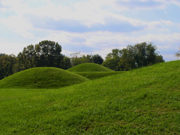
Hopewell Ceremonial Earthworks
United States · 40.0537° N, 82.4461° W · 3 km² · 39 km from Zanesville
Hopewell Ceremonial Earthworks are a World Heritage Site in the United States preserving eight monumental earthworks constructed by the Hopewell tradition. The sites consist of large geometric shapes covering several acres in area. Constructed between approximately 1 and 400 CE, the earthworks lie along tributaries of the Ohio River in the present-day state of Ohio. They depict the richness and depth of precontact culture, science, astronomy, and sacred monumental architecture. Many sites were plowed and reduced in size during almost 200 years of agricultural use.
In 2008, the Department of the Interior submitted Hopewell Ceremonial Earthworks as one of 14 sites on its tentative list from which the United States makes nominations for the UNESCO World Heritage Sites. UNESCO inscribed the earthworks as the United States' 25th and newest World Heritage Site on September 19, 2023. The complexes are owned and managed by the National Park Service and Ohio History Connection.
Adapted from Wikipedia: Hopewell Ceremonial Earthworks (CC BY-SA 4.0).
Why Hopewell Ceremonial Earthworks Is Listed
- (i)
- A masterpiece of human creative genius.
- (iii)
- A unique testimony to a cultural tradition or civilisation.
More about Hopewell Ceremonial Earthworks
UNESCO's Description
This property is a series of eight monumental earthen enclosure complexes built between 2,000 and 1,600 years ago along the central tributaries of the Ohio River. They are the most representative surviving expressions of the Indigenous tradition now referred to as the Hopewell culture. Their scale and complexity are evidenced in precise geometric figures as well as hilltops sculpted to enclose vast, level plazas. There are alignments with the cycles of the Sun and the far more complex cycles of the Moon. These earthworks served as ceremonial centres and the sites have yielded finely crafted ritual objects fashioned from exotic raw materials obtained from distant places.
From the UNESCO World Heritage Centre (CC BY-SA IGO 3.0).
Background
The Ohio Hopewell was an expression of the Hopewell culture that was dominant in southern Ohio. This region contains the largest concentration of Hopewell sites and was a center of the Hopewell interaction sphere which encompassed much of current North America, from the Rocky Mountains to Florida. Although the precise relation to other Hopewell sites is unclear, exotic goods from across North America such as obsidian from Wyoming, shells from the Gulf of Mexico, and copper from Michigan's upper peninsula have been found in huge quantities at these sites. These goods were fashioned into elaborate artifacts like carved sheets of mica and stone animal effigy pipes.
Sections adapted from Wikipedia: Hopewell Ceremonial Earthworks (CC BY-SA 4.0).

Okefenokee National Wildlife Refuge
United States · 30.7381° N, 82.1397° W · 1,646 km² · 64 km from Jacksonville
The Okefenokee National Wildlife Refuge is a 402,000‑acre (1,627 km2) National Wildlife Refuge located in Charlton, Ware, and Clinch Counties of Georgia, and Baker County in Florida, United States. The refuge is administered from offices in Folkston, Georgia. The refuge was established in 1937 to protect a majority of the 438,000 acres (1,770 km2) in the Okefenokee Swamp. The name "Okefenokee", often translated as "land of trembling earth", is likely derived from Hitchiti oki fanôːki ("bubbling water").
Nearly 400,000 people visit the refuge each year, making it the 16th most visited refuge in the National Wildlife Refuge System. It is the largest of any that is not located in a western state. In 1999, the economic impact of tourism in Charlton, Ware, and Clinch Counties in Georgia exceeded $67 million. The refuge has a staff of 16 with a fiscal year 2005 budget of $1,451,000. The refuge also administers the Banks Lake National Wildlife Refuge.
Adapted from Wikipedia: Okefenokee National Wildlife Refuge (CC BY-SA 4.0).
Why Okefenokee National Wildlife Refuge Is Listed
- (ix)
- An outstanding example of ongoing ecological and biological processes.
- (x)
- The most important natural habitats for conserving biodiversity.
More about Okefenokee National Wildlife Refuge
UNESCO's Description
The property, located in southeastern Georgia and northeastern Florida, protects the Okefenokee Swamp, the largest lowland freshwater peatland in the subtropical zone worldwide and one of the largest and most intact ecosystems within the North American Coastal Plain global biodiversity hotspot. The property comprises a diverse mosaic of wetlands, savannas, and forests shaped by the ongoing interaction of water, fire, vegetation, and wildlife, with alternating fire and rainfall processes driving peat formation, vegetation structure, and biodiversity. The site also contains significant areas of endangered Longleaf Pine ( Pinus palustris ) savanna, of which less than 3% remains, supporting high concentrations of plant species endemic to the region. Its extensive peat deposits provide an important archive of palaeo-environmental history and critical carbon storage. The property supports exceptional biodiversity, including at least 856 plant species, 48 mammal species, 238 bird species, 39 fish species, and 90 reptile and amphibian species, and provides important habitat for migratory birds, threatened species, and a significant population of American alligators.
From the UNESCO World Heritage Centre (CC BY-SA IGO 3.0).
Geography
Okefenokee NWR has an approved acquisition boundary of 519,480 acres (2,102.3 km2), which is 123,480 acres (499.7 km2) larger than its current area. Approximately 371,000 acres (1,500 km2) of the Okefenokee Swamp wetlands are incorporated into the refuge. 353,981 acres (1,432.51 km2) within the swamp were designated as the Okefenokee Wilderness, a part of the National Wilderness Preservation System when the Okefenokee Wilderness Act was passed in 1974, making it the third largest wilderness east of the Mississippi River.
The Okefenokee Swamp is a vast bog inside a huge, saucer-shaped depression that was once part of the ocean floor. The swamp now lies 103 to 128 feet (39 m) above mean sea level. Peat deposits, up to 15 feet (4.6 m) thick, cover much of the swamp floor.
History
The swamp has a rich human history including Native American settlement, explorations by Europeans, a massive drainage attempt, and intensive timber harvesting.
Native Americans inhabited Okefenokee Swamp as early as 2500 BC. Peoples of the Deptford Culture, the Swift Creek Culture and the Weeden Island Culture occupied sites within the Okefenokee. The last tribe to seek sanctuary in the swamp were the Seminoles. Troops led by General Charles Rinaldo Floyd during the Second Seminole War, 1838–1842, ended the age of the Native Americans in the Okefenokee.
The Suwannee Canal Company purchased 238,120 acres (963.6 km2) of the Okefenokee Swamp from the State of Georgia in 1891 to drain the swamp for rice, sugar cane, and cotton plantations.
Sections adapted from Wikipedia: Okefenokee National Wildlife Refuge (CC BY-SA 4.0).
Key Facts
| Established | 1937 |
|---|---|
| Area | 1,627 km² |
Facts from Wikidata Q7081911 (CC0).
Shared With Neighbouring Countries
These sites cross the border. Each is written up on the page of the country UNESCO lists first.

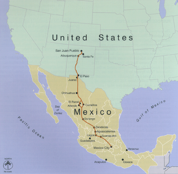
World Heritage in United States: Quick Answers
- How many UNESCO World Heritage Sites are in United States?
- United States has 23 World Heritage Sites: 10 cultural, 12 natural and 1 mixed. 2 of them are shared with a neighbouring country.
- What was the first World Heritage Site in United States?
- Mesa Verde National Park, inscribed in 1978. The most recent is Okefenokee National Wildlife Refuge, inscribed in 2026.
- What are the natural World Heritage Sites in United States?
- Yellowstone National Park, Everglades National Park, Grand Canyon National Park, Kluane / Wrangell – St. Elias / Glacier Bay / Tatshenshini-Alsek, Redwood National and State Parks, Mammoth Cave National Park, Olympic National Park, Great Smoky Mountains National Park, Yosemite National Park, Hawaiʻi Volcanoes National Park, Carlsbad Caverns National Park, Papahānaumokuākea Marine National Monument (mixed), Okefenokee National Wildlife Refuge.
- Are any World Heritage Sites in United States in danger?
- Yes: Everglades National Park is on UNESCO's List of World Heritage in Danger.