
Gandak
Gandak is a mapped river in the YearMaps hydrographic index. River courses organise settlement, agriculture and frontier-making more durably than any political boundary, and this reach is indexed against the dams, lakes and cities within its catchment.
- Feature Class
- River
- Coordinates
- 27.55°, 84.12°
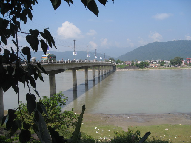
About Gandak
The Gandaki River, also known as the Narayani and Gandak, is one of the major rivers in Nepal and a left-bank tributary of the Ganges in India. In the Vedic text Shatapatha Brahmana, it is mentioned as Sadanira. Its total catchment area is 46,300 km2 (17,900 sq mi), most of it in Nepal. In the Nepal Himalayas, the Gandaki is notable for its deep canyon. The basin also contains three mountains over 8,000 m (26,000 ft), namely Dhaulagiri, Manaslu and Annapurna Massif. Dhaulagiri is the highest point of the Gandaki basin. In its upper reaches, the river is known as Kali Gandaki (or Gandaki) as it flows through the Mustang District and the famous Kali Gandaki Gorge in Nepal. When the river reaches the Terai plains of Nepal, it is referred to as the Narayani River. This name change typically occurs near the confluence with the Trishuli River at Devghat in Chitwan. Upon entering India, the river is known as the Gandak River.
Encyclopedic summary adapted from Wikipedia: Gandaki River (CC BY-SA 4.0).
Gandak in Depth
River course
The Kali Gandaki river source is at the border with Tibet at an elevation of 6,268 m (20,564 ft) at the Nhubine Himal Glacier in the Mustang region of Nepal.
The headwater stream on some maps is named the Chhuama Khola and then, nearing Lo Manthang, the Nhichung Khola or Choro Khola. The Kali Gandaki then flows southwest (with the name of Mustang Khola on old, outdated maps) through a sheer-sided, deep canyon before widening at the steel footbridge at Chele, where part of its flow funnels through a rock tunnel, and from this point the now wide river is called the Kali Gandaki on all maps. In Kagbeni a major tributary named Johng Khola, Kak Khola or Krishnaa descends from Muktinath.
Sections adapted from Wikipedia: Gandaki River (CC BY-SA 4.0).
Gandak: Key Facts
| Length | 630 km |
|---|---|
| Average discharge | 1,760 m³/s |
| Drainage basin | 46,300 km² |
| Source | Dhaulagiri |
| Mouth | Ganges |
| Drainage system | Ganges Basin |
| Tributaries | Myagdi Khola, Trishuli River, Rahughat Khola |
Facts from Wikidata Q849494 (CC0).
Major River Dossiers
Hand-written studies of the great river systems of history.
Connected Reaches
Nearby watercourses in the same drainage network.
Water Bodies in the Catchment
Settlements Along the Reach
Hydraulic Infrastructure Nearby
Surrounding Terrain
Gandak: Quick Answers
- Where is Gandak?
- Gandak is located in Nepal and India, at 27.5489° N, 84.1152° E.
- Are there dams on the Gandak?
- No dam on the Gandak is recorded in the YearMaps dam index, which covers major structures only.