Skip to content
YearMaps
China · Lakes

Largest Lakes in China

Qinghai Hu is the largest of the 60 lakes recorded for China, at 4,457 km², ahead of Lake Khanka at 4,036 km². The full list follows.

How this list is built: Ranked by mapped surface area. A lake on a border is listed under each country it lies in, with the area of the whole lake. It covers the lakes indexed in YearMaps, drawn from open geospatial data, and is not an exhaustive national register.

Lakes Listed
60
Top Ranked
4,457 km²
Qinghai Hu
Second
4,036 km²
Lake Khanka
Profiled Below
22
Photo, encyclopedia text and figures
Largest Lakes in China
#NameSurface Area
1Qinghai Hu4,457 km²
2Lake Khanka4,036 km²
3Tai Hu2,509 km²
4Hongze Hu2,351 km²
5Hulun Nuur2,347 km²
6Poyang Hu2,078 km²
7Nam Co1,880 km²
8Siling Co1,578 km²
9Bosten Hu1,003 km²
10Gaoyou Hu847 km²
11Tangra Yumco800 km²
12Chao Hu789 km²
13Dongting Hu772 km²
14Danjiangkou Shuiku772 km²
15Yamzho Yumco671 km²
16Lop Nur654 km²
17Ayakkum Hu613 km²
18Ngoring Hu604 km²
19Buyr Nuur603 km²
20Ebinur Hu600 km²
21Xinanjiang Shuiku588 km²
22Gyaring Hu544 km²
23Ngangla Ringeo522 km²
24Gyaring Co490 km²
25Liangzi Hu451 km²
26Ngangz Co431 km²
27Mapam Yumco398 km²
28Pangong Tso379 km²
29Long Hu368 km²
30Xinfengjiang Shuiku351 km²
31Aqqikkol Hu348 km²
32Weishan Hu334 km²
33Shijiu Hu312 km²
34Lumajangdong Co309 km²
35Hong Hu306 km²
36Daguan Hu301 km²
37Hoh Xil Hu298 km²
38Hoh Sai Hu274 km²
39Langa Co273 km²
40Huangtang Hu269 km²
41Puma Yumco257 km²
42Huiten Nur256 km²
43Gozha Co255 km²
44Gas Hu246 km²
45Dalai Nur244 km²
46Ulgain Gobi235 km²
47Po Hu213 km²
48Qagan Nur211 km²
49Elsen Nur208 km²
50Ulansuhai Nur196 km²
51Ge Hu196 km²
52Songhua Hu176 km²
53Supung Reservoir165 km²
54Alesayqin Ha156 km²
55Wuchang Hu146 km²
56Dongping Hu135 km²
57Luoma Hu105 km²
58Yueliang Pao69 km²
59Guanting Shuiku51 km²
60Baidagang Shuiku46 km²

The Lakes of China in Detail

The 22 lakes above that have an encyclopedia article, in the same order, each with its photograph, figures and the places around it.

Qinghai Hu
Image via Wikimedia Commons (author and licence on the file page).

Qinghai Hu

Alkaline Lake · 4,457 km²

Qinghai Hu is a alkaline lake in China, with a mapped surface area of about 4,457 km².

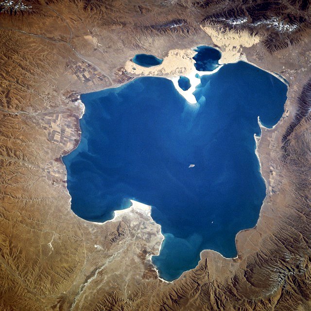
Qinghai Lake is the largest lake in China. Located in the Qinghai Province, to which it gave its name, Qinghai Lake is classified as an alkaline endorheic salt lake. The lake has fluctuated in size, shrinking over much of the 20th century but increasing since 2004. It had a surface area of 4,317 km2 (1,667 sq mi), an average depth of 21 m (69 ft), and a maximum depth of 25.5 m (84 ft) in 2008.

Adapted from Wikipedia: Qinghai Lake (CC BY-SA 4.0).

Surface area
4,457 km²
Area rank
#44 of 756 indexed
Type
Alkaline Lake
Country
China
Coordinates
36.8999°, 100.1555°

Among the 756 water bodies with a mapped extent in YearMaps, Qinghai Hu ranks #44 by surface area, after Lake of the Woods (4,618 km²) and ahead of Lake Urmia (4,382 km²). Areas are computed from the mapped outline and are approximate.

Settlements on the shore:
Xining (147 km), Zhangye (227 km), Wuwei (247 km)
Watercourses:
Yellow River (River), Tongtian (River)
Other water nearby:
Ulansuhai Nur (196 km²), Ayakkum Hu (613 km²)

View on the live map

More about Qinghai Hu

Geography

Qinghai Lake lies about 100 kilometers (62 mi) west of Xining in a hollow of the Tibetan Plateau at 3,205 meters (10,515 ft) above sea level. It lies between Haibei Tibetan Autonomous Prefecture and Hainan Tibetan Autonomous Prefecture in northeastern Qinghai in Northwest China. The lake has fluctuated in size, shrinking over much of the 20th century but increasing since 2004. It had a surface area of 4,317 square kilometers (1,667 sq mi), an average depth of 21 meters (69 ft), and a maximum depth of 25.5 m (84 ft) in 2008.

Twenty-three rivers and streams empty into Qinghai Lake, most of them seasonal. Five permanent streams provide 80% of the total influx.

History

During the Han dynasty (206 BCE – 220 CE), substantial numbers of Han Chinese lived in the Xining valley to the east. In the 17th century, Mongolic-speaking Oirat and Khalkha tribals migrated to Qinghai and became known as Qinghai Mongols. In 1724, the Qinghai Mongols led by Lobzang Danjin revolted against the Qing dynasty. The Yongzheng Emperor, after putting down the rebellion, stripped away Qinghai's autonomy and imposed direct rule. Although some Tibetans lived around the lake, the Qing maintained an administrative division from the time of Güshi Khan between the Dalai Lama's western realm (slightly smaller than the current Tibet Autonomous Region) and the Tibetan-inhabited areas in the east. Yongzheng also sent Manchu and Han settlers to dilute the Mongols.

Sections adapted from Wikipedia: Qinghai Lake (CC BY-SA 4.0).

Qinghai Hu: Key Facts

Key facts about Qinghai Hu
Surface area4,400 km²
Maximum depth21 m
Volume71.6 km³
Surface elevation3,266 m
InflowsBuh He

Facts from Wikidata Q201294 (CC0).

Lake Khanka
Image via Wikimedia Commons (author and licence on the file page).

Lake Khanka

Lake · 4,036 km²

Lake Khanka is a lake in Russia and China, with a mapped surface area of about 4,036 km². About 26% of its surface lies in China, and the rest in Russia.

Lake Khanka (Russian: озеро Ханка) or Lake Xingkai (simplified Chinese: 兴凯湖; traditional Chinese: 興凱湖; pinyin: Xīngkǎi Hú), is a freshwater lake on the border between Primorsky Krai, Russia and Heilongjiang province, Northeast China (at 45°0′N 132°25′E).

Adapted from Wikipedia: Lake Khanka (CC BY-SA 4.0).

Surface area
4,036 km²
Area rank
#53 of 756 indexed
Type
Lake
Countries
Russia, China
Coordinates
45.0683°, 132.4506°

Among the 756 water bodies with a mapped extent in YearMaps, Lake Khanka ranks #53 by surface area, after Bratsk Reservoir (4,078 km²) and ahead of Lagoa Mirim (3,845 km²). Areas are computed from the mapped outline and are approximate.

Settlements on the shore:
Mishan (59 km), Hulin (74 km), Jixi (118 km)
Watercourses:
Song’acha (River), Muling (River)
Other water nearby:
Hongze Hu (2,351 km²), Tai Hu (2,509 km²)

View on the live map

More about Lake Khanka

Lake Khanka: Key Facts

Key facts about Lake Khanka
Surface area4,190 km²
Maximum depth10.6 m
Surface elevation69 m
InflowsIlistaya, Melgunovka, Komissarovka, Spasovka, Tur
OutflowsSungacha

Facts from Wikidata Q201843 (CC0).

Tai Hu
Image via Wikimedia Commons (author and licence on the file page).

Tai Hu

Lake · 2,509 km²

Tai Hu is a lake in China, with a mapped surface area of about 2,509 km².

Taihu (Chinese: 太湖), also known as Lake Tai or Lake Taihu, is a lake in the Yangtze Delta and the third largest freshwater lake in China. The lake is in Jiangsu province and a significant part of its southern shore forms its border with Zhejiang. With an area of 2,250 square kilometers (869 sq mi) and an average depth of 2 meters (6.6 ft), it is the third-largest freshwater lake entirely in China, after Poyang and Dongting. The lake contains about 90 islands, ranging in size from a few square meters to several square kilometers.

Lake Tai is linked to the Grand Canal and is the origin of a number of rivers, including the Suzhou Creek.

The major cities around Taihu Lake include Suzhou, Wuxi, Changzhou and Huzhou. These urban areas form the core of the lake's cultural and economic region. University-led hydrological and ecological studies note that these four cities are the primary urban centers surrounding the lake.

Taihu Lake is officially designated as a national key scenic area under China's Major National Historical and Cultural Sites programme.

Adapted from Wikipedia: Lake Tai (CC BY-SA 4.0).

Surface area
2,509 km²
Area rank
#80 of 756 indexed
Type
Lake
Country
China
Coordinates
31.1740°, 120.1456°

Among the 756 water bodies with a mapped extent in YearMaps, Tai Hu ranks #80 by surface area, after Tonle Sap (2,547 km²) and ahead of Wollaston Lake (2,473 km²). Areas are computed from the mapped outline and are approximate.

Settlements on the shore:
Huzhou (34 km), Suzhou (47 km), Wuxi (48 km)
Watercourses:
Fuchun (River), Ying (River)
Other water nearby:
Chao Hu (789 km²), Hongze Hu (2,351 km²)

View on the live map

More about Tai Hu

Geography

Taihu Lake features 48 islands and 72 surrounding peaks, forming a distinctive landscape of "mountains beyond mountains, lakes within lakes."

The area includes famous scenic locales such as Yuantouzhu, Sanshan (Three Hills), Dongshan, Xishan, and Majishan.

Bordering cities—Wuxi, the Classical Gardens of Suzhou, ancient sites of Wu culture, and the grottoes of Yixing—collectively form the internationally recognized Taihu Scenic Area.

Covering approximately 2,338 km2 in the Yangtze Delta, Taihu Lake lies between Jiangsu and Zhejiang. Its waters flow into the Yangtze River, and it is connected to the Beijing–Hangzhou Grand Canal.

At a normal Wusong elevation of 3.00 m, the lake averages 1.9 m and reaches a maximum of about 2.6 m in depth, holding roughly 4.66 × 10⁹ m3 of water.

Sections adapted from Wikipedia: Lake Tai (CC BY-SA 4.0).

Tai Hu: Key Facts

Key facts about Tai Hu
Surface area2,250 km²
Maximum depth2 m
Surface elevation3.1 m
InflowsXitiao Xi, Dongtiao Xi

Facts from Wikidata Q140712 (CC0).

Hongze Hu
Image via Wikimedia Commons (author and licence on the file page).

Hongze Hu

Lake · 2,351 km²

Hongze Hu is a lake in China, with a mapped surface area of about 2,351 km².

Hongze Lake, previously romanized as Lake Hungtze or Hung-tse, is the fourth-largest freshwater lake in China. Although it is known to have existed from antiquity, it drastically increased in size during the Qing when the Yellow River—then still flowing south of Shandong—merged with the Huai. The increased sediment and flow combined to greatly expand the lake, swallowing the previous regional center of Sizhou and the Ming Zuling tombs. During the imperial and republican periods, the lake formed part of the border between Jiangsu and Anhui provinces but since 1955, border changes have put it entirely in Jiangsu, in the counties of Sihong and Siyang in Suqian Prefecture and Xuyi and Hongze in Huai'an Prefecture. Since the establishment of the People's Republic of China, the lake has generally decreased in size as more of its inflow has been diverted for irrigation.

Adapted from Wikipedia: Hongze Lake (CC BY-SA 4.0).

Surface area
2,351 km²
Area rank
#87 of 756 indexed
Type
Lake
Country
China
Coordinates
33.2673°, 118.5089°

Among the 756 water bodies with a mapped extent in YearMaps, Hongze Hu ranks #87 by surface area, after Lac de Kossou (2,375 km²) and ahead of Hulun Nuur (2,347 km²). Areas are computed from the mapped outline and are approximate.

Settlements on the shore:
Huaiyin (60 km), Shuyang (99 km), Bengbu (115 km)
Watercourses:
Ying (River), Huai (River)
Other water nearby:
Chao Hu (789 km²), Tai Hu (2,509 km²)

View on the live map

More about Hongze Hu

Geography

Hongze Lake reaches an area of about 3 million mu when its depth reaches 12.5 meters (41 ft), making it the second-largest freshwater lake in Jiangsu and the fourth- or fifth-largest in the country, behind lakes Poyang, Dongting, Tai, and Hulun. Hongze Lake's meandering shoreline usually runs around 365 kilometers (227 mi).

History

The area that now forms Hongze Lake was an inlet of the East China Sea about 2 million year ago before being closed in by sediment from the Huai and other nearby rivers. In Chinese antiquity, the area formed a number of shallow lakes collectively known as Fuling. Other nearby lakes at the time that later merged into Hongze were Nidun and Wanjia. The hegemon Fuchai of Wu constructed the Han or Hangou Canal (t 邗溝, s 邗沟, Hángōu), connecting the lake system with Yangzhou and the Yangtze Delta in 486 bc to improve the supply lines of his army in conflicts with Qi.

Under the Han, Fuling was renamed Pofu Pond.

Sections adapted from Wikipedia: Hongze Lake (CC BY-SA 4.0).

Hongze Hu: Key Facts

Key facts about Hongze Hu
Surface area1,960 km²
Maximum depth5.5 m
Surface elevation15 m
InflowsHuai River
OutflowsGrand Canal, North Jiangsu Irrigation Main Channel, Huai river estuarial canal

Facts from Wikidata Q1154914 (CC0).

Poyang Hu
Image via Wikimedia Commons (author and licence on the file page).

Poyang Hu

Lake · 2,078 km²

Poyang Hu is a lake in China, with a mapped surface area of about 2,078 km².

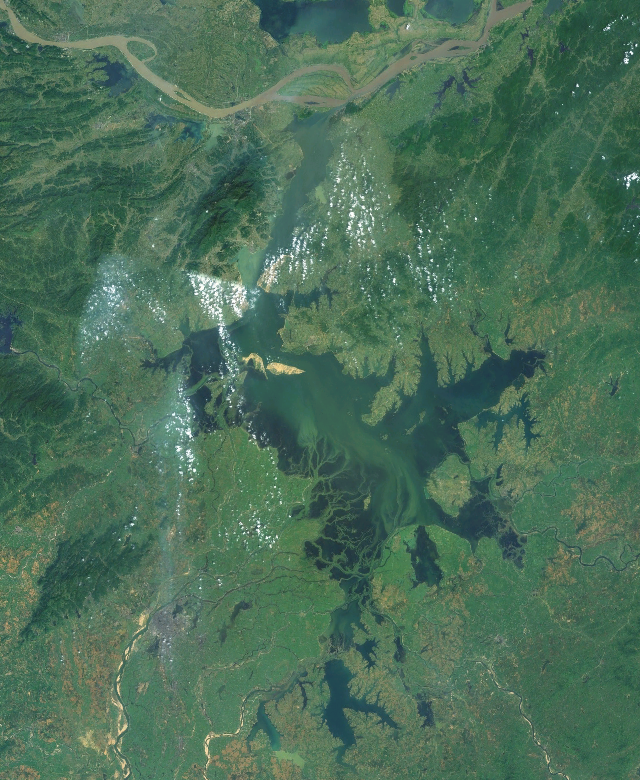
Poyang Lake is the largest freshwater lake in China. Located within Jiujiang Prefecture in Jiangxi Province, it is fed by the Gan, Xin, and Xiu rivers and flows northward into the Yangtze River through a channel.

The area of Poyang Lake fluctuates dramatically between the wet and dry seasons, but in recent years the size of the lake has been decreasing overall. In a normal year the area of the lake averages 3,500 square kilometers (1,400 mi2). In early 2012, drought, sand quarrying, and the practice of storing water at the Three Gorges Dam lowered the area of the lake to about 200 square kilometers (77 mi2).

The lake provides a habitat for half a million migratory birds and is a favorite destination for birding. During the winter, the lake becomes home to many migrating Siberian cranes, up to 90% of this critically endangered species spend the winter there.

Adapted from Wikipedia: Poyang Lake (CC BY-SA 4.0).

Surface area
2,078 km²
Area rank
#95 of 756 indexed
Type
Lake
Country
China
Coordinates
29.0609°, 116.3672°

Among the 756 water bodies with a mapped extent in YearMaps, Poyang Hu ranks #95 by surface area, after Lake Barlee (2,101 km²) and ahead of Kakhovka Reservoir (2,045 km²). Areas are computed from the mapped outline and are approximate.

Settlements on the shore:
Nanchang (64 km), Jingdezhen (82 km), Jiujiang (83 km)
Watercourses:
Fuchun (River), Gan (River)
Other water nearby:
Chao Hu (789 km²), Dongting Hu (772 km²)

View on the live map

More about Poyang Hu

Poyang Hu: Key Facts

Key facts about Poyang Hu
Surface area5,100 km²
Maximum depth25 m
Surface elevation12 m
InflowsGan River, Fu River, Le'an River, Xiushui River, Chang Jiang, Rao He
OutflowsYangtze River
Drainage systemYangtze River basin

Facts from Wikidata Q207690 (CC0).

Nam Co
Image via Wikimedia Commons (author and licence on the file page).

Nam Co

Lake · 1,880 km²

Nam Co is a lake in China, with a mapped surface area of about 1,880 km².

Namtso (officially Namco; Chinese: 纳木错; pinyin: Nàmù Cuò; Tibetan: གནམ་མཚོ་, ZWPY: Nam Co) or Lake Nam (30°42′N 90°33′E), also referred to as Tengri Nor ('Heavenly Lake'; Mongolian: Tenger nuur), is a mountain lake on the border between Damxung County of Lhasa prefecture-level city and Baingoin County of Nagqu Prefecture in the Tibet Autonomous Region of China, approximately 112 kilometres (70 mi) NNW of Lhasa. It lies north of the Nyenchen Tanglha Mountains (Nyainqêntanglha) on the Tibetan Plateau.

Adapted from Wikipedia: Namtso (CC BY-SA 4.0).

Surface area
1,880 km²
Area rank
#107 of 756 indexed
Type
Lake
Country
China
Coordinates
30.6926°, 90.4555°

Among the 756 water bodies with a mapped extent in YearMaps, Nam Co ranks #107 by surface area, after Lago Buenos Aires (1,895 km²) and ahead of Represa Furnas (1,873 km²). Areas are computed from the mapped outline and are approximate.

Settlements on the shore:
Lhasa (132 km), Xigaze (221 km), Thimphu (367 km)
Watercourses:
Tuotuo (River), Brahmaputra River (River)
Other water nearby:
Siling Co (1,578 km²), Yamzho Yumco (671 km²)

View on the live map

More about Nam Co

Geography

Namtso (Namco) is a lake that first formed during the Paleogene age, as a result of Himalayan tectonic plate movements. The lake lies at an elevation of 4,718 m (15,479 ft), and has a surface area of 1,900 km2 (730 sq mi). This salt lake is the largest lake in the Tibet Autonomous Region. However, it is not the largest lake on the Qinghai-Tibet Plateau. That title belongs to Qinghai Lake (more than twice the size of Namtso); which lies more than 1,000 km (620 mi) to the north-east in Qinghai.

Namtso has five uninhabited islands of reasonable size, in addition to one or two rocky outcrops. The islands have been used for spiritual retreat by pilgrims who walk over the lake's frozen surface at the end of winter, carrying their food with them.

Climate

The weather at Namtso is subject to abrupt, sudden change and snowstorms are very common across the Nyenchen Tanglha mountain range.

Namtso has an alpine climate (Köppen ETH) characterised by frigid, extremely dry winters and cool, rainy summers.

Sections adapted from Wikipedia: Namtso (CC BY-SA 4.0).

Nam Co: Key Facts

Key facts about Nam Co
Surface area1,920 km²
Maximum depth125 m
Volume0.77 km³
Surface elevation4,718 m

Facts from Wikidata Q651294 (CC0).

Siling Co
Image via Wikimedia Commons (author and licence on the file page).

Siling Co

Lake · 1,578 km²

Siling Co is a lake in China, with a mapped surface area of about 1,578 km².

Siling Lake (Tibetan: སེར་གླིང་མཚོ, Wylie: ser gling mtsho, ZWPY: Sêling Co; Chinese: 色林错; pinyin: Sèlín cuò) (also known as Qilin or Selincuo) is a salt lake in the Tibet Autonomous Region, China to the north of Xainza. Administratively it belongs to Xainza County and Baingoin County of Nagqu prefecture-level city. Doijiang is located near the lake, whilst Bangecuo is another nearby salt lake around four miles away to the east.

Adapted from Wikipedia: Siling Lake (CC BY-SA 4.0).

Surface area
1,578 km²
Area rank
#125 of 756 indexed
Type
Lake
Country
China
Coordinates
31.7913°, 89.0951°

Among the 756 water bodies with a mapped extent in YearMaps, Siling Co ranks #125 by surface area, after Lake Okeechobee (1,587 km²) and ahead of Lake Tuz (1,564 km²). Areas are computed from the mapped outline and are approximate.

Settlements on the shore:
Xigaze (283 km), Lhasa (306 km), Thimphu (483 km)
Watercourses:
Tuotuo (River), Maquan (River)
Other water nearby:
Nam Co (1,880 km²), Tangra Yumco (800 km²)

View on the live map

More about Siling Co

Overview

The lake lies at an altitude of 4,530 metres (14,860 ft). It is a salt lake fed by the rivers Za'gya Zangbo (or Tsagya Tsangpo) (扎加藏布) and the Boques Tsangpo (波曲藏布). With an area of 1,865 km2 (720 sq mi), Siling Co is the largest saltwater lake in the northern Tibetan Plateau and forms part of the Xainza Nature Reserve. This 400,000-hectare (990,000-acre) reserve was established in 1993 and contains significant populations of black-necked cranes and some 120 species of birds in total. The lake only has a single species of fish, Gymnocypris selincuoensis, exploited by fishermen. The prairie on the banks of the lake is traditionally used as grazing land for yaks and sheep.

Climate

Siling Lake has an alpine climate (Köppen ETH) bordering upon a dry-winter subalpine climate (Dwc), characterised by pleasant summers with cold mornings, and frigid, exceedingly dry winters. The temperature at the lake is an annual average of −0.9 °C (30.4 °F), and the maximum monthly average temperature in July is 9.6 °C (49.3 °F). The average precipitation is 290 mm (11 in) per year, 90 percent of which falls in the months of June to September, often as hail.

Sections adapted from Wikipedia: Siling Lake (CC BY-SA 4.0).

Siling Co: Key Facts

Key facts about Siling Co
Surface area1,640 km²
Surface elevation4,725 m
InflowsZa'gya Zangbo, Bogcang Zangbo

Facts from Wikidata Q1404973 (CC0).

Bosten Hu
Image via Wikimedia Commons (author and licence on the file page).

Bosten Hu

Lake · 1,003 km²

Bosten Hu is a lake in China, with a mapped surface area of about 1,003 km².

Bosten Lake (traditional Chinese: 博斯騰湖; simplified Chinese: 博斯腾湖; pinyin: Bósīténg Hú, Uyghur: باغراش كۆلى / Бағраш Көли / Baghrash Köli / Baƣrax Kɵli, Chagatai: Bostang) is a freshwater lake on the northeastern rim of the Tarim Basin, about 20 km (12 mi) east of Yanqi and 57 km (35 mi) northeast of Korla, Xinjiang, China in the Bayin'gholin Mongol Autonomous Prefecture. Covering an area of about 1,000 km2 (390 sq mi) (together with adjacent small lakes), it is the largest lake in Xinjiang and one of the largest inland freshwater lakes in China. Bosten lake receives water inflow from a catchment area of 56,000 km2 (22,000 sq mi).

The lake's Mongol, Uyghur and Chinese names are sometimes rendered as Bosten Hu, Bagrax-hu, Bagrasch-köl, Baghrasch köl, Bagratsch-kul, Bositeng Lake or Bositeng Hu.

The Kaidu River is the most important tributary to Lake Bosten, accounting for about 83% of its water inflow, other significant tributaries are the Huangshui Ditch (Chinese: 黃水溝), the Qingshui River (清水河), and Wulasite River (烏拉司特河).

Adapted from Wikipedia: Bosten Lake (CC BY-SA 4.0).

Surface area
1,003 km²
Area rank
#199 of 756 indexed
Type
Lake
Country
China
Coordinates
41.9920°, 86.9713°

Among the 756 water bodies with a mapped extent in YearMaps, Bosten Hu ranks #199 by surface area, after Represa Porto Primavera (1,014 km²) and ahead of Lac de Buyo (999 km²). Areas are computed from the mapped outline and are approximate.

Settlements on the shore:
Korla (74 km), Ürümqi (208 km), Turpan (208 km)
Watercourses:
Konqi (River), Tarim (River)
Other water nearby:
Lop Nur (654 km²), Ayakkum Hu (613 km²)

View on the live map

More about Bosten Hu

Bosten Hu: Key Facts

Key facts about Bosten Hu
Surface area1,010 km²
Maximum depth17 m
Volume7.74 km³
Surface elevation1,048 m
InflowsKaidu River
OutflowsKonqi He

Facts from Wikidata Q611206 (CC0).

Tangra Yumco
Image via Wikimedia Commons (author and licence on the file page).

Tangra Yumco

Lake · 800 km²

Tangra Yumco is a lake in China, with a mapped surface area of about 800 km².

Tangra Yumco (Tibetan: དྭངས་རྭ་གཡུ་མཚོ, Wylie: dwangs rwa g.yu mtsho, Chinese: 当惹雍错; pinyin: dāng rě yōng cuò) is a salt lake in Tibet, China. It is in the southwest of Nyima County. Tangra Yumco is 835.8 square kilometres (322.7 sq mi), with a drainage area of 8,219.7 square kilometres (3,173.6 sq mi), an elevation of 4,528 metres (14,856 ft), length 71.7 kilometres (44.6 mi) and mean width 11.65 kilometres (7.24 mi) (maximum width 19.4 metres [64 ft]). It is the holy lake of the

Adapted from Wikipedia: Tangra Yumco (CC BY-SA 4.0).

Surface area
800 km²
Area rank
#231 of 756 indexed
Type
Lake
Country
China
Coordinates
31.1909°, 86.6934°

Among the 756 water bodies with a mapped extent in YearMaps, Tangra Yumco ranks #231 by surface area, after Réservoir de Caniapiscau (805 km²) and ahead of Lago Colhu Huapi (791 km²). Areas are computed from the mapped outline and are approximate.

Settlements on the shore:
Xigaze (301 km), Kathmandu (409 km), Lalitpur (413 km)
Watercourses:
Maquan (River), Gandak (River)
Other water nearby:
Siling Co (1,578 km²), Nam Co (1,880 km²)

View on the live map

More about Tangra Yumco

Tangra Yumco: Key Facts

Key facts about Tangra Yumco
Surface area836 km²
Surface elevation4,528 m

Facts from Wikidata Q659377 (CC0).

Chao Hu
Image via Wikimedia Commons (author and licence on the file page).

Chao Hu

Lake · 789 km²

Chao Hu is a lake in China, with a mapped surface area of about 789 km².

Chao Lake (Chinese: 巢湖), also known by its Chinese name Chao Hu, is a lake wholly situated in Hefei, the capital of Anhui Province. It is the largest lake in Anhui and one of the five major freshwater lakes in China.

Adapted from Wikipedia: Chao Lake (CC BY-SA 4.0).

Surface area
789 km²
Area rank
#233 of 756 indexed
Type
Lake
Country
China
Coordinates
31.5943°, 117.6794°

Among the 756 water bodies with a mapped extent in YearMaps, Chao Hu ranks #233 by surface area, after Lago Colhu Huapi (791 km²) and ahead of Lake Mead (787 km²). Areas are computed from the mapped outline and are approximate.

Settlements on the shore:
Hefei (48 km), Wuhu (71 km), Tongling (72 km)
Watercourses:
Ying (River), Fuchun (River)
Other water nearby:
Hongze Hu (2,351 km²), Tai Hu (2,509 km²)

View on the live map

More about Chao Hu

Tourism

Tourist sites around the lake include Mushan Island, Zhongmiao Temple, Tongyang River, Mount Yinping, and the Immortals Cave. The silver fish, shrimps, and crabs of Lake Chao are called the Three Treasures; as such, the lake is nicknamed "The Land of Fish and Rice".

Sections adapted from Wikipedia: Chao Lake (CC BY-SA 4.0).

Chao Hu: Key Facts

Key facts about Chao Hu
Surface area760 km²
Maximum depth3.8 m
Surface elevation-4 m

Facts from Wikidata Q1062495 (CC0).

Dongting Hu
Image via Wikimedia Commons (author and licence on the file page).

Dongting Hu

Lake · 772 km²

Dongting Hu is a lake in China, with a mapped surface area of about 772 km².

Dongting Lake (Chinese: 洞庭湖) is a large, shallow lake in northeastern Hunan Province, China. Also referred to less frequently as the Dongting Plain, it is a flood basin of the Yangtze River, so its volume depends on the season. The provinces of Hubei and Hunan are named after their location relative to the lake: Hubei means "North of the Lake" and Hunan, "South of the Lake".

Dongting Lake is famous in Chinese culture as the place of origin of dragon boat racing and is home to the critically endangered Yangtze finless porpoise.

Adapted from Wikipedia: Dongting Lake (CC BY-SA 4.0).

Surface area
772 km²
Area rank
#235 of 756 indexed
Type
Lake
Country
China
Coordinates
28.9200°, 112.2129°

Among the 756 water bodies with a mapped extent in YearMaps, Dongting Hu ranks #235 by surface area, after Lake Mead (787 km²) and ahead of Danjiangkou Shuiku (772 km²). Areas are computed from the mapped outline and are approximate.

Settlements on the shore:
Yiyang (37 km), Changde (53 km), Jinshi (87 km)
Watercourses:
Yuan (River), Xiang (River)
Other water nearby:
Poyang Hu (2,078 km²), Chao Hu (789 km²)

View on the live map

More about Dongting Hu

Geography

In the July–September period, flood water from the Yangtze flows into the lake, enlarging it greatly. The lake's area, which normally is 2,820 km2 or 1,090 mi2 (data before 1998), may increase to 20,000 km2 (7,700 mi2) in flood season, when vast amounts of water and sediment from the Chang Jiang flow into the lake. The lake is also fed by four major rivers: the Xiang, Zi, Yuan and Li rivers. Small rivers also flow in, the most famous being the Miluo River, where the loyal official and poet Qu Yuan committed suicide in the early 3rd century BC, according to tradition. In addition, the Xiao River flows into the Xiang near Yongzhou, before the Xiang flows into the lake. Ocean-going vessels can travel through the Xiang to reach Changsha.

History

The earliest rice paddies yet discovered in the world were in the Liyang plain, which was then on the western edge of Dongting lake. The state of Chu occupied the region in the Eastern Zhou period, and its territory there was taken over by Qin in the 3rd century BCE. During the Han dynasty, Yunmeng Marsh (雲夢大澤; Yúnmèng dàzé literally "Great Marsh of Cloud Dream"), which lies to the north of Dongting Lake in Hubei Province, served as the main flood basin of the Yangtze. The rich sediment of the marsh attracted farmers. As embankments were built along the north bank of the Yangtze River, floodwaters that would previously have accumulated there were diverted southwards into Dongting Lake. This means that the large size of Dongting Lake was increasingly the result of human activity.

Sections adapted from Wikipedia: Dongting Lake (CC BY-SA 4.0).

Dongting Hu: Key Facts

Key facts about Dongting Hu
Surface area4,350 km²
Maximum depth31 m
Volume18 km³
Surface elevation33 m
InflowsYangtze River, Yuan River
OutflowsYangtze River
Drainage systemYangtze River basin

Facts from Wikidata Q216083 (CC0).

Yamzho Yumco
Image via Wikimedia Commons (author and licence on the file page).

Yamzho Yumco

Lake · 671 km²

Yamzho Yumco is a lake in China, with a mapped surface area of about 671 km².

Yamdrok Lake (also known as Yamdrok Yumtso or Yamzho Yumco; Tibetan: ཡར་འབྲོག་གཡུ་མཚོ་, Wylie: yar 'brog g.yu mtsho, ZWPY: Yamzhog Yumco; Chinese: 羊卓雍錯; pinyin: Yángzhuó Yōngcuò, Yángzhuō Yōngcuò) is a freshwater lake in Tibet. It is one of the three largest lakes in Tibet. It is over 72 km (45 mi) long. The lake is surrounded by many snow-capped mountains and is fed by numerous small streams. The lake has an outlet stream, a tributary of Yarlung Tsangpo, at its far western end and means turquoise in English due to its color.

Around 90 km (56 mi) to the west of the lake lies the Tibetan town of Gyantse and Lhasa is 100 km (62 mi) to the northeast. According to local mythology, Yamdok Yumtso lake is the transformation of a goddess.

The Yamdrok Hydropower Station was completed and dedicated in 1996 near the small village of Baidi at the lake's western end. This power station is the largest in Tibet.

Adapted from Wikipedia: Yamdrok Lake (CC BY-SA 4.0).

Surface area
671 km²
Area rank
#255 of 756 indexed
Type
Lake
Country
China
Coordinates
28.9895°, 90.9085°

Among the 756 water bodies with a mapped extent in YearMaps, Yamzho Yumco ranks #255 by surface area, after Lake Naococane (672 km²) and ahead of Selwyn Lake (671 km²). Areas are computed from the mapped outline and are approximate.

Settlements on the shore:
Lhasa (75 km), Xigaze (199 km), Thimphu (210 km)
Watercourses:
Tista (River), Subansiri (River)
Other water nearby:
Puma Yumco (257 km²), Nam Co (1,880 km²)

View on the live map

More about Yamzho Yumco

Climate

Yamdrok Lake has a cold steppe climate (BSk) with long, cold, very dry winters and short, cool, wet summers. It is also bordering on an alpine tundra climate (ET) and on a subarctic climate (Dwc). The differences between day and night are great.

Sections adapted from Wikipedia: Yamdrok Lake (CC BY-SA 4.0).

Yamzho Yumco: Key Facts

Key facts about Yamzho Yumco
Surface area640 km²
Surface elevation4,440 m

Facts from Wikidata Q939604 (CC0).

Lop Nur
Image via Wikimedia Commons (author and licence on the file page).

Lop Nur

Lake · 654 km²

Lop Nur is a lake in China, with a mapped surface area of about 654 km².

Lop Nur or Lop Nor (Uyghur: لوپنۇر, Oirat: ᠯᠣ᠊ᠫᠨᡇᡇᠷ, romanized: Lob nuur, from an Oirat Mongolic name meaning "Lop Lake", where "Lop" is a toponym of unknown origin) is a now largely dried-up salt lake formerly located within the Lop Depression in the eastern fringe of the Tarim Basin in the southeastern portion of the Xinjiang Autonomous Region, northwestern China, between the Taklamakan and Kumtag deserts. Administratively, the lake is in Lop Nur town (Chinese: 罗布泊镇; pinyin: Luóbùpō zhèn), also known as Luozhong (罗中; Luózhōng) of Ruoqiang County, which in its turn is part of the Bayingolin Mongol Autonomous Prefecture.

The lake system, into which the Tarim River and Shule River drain from the west and east respectively, is the last remnant of the historical post-glacial Tarim Lake, which once covered more than 10,000 km2 (3,900 sq mi) in the Tarim Basin but had progressively shrunk throughout the Holocene due to rain shadowing by the Tibetan Plateau. Lop Nur is hydrologically endorheic; it is landbound, has no outlet, and has relied largely on meltwater runoffs from the Tianshan, Kunlun and the western Qilian Mountains.

Adapted from Wikipedia: Lop Nur (CC BY-SA 4.0).

Surface area
654 km²
Area rank
#261 of 756 indexed
Type
Lake
Country
China
Coordinates
40.7386°, 90.1714°

Among the 756 water bodies with a mapped extent in YearMaps, Lop Nur ranks #261 by surface area, after Lake Ballard (656 km²) and ahead of Beysehir (652 km²). Areas are computed from the mapped outline and are approximate.

Settlements on the shore:
Turpan (258 km), Korla (354 km), Hami (362 km)
Watercourses:
Konqi (River), Qarqan (River)
Other water nearby:
Bosten Hu (1,003 km²), Ayakkum Hu (613 km²)

View on the live map

More about Lop Nur

History

From around 1800 BC until the 9th century the lake supported a thriving Tocharian culture. Archaeologists have discovered the buried remains of settlements, as well as several of the Tarim mummies, along its ancient shoreline. Former water resources of the Tarim River and Lop Nur nurtured the kingdom of Loulan since the second century BC, an ancient civilisation along the Silk Road, which skirted the lake-filled basin. Loulan became a client state of the Chinese empire in 55 BC, renamed Shanshan. Faxian went by the Lop Desert on his way to the Indus valley (395–414), followed by later Chinese pilgrims. Marco Polo in his travels passed through the Lop Desert.

Ecology

Lop Nur is home to the wild Bactrian camel, which is a species separate from the Bactrian camel. The camels have continued to breed naturally despite the nuclear testing. China signed the Comprehensive Nuclear-Test-Ban Treaty in 1996 but did not ratify it. Subsequently, the camels were classified as an endangered species on the IUCN Red List. Since the cessation of nuclear testing at Lop Nur, human incursions into the area have caused a decline in the camel population. Wild Bactrian camels have been classified as critically endangered since 2002 and approximately half of the 1400 remaining wild Bactrian camels live on the former Lop Nur test base, which has been designated the Lop Nur Wild Camel National Nature Reserve.

Sections adapted from Wikipedia: Lop Nur (CC BY-SA 4.0).

Lop Nur: Key Facts

Key facts about Lop Nur
Surface area2,375 km²
Maximum depth1 m
Surface elevation780 m
InflowsTarim River, Shule River

Facts from Wikidata Q319412 (CC0).

Ayakkum Hu
Image via Wikimedia Commons (author and licence on the file page).

Ayakkum Hu

Lake · 613 km²

Ayakkum Hu is a lake in China, with a mapped surface area of about 613 km².

Ayakkum Lake (Chinese: 阿雅克库木湖; Uyghur: ئاياققۇم كۆلى‎) is a lake near the northern boundary of the Tibetan Plateau, to the southeast of the Kunlun Mountains. While many of the small glacier and snowmelt-fed streams on the Plateau give rise to major South-east Asian rivers (including the Mekong and Yangtze), some empty into saline lakes such as Lake Ayakkum. The lake is growing because of increased flows from small glacier- and snowmelt-fed streams.

Adapted from Wikipedia: Lake Ayakkum (CC BY-SA 4.0).

Surface area
613 km²
Area rank
#271 of 756 indexed
Type
Lake
Country
China
Coordinates
37.5510°, 89.4901°

Among the 756 water bodies with a mapped extent in YearMaps, Ayakkum Hu ranks #271 by surface area, after Lago de Erepecu (614 km²) and ahead of Toktogul Suu Saktagychy (610 km²). Areas are computed from the mapped outline and are approximate.

Settlements on the shore:
Golmud (495 km), Dunhuang (532 km), Korla (546 km)
Watercourses:
Qarqan (River), Konqi (River)
Other water nearby:
Aqqikkol Hu (348 km²), Lop Nur (654 km²)

View on the live map

More about Ayakkum Hu

Ayakkum Hu: Key Facts

Key facts about Ayakkum Hu
Maximum depth50 m

Facts from Wikidata Q631714 (CC0).

Mapam Yumco
Image via Wikimedia Commons (author and licence on the file page).

Mapam Yumco

Lake · 398 km²

Mapam Yumco is a lake in China, with a mapped surface area of about 398 km².

Lake Manasarovar also called Mapam Yumtso, is a high altitude freshwater lake near Mount Kailash in Burang County, Ngari Prefecture, Tibet Autonomous Region, China. It is located at an elevation of 4,600 m (15,100 ft), near the western trijunction between China, India and Nepal. It overflows into the adjacent salt-water lake of Rakshastal via the Ganga Chhu. The sources of four rivers: Indus, Sutlej, Brahmaputra, and Karnali lie in the vicinity of the region.

The lake is sacred in Hinduism, Buddhism, Jainism and the Bon religion. People from India, China, Nepal and other countries in the region undertake a pilgrimage to the region. The pilgrimage generally involves trekking towards Lake Manasarovar and a circumambulation of the nearby Mount Kailash.

Adapted from Wikipedia: Lake Manasarovar (CC BY-SA 4.0).

Surface area
398 km²
Area rank
#353 of 756 indexed
Type
Lake
Country
China
Coordinates
30.6935°, 81.4709°

Among the 756 water bodies with a mapped extent in YearMaps, Mapam Yumco ranks #353 by surface area, after Goose Lake (399 km²) and ahead of Lake Pltipi (392 km²). Areas are computed from the mapped outline and are approximate.

Settlements on the shore:
Dhangarhi (238 km), Pilibhit (279 km), Nepalganj (294 km)
Watercourses:
Shiquan (River), Ghaghara (River)
Other water nearby:
Langa Co (273 km²), Lumajangdong Co (309 km²)

View on the live map

More about Mapam Yumco

Geography

Lake Manasarovar is located in Ngari Prefecture, Tibet Autonomous Region of China. It is located in the southwest region of Tibet north of the western tripoint of the border between China, India and Nepal. It is visible from the Lapcha La pass above the Limi valley in Nepal on a clear day. The freshwater lake lies at 4,600 m (15,100 ft) above mean sea level on the mostly saline lake-studded Tibetan Plateau and is one of the highest freshwater lakes in Asia.

Spread over a surface area of 320 km2 (120 sq mi), Lake Manasarovar is relatively round in shape with a circumference of 88 km (55 mi) and a maximum depth of 100 m (330 ft). Manasarovar overflows into the salt-water endorheic lake of Rakshastal via the natural Ganga Chhu channel.

Climate

The weather is fairly dry during April to June with day time temperatures of more than 5 °C (41 °F) and night time temperatures close to 0 °C (32 °F). The temperature starts to decrease in October with January being the coldest. Winters have day time temperatures below freezing with colder nights. Monsoon bring rain from late June to August with cold winds.

Global warming is described as happening more rapidly on the Tibetan Plateau than anywhere else in the world. According to locals, the land around the region has been growing warmer in recent years with winters not as cold as it used to be. The retreating glaciers and thawing of the permafrost in the Tibet region might lead to uncertain effects on water resources of the region.

Sections adapted from Wikipedia: Lake Manasarovar (CC BY-SA 4.0).

Mapam Yumco: Key Facts

Key facts about Mapam Yumco
Surface area395 km²
Maximum depth90 m
Surface elevation4,556 m

Facts from Wikidata Q233627 (CC0).

Pangong Tso
Image via Wikimedia Commons (author and licence on the file page).

Pangong Tso

High-Altitude Endorheic Salt Lake · 379 km²

Pangong Tso is a high-altitude endorheic salt lake in China and India, with a mapped surface area of about 379 km². About 60% of its surface lies in China, and the rest in India. Spectacular endorheic lake in the Himalayas at 4,225 m elevation, spanning 134 km across Ladakh and Tibet..

Pangong Tso or Pangong Lake is an endorheic lake spanning eastern Ladakh in India and Ngari Prefecture in Tibet. Situated at an elevation of 14,200 ft (4,300 m), it occupies an area of approximately 604 km2 (233 sq mi). It stretches for 134 km (83 mi) and is 5 km (3.1 mi) wide at its broadest point. It is located in a landlocked basin and is separated from the Indus River basin by an elevated ridge. The water is saline, and the lake freezes during winter.

Approximately two-thirds of the lake lies within the area administered by China, with the remainder controlled by India. The Line of Actual Control, which demarcates the Sino-Indian border, passes through the lake. A section of the lake is claimed both by China and India, and has been part of the wider Sino-Indian border dispute. As a result of the dispute, the region saw conflict during the Sino-Indian War in 1962 and 2020–2021 China–India skirmishes.

Adapted from Wikipedia: Pangong Tso (CC BY-SA 4.0).

Surface area
379 km²
Area rank
#364 of 756 indexed
Type
High-Altitude Endorheic Salt Lake
Countries
China, India
Coordinates
33.7146°, 78.9399°

Among the 756 water bodies with a mapped extent in YearMaps, Pangong Tso ranks #364 by surface area, after Tungabhadra (380 km²) and ahead of Lake Skadar (379 km²). Areas are computed from the mapped outline and are approximate.

Settlements on the shore:
Hotan (387 km), Shache (546 km), Kashgar (694 km)
Watercourses:
Shyok (River), Shiquan (River)
Other water nearby:
Gozha Co (255 km²), Lumajangdong Co (309 km²)

View on the live map

More about Pangong Tso

Geography

Pangong Tso spans the Leh district in the Indian union territory of Ladakh, and the Ngari Prefecture in the Tibet Autonomous Region of China. The boomerang-shaped lake, is situated at an altitude of 14,200 ft (4,300 m), and is one of the highest brackish water lakes in the world. The lake stretches for 134 km (83 mi), and is about 5 km (3.1 mi) wide at its broadest point. The lake is surrounded by several mountain ranges–the Changchenmo Range to the north, Pangong Range to the west, and Gangdise Shan (Kailash Range) to the south. The Changchenmo and Pangong Ranges form the easternmost parts of the Karakoram. Mountain spurs of the Chang Chenmo range extend into the lake, forming several "fingers".

Tourism

Pangong Tso is part of the Bharat Ranbhoomi Darshan initiative of the Indian Armed Forces, aimed at boosting local infrastructure and tourism, and providing information on historical battleground locations. An Inner Line Permit is required to visit the lake on the Indian side, as it lies on the Sino-Indian border. Groups are to be accompanied by an accredited guide, and no boating is permitted for security reasons. However, a surge in Indian tourists has presented environmental challenges due to inadequate infrastructure to accommodate and manage the growing number of visitors. The Pangong Frozen Lake Marathon is held annually in February to promote winter tourism at Pangong Tso.

Sections adapted from Wikipedia: Pangong Tso (CC BY-SA 4.0).

Pangong Tso: Key Facts

Key facts about Pangong Tso
Surface area690 km²
Maximum depth328 m
Surface elevation4,250 m

Facts from Wikidata Q1032254 (CC0).

Aqqikkol Hu
Image via Wikimedia Commons (author and licence on the file page).

Aqqikkol Hu

Lake · 348 km²

Aqqikkol Hu is a lake in China, with a mapped surface area of about 348 km².

Lake Aqqikkol is a saline lake in Xinjiang, China. The lake falls within the borders of Ruoqiang County, and is noted as being a gathering place for local and migratory birds.

Adapted from Wikipedia: Lake Aqqikkol (CC BY-SA 4.0).

Surface area
348 km²
Area rank
#380 of 756 indexed
Type
Lake
Country
China
Coordinates
37.0696°, 88.3829°

Among the 756 water bodies with a mapped extent in YearMaps, Aqqikkol Hu ranks #380 by surface area, after Lago Cardiel (350 km²) and ahead of Moosehead Lake (342 km²). Areas are computed from the mapped outline and are approximate.

Settlements on the shore:
Korla (553 km), Golmud (584 km), Dunhuang (644 km)
Watercourses:
Qarqan (River), Konqi (River)
Other water nearby:
Ayakkum Hu (613 km²), Lop Nur (654 km²)

View on the live map

Lumajangdong Co
Image via Wikimedia Commons (author and licence on the file page).

Lumajangdong Co

Lake · 309 km²

Lumajangdong Co is a lake in China, with a mapped surface area of about 309 km².

Lumajangdong Co (Tibetan: ལུ་མ་བྱང་སྟོང་མཚོ, Wylie: lu ma byang stong mtsho; Chinese: 鲁玛江东错; pinyin: Lǔmǎjiāngdōng Cuò) is a lake in the Ngari Prefecture, Tibet, China with an area of 250 km2. It is located at 34° 2' 0" and 81° 40' 0". Gormain lies a few miles (5–7 km) to the northwest.

Adapted from Wikipedia: Lumajangdong Co (CC BY-SA 4.0).

Surface area
309 km²
Area rank
#404 of 756 indexed
Type
Lake
Country
China
Coordinates
34.0347°, 81.6497°

Among the 756 water bodies with a mapped extent in YearMaps, Lumajangdong Co ranks #404 by surface area, after Laguna Iber (311 km²) and ahead of Lake Pedder (308 km²). Areas are computed from the mapped outline and are approximate.

Settlements on the shore:
Hotan (375 km), Simla (532 km), Dehra Dun (534 km)
Watercourses:
Shiquan (River), Yurungkax (River)
Other water nearby:
Gozha Co (255 km²), Pangong Tso (379 km²)

View on the live map

Langa Co
Image via Wikimedia Commons (author and licence on the file page).

Langa Co

Lake · 273 km²

Langa Co is a lake in China, with a mapped surface area of about 273 km².

Lake Rakshastal (Tibetan: ལག་ངར་མཚོ; Sanskrit: राक्षसताल, romanized: Rākṣasatāla; Chinese: 拉昂错; pinyin: Lā áng cuò) is a saltwater lake in Tibet Autonomous Region of China, lying just west of Lake Manasarovar and south of Mount Kailash. The Sutlej River (also known by the Tibetan name Langqen Zangbo in this area) originates about 17 km to the west. Rakshas Tal is at 4,575 metres above sea level whereas the Manasarovar is at 4,690 metres.

Adapted from Wikipedia: Lake Rakshastal (CC BY-SA 4.0).

Surface area
273 km²
Area rank
#432 of 756 indexed
Type
Lake
Country
China
Coordinates
30.6673°, 81.2306°

Among the 756 water bodies with a mapped extent in YearMaps, Langa Co ranks #432 by surface area, after Hoh Sai Hu (274 km²) and ahead of Foxen (273 km²). Areas are computed from the mapped outline and are approximate.

Settlements on the shore:
Dhangarhi (228 km), Pilibhit (264 km), Nepalganj (293 km)
Watercourses:
Shiquan (River), Mandakini (River)
Other water nearby:
Mapam Yumco (398 km²), Tso Moriri (38 km²)

View on the live map

More about Langa Co

Geography

Rakshastal covers a total area of 250 square kilometres (97 sq mi), at an altitude of 4,575 metres (15,010 ft). Though absent of nearby grasslands, the white cobbles, the hills and the island colored with dark red, and the deep blue lake water present another distinctive picture absent from many of the places more frequented by visitors. In 2004, Lake Manasarovar and Rakshastal were designated as a single Ramsar Wetland complex, under the name 'Mapangyong Cuo'.

Sections adapted from Wikipedia: Lake Rakshastal (CC BY-SA 4.0).

Langa Co: Key Facts

Key facts about Langa Co
Surface area250 km²
Surface elevation4,575 m
OutflowsSutlej

Facts from Wikidata Q628327 (CC0).

Puma Yumco
Image via Wikimedia Commons (author and licence on the file page).

Puma Yumco

Lake · 257 km²

Puma Yumco is a lake in China, with a mapped surface area of about 257 km².

Puma Yumco (Tibetan: ཕུ་མ་གཡུ་མཚོ, Wylie: phu ma g.yu mtsho; simplified Chinese: 普莫雍错; traditional Chinese: 普莫雍錯; pinyin: Pǔmò Yōngcuò) is a lake located at 5,030 m (16,500 ft) above mean sea level on the southern Tibetan Plateau, and is situated within Nagarzê County of the Tibet Autonomous Region. It is 32 km (20 mi) long, 14 km (8.7 mi) wide, and covers an area of 280 km2 (110 sq mi). Streams of water from the snow-capped surrounding mountains feed the lake, and its water surplus flows into Yamdrok Lake via an outlet located at its southeastern end. Some sediment can be seen entering the lake at its western end.

Puma Yum literally means The Blue Jewel which is floating in the sky. The lake freezes in winter and is crossed by shepherds with their sheep. The lake is considered ultraoligotrophic, meaning that nutrient concentrations in both the water column and lake sediments are extremely low. Water in such lakes tends to be blue to blue-green and to have high clarity due to low levels of photosynthesizing organisms such as phytoplankton.

Adapted from Wikipedia: Puma Yumco (CC BY-SA 4.0).

Surface area
257 km²
Area rank
#442 of 756 indexed
Type
Lake
Country
China
Coordinates
28.5775°, 90.4243°

Among the 756 water bodies with a mapped extent in YearMaps, Puma Yumco ranks #442 by surface area, after Lake Sidney Lanier (262 km²) and ahead of Ozero Vivi (257 km²). Areas are computed from the mapped outline and are approximate.

Settlements on the shore:
Lhasa (136 km), Thimphu (145 km), Xigaze (168 km)
Watercourses:
Tista (River), Subansiri (River)
Other water nearby:
Yamzho Yumco (671 km²), Nam Co (1,880 km²)

View on the live map

More about Puma Yumco

Climate

The area around Puma Yumco has a dry alpine climate (Köppen ETH) with long, freezing, very dry winters and short, cool, somewhat humid summers. There is a great variety between day and night. Summer temperatures often rise to 15 °C (59 °F), but even then they often fall below freezing at night time. Likewise, while temperatures do quite normally reach above freezing even in January, at night time they commonly reach −20 °C (−4 °F). Thanks to the low temperatures, the lake is frozen over most of the year.

A majority of the 243 millimetres (9.6 in) of precipitation that falls during a year occurs during July and August, and as rain. There is almost no precipitation in the winter months, so that snow is uncommon.

Sections adapted from Wikipedia: Puma Yumco (CC BY-SA 4.0).

Puma Yumco: Key Facts

Key facts about Puma Yumco
Surface area285 km²
Surface elevation5,030 m

Facts from Wikidata Q6477446 (CC0).

Gozha Co
Image via Wikimedia Commons (author and licence on the file page).

Gozha Co

Lake · 255 km²

Gozha Co is a lake in China, with a mapped surface area of about 255 km².

Kotra Tso (Tibetan: ཀོ་བཀྲ་མཚ, Wylie: ko bkra mtsha, THL: ko tra tsa), or Guozha Lake (Chinese: 郭扎错; pinyin: Guō zhā cuò),

previously called Lake Lighten, is a glacial lake in Rutog County in the Ngari Prefecture in the northwest of the Tibet Autonomous Region of China. It lies in the western Kunlun Mountains to the northwest of Bangda Lake, not far from the regional border with Xinjiang. Located at an altitude of 5080 metres, it covers an area of 244 square kilometres with a maximum depth of 81.9 metres and has a drainage basin containing 62 glaciers.

India's claim line in Aksai Chin runs along the water-parting line of Lake Lighten and the Amtogor Lake to the west. However, China has claimed the whole of Aksai Chin in 1959.

Adapted from Wikipedia: Guozha Lake (CC BY-SA 4.0).

Surface area
255 km²
Area rank
#448 of 756 indexed
Type
Lake
Country
China
Coordinates
35.0340°, 80.9908°

Among the 756 water bodies with a mapped extent in YearMaps, Gozha Co ranks #448 by surface area, after Ozero Yarroto Pervoye (255 km²) and ahead of Washburn Lake (254 km²). Areas are computed from the mapped outline and are approximate.

Settlements on the shore:
Hotan (249 km), Shache (503 km), Simla (564 km)
Watercourses:
Yurungkax (River), Shyok (River)
Other water nearby:
Lumajangdong Co (309 km²), Pangong Tso (379 km²)

View on the live map

More about Gozha Co

Gozha Co: Key Facts

Key facts about Gozha Co
Surface area249 km²
Surface elevation5,080 m

Facts from Wikidata Q5619693 (CC0).

Ulansuhai Nur
Image via Wikimedia Commons (author and licence on the file page).

Ulansuhai Nur

Lake · 196 km²

Ulansuhai Nur is a lake in China, with a mapped surface area of about 196 km².

Ulansuhai Nur or Wuliangsuhai (Chinese: 乌梁素海; pinyin: Wūliángsù Hǎi) is a freshwater lake in located in southwest Inner Mongolia, North China, on the north (left) bank of Yellow River's Ordos Loop. The lake has an area of 233 km2 (90 sq mi), a north–south length of 35.4 km (22.0 mi) and mean east–west width of 6.6 km (4.1 mi) (max 12.7 km or 7.9 mi), with a drainage area of 11,800 km2 (4,600 sq mi) at an elevation of 1,018.79 m (3,342.5 ft).

Ulansuhai Nur is a rare big multi-functional lake in the desolate and drought-stricken grassland. It has 150 km2 (58 sq mi) of bulrush square kilometers with nearly 200 species of birds and over 20 species of fish.

Adapted from Wikipedia: Ulansuhai Nur (CC BY-SA 4.0).

Surface area
196 km²
Area rank
#495 of 756 indexed
Type
Lake
Country
China
Coordinates
40.8969°, 108.8060°

Among the 756 water bodies with a mapped extent in YearMaps, Ulansuhai Nur ranks #495 by surface area, after Oneida Lake (197 km²) and ahead of Ge Hu (196 km²). Areas are computed from the mapped outline and are approximate.

Settlements on the shore:
Baotou (90 km), Bayan Obo (137 km), Wuhai (218 km)
Watercourses:
Wujia (River), Wuding (River)
Other water nearby:
Qinghai Hu (4,457 km²), Hongze Hu (2,351 km²)

View on the live map

More about Ulansuhai Nur

Ulansuhai Nur: Key Facts

Key facts about Ulansuhai Nur
Surface area233 km²
Maximum depth2.5 m
Surface elevation1,019 m
OutflowsYellow River

Facts from Wikidata Q7374641 (CC0).

More on China

Quick Answers

What is the largest lake in China?
Qinghai Hu, at 4,457 km². Lake Khanka is second at 4,036 km². Rankings cover the lakes indexed in YearMaps.
How many lakes are there in China?
YearMaps lists 60 lakes for China. This is the number mapped in the atlas, not an official national count.