
Map of Coquimbo
Coquimbo is a first-level division of Chile. Its largest mapped city is Coquimbo, with about 161,317 people in the metropolitan area. The interactive map below is centred on Coquimbo, and the tables list its 7 mapped cities along with the ports nearest to them.
- Cities Mapped
- 7
- Largest City
- Coquimbo
- Country
- Chile
Interactive Map of Coquimbo
About Coquimbo
Coquimbo [koˈkimbo] is a port city, commune and capital of the Elqui Province, located on the Pan-American Highway, in the Coquimbo Region of Chile. Coquimbo is situated in a valley 10 km (6 mi) south of La Serena, with which it forms Greater La Serena with more than 400,000 inhabitants. The commune spans an area around the harbor of 1,429.3 km2 (552 sq mi). The average temperature in the city lies around 14 °C (57 °F), and precipitation is low.
Summary adapted from Wikipedia: Coquimbo (CC BY-SA 4.0).
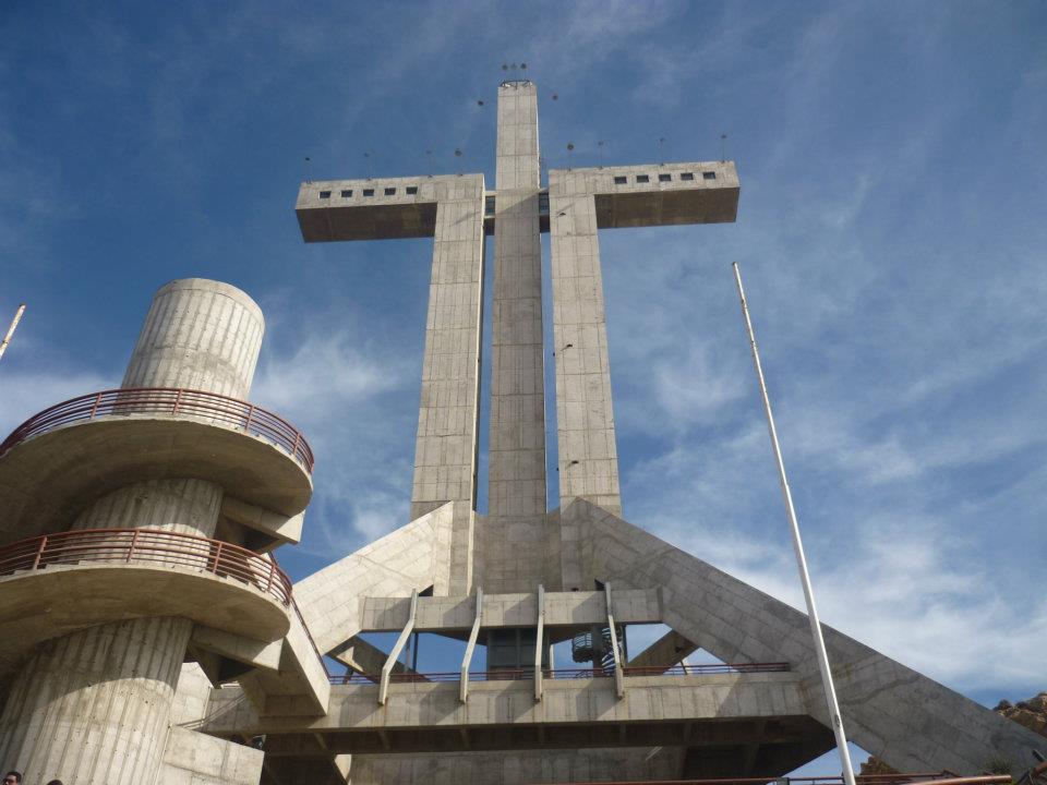
Coquimbo in Depth
History
The area was originally occupied by indigenous people, who used it as a settlement and for fishing purposes. The natural harbor in Coquimbo was taken over by Pedro de Valdivia from Spain in 1550. In 1879 it was recognized as a town. Fort Lambert was built in Coquimbo during the War of the Pacific.
The city was on the main path of totality of the Solar eclipse of July 2, 2019.
Coquimbo was first mentioned in the English speaking world when Charles Darwin visited during his voyage on HMS Beagle, stopping in the town on 14 May 1835 describing the town as "remarkable for nothing but its extreme quietness." Starting in the mid 1800s tens of thousands of Englishmen moved to Coquimbo establishing a distinct English architectural and culinary legacy.
Economy
The city is an industrial and shipping center. It is growing quickly, registering a 32.8% growth rate from 1992 to 2002. Tourism has started to develop. It is an access point for beach towns to the south, such as Guanaqueros and Tongoy. The port is still important for shipping, especially fruit and copper from mines in the region. Wine is also produced in the area.
Demographics
According to the 2002 census of the National Statistics Institute, Coquimbo had 163,036 inhabitants (79,428 men and 83,608 women). Of these, 154,316 (94.7%) lived in urban areas and 8,720 (5.3%) in rural areas. The population grew by 32.8% (40,270 persons) between the 1992 and 2002 censuses.
Sections adapted from Wikipedia: Coquimbo (CC BY-SA 4.0).
Coquimbo: Key Facts
| Population | 204,068 (2017) |
|---|---|
| Area | 53.3 km² |
| Established | 1867 |
Facts from Wikidata Q3871 (CC0).
History of Coquimbo: Empires and States
The atlas records 3 polities whose mapped territory included part of Coquimbo, from The Inca Empire (Tawantinsuyu) in 1497 CE to 2024 CE. They are listed in the order they first appear.
| Polity | Period here |
|---|---|
| The Inca Empire (Tawantinsuyu) | 1497–1539 CE |
| The Spanish Empire | 1540–1819 CE |
| Republic of Chile | 1812–2024 CE |
Historical Maps of Coquimbo
Coquimbo on the world map in each year one of these states held it:
Derived by testing mapped cities against dated territorial polygons. Dates are when the polygons cover this place, not the polity's whole lifespan, and polities absent from the source dataset are not listed.
Visiting Coquimbo
Coquimbo is a city of 257,000 people (2017) in Northern Chile. Coquimbo sits on a peninsula, triangular in shape; the old sector of the city is to the east of it, on an extension of land, long and narrow in a north-south direction, at about 10 m above sea level. The bay allows the port to be protected from the swell of the open sea, which can be seen at the northern end of it.
Travel notes adapted from Wikivoyage: Coquimbo (CC BY-SA 4.0).
Largest Cities in Coquimbo
7 cities mapped. Ranked by metropolitan population. A port city's harbour is written up on the page of its sea.
| # | Name | Population | Region | Role |
|---|---|---|---|---|
| 1 | Coquimbo | 161,317 | Coquimbo | Populated place |
| 2 | La Serena | 154,521 | Coquimbo | Admin-1 capital |
| 3 | Ovalle | 77,138 | Coquimbo | Populated place |
| 4 | Illapel | 26,340 | Coquimbo | Populated place |
| 5 | Salamanca | 20,214 | Coquimbo | Populated place |
| 6 | Vicuña | 13,496 | Coquimbo | Populated place |
| 7 | Combarbalá | 5,134 | Coquimbo | Populated place |
Ports in Coquimbo
1 port mapped. Ranked by approach channel depth, the figure that limits which ships can call. Harbours link to their write-up on the page of the sea or coast they lie on. Assigned by the nearest mapped city, so features near the boundary may belong to a neighbouring division.
| # | Name | Channel Depth | Class | Sea | Max Vessel |
|---|---|---|---|---|---|
| 1 | Bahia Herradura Guayacan | 23.8 m | Very Small | Pacific Coast of South America | large vessels |
Coquimbo: Quick Answers
- Where is Coquimbo?
- Coquimbo is a first-level division of Chile, in South America. Its mapped cities centre on 30.7231° S, 71.0977° W.
- What is the largest city in Coquimbo?
- Coquimbo is the largest city mapped in Coquimbo, with a metropolitan population of about 161,317.
- How many cities are in Coquimbo?
- YearMaps maps 7 cities and towns in Coquimbo, with a combined metropolitan population of about 458,160. This counts mapped settlements, not every municipality.