Skip to content
YearMaps
Kazakhstan · Landforms

Mountain Ranges, Deserts and Landforms of Kazakhstan

Asia is the largest of the 16 mountain ranges, deserts and other landforms recorded for Kazakhstan, at 46.28M km², ahead of Europe at 11.24M km². The full list follows.

How this list is built: Ranked by mapped area. Covers mountain ranges, deserts, plateaus, named glaciers, plains, basins, peninsulas and capes. One that crosses a border is listed under every country it lies in, with the area of the whole feature. It covers the mountain ranges, deserts and other landforms indexed in YearMaps, drawn from open geospatial data, and is not an exhaustive national register.

Landforms Listed
16
Top Ranked
46.28M km²
Asia
Second
11.24M km²
Europe
Profiled Below
11
Photo, encyclopedia text and figures
Mountain Ranges, Deserts and Landforms of Kazakhstan
#NameArea
1Asia46.28M km²
2Europe11.24M km²
3Turan Lowland873,039 km²
4Tian Shan414,352 km²
5Altay Mountains404,274 km²
6Kazakh Steppe272,208 km²
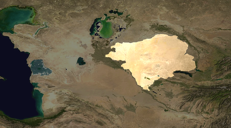
7Betpaqdala Desert133,535 km²
8Pontic Steppe102,190 km²
9Ustyurt Plateau76,986 km²
10Alataw Mountains64,390 km²
11Tarbagatay Range39,343 km²
12Kazakh Upland34,769 km²
13Karatau Range17,002 km²
14Caspian Depression7,242 km²
15Volga Delta1,630 km²
16Qizilqum Desert264 km²

The Landforms of Kazakhstan in Detail

The 11 mountain ranges, deserts and other landforms above that have an encyclopedia article, in the same order, each with its photograph, figures and the places around it.

Turan Lowland
Image via Wikimedia Commons (author and licence on the file page).

Turan Lowland

Plain · 873,039 km²

Turan Lowland is a plain in Asia, covering an estimated 873,039 km². It extends across Turkmenistan, Uzbekistan and Kazakhstan. It is the 19th-largest of the 231 landforms with a mapped extent in YearMaps.

The Turan Depression, Turan Lowland or Turanian Basin is a low-lying desert basin region stretching from southern Turkmenistan through Uzbekistan to Kazakhstan.

Adapted from Wikipedia: Turan Depression (CC BY-SA 4.0).

Feature class
Plain
Mapped extent
873,039 km²
Size rank
#19 of 231 landforms
Region
Asia
Countries
Turkmenistan, Uzbekistan, Kazakhstan
Coordinates
41.7724°, 62.8901°
Summits:
Belukha (4,506 m)
Ranges:
Karatau Range (Asia), Kopet Dag Mountains (Asia)
Settlements:
Qyzylorda (82 km), Zhosaly (110 km), Baykonur (161 km)

View on the live map

More about Turan Lowland

Geography

The lowland region lies to the east of the Caspian Sea and southeast of the Aral Sea in the vast Aral–Caspian Depression but extends to parts above sea level as well. It is one of the largest expanses of sand in the world, covering an area of around 3 million km2. On average, the region receives less than 15 inches (380 mm) of rainfall per year. The Karakum desert lies at the southern portion of the Turan Lowlands.

The part of the depression adjacent to the Aral Sea is drainless. It includes a network of temporary streams usually ending in sor salt flats, which seasonally become salt lakes.

Three of the largest cities in the Turan Depression are Daşoguz in Turkmenistan, Nukus in Uzbekistan, and Urganch, also in Uzbekistan. Akjagaýa in Turkmenistan is 267 feet (81 meters) below sea level.

Sections adapted from Wikipedia: Turan Depression (CC BY-SA 4.0).

Tian Shan
Image via Wikimedia Commons (author and licence on the file page).

Tian Shan

Range/mtn · 414,352 km²

Tian Shan is a range/mtn in Asia, covering an estimated 414,352 km². It extends across China, Kyrgyzstan, Kazakhstan and Uzbekistan. It is the 6th-largest of the 216 mountain ranges with a mapped extent in YearMaps.

The Tian Shan, also known as the Tengri Tagh or Tengir-Too, is a large system of mountain ranges in Central Asia. The highest peak is Jengish Chokusu at 7,439 metres (24,406 ft) high and located in Kyrgyzstan. Its lowest point is at the Turpan Depression, which is 154 m (505 ft) below sea level.

The Tian Shan is sacred in Tengrism. Its second-highest peak is known as Khan Tengri, which can be translated as "Lord of the Spirits". At the 2013 Conference on World Heritage, the eastern portion of Tian Shan in western China's Xinjiang Region was listed as a World Heritage Site. The western portion in Kyrgyzstan, Kazakhstan, and Uzbekistan was then listed in 2016.

Adapted from Wikipedia: Tian Shan (CC BY-SA 4.0).

Feature class
Range/mtn
Mapped extent
414,352 km²
Size rank
#6 of 216 mountain ranges
Region
Asia
Countries
China, Kyrgyzstan, Kazakhstan, Uzbekistan
Coordinates
41.6379°, 77.0899°
Summits:
Belukha (4,506 m)
Adjacent ranges:
Borohoro Mountains (Asia), Karatau Range (Asia)
Settlements:
Esik (101 km), Almaty (140 km), Boralday (147 km)

View on the live map

More about Tian Shan

Geography

The Tian Shan range is located north and west of the Taklamakan Desert and directly north of the Tarim Basin. It straddles the border regions of Kazakhstan, Kyrgyzstan, Uzbekistan and Xinjiang in Northwest China. To the south, it connects with the Pamir Mountains, while to north and east, it meets the Altai Mountains of Mongolia.

The Tian Shan range extends eastwards for approximately 2,900 kilometers from Tashkent, Uzbekistan. It forms part of the Himalayan orogenic belt, resulting from the collision of the Indian and Eurasian tectonic plates during the Cenozoic era. The range encompasses the Bogda Shan in the east, as defined by both Western and Chinese cartography.

The Tian Shan's highest peak is Jengish Chokusu (also known as Victory Peak), shared by Kyrgyzstan and China.

Ecology

The Tian Shan holds important forests of Schrenk's spruce (Picea schrenkiana) at altitudes of over 2,000 metres (6,600 ft); the lower slopes have unique natural forests of wild walnuts and apples.

The Tian Shan in its immediate geological past was kept from glaciation due to the "protecting" warm influence of the Indian Ocean monsoon climate. This defined its ecological features which could sustain its distinctive ecosphere. The mountains were subjected to constant geological changes with constantly evolving drainage systems which affected the patterns of vegetation, as well as exposing fertile soil for newly emerging seedlings to thrive in.

Tulips originated in the Tian Shan Mountains. The plant then made its way to Turkey via the Silk Road and became a symbol of the Ottoman Empire.

Sections adapted from Wikipedia: Tian Shan (CC BY-SA 4.0).

Tian Shan: Key Facts

Key facts about Tian Shan
Length2,500 km
Highest pointJengish Chokusu

Facts from Wikidata Q5474 (CC0).

Altay Mountains
Image via Wikimedia Commons (author and licence on the file page).

Altay Mountains

Range/mtn · 404,274 km²

Altay Mountains is a range/mtn in Asia, covering an estimated 404,274 km². It extends across Mongolia, Russia, China and Kazakhstan. It is the 7th-largest of the 216 mountain ranges with a mapped extent in YearMaps.

The Altai Mountains ( ahl-TY) are a mountain range in Central Asia, where Russia, China, Mongolia, and Kazakhstan converge, and where the rivers Irtysh and Ob have their headwaters. The highest summit of the range is Belukha, whose summit reaches 4,506 m (14,783 ft) above sea level. The massif merges with the Sayan Mountains in the northeast, and gradually becomes lower in the southeast, where it merges into the high plateau of the Gobi Desert. In the southwest, it is separated from the higher Tian Shan range by the Junggar Basin. It spans from about 45° to 52° N and from about 84° to 99° E.

The region is inhabited by a sparse but ethnically diverse population, including Turkic peoples, Mongols, and Volga Germans, though predominantly represented by indigenous ethnic minorities of semi-nomadic people. The local economy is based on bovine, sheep, horse husbandry, hunting, agriculture, forestry, and mining. The now discredited Altaic language family takes its name from this mountain range.

Adapted from Wikipedia: Altai Mountains (CC BY-SA 4.0).

Feature class
Range/mtn
Mapped extent
404,274 km²
Size rank
#7 of 216 mountain ranges
Region
Asia
Countries
Mongolia, Russia, China, Kazakhstan
Coordinates
49.8171°, 85.9828°
Summits:
Belukha (4,506 m)
Adjacent ranges:
Tannu-Ola Range (Asia), Borohoro Mountains (Asia)
Settlements:
Zyryanovsk (54 km), Ridder (139 km), Oskemen (170 km)

View on the live map

More about Altay Mountains

Geography

The Altai Mountains are a system of remote mountains in central Asia that cover an area of 845,000 km2 (326,000 sq mi). The mountains stretch for 2,525 km (1,569 mi) from northwest to southeast.

In the north of the region is the Sailughem Mountains, also known as Kolyvan Altai, which stretch northeast from 49° N and 86° E towards the western extremity of the Sayan Mountains in 51° 60' N and 89° E. Their mean elevation is 1,500–1,750 m (4,920–5,740 ft). The snow-line runs at 2,000 m (6,600 ft) on the northern side and at 2,400 m (7,900 ft) on the southern, and above it the peaks rise some 1,000 m (3,300 ft) higher.

Geology

The Siberian Altai represents the northernmost region affected by the tectonic collision of India into Asia. Extensive fault systems run through the area, including the Kurai fault zone and the recently identified Tashanta fault zone. These fault systems are typically thrusts or right lateral strike-slip faults, some of which are tectonically active. Rock types in the mountains are typically granites and metamorphic schists, and some are highly sheared near to fault zones.

Geologist Victor R. Baker "has discovered past cataclysmic floods in the Altai Mountains of Siberia" from "an even larger glacial lake" than Lake Missoula, which was once thought to have been "the largest ice-dammed lake in the world".

History

The Altai mountains have retained a remarkably stable climate, changing little since the last ice age. In addition the mix of mammals has remained largely the same, with a few exceptions such as extinct mammoths, making it one of the few places on Earth to retain an ice age fauna. Genetic analysis in 2026 also determined that the Altai region served as a likely primary refugium for the woolly rhinoceros, which had originated during the Penultimate Glacial Period, during the warmer period of the Last Interglacial.

The Altai mountains were home to the Denisovan branch of hominids who were contemporaries of Neanderthals and of Homo sapiens (modern humans), descended from Hominids who reached Asia earlier than modern humans.

Sections adapted from Wikipedia: Altai Mountains (CC BY-SA 4.0).

Altay Mountains: Key Facts

Key facts about Altay Mountains
Length2,000 km
Highest pointBelukha Mountain

Facts from Wikidata Q5955 (CC0).

Kazakh Steppe
Image via Wikimedia Commons (author and licence on the file page).

Kazakh Steppe

Plain · 272,208 km²

Kazakh Steppe is a plain in Asia, covering an estimated 272,208 km². It extends across Kazakhstan and Russia.

The Kazakh Steppe (Kazakh: Қазақ даласы, romanized: Qazaq dalasy [qɑˈzɑq dɑɫɑˈsə]), also known as the Great Steppe or Great Dala (Kazakh: Ұлы дала, romanized: Ūly dala [ʊˈɫɤ dɑˈɫɑ]), is a vast region of open grassland in Central Asia, covering areas in northern Kazakhstan and adjacent areas of Russia. It lies east of the Pontic–Caspian steppe and west of the Emin Valley steppe, with which it forms the central and western part of the Eurasian steppe. The Kazakh Steppe is an ecoregion of the temperate grasslands, savannas, and shrublands biome in the Palearctic realm. Before the mid-19th century, it was called the Kirghiz steppe, 'Kirghiz' being an old Russian word for the Kazakhs.

Adapted from Wikipedia: Kazakh Steppe (CC BY-SA 4.0).

Feature class
Plain
Mapped extent
272,208 km²
Size rank
#38 of 231 landforms
Region
Asia
Countries
Kazakhstan, Russia
Coordinates
48.9044°, 72.2606°
Summits:
Belukha (4,506 m)
Ranges:
Karatau Range (Asia), Borohoro Mountains (Asia)
Settlements:
Qaraghandy (161 km), Temirtau (184 km), Balqash (212 km)

View on the live map

Betpaqdala Desert
Image via Wikimedia Commons (author and licence on the file page).

Betpaqdala Desert

Desert · 133,535 km²

Betpaqdala Desert is a desert in Asia, covering an estimated 133,535 km². It is the 15th-largest of the 58 deserts with a mapped extent in YearMaps.

Betpak-Dala or Betpaqdala (Kazakh: Бетпақдала, Betpaqdala; from Turkic batpak, “swampy,” or Persian bedbaht, “unlucky” and Turkic dala, “plain”; Russian: Бетпак-Дала or Сeверная Голодная степь, lit. Hungry Steppe) is a desert zone in the Ulytau, Karaganda, Turkestan, and Zhambyl regions, Kazakhstan.

Adapted from Wikipedia: Betpak-Dala (CC BY-SA 4.0).

Feature class
Desert
Mapped extent
133,535 km²
Size rank
#15 of 58 deserts
Region
Asia
Coordinates
44.8951°, 70.6025°
Summits:
Pik Imeni Ismail Samani (7,495 m), Pik Karakol (5,216 m), Pik Pobeda (7,439 m)
Ranges:
Karatau Range (Asia), Tian Shan (Asia)
Settlements:
Qaratau (190 km), Kentau (226 km), Taraz (230 km)

View on the live map

More about Betpaqdala Desert

Geography

The Betpak-Dala is located between the lower reaches of the Sarysu River, the Chu River, and Lake Balkhash. In the north, near the 46°30’ parallel, Betpak-Dala borders on the Kazakh Uplands, an area of low, rounded, isolated hills. Its area is approximately 75,000 square kilometres (29,000 sq mi). To the southwest lies the Ashchykol Depression.

The desert is a flat, gently rolling plain with an elevation ranging from 300 metres (980 ft) to 350 metres (1,150 ft) and a general south-western incline. Elevations are greatest in the east. In the southeast, the Zheltau highland reaches an elevation of 599 metres (1,965 ft) at Mount Suykadyr (Суықадыр) and of 972 metres (3,189 ft) at Mount Kyzylbelen (Кызылбелен).

History

In Autumn 2014, English explorer Jamie Bunchuk completed an expedition to cross the Betpak-Dala to its fullest longitudinal extent, from Lake Balkash in the east to the Sarysu River in the west. He also ran 190 miles, nearly eight marathons, back-to-back, over the course of eight days within the region.

An epizootic of pasteurellosis occurred in Betpak-Dala in May 2015, in which more than 120,000 saiga antelope — representing more than a third of the global population — were confirmed dead.

Sections adapted from Wikipedia: Betpak-Dala (CC BY-SA 4.0).

Pontic Steppe
Image via Wikimedia Commons (author and licence on the file page).

Pontic Steppe

Plain · 102,190 km²

Pontic Steppe is a plain in Europe, covering an estimated 102,190 km². It extends across Russia, Ukraine, Romania, Bulgaria, Kazakhstan and Moldova.

The Pontic–Caspian steppe extends across Eastern Europe to Central Asia, formed by the Caspian and Pontic steppes. It stretches from the northern shores of the Black Sea (the Pontus Euxinus of antiquity) to the northern area around the Caspian Sea, where it ends at the Ural-Caspian narrowing, which joins it with the Kazakh Steppe in Central Asia, making it a part of the larger Eurasian Steppe. Geopolitically, the Pontic–Caspian Steppe extends from northeastern Bulgaria and southeastern Romania through Moldova, southern and eastern Ukraine, through the North Caucasus of southern Russia, and into the Lower Volga region where it straddles the border of southern Russia and western Kazakhstan. Biogeographically, it is a part of the Palearctic realm, and of the temperate grasslands, savannas, and shrublands biome.

The area corresponds to Cimmeria, Scythia, and Sarmatia of classical antiquity. Across several millennia, numerous tribes of nomadic horsemen used the steppe; many of them went on to conquer lands in the settled regions of Central and Eastern Europe, West Asia, and South Asia.

Adapted from Wikipedia: Pontic–Caspian steppe (CC BY-SA 4.0).

Feature class
Plain
Mapped extent
102,190 km²
Size rank
#63 of 231 landforms
Region
Europe
Countries
Russia, Ukraine, Romania, Bulgaria, Kazakhstan, Moldova
Coordinates
53.2330°, 46.3431°
Summits:
Belukha (4,506 m)
Ranges:
Pontic Mountains (Asia), Lesser Caucasus (Asia)
Settlements:
Oral (377 km), Atyrau (396 km), Balyqshy (396 km)

View on the live map

More about Pontic Steppe

Geography and ecology

The steppe covers an area of 994,000 km2 (384,000 sq mi) of Central and Eastern Europe, that extends from northeastern Bulgaria and southeastern Romania, through Moldova, and southern and eastern Ukraine, through the Northern Caucasus of southern Russia, and into the Lower Volga region of western Kazakhstan, to the east of the Ural Mountains. It is bounded by the East European forest steppe to the north, a transitional zone of mixed grasslands and temperate broadleaf and mixed forests. To the south, the steppe extends to the Black Sea, except the Crimean and western Caucasus mountains' border with the sea, where the Crimean Submediterranean forest complex defines the southern edge of the steppes.

Sections adapted from Wikipedia: Pontic–Caspian steppe (CC BY-SA 4.0).

Pontic Steppe: Key Facts

Key facts about Pontic Steppe
Area994,000 km²

Facts from Wikidata Q599529 (CC0).

Ustyurt Plateau
Image via Wikimedia Commons (author and licence on the file page).

Ustyurt Plateau

Plateau · 76,986 km²

Ustyurt Plateau is a plateau in Asia, covering an estimated 76,986 km². It extends across Kazakhstan, Uzbekistan and Turkmenistan.

The Ustyurt or Ust-Yurt (from Kazakh: Үстірт; Uzbek: Ustyurt; Turkmen: Üstyurt; Karakalpak: Ústirt — flat hill, plateau) is a transboundary clay desert shared by Kazakhstan, Turkmenistan, and Uzbekistan.

The plateau's semi-nomadic population raises camels, goats, and sheep.

Adapted from Wikipedia: Ustyurt Plateau (CC BY-SA 4.0).

Feature class
Plateau
Mapped extent
76,986 km²
Size rank
#37 of 69 plateaus
Region
Asia
Countries
Kazakhstan, Uzbekistan, Turkmenistan
Coordinates
44.0394°, 55.5062°
Summits:
Belukha (4,506 m)
Ranges:
Kopet Dag Mountains (Asia), Lesser Caucasus (Asia)
Settlements:
Beyneu (144 km), Mangyshlak (286 km), Qulsary (344 km)

View on the live map

More about Ustyurt Plateau

Geography

The Ustyurt is located between the Dead Kultuk, Mangyshlak Peninsula and Kara-Bogaz-Gol of the Caspian Sea to the west, and the Aral Sea, Amudarya Delta and Sarygamysh Lake to the east.

It extends roughly 200,000 km2 (77,000 sq mi), with an average altitude of 150 m (490 ft). Its highest point rises to 370 m (1,200 ft) in the south-west. At its northeastern edge it drops steeply to the Aral Sea and the surrounding plain.

The Ustyurt Plateau is bounded by steep cliffs called chinks nearly from everywhere. To the east, it encompasses the historical western shoreline of the Aral Sea. In the southern region, it extends to the Kunya-Darya alluvial plain and the valley of the Uzboy, while in the west, it reaches the Karynyaryk depression.

Sections adapted from Wikipedia: Ustyurt Plateau (CC BY-SA 4.0).

Ustyurt Plateau: Key Facts

Key facts about Ustyurt Plateau
Area200,000 km²
Elevation365 m

Facts from Wikidata Q913329 (CC0).

Karatau Range
Image via Wikimedia Commons (author and licence on the file page).

Karatau Range

Range/mtn · 17,002 km²

Karatau Range is a range/mtn in Asia, covering an estimated 17,002 km².

The Karatau or Qaratau (Kazakh: Қаратау жотасы, Qaratau jotasy) is a mountain range located in southern Kazakhstan. The mountains have deposits of phosphorite, lead, and zinc.

Adapted from Wikipedia: Karatau Mountains (CC BY-SA 4.0).

Feature class
Range/mtn
Mapped extent
17,002 km²
Size rank
#132 of 216 mountain ranges
Region
Asia
Coordinates
43.0151°, 70.1211°
Summits:
Pik Imeni Ismail Samani (7,495 m), Ayrybaba (3,137 m), Pik Karakol (5,216 m)
Adjacent ranges:
Pamirs (Asia), Tian Shan (Asia)
Settlements:
Qaratau (33 km), Shymkent (88 km), Lenger (94 km)

View on the live map

More about Karatau Range

Geography

The range extends for about 420 kilometres (260 mi) in a roughly NW/SE direction just north of the Syr Darya. The Muyunkum Desert lies to the north of the range. The Karatau is the westernmost prolongation of the Tian Shan. The summits of the mountains are smooth and the slopes are cut by snow-fed rivers. The Shabakty, Kyrshabakty, Ushbas, Bugun and Asa, are among the rivers having their sources in the range.

Sections adapted from Wikipedia: Karatau Mountains (CC BY-SA 4.0).

Karatau Range: Key Facts

Key facts about Karatau Range
Length420 km
Part ofTianshan Mountains

Facts from Wikidata Q2062939 (CC0).

Caspian Depression
Image via Wikimedia Commons (author and licence on the file page).

Caspian Depression

Lowland · 7,242 km²

Caspian Depression is a lowland in Europe, covering an estimated 7,242 km². It extends across Russia and Kazakhstan.

The Caspian Depression or the Caspian Lowland is a low-lying flatland region encompassing the northern part of the Caspian Sea, the largest enclosed body of water on Earth. It is the larger northern part of the wider Aral–Caspian Depression around the Aral and Caspian Seas.

The level of the Caspian sea is 28 metres (92 ft) below sea level, however several areas in the depression are even lower, and among them Karagiye near Aktau is the lowest at −132 metres (−433 ft).

Adapted from Wikipedia: Caspian Depression (CC BY-SA 4.0).

Feature class
Lowland
Mapped extent
7,242 km²
Size rank
#127 of 231 landforms
Region
Europe
Countries
Russia, Kazakhstan
Coordinates
46.1563°, 48.1868°
Summits:
Belukha (4,506 m)
Ranges:
Kopet Dag Mountains (Asia), Lesser Caucasus (Asia)
Settlements:
Beyneu (40 km), Qulsary (218 km), Balyqshy (307 km)

View on the live map

More about Caspian Depression

Geography

The depression is in the southeastern part of the East European Plain and covers parts of Kazakhstan and Russia. In Kazakhstan it covers parts of Atyrau Region, West Kazakhstan Region, and Mangystau Region. In Russia it covers parts of Dagestan, Kalmykia, Saratov Oblast, Volgograd Oblast, Astrakhan Oblast, and Stavropol Krai. In the north it is bounded by Obshchy Syrt highland; in the west by Volga Upland, Yergeni, and Stavropol Upland; in the east by Ustyurt Plateau and Sub-Ural Plateau (a.k.a. Cis-Ural Plateau, Pre-Ural Plateau, Poduralskoe Plateau) It significantly overlaps with the Ryn Desert.

The Volga River and the Ural River flow into the Caspian Sea through this region. The deltas of the Ural and Volga Rivers are extensive wetlands.

Sections adapted from Wikipedia: Caspian Depression (CC BY-SA 4.0).

Caspian Depression: Key Facts

Key facts about Caspian Depression
Area200,000 km²
Highest pointBolshoye Bogdo

Facts from Wikidata Q737789 (CC0).

Volga Delta
Image via Wikimedia Commons (author and licence on the file page).

Volga Delta

Delta · 1,630 km²

Volga Delta is a delta in Europe, covering an estimated 1,630 km². It extends across Russia and Kazakhstan.

The Volga Delta is the largest river delta in Europe and occurs where Europe's largest river system, the Volga River, drains into the Caspian Sea in Russia's Astrakhan Oblast, north-east of the republic of Kalmykia. The delta is located in the Caspian Depression—the far eastern part of the delta lies in Kazakhstan. The delta drains into the Caspian approximately 60 km (37 mi) downstream from the city of Astrakhan.

The Volga delta has grown significantly in the 20th century because of changes in the level of the Caspian Sea. In 1880, the delta had an area of 3,222 km2 (1,244 mi2). Today the Volga Delta covers an area of 27,224 km2 (10,511 mi2) and is approximately 160 km (100 mi) across. It has a classical "delta pattern". The delta lies in the arid climate zone, characterized by very little rainfall. The region receives less than one inch of rainfall in January and July in normal years. Strong winds often sweep across the delta and form linear dunes. Along the front of the delta, one will find muddy sand shoals, mudflats, and coquina banks.

Adapted from Wikipedia: Volga Delta (CC BY-SA 4.0).

Feature class
Delta
Mapped extent
1,630 km²
Size rank
#166 of 231 landforms
Region
Europe
Countries
Russia, Kazakhstan
Coordinates
45.6481°, 47.9976°
Summits:
Belukha (4,506 m)
Ranges:
Lesser Caucasus (Asia), Pontic Mountains (Asia)
Settlements:
Mangyshlak (330 km), Balyqshy (336 km), Atyrau (342 km)

View on the live map

Qizilqum Desert
Image via Wikimedia Commons (author and licence on the file page).

Qizilqum Desert

Desert · 264 km²

Qizilqum Desert is a desert in Asia, covering an estimated 264 km². It extends across Kazakhstan, Turkmenistan and Uzbekistan.

The Kyzylkum Desert (Uzbek: Qizilqum; Kazakh: Qyzylqūm) is the 15th largest desert in the world. Its name means 'Red Sand' in Turkic languages. It is located in Central Asia, in the land between the confluent rivers Amu Darya and Syr Darya, a region historically known as Transoxania. Today it is divided among Kazakhstan, Turkmenistan and Uzbekistan. It covers about 298,000 km2 (115,000 sq mi).

Adapted from Wikipedia: Kyzylkum Desert (CC BY-SA 4.0).

Feature class
Desert
Mapped extent
264 km²
Size rank
#54 of 58 deserts
Region
Asia
Countries
Kazakhstan, Turkmenistan, Uzbekistan
Coordinates
46.8672°, 60.5550°
Summits:
Belukha (4,506 m)
Ranges:
Karatau Range (Asia), Kopet Dag Mountains (Asia)
Settlements:
Aral (90 km), Shalqar (134 km), Baykonur (244 km)

View on the live map

More about Qizilqum Desert

Geography

Kyzylkum is mainly located in Uzbekistan. Its territory consists mainly of an extensive plain at an altitude up to 300 m (980 ft) above sea level, with a number of depressions and highlands (Sultanuizdag, Bukantau). Most of the area is covered with dunes (barchans); in the northwest large areas are covered with takirs (clay coatings); there are also some oases. There are agricultural settlements along the rivers and in the oases. Temperatures can be very high during the summer months, from mid-May to mid-September. Kerki, one extreme inland city located on the banks of the Amu Darya River, recorded 52 °C (126 °F) in July 1983.

Economy

The local population uses the large spaces of the Kyzylkum Desert as a pasture for livestock (mostly sheep, Bactrian camels and dromedaries).

The desert is well known for its deposits of gold, uranium, copper, aluminium and silver, natural gas and oil. The development of the most famous gold-field at Muruntau began in the early 1970s. The centres for the mining and smelting industry at the region are Navoi, Zarafshan, Uchkuduk. The major industrial enterprises are: НГМК (Navoi Mining and Smelting Complex) and the Uzbek U.S.A. Joint Venture "Zarafshan-Newmont". The centres of the gas-production industry are Gazli and Mubarek.

Sections adapted from Wikipedia: Kyzylkum Desert (CC BY-SA 4.0).

Qizilqum Desert: Key Facts

Key facts about Qizilqum Desert
Area298,000 km²

Facts from Wikidata Q184364 (CC0).

More on Kazakhstan

Quick Answers

What is the largest landform in Kazakhstan?
Asia, at 46.28M km². Europe is second at 11.24M km². Rankings cover the mountain ranges, deserts and other landforms indexed in YearMaps.
How many mountain ranges, deserts and other landforms are there in Kazakhstan?
YearMaps lists 16 mountain ranges, deserts and other landforms for Kazakhstan. This is the number mapped in the atlas, not an official national count.