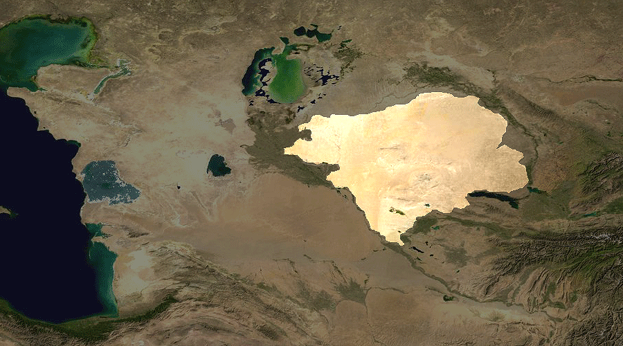
Turan Lowland
Plain · 873,039 km²
Turan Lowland is a plain in Asia, covering an estimated 873,039 km². It extends across Turkmenistan, Uzbekistan and Kazakhstan. It is the 19th-largest of the 231 landforms with a mapped extent in YearMaps.
The Turan Depression, Turan Lowland or Turanian Basin is a low-lying desert basin region stretching from southern Turkmenistan through Uzbekistan to Kazakhstan.
Adapted from Wikipedia: Turan Depression (CC BY-SA 4.0).
- Feature class
- Plain
- Mapped extent
- 873,039 km²
- Size rank
- #19 of 231 landforms
- Region
- Asia
- Countries
- Turkmenistan, Uzbekistan, Kazakhstan
- Coordinates
- 41.7724°, 62.8901°
- Summits:
- Gora Arlan (1,880 m), Ayrybaba (3,137 m)
- Ranges:
- Kopet Dag Mountains (Asia), Karatau Range (Asia)
More about Turan Lowland
Geography
The lowland region lies to the east of the Caspian Sea and southeast of the Aral Sea in the vast Aral–Caspian Depression but extends to parts above sea level as well. It is one of the largest expanses of sand in the world, covering an area of around 3 million km2. On average, the region receives less than 15 inches (380 mm) of rainfall per year. The Karakum desert lies at the southern portion of the Turan Lowlands.
The part of the depression adjacent to the Aral Sea is drainless. It includes a network of temporary streams usually ending in sor salt flats, which seasonally become salt lakes.
Three of the largest cities in the Turan Depression are Daşoguz in Turkmenistan, Nukus in Uzbekistan, and Urganch, also in Uzbekistan. Akjagaýa in Turkmenistan is 267 feet (81 meters) below sea level.
Sections adapted from Wikipedia: Turan Depression (CC BY-SA 4.0).