
UNESCO World Heritage Sites in Jordan
Jordan has 8 sites on the UNESCO World Heritage List (6 cultural, 1 natural and 1 mixed), the first inscribed in 1985 (Petra). The map below plots every one of them alongside the rest of the List, and each site is written up in full further down the page.
- World Heritage Sites
- 8
- Cultural
- 6
- Natural and Mixed
- 2
- First Inscribed
- 1985
Map of World Heritage Sites in Jordan
CulturalNaturalMixedIn DangerLarge dots are in Jordan. Click a dot to read about the site.

Petra
Jordan · 30.3289° N, 35.4403° E · 262 km² · 32 km from Ma'an
Petra (Arabic: ٱلْبَتْراء, romanized: al-Batrāʾ; Ancient Greek: Πέτρα, lit. 'Rock'), originally known to its inhabitants as Raqmu (Nabataean Aramaic: 𐢛𐢚𐢒 or 𐢛𐢚𐢓𐢈, *Raqēmō), is an ancient city and archaeological site in southern Jordan. Famous for its rock-cut architecture and water conduit systems, Petra is also called the "Rose City" because of the colour of the sandstone from which it is carved. The city is one of the New 7 Wonders of the World and a UNESCO World Heritage Site.
The area around Petra has been inhabited from as early as 7000 BC, and was settled by the Nabataeans, a nomadic Arab people, in the 4th century BC. Petra would later become the capital city of the Nabataean Kingdom in the second century BC. The Nabataeans invested in Petra's proximity to the incense trade routes by establishing it as a major regional trading hub, which gained them considerable revenue. The Nabataeans were able to survive the desert due to efficient rainwater collecting and desert farming.
Adapted from Wikipedia: Petra (CC BY-SA 4.0).
Why Petra Is Listed
- (i)
- A masterpiece of human creative genius.
- (iii)
- A unique testimony to a cultural tradition or civilisation.
- (iv)
- An outstanding example of a type of building or landscape.
More about Petra
UNESCO's Description
Inhabited since prehistoric times, this Nabataean caravan-city, situated between the Red Sea and the Dead Sea, was an important crossroads between Arabia, Egypt and Syria-Phoenicia. Petra is half-built, half-carved into the rock, and is surrounded by mountains riddled with passages and gorges. It is one of the world's most famous archaeological sites, where ancient Eastern traditions blend with Hellenistic architecture.
From the UNESCO World Heritage Centre (CC BY-SA IGO 3.0).
Climate
In Petra, there is a semi-arid climate. Most rain falls in the winter. The Köppen-Geiger climate classification is BSk. The average annual temperature in Petra is 15.5 °C (59.9 °F). About 193 mm (7.60 in) of precipitation falls annually.
History
By 7000 BC, some of the earliest recorded farmers had settled in Beidha, a Pre-Pottery Neolithic settlement just north of Petra.
Petra is listed in Egyptian campaign accounts and the Amarna letters as Pel, Sela, or Seir.
The Iron Age lasted between 1200 and 600 BC; in that time, the Petra area was occupied by the Edomites. The configuration of mountains in Petra allowed for a reservoir of water for the Edomites. This made Petra a stopping point for merchants, making it an outstanding area for trade. Some wares that were traded included wines, olive oil, and wood.
Initially, the Edomites were accompanied by Nomads who eventually left, but the Edomites stayed and made their mark on Petra before the emergence of the Nabataens.
Sections adapted from Wikipedia: Petra (CC BY-SA 4.0).
Visiting Petra
Petra (Arabic: البتراء, Al-Batrāʾ), the fabled "rose red city, half as old as time", is a well known ancient Nabataean city in the south of Jordan. Due to its breathtaking grandeur and fabulous ruins, Petra was recognised as a World Heritage Site by UNESCO in 1985.
Travel notes adapted from Wikivoyage: Petra (CC BY-SA 4.0).

Qasr Amra
Jordan · 31.8017° N, 36.5873° E · 55 km from Az Zarqa
Qusayr 'Amra or Quseir Amra, sometimes also named Qasr Amra (Arabic: قصر عمرة, romanized: Qaṣr ‘Amrah, lit. 'small qasr of 'Amra'), is the best-known of the desert castles located in present-day eastern Jordan. It was built some time between 723 and 743, by Walid Ibn Yazid, the future Umayyad caliph Walid II, whose dominance of the region was rising at the time. It is considered one of the most important examples of early Islamic art and architecture.
The building is actually the remnant of a larger complex that included an actual castle, meant as a royal retreat, without any military function, of which only the foundation remains. What stands today is a small country cabin. The foundation has a simple layout with a rectangular audience hall, hydraulic structures, and a bathhouse. The bathhouse is also one of the oldest surviving remains of a hammam in the historic Muslim world.
Adapted from Wikipedia: Qusayr 'Amra (CC BY-SA 4.0).
Why Qasr Amra Is Listed
- (i)
- A masterpiece of human creative genius.
- (iii)
- A unique testimony to a cultural tradition or civilisation.
- (iv)
- An outstanding example of a type of building or landscape.
More about Qasr Amra
UNESCO's Description
Built in the early 8th century, this exceptionally well-preserved desert castle was both a fortress with a garrison and a residence of the Umayyad caliphs. The most outstanding features of this small pleasure palace are the reception hall and the hammam , both richly decorated with figurative murals that reflect the secular art of the time.
From the UNESCO World Heritage Centre (CC BY-SA IGO 3.0).
History
The painting of the six kings includes King Roderick of Visgothic Kingdom, whose short reign (710–712) has been taken to date of the image, and possibly the building, to around 710. Therefore, for a long time researchers believed that sitting caliph Walid I was the builder and primary user of Qasr Amra, until doubts arose, making specialists believe that one of two princes who later became caliph themselves, Walid or Yazid, were the more likely candidates for that role. The discovery of an inscription during work in 2012 has allowed for the dating of the structure to the two decades between 723 and 743, when it was commissioned by Walid Ibn Yazid, crown prince under caliph Hisham and his successor during a short reign as caliph in 743–744.
Description
Traces of stone walls used to enclose the site suggest it was part of a 25-hectare (62-acre) complex; there are remains of a castle which could have temporarily housed a garrison of soldiers.
Just to the southeast of the building is a well, 40 metres (130 ft) deep, and traces of the animal-driven lifting mechanism and a dam have been found as well.
The architecture of the reception-hall-cum-bathhouse is identical to that of Hammam al-Sarah, also in Jordan, except the latter was erected using finely-cut limestone ashlars (based on the Late Roman architectural tradition), while Amra's bath was erected using rough masonry held together by gypsum-lime mortar (based on the Sasanian architectural tradition).
It is a low building made from limestone and basalt.
Location and access
Qusayr 'Amra is located on the north side of Jordan's Highway 40, roughly 85 kilometres (53 mi) from Amman and 21 kilometres (13 mi) southwest of Al-Azraq.
It is within a large area fenced off in barbed wire. A paved parking lot is located at the southeast corner, just off the road. A small visitor center collects admission fees. The castle is located in the west of the enclosed area, below a small rise.
Sections adapted from Wikipedia: Qusayr 'Amra (CC BY-SA 4.0).
Key Facts
| Established | 712 CE |
|---|---|
| Architectural style | Islamic architecture, Umayyad architecture |
Facts from Wikidata Q499517 (CC0).

Umm ar-Rasas
Jordan · 31.4997° N, 35.9197° E · 41 km from Al Karak
Umm ar-Rasas (Arabic: أم الرّصاص; ancient name: Kastron Mefa'a) is located 30 km southeast of Madaba in the Amman Governorate in central Jordan. It was once accessible by branches of the King's Highway, and is situated in the semi-arid steppe region of the Jordanian Desert. The site has been associated with the biblical settlement of Mephaat mentioned in the Book of Jeremiah. The Roman military utilized the site as a strategic garrison, but it was later converted and inhabited by Christian and Islamic communities. In 2004, the site was inscribed as a UNESCO World Heritage Site, and is valued by archaeologists for its extensive ruins dating to the Roman, Byzantine, and early Muslim periods. The Franciscan academic society in Jerusalem, Studium Biblicum Franciscanum (SBF), carried out excavations at the north end of the site in 1986, but much of the area remains buried under debris.
Adapted from Wikipedia: Umm ar-Rasas (CC BY-SA 4.0).
Why Umm ar-Rasas Is Listed
- (i)
- A masterpiece of human creative genius.
- (iv)
- An outstanding example of a type of building or landscape.
- (vi)
- A direct association with events, ideas or beliefs of universal significance.
More about Umm ar-Rasas
UNESCO's Description
Most of this archaeological site, which started as a Roman military camp and grew to become a town from the 5th century, has not been excavated. It contains remains from the Roman, Byzantine and Early Muslim periods (end of 3rd to 9th centuries AD) and a fortified Roman military camp. The site also has 16 churches, some with well-preserved mosaic floors. Particularly noteworthy is the mosaic floor of the Church of Saint Stephen with its representation of towns in the region. Two square towers are probably the only remains of the practice, well known in this part of the world, of the stylites (ascetic monks who spent time in isolation atop a column or tower). Um er-Rasas is surrounded by, and dotted with, remains of ancient agricultural cultivation in an arid area.
From the UNESCO World Heritage Centre (CC BY-SA IGO 3.0).
Early history
Particularly during the epochs of the Early Bronze Age III-IV, Iron Age II, and Roman-Byzantine eras, dense populations inhabited the topographical regions beyond the western banks of the Dead Sea. Among these ancient settlements, the site of Mephaat has been mentioned in biblical texts as one of the cities upon the plateau to be condemned to great destruction (Jeremiah 48:21). Many branches of the King's Highway provided a means for reaching the more remote ancient cities, but the main route served as the forerunner for the Via Traiana Nova built by the Roman Emperor Trajan (98–117 AD).
Sections adapted from Wikipedia: Umm ar-Rasas (CC BY-SA 4.0).

Wadi Rum
Jordan · 29.5765° N, 35.4199° E · 742 km² · 34 km from Al Aqabah
Wadi Rum (Arabic: وادي رم Wādī Ramm, also Wādī al-Ramm, known also as the Valley of the Moon or Red mountains (Arabic: وادي القمر, romanized: Wādī al-Qamar), is a valley cut into the sandstone and granite rock in southern Jordan, near the border with Saudi Arabia and about 60 km (37 mi) to the east of the city of Aqaba. With an area of 720 km2 (280 mi2) it is the largest wadi (river valley) in Jordan.
Several prehistoric civilizations left petroglyphs, rock inscriptions and ruins in Wadi Rum. Today it is a tourist attraction, offering guided tours, hiking and rock climbing. The Wadi Rum Protected Area has been a UNESCO World Heritage site since 2011.
Adapted from Wikipedia: Wadi Rum (CC BY-SA 4.0).
Why Wadi Rum Is Listed
- (iii)
- A unique testimony to a cultural tradition or civilisation.
- (v)
- An outstanding example of traditional human settlement or land use.
- (vii)
- Superlative natural phenomena or exceptional natural beauty.
More about Wadi Rum
UNESCO's Description
The 74,000-hectare property, inscribed as a mixed natural and cultural site, is situated in southern Jordan, near the border with Saudi Arabia. It features a varied desert landscape consisting of a range of narrow gorges, natural arches, towering cliffs, ramps, massive landslides and caverns. Petroglyphs, inscriptions and archaeological remains in the site testify to 12,000 years of human occupation and interaction with the natural environment. The combination of 25,000 rock carvings with 20,000 inscriptions trace the evolution of human thought and the early development of the alphabet. The site illustrates the evolution of pastoral, agricultural and urban activity in the region.
From the UNESCO World Heritage Centre (CC BY-SA IGO 3.0).
Geography
The area is centered on the main valley of Wadi Rum. The highest elevation in Jordan is Jabal Umm ad Dami at 1,840 m (6,040 ft) high (SRTM data states 1854 m), located 30 km (19 mi) south of Wadi Rum village. It was first located by Difallah Ateeg, a Zalabia Bedouin from Rum. On a clear day, it is possible to see the Red Sea and the Saudi border from the top.
Jabal Ram or Jebel Rum (1,734 m (5,689 ft) above sea level) is the second highest peak in Jordan and the highest peak in the central Rum, rising directly above Rum valley, opposite Jebel um Ishrin, which is possibly one metre lower.
Khaz'ali Canyon in Wadi Rum is the site of petroglyphs etched into the cave walls depicting humans and antelopes dating back to the Thamudic times.
Geology
Wadi Rum is located within the Sandstone Mountain and Valley Region of southern Jordan the area is characterized by tall, near vertical mountains of iron-rich, erosion resistant, Umm Ishrin Sandstone, separated by flat-bottom valleys of alluvial sediments, aeolian sands, and salt pans. The Umm Ishrin is the thickest formation in the Lower Palaeozoic-Upper Cretaceous Nubian Sandstone, underlying the Disi and Umm Sahn sandstone formations, and overlying the Salib Arkosic Formation. The Salib in turn overlies the eroded Aqaba Complex of plutonic granitoids. An aquifer forms along this lithologic contact, with springs forming on the eastern mountain slopes. Alluvial fans compose most of the alluvial sediments. Aeolian systems include tafoni, natural bridges, and sand dunes.
Climate
Wadi Rum experiences a desert climate (Köppen: BWh/BWk). Rainfall is scarce, often occurring as flash floods, and results almost exclusively from thunderstorms. These thunderstorms are caused when cold upper air pools passing through the Eastern Mediterranean interact with the Red Sea thermal low, combined with the presence of subtropical moisture in the mid and high levels of the atmosphere.
History
Various human cultures have inhabited Wadi Rum since prehistoric times, with many cultures–including the Nabataeans–leaving their mark in the form of petroglyphs, inscriptions, and temple ruins.
According to Bienkowski, the area was part of the Kingdom of Edom (between the 13th and 6th centuries BCE). The region contains numerous archaeological remains, including copper mining sites at Wadi Feynan and ancient fortifications. Trade routes connecting Arabia to the Levant passed through the area, contributing to its prosperity.
Currently, the majority is made up by the Zalabieh Bedouins who arrived to the region around 1980. The word "Bedouin" comes from the Arabic word for desert, pronounced badiya in the Arabic language.
Sections adapted from Wikipedia: Wadi Rum (CC BY-SA 4.0).
Visiting Wadi Rum
Wadi Rum is a spectacularly scenic desert valley (wadi in Arabic) in southern Jordan. It is also known as "Valley of the Moon" and inscribed on the UNESCO World Heritage List.
Travel notes adapted from Wikivoyage: Wadi Rum (CC BY-SA 4.0).

Al Maghtas
Jordan · 31.8372° N, 35.5503° E · 3 km² · 28 km from As Salt
Al-Maghtas (Arabic: المغطس, romanized: al-Maghṭas, lit. 'the Baptism' or 'the Immersion'), officially known as Baptism Site "Bethany Beyond the Jordan", is an archaeological World Heritage Site in Jordan, on the east bank of the Jordan River, reputed to be the location of the Baptism of Jesus by John the Baptist and venerated as such since at least the Byzantine period. The place has also been referred to as Bethabara (Hebrew: בית עברה) and historically Bethany (בית עניה) or Bethany Beyond the Great Jordan (see below).
Al-Maghtas includes two principal archaeological areas: the remnants of a monastery on a mound known as Jabal Mar-Elias (جبل مار إلياس, 'Elijah's Hill') and an area close to the river with remains of churches, baptism ponds and pilgrim and hermit dwellings. The two areas are connected by a stream called Wadi Kharrar (وادي خرار).
The strategic location between Jerusalem and the King's Highway is already evident from the Book of Joshua report about the Israelites crossing the Jordan there. Jabal Mar-Elias is traditionally identified as the site of the ascension of the prophet Elijah to heaven.
Adapted from Wikipedia: Al-Maghtas (CC BY-SA 4.0).
Why Al Maghtas Is Listed
- (iii)
- A unique testimony to a cultural tradition or civilisation.
- (vi)
- A direct association with events, ideas or beliefs of universal significance.
More about Al Maghtas
UNESCO's Description
Situated on the eastern bank of the River Jordan, nine kilometres north of the Dead Sea, the archaeological site consists of two distinct areas: Tell Al-Kharrar, also known as Jabal Mar-Elias (Elijah’s Hill) and the area of the churches of Saint John the Baptist near the river. Situated in a pristine natural environment the site is believed to be the location where Jesus of Nazareth was baptized by John the Baptist. It features Roman and Byzantine remains including churches and chapels, a monastery, caves that have been used by hermits and pools in which baptisms were celebrated, testifying to the religious character of the place. The site is a Christian place of pilgrimage.
From the UNESCO World Heritage Centre (CC BY-SA IGO 3.0).
Geography
Al-Maghtas is located on the eastern bank of the Jordan River, 9 kilometres (5.6 mi) north of the Dead Sea and 10 km (6.2 mi) southeast of Jericho. The entire site, which is spread over an area of 533.7 hectares (5.337 km2; 1,319 acres), has two distinct zones – Tell al-Kharrar, also called Jabal Mar Elias (Elijah's Hill), and the area close to the river (2 km (1.2 mi) to the west), the Zor area, where the ancient Church of Saint John the Baptist is situated.
The site is close to the ancient road between Jerusalem and Transjordan, via Jericho, across a Jordan River ford and connecting to other biblical sites such as Madaba, Mount Nebo and the King's Highway.
History and archaeology
The archaeological excavations have unearthed antiquities which attest to the conclusion that this site was first settled by a small group of agriculturists during the Chalcolithic period, around 3500 BC. There are again signs of settlement from the Hellenistic period.
The site contains buildings with both aspects of a Jewish mikveh (ritual bath) resembling Second Temple period pools from Qumran, and later of Christian use, with large pools for baptism, linking both customs.
Possibly in the 2nd–3rd and certainly starting with the 5th–6th centuries, Christian religious structures were built at Tell al-Kharrar.
Sections adapted from Wikipedia: Al-Maghtas (CC BY-SA 4.0).

Salt
Jordan · 32.0392° N, 35.7272° E · 0 km from As Salt
As-Salt (Arabic: السلط As-Salt), also known as Salt, is an ancient trading city and administrative centre in west-central Jordan. It is on the old main highway leading from Amman to Jerusalem. Situated in the Balqa highland, about 790–1,100 metres above sea level, the city is built in the crook of three hills, close to the Jordan Valley. One of the three hills, Jabal al-Qal'a, is the site of a 13th-century ruined fortress. It is the capital of Balqa Governorate of Jordan.
The Greater Salt Municipality has about 107,874 inhabitants (2018).
In 2021, the city of Salt was inscribed at the UNESCO World Heritage list.
Adapted from Wikipedia: As-Salt (CC BY-SA 4.0).
Why Salt Is Listed
- (ii)
- An important interchange of human values.
- (iii)
- A unique testimony to a cultural tradition or civilisation.
More about Salt
UNESCO's Description
Built on three closely-spaced hills in the Balqa highland of west-central Jordan, the city of As-Salt, was an important trading link between the eastern desert and the west. During the last 60 years of the Ottoman period, the region prospered from the arrival and settlement of merchants from Nablus, Syria, and Lebanon who made their fortunes in trade, banking, and farming. This prosperity attracted skilled craftsmen from different parts of the region who worked on transforming the modest rural settlement into a thriving town with a distinctive layout and an architecture characterized by large public buildings and family residences constructed of local yellow limestone. The site’s urban core includes approximately 650 significant historic buildings exhibiting a blend of European Art Nouveau and Neo-Colonial styles combined with local traditions. The city’s non-segregated development expresses tolerance between Muslims and Christians who developed traditions of hospitality evidenced in Madafas (guest houses, known as Dawaween) and the social welfare system known as Takaful Ijtimai’. These tangible and intangible aspects emerged through a melding of rural traditions and bourgeois merchants’ and tradespeople’s practices during the Golden Age of As-Salt’s development between 1860s to 1920s.
From the UNESCO World Heritage Centre (CC BY-SA IGO 3.0).
History
It is not known when the city was first inhabited, but it is believed to have been built by the Macedonian army during the reign of Alexander the Great. The city was known as Saltus in Byzantine times and was the seat of a bishopric. At this time, the city was considered to be the principal settlement on the East Bank of the Jordan River. The settlement was destroyed by the Mongols and then rebuilt during the reign of the Mamluk sultan Baibars (1260–1277).
Salt was once the most important settlement in the area between the Jordan Valley and the eastern desert. Because of its history as an important trading link between the eastern desert and the west, it was a significant place for the region's many rulers.
Tourism
The house of the Mismar family (Beit Mismar) is located at the lower slopes of Jabal aj-Jad'a in as-Salt. It is a two-storeyed building, built of well-cut yellow limestone, with a flat roof. The ground floor was built in the last deсade of the 19th century (circa 1880 CE) resembling the Nablus architectural style with an approximate area of 250 m2. The mason was the Syrian Hajj Hussein Faris. The first floor was added later in the year 1910 CE. The house was owned by Abdallah Mismar, a latifundist and trader who had received an elementary education under the Ottoman authorities. The house was once more renovated in 2007.
The Balqa' Governorate leased the house between 2005 and 2009 to serve as a tourist attraction and a venue for promoting the cultural heritage of the city of as-Salt.
Sections adapted from Wikipedia: As-Salt (CC BY-SA 4.0).

Umm el-Jimal
Jordan · 32.3267° N, 36.3697° E · 14 km from Al Mafraq
Umm el-Jimal (Arabic: ام الجمال, "Mother of Camels"), also rendered as Umm ej Jemāl, Umm al-Jimal or Umm idj-Djimal, is a village in northern Jordan approximately 17 kilometers east of Mafraq. It is primarily notable for the substantial ruins of a Byzantine and early Islamic town which are clearly visible above the ground, as well as an older Roman village (locally referred to as al-Herri) located to the southwest of the Byzantine ruins.
Adapted from Wikipedia: Umm el-Jimal (CC BY-SA 4.0).
Why Umm el-Jimal Is Listed
- (v)
- An outstanding example of traditional human settlement or land use.
- (vi)
- A direct association with events, ideas or beliefs of universal significance.
More about Umm el-Jimal
UNESCO's Description
The property is a rural settlement in northern Jordan that developed organically on the site of an earlier Roman settlement around the 5th century CE and functioned until the end of the 8th century CE. It preserves basaltic structures from the Byzantine and Early Islamic periods that represent the local architecture style of the Hauran region, with some earlier Roman military buildings re-purposed by later inhabitants. The settlement formed part of a broader agricultural landscape that included a complex water catchment system, which sustained agriculture and animal herding. The earliest structures uncovered at Umm Al-Jimāl date back to the 1st century CE, when the area formed part of the Nabataean Kingdom. A rich epigraphic corpus in Greek, Nabataean, Safaitic, Latin and Arabic uncovered on the site and spanning many centuries provides insights into its history, and sheds light on the changes in its inhabitants’ religious beliefs.
From the UNESCO World Heritage Centre (CC BY-SA IGO 3.0).
History
Little is known of pre-historical times in Umm el-Jimal, aside from the few scattered remains of what appear to be settlements of nomadic hunter-gatherer tribes. In some of these places it is possible to find chert knapping stones and some prehistoric tools. In the nearby wadis the remains of kites, which are large animal traps, have been found. The prehistoric people would have used these to catch large groups of animals at once.
The Nabataean peoples were the first to build permanent homesteads in the area in the first century AD. The settlement was mainly a farming community and a trading outpost dependent on Bostra, the nearby capital of the Nabataeans.
Overview
Umm el-Jimal is a large village located in northern Jordan less than 10 km (6.2 mi) from the Syrian border. It is located in the Hauran, the northern desert region of the country. Despite this aridity, Umm el-Jimal is surprisingly well suited for agriculture, and its livelihood and economy is largely derived from agricultural and pastoral sustenance. The ruins of an ancient village lie in the midst of modern Umm el-Jimal. The ruins date from the Nabataean through the Abbasid periods. The earthquake circa 749 did major damage, but the community survived well into the Abbasid period. In the early 20th century the area was repopulated by the Druze and then the Bedouin Msa'eid tribe.
Location
The village of Umm el-Jimal is located in the semi-arid region of Jordan known as the Southern Hauran, at the western edge of the desert Badiya region. The area consists mainly of the igneous rock basalt, which was used as the primary building material. Basalt also served as a natural insulation which was extremely important in the area. In the cool winter months the basalt blocks would trap the heat from the sun and then radiate that heat throughout the structure, thus acting as a natural heating source. In the hot summer months it would serve as a cooling unit because the dense nature of the blocks trapped the cool air within the structure, despite the fact that temperatures exceed 100 °F. The volcanic nature of the soil has made it one of the most fertile areas in Jordan and Syria.
Sections adapted from Wikipedia: Umm el-Jimal (CC BY-SA 4.0).
Aqaba Marine Reserve
Jordan · 29.4307° N, 34.9718° E · 7 km² · 15 km from Al Aqabah
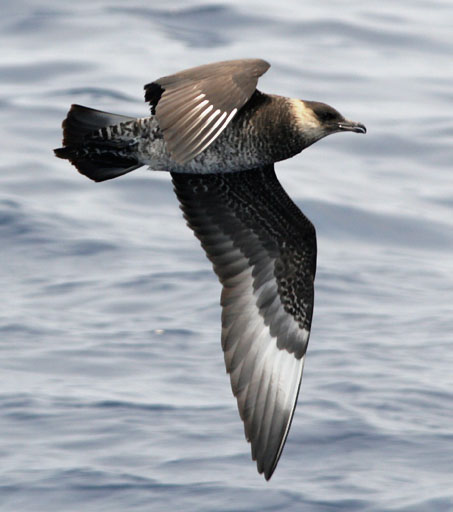
Aqaba Marine Reserve is a nature reserve located in the Aqaba Governorate, Jordan, established in 1997, covers an area of 2.8 square kilometers. This reserve is considered a habitat for important marine life, such as seagrass. It is known for its distinctive fish diversity and coral diversity. The marine park has numerous recorded waterbirds, especially gulls, terns, and skuas.
Adapted from Wikipedia: Aqaba Marine Reserve (CC BY-SA 4.0).
Why Aqaba Marine Reserve Is Listed
- (ix)
- An outstanding example of ongoing ecological and biological processes.
- (x)
- The most important natural habitats for conserving biodiversity.
More about Aqaba Marine Reserve
UNESCO's Description
The property, located at the northernmost tip of the Red Sea, comprises a mosaic of coral reefs, seagrass beds, and mesophotic reefs that sustain diverse marine life and ecological processes. Recognized as the world’s northernmost tropical coral reef system, the property is notable for its thermally resilient corals, which have adapted over the last 10,000 years to marine heatwaves, high salinity, and elevated summer temperatures. The reserve safeguards important marine genetic resources and supports exceptional biodiversity, including more than 150 species of hard coral, over 500 species of fish, and 1,000 species of molluscs. Its coral endemism is globally significant, supporting approximately 61% of all Red Sea endemic hard coral species, while more than 80 fish species are endemic to the Red Sea or Gulf of Aqaba.
From the UNESCO World Heritage Centre (CC BY-SA IGO 3.0).
History
The Gulf of Aqaba is Jordan’s only maritime outlet to the Red Sea, with Jordan owning only 27 km of the total 160 km of coastline. Despite the limited coastline, it experiences intense economic and tourist activity. Environmental expert emphasizes the importance of protecting part of this coastline due to the presence of various marine species. The establishment of the marine reserve is an opportunity to include it within the important environmental areas recognized by the International Union for Conservation of Nature, reflecting Jordan's commitment to international agreements for the protection of marine environments.
Description
The reserve is home to 300 species of hard and soft coral, 512 species of various fish, 3 types of seagrass beds, and two main types of shallow seagrass communities, ranging from half a meter to 40 meters in depth. The annual rainfall is about 30 mm, and the temperature ranges from 14°C in winter to 32°C in summer, with a maximum of up to 50°C. The humidity ranges between 30–55%, and the climate is dry.
Sections adapted from Wikipedia: Aqaba Marine Reserve (CC BY-SA 4.0).
World Heritage in Jordan: Quick Answers
- How many UNESCO World Heritage Sites are in Jordan?
- Jordan has 8 World Heritage Sites: 6 cultural, 1 natural and 1 mixed.
- What was the first World Heritage Site in Jordan?
- Petra, inscribed in 1985. The most recent is Aqaba Marine Reserve, inscribed in 2026.
- What are the natural World Heritage Sites in Jordan?
- Wadi Rum (mixed), Aqaba Marine Reserve.
- Are any World Heritage Sites in Jordan in danger?
- None of the World Heritage Sites in Jordan is on UNESCO's List of World Heritage in Danger.