Skip to content
YearMaps
Antarctica · Islands

Largest Islands of Antarctica

South Shetland Islands is the largest of the 24 islands recorded for Antarctica, at 13,994 km², ahead of Balleny Islands at 3,113 km². The full list follows.

How this list is built: Ranked by mapped area. An island divided between countries is listed under each, with the area of the whole island. It covers the islands indexed in YearMaps, drawn from open geospatial data, and is not an exhaustive national register.

Islands Listed
24
Top Ranked
13,994 km²
South Shetland Islands
Second
3,113 km²
Balleny Islands
Profiled Below
22
Photo, encyclopedia text and figures
Largest Islands of Antarctica
#NameArea
1South Shetland Islands13,994 km²
2Balleny Islands3,113 km²
3South Orkney Islands1,895 km²
4Joinville Island1,675 km²
5Biscoe Islands1,640 km²
6James Ross Island1,545 km²
7Hearst Island1,130 km²
8Berkner Island636 km²
9Brabant Island620 km²
10King George Island518 km²
11Burke Island315 km²
12Livingston Island294 km²
13Elephant Island246 km²
14Charcot Island204 km²
15Anvers Island129 km²
16Siple Island93 km²
17Carney Island77 km²
18Thurston Island65 km²
19Spaatz Island54 km²
20Farwell Island7 km²
21Latady Island3 km²
22Mill Island—
23Roosevelt Island—
24Marshall Archipelago—

The Islands of Antarctica in Detail

The 22 islands above that have an encyclopedia article, in the same order, each with its photograph, figures and the places around it.

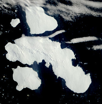
South Shetland Islands
Image via Wikimedia Commons (author and licence on the file page).

South Shetland Islands

Island group · 13,994 km²

South Shetland Islands is an island group in Antarctica, covering an estimated 13,994 km².

The South Shetland Islands are a group of Antarctic islands located in the Drake Passage with a total area of 3,687 km2 (1,424 sq mi). They lie about 120 kilometres (65 nautical miles) north of the Antarctic Peninsula, and between 430 and 900 km (230 and 485 nmi) southwest of the nearest point of the South Orkney Islands. By the Antarctic Treaty of 1959, the islands' sovereignty is neither recognized nor disputed by the signatories. According to British government language on the topic, "the whole of Antarctica is protected in the interests of peace and science."

The islands have been claimed by three countries, beginning with the United Kingdom since 1908 (since 1962 as part of the equally unrecognized British Antarctic Territory). The islands are also claimed by the governments of Chile (since 1940, as part of the Antártica Chilena province), and by Argentina (since 1943, as part of Argentine Antarctica, Tierra del Fuego Province), both equally unrecognized.

Several countries maintain research stations on the islands. Most of them are situated on King George Island, benefitting from the airfield of the Chilean base Eduardo Frei.

Adapted from Wikipedia: South Shetland Islands (CC BY-SA 4.0).

Feature class
Island group
Mapped extent
13,994 km²
Size rank
#127 of 445 islands
Region
Antarctica
Coordinates
-61.2538°, -54.2777°
Summits:
Mount Usborne (705 m), Mount Paget (2,915 m), Torres del Paine (2,500 m)
Ranges:
Jones Mountains (Antarctica), Ellsworth Mountains (Antarctica)
Settlements:
Ushuaia (1,091 km), Rio Grande (1,149 km), Punta Arenas (1,341 km)

View on the live map

More about South Shetland Islands

Geography

As a group of islands, the South Shetland Islands are located at 62°0′S 58°0′W. They are within the region 61° 00'–63° 37' South, 53° 83'–62° 83' West. The islands lie 940 km (510 nmi) south of the Falkland Islands, and between 93 km (50 nmi) (Deception Island) and 269 km (145 nmi) (Clarence Island) northwest and north from the nearest point of the Antarctic continent, Graham Land.

The South Shetlands consist of 11 major islands and several minor ones, totalling 3,687 km2 (1,424 sq mi) of land area. Between 80 and 90% of the land area is permanently glaciated. The highest point on the island chain is Mount Foster on Smith Island at 2,025 m (6,644 ft) above sea level at 2-meter spatial resolution.

History

The islands were discovered by British mariner William Smith, in William, in 1819, although Dutch mariner Dirck Gerritsz in 1599 or Spanish Admiral Gabriel de Castilla in 1603 might have sighted the South Shetlands, or North or South American sealers might have visited the archipelago before Smith. Smith's discovery was well documented and had wider historical implications beyond its geographic significance.

Chilean scientists have claimed that Amerinds have visited the islands, due to stone artifacts recovered from bottom-sampling operations in Admiralty Bay, King George Island, and Discovery Bay, Greenwich Island; however, the artifacts – two arrowheads – were later found to have been planted.

Sections adapted from Wikipedia: South Shetland Islands (CC BY-SA 4.0).

South Shetland Islands: Key Facts

Key facts about South Shetland Islands
Area3,687 km²
Population500
Highest pointMount Irving
Surrounded bySouthern Ocean, Scotia Sea

Facts from Wikidata Q140948 (CC0).

Visiting South Shetland Islands

The South Shetland Islands are an archipelago 120 km (75 miles) north of the Antarctic Peninsula. They have a marine polar climate: very cold, but not as extremely cold as the mainland. They were discovered in the early 19th century and supported temporary bases for whaling and sealing, and later research and exploration bases. They have never had permanent residents.

Travel notes adapted from Wikivoyage: South Shetland Islands (CC BY-SA 4.0).

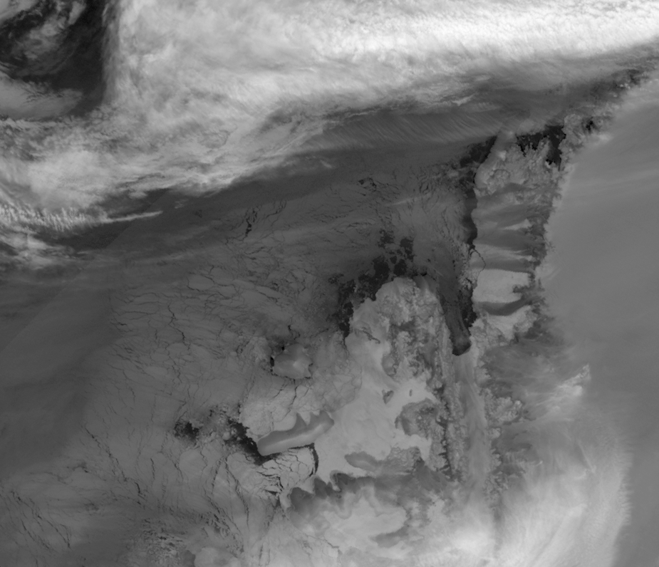
Balleny Islands
Image via Wikimedia Commons (author and licence on the file page).

Balleny Islands

Island group · 3,113 km²

Balleny Islands is an island group in Antarctica, covering an estimated 3,113 km².

The Balleny Islands (66°55′S 163°45′E) are a series of uninhabited islands in the Southern Ocean extending from 66°15' to 67°35'S and 162°30' to 165°00'E. The group extends for about 160 km (99 mi) in a northwest–southeast direction. The islands are heavily glaciated and of volcanic origin. Glaciers project from their slopes into the sea. The islands were formed by the so-called Balleny hotspot.

The group includes three main islands: Young, Buckle and Sturge, which lie in a line from northwest to southeast, and several smaller islets and rocks:

northeast of Young Island: Seal Rocks, Pillar

southeast of Young Island: Row Island, Borradaile Island (with Swan Base shelter hut)

south of Buckle Island: Scott Cone, Chinstrap Islet, Sabrina Islet (with Sabrina Refuge shelter hut), and the Monolith

The islands are claimed by New Zealand as part of the Ross Dependency (see Territorial claims in Antarctica).

Adapted from Wikipedia: Balleny Islands (CC BY-SA 4.0).

Feature class
Island group
Mapped extent
3,113 km²
Size rank
#221 of 445 islands
Region
Antarctica
Coordinates
-66.7677°, 163.2514°
Summits:
Mount Erebus (3,795 m), Mount Lister (4,023 m), Mount Kirkpatrick (4,528 m)
Ranges:
Admiralty Mountains (Antarctica), Prince Albert Mountains (Antarctica)
Settlements:
Invercargill (2,283 km), Dunedin (2,361 km), Timaru (2,533 km)

View on the live map

More about Balleny Islands

Geology

In the archipelago, the Buckle, Sturge and Young Islands are examples of stratovolcanoes. Strong earthquakes very close to the islands are rare, but tremors of moderate strength do occur over the Pacific-Antarctic Ridge, Macquarie triple junction and Pacific Rim between the Balleny Islands and Macquarie Island. Other earthquakes occur near the Southeast Indian Ridge and Balleny fracture zone, including a magnitude 8.1 earthquake in 1998 that struck just over 700 km (430 mi) west-northwest of the islands which changed the pattern of seismicity in a wide area around the islands.

It is possible that these islands are still volcanically active. The Brown Peak volcano may have had an eruption in 2001, based on satellite observation.

Sections adapted from Wikipedia: Balleny Islands (CC BY-SA 4.0).

Balleny Islands: Key Facts

Key facts about Balleny Islands
Area792 km²
Highest pointBrown Peak
Surrounded bySomov Sea

Facts from Wikidata Q805218 (CC0).

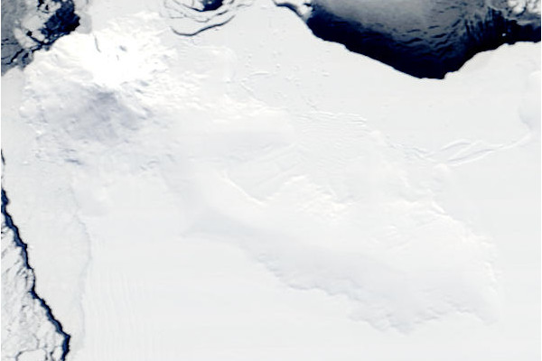
South Orkney Islands
Image via Wikimedia Commons (author and licence on the file page).

South Orkney Islands

Island group · 1,895 km²

South Orkney Islands is an island group in Seven seas (open ocean) (Southern Atlantic Ocean), covering an estimated 1,895 km².

The South Orkney Islands are a group of islands in the Southern Ocean, about 604 km (375 mi) north-east of the tip of the Antarctic Peninsula and 844 km (524 mi) south-west of South Georgia Island. They have a total area of about 620 km2 (240 sq mi). The islands are claimed both by Britain (as part of the British Antarctic Territory since 1962, previously as a Falkland Islands Dependency) and by Argentina (as part of Argentine Antarctica). Under the 1959 Antarctic Treaty, sovereignty claims are held in abeyance.

Britain and Argentina both maintain bases on the islands. The Argentine base, Orcadas, established in 1904, is sited on Laurie Island. The 11 buildings of the Argentine station house up to 45 people during the summer, and an average of 14 during winter. The British Antarctic Survey base, Signy Research Station, is located on Signy Island and was established in 1947. Initially operated year-round, since 1995–1996 the Signy Research Station has been open only from November to April each year.

Apart from personnel at the bases, there are no permanent human inhabitants on the islands.

Adapted from Wikipedia: South Orkney Islands (CC BY-SA 4.0).

Feature class
Island group
Mapped extent
1,895 km²
Size rank
#255 of 445 islands
Region
Seven seas (open ocean)
Subregion
Southern Atlantic Ocean
Coordinates
-60.5889°, -45.5115°
Summits:
Mount Paget (2,915 m), Mount Usborne (705 m), Torres del Paine (2,500 m)
Ranges:
Shackleton Range (Antarctica), Jones Mountains (Antarctica)
Settlements:
Ushuaia (1,490 km), Rio Grande (1,525 km), Punta Arenas (1,736 km)

View on the live map

More about South Orkney Islands

Geography and climate

The islands are situated at latitudes about 60°30' to 60°48' S and longitudes 44°25' to 46°43' W in the Southern Ocean. As a group of islands, the South Orkney Islands are at approximately 60°36′S 45°30′W.

The archipelago comprises four main islands. Coronation Island is the largest, measuring about 30 mi (48 km) long; its highest point is Mount Nivea which rises to 4,153 ft (1,266 m) above sea level. Laurie Island is the easternmost of the islands. The other main islands are Powell and Signy. Smaller islands in the group include Robertson Islands, the Saddle Islands, and Acuña Island. The total area of the archipelago is about 240 sq mi (620 km2), of which about 90 percent is glaciated.

History

The South Orkney Islands were discovered in 1821 by two sealers, the American Nathaniel Brown Palmer and the Briton George Powell. The islands were originally named Powell's Group, with the main island named Coronation Island as it was the year of the coronation of King George IV. In 1823, James Weddell visited the islands, gave the archipelago its present name (after the Orkney Islands in the north of Scotland) and also renamed some of the islands. The South Orkney Islands are located at roughly the same latitude south as the Orkney Islands are north (60°S vs 59°N), although it is not known if this was a factor behind the naming of the islands.

Sections adapted from Wikipedia: South Orkney Islands (CC BY-SA 4.0).

South Orkney Islands: Key Facts

Key facts about South Orkney Islands
Area622 km²
Highest pointMount Nivea
Surrounded bySouthern Ocean, Scotia Sea

Facts from Wikidata Q207383 (CC0).

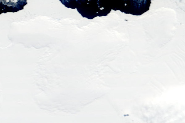
Joinville Island
Image via Wikimedia Commons (author and licence on the file page).

Joinville Island

Island · 1,675 km²

Joinville Island is an island in Antarctica, covering an estimated 1,675 km².

Joinville Island (63°15′S 55°45′W) is the largest island of the Joinville Island group, about 40 nautical miles (74 km; 46 mi) long in an east–west direction and 12 nautical miles (22 km; 14 mi) wide, lying off the northeastern tip of the Antarctic Peninsula, from which it is separated by the Antarctic Sound.

Adapted from Wikipedia: Joinville Island (CC BY-SA 4.0).

Feature class
Island
Mapped extent
1,675 km²
Size rank
#259 of 445 islands
Region
Antarctica
Coordinates
-63.2230°, -55.8329°
Summits:
Mount Usborne (705 m), Mount Paget (2,915 m), Torres del Paine (2,500 m)
Ranges:
Jones Mountains (Antarctica), Ellsworth Mountains (Antarctica)
Settlements:
Ushuaia (1,175 km), Rio Grande (1,251 km), Punta Arenas (1,419 km)

View on the live map

More about Joinville Island

Location

Joinville Island lies in Graham Land to the east of the tip of Trinity Peninsula, which is itself the tip of the Antarctic Peninsula.

D'Urville Island is to the north, Danger Islands to the east and Dundee Island to the west.

Northern features include Cape Kinnes, Boral Point, King Point and Fitzroy Point.

Southern features include Mount Percy, Mount Quilmes, Tay Head and Moody Point.

Sections adapted from Wikipedia: Joinville Island (CC BY-SA 4.0).

Joinville Island: Key Facts

Key facts about Joinville Island
Area1,607 km²
Population0
Highest pointMount Tholus
Surrounded bySouthern Ocean

Facts from Wikidata Q887590 (CC0).

Biscoe Islands
Image via Wikimedia Commons (author and licence on the file page).

Biscoe Islands

Island group · 1,640 km²

Biscoe Islands is an island group in Antarctica, covering an estimated 1,640 km².

Biscoe Islands is a series of islands, of which the principal ones are Renaud, Lavoisier (named Serrano by Chile and Mitre by Argentina), Watkins, Krogh, Pickwick and Rabot, lying parallel to the west coast of Graham Land and extending 150 km (81 nmi) between Southwind Passage on the northeast and Matha Strait on the southwest. Another group of islands are the Adolph Islands.

The islands are named for John Biscoe, the commander of an English expedition which explored the islands in March 1832.

Adapted from Wikipedia: Biscoe Islands (CC BY-SA 4.0).

Feature class
Island group
Mapped extent
1,640 km²
Size rank
#263 of 445 islands
Region
Antarctica
Coordinates
-65.6967°, -66.4470°
Summits:
Vinson Massif (4,892 m), Mount Usborne (705 m), Torres del Paine (2,500 m)
Ranges:
Jones Mountains (Antarctica), Ellsworth Mountains (Antarctica)
Settlements:
Ushuaia (1,217 km), Rio Grande (1,326 km), Punta Arenas (1,416 km)

View on the live map

More about Biscoe Islands

Biscoe Islands: Key Facts

Key facts about Biscoe Islands
Area478 km²
Surrounded bySouthern Ocean

Facts from Wikidata Q866276 (CC0).

James Ross Island
Image via Wikimedia Commons (author and licence on the file page).

James Ross Island

Island · 1,545 km²

James Ross Island is an island in Antarctica, covering an estimated 1,545 km².

James Ross Island is a large island off the southeast side and near the northeastern extremity of the Antarctic Peninsula, from which it is separated by Prince Gustav Channel.

Rising to 1,630 metres (5,350 ft), it is irregularly shaped and extends 40 nautical miles (74 km; 46 mi) in a north–south direction.

Adapted from Wikipedia: James Ross Island (CC BY-SA 4.0).

Feature class
Island
Mapped extent
1,545 km²
Size rank
#270 of 445 islands
Region
Antarctica
Coordinates
-64.1553°, -57.5099°
Summits:
Mount Usborne (705 m), Mount Paget (2,915 m), Torres del Paine (2,500 m)
Ranges:
Jones Mountains (Antarctica), Ellsworth Mountains (Antarctica)
Settlements:
Ushuaia (1,203 km), Rio Grande (1,288 km), Punta Arenas (1,441 km)

View on the live map

More about James Ross Island

Location

James Ross Island is separated from Trinity Peninsula, at the tip of the Antarctic Peninsula to the northwest, by the Prince Gustav Channel.

Vega Island is to the north of the island, separated from James Ross Island by the Herbert Sound.

The island was connected to the Antarctic mainland by an ice shelf until 1995, when the ice shelf collapsed, making the Prince Gustav Channel passable for the first time.

Mendel Polar Station, the first Czech Antarctic Base, is located on the island.

Sections adapted from Wikipedia: James Ross Island (CC BY-SA 4.0).

James Ross Island: Key Facts

Key facts about James Ross Island
Area2,598 km²
Population0
Highest pointMount Haddington
Surrounded bySouthern Ocean

Facts from Wikidata Q1022143 (CC0).

Hearst Island

Island · 1,130 km²

Hearst Island is an island in Antarctica, covering an estimated 1,130 km².

Stefansson Strait (69°26′S 62°25′W) is an ice-filled strait 35 nautical miles (65 km; 40 mi) long and 3 to 10 nautical miles (5.6 to 18.5 km; 3.5 to 11.5 mi) wide, between the east coast of Palmer Land and Hearst Island, Antarctica.

Adapted from Wikipedia: Stefansson Strait (CC BY-SA 4.0).

Feature class
Island
Mapped extent
1,130 km²
Size rank
#285 of 445 islands
Region
Antarctica
Coordinates
-69.4780°, -62.0281°
Summits:
Vinson Massif (4,892 m), Mount Takahe (3,460 m), Mount Seelig (3,022 m)
Ranges:
Jones Mountains (Antarctica), Ellsworth Mountains (Antarctica)
Settlements:
Ushuaia (1,663 km), Rio Grande (1,768 km), Punta Arenas (1,871 km)

View on the live map

More about Hearst Island

Location

Stefansson Strait is on the Wilkins Coast of Palmer Land, beside the Weddell Sea to the east.

It is east of the Eternity Range, north of Hughes Ice Piedmont and south of Scripps Heights and Casey Inlet.

The south of the strait is at the north side of the mouth of Anthony Glacier, which flows eastward past the Engel Peaks and Mount Martin to enter the sea north of Lewis Point.

Features of the coast to the west of the strait, from south to north, include Rhino Rock, Cape Rymill, Briesemeister Peak and Cape Reichelderfer.

The Binghy Glacier flows east between De Busk Scarp and Le Feuvre Scarp to enter the trait north of Cape Reichelderfer.

Sections adapted from Wikipedia: Stefansson Strait (CC BY-SA 4.0).

Berkner Island
Image via Wikimedia Commons (author and licence on the file page).

Berkner Island

Island · 636 km²

Berkner Island is an island in Antarctica, covering an estimated 636 km².

Berkner Island (also known as the Berkner Ice Rise or as Hubley Island) is an Antarctic ice rise, where bedrock below sea level has caused the surrounding ice sheet to create a dome. If the ice cap were removed, the island would be underwater. Berkner Island is completely ice-covered and is about 320 kilometres (200 mi) long and 150 kilometres (93 mi) wide, with an area of 44,000 km2 (17,000 sq mi). It is surrounded by the Filchner-Ronne Ice Shelf. The northernmost point of the Berkner is about 20 kilometres (12 mi) from the open sea. It lies in the overlapping portion of the Argentine and the British Antarctic territorial claims.

The island rises to 869 m (2,850 ft) (975 m or 3,200 ft, according to other sources) and separates the Ronne Ice Shelf from the Filchner Ice Shelf. It is characterized by two domes, Reinwarthhöhe in the north (698 m or 2,290 ft), and Thyssenhöhe in the south (869 m or 2,851 ft). It is indented by three bays on the eastern side, which are, from north to south, the McCarthy Inlet, the Roberts Inlet, and the Spilhaus Inlet. The southern tip is named the Mulvaney Promontory. Gould Bay is on the north coast.

Adapted from Wikipedia: Berkner Island (CC BY-SA 4.0).

Feature class
Island
Mapped extent
636 km²
Size rank
#321 of 445 islands
Region
Antarctica
Coordinates
-77.7806°, -45.2009°
Summits:
Vinson Massif (4,892 m), Anderson Summit (2,810 m), Mount Seelig (3,022 m)
Ranges:
Shackleton Range (Antarctica), Pensacola Mountains (Antarctica)
Settlements:
Ushuaia (2,712 km), Rio Grande (2,813 km), Punta Arenas (2,924 km)

View on the live map

More about Berkner Island

History

Berkner Island was discovered by members of the United States-International Geophysical Year party from Ellsworth Station during the 1957–1958 season. It was named by the United States Advisory Committee on Antarctic Names after American physicist Lloyd Berkner, engineer with the Byrd Antarctic Expedition (1928–1930).

Since 1990, Berkner Island has been a jumping-off point for a number of long-distance polar expeditions. Ben Saunders has planned an unsupported journey from the island to the South Pole and back, and it was the start point of Henry Worsley's attempt to cross the Antarctic in 2015–16.

Sections adapted from Wikipedia: Berkner Island (CC BY-SA 4.0).

Berkner Island: Key Facts

Key facts about Berkner Island
Area43,873 km²
Surrounded byWeddell Sea

Facts from Wikidata Q741243 (CC0).

Brabant Island
Image via Wikimedia Commons (author and licence on the file page).

Brabant Island

Island · 620 km²

Brabant Island is an island in Antarctica, covering an estimated 620 km².

Brabant Island is the second largest island of the Palmer Archipelago within the British Antarctic Territory, lying between Anvers Island and Liège Island. Brabant Island is 59 km (37 mi) long north-south, 30 km (19 mi) wide, and rises to 2,520 m (8,268 ft) in Mount Parry. The interior of the island is occupied by two mountain ranges, Solvay Mountains (Cook Summit, 1590 m) in its southern part and Stribog Mountains (summit Mount Parry) in its central and northern parts.

It was named by the Belgian Antarctic Expedition (1897–1899) under Adrien de Gerlache, who named it after the Belgian Province of Brabant, in recognition of the support given to the expedition by its citizens.

A paper summarizing the Joint Services expedition of 1984–1985 describes the island as "notoriously inhospitable" and states that there is evidence for only six visits between the discovery in 1898 and 1984. Members of the expedition overwintered there in 1984–1985, and made the first ascent of Mount Parry.

Adapted from Wikipedia: Brabant Island (CC BY-SA 4.0).

Feature class
Island
Mapped extent
620 km²
Size rank
#322 of 445 islands
Region
Antarctica
Coordinates
-64.1199°, -62.3575°
Summits:
Mount Usborne (705 m), Torres del Paine (2,500 m), Monte Fitz Roy (3,375 m)
Ranges:
Jones Mountains (Antarctica), Ellsworth Mountains (Antarctica)
Settlements:
Ushuaia (1,089 km), Rio Grande (1,188 km), Punta Arenas (1,313 km)

View on the live map

More about Brabant Island

History

On 6 February 2024, for the first time since 2017, British Royal Navy personnel from HMS Protector landed on the island in an effort to clear three tonnes of waste and abandoned equipment from the 1980s antarctic expedition.

Geology

The Brabant Island Tectonic Block includes up to 2000 m of basaltic-andesitic lavas and volcaniclastics, possibly corresponding to the Lower Cretaceous Antarctic Peninsula Volcanic Group of the Danco Coast. This group is intruded by a granodiorite sill and Early Eocene hypabyssal dykes. Late Tertiary to Pleistocene basaltic lavas uncomformably overlay this complex.

Sections adapted from Wikipedia: Brabant Island (CC BY-SA 4.0).

Brabant Island: Key Facts

Key facts about Brabant Island
Area977 km²
Population0
Highest pointMount Parry
Surrounded bySouthern Ocean

Facts from Wikidata Q896462 (CC0).

Burke Island

Island · 315 km²

Burke Island is an island in Antarctica, covering an estimated 315 km².

King Peninsula (73°12′S 101°00′W) is an ice-covered peninsula, 100 nautical miles (190 km; 120 mi) long and 20 nautical miles (37 km; 23 mi) wide, lying south of Thurston Island and forming the south side of Peacock Sound, Antarctica.

It projects from the continental ice sheet and trends west between the Abbot Ice Shelf and Cosgrove Ice Shelf to terminate at the Amundsen Sea.

Adapted from Wikipedia: King Peninsula (CC BY-SA 4.0).

Feature class
Island
Mapped extent
315 km²
Size rank
#357 of 445 islands
Region
Antarctica
Coordinates
-73.1044°, -104.8762°
Summits:
Mount Takahe (3,460 m), Mount Sidley (4,285 m), Vinson Massif (4,892 m)
Ranges:
Jones Mountains (Antarctica), Executive Committee Range (Antarctica)
Settlements:
Ushuaia (2,624 km), Punta Arenas (2,718 km), Rio Grande (2,742 km)

View on the live map

More about Burke Island

Location

The north shore of the King Peninsula is the western end of the Eights Coast, while the west and southern shore is in the Walgreen Coast.

Peacock Sound is to the north, completely filled by the western part of the Abbot Ice Shelf.

Burke Island is in the sea to the west. The Waite Islands are off Cape Waite, the northwest extremity of the peninsula.

Marelli Glacier drains northeast from the peninsula into the Abbot Ice Shelf.

Sections adapted from Wikipedia: King Peninsula (CC BY-SA 4.0).

Burke Island: Key Facts

Key facts about Burke Island
Surrounded byBellingshausen Sea

Facts from Wikidata Q2646966 (CC0).

Livingston Island
Image via Wikimedia Commons (author and licence on the file page).

Livingston Island

Island · 294 km²

Livingston Island is an island in Antarctica, covering an estimated 294 km².

Livingston Island (Russian name Smolensk, 62°36′S 60°30′W) is an Antarctic island in the Southern Ocean, part of the South Shetlands Archipelago, a group of Antarctic islands north of the Antarctic Peninsula. It was the first land discovered south of 60° south latitude in 1819, a historic event that marked the end of a centuries-long pursuit of the mythical Terra Australis Incognita and the beginning of the exploration and utilization of real Antarctica. The name Livingston, although of unknown derivation, has been well established in international usage since the early 1820s.

Adapted from Wikipedia: Livingston Island (CC BY-SA 4.0).

Feature class
Island
Mapped extent
294 km²
Size rank
#361 of 445 islands
Region
Antarctica
Coordinates
-62.4844°, -60.7592°
Summits:
Mount Usborne (705 m), Torres del Paine (2,500 m), Monte Fitz Roy (3,375 m)
Ranges:
Jones Mountains (Antarctica), Ellsworth Mountains (Antarctica)
Settlements:
Ushuaia (959 km), Rio Grande (1,048 km), Punta Arenas (1,196 km)

View on the live map

More about Livingston Island

Geography

Livingston Island is situated in West Antarctica, 110 km (68 mi) northwest of Cape Roquemaurel on the Antarctic mainland, 809 km (503 mi) south-southeast of Cape Horn in South America, 796 km (495 mi) southeast of the Diego Ramírez Islands (the southernmost land of South America), 1,063 km (661 mi) due south of the Falkland Islands, 1,571 km (976 mi) southwest of South Georgia Islands, and 3,040 km (1,889 mi) from the South Pole.

The island is part of the South Shetlands archipelago, an islands chain extending 510 km (317 mi) in east-northeast to west-southwest direction, and separated from the nearby Antarctic Peninsula by Bransfield Strait, and from South America by the Drake Passage.

History

It was only during the nineteenth century that any land was discovered in what is now the ‘political’ territory of Antarctica, and that land happened to be Livingston Island. The English merchant William Smith in his brig William, while sailing to Valparaíso in early 1819, strayed from his route south of Cape Horn and on 19 February sighted Williams Point, the northeast extremity of Livingston. That was the first land ever discovered south of 60° south latitude, in what is now the Antarctic Treaty area.

It is noteworthy that navigation round Fire Land spanned over two hundred years, yet no one saw the coasts of New Shetland. In 1616 the Dutch mariners Lemaire and Schouten found a strait between Fire Land and Staten Land named after Lemaire.

Climate

The climate of Livingston is polar tundra under the Köppen-Geiger climate classification system. Climatic conditions are influenced by the following specific factors: the island's location in the narrowest part of the Southern Ocean (less than 600 km between the Antarctic Convergence and the Antarctic Peninsula); the relatively small amplitude of water temperatures in the surrounding sea; the local relief including Tangra Mountains, one of the highest mountain ranges in the archipelago that contributes to shaping the local atmospheric circulation; and the ice cap of the island. Surface air temperature decreases with increasing altitudes, which in the interior of eastern Livingston Island reach 550 m at the centrally located Wörner Gap and over 1400 m at the crest of Tangra Mountains.

Tourism

Antarctic shipborne tourism was initiated in the 1957/58 season with four cruises operated by Chile and Argentina in the South Shetland Islands. Since then the number of tourists visiting Antarctica has grown to several tens of thousands annually. Over 95% of them tour the South Shetlands and the nearby Antarctic Peninsula. Hannah Point on the south coast of Livingston, Half Moon Island off its east coast, Aitcho Islands just north of Greenwich Island, and Deception Island are among the most popular destinations.

Sections adapted from Wikipedia: Livingston Island (CC BY-SA 4.0).

Livingston Island: Key Facts

Key facts about Livingston Island
Area974 km²
Population0
Highest pointMount Friesland
Surrounded bySouthern Ocean

Facts from Wikidata Q856906 (CC0).

Visiting Livingston Island

Livingston Island is one of the South Shetland Islands, about 120 km north of the Antarctic Peninsula. Extending 73 km east-west and 20-30 km north-south, it's the focus of Bulgarian exploration of the Antarctic.

Travel notes adapted from Wikivoyage: Livingston Island (CC BY-SA 4.0).

Elephant Island
Image via Wikimedia Commons (author and licence on the file page).

Elephant Island

Island · 246 km²

Elephant Island is an island in Antarctica, covering an estimated 246 km².

Elephant Island is an ice-covered, mountainous island off the coast of Antarctica in the outer reaches of the South Shetland Islands, in the Southern Ocean. The island is situated 245 kilometres (152 miles) north-northeast of the tip of the Antarctic Peninsula, 1,253 kilometres (779 miles) west-southwest of South Georgia, 935 kilometres (581 miles) south of the Falkland Islands, and 885 kilometres (550 miles) southeast of Cape Horn. It is within the Antarctic claims of Argentina, Chile and the United Kingdom.

The Brazilian Antarctic Program maintains a shelter on the island, Goeldi, and formerly had another (Wiltgen) supporting the work of up to six researchers each during the summer. Wiltgen was dismantled in the summers of 1997 and 1998.

Adapted from Wikipedia: Elephant Island (CC BY-SA 4.0).

Feature class
Island
Mapped extent
246 km²
Size rank
#364 of 445 islands
Region
Antarctica
Coordinates
-61.1375°, -54.7954°
Summits:
Mount Usborne (705 m), Mount Paget (2,915 m), Torres del Paine (2,500 m)
Ranges:
Jones Mountains (Antarctica), Ellsworth Mountains (Antarctica)
Settlements:
Ushuaia (1,061 km), Rio Grande (1,120 km), Punta Arenas (1,310 km)

View on the live map

More about Elephant Island

Geography

Elephant Island marks the western end of the South Scotia Ridge. The island is oriented approximately east–west, with a maximum elevation of 973 m (3,192 ft) at Mount Pendragon. The weather is normally foggy with much snow, and winds can reach 160 km/h (100 mph).

Significant named features are Cape Yelcho, Cape Valentine and Cape Lookout at the northeastern and southern extremes, and Point Wild, a spit on the north coast. The Endurance Glacier is the main discharge glacier.

History

The First Russian Antarctic expedition led by Fabian Gottlieb von Bellingshausen and Mikhail Lazarev on the 985-ton sloop-of-war Vostok ("East") and the 530-ton support vessel Mirny ("Peaceful") discovered Elephant Island on 29 January 1821 and named it Mordvinov Island (Остров Мордвинова) in honour of Admiral Mordvinov.

The island was the refuge of explorer Ernest Shackleton and his crew in 1916 following the loss of their ship Endurance in the pack ice of the Weddell Sea. The crew of 28 reached Cape Valentine on Elephant Island after months spent drifting on ice floes and a harrowing crossing of the open ocean in small lifeboats.

Geology

Elephant Island is part of the Scotia metamorphic complex, which was created by Cretaceous sea floor sediments being scraped off and metamorphosed at the Scotia subduction zone. The resulting rocks are phyllites, blueschists and greenschists typical of an accretionary wedge, with increased metamorphism from northeast to southwest. These rocks are at the surface here because of uplift along the Shackleton Fault Zone where it meets the South Scotia Ridge. This complex is very similar in age and rock types to those of coastal California, including Catalina Island and the Big Sur coast.

Elephant Island is the type locality for phosphate mineral spheniscidite.

Sections adapted from Wikipedia: Elephant Island (CC BY-SA 4.0).

Elephant Island: Key Facts

Key facts about Elephant Island
Area558 km²
Population0
Highest pointMount Pendragon
Surrounded bySouthern Ocean

Facts from Wikidata Q988689 (CC0).

Charcot Island
Image via Wikimedia Commons (author and licence on the file page).

Charcot Island

Island · 204 km²

Charcot Island is an island in Antarctica, covering an estimated 204 km².

Charcot Island or Charcot Land is an island administered under the Antarctic Treaty System, 56 kilometres (30 nmi) long and 46 kilometres (25 nmi) wide, which is ice covered except for prominent mountains overlooking the north coast. Charcot Island lies within the Bellingshausen Sea, 102 kilometres (55 nmi) west of Alexander Island, and about 57 kilometres (31 nmi) north of Latady Island. A notable landmark of the island is its northernmost point, Cape Byrd.

Adapted from Wikipedia: Charcot Island (CC BY-SA 4.0).

Feature class
Island
Mapped extent
204 km²
Size rank
#367 of 445 islands
Region
Antarctica
Coordinates
-69.8657°, -75.6441°
Summits:
Vinson Massif (4,892 m), Mount Takahe (3,460 m), Mount Seelig (3,022 m)
Ranges:
Jones Mountains (Antarctica), Ellsworth Mountains (Antarctica)
Settlements:
Ushuaia (1,716 km), Rio Grande (1,832 km), Punta Arenas (1,872 km)

View on the live map

More about Charcot Island

History

Charcot Island was discovered on 11 January 1910 by the French Antarctic Expedition under Jean-Baptiste Charcot, who, at the insistence of his crew and the recommendation of Edwin S. Balch and others, named it Charcot Land. He did so with the stated intention of honoring his father, Jean-Martin Charcot, a famous French physician. The insularity of Charcot Land was proved by Sir Hubert Wilkins, who flew around it on 29 December 1929.

The ice bridge holding the Wilkins Ice Shelf to the Antarctic coastline and Charcot Island was 40 kilometres (25 mi) long but only 500 metres (1,640 ft) wide at its narrowest point – in 1950 it was 100 kilometres (62 mi) It shattered in April 2009 over an area measuring 20.1 by 2.4 kilometres (12.5 by 1.5 mi).

Sections adapted from Wikipedia: Charcot Island (CC BY-SA 4.0).

Charcot Island: Key Facts

Key facts about Charcot Island
Area1,500 km²
Population0 (2023)
Highest pointMount Monique
Surrounded bySouthern Ocean

Facts from Wikidata Q1063104 (CC0).

Anvers Island
Image via Wikimedia Commons (author and licence on the file page).

Anvers Island

Island · 129 km²

Anvers Island is an island in Antarctica, covering an estimated 129 km².

Anvers Island, Antwerp Island, Antwerpen Island, or Isla Amberes is a high, mountainous island 61 km (38 miles) long, the largest in the Palmer Archipelago of Antarctica. It was discovered by John Biscoe in 1832 and named in 1898 by the Belgian Antarctic Expedition under Adrien de Gerlache after the province of Antwerp in Belgium. It lies south-west of Brabant Island at the south-western end of the group. The south-western coastline of the island forms part of the Southwest Anvers Island and Palmer Basin Antarctic Specially Managed Area (ASMA 7). Cormorant Island, an Important Bird Area, lies 1 km off the south coast.

There is a small science outpost called Palmer Station on the south end of Anvers island since the late 1960s; it is the smallest and farthest north of three the U.S. has on the continent. It is staffed by a few dozen people mostly doing marine and biology research, and is usually resupplied by ship as it has no regular airport.

Adapted from Wikipedia: Anvers Island (CC BY-SA 4.0).

Feature class
Island
Mapped extent
129 km²
Size rank
#381 of 445 islands
Region
Antarctica
Coordinates
-64.6609°, -64.2008°
Summits:
Mount Usborne (705 m), Torres del Paine (2,500 m), Vinson Massif (4,892 m)
Ranges:
Jones Mountains (Antarctica), Ellsworth Mountains (Antarctica)
Settlements:
Ushuaia (1,121 km), Rio Grande (1,224 km), Punta Arenas (1,334 km)

View on the live map

More about Anvers Island

Geology

The Anvers-Melchior Islands Tectonic Block includes the northwest portion of Anvers Island and the Melchior Islands offshore. The block is bounded on the southeast by the SW-NE trending strike-slip Fournier Fault. The block is composed of a volcanic suite which may correspond to the Antarctic Peninsula Volcanic Group. Granite, diorite, and tonalite plutons indicate three phases of intrusion dated at 68-54 Ma, 34 Ma, and 21-20 Ma. Two distinct systems of dykes are present, possibly of Tertiary age. The southeast portion of Anvers Island is part of the Neumayer Channel Tectonic Block.

Sections adapted from Wikipedia: Anvers Island (CC BY-SA 4.0).

Anvers Island: Key Facts

Key facts about Anvers Island
Area2,432 km²
Population50
Highest pointMount Francais
Surrounded bySouthern Ocean

Facts from Wikidata Q612965 (CC0).

Siple Island
Image via Wikimedia Commons (author and licence on the file page).

Siple Island

Island · 93 km²

Siple Island is an island in Antarctica, covering an estimated 93 km².

Siple Island ( SIGH-p'l) is a 110 km (68 mi) long snow-covered island lying east of Wrigley Gulf along the Getz Ice Shelf off Bakutis Coast of Marie Byrd Land, Antarctica. Its centre is located at 73°51′S 125°50′W.

Its area is 6,390 km2 (2,467 sq mi) and it is dominated by the dormant shield volcano Mount Siple, rising to 3,110 m (10,203 ft) — making Siple the 15th ranking island in the world in terms of maximum elevation.

The feature was first indicated as an island on U.S. Geological Survey (USGS) maps compiled from ground surveys and U.S. Navy air photos, 1959–65. The island was visited by USCG Icebreaker, Polar Sea, in 1984 during Operation Deep Freeze. USCG serviceman, James F. Woodruff, was first to record footing on the island.

The island and the mountain were named by the United States Advisory Committee on Antarctic Names (US-ACAN) in 1967 in honour of the American Antarctic explorer Paul A. Siple (1909–1968), a member of Admiral Byrd's expeditions.

Adapted from Wikipedia: Siple Island (CC BY-SA 4.0).

Feature class
Island
Mapped extent
93 km²
Size rank
#390 of 445 islands
Region
Antarctica
Coordinates
-73.3642°, -125.4821°
Summits:
Mount Sidley (4,285 m), Mount Takahe (3,460 m), Mount Seelig (3,022 m)
Ranges:
Flood Range (Antarctica), Executive Committee Range (Antarctica)
Settlements:
Ushuaia (3,255 km), Punta Arenas (3,331 km), Rio Grande (3,371 km)

View on the live map

More about Siple Island

Siple Island: Key Facts

Key facts about Siple Island
Area6,390 km²
Population0
Highest pointMount Siple
Surrounded byRoss Sea

Facts from Wikidata Q1130726 (CC0).

Carney Island
Image via Wikimedia Commons (author and licence on the file page).

Carney Island

Island · 77 km²

Carney Island is an island in Antarctica, covering an estimated 77 km².

Carney Island (73°57′S 121°00′W) is an ice-covered island, 70 nautical miles (130 km; 81 mi) long with all but its north coast lying within the Getz Ice Shelf, Antarctica.

It is located between Siple Island and Wright Island along the coast of Marie Byrd Land.

Adapted from Wikipedia: Carney Island (CC BY-SA 4.0).

Feature class
Island
Mapped extent
77 km²
Size rank
#424 of 445 islands
Region
Antarctica
Coordinates
-73.7590°, -120.5772°
Summits:
Mount Takahe (3,460 m), Mount Sidley (4,285 m), Mount Seelig (3,022 m)
Ranges:
Executive Committee Range (Antarctica), Flood Range (Antarctica)
Settlements:
Ushuaia (3,111 km), Punta Arenas (3,193 km), Rio Grande (3,228 km)

View on the live map

More about Carney Island

Carney Island: Key Facts

Key facts about Carney Island
Area8,500 km²
Population0
Surrounded byAmundsen Sea

Facts from Wikidata Q1044030 (CC0).

Thurston Island
Image via Wikimedia Commons (author and licence on the file page).

Thurston Island

Island · 65 km²

Thurston Island is an island in Antarctica, covering an estimated 65 km².

Thurston Island (72°6′S 99°0′W) is a largely ice-covered, glacially dissected island, 135 nautical miles (250 km; 155 mi) long and 55 nautical miles (102 km; 63 mi) wide, lying between Amundsen Sea and Bellingshausen Sea a short way off the northwest end of Ellsworth Land, Antarctica.

The island is separated from the mainland by Peacock Sound, which is occupied by the west portion of Abbot Ice Shelf.

Adapted from Wikipedia: Thurston Island (CC BY-SA 4.0).

Feature class
Island
Mapped extent
65 km²
Size rank
#432 of 445 islands
Region
Antarctica
Coordinates
-71.9739°, -102.1844°
Summits:
Mount Takahe (3,460 m), Vinson Massif (4,892 m), Mount Sidley (4,285 m)
Ranges:
Jones Mountains (Antarctica), Executive Committee Range (Antarctica)
Settlements:
Ushuaia (2,482 km), Punta Arenas (2,571 km), Rio Grande (2,599 km)

View on the live map

More about Thurston Island

Geography

Thurston Island is separated from the mainland by Peacock Sound, which is occupied by the western portion of Abbot Ice Shelf.

Sherman Island, Carpenter Island and Dustin Island in Seraph Bay lie to the south of Thurston Island.

Peaks in that range include, from west to east, Landfall Peak, Mount Lopez, Mount Caldwell, Mount Kazukaitis, Mount Simpson, Mount Noxon, Mount Leech, Mount Hubbard, Smith Peak, Mount Borgesen, Guy Peaks, Mount Hawthorne, Mount Bramhall, Zuhn Bluff and Parker Peak.

The northwest side of the island consists of a series of capes, peninsulas and inlets.

History

Thurston Island was discovered by Rear Admiral Richard E. Byrd and members of the United States Antarctic Service (USAS) in a flight from the Bear on 27 February 1940.

Byrd named it for W. Harris Thurston, a New York textile manufacturer, designer of the windproof "Byrd Cloth" and contributor to the expedition.

Originally charted as a peninsula, the feature was found to be an island by the USN Bellingshausen Sea Expedition in February 1960.

On 30 December 1946, Thurston Island was the site of Antarctica's first fatal plane crash. A Martin PBM-5 Mariner (59098) of the US Navy with the Byrd expedition hit a ridge and burned on the island, killing 3 of the 9 occupants. The 6 survivors were rescued 13 days later.

Sections adapted from Wikipedia: Thurston Island (CC BY-SA 4.0).

Thurston Island: Key Facts

Key facts about Thurston Island
Area15,700 km²
Population0
Highest pointMount Howell
Surrounded byBellingshausen Sea

Facts from Wikidata Q583990 (CC0).

Spaatz Island
Image via Wikimedia Commons (author and licence on the file page).

Spaatz Island

Island · 54 km²

Spaatz Island is an island in Antarctica, covering an estimated 54 km².

Stange Sound (73°10′S 76°40′W) is a sound about 60 nautical miles (110 km; 69 mi) long and 25 nautical miles (46 km; 29 mi) wide along the coast of Ellsworth Land, Antarctica.

An ice shelf occupies the sound, which is bounded on the west by Smyley Island and Case Island, on the south by the mainland, on the east by Spaatz Island and on the north by open water in the Ronne Entrance.

Photographed from the air and roughly plotted by the Ronne Antarctic Research Expedition (RARE. 1947-48) under Finn Ronne.

Named for Henry Stange of New York, a contributor to RARE who gave much time to assisting in preparations for the expedition.

Adapted from Wikipedia: Stange Sound (CC BY-SA 4.0).

Feature class
Island
Mapped extent
54 km²
Size rank
#434 of 445 islands
Region
Antarctica
Coordinates
-72.8025°, -74.9235°
Summits:
Vinson Massif (4,892 m), Mount Takahe (3,460 m), Mount Seelig (3,022 m)
Ranges:
Jones Mountains (Antarctica), Ellsworth Mountains (Antarctica)
Settlements:
Ushuaia (2,026 km), Rio Grande (2,141 km), Punta Arenas (2,192 km)

View on the live map

Farwell Island
Image via Wikimedia Commons (author and licence on the file page).

Farwell Island

Island · 7 km²

Farwell Island is an island in Antarctica, covering an estimated 7 km².

The Abbot Ice Shelf (72°45′S 96°00′W) is an ice shelf 250 nautical miles (460 km; 290 mi) long and 40 nautical miles (74 km; 46 mi) wide, bordering Eights Coast from Cape Waite to Pfrogner Point in Antarctica.

Thurston Island lies along the northern edge of the western half of this ice shelf; other sizable islands (Sherman Island, Carpenter Island, Dustin Island, Johnson Island, McNamara Island, Farwell Island and Dendtler Island) lie partly or wholly within this shelf.

Adapted from Wikipedia: Abbot Ice Shelf (CC BY-SA 4.0).

Feature class
Island
Mapped extent
7 km²
Size rank
#441 of 445 islands
Region
Antarctica
Coordinates
-72.5581°, -91.5238°
Summits:
Vinson Massif (4,892 m), Mount Takahe (3,460 m), Mount Sidley (4,285 m)
Ranges:
Jones Mountains (Antarctica), Ellsworth Mountains (Antarctica)
Settlements:
Ushuaia (2,250 km), Punta Arenas (2,367 km), Rio Grande (2,367 km)

View on the live map

More about Farwell Island

Location

The Abbott Ice Shelf extends to the south of Thurston Island, Dustin Island, McNamara Island, and Farwell Island all of which lie between the ice shelf and the Bellingshausen Sea.

The Demas Ice Tongue extends into the Amundsen Sea from the west end of the ice shelf.

Islands embedded in the Abbott Ice Shelf include the Trice Islands, Sherman Island, Carpenter Island, Johnson Island, Lepley Nunatak and Dendtler Island.

Cape Waite on King Peninsula lies at its western end, and Pfrogner Point on Fletcher Peninsula is at its eastern end.

Fletcher Peninsula separates it from the Venable Ice Shelf to the east.

Sections adapted from Wikipedia: Abbot Ice Shelf (CC BY-SA 4.0).

Latady Island
Image via Wikimedia Commons (author and licence on the file page).

Latady Island

Island · 3 km²

Latady Island is an island in Antarctica, covering an estimated 3 km².

Latady Island is a low ice-covered island off the coast of Antarctica, about 35 nmi (65 km) long and 10 nmi (20 km) wide, lying 45 nmi (85 km) south of Charcot Island and west of Alexander Island. An ice-covered feature in this approximate position was seen from the air and described by Sir Hubert Wilkins in 1929, but not recognized as an island or separately mapped. Latady Island was first photographed from the air by the Ronne Antarctic Research Expedition (RARE), 1947–1948, and mapped from these photos by D. Searle of the Falkland Islands Dependencies Survey in 1960. it was named by the UK Antarctic Place-Names Committee for William R. Latady, an aerial photographer and navigator on the RARE flight.

Adapted from Wikipedia: Latady Island (CC BY-SA 4.0).

Feature class
Island
Mapped extent
3 km²
Size rank
#445 of 445 islands
Region
Antarctica
Coordinates
-71.1445°, -76.3732°
Summits:
Vinson Massif (4,892 m), Mount Takahe (3,460 m), Mount Seelig (3,022 m)
Ranges:
Jones Mountains (Antarctica), Ellsworth Mountains (Antarctica)
Settlements:
Ushuaia (1,860 km), Rio Grande (1,976 km), Punta Arenas (2,017 km)

View on the live map

More about Latady Island

Latady Island: Key Facts

Key facts about Latady Island
Area3,300 km²
Population0
Surrounded byBellingshausen Sea

Facts from Wikidata Q1292073 (CC0).

Mill Island

Island

Mill Island is an island in Antarctica.

Mill Island is an ice-domed island, 46 kilometres (25 nmi) long and 30 kilometres (16 nmi) wide, lying 46 kilometres (25 nmi) north of the Bunger Hills. Mill Island was discovered in February 1936 by personnel on the William Scoresby, and named for British geographer and meteorologist Hugh Robert Mill. It is currently uninhabitable.

Adapted from Wikipedia: Mill Island (CC BY-SA 4.0).

Feature class
Island
Region
Antarctica
Coordinates
-65.3619°, 100.6439°
Summits:
Mount McMaster (2,830 m), Mount Lister (4,023 m), Mount Erebus (3,795 m)
Ranges:
Prince Charles Mountains (Antarctica), Napier Mountains (Antarctica)
Settlements:
Albany (3,563 km), Bunbury (3,700 km), Mandurah (3,792 km)

View on the live map

More about Mill Island

Mill Island: Key Facts

Key facts about Mill Island
Area1,258 km²
Population0
Surrounded bySouthern Ocean

Facts from Wikidata Q2705728 (CC0).

Marshall Archipelago
Image via Wikimedia Commons (author and licence on the file page).

Marshall Archipelago

Island group

Marshall Archipelago is an island group in Antarctica.

The Marshall Archipelago (77°0′S 148°30′W) is an extensive group of large ice-covered islands within the Sulzberger Ice Shelf, Antarctica.

Adapted from Wikipedia: Marshall Archipelago (CC BY-SA 4.0).

Feature class
Island group
Region
Antarctica
Coordinates
-77.1101°, -151.5908°
Summits:
Mount Sidley (4,285 m), Mount Fridtjof Nansen (4,069 m), Mount Kaplan (4,230 m)
Ranges:
Ford Ranges (Antarctica), Flood Range (Antarctica)
Settlements:
Invercargill (3,840 km), Dunedin (3,856 km), Ushuaia (3,976 km)

View on the live map

More about Marshall Archipelago

Location

The islands of the Marshall Archipelago are scattered throughout the Sulzberger Ice Shelf.

The landward side of the ice shelf extends southeast from Howard Heights to McKinley Peak, then runs northeast to the Denfeld Mountains and then runs northwest along the southern edge of the Guest Peninsula.

The seaward side extends in a generally northeast direction from the tip of the Reeves Peninsula to the tip of the Guest Peninsula.

Islands in the southwest include Kizer Island, Cronenwett Island, Orr Island, Grinder Island, Madden Island, Moody Island, Przybyszewski Island and Steventon Island.

Islands in the southeast include Thode Island, Benton Island, Gould Island, Spencer Island, Nolan Island and Kramer Island.

Sections adapted from Wikipedia: Marshall Archipelago (CC BY-SA 4.0).

More on Antarctica

Quick Answers

What is the largest island in Antarctica?
South Shetland Islands, at 13,994 km². Balleny Islands is second at 3,113 km². Rankings cover the islands indexed in YearMaps.
How many islands are there in Antarctica?
YearMaps lists 24 islands for Antarctica. This is the number mapped in the atlas, not an official national count.