Vinson Massif
Mountain · 4,892 m
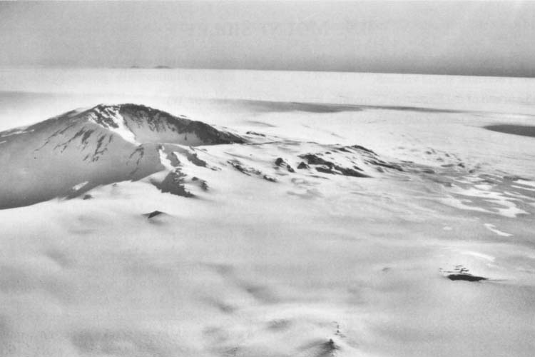
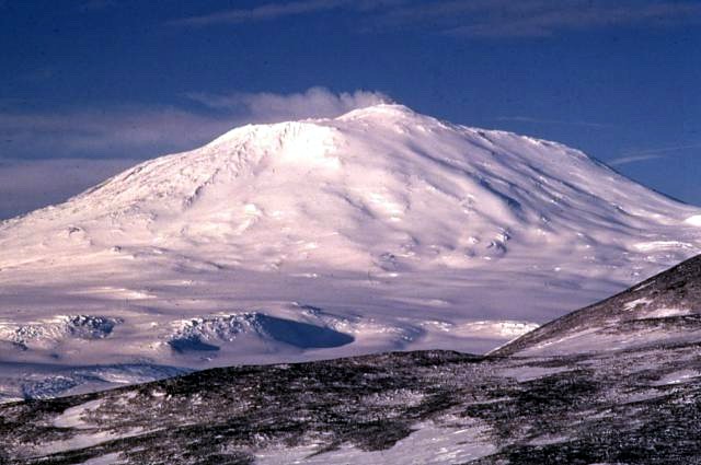
Vinson Massif is a mountain rising to 4,892 metres (16,050 ft) in Antarctica, in the Antarctica region.
Vinson Massif () is a large mountain massif in Antarctica that is 21 km (13 mi) long and 13 km (8 mi) wide and lies within the Sentinel Range of the Ellsworth Mountains. It overlooks the Ronne Ice Shelf near the base of the Antarctic Peninsula. The massif is located about 1,200 kilometers (750 mi) from the South Pole. Vinson Massif was discovered in January 1958 by U.S. Navy aircraft. In 1961, the Vinson Massif was named by the Advisory Committee on Antarctic Names (US-ACAN), after Carl G. Vinson, United States congressman from the state of Georgia, for his support for Antarctic exploration. On 1 November 2006, US-ACAN declared Mount Vinson and Vinson Massif to be separate entities. Vinson Massif lies within the unrecognized Chilean claim under the Antarctic Treaty System.
Mount Vinson is the highest peak in Antarctica, at 4,892 meters (16,050 ft). It lies in the north part of Vinson Massif's summit plateau in the south portion of the main ridge of the Sentinel Range about 2 kilometers (1+1⁄4 mi) north of Hollister Peak. It was first climbed in 1966 by an American team led by Nicholas Clinch.
Adapted from Wikipedia: Vinson Massif (CC BY-SA 4.0).
- Elevation
- 4,892 m (16,050 ft)
- Global rank
- #65 of 641 indexed
- Region
- Antarctica (#1)
- Country
- Antarctica
- Coordinates
- -78.5294°, -85.6337°
Of the 641 named summits indexed in YearMaps, Vinson Massif ranks #65 by elevation, below Pik Talghar (4,979 m) and above Puncak Jaya (4,884 m).
- Ranges:
- Ellsworth Mountains (Antarctica), Jones Mountains (Antarctica)
- Neighbouring summits:
- Mount Seelig (3,022 m), Mount Takahe (3,460 m), Anderson Summit (2,810 m)
- Settlements below:
- Ushuaia (2,721 km), Rio Grande (2,836 km), Punta Arenas (2,878 km)
More about Vinson Massif
Geography
The Vinson Massif extends between Goodge Col and Branscomb Glacier to the northwest, Nimitz Glacier and Gildea Glacier to the southwest and south, and Dater Glacier and its tributary Hinkley Glacier to the east. The southeastern part of the massif ends at Hammer Col, which joins it to the Craddock Massif, of which the highest point is Mount Rutford (4,477 metres or 14,688 feet). The massif comprises both the high central Vinson Plateau with its few peaks rising to over 4,700 metres or 15,420 feet, and several side ridges mostly trending southwest or northeast from the plateau.
Geology
Steeply inclined strata known as the Crashsite Group forms Vinson Massif. It consists of 3,000 metres or 9,843 feet of shallow-water, mostly marine, tan, green, and red quartzose sandstones (quartzites) and argillites. In ascending order, the Crashsite Group is subdivided into the Howard Nunataks Formation (1,630 metres or 5,348 feet), the Mount Liptak Formation (1,070 metres or 3,510 feet), and the Mount Wyatt Earp Formation (300 meters or 980 feet). Erosion-resistant and steeply inclined beds of the Mount Wyatt Earp Formation comprise the crest of the Vinson Massif, including Mount Vinson. The steeply inclined strata of the Crashsite Group are part of the western limb of a major syncline that forms the core of the Sentinel Range within the Ellsworth Mountains.
History
A high mountain, provisionally known as "Vinson", was long suspected to be in this part of West Antarctica, but it was not actually seen until January 1958, when it was spotted by US Navy aircraft from Byrd Station. It was named after Carl Vinson, a United States Representative from Georgia who was a key supporter of funding for Antarctic research. The first measurement of the Vinson Massif was established in 1959 at the elevation of 5,140 m (16,864 ft).
In 1963, two groups within the American Alpine Club (AAC), one led by Charles D. Hollister and Samuel C. Silverstein, M.D., then in New York, and the other led by Peter Schoening of Seattle, Washington, began lobbying the National Science Foundation to support an expedition to climb Mount Vinson.
Climate and glaciers
The climate on Mount Vinson is generally controlled by the polar ice cap's high-pressure system, creating predominantly stable conditions but, as in any polar climate, high winds and snowfall are a possibility. Though the annual snowfall on Mount Vinson is low, high winds can cause base camp accumulations up to 46 centimetres (18 in) in a year. During the summer season, November through January, there are 24 hours of sunlight. While the average temperature during these months is −30 °C (−20 °F), the intense sun will melt snow on dark objects.
Over successive years, the limited amount of snow that falls on Vinson Massif compacts and is transformed into ice, forming glaciers.
Sections adapted from Wikipedia: Vinson Massif (CC BY-SA 4.0).
Vinson Massif: Key Facts
| Topographic prominence | 4,892 m |
|---|---|
| Mountain range | Sentinel Range |
Facts from Wikidata Q163758 (CC0).