Skip to content
YearMaps
Canada · Lakes

Largest Lakes in Canada

Lake Superior is the largest of the 121 lakes recorded for Canada, at 84,920 km², ahead of Lake Huron at 64,004 km². The full list follows.

How this list is built: Ranked by mapped surface area. A lake on a border is listed under each country it lies in, with the area of the whole lake. It covers the lakes indexed in YearMaps, drawn from open geospatial data, and is not an exhaustive national register.

Lakes Listed
121
Top Ranked
84,920 km²
Lake Superior
Second
64,004 km²
Lake Huron
Profiled Below
68
Photo, encyclopedia text and figures
Largest Lakes in Canada
#NameSurface Area
1Lake Superior84,920 km²
2Lake Huron64,004 km²
3Great Bear Lake30,907 km²
4Great Slave Lake27,481 km²
5Lake Erie25,815 km²
6Lake Winnipeg25,237 km²
7Lake Ontario19,732 km²
8Georgian Bay13,897 km²
9Lake Athabasca8,047 km²
10Reindeer Lake6,875 km²
11Smallwood Reservoir5,630 km²
12Lake Winnipegosis5,486 km²
13Nettilling Lake5,417 km²
14Lake Manitoba4,820 km²
15Lake Nipigon4,727 km²
16Lake of the Woods4,618 km²
17Réservoir Manicouagan4,186 km²
18Dubawnt Lake3,831 km²
19North Channel3,768 km²
20Réservoir de La Grande 23,229 km²
21Amadjuak Lake3,112 km²
22Cedar Lake2,977 km²
23Lake Mistassini2,877 km²
24Churchill Lake2,601 km²
25Wollaston Lake2,473 km²
26Nueltin Lake2,463 km²
27Southern Indian Lake2,454 km²
28Réservoir de La Grande 32,408 km²
29Whitefish Bay1,959 km²
30McLeod Bay1,934 km²
31Baker Lake1,867 km²
32Aberdeen Lake1,833 km²
33Réservoir Gouin1,807 km²
34Lac la Martre1,762 km²
35Williston Lake1,650 km²
36Cree Lake1,547 km²
37Lac Seul1,512 km²
38Yathkyed Lake1,479 km²
39Lake Clare1,471 km²
40Contwoyto Lake1,460 km²
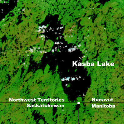
41Kasba Lake1,455 km²
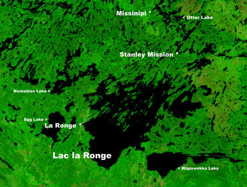
42Lac la Ronge1,439 km²
43Garry Lake1,365 km²
44Lac-à-l'Eau-Claire1,341 km²
45Lake Champlain1,326 km²
46Lake Bienville1,303 km²
47Wholdaia Lake1,274 km²
48Lesser Slave Lake1,189 km²
49Rainy Lake1,162 km²
50Gods Lake1,154 km²
51Lake St. Clair1,146 km²
52Island Lake1,126 km²
53Takijuq Lake1,070 km²
54Aylmer Lake1,069 km²
55Lynx Lake1,065 km²
56Lac St.-Jean1,048 km²
57Lake Abitibi1,019 km²
58Réservoir Pipmuacan996 km²
59Hottah Lake963 km²
60Point Lake959 km²
61Nonacho Lake941 km²
62Réservoir Outardes Quatre935 km²
63Lake Nipissing908 km²
64Cabonga Reservoir887 km²
65Clinton-Colden Lake830 km²
66Réservoir de Caniapiscau805 km²
67Lac Minto765 km²
68Lake Simcoe731 km²
69Scott Lake709 km²
70Lake Sakami673 km²
71Big Trout Lake672 km²
72Lake Naococane672 km²
73Selwyn Lake671 km²
74Lake St. Joseph645 km²
75Grand Lake642 km²
76Tathlina Lake603 km²
77Black Lake593 km²
78Lake Diefenbaker573 km²
79Lac Bermen570 km²
80Lac Île-à-la-Crosse559 km²
81Lake Payne544 km²
82Tehek Lake522 km²
83Trout Lake516 km²
84Trout Lake509 km²
85Bluenose Lake506 km²
86Sipiwesk Lac496 km²
87Ogoki Reservoir471 km²
88Sandy Lake439 km²
89Split Lake422 km²
90Lake Kipawa418 km²
91Lac Chavigny415 km²
92Colville Lake413 km²
93Lake Pltipi392 km²
94Keller Lake388 km²
95Teslin Lake387 km²
96North Caribou Lake364 km²
97Kinbasket Lake335 km²
98Zeta Lake329 km²
99Réservoir Baskatong325 km²
100Kluane Lake318 km²
101Lac des Mille Lacs299 km²
102Tobin Lake293 km²
103Minnitaki Lake289 km²
104Dozois Reservoir278 km²
105Washburn Lake254 km²
106Ossokmanuan Lake233 km²
107Marmion Lake226 km²
108St. Marys River202 km²
109Lake Peribonca184 km²
110Grand Lake176 km²
111Chiputneticook Lakes176 km²
112Lower Arrow Lake173 km²
113Aishik Lake173 km²
114Sturgeon Lake172 km²
115Big Rideau Lake170 km²
116Lac Low170 km²
117Lake Rossignol169 km²
118Umfreville Lake165 km²
119Long Lake157 km²
120Lac du Bonnet124 km²
121Travaillant Lake110 km²

The Lakes of Canada in Detail

The 68 lakes above that have an encyclopedia article, in the same order, each with its photograph, figures and the places around it.

Lake Superior
Image via Wikimedia Commons (author and licence on the file page).

Lake Superior

Lake · 84,920 km²

Lake Superior is a lake in the United States and Canada, with a mapped surface area of about 84,920 km². About 35% of its surface lies in Canada, and the rest in the United States.

Lake Superior is a lake in central North America. The northernmost, westernmost, and highest of the Great Lakes, Lake Superior straddles the Canada–United States border with the Canadian province of Ontario to the north and east and the U.S. states of Minnesota to the west and Michigan and Wisconsin to the south. It is the largest freshwater lake in the world by surface area and the third-largest freshwater lake by volume. It drains into Lake Huron via St. Marys River, then through the lower Great Lakes to the St. Lawrence River and ultimately the Atlantic Ocean.

Adapted from Wikipedia: Lake Superior (CC BY-SA 4.0).

Surface area
84,920 km²
Area rank
#2 of 756 indexed
Type
Lake
Countries
United States, Canada
Coordinates
47.9334°, -87.0297°

Among the 756 water bodies with a mapped extent in YearMaps, Lake Superior ranks #2 by surface area, after Caspian Sea (425,231 km²) and ahead of Lake Victoria (69,385 km²). Areas are computed from the mapped outline and are approximate.

Settlements on the shore:
Thunder Bay (200 km), Timmins (397 km), Sudbury (461 km)
Watercourses:
Ivanhoe (River), Groundhog (River)
Other water nearby:
Whitefish Bay (1,959 km²), Lake Nipigon (4,727 km²)

View on the live map

More about Lake Superior

Geography

The largest island in Lake Superior is Isle Royale in Michigan. Isle Royale contains several lakes, some of which also contain islands. Other well-known islands include Madeline Island in Wisconsin, Michipicoten Island in Ontario, and Grand Island (the location of the Grand Island National Recreation Area) in Michigan.

The larger cities on Lake Superior include the twin ports of Duluth, Minnesota, and Superior, Wisconsin; Thunder Bay, Ontario; Marquette, Michigan; and the twin cities of Sault Ste. Marie, Michigan, and Sault Ste. Marie, Ontario. Duluth-Superior, at the western end of Lake Superior, is the most inland point on the Saint Lawrence Seaway and the most inland port in the world.

Geology

The rocks of Lake Superior's northern shore date back to the early history of the earth. During the Precambrian (between 4.5 billion and 540 million years ago) magma forcing its way to the surface created the intrusive granites of the Canadian Shield. These ancient granites can be seen on the North Shore today. It was during the Penokean orogeny, part of the process that created the Great Lakes tectonic zone, that many valuable metals were deposited. The region surrounding the lake has proved to be rich in minerals, with copper, iron, silver, gold and nickel the most frequently mined.

History

The first people came to the Lake Superior region 10,000 years ago after the retreat of the glaciers in the Last Glacial Period. They are known as the Plano, and they used stone-tipped spears to hunt caribou on the northwestern side of Lake Minong. The Shield Archaic peoples arrived around 5000 BC; evidence of this culture can be found at the eastern and western ends of the Canadian shore. They used bows and arrows, paddled dugout canoes, fished, hunted, mined copper for tools and weapons, and established trading networks. They are believed to be the direct ancestors of the Ojibwe and Cree. The people of the Laurel complex (c. 500 BC to AD 500) developed seine net fishing, evidence being found at rivers around Superior such as the Pic and Michipicoten.

Ecology

More than 80 species of fish have been found in Lake Superior. Species native to the lake include banded killifish, bloater, brook trout, burbot, cisco, lake sturgeon, lake trout, lake whitefish, longnose sucker, muskellunge, northern pike, pumpkinseed, rock bass, round whitefish, smallmouth bass, walleye, white sucker and yellow perch. In addition, many fish species have been either intentionally or accidentally introduced to Lake Superior: Atlantic salmon, brown trout, carp, chinook salmon, coho salmon, freshwater drum, pink salmon, rainbow smelt, rainbow trout, round goby, ruffe, sea lamprey and white perch.

Sections adapted from Wikipedia: Lake Superior (CC BY-SA 4.0).

Lake Superior: Key Facts

Key facts about Lake Superior
Surface area82,350 km²
Maximum depth406 m
Surface elevation183 m
InflowsSaint Louis River, Pigeon River, Pic River, White River, Michipicoten River, Kaministiquia River
OutflowsSt. Marys River
Drainage systemLake Superior drainage basin

Facts from Wikidata Q1066 (CC0).

Lake Huron
Image via Wikimedia Commons (author and licence on the file page).

Lake Huron

Lake · 64,004 km²

Lake Huron is a lake in Canada and the United States, with a mapped surface area of about 64,004 km². About 62% of its surface lies in Canada, and the rest in the United States.

Lake Huron ( HURE-on, -⁠ən) is one of the five Great Lakes of North America. It is shared on the north and east by the Canadian province of Ontario and on the south and west by the U.S. state of Michigan. The name of the lake is derived from early French explorers who named it for the indigenous people they knew as Huron (Wyandot) inhabiting the region.

Hydrologically, Lake Huron comprises the eastern portion of Lake Michigan–Huron, having the same surface elevation as Lake Michigan, to which it is connected by the wide and deep Straits of Mackinac. Combined, Lake Michigan–Huron is the largest freshwater lake by area in the world. The Huronian glaciation was named from evidence collected from the Lake Huron region. The northern parts of the lake include the North Channel and Georgian Bay. Saginaw Bay is located in the southwest corner of the lake. The main inlet is the St. Marys River from Lake Superior, and the main outlet is through the St. Clair River toward Lake Erie. Lake Huron has a fairly large drainage basin covering parts of Michigan and Ontario. Water flows through Lake Huron faster than the other Great Lakes with a retention time of only 22 years.

Adapted from Wikipedia: Lake Huron (CC BY-SA 4.0).

Surface area
64,004 km²
Area rank
#4 of 756 indexed
Type
Lake
Countries
Canada, United States
Coordinates
44.7249°, -82.3520°

Among the 756 water bodies with a mapped extent in YearMaps, Lake Huron ranks #4 by surface area, after Lake Victoria (69,385 km²) and ahead of Lake Michigan (58,387 km²). Areas are computed from the mapped outline and are approximate.

Settlements on the shore:
Owen Sound (87 km), Sudbury (168 km), Barrie (175 km)
Watercourses:
St. Clair (River), Niagara (River)
Other water nearby:
Georgian Bay (13,897 km²), Lake Simcoe (731 km²)

View on the live map

More about Lake Huron

Geography

By surface area, Lake Huron is the second-largest of the Great Lakes, with a surface area of 23,000 square miles (59,570 km2). It is the third-largest fresh water lake on Earth (or the fourth-largest lake, if the Caspian Sea is counted as a lake). By volume however, Lake Huron is only the third largest of the Great Lakes, being surpassed by Lake Michigan and Lake Superior. When measured at the low water datum, the lake contains a volume of 850 cubic miles (3,500 km3) and a shoreline length (including islands) of 3,827 mi (6,159 km).

The surface of Lake Huron is 577 feet (176 m) above sea level. The lake's average depth is 32 fathoms 3 feet (195 ft; 59 m), while the maximum recorded (by sonar) depth is 125 fathoms (750 ft; 229 m).

Geology

Counting its 30,000 islands, Lake Huron has the largest shore line length of any of the Great Lakes. It is separated from Lake Michigan, which lies at the same level, by the 5-mile-wide (8.0 km), 20-fathom-deep (120 ft; 37 m) Straits of Mackinac, making them hydrologically the same body of water (sometimes called Lake Michigan-Huron and sometimes described as two 'lobes of the same lake'). Aggregated, Lake Huron-Michigan, at 45,300 square miles (117,000 km2), "is technically the world's largest freshwater lake". Lake Superior, at 21 feet higher elevation, drains into the St. Marys River which then flows into Lake Huron. The water then flows south to the St. Clair River, at Port Huron, Michigan, and Sarnia, Ontario.

History

About 9,000 years ago, when water levels in Lake Huron were approximately 100 m (330 ft) below today's levels, the Alpena-Amberley Ridge was exposed. That land bridge was used as a migration route for large herds of caribou. Since 2008, archaeologists have discovered at least 60 stone constructions along the submerged ridge that are thought to have been used as hunting blinds by Paleo-Indians. That a trade network brought obsidian from Oregon almost ten thousand years ago to be used for toolmaking was confirmed by a 2013 underwater discovery along the ridge.

Ecology

Lake Huron has a lake retention time of 22 years. Like all of the Great Lakes, the ecology of Lake Huron has undergone drastic changes in the last century. The lake originally supported a native deepwater fish community dominated by lake trout, which fed on several species of ciscos as well as sculpins and other native fishes. Several invasive species, including sea lamprey, alewife and rainbow smelt, became abundant in the lake by the 1930s. The major native top predator, lake trout, was virtually extirpated from the lake by 1950 through a combination of overfishing and the effects of sea lamprey. Several species of ciscos were also extirpated from the lake by the 1960s; the only remaining native ciscoes are bloater and cisco (lake herring).

Sections adapted from Wikipedia: Lake Huron (CC BY-SA 4.0).

Lake Huron: Key Facts

Key facts about Lake Huron
Surface area59,600 km²
Maximum depth230 m
Surface elevation176 m
InflowsSt. Marys River, Penetangore River, Saugeen River, Bighead River, Black Mallard River, Swan River
OutflowsSt. Clair River
Drainage systemLake Huron drainage basin

Facts from Wikidata Q1383 (CC0).

Great Bear Lake
Image via Wikimedia Commons (author and licence on the file page).

Great Bear Lake

Lake · 30,907 km²

Great Bear Lake is a lake in Canada, with a mapped surface area of about 30,907 km².

Great Bear Lake (North Slavey: Sahtú; French: Grand lac de l'Ours) in the boreal forest of Canada is the largest lake entirely in Canada (Lake Superior and Lake Huron are larger but straddle the Canada–US border), the fourth-largest in North America, and the eighth-largest in the world. The lake is in the Northwest Territories, on the Arctic Circle between 65 and 67 degrees of northern latitude and between 118 and 123 degrees western longitude, 156 m (512 ft) above sea level. It drains into the Great Bear River, thence into the Mackenzie River.

The name originated from the Chipewyan word satudene, meaning "grizzly bear-water people". The Sahtu, a Dene people, are named after the lake. Grizzly Bear Mountain, or Sahoyue, on the shore of the lake also comes from Chipewyan, meaning "bear-large hill".

Sahoyue (Grizzly Bear Mountain), a peninsula on the south side of the lake, and Edacho (Scented Grass Hills), another peninsula on the west side, form the Saoyú-ʔehdacho National Historic Site of Canada.

Adapted from Wikipedia: Great Bear Lake (CC BY-SA 4.0).

Surface area
30,907 km²
Area rank
#8 of 756 indexed
Type
Lake
Country
Canada
Coordinates
66.0247°, -120.3686°

Among the 756 water bodies with a mapped extent in YearMaps, Great Bear Lake ranks #8 by surface area, after Lake Baikal (32,120 km²) and ahead of Lake Malawi (28,974 km²). Areas are computed from the mapped outline and are approximate.

Settlements on the shore:
Whitehorse (936 km), Juneau (1,121 km), Fort McMurray (1,136 km)
Watercourses:
Coppermine (River), Mackenzie (River)
Other water nearby:
Keller Lake (388 km²), Bluenose Lake (506 km²)

View on the live map

More about Great Bear Lake

Geography

The lake has a surface area of 31,153 km2 (12,028 sq mi) and a volume of 2,234 km3 (536 cu mi). Its maximum depth is 446 m (1,463 ft) and average depth 71.7 m (235 ft). The shoreline is 2,719 km (1,690 mi) and the catchment area of the lake is 114,717 km2 (44,292 sq mi). Great Bear Lake is covered with ice from late November to July.

The lake is known for its considerable clarity. Explorer John Franklin wrote in 1828 that a white rag placed in the water did not disappear until it exceeded a depth of 15 fathoms (90 ft; 27 m).

Arms of Great Bear Lake include the Smith Arm (northwest), the Dease Arm (northeast), the McTavish Arm (southeast), the McVicar Arm (south) and the Keith Arm (southwest).

Geology and geomorphology

Great Bear Lake lies between two major physiographic regions: the Kazan Uplands portion of the Canadian Shield and the Interior Plains. It was part of glacial Lake McConnell in the pre-glacial valleys reshaped by ice erosion during the Pleistocene. Since, the lake has changed from post-glacial rebound following the ice melting. Precambrian rocks of the Canadian Shield form the eastern margin of the McTavish Arm. These rocks of the Precambrian are sedimentary and metamorphic deposits supplemented by igneous intrusions forming dikes and sills.

Sections adapted from Wikipedia: Great Bear Lake (CC BY-SA 4.0).

Great Bear Lake: Key Facts

Key facts about Great Bear Lake
Surface area31,153 km²
Maximum depth446 m
Surface elevation155 m
InflowsHaldane River, Whitefish River, Johnny Hoe River, Bloody River, Camsell River, Sloan River
OutflowsGreat Bear River
Drainage systemMackenzie River basin

Facts from Wikidata Q5525 (CC0).

Great Slave Lake
Image via Wikimedia Commons (author and licence on the file page).

Great Slave Lake

Lake · 27,481 km²

Great Slave Lake is a lake in Canada, with a mapped surface area of about 27,481 km².

Great Slave Lake is the second-largest lake in the Northwest Territories, Canada (after Great Bear Lake), the deepest lake in North America at 614 m (2,014 ft), and the tenth-largest lake in the world by area. It is 469 km (291 mi) long and 20 to 203 km (12 to 126 mi) wide. It covers an area of 27,200 km2 (10,500 sq mi) in the southern part of the territory. Its given volume ranges from 1,070 km3 (260 cu mi) to 1,580 km3 (380 cu mi) and up to 2,088 km3 (501 cu mi) making it the 13th largest by volume.

The lake shares its name with the Dene, a group of First Nations peoples, who were called Slavey by their enemies, the Cree. Towns situated on the lake include (clockwise from east) Łutselk'e, Fort Resolution, Hay River, Hay River Reserve, Behchokǫ̀, Yellowknife, Ndilǫ, and Dettah. The only community in the East Arm is Łutselk'e, a hamlet of about 350 people, largely Chipewyan Indigenous peoples of the Dene Nation, and the abandoned winter camp and Hudson's Bay Company post Fort Reliance. Along the south shore, east of Hay River is the abandoned Pine Point Mine and the company town of Pine Point.

Adapted from Wikipedia: Great Slave Lake (CC BY-SA 4.0).

Surface area
27,481 km²
Area rank
#10 of 756 indexed
Type
Lake
Country
Canada
Coordinates
61.3463°, -114.7631°

Among the 756 water bodies with a mapped extent in YearMaps, Great Slave Lake ranks #10 by surface area, after Lake Malawi (28,974 km²) and ahead of Lake Erie (25,815 km²). Areas are computed from the mapped outline and are approximate.

Settlements on the shore:
Fort McMurray (548 km), Grand Prairie (726 km), Edmonton (870 km)
Watercourses:
Slave (River), Peace (River)
Other water nearby:
Tathlina Lake (603 km²), Lake Athabasca (8,047 km²)

View on the live map

More about Great Slave Lake

Geography and natural history

The Hay, Slave (which in turn includes the Peace), Lockhart, and Taltson Rivers are its chief tributaries. It is drained by the Mackenzie River. Though the western shore is forested, the east shore and northern arm are tundra-like. The southern and eastern shores reach the edge of the Canadian Shield. Along with other lakes such as the Great Bear and Athabasca, it is a remnant of the vast glacial Lake McConnell.

The lake has a very irregular shoreline. The East Arm of Great Slave Lake is filled with islands, and the area is within the proposed Thaidene Nene National Park Reserve. The Pethei Peninsula separates the East Arm into McLeod Bay in the north and Christie Bay in the south. The lake is at least partially frozen during an average of eight months of the year.

History

Indigenous peoples were the first settlers around the lake after the retreat of glacial ice. Archaeological evidence has revealed several different periods of cultural history, including the Northern Plano tradition (8,000 years before present), Shield Archaic tradition (6,500 years), Arctic small tool tradition (3,500 years), and the Taltheilei Shale tradition (2,500 years before present). Each culture has left a distinct mark in the archaeological record based on type or size of lithic tools.

Great Slave Lake was put on European maps during the emergence of the fur trade towards the northwest from Hudson Bay in the mid-18th century. The name refers to the Slavey people, who lived on the lake's southern shores at the time and were known to the Cree as the Awokanek ("slaves").

Sections adapted from Wikipedia: Great Slave Lake (CC BY-SA 4.0).

Great Slave Lake: Key Facts

Key facts about Great Slave Lake
Surface area27,209 km²
Maximum depth614 m
Surface elevation156 m
InflowsSlave River, Tsąkuı Thedá Dezé, Taltson River, Little Buffalo River, Buffalo River, Hay River
OutflowsMackenzie River
Drainage systemMackenzie River basin

Facts from Wikidata Q5539 (CC0).

Lake Erie
Image via Wikimedia Commons (author and licence on the file page).

Lake Erie

Lake · 25,815 km²

Lake Erie is a lake in the United States and Canada, with a mapped surface area of about 25,815 km². About 49% of its surface lies in Canada, and the rest in the United States.

Lake Erie ( EER-ee) is the fourth-largest lake by surface area of the five Great Lakes in North America and the eleventh-largest globally. It is the southernmost, shallowest, and smallest by volume of the Great Lakes and also has the shortest average water residence time. At its deepest point, Lake Erie is 210 feet (64 m) deep, making it the only Great Lake whose deepest point is above sea level.

Located on the International Boundary between Canada and the United States, Lake Erie's northern shore is the Canadian province of Ontario, specifically the Ontario Peninsula, with the U.S. states of Michigan, Ohio, Pennsylvania, and New York on its western, southern, and eastern shores. These jurisdictions divide the surface area of the lake with water boundaries. The largest city on the lake is Cleveland, anchoring the third largest U.S. metro area in the Great Lakes region, after Greater Chicago and Metro Detroit. Other major cities along the lake shore include Buffalo, New York; Erie, Pennsylvania; and Toledo, Ohio.

Situated below Lake Huron, Erie's primary inlet is the Detroit River.

Adapted from Wikipedia: Lake Erie (CC BY-SA 4.0).

Surface area
25,815 km²
Area rank
#11 of 756 indexed
Type
Lake
Countries
United States, Canada
Coordinates
42.2479°, -81.1668°

Among the 756 water bodies with a mapped extent in YearMaps, Lake Erie ranks #11 by surface area, after Great Slave Lake (27,481 km²) and ahead of Lake Winnipeg (25,237 km²). Areas are computed from the mapped outline and are approximate.

Settlements on the shore:
London (71 km), Sarnia (121 km), Kitchener (137 km)
Watercourses:
St. Clair (River), Allegheny (River)
Other water nearby:
Lake St. Clair (1,146 km²), Lake Simcoe (731 km²)

View on the live map

More about Lake Erie

Geography

Lake Erie (42.2°N 81.2°W / 42.2; -81.2) has a mean elevation of 571 feet (174 m) above sea level. It has a surface area of 9,910 square miles (26,000 km2), of which about 4,990 square miles (13,000 km2) is in the United States and 4,950 square miles (13,000 km2) is in Canada. Lake Erie has a length of 241 statute miles (388 km; 209 nmi) and breadth of 57 statute miles (92 km; 50 nmi) at its widest points.

Geology

Lake Erie was carved out by glacier ice and went through many phases before its current form which is less than 4,000 years old, which is a short span in geological terms. Before this, the land on which the lake now sits went through several complex stages. A large lowland basin formed over two million years ago as a result of an eastern flowing river that existed well before the Pleistocene ice ages. This ancient drainage system was destroyed by the first major glacier in the area, while it deepened and enlarged the lowland areas, allowing water to settle and form a lake. The glaciers were able to carve away more land on the eastern side of the lowland because the bedrock is made of shale which is softer than the carbonate rocks of dolomite and limestone on the western side.

History

At the time of European contact, there were several Indigenous peoples living around the shores of the eastern end of the lake. The Erie tribe (from whom the lake takes its name) lived along the southern edge, while the Neutrals (also known as Attawandaron) lived along the northern shore. The tribal name "erie" is a shortened form of the Iroquoian word erielhonan, meaning "long tail". The name may also come from the word eri, meaning "cherry tree". Near Port Stanley, there is an Indigenous village dating from the 16th century known as the Southwold Earthworks where as many as 800 Neutral Indigenous peoples once lived; the archaeological remains include double earth walls winding around the grass-covered perimeter.

Economy

Lake Erie is home to one of the world's largest freshwater commercial fisheries. Lake Erie's fish populations are the most abundant of the Great Lakes, partially because of the lake's relatively mild temperatures and plentiful supply of plankton, which is the basic building block of the food chain. The lake's fish population accounts for an estimated 50% of all fish inhabiting the Great Lakes. The lake contains steelhead, walleye, largemouth bass, smallmouth bass, perch, lake trout, king salmon, whitefish, smelt, and many others. The lake consists of a long list of well established introduced species. Common non-indigenous fish species include the rainbow smelt, alewife, white perch and common carp.

Sections adapted from Wikipedia: Lake Erie (CC BY-SA 4.0).

Lake Erie: Key Facts

Key facts about Lake Erie
Surface area25,744 km²
Maximum depth64 m
Surface elevation173 m
InflowsDetroit River, Maumee River, Sandusky River, Ashtabula River, Black River, Conneaut Creek
OutflowsNiagara River
Drainage systemLake Erie drainage basin

Facts from Wikidata Q5492 (CC0).

Lake Winnipeg
Image via Wikimedia Commons (author and licence on the file page).

Lake Winnipeg

Lake · 25,237 km²

Lake Winnipeg is a lake in Canada, with a mapped surface area of about 25,237 km².

Lake Winnipeg is a 24,514-square-kilometre (9,465-square-mile) lake in North America, in the Canadian province of Manitoba. Its southern end is about 55 kilometres (34 miles) north of the namesake city, Winnipeg. It is the 12th largest lake on Earth, Canada's sixth-largest freshwater lake, and the third-largest freshwater lake contained entirely within Canada. It is relatively shallow, with a mean depth of 12 metres [39 feet]. Its deepest section is a narrow 36-metre (118-foot) deep channel between the northern and southern basins.

The lake's east side has pristine boreal forests and rivers that were inscribed in 2018 as Pimachiowin Aki, a UNESCO World Heritage Site. The lake is 416 km (258 mi) from north to south, with remote sandy beaches, large limestone cliffs, and many bat caves in some areas. Manitoba Hydro uses the lake as one of the largest reservoirs in the world. There are many islands, most of them undeveloped.

Adapted from Wikipedia: Lake Winnipeg (CC BY-SA 4.0).

Surface area
25,237 km²
Area rank
#12 of 756 indexed
Type
Lake
Country
Canada
Coordinates
53.4364°, -98.4554°

Among the 756 water bodies with a mapped extent in YearMaps, Lake Winnipeg ranks #12 by surface area, after Lake Erie (25,815 km²) and ahead of Lake Ontario (19,732 km²). Areas are computed from the mapped outline and are approximate.

Settlements on the shore:
Winnipeg (405 km), Brandon (414 km), Prince Albert (485 km)
Watercourses:
Saskatchewan (River), Nelson (River)
Other water nearby:
Lake Winnipegosis (5,486 km²), Gods Lake (1,154 km²)

View on the live map

More about Lake Winnipeg

Geology

Lake Winnipeg and Lake Manitoba are remnants of prehistoric Glacial Lake Agassiz, although there is evidence of a desiccated south basin of Lake Winnipeg approximately 4,000 years ago. The area between the lakes is called the Interlake Region, and the whole region is called the Manitoba Lowlands.

History

It is believed Henry Kelsey was the first European to see the lake, in 1690. He adopted the Cree language name for the lake: wīnipēk (ᐐᓂᐯᐠ), meaning "muddy waters". La Vérendrye referred to the lake as Ouinipigon when he built the first forts in the area in the 1730s. Later, the Red River Colony to its south took the lake's name for Winnipeg, the capital of Manitoba.

Lake Winnipeg lies along one of the oldest trading routes in North America to have flown the British flag. For several centuries, furs were traded along this route between York Factory on Hudson Bay (which was the long-time headquarters for the Hudson's Bay Company) over Lake Winnipeg and the Red River Trails to the confluence of the Minnesota and Mississippi Rivers at Saint Paul, Minnesota.

Natural history

The varying habitats found within the lake support a large number of fish species, more than any other lake in Canada west of the Great Lakes. Sixty of seventy-nine native species found in Manitoba are present in the lake. Families represented include lampreys (Petromyzontidae), sturgeon (Acipenseridae), mooneyes (Hiodontidae), minnows (Cyprinidae), suckers (Catostomidae), catfish (Ictaluridae), pike (Esocidae), trout and whitefish (Salmonidae), troutperch (Percopsidae), codfish (Gadidae), sticklebacks (Gasterosteidae), sculpins (Cottidae), sunfish (Centrarchidae), perch (Percidae), and drum (Sciaenidae).

Two fish species present in the lake are considered to be at risk, the shortjaw cisco and the bigmouth buffalo.

Economy

Because of its length, the Lake Winnipeg water system and the lake was an important transportation route in the province before the railways reached Manitoba. It continued to be a major transportation route even after the railways reached the province. In addition to aboriginal canoes and York boats, several steamboats plied the lake, including Anson Northup, City of Selkirk, Colvile, Keenora, Premier, Princess, Winnitoba, Wolverine and most recently the diesel-powered MS Lord Selkirk II passenger cruise ship.

Communities on the lake include Grand Marais, Lester Beach, Riverton, Gimli, Winnipeg Beach, Victoria Beach, Hillside Beach, Pine Falls, Manigotagan, Berens River, Bloodvein, Sandy Hook, Albert Beach, Hecla Village and Grand Rapids.

Sections adapted from Wikipedia: Lake Winnipeg (CC BY-SA 4.0).

Lake Winnipeg: Key Facts

Key facts about Lake Winnipeg
Surface area24,400 km²
Maximum depth12 m
Volume294 km³
Surface elevation217 m
InflowsSaskatchewan River, Red River of the North, Winnipeg River, Pigeon River, Berens River, Dauphin River
OutflowsNelson River
Drainage systemLake Winnipeg basin

Facts from Wikidata Q3272 (CC0).

Lake Ontario
Image via Wikimedia Commons (author and licence on the file page).

Lake Ontario

Lake · 19,732 km²

Lake Ontario is a lake in Canada and the United States, with a mapped surface area of about 19,732 km². About 57% of its surface lies in Canada, and the rest in the United States.

Lake Ontario (French: Lac Ontario) is one of the five Great Lakes of North America. It is bounded on the north, west, and southwest by the Canadian province of Ontario, and on the south and east by the U.S. state of New York. The Canada–United States border spans the centre of the lake. On the Canadian side, the major cities are Kingston, Mississauga, Toronto, Hamilton, and St. Catharines. On the American side, the major cities are Rochester and Watertown.

As the last in the Great Lakes chain of freshwater lakes, Lake Ontario serves as the outlet to the Atlantic Ocean via the St. Lawrence River, comprising the western end of the St. Lawrence Seaway. Its primary inlet is the Niagara River from Lake Erie. The Long Sault control dam, primarily along with the Moses-Saunders Power Dam regulates the water level of the lake.

Adapted from Wikipedia: Lake Ontario (CC BY-SA 4.0).

Surface area
19,732 km²
Area rank
#13 of 756 indexed
Type
Lake
Countries
Canada, United States
Coordinates
43.6784°, -77.7435°

Among the 756 water bodies with a mapped extent in YearMaps, Lake Ontario ranks #13 by surface area, after Lake Winnipeg (25,237 km²) and ahead of Aral Sea (18,580 km²). Areas are computed from the mapped outline and are approximate.

Settlements on the shore:
Peterborough (65 km), Oshawa (68 km), Belleville (69 km)
Watercourses:
Niagara (River), Allegheny (River)
Other water nearby:
Lake Simcoe (731 km²), Big Rideau Lake (170 km²)

View on the live map

More about Lake Ontario

Geography

Lake Ontario is the easternmost of the Great Lakes and the smallest in surface area (19,000 square kilometres [7,340 mi2]), of which about 10,000 square kilometres (3,980 mi2) is in Canada and 9,000 square kilometres (3,560 mi2) in the United States. Lake Ontario exceeds Lake Erie in volume (1,640 km3 [393 mi3] to 480 km3 [116 cu mi]). It is the 13th-largest lake in the world. When its islands are included, the lake's shoreline is about 1,146 kilometres (712 mi) long. As the last lake in the Great Lakes' hydrologic chain, Lake Ontario has the lowest mean surface elevation of the lakes at 74 metres (243 ft) above sea level; 99 metres (326 ft) lower than its neighbor upstream.

Geology

The lake basin was carved out of soft, weak Silurian-age rocks by the Wisconsin ice sheet during the last ice age. The action of the ice occurred along the pre-glacial Ontarian River valley, which had approximately the same orientation as today's basin. Material that was pushed southward by the ice sheet left landforms such as drumlins, kames, and moraines, both on the modern land surface and the lake bottom, reorganizing the region's entire drainage system. As the ice sheet retreated toward the north, it still dammed the St. Lawrence Valley outlet, so the lake surface was at a higher level. This stage is known as Lake Iroquois. During that time, the lake drained through present-day Syracuse, New York, into the Mohawk River, thence to the Hudson River and the Atlantic.

Human history

The first archaeological evidence of humans in the Lake Ontario region dates to circa 11,000 BP. These peoples were mobile foragers who based much of their movement and settlement on the seasonal migrations of caribou, but who also used smaller animals and plant resources. These early settlers likely inhabited the lake margins, but those early lake shores are now either far from the current lake representing earlier, higher waters, or submerged under the modern lake, representing periods of lower lake levels. Lake Ontario reached its modern level circa 4000 BP. The lake was a border between the Wendat people and the Haudenosaunee Confederacy (Iroquois) in the pre-Columbian era.

Ecology

The Great Lakes watershed is a region of high biodiversity, and Lake Ontario is important for its diversity of birds, fish, reptiles, amphibians, and plants. Many of these special species are associated with shorelines, particularly sand dunes, lagoons, and wetlands. The importance of wetlands to the lake has been appreciated, and many of the larger wetlands have protected status. These wetlands are changing, partly because the natural water level fluctuations have been reduced. Many wetland plants are dependent upon low water levels to reproduce. When water levels are stabilized, the area and diversity of the marsh is reduced.

Sections adapted from Wikipedia: Lake Ontario (CC BY-SA 4.0).

Lake Ontario: Key Facts

Key facts about Lake Ontario
Surface area18,529 km²
Maximum depth244 m
Surface elevation74.1 m
InflowsNiagara River, Millhaven Creek, Black River, Don River, Genesee River, Humber River
OutflowsSt. Lawrence River
Drainage systemLake Ontario drainage basin

Facts from Wikidata Q1062 (CC0).

Georgian Bay
Image via Wikimedia Commons (author and licence on the file page).

Georgian Bay

Lake · 13,897 km²

Georgian Bay is a lake in Canada, with a mapped surface area of about 13,897 km².

Georgian Bay (French: Baie Georgienne) is a large bay of Lake Huron. It is located entirely within the borders of Ontario, Canada. The main body of the bay lies east of the Bruce Peninsula and Manitoulin Island. To its northwest is the North Channel.

Georgian Bay is surrounded by (listed clockwise) the districts of Manitoulin, Sudbury, Parry Sound and Muskoka, as well as the more populous counties of Simcoe, Grey and Bruce. The Main Channel separates the Bruce Peninsula from Manitoulin Island and connects Georgian Bay to the rest of Lake Huron. The North Channel, located between Manitoulin Island and the Sudbury District, west of Killarney, was once a popular route for steamships and is now used by a variety of pleasure craft to travel to and from Georgian Bay.

The shores and waterways of Georgian Bay are the traditional domain of the Anishinaabeg First Nations peoples to the north and Huron-Petun (Wyandot) to the south. The bay was thus a major Algonquian-Iroquoian trade route.

Adapted from Wikipedia: Georgian Bay (CC BY-SA 4.0).

Surface area
13,897 km²
Area rank
#17 of 756 indexed
Type
Lake
Country
Canada
Coordinates
45.5809°, -81.1000°

Among the 756 water bodies with a mapped extent in YearMaps, Georgian Bay ranks #17 by surface area, after Lake Balkhash (17,551 km²) and ahead of Lake Saimaa (11,134 km²). Areas are computed from the mapped outline and are approximate.

Settlements on the shore:
Sudbury (103 km), Owen Sound (114 km), North Bay (151 km)
Watercourses:
Ivanhoe (River), Niagara (River)
Other water nearby:
Lake Nipissing (908 km²), Lake Huron (64,004 km²)

View on the live map

More about Georgian Bay

Geography

Georgian Bay is about 190 kilometres (120 mi) long by 80 kilometres (50 mi) wide. It covers approximately 15,000 square kilometres (5,800 sq mi), making it nearly 80% the size of Lake Ontario.

The eastern Georgian Bay is part of the southern edge of the Canadian Shield, granite bedrock exposed by the glaciers at the end of the last ice age, about 11,000 years ago. The granite rock formations and windswept eastern white pine are characteristic of the islands and much of the shoreline of the bay. The rugged beauty of the area inspired landscapes by artists of the Group of Seven. The western part of the bay, from Collingwood north, and including Manitoulin, Drummond, Cockburn and St. Joseph islands, borders the Niagara Escarpment.

History

Archaeological records reveal an Aboriginal presence in the southern regions of the Canadian Shield dating from 11,000 years ago. Evidence of later Paleo-Indian settlements have been found on Manitoulin Island and near Killarney.

During the period of deglaciation, a succession of prehistoric lakes in the Huron basin caused shoreline advance and retreat. The former shoreline of pro-glacial Lake Algonquin left behind high ridges which were attractive sites for human occupation. As shorelines retreated, the highly mobile Paleo-Indian groups of the period were able to migrate northward into this new land. Declining water levels created two distinct lakes in the Huron basin: Lake Stanley and Lake Hough, the latter of which corresponds to the modern Georgian Bay.

Sections adapted from Wikipedia: Georgian Bay (CC BY-SA 4.0).

Georgian Bay: Key Facts

Key facts about Georgian Bay
Maximum depth92 m
Surface elevation176 m
InflowsMoon River, Muskoka River, Musquash River, Pottawatomi River, Beaver River
Drainage systemLake Huron drainage basin

Facts from Wikidata Q1267413 (CC0).

Lake Athabasca
Image via Wikimedia Commons (author and licence on the file page).

Lake Athabasca

Lake · 8,047 km²

Lake Athabasca is a lake in Canada, with a mapped surface area of about 8,047 km².

Lake Athabasca ( ATH-ə-BASK-ə; French: lac Athabasca; from Woods Cree: ᐊᖬᐸᐢᑳᐤ aðapaskāw, "[where] there are plants one after another") is in the north-west corner of Saskatchewan and the north-east corner of Alberta between 58° and 60° N in Canada. The lake is about 26% in Alberta and 74% in Saskatchewan.

The lake is fed by the Athabasca River and other rivers, and its water flows northward via the Slave River to the Mackenzie River system, eventually reaching the Arctic Ocean.

Adapted from Wikipedia: Lake Athabasca (CC BY-SA 4.0).

Surface area
8,047 km²
Area rank
#26 of 756 indexed
Type
Lake
Country
Canada
Coordinates
59.3468°, -109.3624°

Among the 756 water bodies with a mapped extent in YearMaps, Lake Athabasca ranks #26 by surface area, after Lago Titicaca (8,135 km²) and ahead of Lake Turkana (7,747 km²). Areas are computed from the mapped outline and are approximate.

Settlements on the shore:
Fort McMurray (314 km), Edmonton (692 km), Prince Albert (719 km)
Watercourses:
Slave (River), Cree (River)
Other water nearby:
Cree Lake (1,547 km²), Wollaston Lake (2,473 km²)

View on the live map

More about Lake Athabasca

Geography

The lake covers 7,849 square kilometres (3,031 sq mi) or 7,935 square kilometres (3,064 sq mi) including islands, is 283 kilometres (176 mi) long, has a maximum width of 50 kilometres (31 mi), and a maximum depth of 124 metres (407 ft), and holds 204 cubic kilometres (49 cu mi) of water, making it the largest and one of the deepest lakes in both Alberta and Saskatchewan (nearby Tazin Lake is deeper), and the eighth largest in Canada. It is the 20th largest lake in the world by area. Water flows northward from the lake via the Slave River and Mackenzie River systems, eventually reaching the Arctic Ocean.

History

First Nations have lived in the area for more than 2,000 years. In the era of the North American fur trade, the lake was a pivotal point, since it was as far west as canoes could travel from the east and still return before freeze-up. The first European settlement on Lake Athabasca is Fort Chipewyan, founded as a North West Company (NWC) trading post in 1788. Its original location was Old Fort Point, on the southwest shore west of the Old Fort River. In 1798, Fort Chipewyan was relocated to its current site on the north shore.

In fall 1790, Malcolm Ross, Peter Fidler, Philip Turnor, and others, all working for the Hudson's Bay Company (HBC), travelled from Cumberland House to Île-à-la-Crosse, and on to Lake Athabasca the following spring.

Sections adapted from Wikipedia: Lake Athabasca (CC BY-SA 4.0).

Lake Athabasca: Key Facts

Key facts about Lake Athabasca
Surface area7,850 km²
Maximum depth243 m
Surface elevation213 m
InflowsAthabasca River, Fond du Lac River, Grease River, Harrison River, MacFarlane River, William River
OutflowsSlave River
Drainage systemMackenzie River basin

Facts from Wikidata Q272463 (CC0).

Reindeer Lake
Image via Wikimedia Commons (author and licence on the file page).

Reindeer Lake

Lake · 6,875 km²

Reindeer Lake is a lake in Canada, with a mapped surface area of about 6,875 km².

Reindeer Lake is a large lake in Western Canada located on the border between north-eastern Saskatchewan and north-western Manitoba. It is the 21st largest lake in the world by area, as well as being the second-largest lake in Saskatchewan and the ninth largest in Canada. Eight percent of the lake lies in Manitoba while 92% of the lake is in Saskatchewan. Formerly called Deer Lake, its name appears to be a translation of the Algonquian name.

Access to the lake is from Saskatchewan's Highways 102 and 994 and Manitoba's Highway 394. Highway 102 ends at the community of Southend at Reindeer Lake's southern end. Highway 394 ends at the Saskatchewan border and carries on as Highway 994 for 1.1 kilometres (0.7 mi) into Kinoosao on the eastern shore.

Adapted from Wikipedia: Reindeer Lake (CC BY-SA 4.0).

Surface area
6,875 km²
Area rank
#28 of 756 indexed
Type
Lake
Country
Canada
Coordinates
57.6722°, -102.1968°

Among the 756 water bodies with a mapped extent in YearMaps, Reindeer Lake ranks #28 by surface area, after Lake Turkana (7,747 km²) and ahead of Issyk-Kul (6,252 km²). Areas are computed from the mapped outline and are approximate.

Settlements on the shore:
Prince Albert (545 km), Fort McMurray (563 km), Saskatoon (675 km)
Watercourses:
Cree (River), Thlewiaza (River)
Other water nearby:
Wollaston Lake (2,473 km²), Southern Indian Lake (2,454 km²)

View on the live map

More about Reindeer Lake

Geography

Reindeer Lake is a monomictic lake with a heavily indented shoreline and numerous small islands. On its eastern shore is the community of Kinoosao, at its northern end Brochet, Manitoba; and at its southern end, Southend, Saskatchewan. It drains mainly to the south, via the Reindeer River and a controlled weir, to the Churchill River and then east to Hudson Bay. Water flow out of the lake is regulated by the Whitesand Dam.

Its total area (including islands) is 6,650 square kilometres (2,570 sq mi), while its net area (water only) is 5,658 square kilometres (2,185 sq mi).

Deep Bay, located at the south end of the lake and measuring about 13 kilometres (8.1 mi) wide and 220 metres (720 ft) deep, is the site of a large meteorite impact dating to about 99 million years ago.

History

Several early explorers travelled through Reindeer Lake, including David Thompson, who set up a fur-trade post for the Hudson's Bay Company (HBC) on Bedford Island along the west shore in 1796, called Bedford House. While surveying a route to Lake Athabasca, Thompson wintered at Reindeer Lake and abandoned the post in spring 1797.

The following year, Thompson established a new HBC post at the southern end of the west shore. The Reindeer Lake Post (also known as Deer Lake or Deers Lake Post and Clapham House circa 1808) was destroyed by the rival North West Company (NWC) in the spring of 1817, but rebuilt in the fall of 1818. It remained in continuous operation until 1894, except between 1922 and 1824, and between 1872 and 1886 when it operated sporadically.

Sections adapted from Wikipedia: Reindeer Lake (CC BY-SA 4.0).

Reindeer Lake: Key Facts

Key facts about Reindeer Lake
Surface area6,500 km²
Maximum depth219 m
Volume95.2 km³
Surface elevation337 m
InflowsCochrane River
OutflowsReindeer River
Drainage systemChurchill river basin

Facts from Wikidata Q1134446 (CC0).

Smallwood Reservoir

Reservoir · 5,630 km²

Smallwood Reservoir is an artificial reservoir in Canada, with a mapped surface area of about 5,630 km². It exists because of a dam rather than natural drainage, and was filled in 1971 behind Churchill Falls.

The Smallwood Reservoir is the reservoir created for the Churchill Falls Generating Station in the western part of Labrador, Canada. Unlike other reservoirs, water is contained not by a single large dam, but by a series of 88 dikes that total 64 km (40 mi) in length in the drainage area of the Churchill River. It is named in honour of Joey Smallwood, the first premier of Newfoundland.

With an area of 6,527 km2 (2,520 sq mi), is the largest body of freshwater in the province and the fifth-largest reservoir in the world in terms of surface area.

Adapted from Wikipedia: Smallwood Reservoir (CC BY-SA 4.0).

Surface area
5,630 km²
Area rank
#32 of 756 indexed
Type
Reservoir
Country
Canada
Impounded
1971
Dam
Churchill Falls
Coordinates
54.0038°, -63.9288°

Among the 756 water bodies with a mapped extent in YearMaps, Smallwood Reservoir ranks #32 by surface area, after Samara Reservoir (5,757 km²) and ahead of Lake Winnipegosis (5,486 km²). Areas are computed from the mapped outline and are approximate.

Impounding dam:
Churchill Falls (61 m)
Settlements on the shore:
Sept-Îles (442 km), Rimouski (697 km), Corner Brook (698 km)
Watercourses:
Natashquan (River), Caniapiscau (River)
Other water nearby:
Ossokmanuan Lake (233 km²), Réservoir de Caniapiscau (805 km²)

View on the live map

More about Smallwood Reservoir

Geography

The reservoir is located on the Labrador Plateau, a saucer shaped plateau that ranged from 457 to 579 m (1,499 to 1,900 ft) above sea level. Before construction, it was inundated with many bogs and small interconnected lakes. The three largest of these lakes were Ossokmanuan, Lobstick and Michikamau. Ossokmanuan became a reservoir for the Twin Falls power station.

The area was mostly drained by the Churchill River. At the edge of the plateau it dropped 66 m (217 ft) before the falls, a further 75 m (246 ft) at the falls and a further 158 m (518 ft) through the Bowdoin Canyon. It was named after Bowdoin College in Maine which sponsored an expedition in 1891 to visit the falls.

History

The earliest evaluation of hydro potential of this vast reservoir was in 1942 when H.G. Acres Company carried out a study for the Aluminum Company of Canada (Alcan). Due to the remoteness of the site then, it was considered too expensive to build and deemed not viable.

With the development of technologies for transmission of electricity over long distances the project design to build the power development including the main dam and control structure and the many dykes began in July 1967 by Acres Canadian Bechtel of Churchill Falls, a joint venture formed by Canadian Bechtel and Acres Engineering, as part of the construction of the Churchill Falls Generating Station.

Sections adapted from Wikipedia: Smallwood Reservoir (CC BY-SA 4.0).

Smallwood Reservoir: Key Facts

Key facts about Smallwood Reservoir
Surface area6,527 km²
Surface elevation472 m
InflowsAshuanipi River
OutflowsChurchill River

Facts from Wikidata Q1539726 (CC0).

Lake Winnipegosis
Image via Wikimedia Commons (author and licence on the file page).

Lake Winnipegosis

Lake · 5,486 km²

Lake Winnipegosis is a lake in Canada, with a mapped surface area of about 5,486 km².

Lake Winnipegosis is a large (5,370 km2) lake in central North America, in Manitoba, Canada, some 300 km northwest of Winnipeg. It is Canada's eleventh-largest lake.

The lake's name derives from that of Lake Winnipeg, with a diminutive suffix. Winnipeg means 'big muddy waters' and Winnipegosis means 'little muddy waters'., both characterized by coastal wetlands.

It appears as Winipgassish on the Fidler map of 1820, while modern spelling dates from as early as 1811.

Adapted from Wikipedia: Lake Winnipegosis (CC BY-SA 4.0).

Surface area
5,486 km²
Area rank
#33 of 756 indexed
Type
Lake
Country
Canada
Coordinates
52.6786°, -99.8721°

Among the 756 water bodies with a mapped extent in YearMaps, Lake Winnipegosis ranks #33 by surface area, after Smallwood Reservoir (5,630 km²) and ahead of Nettilling Lake (5,417 km²). Areas are computed from the mapped outline and are approximate.

Settlements on the shore:
Brandon (316 km), Winnipeg (363 km), Prince Albert (398 km)
Watercourses:
Saskatchewan (River), Assiniboine (River)
Other water nearby:
Lake Winnipeg (25,237 km²), Tobin Lake (293 km²)

View on the live map

More about Lake Winnipegosis

Geography

The elongated 195-kilometre-long lake is the second-largest of three large lakes in central Manitoba; the other two are Lake Winnipeg, the largest, and Lake Manitoba. All three lakes are on the floor of the prehistoric glacial Lake Agassiz (as are nearby Cedar Lake and the Lake of the Woods). The lake's watershed extends over some 49,825 km2 in Manitoba and Saskatchewan. It receives most of its waters from the Manitoba Escarpment.

Lake Winnipegosis is separated from Cedar Lake by a 6 km (3.7 miles) wide (minimum width) land barrier at the north end and from Lake Manitoba by a 3 km (1.9 miles) wide (minimum width) land barrier at the southeast end at Meadow Portage.

Birch Island is the largest island on Lake Winnipegosis.

Sections adapted from Wikipedia: Lake Winnipegosis (CC BY-SA 4.0).

Lake Winnipegosis: Key Facts

Key facts about Lake Winnipegosis
Surface area5,164 km²
Maximum depth12 m
Volume20.1 km³
Surface elevation254 m
InflowsRed Deer River, Pelican River, Shoal River, Mossy River
OutflowsWaterhen River
Drainage systemLake Winnipeg basin

Facts from Wikidata Q934638 (CC0).

Nettilling Lake
Image via Wikimedia Commons (author and licence on the file page).

Nettilling Lake

Lake · 5,417 km²

Nettilling Lake is a lake in Canada, with a mapped surface area of about 5,417 km².

Nettilling Lake () is a cold freshwater lake located toward the south end of Baffin Island in the Qikiqtaaluk Region, Nunavut, Canada. It is the 27th largest lake in the world by area, and the world's largest lake on an island, with an area of 5,542 km2 (2,140 sq mi) and a maximum length of 123 km (76 mi). The lake is in the Great Plain of the Koukdjuak about 280 km (170 mi) northwest of Iqaluit. The Arctic Circle crosses the lake. The lake's name is of Inuktitut origin, coming from the word for the adult ringed seal (netsilak). Franz Boas explored its southern shore in 1884.

Nettilling is the largest lake in Nunavut. It is fed by the second largest lake on Baffin Island, Amadjuak Lake; as well as several other smaller lakes and streams. It empties west via the very shallow Koukdjuak River into Foxe Basin. The eastern half has many small islands and the western half is deeper with no islands. The lake is frozen for most of the year. Ringed seals live in the lake, along with three recorded species of fish: the Arctic char, the ninespine, and three-spined stickleback. The tundra around the lake and south to Amadjuak Lake is important for barren-ground caribou feeding and calving.

Adapted from Wikipedia: Nettilling Lake (CC BY-SA 4.0).

Surface area
5,417 km²
Area rank
#34 of 756 indexed
Type
Lake
Country
Canada
Coordinates
66.5512°, -70.7444°

Among the 756 water bodies with a mapped extent in YearMaps, Nettilling Lake ranks #34 by surface area, after Lake Winnipegosis (5,486 km²) and ahead of Lake Albert (5,404 km²). Areas are computed from the mapped outline and are approximate.

Settlements on the shore:
Sept-Îles (1,822 km), Chicoutimi (2,015 km), Rimouski (2,019 km)
Watercourses:
Arnaud (River), Koksoak (River)
Other water nearby:
Amadjuak Lake (3,112 km²), Lake Bienville (1,303 km²)

View on the live map

More about Nettilling Lake

Nettilling Lake: Key Facts

Key facts about Nettilling Lake
Surface area5,051 km²
Maximum depth132 m
Surface elevation30 m
InflowsIsurtuq River, Amadjuak River
OutflowsKoukdjuak River

Facts from Wikidata Q1132211 (CC0).

Lake Manitoba
Image via Wikimedia Commons (author and licence on the file page).

Lake Manitoba

Lake · 4,820 km²

Lake Manitoba is a lake in Canada, with a mapped surface area of about 4,820 km².

Lake Manitoba (French: Lac Manitoba) is the 14th largest lake in Canada and the 31st largest lake in the world with a total area of 4,624 square kilometres (1,785 sq mi). It is located within the Canadian province of Manitoba about 75 kilometres (47 mi) northwest of the province's capital, Winnipeg, at 50°59′N 98°48′W.

Adapted from Wikipedia: Lake Manitoba (CC BY-SA 4.0).

Surface area
4,820 km²
Area rank
#38 of 756 indexed
Type
Lake
Country
Canada
Coordinates
50.4038°, -98.2469°

Among the 756 water bodies with a mapped extent in YearMaps, Lake Manitoba ranks #38 by surface area, after Lac Moeru (5,057 km²) and ahead of Lake Nipigon (4,727 km²). Areas are computed from the mapped outline and are approximate.

Settlements on the shore:
Winnipeg (96 km), Brandon (137 km), Grand Forks (289 km)
Watercourses:
Assiniboine (River), Winnipeg (River)
Other water nearby:
Lake Winnipegosis (5,486 km²), Lake of the Woods (4,618 km²)

View on the live map

More about Lake Manitoba

Geography

The irregularly shaped lake, about 200 kilometres (120 mi) long, is the smallest of a group of three large lakes, the other two being Lake Winnipeg (the largest) and Lake Winnipegosis, which are found on the floor of the prehistoric Glacial Lake Agassiz. The lake is subdivided into two connected but distinctly different basins: a small, irregular-shaped north basin and a much larger south basin. It is part of the watershed of the Nelson River and Hudson Bay.

The southern tip of the lake, 24 kilometres (15 mi) north of Portage la Prairie, Manitoba, ends in the Delta Marsh, an important staging ground for migrating birds.

Communities on the lake include Fairford, Steep Rock, St. Laurent, and Sandy Bay.

History

The lake, its shores populated by the Assiniboine and Cree, was made known to Europeans by La Vérendrye in the mid-1730s. He and his sons travelled from Fort La Reine through this lake to explore the Saskatchewan River and its environs. Forts were established on both the Saskatchewan and Cedar Lake. It also was part of the fur trade route to Hudson Bay.

The name derives from Cree manitou-wapow or Ojibwa manidoobaa, both meaning "straits of Manitou, the Great Spirit", a toponym referring to what are now called The Narrows in the centre of the lake. These narrows were an area that the spirit could be heard. What exactly was heard, and in what exact location, seems to be a mystery. The lake was known to French explorers as Lac des Prairies.

Sections adapted from Wikipedia: Lake Manitoba (CC BY-SA 4.0).

Lake Manitoba: Key Facts

Key facts about Lake Manitoba
Surface area4,624 km²
Maximum depth7 m
Volume14.1 km³
Surface elevation248 m
InflowsWaterhen River, Portage Diversion
OutflowsFairford River
Drainage systemLake Winnipeg basin

Facts from Wikidata Q645901 (CC0).

Lake Nipigon
Image via Wikimedia Commons (author and licence on the file page).

Lake Nipigon

Lake · 4,727 km²

Lake Nipigon is a lake in Canada, with a mapped surface area of about 4,727 km².

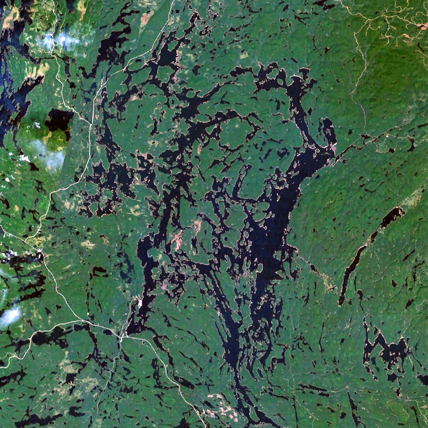
Lake Nipigon ( NIP-ih-gon; French: lac Nipigon; Ojibwe: Animbiigoo-zaaga'igan) is a freshwater lake in Northwestern Ontario. Part of the Great Lakes drainage basin, it drains through the Nipigon River into Lake Superior. It is the largest lake entirely within the Canadian province of Ontario.

Adapted from Wikipedia: Lake Nipigon (CC BY-SA 4.0).
Surface area
4,727 km²
Area rank
#39 of 756 indexed
Type
Lake
Country
Canada
Coordinates
49.8337°, -88.3727°

Among the 756 water bodies with a mapped extent in YearMaps, Lake Nipigon ranks #39 by surface area, after Lake Manitoba (4,820 km²) and ahead of Lake Kariba (4,724 km²). Areas are computed from the mapped outline and are approximate.

Settlements on the shore:
Thunder Bay (168 km), Marquette (372 km), Duluth (437 km)
Watercourses:
Albany (River), Missinaibi (River)
Other water nearby:
Lac des Mille Lacs (299 km²), Lake Superior (84,920 km²)

View on the live map

More about Lake Nipigon

Geography

Lying 260 metres (850 ft) above sea level, the lake drains into the Nipigon River and thence into Nipigon Bay of Lake Superior. The lake and river are the largest tributaries of Lake Superior. It lies about 120 kilometres (75 mi) northeast of the city of Thunder Bay, Ontario.

Lake Nipigon has a total area (including islands within the lake) of 4,848 square kilometres (1,872 sq mi), compared to 3,150 square kilometres (1,220 sq mi) for Lake of the Woods. It is the 30th largest lake in the world by area. The largest islands are Caribou Island, Geikie Island, Katatota Island, Kelvin Island, Logan Island, Murchison Island, Murray Island, and Shakespeare Island. Maximum depth is 165 metres (541 ft).

Its original watershed area is 24,560 square kilometres (9,484 mi2).

Geology

Lake Nipigon occupies a basin created by repeated and preferential erosion of relatively flat-lying and faulted, Proterozoic sedimentary strata and igneous sills by repeated Pleistocene glaciations. The Sibley Group consists of about 950 m (3,120 ft) of unmetamorphosed Mesoproterozoic red beds that are typically flat-lying. These red beds consist of basal fluvial-lacustrine conglomerates, sandstones, and shales overlain by cyclic dolomite-siltstone layers, stromatolites and red mudstones, which represent a playa lake, sabkha, and mudflat environments; purple shales and siltstones interpreted as subaerial mudflat deposits; and an upper unit of cross-stratified sandstone beds, which are interpreted to be aeolian in origin.

History

As the last ice age was ending, Lake Nipigon was, at times, part of the drainage path for Lake Agassiz.

Claude-Jean Allouez, a French Jesuit missionary celebrated the first Mass beside the Nipigon River 29 May 1667. He visited the village of the Nipissing Indians who had fled there during the Iroquois onslaught of 1649-50.

In 1683, Daniel Greysolon, Sieur du Lhut, established a fur trading post on Lake Nipigon named Fort la Tourette after his brother, Claude Greysolon, Sieur de la Tourette. The Alexis Hubert Jaillot map of 1685 (Partie de la Nouvelle-France) suggests that this fort was somewhere in Ombabika Bay at the northeast end of the lake where the Ombabika River and Little Jackfish River (Kabasakkandagaming) empty.

Sections adapted from Wikipedia: Lake Nipigon (CC BY-SA 4.0).

Lake Nipigon: Key Facts

Key facts about Lake Nipigon
Surface area4,848 km²
Maximum depth165 m
Volume320 km³
Surface elevation258 m
InflowsNamewaminikan River, Whitesand River, Gull River, Little Jackfish River
OutflowsNipigon River
Drainage systemLake Nipigon drainage basin

Facts from Wikidata Q122184 (CC0).

Lake of the Woods
Image via Wikimedia Commons (author and licence on the file page).

Lake of the Woods

Lake · 4,618 km²

Lake of the Woods is a lake in Canada and the United States, with a mapped surface area of about 4,618 km². About 77% of its surface lies in Canada, and the rest in the United States.

Lake of the Woods (French: lac des Bois; Ojibwe: Pikwedina Sagainan, lit. 'inland lake of the sand hills') is a lake occupying parts of the Canadian provinces of Ontario and Manitoba and the U.S. state of Minnesota. Lake of the Woods is over 70 miles (110 km) long and wide, containing more than 14,552 islands and 65,000 miles (105,000 km) of shoreline. It is fed by the Rainy River, Shoal Lake, Kakagi Lake and other smaller rivers. The lake drains into the Winnipeg River and then into Lake Winnipeg. Ultimately, its outflow goes north through the Nelson River to Hudson Bay.

Lake of the Woods is also the sixth largest freshwater lake located (at least partially) in the United States, after the five Great Lakes, and the 35th largest lake in the world by area. It separates a small land area of Minnesota from the rest of the United States. The Northwest Angle and Angle Township can be reached from the rest of Minnesota only by crossing the lake or by traveling through Canada. The Northwest Angle is the northernmost part of the contiguous United States. Its "northwesternmost point" served as a problematic landmark in treaties defining the international border.

Adapted from Wikipedia: Lake of the Woods (CC BY-SA 4.0).

Surface area
4,618 km²
Area rank
#43 of 756 indexed
Type
Lake
Countries
Canada, United States
Coordinates
49.0826°, -94.9111°

Among the 756 water bodies with a mapped extent in YearMaps, Lake of the Woods ranks #43 by surface area, after Lake Taymyr (4,622 km²) and ahead of Qinghai Hu (4,457 km²). Areas are computed from the mapped outline and are approximate.

Settlements on the shore:
Winnipeg (192 km), Brandon (388 km), Thunder Bay (403 km)
Watercourses:
Winnipeg (River), Assiniboine (River)
Other water nearby:
Rainy Lake (1,162 km²), Lac Seul (1,512 km²)

View on the live map

More about Lake of the Woods

Lake of the Woods: Key Facts

Key facts about Lake of the Woods
Surface area4,350 km²
Maximum depth64 m
Surface elevation322 m
InflowsRainy River
OutflowsWinnipeg River
Drainage systemLake Winnipeg basin

Facts from Wikidata Q845876 (CC0).

Dubawnt Lake
Image via Wikimedia Commons (author and licence on the file page).

Dubawnt Lake

Lake · 3,831 km²

Dubawnt Lake is a lake in Canada, with a mapped surface area of about 3,831 km².

Dubawnt Lake is a lake in the Kivalliq Region, Nunavut, Canada. It is 3,630 km2 (1,400 sq mi) in size and has several islands. It is about 320 km (200 mi) north of the Four Corners, about 480 km (300 mi) west of Hudson Bay and about 400 km (250 mi) south of the Arctic Circle. To the northwest is the Thelon Wildlife Sanctuary. Its main inlet and outlet is the north-flowing Dubawnt River which joins the Thelon River at Beverly Lake. The Thelon flows east to Hudson Bay at Chesterfield Inlet. It is on the line of contact between the Sayisi Dene band of Eastern Caribou-Eater Chipewyan people and the Harvaqtuurmiut and Ihalmiut bands of Caribou Inuit. The first recorded European to reach the lake was Samuel Hearne in 1770, but it remained largely unknown to outsiders until it was explored by Joseph Tyrrell in 1893. There are no permanent settlements but there are fly-in fish camps where large lake trout can be caught during the two month ice-free season.

Adapted from Wikipedia: Dubawnt Lake (CC BY-SA 4.0).

Surface area
3,831 km²
Area rank
#55 of 756 indexed
Type
Lake
Country
Canada
Coordinates
63.1272°, -101.5357°

Among the 756 water bodies with a mapped extent in YearMaps, Dubawnt Lake ranks #55 by surface area, after Lagoa Mirim (3,845 km²) and ahead of Sarygamysh Köli (3,810 km²). Areas are computed from the mapped outline and are approximate.

Settlements on the shore:
Fort McMurray (896 km), Prince Albert (1,131 km), Saskatoon (1,255 km)
Watercourses:
Kazan (River), Thelon (River)
Other water nearby:
Yathkyed Lake (1,479 km²), Clinton-Colden Lake (830 km²)

View on the live map

More about Dubawnt Lake

Dubawnt Lake: Key Facts

Key facts about Dubawnt Lake
Surface area3,833 km²
Maximum depth236 m
Surface elevation236 m
InflowsDubawnt River, Kamilukuak River
OutflowsDubawnt River

Facts from Wikidata Q1262967 (CC0).

Amadjuak Lake
Image via Wikimedia Commons (author and licence on the file page).

Amadjuak Lake

Lake · 3,112 km²

Amadjuak Lake is a lake in Canada, with a mapped surface area of about 3,112 km².

Amadjuak Lake is a lake in the Qikiqtaaluk Region, Nunavut, Canada. Along with Nettilling Lake, it is located in south-central Baffin Island's Great Plain of the Koukdjuak. It is 154 km (96 mi) south of Burwash Bay. The closest community is Iqaluit.

Adapted from Wikipedia: Amadjuak Lake (CC BY-SA 4.0).

Surface area
3,112 km²
Area rank
#66 of 756 indexed
Type
Lake
Country
Canada
Coordinates
64.9519°, -71.0380°

Among the 756 water bodies with a mapped extent in YearMaps, Amadjuak Lake ranks #66 by surface area, after Lake Tana (3,154 km²) and ahead of Tsimlyansk Reservoir (3,057 km²). Areas are computed from the mapped outline and are approximate.

Settlements on the shore:
Sept-Îles (1,650 km), Chicoutimi (1,837 km), Rimouski (1,843 km)
Watercourses:
Arnaud (River), Koksoak (River)
Other water nearby:
Nettilling Lake (5,417 km²), Lake Bienville (1,303 km²)

View on the live map

More about Amadjuak Lake

Geography

The lake is 3,115 km2 (1,203 sq mi) in size, and sits at an elevation of 113 m (371 ft).

This lower-lying area only emerged 4,500 years ago (recently in geological terms) from beneath the waters of Foxe Basin. Amadjuak is the second largest lake on Baffin Island (after Nettilling Lake) and third-largest in Nunavut.

Sections adapted from Wikipedia: Amadjuak Lake (CC BY-SA 4.0).

Amadjuak Lake: Key Facts

Key facts about Amadjuak Lake
Surface area3,115 km²
Surface elevation108 m
InflowsMingo River, Nuvungmiut River, Hone River
OutflowsAmadjuak River

Facts from Wikidata Q452088 (CC0).

Lake Mistassini
Image via Wikimedia Commons (author and licence on the file page).

Lake Mistassini

Lake · 2,877 km²

Lake Mistassini is a lake in Canada, with a mapped surface area of about 2,877 km².

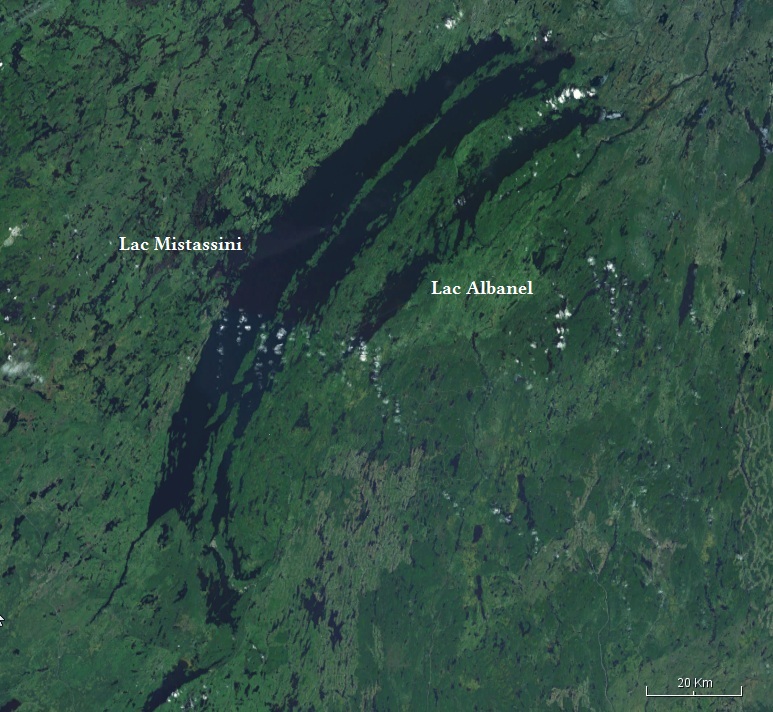
Lake Mistassini (French: Lac Mistassini) is the largest natural lake by surface area in the province of Quebec, Canada, with a total surface area of approximately 2,335 square kilometres (902 sq mi) and a net area (water surface area only) of 2,164 square kilometres (836 sq mi). It is located in the Jamésie region of the province, approximately 360 kilometers (220 mi) east of James Bay. The Cree town of Mistissini is located on Watson Peninsula in the south-east corner of the lake, which separates Baie du Poste from Abatagouche Bay.

Extensive forests of spruce, birch, pine, and fir trees, which support a booming forestry industry, surround the lake.

Significant tributaries flowing into the lake include: Chalifour, Pépeshquasati, Takwa, Témiscamie, and Wabissinane.

Other nearby lakes include Lake Albanel and Lake Troilus.

Adapted from Wikipedia: Lake Mistassini (CC BY-SA 4.0).

Surface area
2,877 km²
Area rank
#70 of 756 indexed
Type
Lake
Country
Canada
Coordinates
50.9373°, -73.7158°

Among the 756 water bodies with a mapped extent in YearMaps, Lake Mistassini ranks #70 by surface area, after IJsselmeer (2,893 km²) and ahead of Saginaw Bay (2,858 km²). Areas are computed from the mapped outline and are approximate.

Settlements on the shore:
Chicoutimi (337 km), Val d'Or (429 km), Rimouski (466 km)
Watercourses:
Péribonka (River), Eastmain (River)
Other water nearby:
Lake Peribonca (184 km²), Réservoir Pipmuacan (996 km²)

View on the live map

More about Lake Mistassini

History

The existence of this large lake was known to French explorers prior to its official discovery; Samuel de Champlain knew of it in 1603. It was finally discovered by Europeans in 1663 as part of an expedition ordered by Governor D'Avaugour and led by Guillaume Couture (first settler of Pointe-Lévy (Lévis) and hero of New France). He was accompanied by Pierre Duquet and Jean Langlois, as well as by Native American guides; the whole group consisted of a fleet of 44 canoes. They went up the Saguenay River, reached Lake Mistassini and continued on the Rupert River, which flows to the Hudson Bay.

Thereafter, Lake Mistassini became an important step along the route from the Saguenay to James Bay. In 1672, Charles Albanel crossed the lake in an official mission.

Sections adapted from Wikipedia: Lake Mistassini (CC BY-SA 4.0).

Lake Mistassini: Key Facts

Key facts about Lake Mistassini
Surface area2,335 km²
Maximum depth180 m
Surface elevation371 m
InflowsRivière Wabissinane, Rivière à la Perche, Rivière Chalifour, Rivière Pipounichouane, Rivière Takwa, Rivière Waconichi
OutflowsRivière Rupert
Drainage systemRupert River basin

Facts from Wikidata Q1458051 (CC0).

Churchill Lake
Image via Wikimedia Commons (author and licence on the file page).

Churchill Lake

Lake · 2,601 km²

Churchill Lake is a lake in Canada, with a mapped surface area of about 2,601 km².

Churchill Lake is a large glacial lake in the north-western part of the Canadian province of Saskatchewan. It is the source of the 1,609-kilometre (1,000 mi) long Churchill River, which flows east into Hudson Bay. Frobisher Lake flows into Churchill Lake from the north through Simonds Channel and Peter Pond Lake flows in from the east through Kisis Channel. The outflow is at the southern end through MacBeth Channel, which flows south into Lac Île-à-la-Crosse. The lake can freeze from as early as November and remain frozen till May.

The village of Buffalo Narrows is on the south-western shore near Kisis Channel and the Churchill Lake Indian reserve is at the northern end. Churchill Lake Outfitting is on the north-western shore. Access to the lake is from Highway 155 (which crosses Kisis Channel) and Buffalo Narrows Airport.

Adapted from Wikipedia: Churchill Lake (CC BY-SA 4.0).

Surface area
2,601 km²
Area rank
#77 of 756 indexed
Type
Lake
Country
Canada
Coordinates
56.0126°, -108.9554°

Among the 756 water bodies with a mapped extent in YearMaps, Churchill Lake ranks #77 by surface area, after Iliamna Lake (2,677 km²) and ahead of Lake Frome (2,582 km²). Areas are computed from the mapped outline and are approximate.

Settlements on the shore:
Fort McMurray (170 km), Prince Albert (375 km), Edmonton (400 km)
Watercourses:
North Saskatchewan (River), Cree (River)
Other water nearby:
Lac Île-à-la-Crosse (559 km²), Cree Lake (1,547 km²)

View on the live map

More about Churchill Lake

Churchill Lake: Key Facts

Key facts about Churchill Lake
Surface area559 km²
Maximum depth24 m
Volume4.88 km³
Surface elevation421 m
InflowsKisis Channel, Frobisher Lake
OutflowsChurchill River
Drainage systemChurchill river basin

Facts from Wikidata Q1089891 (CC0).

Wollaston Lake
Image via Wikimedia Commons (author and licence on the file page).

Wollaston Lake

Lake · 2,473 km²

Wollaston Lake is a lake in Canada, with a mapped surface area of about 2,473 km².

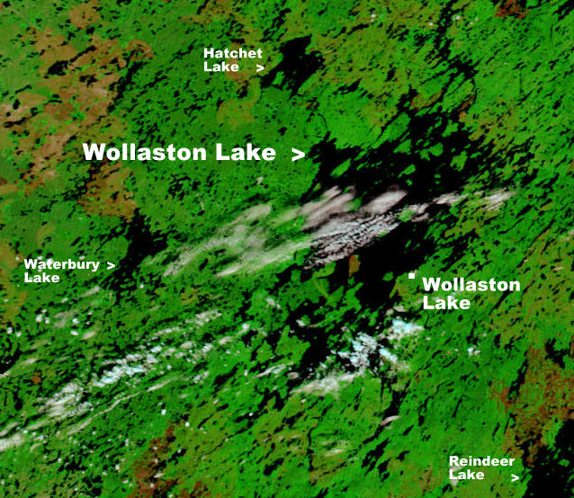
Wollaston Lake (Woods Cree: ᒌᑲᐦᐃᑲᐣ ᓵᑲᐦᐃᑲᓂᕽ, romanized: cîkahikan sâkahikanihk, lit. 'at hatchet/axe lake') is a lake in the north-eastern part of the Canadian province of Saskatchewan. It is about 550 kilometres (340 mi) north-east of Prince Albert. With a surface area of 2,286 square kilometres (883 sq mi) (excluding islands; 2,681 square kilometres (1,035 sq mi) if islands are included), it is the largest bifurcation lake in the world — that is, a lake that drains naturally in two directions.

About 10% of the lake's water drains into the Fond du Lac River, which flows out of the lake to the north-west, where it drains into Lake Athabasca, which ultimately drains into the Arctic Ocean via the Mackenzie River system. The rest of the water drains into the Cochrane River, which flows out of the north-eastern side of the lake and into Reindeer Lake, which drains via the Churchill River system into Hudson Bay.

Wollaston Lake's main inflow is the Geikie River which flows from the south-west into the south-west section of the lake. If Hudson Bay is considered an arm of the Atlantic Ocean, then the Geikie is the largest river in the world to flow naturally into two oceans.

Adapted from Wikipedia: Wollaston Lake (CC BY-SA 4.0).

Surface area
2,473 km²
Area rank
#81 of 756 indexed
Type
Lake
Country
Canada
Coordinates
58.2740°, -103.2877°

Among the 756 water bodies with a mapped extent in YearMaps, Wollaston Lake ranks #81 by surface area, after Tai Hu (2,509 km²) and ahead of Nueltin Lake (2,463 km²). Areas are computed from the mapped outline and are approximate.

Settlements on the shore:
Fort McMurray (513 km), Prince Albert (585 km), Saskatoon (712 km)
Watercourses:
Cree (River), Thlewiaza (River)
Other water nearby:
Reindeer Lake (6,875 km²), Cree Lake (1,547 km²)

View on the live map

More about Wollaston Lake

Wollaston Lake: Key Facts

Key facts about Wollaston Lake
Surface area2,286 km²
Maximum depth71 m
Volume75 km³
Surface elevation398 m
InflowsGeikie River
OutflowsCochrane River
Drainage systemChurchill river basin

Facts from Wikidata Q1640500 (CC0).

Nueltin Lake

Lake · 2,463 km²

Nueltin Lake is a lake in Canada, with a mapped surface area of about 2,463 km².

Nueltin Lake (Chipewyan: Nu-thel-tin-tu-ch-eh, meaning "sleeping island lake") straddles the Manitoba—Nunavut border in Canada. The lake, which has an area of 2,279 km2 (880 sq mi), is predominantly in Nunavut's Kivalliq Region, and on the Manitoba side there is the Nueltin Lake Airport which serves the fishing lodge. The lake is split into two parts by a set of narrows. It is drained by the Thlewiaza River.

Adapted from Wikipedia: Nueltin Lake (CC BY-SA 4.0).

Surface area
2,463 km²
Area rank
#82 of 756 indexed
Type
Lake
Country
Canada
Coordinates
60.0239°, -99.7514°

Among the 756 water bodies with a mapped extent in YearMaps, Nueltin Lake ranks #82 by surface area, after Wollaston Lake (2,473 km²) and ahead of Southern Indian Lake (2,454 km²). Areas are computed from the mapped outline and are approximate.

Settlements on the shore:
Fort McMurray (769 km), Prince Albert (842 km), Saskatoon (972 km)
Watercourses:
Thlewiaza (River), Kazan (River)
Other water nearby:
Kasba Lake (1,455 km²), Wollaston Lake (2,473 km²)

View on the live map

More about Nueltin Lake

History

Ilya Andreyevich Tolstoy, the grandson of count Leo Tolstoy, stayed at the Revillon Frères Post of Windy Lake by Nueltin Lake in the winter of 1928–1929. He was in a group attempting to get film footage of the migrating caribou for the William Douglas Burden and William C. Chanler's production, The Silent Enemy, one of the last and greatest of the silent films, released in 1930.

The American naturalist, Francis Harper (biologist) with funding from the United States National Science Foundation, undertook a study of the barren-ground caribou in 1947 in the Nueltin Lake area with research assistants, including Farley Mowat, resulting in the publication of Harper's book entitled Caribou of Keewatin. Inuk artist Luke Anowtalik, who was fifteen at the time, was featured in this publication.

Sections adapted from Wikipedia: Nueltin Lake (CC BY-SA 4.0).

Nueltin Lake: Key Facts

Key facts about Nueltin Lake
Surface area2,033 km²
Surface elevation278 m
InflowsThlewiaza River
OutflowsThlewiaza River
Drainage systemHudson Bay drainage basin

Facts from Wikidata Q1514307 (CC0).

Southern Indian Lake
Image via Wikimedia Commons (author and licence on the file page).

Southern Indian Lake

Reservoir · 2,454 km²

Southern Indian Lake is an artificial reservoir in Canada, with a mapped surface area of about 2,454 km². It exists because of a dam rather than natural drainage, and was filled in 1976 behind Missi Falls Control.

Southern Indian Lake is a large lake in northern Manitoba, Canada. It has an area of 2,247 square kilometres (868 sq mi) (including islands) with a surface elevation of 258 metres (846 ft).

Southern Indian Lake is the fourth largest lake in Manitoba. It has a complex shoreline with many islands, long peninsulas and deep bays. The Churchill River flows through the lake.

The community of South Indian Lake is located on the southeast shore, about 130 kilometres (81 mi) (by air) north of the city of Thompson. It had a population of 767 in 2011 and is the main settlement of the O-Pipon-Na-Piwin Cree Nation, a First Nations band government.

Southern Indian Lake is on the Fidler map of 1814.

The lake and the settlement are accessed by the South Indian Lake Airport and Manitoba Provincial Road 493 (PR 493). PR 493, a gravel road, begins at Leaf Rapids on PR 391 (also a gravel road), running 219.1 kilometres (136.1 mi) northeast to its terminus at South Indian Lake. The nearest city, Thompson, is 436 kilometres (271 mi) by road.

Adapted from Wikipedia: Southern Indian Lake (CC BY-SA 4.0).

Surface area
2,454 km²
Area rank
#83 of 756 indexed
Type
Reservoir
Country
Canada
Impounded
1976
Dam
Missi Falls Control
Coordinates
57.2610°, -98.3310°

Among the 756 water bodies with a mapped extent in YearMaps, Southern Indian Lake ranks #83 by surface area, after Nueltin Lake (2,463 km²) and ahead of Represa Itaipu (2,418 km²). Areas are computed from the mapped outline and are approximate.

Settlements on the shore:
Prince Albert (651 km), Saskatoon (778 km), Fort McMurray (791 km)
Watercourses:
Nelson (River), Hayes (River)
Other water nearby:
Reindeer Lake (6,875 km²), Wollaston Lake (2,473 km²)

View on the live map

More about Southern Indian Lake

Southern Indian Lake: Key Facts

Key facts about Southern Indian Lake
Surface area2,015 km²
Maximum depth30 m
Surface elevation258 m
InflowsChurchill River, Numaykoos Creek
OutflowsChurchill River
Drainage systemChurchill river basin

Facts from Wikidata Q1888211 (CC0).

Whitefish Bay
Image via Wikimedia Commons (author and licence on the file page).

Whitefish Bay

Lake · 1,959 km²

Whitefish Bay is a lake in Canada and the United States, with a mapped surface area of about 1,959 km². About 58% of its surface lies in Canada, and the rest in the United States.

Whitefish Bay is a large bay on the eastern end of Lake Superior between Michigan, United States; and Ontario, Canada. It is located between Whitefish Point in Michigan and Whiskey Point along the more rugged, largely wilderness Canadian Shield of Ontario. The international border runs through the bay, which is heavily used by shipping traffic northbound from and southbound to the Soo Locks. It was previously known as Tequamenon Bay in vintage maps and surveyor documents from the 18th and 19th centuries, named for the prominent Tahquamenon River whose mouth feeds into the bay.

The Whitefish Point Light marks the entry of the bay, Ile Parisienne Light is in the middle of the bay, and Gros Cap Reefs Light lies near the outlet of the bay and the approach to the Soo Locks at Sault Ste. Marie, Michigan.

Whitefish Point Lighthouse is the oldest active light on Lake Superior. Part of the lighthouse station houses the Great Lakes Shipwreck Museum. It holds artifacts from the shipwrecks listed below and has information on the notable wreck of SS Edmund Fitzgerald in 1975, in which all 29 crew were lost.

Adapted from Wikipedia: Whitefish Bay (CC BY-SA 4.0).

Surface area
1,959 km²
Area rank
#100 of 756 indexed
Type
Lake
Countries
Canada, United States
Coordinates
46.6607°, -84.7853°

Among the 756 water bodies with a mapped extent in YearMaps, Whitefish Bay ranks #100 by surface area, after Lac Mai-Ndombe (2,000 km²) and ahead of Vättern (1,947 km²). Areas are computed from the mapped outline and are approximate.

Settlements on the shore:
Sudbury (282 km), Timmins (312 km), Owen Sound (383 km)
Watercourses:
Ivanhoe (River), Groundhog (River)
Other water nearby:
Lake Superior (84,920 km²), Lake Huron (64,004 km²)

View on the live map

More about Whitefish Bay

Whitefish Bay: Key Facts

Key facts about Whitefish Bay
Surface elevation183 m

Facts from Wikidata Q12341531 (CC0).

Williston Lake
Image via Wikimedia Commons (author and licence on the file page).

Williston Lake

Reservoir · 1,650 km²

Williston Lake is an artificial reservoir in Canada, with a mapped surface area of about 1,650 km². It exists because of a dam rather than natural drainage, and was filled in 1967 behind W.A.C. Bennett Dam.

Williston Lake is a reservoir created by the W. A. C. Bennett Dam which is located in the Northern Interior of British Columbia, Canada.

Adapted from Wikipedia: Williston Lake (CC BY-SA 4.0).

Surface area
1,650 km²
Area rank
#120 of 756 indexed
Type
Reservoir
Country
Canada
Impounded
1967
Dam
W.A.C. Bennett Dam
Coordinates
56.1754°, -124.1788°

Among the 756 water bodies with a mapped extent in YearMaps, Williston Lake ranks #120 by surface area, after Volgograd Reservoir (1,651 km²) and ahead of Krasnoyarsk Reservoir (1,644 km²). Areas are computed from the mapped outline and are approximate.

Settlements on the shore:
Prince George (267 km), Grand Prairie (355 km), Juneau (660 km)
Watercourses:
Finlay (River), Babine (River)
Other water nearby:
Lesser Slave Lake (1,189 km²), Kinbasket Lake (335 km²)

View on the live map

More about Williston Lake

Geography

The lake fills the basin of the upper Peace River, backing into the Rocky Mountain Trench which is where the Parsnip and Finlay met at Finlay Forks to form the Peace. The lake includes three reaches, the Peace Reach (formerly the Peace Canyon), and the Parsnip and Finlay Reaches, which are the lowermost basins of those rivers, and covers a total area of 1,761 km2 (680 sq mi), being the largest lake in British Columbia and the seventh largest reservoir (by volume) in the world.

The reservoir is fed by the Finlay, Omineca, Ingenika, Ospika, Parsnip, Manson, Nation and Nabesche rivers and by Clearwater Creek, Carbon Creek, and other smaller creeks.

History

Williston Lake was created in 1968 by the building of the W. A. C. Bennett Dam on the Peace River, which flooded the territory and homes of the Tsay Keh Dene First Nation.

The reservoir was named after the Honourable Ray Gillis Williston, at the time the Minister of Lands, Forests and Water Resources.

Sections adapted from Wikipedia: Williston Lake (CC BY-SA 4.0).

Williston Lake: Key Facts

Key facts about Williston Lake
Surface area1,761 km²
Maximum depth166 m
Surface elevation671 m
InflowsOmineca River, Finlay River, Ingenika River, Mesilinka River, Nation River, Pack River
OutflowsPeace River
Drainage systemMackenzie River basin

Facts from Wikidata Q967775 (CC0).

Cree Lake
Image via Wikimedia Commons (author and licence on the file page).

Cree Lake

Lake · 1,547 km²

Cree Lake is a lake in Canada, with a mapped surface area of about 1,547 km².

Cree Lake is a large glacial lake in the Canadian province of Saskatchewan. The lake is the fourth largest in the province and is located west of Reindeer Lake and south of Lake Athabasca in the Mackenzie River drainage basin. Cree Lake is the remnant of a large proglacial lake that flowed south into the Churchill River during the last ice age.

Cree Lake has no highway access. Floatplanes are the means used to access the lodges and amenities on the lake.

Adapted from Wikipedia: Cree Lake (CC BY-SA 4.0).

Surface area
1,547 km²
Area rank
#132 of 756 indexed
Type
Lake
Country
Canada
Coordinates
57.5056°, -106.3229°

Among the 756 water bodies with a mapped extent in YearMaps, Cree Lake ranks #132 by surface area, after Buhayrat ath Tharthar (1,548 km²) and ahead of Lake Carnegie (1,524 km²). Areas are computed from the mapped outline and are approximate.

Settlements on the shore:
Fort McMurray (317 km), Prince Albert (480 km), Saskatoon (594 km)
Watercourses:
Cree (River), Slave (River)
Other water nearby:
Wollaston Lake (2,473 km²), Churchill Lake (2,601 km²)

View on the live map

More about Cree Lake

Description

Cree Lake is in the Canadian Shield in Saskatchewan's Northern Administration District. Covering an area of 143,400 hectares (354,000 acres), it is Saskatchewan's fourth largest lake. It spans a length of 81 kilometres (50 mi), a width of 57 kilometres (35 mi), and has a depth of about 60 metres (200 ft). The lake has many islands and a jagged shoreline that measures about 2,180 kilometres (1,350 mi) long. Several rivers feed the lake with the larger ones being Brustad River, Karras River, and Routledge River. Cree River, the lake's outflow, flows out at the northern end and heads north into Black Lake, which is connected to Lake Athabasca via the Fond du Lac River. The whole system is part of the Mackenzie River drainage basin.

Sections adapted from Wikipedia: Cree Lake (CC BY-SA 4.0).

Cree Lake: Key Facts

Key facts about Cree Lake
Surface area1,228 km²
Maximum depth60 m
Surface elevation482 m
OutflowsCree River

Facts from Wikidata Q945023 (CC0).

Lac Seul
Image via Wikimedia Commons (author and licence on the file page).

Lac Seul

Reservoir · 1,512 km²

Lac Seul is an artificial reservoir in Canada, with a mapped surface area of about 1,512 km². It exists because of a dam rather than natural drainage.

Lac Seul is a large, crescent-shaped reservoir in Kenora District, northwestern Ontario, Canada. It is approximately 241 km (150 mi) long. It has a maximum (regulated) depth of 47.2 m, with a surface elevation of 357 m above sea level. Its level is raised in the summer and then drawn down in the winter months to reach points of as low as 4.9 m below the maximum level. It is the second largest body of water entirely within the province of Ontario (Lake Nipigon being first).

The lake consists of open-water bays, narrow channels, and islands. It is a relatively shallow lake with many rock shoals. This provides a good habitat for walleye (also known as "yellow pickerel") and northern pike as well as yellow perch. During the Lac Seul project of 1968-1972 no muskelunge were noted in the catches of research nets set over those years. Significant numbers of whitefish, tullibee, burbot, walleye, northern pike, perch, fighting muskies, and cisco were noted as well, although they infrequently were noted in the sport fishery. Lac Seul is noted for offering some of the best fishing in Ontario.

Lac Seul is located on the former lakebed of Glacial Lake Agassiz.

Adapted from Wikipedia: Lac Seul (CC BY-SA 4.0).

Surface area
1,512 km²
Area rank
#135 of 756 indexed
Type
Reservoir
Country
Canada
Coordinates
50.3021°, -92.6109°

Among the 756 water bodies with a mapped extent in YearMaps, Lac Seul ranks #135 by surface area, after Khantayskoye Reservoir (1,516 km²) and ahead of Repressa de Jupia (1,500 km²). Areas are computed from the mapped outline and are approximate.

Settlements on the shore:
Thunder Bay (318 km), Winnipeg (328 km), Duluth (393 km)
Watercourses:
Winnipeg (River), Severn (River)
Other water nearby:
Minnitaki Lake (289 km²), Rainy Lake (1,162 km²)

View on the live map

More about Lac Seul

History

In fur trade days, it was part of a canoe route west from James Bay: James Bay, Albany River, Lake St. Joseph, portage, Lac Seul, English River (Ontario), Winnipeg River, Lake Winnipeg.

Lac Seul, once a significant water transportation route, played a crucial role during the Red Lake Gold Rush, which began in late 1925 following the discovery of substantial gold deposits. The community of Hudson, Ontario, served as a key transportation hub due to its position along the railway line. From Hudson, supplies were transported via steamboats, scows, and tugboats across Lac Seul toward Red Lake, supporting the burgeoning mining industry in the region.

Sections adapted from Wikipedia: Lac Seul (CC BY-SA 4.0).

Lac Seul: Key Facts

Key facts about Lac Seul
Surface area1,657 km²
Maximum depth47 m
Surface elevation351 m
InflowsEnglish River, Winston Creek, Root River, Vermilion River
OutflowsEnglish River
Drainage systemLake Winnipeg basin

Facts from Wikidata Q958928 (CC0).

Yathkyed Lake
Image via Wikimedia Commons (author and licence on the file page).

Yathkyed Lake

Lake · 1,479 km²

Yathkyed Lake is a lake in Canada, with a mapped surface area of about 1,479 km².

Yathkyed Lake (variant: Haecoligua; meaning: "white swan") is a natural freshwater lake in Kivalliq Region, Nunavut, Canada. Located between Angikuni Lake and Forde Lake, it is one of several lakes on the Kazan River. Yathkyed lake was named by the Sayisi Dene, historical barren-ground caribou hunters of the area. Caribou Inuit artifacts have also been found here. The lake has a surface area of 1,449 square kilometres.

It contains an island in a lake on an island in a lake on an island in a lake, also known as a fourth-order island. It is the only known fourth order island in the world.

Adapted from Wikipedia: Yathkyed Lake (CC BY-SA 4.0).

Surface area
1,479 km²
Area rank
#137 of 756 indexed
Type
Lake
Country
Canada
Coordinates
62.7408°, -97.8993°

Among the 756 water bodies with a mapped extent in YearMaps, Yathkyed Lake ranks #137 by surface area, after Repressa de Jupia (1,500 km²) and ahead of Lake Clare (1,471 km²). Areas are computed from the mapped outline and are approximate.

Settlements on the shore:
Fort McMurray (1,005 km), Prince Albert (1,156 km), Saskatoon (1,284 km)
Watercourses:
Kazan (River), Thlewiaza (River)
Other water nearby:
Dubawnt Lake (3,831 km²), Nueltin Lake (2,463 km²)

View on the live map

More about Yathkyed Lake

Geography

It is part of the Hearne Domain, Western Churchill province of the Churchill craton, which is the northwest section of the Canadian Shield. According to the Atlas of Canada the geographical centre of the country lies just south of the lake at 62°24′N 096°28′W. Yathkyed Lake lies at an elevation of 82 metres (269 feet). Some locations or hamlets near Yathkyed Lake are Baker Lake at 198 kilometres north north-east, Ennadai at 236 kilometres south-west and Rankin Inlet at 300 kilometres east.

Sections adapted from Wikipedia: Yathkyed Lake (CC BY-SA 4.0).

Yathkyed Lake: Key Facts

Key facts about Yathkyed Lake
Surface area1,334 km²
Surface elevation82 m
InflowsKazan River
OutflowsKazan River

Facts from Wikidata Q1888261 (CC0).

Contwoyto Lake

Lake · 1,460 km²

Contwoyto Lake is a lake in Canada, with a mapped surface area of about 1,460 km².

Contwoyto Lake is a lake in the Kitikmeot Region of the Canadian territory of Nunavut, located near the border with the Northwest Territories. With a total area of 957 km2 (369 sq mi), it is the territories' tenth largest lake.

Lupin Mine is located near Contwoyto Lake. The lake is also the terminus of the Tibbitt to Contwoyto Winter Road from Tibbitt Lake in the Northwest Territories, Nunavut's only currently existing road access to the rest of Canada. In 2005, there was a proposal put forward to extend the winter road to a possible port at Bathurst Inlet.

Adapted from Wikipedia: Contwoyto Lake (CC BY-SA 4.0).

Surface area
1,460 km²
Area rank
#139 of 756 indexed
Type
Lake
Country
Canada
Coordinates
65.4528°, -110.3263°

Among the 756 water bodies with a mapped extent in YearMaps, Contwoyto Lake ranks #139 by surface area, after Lake Clare (1,471 km²) and ahead of Kasba Lake (1,455 km²). Areas are computed from the mapped outline and are approximate.

Settlements on the shore:
Fort McMurray (971 km), Grand Prairie (1,233 km), Edmonton (1,335 km)
Watercourses:
Burnside (River), Coppermine (River)
Other water nearby:
Takijuq Lake (1,070 km²), Aylmer Lake (1,069 km²)

View on the live map

More about Contwoyto Lake

Contwoyto Lake: Key Facts

Key facts about Contwoyto Lake
Surface area933 km²
Surface elevation447 m
OutflowsBurnside River, Contwoyto River

Facts from Wikidata Q917094 (CC0).

Kasba Lake
Image via Wikimedia Commons (author and licence on the file page).

Kasba Lake

Lake · 1,455 km²

Kasba Lake is a lake in Canada, with a mapped surface area of about 1,455 km².

Kasba Lake is a lake in the northern Canadian wilderness. The majority of the lake lies within the Northwest Territories, but a small section is in Nunavut. The lake is close to Canada's four corners. A seasonal fishing lodge is open to tourists each summer.

Adapted from Wikipedia: Kasba Lake (CC BY-SA 4.0).

Surface area
1,455 km²
Area rank
#140 of 756 indexed
Type
Lake
Country
Canada
Coordinates
60.3130°, -102.1573°

Among the 756 water bodies with a mapped extent in YearMaps, Kasba Lake ranks #140 by surface area, after Contwoyto Lake (1,460 km²) and ahead of Lago Argentino (1,450 km²). Areas are computed from the mapped outline and are approximate.

Settlements on the shore:
Fort McMurray (666 km), Prince Albert (820 km), Saskatoon (947 km)
Watercourses:
Kazan (River), Thlewiaza (River)
Other water nearby:
Nueltin Lake (2,463 km²), Wollaston Lake (2,473 km²)

View on the live map

More about Kasba Lake

Kasba Lake: Key Facts

Key facts about Kasba Lake
Surface area1,317 km²
Surface elevation335 m
InflowsSchwandt River
OutflowsKazan River
Drainage systemHudson Bay drainage basin

Facts from Wikidata Q719538 (CC0).

Lac la Ronge
Image via Wikimedia Commons (author and licence on the file page).

Lac la Ronge

Lake · 1,439 km²

Lac la Ronge is a lake in Canada, with a mapped surface area of about 1,439 km².

Lac la Ronge is a glacial lake in the Canadian province of Saskatchewan. It is the fifth largest lake in the province and is approximately 250 kilometres (160 mi) north of Prince Albert, on the edge of the Canadian Shield. La Ronge, Air Ronge, and the Lac La Ronge First Nation are on the western shore. The lake is a popular vacation spot. Recreational activities include fishing, boating, canoeing, hiking, and camping.

Adapted from Wikipedia: Lac la Ronge (CC BY-SA 4.0).

Surface area
1,439 km²
Area rank
#142 of 756 indexed
Type
Lake
Country
Canada
Coordinates
55.1183°, -104.9819°

Among the 756 water bodies with a mapped extent in YearMaps, Lac la Ronge ranks #142 by surface area, after Lago Argentino (1,450 km²) and ahead of Bariri (1,435 km²). Areas are computed from the mapped outline and are approximate.

Settlements on the shore:
Prince Albert (219 km), Saskatoon (346 km), Fort McMurray (437 km)
Watercourses:
Saskatchewan (River), Cree (River)
Other water nearby:
Lac Île-à-la-Crosse (559 km²), Tobin Lake (293 km²)

View on the live map

More about Lac la Ronge

Island ecology

The lake's numerous islands have been the focus of biogeography studies investigating how island size and isolation influence the wildlife inhabiting them. In the northern half of the lake, you'll find over 1,300 ice age-carved granite islands.

Sections adapted from Wikipedia: Lac la Ronge (CC BY-SA 4.0).

Lac la Ronge: Key Facts

Key facts about Lac la Ronge
Surface area1,413 km²
Maximum depth41 m
Surface elevation360 m
InflowsMontreal River, Nipekamew River, Nemeiben Creek, Bow River, Potato River
OutflowsRapid River
Drainage systemChurchill river basin

Facts from Wikidata Q250257 (CC0).

Garry Lake
Image via Wikimedia Commons (author and licence on the file page).

Garry Lake

Lake · 1,365 km²

Garry Lake is a lake in Canada, with a mapped surface area of about 1,365 km².

Garry Lake (variant: Garry Lakes; Inuktitut: Hanningajuq, meaning "sideways", or "crooked") is a lake in sub-Arctic Kivalliq Region, Nunavut, Canada. As a portion of the Back River waterway, Garry Lake originates directly east of Lake Pelly and drains to the east by the Back River. A set of rapids separate Buliard Lake (directly to the north) from Garry Lake. Two other sets of rapids separate Garry Lake's three sections (Upper Garry Lake, Garry Lake, Lower Garry Lake) which are also differentiated by elevation. Garry Lakes are isolated from nearby communities.

Adapted from Wikipedia: Garry Lake (CC BY-SA 4.0).

Surface area
1,365 km²
Area rank
#149 of 756 indexed
Type
Lake
Country
Canada
Coordinates
65.8793°, -99.8378°

Among the 756 water bodies with a mapped extent in YearMaps, Garry Lake ranks #149 by surface area, after Lake Sevan (1,377 km²) and ahead of Represa Iepe (1,360 km²). Areas are computed from the mapped outline and are approximate.

Settlements on the shore:
Fort McMurray (1,185 km), Prince Albert (1,447 km), Edmonton (1,563 km)
Watercourses:
Thelon (River), Burnside (River)
Other water nearby:
Dubawnt Lake (3,831 km²), Yathkyed Lake (1,479 km²)

View on the live map

More about Garry Lake

Geography

Garry Lakes are a part of the Churchill craton—Rae craton geological province.

It is a low relief area including sedge/grass meadows along lake shores, and substrates of glacial silts, sands, and gravels.

Sections adapted from Wikipedia: Garry Lake (CC BY-SA 4.0).

Garry Lake: Key Facts

Key facts about Garry Lake
Surface area976 km²
Surface elevation148 m
InflowsBack River
OutflowsBack River

Facts from Wikidata Q1494524 (CC0).

Lake Champlain
Image via Wikimedia Commons (author and licence on the file page).

Lake Champlain

Lake · 1,326 km²

Lake Champlain is a lake in the United States and Canada, with a mapped surface area of about 1,326 km². About 6% of its surface lies in Canada, and the rest in the United States.

Lake Champlain ( sham-PLAYN; French: Lac Champlain, pronounced [lak ʃɑ̃plɛ̃] ) is a large natural freshwater lake in North America. With a length of 107 mi (172 km) and surface area over 500 sq mi (1,295 km2), it lies mostly between the U.S. states of New York and Vermont, but also extends north into the Canadian province of Quebec.

Burlington, Vermont, and Plattsburgh, New York, are the largest settlements on the lake, and towards the south lies the historic Fort Ticonderoga in New York. The Quebec portion is in the regional county municipalities of Le Haut-Richelieu and Brome-Missisquoi. There are numerous islands in the lake; the largest include Grand Isle, Isle La Motte and North Hero: all part of Grand Isle County, Vermont. Because of its connections both to the St. Lawrence Seaway via the Richelieu River, and to the Hudson River via the Champlain Canal, Lake Champlain is sometimes referred to as "The Sixth Great Lake".

The coastline is relatively undeveloped and hosts several state parks, including North Hero and Button Bay in Vermont, and Cumberland Bay in New York. Much of New York's shoreline is located within the larger Adirondack Park.

Adapted from Wikipedia: Lake Champlain (CC BY-SA 4.0).

Surface area
1,326 km²
Area rank
#154 of 756 indexed
Type
Lake
Countries
United States, Canada
Coordinates
44.4907°, -73.3330°

Among the 756 water bodies with a mapped extent in YearMaps, Lake Champlain ranks #154 by surface area, after Lac-à-l'Eau-Claire (1,341 km²) and ahead of Lake Bienville (1,303 km²). Areas are computed from the mapped outline and are approximate.

Settlements on the shore:
Montréal (60 km), St.-Jerome (103 km), Sherbrooke (107 km)
Watercourses:
Richelieu (River), Connecticut (River)
Other water nearby:
Big Rideau Lake (170 km²), Cabonga Reservoir (887 km²)

View on the live map

More about Lake Champlain

Hydrology

Lake Champlain covers approximately 514 square miles (1,331 km2), making it the thirteenth-largest lake by area in the U.S. It lies at an elevation of 95 to 100 ft (29 to 30 m), is 107 miles (172 km), has a 587-mile (945 km) shoreline, averages 14 miles (23 km) in width, has an average depth of 64 feet (19.5 m), a maximum depth of 400 feet (121.9 m), and holds some 6.2 cubic miles (25.8 km3) of water.

Located in the Champlain Valley between the Green Mountains of Vermont and the Adirondack Mountains of New York, it is drained northward by the 106-mile-long (171 km) Richelieu River into the St. Lawrence River at Sorel-Tracy, Quebec.

Geology

The Champlain Valley is the northernmost unit of a landform system known as the Great Appalachian Valley, which stretches between Quebec to the north and Alabama to the south. The Champlain Valley is a physiographic section of the larger St. Lawrence Valley, which in turn is part of the larger Appalachian physiographic division.

Lake Champlain is one of numerous large lakes scattered in an arc through Labrador, the Northern United States, and the Northwest Territories.

The Chazy Reef is an extensive Ordovician carbonate rock formation that extends from Tennessee to Quebec and Newfoundland. The oldest reefs are around "The Head" of the south end of Isle La Motte; slightly younger reefs are found at the Fisk Quarry, and the youngest (the famous coral reefs) are in fields to the north.

History

The lake has long acted as a border between indigenous nations, much as it is today between the states of New York and Vermont. The lake is located at the frontier between Abenaki and Mohawk (Iroquois Confederacy) traditional territories. The official toponym for the lake, according to the orthography established by the Grand Council of Waban-aki Nation, is Pitawbagok (alternative orthographies include Petonbowk and Bitawbagok), meaning "middle lake", "lake in between" or "double lake".

The Mohawk language name in modern orthography, as standardized in 1993, is Kaniatarakwà:ronte, meaning "a bulged lake" or "lake with a bulge in it". An alternate name is Kaniá:tare tsi kahnhokà:ronte (phonetic English spelling Caniaderi Guarunte), meaning "door of the country" or "lake to the country".

Natural history

In 2010, the estimated cormorant population, now classified as a nuisance species because they take so much of the lake fish, ranged from 14,000 to 16,000. A Fish and Wildlife commissioner said that the ideal population would be about 3,300, amounting to 7.8/sq mi (3/km2). Cormorants had disappeared from the lake (and all northern lakes) due to the use of DDT in the 1940s and 1950s, which made their eggs more fragile and reduced breeding populations.

Ring-billed gulls are also considered a nuisance, and measures have been taken to reduce their population.

Sections adapted from Wikipedia: Lake Champlain (CC BY-SA 4.0).

Lake Champlain: Key Facts

Key facts about Lake Champlain
Surface area1,269 km²
Maximum depth122 m
Surface elevation30 m
InflowsOtter Creek, Missisquoi River, Winooski River, La Chute, Ausable River, Pike River
OutflowsRichelieu River
Drainage systemLake Champlain basin

Facts from Wikidata Q68467 (CC0).

Lake Bienville
Image via Wikimedia Commons (author and licence on the file page).

Lake Bienville

Lake · 1,303 km²

Lake Bienville is a lake in Canada, with a mapped surface area of about 1,303 km².

Lake Bienville (French: Lac Bienville; Cree: apišikamîš) is a lake in western central Quebec in Canada. The lake was named after Jean-Baptiste Le Moyne de Bienville, the younger brother of Sieur d'Iberville. The lake has several outlets, draining both east into Ungava Bay and west into Little Whale River, and into Great Whale River, which flows through this lake on its way to Hudson Bay.

Lake Bienville is on the southern edge of the subarctic climate zone. The lake has an area of 1015 km2. Freshwater seals have been reported living in the lake, and wood caribou roam around its shores.

A proposed hydroelectric project, James Bay II, would result in the flooding of the land around the lake.

On 16 March 1981, an Air Inuit Douglas C-47 Skytrain, C-FIRW, was damaged beyond repair when it broke through the frozen surface of the lake while taxiing for take-off on a cargo flight.

Adapted from Wikipedia: Lake Bienville (CC BY-SA 4.0).

Surface area
1,303 km²
Area rank
#155 of 756 indexed
Type
Lake
Country
Canada
Coordinates
55.0468°, -73.0224°

Among the 756 water bodies with a mapped extent in YearMaps, Lake Bienville ranks #155 by surface area, after Lake Champlain (1,326 km²) and ahead of Lake Chad (1,293 km²). Areas are computed from the mapped outline and are approximate.

Settlements on the shore:
Sept-Îles (691 km), Chicoutimi (748 km), Rimouski (798 km)
Watercourses:
La Grande (River), Caniapiscau (River)
Other water nearby:
Réservoir de Caniapiscau (805 km²), Lake Naococane (672 km²)

View on the live map

More about Lake Bienville

Lake Bienville: Key Facts

Key facts about Lake Bienville
Surface area1,249 km²
Surface elevation389 m
InflowsGreat Whale River
OutflowsGreat Whale River
Drainage systemHudson Bay drainage basin

Facts from Wikidata Q1496993 (CC0).

Lesser Slave Lake
Image via Wikimedia Commons (author and licence on the file page).

Lesser Slave Lake

Lake · 1,189 km²

Lesser Slave Lake is a lake in Canada, with a mapped surface area of about 1,189 km².

Lesser Slave Lake is located in northern Alberta, Canada, northwest of Edmonton. It is the second largest lake entirely within Alberta boundaries (and the largest easily accessible by vehicle), covering 1,160 km2 (450 sq mi) and measuring over 100 km (62 mi) long and 15 km (9.3 mi) at its widest point. Lesser Slave Lake averages 11.4 m (37 ft) in depth and is 20.5 m (67 ft) at its deepest. It drains eastwards into the Athabasca River by way of the Lesser Slave River.

The town of Slave Lake is located at the eastern tip of the lake, around the outflow of Lesser Slave River.

Adapted from Wikipedia: Lesser Slave Lake (CC BY-SA 4.0).

Surface area
1,189 km²
Area rank
#167 of 756 indexed
Type
Lake
Country
Canada
Coordinates
55.4635°, -115.0345°

Among the 756 water bodies with a mapped extent in YearMaps, Lesser Slave Lake ranks #167 by surface area, after Oulujarvi (1,210 km²) and ahead of Gorky Reservoir (1,169 km²). Areas are computed from the mapped outline and are approximate.

Settlements on the shore:
Edmonton (234 km), Grand Prairie (241 km), Fort McMurray (267 km)
Watercourses:
Athabasca (River), Peace (River)
Other water nearby:
Churchill Lake (2,601 km²), Kinbasket Lake (335 km²)

View on the live map

More about Lesser Slave Lake

Lesser Slave Lake: Key Facts

Key facts about Lesser Slave Lake
Surface area1,168 km²
Maximum depth20.5 m
Surface elevation578 m
InflowsSouth Heart River, Assineau River, Driftpile River, Marten River
OutflowsLesser Slave River

Facts from Wikidata Q956201 (CC0).

Rainy Lake
Image via Wikimedia Commons (author and licence on the file page).

Rainy Lake

Lake · 1,162 km²

Rainy Lake is a lake in Canada and the United States, with a mapped surface area of about 1,162 km². About 69% of its surface lies in Canada, and the rest in the United States.

Rainy Lake (French: lac à la Pluie; Ojibwe: gojiji-zaaga'igan) is a freshwater lake with a surface area of 930 km2 (360 sq mi) that straddles the border between the United States and Canada. The Rainy River issues from the west side of the lake. Today it is harnessed to make hydroelectricity for United States (US) and Canadian locations. International Falls, Minnesota and the much smaller city of Ranier, Minnesota are situated opposite Fort Frances, Ontario, on either side of the Rainy River. Rainy Lake and Rainy River establish part of the boundary between the U.S. state of Minnesota and the Canadian province of Ontario.

Voyageurs National Park is located on the southeastern corner of the lake, where it connects with Kabetogama and Namakan lakes at Kettle Falls. Rainy Lake is part of an extremely large system of lakes forming the Hudson Bay drainage basin that stretches from west of Lake Superior north to the Arctic Ocean. The Rainy Lake watershed includes the Boundary Waters Canoe Area Wilderness (BWCA), portions of the Superior National Forest on the Us side of the border, and the Quetico Provincial Park on the Canadian side of the border.

Adapted from Wikipedia: Rainy Lake (CC BY-SA 4.0).

Surface area
1,162 km²
Area rank
#169 of 756 indexed
Type
Lake
Countries
Canada, United States
Coordinates
48.7507°, -93.2825°

Among the 756 water bodies with a mapped extent in YearMaps, Rainy Lake ranks #169 by surface area, after Gorky Reservoir (1,169 km²) and ahead of Gods Lake (1,154 km²). Areas are computed from the mapped outline and are approximate.

Settlements on the shore:
Thunder Bay (282 km), Winnipeg (324 km), Brandon (513 km)
Watercourses:
Winnipeg (River), Namekagon (River)
Other water nearby:
Lake of the Woods (4,618 km²), Minnitaki Lake (289 km²)

View on the live map

More about Rainy Lake

Geology

Geologically Rainy Lake is part of the Superior Craton of the Canadian Shield and retains features associated with it, such as a large, ancient caldera and fault lines that can be clearly seen in satellite images of the lake.

The Rainy Lake – Seine River Fault zone is a strike-slip fault zone passing through Rainy Lake from Tilson Bay in the southwest to Seine Bay in the northeast.

The Quetico Fault passes through Rainy Lake on an east–west path through McDonald Inlet.

The fault system forms a triangular wrench zone separating the granite-greenstone terrain of the Wabigoon subprovince to the north from the metasedimentary terrain of the Quetico subprovince to the south.

Sections adapted from Wikipedia: Rainy Lake (CC BY-SA 4.0).

Rainy Lake: Key Facts

Key facts about Rainy Lake
Surface area932 km²
Maximum depth50 m
Surface elevation335 m
InflowsSeine River, Pipestone River, Namakan River
OutflowsRainy River
Drainage systemLake Winnipeg basin

Facts from Wikidata Q202019 (CC0).

Gods Lake

Lake · 1,154 km²

Gods Lake is a lake in Canada, with a mapped surface area of about 1,154 km².

Gods Lake is a lake in northeastern Manitoba in Canada. The lake covers an area of 1,151 square kilometres (444 sq mi) with a net (water surface) area of 1,061 square kilometres (410 sq mi), making it the 7th largest lake in the province. It lies north of Island Lake at an elevation of 178 metres (584 ft), approximately 280 kilometres (174 mi) east of Thompson, Manitoba. It has a shore length of 474 kilometres (295 mi). It drains north via the Gods River and the Hayes River to Hudson Bay.

The area was featured in season 7 of the reality television series Ice Road Truckers. Richard Wagamese writes about Gods Lake in Indian Horse.

Adapted from Wikipedia: Gods Lake (CC BY-SA 4.0).

Surface area
1,154 km²
Area rank
#170 of 756 indexed
Type
Lake
Country
Canada
Coordinates
54.7561°, -94.2703°

Among the 756 water bodies with a mapped extent in YearMaps, Gods Lake ranks #170 by surface area, after Rainy Lake (1,162 km²) and ahead of Pielinen (1,153 km²). Areas are computed from the mapped outline and are approximate.

Settlements on the shore:
Winnipeg (576 km), Brandon (669 km), Prince Albert (769 km)
Watercourses:
Gods (River), Nelson (River)
Other water nearby:
Big Trout Lake (672 km²), Lake Winnipeg (25,237 km²)

View on the live map

More about Gods Lake

Gods Lake: Key Facts

Key facts about Gods Lake
Surface area1,061 km²
Surface elevation178 m
InflowsWesachewan River
OutflowsGods River
Drainage systemHudson Bay drainage basin

Facts from Wikidata Q1533897 (CC0).

Lake St. Clair
Image via Wikimedia Commons (author and licence on the file page).

Lake St. Clair

Lake · 1,146 km²

Lake St. Clair is a lake in Canada and the United States, with a mapped surface area of about 1,146 km². About 65% of its surface lies in Canada, and the rest in the United States.

Lake St. Clair (French: Lac Sainte-Claire) is a freshwater lake that lies between the Canadian province of Ontario and the U.S. state of Michigan. It was named in 1679 by French Catholic explorers after Saint Clare of Assisi, on whose feast day they first saw the lake.

It is part of the Great Lakes system (although not considered one of the five Great Lakes), and along with the St. Clair River and Detroit River, Lake St. Clair connects Lake Huron (to the north) with Lake Erie (to the south). It has a total surface area of about 430 square miles (1,100 km2) and an average depth of just 11 feet (3.4 m); to ensure an uninterrupted waterway, government agencies in both countries have maintained a 30-foot-deep (9.1 m) shipping channel through the shallow lake for more than a century.

Adapted from Wikipedia: Lake St. Clair (CC BY-SA 4.0).

Surface area
1,146 km²
Area rank
#173 of 756 indexed
Type
Lake
Countries
Canada, United States
Coordinates
42.4296°, -82.7135°

Among the 756 water bodies with a mapped extent in YearMaps, Lake St. Clair ranks #173 by surface area, after Danau Toba (1,149 km²) and ahead of Pjrvi (1,130 km²). Areas are computed from the mapped outline and are approximate.

Settlements on the shore:
Windsor (34 km), Sarnia (65 km), London (129 km)
Watercourses:
St. Clair (River), Tuscarawas (River)
Other water nearby:
Lake Erie (25,815 km²), Lake Huron (64,004 km²)

View on the live map

More about Lake St. Clair

Geography

This lake is situated about six miles (10 km) northeast of the downtown areas of Detroit, Michigan, and Windsor, Ontario. Along with the St. Clair River and Detroit River, Lake St. Clair connects Lake Huron (to its north) with Lake Erie (to its south). The area is notable for the fact that the Canadian territory around the lake (Windsor metropolitan area) lies south of the adjacent United States territory.

Lake St. Clair measures about 22.5 nautical miles (42 km; 26 mi) from north to south and about 21 nautical miles (39 km; 24 mi) from east to west. Its total surface area is about 430 square miles (1,100 km2). This is a rather shallow lake for its size, with an average depth of about 11 feet (3.4 m), and a maximum natural depth of 23 feet (7.0 m).

History

The Crawford Knoll Site located on the eastern branch of the St. Clair River delta uncovered bone and projectile points dating back to 1500 to 1000 BCE which suggest seasonal usage by the local Indigenous population.

First Nations/Native Americans used the lake as part of their extensive navigation of the Great Lakes. The Mississauga called it Waawiyaataan(ong), meaning "(at) the whirlpool". The Wea derived their name from a Miami cognate: Waayaahtanonki.

In the latter part of the 17th century, the Mississauga established a village near the lake. Early French mapmakers had identified the lake by a variety of French and Iroquoian-language names, including Lac des Eaux de Mer [Seawater Lake]; Lac Ganatchio ("kettle," for its shape), in French Lac de la Chaudière.

Sections adapted from Wikipedia: Lake St. Clair (CC BY-SA 4.0).

Lake St. Clair: Key Facts

Key facts about Lake St. Clair
Surface area1,114 km²
Maximum depth3.4 m
Surface elevation175 m
InflowsSt. Clair River, Thames River, Chenail Ecarté (The Snye), Johnston Channel, Salt River, Clinton River
OutflowsDetroit River
Drainage systemLake Saint Clair drainage basin

Facts from Wikidata Q736707 (CC0).

Takijuq Lake
Image via Wikimedia Commons (author and licence on the file page).

Takijuq Lake

Lake · 1,070 km²

Takijuq Lake is a lake in Canada, with a mapped surface area of about 1,070 km².

Napaktulik Lake formerly Takiyuak Lake or Takijuq Lake is the eighth largest lake in Nunavut, Canada. It is located 173 km (107 mi) south of Kugluktuk and is the source of the Hood River.

Adapted from Wikipedia: Napaktulik Lake (CC BY-SA 4.0).

Surface area
1,070 km²
Area rank
#183 of 756 indexed
Type
Lake
Country
Canada
Coordinates
66.4340°, -113.0134°

Among the 756 water bodies with a mapped extent in YearMaps, Takijuq Lake ranks #183 by surface area, after Lake Eyasi (1,077 km²) and ahead of Aylmer Lake (1,069 km²). Areas are computed from the mapped outline and are approximate.

Settlements on the shore:
Fort McMurray (1,082 km), Whitehorse (1,252 km), Grand Prairie (1,290 km)
Watercourses:
Coppermine (River), Burnside (River)
Other water nearby:
Contwoyto Lake (1,460 km²), Great Bear Lake (30,907 km²)

View on the live map

More about Takijuq Lake

Takijuq Lake: Key Facts

Key facts about Takijuq Lake
Surface area963 km²
Surface elevation381 m
InflowsAvaarvik River
OutflowsFairy Lake River

Facts from Wikidata Q1546823 (CC0).

Aylmer Lake
Image via Wikimedia Commons (author and licence on the file page).

Aylmer Lake

Lake · 1,069 km²

Aylmer Lake is a lake in Canada, with a mapped surface area of about 1,069 km².

Aylmer Lake is a lake along the Lockhart River in the Northwest Territories of Canada. Of lakes in the Northwest Territories, it is the seventh largest.

Adapted from Wikipedia: Aylmer Lake (CC BY-SA 4.0).

Surface area
1,069 km²
Area rank
#184 of 756 indexed
Type
Lake
Country
Canada
Coordinates
64.0684°, -108.5259°

Among the 756 water bodies with a mapped extent in YearMaps, Aylmer Lake ranks #184 by surface area, after Takijuq Lake (1,070 km²) and ahead of Lake Amadeus (1,067 km²). Areas are computed from the mapped outline and are approximate.

Settlements on the shore:
Fort McMurray (830 km), Grand Prairie (1,143 km), Edmonton (1,203 km)
Watercourses:
Burnside (River), Coppermine (River)
Other water nearby:
Clinton-Colden Lake (830 km²), Contwoyto Lake (1,460 km²)

View on the live map

More about Aylmer Lake

Aylmer Lake: Key Facts

Key facts about Aylmer Lake
Surface area847 km²
Surface elevation366 m
InflowsTsąkuı Thedá Dezé
OutflowsTsąkuı Thedá Dezé

Facts from Wikidata Q793085 (CC0).

Lake Abitibi
Image via Wikimedia Commons (author and licence on the file page).

Lake Abitibi

Reservoir · 1,019 km²

Lake Abitibi is an artificial reservoir in Canada, with a mapped surface area of about 1,019 km². It exists because of a dam rather than natural drainage, and was filled in 1921 behind Twin Falls.

Lake Abitibi (French: Lac Abitibi, Ojibwe: Aabitibiiwi-zaaga’igan) is a shallow lake in northeastern Ontario and western Quebec, Canada.

The lake, which lies within the vast Clay Belt, takes its name from the river. "Abitibi" comes from the Algonquin words abitah, meaning middle and nipi meaning water, possibly a reference to its geographic location between the Harricana (from the Algonquin word Nanikana, meaning "the main way") to the east and the Kapuskasing–Mattagami river system to the west.

Portions of Lake Abitibi's southern shores and a section of the Abitibi River are part of the Abitibi-de-Troyes Provincial Park. The islands in Ontario's portion of the lake are protected in the Lake Abitibi Islands Provincial Park. The entire McDougall Point Peninsula, that separates the lake in two, is part of the 6,036 hectares (14,920 acres) Mcdougal Point Peninsula Conservation Reserve.

Pointe Abitibi at the mouth of the Duparquet River (today part of Gallichan municipality) is a National Historic Site of Canada.

Adapted from Wikipedia: Lake Abitibi (CC BY-SA 4.0).

Surface area
1,019 km²
Area rank
#196 of 756 indexed
Type
Reservoir
Country
Canada
Impounded
1921
Dam
Twin Falls
Coordinates
48.6818°, -79.5838°

Among the 756 water bodies with a mapped extent in YearMaps, Lake Abitibi ranks #196 by surface area, after Lake Carey (1,032 km²) and ahead of Lake Imandra (1,019 km²). Areas are computed from the mapped outline and are approximate.

Settlements on the shore:
Rouyn-Noranda (63 km), Timmins (131 km), Val d'Or (148 km)
Watercourses:
Harricana (River), Groundhog (River)
Other water nearby:
Lake Kipawa (418 km²), Dozois Reservoir (278 km²)

View on the live map

More about Lake Abitibi

Geography

Abitibi Lake is separated in two distinct portions by a short narrows, making it actually two lakes. Its total area is 931 square kilometres (359 sq mi), and net area 903 square kilometres (349 sq mi). The lake is shallow and studded with islands. Its shores and vicinity are covered with small timber.

Its outlet is the Abitibi River, a tributary of the Moose River, which empties into James Bay. Water levels on the lake are influenced by the Twin Falls Dam on the Abitibi River.

History

Artifacts dating to the Late Archaic period have been found at Lake Abitibi.

Application of Abitibi to describe the lake and the people living in the area around it was first noted in The Jesuit Relations in 1640. One of the first Europeans in this area was Pierre de Troyes, who built a post on Lake Abitibi when he was on his way to capture English HBC posts on James Bay in 1686. The Abitibi Post lay halfway between trading posts on James Bay and those on the Ottawa River and was in continuous existence throughout the French period.

The lake was part of the canoe route from James Bay to Montreal, via the Moose and Abitibi Rivers, then a series of intermediate streams and portages to Lake Temiskaming and the Ottawa River.

Sections adapted from Wikipedia: Lake Abitibi (CC BY-SA 4.0).

Lake Abitibi: Key Facts

Key facts about Lake Abitibi
Surface area931 km²
Maximum depth3.5 m
Surface elevation265 m
InflowsRivière La Sarre, Rivière Dagenais, Rivière Duparquet, Rivière Cachée, Rivière du Québec, Rivière La Reine
OutflowsAbitibi River
Drainage systemMoose River basin

Facts from Wikidata Q321534 (CC0).

Réservoir Pipmuacan
Image via Wikimedia Commons (author and licence on the file page).

Réservoir Pipmuacan

Reservoir · 996 km²

Réservoir Pipmuacan is an artificial reservoir in Canada, with a mapped surface area of about 996 km². It exists because of a dam rather than natural drainage, and was filled in 1963.

The Pipmuacan Reservoir (French: Réservoir Pipmuacan) is a man-made lake on the boundary of the Saguenay–Lac-Saint-Jean and Côte-Nord regions of Quebec, Canada, about 130 kilometres (81 mi) north of Chicoutimi. It is used to control the flow for downstream hydro-electric generating stations on the Betsiamites River and, through Lake Pamouscachiou, also on the Shipshaw River. It has a total surface area of 978 square kilometres (378 sq mi) and a net area (water only) of 802 square kilometres (310 sq mi).

The reservoir is shaped highly irregularly, with many deep bays, dotted with islands in its western section, and characterized by a large rounded peninsula in the centre. Primary tributaries are the Betsiamites, Sylvestre, Hirondelles, and Pipmuacan Rivers.

The reservoir is named after Lake Pipmuacan that was flooded during the formation of the reservoir. The name is of Innu origin, that may mean "arrow".

Adapted from Wikipedia: Pipmuacan Reservoir (CC BY-SA 4.0).

Surface area
996 km²
Area rank
#201 of 756 indexed
Type
Reservoir
Country
Canada
Impounded
1963
Coordinates
49.6032°, -70.4334°

Among the 756 water bodies with a mapped extent in YearMaps, Réservoir Pipmuacan ranks #201 by surface area, after Lac de Buyo (999 km²) and ahead of Represa Agua Vermetha (976 km²). Areas are computed from the mapped outline and are approximate.

Settlements on the shore:
Chicoutimi (138 km), Rimouski (191 km), Sept-Îles (302 km)
Watercourses:
Péribonka (River), Manicouagan (River)
Other water nearby:
Lake Peribonca (184 km²), Lake Mistassini (2,877 km²)

View on the live map

More about Réservoir Pipmuacan

History

The Pipmuacan Reservoir was formed in October 1953 when Hydro-Québec began construction on the dams and power plant of Bersimis-1. The first dam, 674 m (2,211 ft) long and 74 m (243 ft) high, was built between two mountains surrounding Lake Cassé, and the second, 315 m (1,033 ft) long, curtailed the release of water into the Desroches River. The reservoir's spillway was cut through a mountain between the two dams. By 1956, the construction work was completed.

In 2002, Hydro-Québec diverted part of the Portneuf River to the north into the Pipmuacan Reservoir to increase the capacity of the Bersimis power stations. The partial diversion of the Sault aux Cochons River is being studied to further optimize the operation of the existing stations.

Sections adapted from Wikipedia: Pipmuacan Reservoir (CC BY-SA 4.0).

Réservoir Pipmuacan: Key Facts

Key facts about Réservoir Pipmuacan
Surface elevation393 m
InflowsRivière Betsiamites, Rivière aux Sables, Rivière aux Chutes, Rivière Desroches, Rivière Andrieux, Rivière Lionnet
OutflowsRivière Betsiamites, Rivière Shipshaw
Drainage systembassin de la Betsiamites

Facts from Wikidata Q1471254 (CC0).

Lake Nipissing
Image via Wikimedia Commons (author and licence on the file page).

Lake Nipissing

Lake · 908 km²

Lake Nipissing is a lake in Canada, with a mapped surface area of about 908 km².

Lake Nipissing (; French: lac Nipissing, Ojibwe: ᑭᒋᓂᐲᓐᓯᓐᓵᑲᐃᑲᓐ, romanized: Gichi-nibiinsing-zaaga’igan) is a lake in the Canadian province of Ontario. It has a surface area of 873.3 km2 (337.2 sq mi), a mean elevation of 196 m (643 ft) above sea level, and is located between the Ottawa River and Georgian Bay. Lake Nipissing is the third-largest lake entirely in Ontario. It is relatively shallow for a large lake, with an average depth of only 4.5 m (15 ft). The shallowness of the lake makes for many sandbars along the lake's irregular shoreline. The lake reaches a maximum depth of 64 m (210 ft) near the mouth of the French River, off the shore of Blueberry Island. The lake has many islands most of which are protected under the Protection of Significant Wetlands scheme, controlled by the Ministry of Natural Resources and Forestry.

The largest population centre on the lake's shoreline is the city of North Bay. North Bay sits along the lake's northeastern shoreline. Other notable towns include Callander (south of North Bay along Highway 11). The larger towns toward the western end of the lake are Sturgeon Falls, Garden Village, Cache Bay and Lavigne.

Adapted from Wikipedia: Lake Nipissing (CC BY-SA 4.0).

Surface area
908 km²
Area rank
#212 of 756 indexed
Type
Lake
Country
Canada
Coordinates
46.2899°, -79.6699°

Among the 756 water bodies with a mapped extent in YearMaps, Lake Nipissing ranks #212 by surface area, after Laguna de Bay (912 km²) and ahead of Lake Il'Men' (892 km²). Areas are computed from the mapped outline and are approximate.

Settlements on the shore:
North Bay (17 km), Sudbury (102 km), Orillia (189 km)
Watercourses:
Ottawa (River), Gatineau (River)
Other water nearby:
Lake Kipawa (418 km²), Georgian Bay (13,897 km²)

View on the live map

More about Lake Nipissing

Geography and history

Lake Nipissing drains into Georgian Bay, which is a part of Lake Huron, via the French River. Lake Nipissing lies about 25 km (16 mi) northwest of Algonquin Provincial Park. The French fur trader Étienne Brûlé was the first European to visit the lake in 1610. Jean Nicolet, another French trader and explorer had a "cabin and trading-house" for eight or nine years living among the Indigenous people on the shores of Lake Nipissing until 1633 when he was recalled to Quebec to become Commissary and Indian Interpreter for the "Company of the Hundred Associates." In a map dated 1776, the lake is still referred to with its French name "Lac des Sorcières".

Sections adapted from Wikipedia: Lake Nipissing (CC BY-SA 4.0).

Lake Nipissing: Key Facts

Key facts about Lake Nipissing
Surface area873 km²
Maximum depth52 m
Surface elevation196 m
InflowsSturgeon River, Duchesnay Creek
OutflowsFrench River
Drainage systemLake Huron drainage basin

Facts from Wikidata Q1356838 (CC0).

Cabonga Reservoir
Image via Wikimedia Commons (author and licence on the file page).

Cabonga Reservoir

Reservoir · 887 km²

Cabonga Reservoir is an artificial reservoir in Canada, with a mapped surface area of about 887 km². It exists because of a dam rather than natural drainage, and was filled in 1957 behind Cabonga Dam.

The Cabonga Reservoir (French: Réservoir Cabonga) is a man-made lake in central Quebec, Canada, with a total surface area of 677 square kilometres (261 sq mi) and a net area (water only) of 484 square kilometres (187 sq mi). It is located on the boundary between the unorganized territories of Lac-Pythonga and Réservoir-Dozois, and fully within the La Vérendrye Wildlife Reserve. The First Nations reserve of Rapide Lake is on its western shores.

Its name is derived from the Algonquin kakibonga and means "completely blocked by sand."

The reservoir has two outlets: the Gens de Terre River flowing to the south-east which is a tributary of the Baskatong Reservoir and Gatineau River; and an outflow to the north-west flowing directly into Barrière Lake which is part of the Ottawa River system. Both outflows are controlled by dams to regulate the flow on the respective rivers.

Many fishing magazines and websites consider Cabonga Reservoir one of North America's top 20 walleye and northern pike waters. Also, Outdoor Canada magazine includes it among its "simply the best" hot spots for lake trout fishing.

Adapted from Wikipedia: Cabonga Reservoir (CC BY-SA 4.0).

Surface area
887 km²
Area rank
#214 of 756 indexed
Type
Reservoir
Country
Canada
Impounded
1957
Dam
Cabonga Dam
Coordinates
47.3199°, -76.5614°

Among the 756 water bodies with a mapped extent in YearMaps, Cabonga Reservoir ranks #214 by surface area, after Lake Il'Men' (892 km²) and ahead of Lake Cowan (882 km²). Areas are computed from the mapped outline and are approximate.

Settlements on the shore:
Val d'Or (126 km), Rouyn-Noranda (212 km), Ottawa (221 km)
Watercourses:
Gatineau (River), Ottawa (River)
Other water nearby:
Dozois Reservoir (278 km²), Lake Kipawa (418 km²)

View on the live map

More about Cabonga Reservoir

Cabonga Reservoir: Key Facts

Key facts about Cabonga Reservoir
Surface area677 km²
Surface elevation356 m
InflowsOttawa River, Rivière Cabonga
OutflowsOttawa River, Rivière Gens de Terre
Drainage systemOttawa River drainage basin

Facts from Wikidata Q1328792 (CC0).

Clinton-Colden Lake
Image via Wikimedia Commons (author and licence on the file page).

Clinton-Colden Lake

Lake · 830 km²

Clinton-Colden Lake is a lake in Canada, with a mapped surface area of about 830 km².

Clinton-Colden Lake is the ninth largest lake in the Northwest Territories, Canada. It is about 90 miles north of the eastern tip of the Great Slave Lake. George Back reached it in 1834.

Adapted from Wikipedia: Clinton-Colden Lake (CC BY-SA 4.0).

Surface area
830 km²
Area rank
#225 of 756 indexed
Type
Lake
Country
Canada
Coordinates
63.8949°, -107.3997°

Among the 756 water bodies with a mapped extent in YearMaps, Clinton-Colden Lake ranks #225 by surface area, after Presa del Infiernillo (832 km²) and ahead of Pskoyskoye Ozero (825 km²). Areas are computed from the mapped outline and are approximate.

Settlements on the shore:
Fort McMurray (826 km), Grand Prairie (1,160 km), Prince Albert (1,193 km)
Watercourses:
Burnside (River), Thelon (River)
Other water nearby:
Aylmer Lake (1,069 km²), Contwoyto Lake (1,460 km²)

View on the live map

More about Clinton-Colden Lake

Clinton-Colden Lake: Key Facts

Key facts about Clinton-Colden Lake
Surface area596 km²
Surface elevation375 m
InflowsTsąkuı Thedá Dezé
OutflowsTsąkuı Thedá Dezé

Facts from Wikidata Q1101640 (CC0).

Réservoir de Caniapiscau
Image via Wikimedia Commons (author and licence on the file page).

Réservoir de Caniapiscau

Reservoir · 805 km²

Réservoir de Caniapiscau is an artificial reservoir in Canada, with a mapped surface area of about 805 km². It exists because of a dam rather than natural drainage, and was filled in 1980.

The Caniapiscau Reservoir (French: Réservoir de Caniapiscau) is a reservoir on the upper Caniapiscau River in the Côte-Nord administrative region of the Canadian province of Quebec. It is the largest body of water in Quebec and the second largest reservoir in Canada.

The Caniapiscau Reservoir, formed by two dams and forty-three dikes, is the largest reservoir by surface area of the James Bay Project. As headpond, it feeds the power plants of the La Grande complex in the winter and provides up to 35% of their production. Its total catchment area is about 36,800 square kilometres (14,200 sq mi).

The reservoir was named after Lake Caniapiscau that was flooded during the formation of the reservoir. The name is an adaptation of the Cree or Innu toponym kâ-neyâpiskâw, which means "rocky point". Albert Peter Low had noted in 1895 that "a high rocky headland juts into the lake." He probably referred to the northwest facing peninsula that gives the reservoir the shape of an arc as we currently know it.

The Caniapiscau Reservoir is accessible by bush plane and, since 1981, by a gravel road from James Bay (the Trans-Taiga Road).

Adapted from Wikipedia: Caniapiscau Reservoir (CC BY-SA 4.0).

Surface area
805 km²
Area rank
#230 of 756 indexed
Type
Reservoir
Country
Canada
Impounded
1980
Coordinates
54.0418°, -69.5731°

Among the 756 water bodies with a mapped extent in YearMaps, Réservoir de Caniapiscau ranks #230 by surface area, after Toledo Bend Reservoir (811 km²) and ahead of Tangra Yumco (800 km²). Areas are computed from the mapped outline and are approximate.

Settlements on the shore:
Sept-Îles (469 km), Rimouski (628 km), Chicoutimi (632 km)
Watercourses:
Caniapiscau (River), La Grande (River)
Other water nearby:
Lake Naococane (672 km²), Lake Bienville (1,303 km²)

View on the live map

More about Réservoir de Caniapiscau

Réservoir de Caniapiscau: Key Facts

Key facts about Réservoir de Caniapiscau
Surface area4,318 km²
Maximum depth50 m
Surface elevation535 m
InflowsRené-Lévesque River
OutflowsCaniapiscau River
Drainage systemJames Bay Basin

Facts from Wikidata Q1033302 (CC0).

Lake Simcoe
Image via Wikimedia Commons (author and licence on the file page).

Lake Simcoe

Lake · 731 km²

Lake Simcoe is a lake in Canada, with a mapped surface area of about 731 km².

Lake Simcoe is a lake in southern Ontario, Canada, the fourth-largest lake entirely within provincial boundaries, after Lake Nipigon, Lac Seul, and Lake Nipissing. At the time of the first European contact in the 17th century, the lake was called Ouentironk ("Beautiful Water") by the native Wendat/Ouendat (Huron) people. It was also known as Lake Taronto until it was renamed by John Graves Simcoe, the first lieutenant-governor of Upper Canada, in memory of his father, Captain John Simcoe of the Royal Navy. In Anishinaabemowin, the historical language of the First Nations living around this lake, namely Anishinaabek of Rama and Georgina Island First Nations, the lake is called Zhooniyaang-zaaga'igan, meaning "Silver Lake".

Adapted from Wikipedia: Lake Simcoe (CC BY-SA 4.0).

Surface area
731 km²
Area rank
#244 of 756 indexed
Type
Lake
Country
Canada
Coordinates
44.4610°, -79.3100°

Among the 756 water bodies with a mapped extent in YearMaps, Lake Simcoe ranks #244 by surface area, after Represa Itarare (732 km²) and ahead of Hinakud Dam (729 km²). Areas are computed from the mapped outline and are approximate.

Settlements on the shore:
Orillia (18 km), Barrie (32 km), Oshawa (74 km)
Watercourses:
Niagara (River), Ottawa (River)
Other water nearby:
Lake Ontario (19,732 km²), Georgian Bay (13,897 km²)

View on the live map

More about Lake Simcoe

Lake Simcoe: Key Facts

Key facts about Lake Simcoe
Surface area725 km²
Maximum depth41 m
Surface elevation219 m
InflowsTalbot River, Beaver River
OutflowsSevern River
Drainage systemLake Huron drainage basin

Facts from Wikidata Q366985 (CC0).

Big Trout Lake
Image via Wikimedia Commons (author and licence on the file page).

Big Trout Lake

Lake · 672 km²

Big Trout Lake is a lake in Canada, with a mapped surface area of about 672 km².

Big Trout Lake is a large lake in Northern Ontario. The Fawn River fills it from the west and drains it from the east. The reserve of the Kitchenuhmaykoosib Inninuwug First Nation, also known as Big Trout Lake, is on Post Island near the northern shore.

Adapted from Wikipedia: Big Trout Lake (CC BY-SA 4.0).

Surface area
672 km²
Area rank
#253 of 756 indexed
Type
Lake
Country
Canada
Coordinates
53.7879°, -89.9970°

Among the 756 water bodies with a mapped extent in YearMaps, Big Trout Lake ranks #253 by surface area, after Lake Sakami (673 km²) and ahead of Lake Naococane (672 km²). Areas are computed from the mapped outline and are approximate.

Settlements on the shore:
Thunder Bay (596 km), Winnipeg (656 km), Duluth (793 km)
Watercourses:
Severn (River), Winisk (River)
Other water nearby:
Gods Lake (1,154 km²), Lac Seul (1,512 km²)

View on the live map

More about Big Trout Lake

Big Trout Lake: Key Facts

Key facts about Big Trout Lake
Surface area646 km²
Surface elevation211 m
InflowsFawn River
OutflowsFawn River
Drainage systemSevern River drainage basin

Facts from Wikidata Q859461 (CC0).

Lake Naococane

Lake · 672 km²

Lake Naococane is a lake in Canada, with a mapped surface area of about 672 km².

Lake Naococane (Lac Naococane) is a lake in northern Quebec, Canada. It is located in the eastern part of the municipality of Baie-James.

Adapted from Wikipedia: Lake Naococane (CC BY-SA 4.0).

Surface area
672 km²
Area rank
#254 of 756 indexed
Type
Lake
Country
Canada
Coordinates
52.8719°, -70.6480°

Among the 756 water bodies with a mapped extent in YearMaps, Lake Naococane ranks #254 by surface area, after Big Trout Lake (672 km²) and ahead of Yamzho Yumco (671 km²). Areas are computed from the mapped outline and are approximate.

Settlements on the shore:
Sept-Îles (410 km), Chicoutimi (494 km), Rimouski (516 km)
Watercourses:
La Grande (River), Manicouagan (River)
Other water nearby:
Réservoir de Caniapiscau (805 km²), Lake Bienville (1,303 km²)

View on the live map

More about Lake Naococane

Lake Naococane: Key Facts

Key facts about Lake Naococane
Surface area398 km²
Surface elevation543 m
OutflowsLa Grande River
Drainage systemJames Bay Basin

Facts from Wikidata Q3215083 (CC0).

Tathlina Lake
Image via Wikimedia Commons (author and licence on the file page).

Tathlina Lake

Lake · 603 km²

Tathlina Lake is a lake in Canada, with a mapped surface area of about 603 km².

Tathlina Lake is a large, shallow lake, located in the Northwest Territories, Canada. An outcropping of the Kakisa Formation occurs along the side of this lake.

This turbid lake, the 15th largest in the Northwest Territories, is located at an elevation of 269 metres, and has an average depth of only 1 metre. Due to this shallow depth, it is considered vulnerable to changes in such variables as water level and temperature, ice thickness, and dissolved oxygen levels. It has also been subject to fish kills.

Commercial fishing for walleye (Sander vitreus) commenced in 1953. However, during the 1960s to 1990s it experienced poor harvests. It has been closed to commercial fishing since 2000.

Adapted from Wikipedia: Tathlina Lake (CC BY-SA 4.0).

Surface area
603 km²
Area rank
#276 of 756 indexed
Type
Lake
Country
Canada
Coordinates
60.5532°, -117.4899°

Among the 756 water bodies with a mapped extent in YearMaps, Tathlina Lake ranks #276 by surface area, after Buyr Nuur (603 km²) and ahead of Ebinur Hu (600 km²). Areas are computed from the mapped outline and are approximate.

Settlements on the shore:
Fort McMurray (552 km), Grand Prairie (604 km), Prince George (803 km)
Watercourses:
Slave (River), Peace (River)
Other water nearby:
Great Slave Lake (27,481 km²), Keller Lake (388 km²)

View on the live map

More about Tathlina Lake

Tathlina Lake: Key Facts

Key facts about Tathlina Lake
Surface area573 km²
Surface elevation278 m
InflowsKakisa River, Cameron River
OutflowsKakisa River

Facts from Wikidata Q1630256 (CC0).

Lake Diefenbaker
Image via Wikimedia Commons (author and licence on the file page).

Lake Diefenbaker

Reservoir · 573 km²

Lake Diefenbaker is an artificial reservoir in Canada, with a mapped surface area of about 573 km². It exists because of a dam rather than natural drainage, and was filled in 1967.

Lake Diefenbaker is a reservoir and bifurcation lake in the southern part of the Canadian province of Saskatchewan. It was formed by the construction of the Gardiner Dam and the Qu'Appelle River Dam across the South Saskatchewan and Qu'Appelle Rivers respectively. Construction began in 1959 and the lake was filled in 1967. Lake Diefenbaker is the largest body of water in southern Saskatchewan, although Last Mountain Lake is the largest naturally occurring one. The lake was named after John G. Diefenbaker, a former Prime Minister of Canada.

Lake Diefenbaker provides water for domestic irrigation, drinking, and industrial uses. An extensive aqueduct (canal) system was built from the Gardiner Dam called the South Saskatchewan River Project. From the east-side of Gardiner Dam, the aqueduct system heads in a generally north-easterly direction ending at Dellwood Reservoir north-east of Little Manitou Lake in the RM of Usborne No. 310. Reservoirs along the course of the canal include Broderick Reservoir, Brightwater Reservoir, Indi Lake, Blackstrap Lake, Bradwell Reservoir, and Zelma Reservoir.

Along the lake's shores, there are several parks, protected areas, and communities.

Adapted from Wikipedia: Lake Diefenbaker (CC BY-SA 4.0).

Surface area
573 km²
Area rank
#285 of 756 indexed
Type
Reservoir
Country
Canada
Impounded
1967
Coordinates
51.2435°, -106.8285°

Among the 756 water bodies with a mapped extent in YearMaps, Lake Diefenbaker ranks #285 by surface area, after Ozero Keta (574 km²) and ahead of Lac Bermen (570 km²). Areas are computed from the mapped outline and are approximate.

Settlements on the shore:
Saskatoon (104 km), Moose Jaw (130 km), Regina (179 km)
Watercourses:
South Saskatchewan (River), North Saskatchewan (River)
Other water nearby:
Tobin Lake (293 km²), Fort Peck Lake (1,040 km²)

View on the live map

More about Lake Diefenbaker

Lake Diefenbaker: Key Facts

Key facts about Lake Diefenbaker
Maximum depth66 m
Surface elevation551 m
Drainage systemLake Winnipeg basin

Facts from Wikidata Q399604 (CC0).

Lac Île-à-la-Crosse
Image via Wikimedia Commons (author and licence on the file page).

Lac Île-à-la-Crosse

Lake · 559 km²

Lac Île-à-la-Crosse is a lake in Canada, with a mapped surface area of about 559 km².

Lac Île-à-la-Crosse is a Y-shaped lake in the north-central region of the Canadian province of Saskatchewan along the course of the Churchill River. At the centre of the "Y" is the village of Île-à-la-Crosse, the second oldest community in Saskatchewan. Situated at the confluence of the Churchill and Beaver Rivers, the lake was an important fur trading centre in the 18th and 19th centuries. The lake, and the community of Île-à-la-Crosse, are named after the game of Lacrosse as French voyageurs had witnessed local Indians playing the game on an island in the lake.

Lac Île-à-la-Crosse is reached from the south by Highway 155, which follows the Beaver River. On the north side of the mouth of the Beaver River is the Île-à-la-Crosse Indian reserve. On the south side is Fort Black, the site of a former North West Trading Company Post. Highway 918 runs along the eastern shore and provides access to Patuanak and the Wapachewunak Indian reserve. The community of Île-à-la-Crosse is reached from Highway 908. There are two airports — Île-à-la-Crosse Airport and Patuanak Airport — on the lake's shores.

Adapted from Wikipedia: Lac Île-à-la-Crosse (CC BY-SA 4.0).

Surface area
559 km²
Area rank
#288 of 756 indexed
Type
Lake
Country
Canada
Coordinates
55.4450°, -107.8388°

Among the 756 water bodies with a mapped extent in YearMaps, Lac Île-à-la-Crosse ranks #288 by surface area, after Mingevir Reservoir (564 km²) and ahead of Roseires Reservoir (557 km²). Areas are computed from the mapped outline and are approximate.

Settlements on the shore:
Fort McMurray (262 km), Prince Albert (284 km), Saskatoon (372 km)
Watercourses:
North Saskatchewan (River), Cree (River)
Other water nearby:
Churchill Lake (2,601 km²), Lac la Ronge (1,439 km²)

View on the live map

More about Lac Île-à-la-Crosse

Lac Île-à-la-Crosse: Key Facts

Key facts about Lac Île-à-la-Crosse
Surface area391 km²
Surface elevation421 m
InflowsChurchill River, Beaver River, Canoe River
OutflowsChurchill River
Drainage systemChurchill river basin

Facts from Wikidata Q6468085 (CC0).

Bluenose Lake
Image via Wikimedia Commons (author and licence on the file page).

Bluenose Lake

Lake · 506 km²

Bluenose Lake is a lake in Canada, with a mapped surface area of about 506 km².

Bluenose Lake is a lake in Kitikmeot Region, Nunavut, Canada. It is located north of the Arctic Circle within the large, shallow basin of the Melville Hills. It is approximately 33 mi (53 km) long, 12 mi (19 km) wide, and is situated at 1,800 ft (550 m) above sea level. The Croker River flows north from Bluenose Lake to the Arctic Ocean, entering at Dolphin and Union Strait.

It was officially named in 1953 by John Kelsall and James Mitchell subsequent to their biological investigation of the previously unnamed lake.

Adapted from Wikipedia: Bluenose Lake (CC BY-SA 4.0).

Surface area
506 km²
Area rank
#305 of 756 indexed
Type
Lake
Country
Canada
Coordinates
68.3579°, -119.6955°

Among the 756 water bodies with a mapped extent in YearMaps, Bluenose Lake ranks #305 by surface area, after Trout Lake (509 km²) and ahead of Storsjön (506 km²). Areas are computed from the mapped outline and are approximate.

Settlements on the shore:
Whitehorse (1,117 km), Fairbanks (1,285 km), Juneau (1,329 km)
Watercourses:
Coppermine (River), Mackenzie (River)
Other water nearby:
Great Bear Lake (30,907 km²), Takijuq Lake (1,070 km²)

View on the live map

More about Bluenose Lake

Bluenose Lake: Key Facts

Key facts about Bluenose Lake
Surface area391 km²
Surface elevation561 m
OutflowsCroker River

Facts from Wikidata Q886010 (CC0).

Lake Kipawa
Image via Wikimedia Commons (author and licence on the file page).

Lake Kipawa

Lake · 418 km²

Lake Kipawa is a lake in Canada, with a mapped surface area of about 418 km².

Lake Kipawa (in French: Lac Kipawa) is a lake in far south-west Quebec, Canada, near the border with Ontario, north of Témiscaming, Quebec. Also see Kipawa River which is the only natural outflow of Kipawa Lake, Gordon Creek in Témiscaming on the south end being artificial.

Lake Kipawa is currently the source of debate among Innergex and Hydro Quebec concerning water rights for their competing hydro electric projects.

Lake Kipawa has a highly irregular shape, with deep bays (such as Chemagan, des Plongeurs, du Huard, Dorval, Pratt, des Anglais, and Campbell) and large islands (notably McKenzie and aux Ours). It forms a vast labyrinth with many other interconnecting bodies of water. Bordering the lake are the communities of Kipawa, Laniel, and the Keboawek Reserve. The lake is popular with fishermen for its walleye and northern pike abundance, as well as a supply of trout. Various lodges (such as Kipawa Lodge which is located at Edward's Narrows and Alwaki Lodge, which is located on Thompson Island) bordering the lake offer hunting and fishing tours and accommodations.

Adapted from Wikipedia: Lake Kipawa (CC BY-SA 4.0).

Surface area
418 km²
Area rank
#341 of 756 indexed
Type
Lake
Country
Canada
Coordinates
46.9552°, -79.0197°

Among the 756 water bodies with a mapped extent in YearMaps, Lake Kipawa ranks #341 by surface area, after Malheur Lake (418 km²) and ahead of Lac Chavigny (415 km²). Areas are computed from the mapped outline and are approximate.

Settlements on the shore:
North Bay (80 km), Rouyn-Noranda (144 km), Sudbury (157 km)
Watercourses:
Ottawa (River), Gatineau (River)
Other water nearby:
Lake Nipissing (908 km²), Dozois Reservoir (278 km²)

View on the live map

More about Lake Kipawa

Lake Kipawa: Key Facts

Key facts about Lake Kipawa
Surface area300 km²
Surface elevation265 m
InflowsKipawa River, Rivière des Lacs
OutflowsKipawa River
Drainage systemOttawa River drainage basin

Facts from Wikidata Q6476463 (CC0).

Keller Lake

Lake · 388 km²

Keller Lake is a lake in Canada, with a mapped surface area of about 388 km².

Keller Lake is a surface water body in the Northwest Territories of Canada. It is located 85 kilometers (53 mi) south of the Great Bear Lake and 220 kilometers (140 mi) north of Fort Simpson, at an elevation of 255 meters (837 ft). The lake has a triangular shape, a surface area of 380 square kilometers (150 sq mi), and it empties through the Johnny Hoe River into the Great Bear Lake.

There is a salmonid population in Keller Lake. On some of the plains surrounding Keller Lake, climax polygonal bogs have formed, the early successional stage to which often consists of pioneer Black Spruce.

Adapted from Wikipedia: Keller Lake (CC BY-SA 4.0).

Surface area
388 km²
Area rank
#358 of 756 indexed
Type
Lake
Country
Canada
Coordinates
63.9210°, -121.5333°

Among the 756 water bodies with a mapped extent in YearMaps, Keller Lake ranks #358 by surface area, after Lake Habbaniyah (388 km²) and ahead of Teslin Lake (387 km²). Areas are computed from the mapped outline and are approximate.

Settlements on the shore:
Whitehorse (782 km), Juneau (928 km), Fort McMurray (973 km)
Watercourses:
Keele (River), Mackenzie (River)
Other water nearby:
Great Bear Lake (30,907 km²), Tathlina Lake (603 km²)

View on the live map

More about Keller Lake

Keller Lake: Key Facts

Key facts about Keller Lake
Surface area330 km²
Surface elevation255 m

Facts from Wikidata Q1328483 (CC0).

Teslin Lake
Image via Wikimedia Commons (author and licence on the file page).

Teslin Lake

Lake · 387 km²

Teslin Lake is a lake in Canada, with a mapped surface area of about 387 km².

Teslin Lake is a large lake spanning the border between British Columbia and Yukon, Canada. It is one of a group of large lakes in the region of far northwestern BC, east of the upper Alaska Panhandle, which are the southern extremity of the basin of the Yukon River, and which are known in Yukon as "the Southern Lakes" (the other major ones in the group are Atlin Lake and Tagish Lake but include Bennett and Lindeman Lakes, the headwaters of the Yukon River itself). The lake is fed and drained primarily by the Teslin River, south and north, but is also fed from the east by the Jennings River and the Swift River, and from the west by the Hayes River.

According to the Yukon Geographical Names Project, "Teslin" means "long water", but in the Tlingit language the local kwaan or tribe of Tlingit is called Deisleen Kwáan", meaning "Big Sinew Tribe".

There are three Taku River Tlingit First Nation communities around the south end of the lake in British Columbia: Jennings River Indian Reserve No. 8, Teslin Lake Indian Reserve No. 7, and Teslin Lake Indian Reserve No. 9; in the same area there once was a Hudson's Bay Company trading post.

Adapted from Wikipedia: Teslin Lake (CC BY-SA 4.0).

Surface area
387 km²
Area rank
#359 of 756 indexed
Type
Lake
Country
Canada
Coordinates
60.0258°, -132.4373°

Among the 756 water bodies with a mapped extent in YearMaps, Teslin Lake ranks #359 by surface area, after Keller Lake (388 km²) and ahead of Lough Neagh (386 km²). Areas are computed from the mapped outline and are approximate.

Settlements on the shore:
Whitehorse (163 km), Juneau (221 km), Prince George (895 km)
Watercourses:
Teslin (River), Pelly (River)
Other water nearby:
Kluane Lake (318 km²), Williston Lake (1,650 km²)

View on the live map

More about Teslin Lake

Teslin Lake: Key Facts

Key facts about Teslin Lake
Surface area354 km²
Surface elevation683 m
InflowsHayes River, Gladys River, Morley River, Swift River
OutflowsTeslin River
Drainage systemYukon River Basin

Facts from Wikidata Q283793 (CC0).

Kinbasket Lake
Image via Wikimedia Commons (author and licence on the file page).

Kinbasket Lake

Reservoir · 335 km²

Kinbasket Lake is an artificial reservoir in Canada, with a mapped surface area of about 335 km². It exists because of a dam rather than natural drainage, and was filled in 1973 behind Mica Dam.

Kinbasket Lake (or Kinbasket Reservoir) is a reservoir on the Columbia River in southeast British Columbia, north of the city of Revelstoke and the town of Golden. The reservoir was created by the construction of the Mica Dam. The lake includes two reaches, Columbia Reach (to the south) and Canoe Reach (to the north), referring to the river valleys flooded by the dam. To the north it almost reaches the town of Valemount in an impoundment of the Canoe River. To the south it reaches upstream the Columbia River towards the city of Golden.

The original, smaller Kinbasket Lake was named in 1866 after Kinbasket, a chief of the Shuswap people. The modern, large lake was created after the completion of the Mica Dam in 1973, and was called McNaughton Lake (after Andrew McNaughton) until 1980.

A number of small communities were inundated by the creation of Kinbasket Lake, and comprised a region known as the Big Bend Country, a subregion of the Columbia Country. Among these towns were Boat Encampment and Beavermouth. The Caribou Creek site offers a gravel boat launch.

Adapted from Wikipedia: Kinbasket Lake (CC BY-SA 4.0).

Surface area
335 km²
Area rank
#383 of 756 indexed
Type
Reservoir
Country
Canada
Impounded
1973
Dam
Mica Dam
Coordinates
52.1191°, -118.4421°

Among the 756 water bodies with a mapped extent in YearMaps, Kinbasket Lake ranks #383 by surface area, after Lake Abbe (339 km²) and ahead of Lake Chamo (335 km²). Areas are computed from the mapped outline and are approximate.

Settlements on the shore:
Kamloops (208 km), Kelowna (257 km), Penticton (302 km)
Watercourses:
Thompson (River), Fraser (River)
Other water nearby:
Lower Arrow Lake (173 km²), Franklin D. Roosevelt Lake (119 km²)

View on the live map

More about Kinbasket Lake

Kinbasket Lake: Key Facts

Key facts about Kinbasket Lake
Surface elevation729 m
InflowsColumbia River, Windfall Creek
OutflowsColumbia River
Drainage systemColumbia Basin

Facts from Wikidata Q317407 (CC0).

Kluane Lake
Image via Wikimedia Commons (author and licence on the file page).

Kluane Lake

Lake · 318 km²

Kluane Lake is a lake in Canada, with a mapped surface area of about 318 km².

Kluane Lake is located in the southwest area of Yukon. It is the largest lake contained entirely within Yukon with an area of approximately 408 km2 (158 sq mi), and a length of 81 km (50 mi).

Kluane Lake is located approximately 60 km (37 mi) northwest of Haines Junction. The Alaska Highway follows most of the south side of Kluane Lake and offers lake views. The lake has a mean depth of 31 m (102 ft) and a maximum depth of 91 m (299 ft).

It is situated within the Kluane First Nation and White River First Nation territories, adjacent to the traditional territory of the Champagne and Aishihik First Nations.

Adapted from Wikipedia: Kluane Lake (CC BY-SA 4.0).

Surface area
318 km²
Area rank
#396 of 756 indexed
Type
Lake
Country
Canada
Coordinates
61.3332°, -138.7865°

Among the 756 water bodies with a mapped extent in YearMaps, Kluane Lake ranks #396 by surface area, after Gariep Dam (322 km²) and ahead of Vembanad Lake (317 km²). Areas are computed from the mapped outline and are approximate.

Settlements on the shore:
Whitehorse (213 km), Juneau (415 km), Anchorage (593 km)
Watercourses:
Pelly (River), Teslin (River)
Other water nearby:
Teslin Lake (387 km²), Lake Minchumina (66 km²)

View on the live map

More about Kluane Lake

Kluane Lake: Key Facts

Key facts about Kluane Lake
Surface area408 km²
Maximum depth31 m
Surface elevation781 m
InflowsSlims River, Silver Creek
OutflowsKluane River
Drainage systemYukon River Basin

Facts from Wikidata Q1776556 (CC0).

Lac des Mille Lacs

Lake · 299 km²

Lac des Mille Lacs is a lake in Canada, with a mapped surface area of about 299 km².

Lac des Mille Lacs is a lake in the western part of Thunder Bay District in northwestern Ontario, Canada. It is in the Nelson River drainage basin and is the source of the Seine River. The lake lies between Ontario Highway 17 on the north and Ontario Highway 11 on the south about 100 kilometres (62 mi) west of the city of Thunder Bay.

Lac des Mille Lacs has an area of 245.1 square kilometres (94.6 sq mi) and a drainage basin of 1,774.55 square kilometres (685.16 sq mi). The named inflows are the Savanne River and McKay Creek at Sawmill Bay at the northeast, Joe's Creek at Baril Bay at the southwest, and Inwood Creek at the north. The only outflow, at the northwest tip of the lake, is the Seine River, which flows to Rainy Lake and eventually via the Nelson River to Hudson Bay. The lake has numerous arms, named bays and named islands.

Adapted from Wikipedia: Lac des Mille Lacs (CC BY-SA 4.0).

Surface area
299 km²
Area rank
#412 of 756 indexed
Type
Lake
Country
Canada
Coordinates
48.8401°, -90.4065°

Among the 756 water bodies with a mapped extent in YearMaps, Lac des Mille Lacs ranks #412 by surface area, after J. Strom Thurmond Lake (300 km²) and ahead of Ozero Dyupkun (299 km²). Areas are computed from the mapped outline and are approximate.

Settlements on the shore:
Thunder Bay (94 km), Duluth (262 km), Superior (268 km)
Watercourses:
Namekagon (River), Albany (River)
Other water nearby:
Minnitaki Lake (289 km²), Lake Nipigon (4,727 km²)

View on the live map

More about Lac des Mille Lacs

Lac des Mille Lacs: Key Facts

Key facts about Lac des Mille Lacs
Surface area245 km²
Surface elevation455 m
OutflowsSeine River
Drainage systemLake Winnipeg basin

Facts from Wikidata Q3215670 (CC0).

Tobin Lake
Image via Wikimedia Commons (author and licence on the file page).

Tobin Lake

Reservoir · 293 km²

Tobin Lake is an artificial reservoir in Canada, with a mapped surface area of about 293 km². It exists because of a dam rather than natural drainage, and was filled in 1962 behind Squaw Rapids Dam.

Tobin Lake is a reservoir along the course of the Saskatchewan River in the Canadian province of Saskatchewan. Tobin Lake was formed by the building of the E.B. Campbell Dam (known as Squaw Rapids Dam until 1983) on the Saskatchewan River in 1963. Tobin Lake is named for William Thorburn, who was a fur trader on the Saskatchewan River. He had built a trading post on the Saskatchewan River where it is met by the Petaigan River. The rapids near the post became known as the "Thornburn Rapids". The name was later shortened to "Tobin Rapids".

The town of Nipawin is near the western end of the lake and upstream from Nipawin along the Saskatchewan River is Codette Lake, which was formed by the construction of the Francois-Finlay Dam in 1986. Situated between these two man-made lakes, Nipawin earned the nickname The Town of Two Lakes.

Most of the lake is in the RMs of Moose Range No. 486 and Torch River No. 488; the northernmost shoreline is in the Northern Saskatchewan Administration District. Access to the west and north side of the lake is from Highway 35, the east side from Highway 123, and on the south-west corner from Highway 255.

Adapted from Wikipedia: Tobin Lake (CC BY-SA 4.0).

Surface area
293 km²
Area rank
#418 of 756 indexed
Type
Reservoir
Country
Canada
Impounded
1962
Dam
Squaw Rapids Dam
Coordinates
53.6060°, -103.4657°

Among the 756 water bodies with a mapped extent in YearMaps, Tobin Lake ranks #418 by surface area, after Virihaure (294 km²) and ahead of Wheeler Lake (291 km²). Areas are computed from the mapped outline and are approximate.

Settlements on the shore:
Prince Albert (158 km), Saskatoon (268 km), Regina (360 km)
Watercourses:
Saskatchewan (River), Assiniboine (River)
Other water nearby:
Lac la Ronge (1,439 km²), Lake Winnipegosis (5,486 km²)

View on the live map

More about Tobin Lake

Tobin Lake: Key Facts

Key facts about Tobin Lake
Surface elevation309 m
InflowsSaskatchewan River
OutflowsSaskatchewan River

Facts from Wikidata Q7359179 (CC0).

Minnitaki Lake
Image via Wikimedia Commons (author and licence on the file page).

Minnitaki Lake

Lake · 289 km²

Minnitaki Lake is a lake in Canada, with a mapped surface area of about 289 km².

Minnitaki Lake is a large lake with numerous islands in Kenora District, Ontario, Canada. The nearest city is Sioux Lookout.

Adapted from Wikipedia: Minnitaki Lake (CC BY-SA 4.0).

Surface area
289 km²
Area rank
#421 of 756 indexed
Type
Lake
Country
Canada
Coordinates
50.0143°, -91.8614°

Among the 756 water bodies with a mapped extent in YearMaps, Minnitaki Lake ranks #421 by surface area, after Achit Nuur (290 km²) and ahead of Lake Rentenue (288 km²). Areas are computed from the mapped outline and are approximate.

Settlements on the shore:
Thunder Bay (256 km), Duluth (360 km), Superior (367 km)
Watercourses:
Winnipeg (River), Albany (River)
Other water nearby:
Lac Seul (1,512 km²), Lac des Mille Lacs (299 km²)

View on the live map

More about Minnitaki Lake

Minnitaki Lake: Key Facts

Key facts about Minnitaki Lake
Surface area189 km²
Surface elevation357 m
InflowsEnglish River
OutflowsEnglish River
Drainage systemLake Winnipeg basin

Facts from Wikidata Q6868864 (CC0).

Dozois Reservoir
Image via Wikimedia Commons (author and licence on the file page).

Dozois Reservoir

Reservoir · 278 km²

Dozois Reservoir is an artificial reservoir in Canada, with a mapped surface area of about 278 km². It exists because of a dam rather than natural drainage, and was filled in 1949 behind Dozois.

The Dozois Reservoir (French: Réservoir Dozois) is a man-made lake in central Quebec, Canada. It is fully within the unorganized territory of Réservoir-Dozois and the La Vérendrye Wildlife Reserve.

Dozois Reservoir, located about 10 kilometers west of Cabonga Reservoir and about 15 km east of Great Victoria Lake, is fed by the Chochocouane, Capitachouane, and Ottawa Rivers. It is accessible directly off Quebec Route 117.

Adapted from Wikipedia: Dozois Reservoir (CC BY-SA 4.0).

Surface area
278 km²
Area rank
#429 of 756 indexed
Type
Reservoir
Country
Canada
Impounded
1949
Dam
Dozois
Coordinates
47.4903°, -77.2130°

Among the 756 water bodies with a mapped extent in YearMaps, Dozois Reservoir ranks #429 by surface area, after Presa Nezahualcyotl (281 km²) and ahead of Võrtsjärv (274 km²). Areas are computed from the mapped outline and are approximate.

Settlements on the shore:
Val d'Or (81 km), Rouyn-Noranda (160 km), North Bay (215 km)
Watercourses:
Gatineau (River), Ottawa (River)
Other water nearby:
Cabonga Reservoir (887 km²), Lake Kipawa (418 km²)

View on the live map

More about Dozois Reservoir

Dozois Reservoir: Key Facts

Key facts about Dozois Reservoir
Surface area404 km²
Surface elevation373 m
InflowsOttawa River, Rivière Chochocouane, Rivière Camatose, Rivière Camitogama, Rivière Capitachouane
OutflowsOttawa River
Drainage systemOttawa River drainage basin

Facts from Wikidata Q1330203 (CC0).

Ossokmanuan Lake

Reservoir · 233 km²

Ossokmanuan Lake is an artificial reservoir in Canada, with a mapped surface area of about 233 km². It exists because of a dam rather than natural drainage.

Ossokmanuan Lake is a reservoir lake in western Labrador, Newfoundland and Labrador, Canada. It was formed in the early 1960s by the Twin Falls hydroelectric plant. In 1976 it had a reported 2.8×10⁹ m3 (9.9×10¹⁰ cu ft) of active storage.

Adapted from Wikipedia: Ossokmanuan Lake (CC BY-SA 4.0).

Surface area
233 km²
Area rank
#464 of 756 indexed
Type
Reservoir
Country
Canada
Coordinates
53.3910°, -64.8521°

Among the 756 water bodies with a mapped extent in YearMaps, Ossokmanuan Lake ranks #464 by surface area, after Storuman (234 km²) and ahead of Røssvatnet (233 km²). Areas are computed from the mapped outline and are approximate.

Settlements on the shore:
Sept-Îles (357 km), Rimouski (608 km), Corner Brook (690 km)
Watercourses:
Natashquan (River), Caniapiscau (River)
Other water nearby:
Smallwood Reservoir (5,630 km²), Réservoir de Caniapiscau (805 km²)

View on the live map

Lake Peribonca

Reservoir · 184 km²

Lake Peribonca is an artificial reservoir in Canada, with a mapped surface area of about 184 km². It exists because of a dam rather than natural drainage, and was filled in 1943 behind Passes Dangereuses.

Lake Péribonka is a freshwater body of the unorganized territory of Mont-Valin, Quebec, in Le Fjord-du-Saguenay Regional County Municipality, in the administrative region of Saguenay-Lac-Saint-Jean, in Quebec, Canada.

By the middle of the 19th century, forestry was the predominant economic activity of the sector. This large body of water is generally frozen from mid-November to the end of April; however, the period of safe ice traffic is usually from mid-December to the end of March.

Adapted from Wikipedia: Lake Péribonka (CC BY-SA 4.0).

Surface area
184 km²
Area rank
#507 of 756 indexed
Type
Reservoir
Country
Canada
Impounded
1943
Dam
Passes Dangereuses
Coordinates
50.0873°, -71.2009°

Among the 756 water bodies with a mapped extent in YearMaps, Lake Peribonca ranks #507 by surface area, after Ozero Bolshoye Morskoye (184 km²) and ahead of Embalse de Gurico (184 km²). Areas are computed from the mapped outline and are approximate.

Settlements on the shore:
Chicoutimi (184 km), Rimouski (268 km), Sept-Îles (345 km)
Watercourses:
Péribonka (River), Saguenay (River)
Other water nearby:
Réservoir Pipmuacan (996 km²), Lake Mistassini (2,877 km²)

View on the live map

More about Lake Peribonca

Lake Peribonca: Key Facts

Key facts about Lake Peribonca
Surface area264 km²
Surface elevation435 m

Facts from Wikidata Q6477455 (CC0).

Chiputneticook Lakes

Lake · 176 km²

Chiputneticook Lakes is a lake in the United States and Canada, with a mapped surface area of about 176 km². About 46% of its surface lies in Canada, and the rest in the United States.

The Chiputneticook Lakes are a group of several lakes along the international boundary between Maine and New Brunswick.

They are East Grand Lake, North Lake, Mud Lake, Spednic Lake, and Palfrey Lake.

This lake system forms the head waters of the St. Croix River which the International Boundary follows to Passamaquoddy Bay.

Chiputneticook comes from the Passamaquody Chiputneticook, "great fork river", a possible reference to the St. Croix River.

Adapted from Wikipedia: Chiputneticook Lakes (CC BY-SA 4.0).

Surface area
176 km²
Area rank
#518 of 756 indexed
Type
Lake
Countries
United States, Canada
Coordinates
45.6796°, -67.7320°

Among the 756 water bodies with a mapped extent in YearMaps, Chiputneticook Lakes ranks #518 by surface area, after Grand Lake (176 km²) and ahead of Songhua Hu (176 km²). Areas are computed from the mapped outline and are approximate.

Settlements on the shore:
Fredericton (82 km), Saint John (128 km), Moncton (225 km)
Watercourses:
Miramichi (River), Kennebec (River)
Other water nearby:
Lake Rossignol (169 km²), Lake Champlain (1,326 km²)

View on the live map

More about Chiputneticook Lakes

Chiputneticook Lakes: Key Facts

Key facts about Chiputneticook Lakes
Surface elevation114 m

Facts from Wikidata Q3215856 (CC0).

Lower Arrow Lake
Image via Wikimedia Commons (author and licence on the file page).

Lower Arrow Lake

Reservoir · 173 km²

Lower Arrow Lake is an artificial reservoir in Canada, with a mapped surface area of about 173 km². It exists because of a dam rather than natural drainage, and was filled in 1960 behind Hugh Keenleyside (Arrow).

The Arrow Lakes in British Columbia, Canada, divided into Upper Arrow Lake and Lower Arrow Lake, are widenings of the Columbia River. The lakes are situated between the Selkirk Mountains to the east and the Monashee Mountains to the west. Beachland is fairly rare and is interspersed with rocky headlands and steep cliffs. Mountain sides are heavily forested, and rise sharply to elevations around 2,600 metres (8,500 ft).

Originally two lakes 23 kilometres (14 mi) apart, the Arrow Lakes became one 230-kilometre-long (140 mi) lake due to the reservoir created by the 1960s construction of the Keenleyside Dam; at low water the two lakes remain distinct, connected by a fast-moving section known as the Narrows. Damming the Lower Arrow Lake resulted in water rising 12 metres (39 ft) above natural levels. As a result of higher water, the valley lost two-thirds of its arable land. Approximately two thousand people were relocated. The Arrow Lakes stretches from just north of Castlegar in the south to Revelstoke in the north. Another hydroelectric development Whatshan Dam, diverted Whatshan Lake from the Whatshan River directly into the Arrow Lakes, just north of the Needles-Fauquier Ferry.

Adapted from Wikipedia: Arrow Lakes (CC BY-SA 4.0).

Surface area
173 km²
Area rank
#523 of 756 indexed
Type
Reservoir
Country
Canada
Impounded
1960
Dam
Hugh Keenleyside (Arrow)
Coordinates
49.5579°, -118.1378°

Among the 756 water bodies with a mapped extent in YearMaps, Lower Arrow Lake ranks #523 by surface area, after Saryqopa Kli (174 km²) and ahead of Aishik Lake (173 km²). Areas are computed from the mapped outline and are approximate.

Settlements on the shore:
Kelowna (104 km), Penticton (105 km), Kamloops (199 km)
Watercourses:
Columbia (River), Thompson (River)
Other water nearby:
Franklin D. Roosevelt Lake (119 km²), Lake Pend Oreille (353 km²)

View on the live map

More about Lower Arrow Lake

Lower Arrow Lake: Key Facts

Key facts about Lower Arrow Lake
InflowsColumbia River
OutflowsColumbia River
Drainage systemColumbia Basin

Facts from Wikidata Q280135 (CC0).

Big Rideau Lake
Image via Wikimedia Commons (author and licence on the file page).

Big Rideau Lake

Lake · 170 km²

Big Rideau Lake is a lake in Canada, with a mapped surface area of about 170 km².

Big Rideau Lake is a lake in the municipalities of Tay Valley and Drummond/North Elmsley, Lanark County and Rideau Lakes, United Counties of Leeds and Grenville in Eastern Ontario, Canada. The lake is on the border between the two counties, 72 kilometres (45 mi) to the southwest of Ottawa. It is 32 kilometres (20 mi) long and is 6 kilometres (3.7 mi) wide, is much narrower at its northeastern end than at its southwestern end, and is part of the Saint Lawrence River drainage basin. It is the largest lake on the Rideau Canal, which was designated a UNESCO world heritage site in 2007.

Adapted from Wikipedia: Big Rideau Lake (CC BY-SA 4.0).

Surface area
170 km²
Area rank
#529 of 756 indexed
Type
Lake
Country
Canada
Coordinates
44.7427°, -76.2232°

Among the 756 water bodies with a mapped extent in YearMaps, Big Rideau Lake ranks #529 by surface area, after Ozero Ergipskiy Sor (172 km²) and ahead of Lac Low (170 km²). Areas are computed from the mapped outline and are approximate.

Settlements on the shore:
Brockville (45 km), Kingston (60 km), Ottawa (86 km)
Watercourses:
Ottawa (River), Gatineau (River)
Other water nearby:
Lake Ontario (19,732 km²), Oneida Lake (197 km²)

View on the live map

More about Big Rideau Lake

Big Rideau Lake: Key Facts

Key facts about Big Rideau Lake
Surface elevation122 m
InflowsBlack Creek
Drainage systemSaint Lawrence River basin

Facts from Wikidata Q3113637 (CC0).

Lake Rossignol
Image via Wikimedia Commons (author and licence on the file page).

Lake Rossignol

Lake · 169 km²

Lake Rossignol is a lake in Canada, with a mapped surface area of about 169 km².

Lake Rossignol is a freshwater lake in Nova Scotia, Canada. At more than 32 kilometers in length, Rossignol is the largest freshwater lake in the province. It is located in Nova Scotia's southwestern interior, in Queens County.

Adapted from Wikipedia: Lake Rossignol (CC BY-SA 4.0).

Surface area
169 km²
Area rank
#531 of 756 indexed
Type
Lake
Country
Canada
Coordinates
44.1900°, -65.1476°

Among the 756 water bodies with a mapped extent in YearMaps, Lake Rossignol ranks #531 by surface area, after Lac Low (170 km²) and ahead of Petenwell Lake (168 km²). Areas are computed from the mapped outline and are approximate.

Settlements on the shore:
Halifax (133 km), Saint John (140 km), Moncton (213 km)
Watercourses:
Miramichi (River), Kennebec (River)
Other water nearby:
Chiputneticook Lakes (176 km²), Moosehead Lake (342 km²)

View on the live map

More about Lake Rossignol

Lake Rossignol: Key Facts

Key facts about Lake Rossignol
Surface area180 km²
Surface elevation81 m
InflowsMersey River
OutflowsMersey River

Facts from Wikidata Q3215164 (CC0).

More on Canada

Quick Answers

What is the largest lake in Canada?
Lake Superior, at 84,920 km². Lake Huron is second at 64,004 km². Rankings cover the lakes indexed in YearMaps.
How many lakes are there in Canada?
YearMaps lists 121 lakes for Canada. This is the number mapped in the atlas, not an official national count.