Skip to content
YearMaps
United States · Lakes

Largest Lakes in United States

Lake Superior is the largest of the 121 lakes recorded for United States, at 84,920 km², ahead of Lake Huron at 64,004 km². The full list follows.

How this list is built: Ranked by mapped surface area. A lake on a border is listed under each country it lies in, with the area of the whole lake. It covers the lakes indexed in YearMaps, drawn from open geospatial data, and is not an exhaustive national register.

Lakes Listed
121
Top Ranked
84,920 km²
Lake Superior
Second
64,004 km²
Lake Huron
Profiled Below
91
Photo, encyclopedia text and figures
Largest Lakes in United States
#NameSurface Area
1Lake Superior84,920 km²
2Lake Huron64,004 km²
3Lake Michigan58,387 km²
4Lake Erie25,815 km²
5Lake Ontario19,732 km²
6Lake of the Woods4,618 km²
7Great Salt Lake4,233 km²
8Saginaw Bay2,858 km²
9Iliamna Lake2,677 km²
10Whitefish Bay1,959 km²
11Lake Oahe1,922 km²
12Lake Sakakawea1,626 km²
13Lake Okeechobee1,587 km²
14Lake Champlain1,326 km²
15Rainy Lake1,162 km²
16Lake St. Clair1,146 km²
17Fort Peck Lake1,040 km²
18Teshekpuk Lake864 km²
19Salton Sea841 km²
20Lake Powell841 km²
21Toledo Bend Reservoir811 km²
22Lake Mead787 km²
23Lower Red Lake640 km²
24Lake Winnebago501 km²
25Kentucky Lake492 km²
26Mille Lacs Lake488 km²
27Lake Tahoe485 km²
28Upper Red Lake475 km²
29Falcon Lake468 km²
30Flathead Lake452 km²
31Malheur Lake418 km²
32Pyramid Lake408 km²
33Leech Lake402 km²
34Goose Lake399 km²
35Lake Texoma389 km²
36Lake Francis Case372 km²
37Lake Pend Oreille353 km²
38Moosehead Lake342 km²
39Yellowstone Lake329 km²
40Lake Clark327 km²
41Utah Lake312 km²
42Upper Klamath Lake301 km²
43J. Strom Thurmond Lake300 km²
44Wheeler Lake291 km²
45Lake Barkley286 km²
46John H. Kerr Reservoir283 km²
47Bear Lake269 km²
48Lake Sidney Lanier262 km²
49Tikchik Lakes251 km²
50Amistad Reservoir251 km²
51Lake Marion234 km²
52Tikchik Lakes229 km²
53Hartwell Lake223 km²
54Lake Winnibigoshish214 km²
55Lake George209 km²
56American Falls Reservoir203 km²
57St. Marys River202 km²
58Lake Moultrie202 km²
59Lake Winnipesaukee200 km²
60Oneida Lake197 km²
61Walter F. George Reservoir190 km²
62Lake Chelan179 km²
63Chiputneticook Lakes176 km²
64Lake Gaston175 km²
65Petenwell Lake168 km²
66Chesuncook Lake166 km²
67Harney Lake164 km²
68Seneca Lake161 km²
69Lake Kissimmee156 km²
70Smith Mountain Lake152 km²
71Flaming Gorge Reservoir151 km²
72Lake Murray148 km²
73Cayuga Lake143 km²
74Lake Seminole143 km²
75Canyon Ferry Lake140 km²
76Shasta Lake135 km²
77Seminoe Reservoir135 km²
78Jackson Lake128 km²
79Lake Louise126 km²
80Franklin D. Roosevelt Lake119 km²
81Lake Apopka113 km²
82Sebago Lake111 km²
83Lake C.W. McConaughy109 km²
84Lake Oroville108 km²
85Lake Istokpoga108 km²
86Pathfinder Reservoir105 km²
87Tikchik Lakes103 km²
88Lake Meredith103 km²
89Tikchik Lakes102 km²
90Clair Engle Lake99 km²
91Tikchik Lakes98 km²
92Boysen Reservoir96 km²
93Tikchik Lakes91 km²
94Conchas Lake91 km²
95Tikchik Lakes88 km²
96Lake Mohave81 km²
97Lake Havasu77 km²
98Logan Martin Lake69 km²
99Cass Lake68 km²
100Keuka Lake66 km²
101Lake Minchumina66 km²
102Palisades Reservoir66 km²
103Tetlin Lake65 km²
104Lake Traverse62 km²
105Elephant Butte Reservoir58 km²
106Hebgen Lake57 km²
107Brantley Lake56 km²
108Canandaigua Lake51 km²
109Caballo Reservoir50 km²
110Red Bluff Lake50 km²
111Tikchik Lakes50 km²
112Mitchell Lake50 km²
113Glendo Reservoir47 km²
114Skaneateles Lake45 km²
115Rye Patch Reservoir42 km²
116Ute Reservoir41 km²
117Tikchik Lakes39 km²
118Lake Walcott34 km²
119Lake Granby27 km²
120Owasco Lake26 km²
121Millerton Lake22 km²

The Lakes of United States in Detail

The 91 lakes above that have an encyclopedia article, in the same order, each with its photograph, figures and the places around it.

Lake Superior
Image via Wikimedia Commons (author and licence on the file page).

Lake Superior

Lake · 84,920 km²

Lake Superior is a lake in the United States and Canada, with a mapped surface area of about 84,920 km². About 65% of its surface lies in the United States, and the rest in Canada.

Lake Superior is a lake in central North America. The northernmost, westernmost, and highest of the Great Lakes, Lake Superior straddles the Canada–United States border with the Canadian province of Ontario to the north and east and the U.S. states of Minnesota to the west and Michigan and Wisconsin to the south. It is the largest freshwater lake in the world by surface area and the third-largest freshwater lake by volume. It drains into Lake Huron via St. Marys River, then through the lower Great Lakes to the St. Lawrence River and ultimately the Atlantic Ocean.

Adapted from Wikipedia: Lake Superior (CC BY-SA 4.0).

Surface area
84,920 km²
Area rank
#2 of 756 indexed
Type
Lake
Countries
United States, Canada
Coordinates
47.9334°, -87.0297°

Among the 756 water bodies with a mapped extent in YearMaps, Lake Superior ranks #2 by surface area, after Caspian Sea (425,231 km²) and ahead of Lake Victoria (69,385 km²). Areas are computed from the mapped outline and are approximate.

Settlements on the shore:
Marquette (108 km), Marinette (248 km), Wausau (276 km)
Watercourses:
Namekagon (River), Wisconsin (River)
Other water nearby:
Whitefish Bay (1,959 km²), Lake Winnebago (501 km²)

View on the live map

More about Lake Superior

Geography

The largest island in Lake Superior is Isle Royale in Michigan. Isle Royale contains several lakes, some of which also contain islands. Other well-known islands include Madeline Island in Wisconsin, Michipicoten Island in Ontario, and Grand Island (the location of the Grand Island National Recreation Area) in Michigan.

The larger cities on Lake Superior include the twin ports of Duluth, Minnesota, and Superior, Wisconsin; Thunder Bay, Ontario; Marquette, Michigan; and the twin cities of Sault Ste. Marie, Michigan, and Sault Ste. Marie, Ontario. Duluth-Superior, at the western end of Lake Superior, is the most inland point on the Saint Lawrence Seaway and the most inland port in the world.

Geology

The rocks of Lake Superior's northern shore date back to the early history of the earth. During the Precambrian (between 4.5 billion and 540 million years ago) magma forcing its way to the surface created the intrusive granites of the Canadian Shield. These ancient granites can be seen on the North Shore today. It was during the Penokean orogeny, part of the process that created the Great Lakes tectonic zone, that many valuable metals were deposited. The region surrounding the lake has proved to be rich in minerals, with copper, iron, silver, gold and nickel the most frequently mined.

History

The first people came to the Lake Superior region 10,000 years ago after the retreat of the glaciers in the Last Glacial Period. They are known as the Plano, and they used stone-tipped spears to hunt caribou on the northwestern side of Lake Minong. The Shield Archaic peoples arrived around 5000 BC; evidence of this culture can be found at the eastern and western ends of the Canadian shore. They used bows and arrows, paddled dugout canoes, fished, hunted, mined copper for tools and weapons, and established trading networks. They are believed to be the direct ancestors of the Ojibwe and Cree. The people of the Laurel complex (c. 500 BC to AD 500) developed seine net fishing, evidence being found at rivers around Superior such as the Pic and Michipicoten.

Ecology

More than 80 species of fish have been found in Lake Superior. Species native to the lake include banded killifish, bloater, brook trout, burbot, cisco, lake sturgeon, lake trout, lake whitefish, longnose sucker, muskellunge, northern pike, pumpkinseed, rock bass, round whitefish, smallmouth bass, walleye, white sucker and yellow perch. In addition, many fish species have been either intentionally or accidentally introduced to Lake Superior: Atlantic salmon, brown trout, carp, chinook salmon, coho salmon, freshwater drum, pink salmon, rainbow smelt, rainbow trout, round goby, ruffe, sea lamprey and white perch.

Sections adapted from Wikipedia: Lake Superior (CC BY-SA 4.0).

Lake Superior: Key Facts

Key facts about Lake Superior
Surface area82,350 km²
Maximum depth406 m
Surface elevation183 m
InflowsSaint Louis River, Pigeon River, Pic River, White River, Michipicoten River, Kaministiquia River
OutflowsSt. Marys River
Drainage systemLake Superior drainage basin

Facts from Wikidata Q1066 (CC0).

Lake Huron
Image via Wikimedia Commons (author and licence on the file page).

Lake Huron

Lake · 64,004 km²

Lake Huron is a lake in Canada and the United States, with a mapped surface area of about 64,004 km². About 38% of its surface lies in the United States, and the rest in Canada.

Lake Huron ( HURE-on, -⁠ən) is one of the five Great Lakes of North America. It is shared on the north and east by the Canadian province of Ontario and on the south and west by the U.S. state of Michigan. The name of the lake is derived from early French explorers who named it for the indigenous people they knew as Huron (Wyandot) inhabiting the region.

Hydrologically, Lake Huron comprises the eastern portion of Lake Michigan–Huron, having the same surface elevation as Lake Michigan, to which it is connected by the wide and deep Straits of Mackinac. Combined, Lake Michigan–Huron is the largest freshwater lake by area in the world. The Huronian glaciation was named from evidence collected from the Lake Huron region. The northern parts of the lake include the North Channel and Georgian Bay. Saginaw Bay is located in the southwest corner of the lake. The main inlet is the St. Marys River from Lake Superior, and the main outlet is through the St. Clair River toward Lake Erie. Lake Huron has a fairly large drainage basin covering parts of Michigan and Ontario. Water flows through Lake Huron faster than the other Great Lakes with a retention time of only 22 years.

Adapted from Wikipedia: Lake Huron (CC BY-SA 4.0).

Surface area
64,004 km²
Area rank
#4 of 756 indexed
Type
Lake
Countries
Canada, United States
Coordinates
44.7249°, -82.3520°

Among the 756 water bodies with a mapped extent in YearMaps, Lake Huron ranks #4 by surface area, after Lake Victoria (69,385 km²) and ahead of Lake Michigan (58,387 km²). Areas are computed from the mapped outline and are approximate.

Settlements on the shore:
Bay City (143 km), Saginaw (162 km), Traverse City (196 km)
Watercourses:
St. Clair (River), Niagara (River)
Other water nearby:
Saginaw Bay (2,858 km²), Whitefish Bay (1,959 km²)

View on the live map

More about Lake Huron

Geography

By surface area, Lake Huron is the second-largest of the Great Lakes, with a surface area of 23,000 square miles (59,570 km2). It is the third-largest fresh water lake on Earth (or the fourth-largest lake, if the Caspian Sea is counted as a lake). By volume however, Lake Huron is only the third largest of the Great Lakes, being surpassed by Lake Michigan and Lake Superior. When measured at the low water datum, the lake contains a volume of 850 cubic miles (3,500 km3) and a shoreline length (including islands) of 3,827 mi (6,159 km).

The surface of Lake Huron is 577 feet (176 m) above sea level. The lake's average depth is 32 fathoms 3 feet (195 ft; 59 m), while the maximum recorded (by sonar) depth is 125 fathoms (750 ft; 229 m).

Geology

Counting its 30,000 islands, Lake Huron has the largest shore line length of any of the Great Lakes. It is separated from Lake Michigan, which lies at the same level, by the 5-mile-wide (8.0 km), 20-fathom-deep (120 ft; 37 m) Straits of Mackinac, making them hydrologically the same body of water (sometimes called Lake Michigan-Huron and sometimes described as two 'lobes of the same lake'). Aggregated, Lake Huron-Michigan, at 45,300 square miles (117,000 km2), "is technically the world's largest freshwater lake". Lake Superior, at 21 feet higher elevation, drains into the St. Marys River which then flows into Lake Huron. The water then flows south to the St. Clair River, at Port Huron, Michigan, and Sarnia, Ontario.

History

About 9,000 years ago, when water levels in Lake Huron were approximately 100 m (330 ft) below today's levels, the Alpena-Amberley Ridge was exposed. That land bridge was used as a migration route for large herds of caribou. Since 2008, archaeologists have discovered at least 60 stone constructions along the submerged ridge that are thought to have been used as hunting blinds by Paleo-Indians. That a trade network brought obsidian from Oregon almost ten thousand years ago to be used for toolmaking was confirmed by a 2013 underwater discovery along the ridge.

Ecology

Lake Huron has a lake retention time of 22 years. Like all of the Great Lakes, the ecology of Lake Huron has undergone drastic changes in the last century. The lake originally supported a native deepwater fish community dominated by lake trout, which fed on several species of ciscos as well as sculpins and other native fishes. Several invasive species, including sea lamprey, alewife and rainbow smelt, became abundant in the lake by the 1930s. The major native top predator, lake trout, was virtually extirpated from the lake by 1950 through a combination of overfishing and the effects of sea lamprey. Several species of ciscos were also extirpated from the lake by the 1960s; the only remaining native ciscoes are bloater and cisco (lake herring).

Sections adapted from Wikipedia: Lake Huron (CC BY-SA 4.0).

Lake Huron: Key Facts

Key facts about Lake Huron
Surface area59,600 km²
Maximum depth230 m
Surface elevation176 m
InflowsSt. Marys River, Penetangore River, Saugeen River, Bighead River, Black Mallard River, Swan River
OutflowsSt. Clair River
Drainage systemLake Huron drainage basin

Facts from Wikidata Q1383 (CC0).

Lake Michigan
Image via Wikimedia Commons (author and licence on the file page).

Lake Michigan

Lake · 58,387 km²

Lake Michigan is a lake in the United States, with a mapped surface area of about 58,387 km².

Lake Michigan ( MISH-ig-ən) is one of the five Great Lakes of North America. It is the second-largest of the Great Lakes by volume (1,180 cu mi; 4,900 km3) and depth (923 ft; 281 m) after Lake Superior and the third-largest by surface area (22,300 square miles; 57,757 km2), after Lake Superior and Lake Huron. To the east, its basin is conjoined with that of Lake Huron through the wide and deep Straits of Mackinac, giving it the same surface elevation as its eastern counterpart; hydrologically, the two bodies are a single lake that is, by area, the largest freshwater lake in the world.

Lake Michigan is the only Great Lake located fully in the United States; the other four are shared between the U.S. and Canada. It is the world's largest lake, by area, located fully in one country, and is shared, from west to east, by the U.S. states of Wisconsin, Illinois, Indiana, and Michigan. Ports along its shores include Chicago, Illinois; Gary, Indiana; Milwaukee and Green Bay, Wisconsin; and Muskegon, Michigan. To the north, the lake is flanked by long bays, including Green Bay in the northwest, and Grand Traverse and Little Traverse bays in the northeast.

Adapted from Wikipedia: Lake Michigan (CC BY-SA 4.0).

Surface area
58,387 km²
Area rank
#5 of 756 indexed
Type
Lake
Country
United States
Coordinates
42.9652°, -87.0313°

Among the 756 water bodies with a mapped extent in YearMaps, Lake Michigan ranks #5 by surface area, after Lake Huron (64,004 km²) and ahead of Lake Tanganyika (32,896 km²). Areas are computed from the mapped outline and are approximate.

Settlements on the shore:
Racine (69 km), Muskegon (70 km), Milwaukee (73 km)
Watercourses:
Kankakee (River), Wisconsin (River)
Other water nearby:
Lake Winnebago (501 km²), Petenwell Lake (168 km²)

View on the live map

More about Lake Michigan

Hydrology

The Milwaukee Reef, running under Lake Michigan from a point between Milwaukee and Racine to a point between Grand Haven and Muskegon, divides the lake into northern and southern basins. Each basin has a clockwise flow of water, deriving from rivers and winds. Prevailing westerly winds tend to move the surface water toward the east, producing a moderating effect on the climate of western Michigan. There is a mean difference in summer water temperatures of 5 to 10 degrees Fahrenheit (2 to 5 degrees Celsius) between the Wisconsin and Michigan shores.

Hydrologically Michigan and Huron are the same body of water (sometimes called Lake Michigan-Huron) but are normally considered distinct. Counted together, it is the largest body of fresh water in the world by surface area.

History

Some of the most well-studied early human inhabitants of the Lake Michigan region were the Hopewell Native Americans. Their culture declined after 800 AD, when, for the following few hundred years, the region was the home of peoples known as the Late Woodland Native Americans. In the early 17th century, when Western European explorers made their first forays into the region, they encountered descendants of the Late Woodland Native Americans, mainly the historic Ojibwe, Menominee, Noquet, Sauk, Meskwaki, Ho-Chunk, Miami, Odawa and Potawatomi peoples. The French explorer Jean Nicolet is believed to have been the first European to reach Lake Michigan, possibly in 1634 or 1638.

Sections adapted from Wikipedia: Lake Michigan (CC BY-SA 4.0).

Lake Michigan: Key Facts

Key facts about Lake Michigan
Surface area57,750 km²
Maximum depth281 m
Surface elevation176 m
InflowsPere Marquette Lake, Dunes Creek, Trail Creek, Sheboygan River, Pointe aux Chenes River, Platte River
OutflowsLake Huron
Drainage systemLake Michigan drainage basin

Facts from Wikidata Q1169 (CC0).

Lake Erie
Image via Wikimedia Commons (author and licence on the file page).

Lake Erie

Lake · 25,815 km²

Lake Erie is a lake in the United States and Canada, with a mapped surface area of about 25,815 km². About 51% of its surface lies in the United States, and the rest in Canada.

Lake Erie ( EER-ee) is the fourth-largest lake by surface area of the five Great Lakes in North America and the eleventh-largest globally. It is the southernmost, shallowest, and smallest by volume of the Great Lakes and also has the shortest average water residence time. At its deepest point, Lake Erie is 210 feet (64 m) deep, making it the only Great Lake whose deepest point is above sea level.

Located on the International Boundary between Canada and the United States, Lake Erie's northern shore is the Canadian province of Ontario, specifically the Ontario Peninsula, with the U.S. states of Michigan, Ohio, Pennsylvania, and New York on its western, southern, and eastern shores. These jurisdictions divide the surface area of the lake with water boundaries. The largest city on the lake is Cleveland, anchoring the third largest U.S. metro area in the Great Lakes region, after Greater Chicago and Metro Detroit. Other major cities along the lake shore include Buffalo, New York; Erie, Pennsylvania; and Toledo, Ohio.

Situated below Lake Huron, Erie's primary inlet is the Detroit River.

Adapted from Wikipedia: Lake Erie (CC BY-SA 4.0).

Surface area
25,815 km²
Area rank
#11 of 756 indexed
Type
Lake
Countries
United States, Canada
Coordinates
42.2479°, -81.1668°

Among the 756 water bodies with a mapped extent in YearMaps, Lake Erie ranks #11 by surface area, after Great Slave Lake (27,481 km²) and ahead of Lake Winnipeg (25,237 km²). Areas are computed from the mapped outline and are approximate.

Settlements on the shore:
Cleveland (68 km), Erie (99 km), Akron (105 km)
Watercourses:
St. Clair (River), Tuscarawas (River)
Other water nearby:
Lake St. Clair (1,146 km²), Saginaw Bay (2,858 km²)

View on the live map

More about Lake Erie

Geography

Lake Erie (42.2°N 81.2°W / 42.2; -81.2) has a mean elevation of 571 feet (174 m) above sea level. It has a surface area of 9,910 square miles (26,000 km2), of which about 4,990 square miles (13,000 km2) is in the United States and 4,950 square miles (13,000 km2) is in Canada. Lake Erie has a length of 241 statute miles (388 km; 209 nmi) and breadth of 57 statute miles (92 km; 50 nmi) at its widest points.

Geology

Lake Erie was carved out by glacier ice and went through many phases before its current form which is less than 4,000 years old, which is a short span in geological terms. Before this, the land on which the lake now sits went through several complex stages. A large lowland basin formed over two million years ago as a result of an eastern flowing river that existed well before the Pleistocene ice ages. This ancient drainage system was destroyed by the first major glacier in the area, while it deepened and enlarged the lowland areas, allowing water to settle and form a lake. The glaciers were able to carve away more land on the eastern side of the lowland because the bedrock is made of shale which is softer than the carbonate rocks of dolomite and limestone on the western side.

History

At the time of European contact, there were several Indigenous peoples living around the shores of the eastern end of the lake. The Erie tribe (from whom the lake takes its name) lived along the southern edge, while the Neutrals (also known as Attawandaron) lived along the northern shore. The tribal name "erie" is a shortened form of the Iroquoian word erielhonan, meaning "long tail". The name may also come from the word eri, meaning "cherry tree". Near Port Stanley, there is an Indigenous village dating from the 16th century known as the Southwold Earthworks where as many as 800 Neutral Indigenous peoples once lived; the archaeological remains include double earth walls winding around the grass-covered perimeter.

Economy

Lake Erie is home to one of the world's largest freshwater commercial fisheries. Lake Erie's fish populations are the most abundant of the Great Lakes, partially because of the lake's relatively mild temperatures and plentiful supply of plankton, which is the basic building block of the food chain. The lake's fish population accounts for an estimated 50% of all fish inhabiting the Great Lakes. The lake contains steelhead, walleye, largemouth bass, smallmouth bass, perch, lake trout, king salmon, whitefish, smelt, and many others. The lake consists of a long list of well established introduced species. Common non-indigenous fish species include the rainbow smelt, alewife, white perch and common carp.

Sections adapted from Wikipedia: Lake Erie (CC BY-SA 4.0).

Lake Erie: Key Facts

Key facts about Lake Erie
Surface area25,744 km²
Maximum depth64 m
Surface elevation173 m
InflowsDetroit River, Maumee River, Sandusky River, Ashtabula River, Black River, Conneaut Creek
OutflowsNiagara River
Drainage systemLake Erie drainage basin

Facts from Wikidata Q5492 (CC0).

Lake Ontario
Image via Wikimedia Commons (author and licence on the file page).

Lake Ontario

Lake · 19,732 km²

Lake Ontario is a lake in Canada and the United States, with a mapped surface area of about 19,732 km². About 43% of its surface lies in the United States, and the rest in Canada.

Lake Ontario (French: Lac Ontario) is one of the five Great Lakes of North America. It is bounded on the north, west, and southwest by the Canadian province of Ontario, and on the south and east by the U.S. state of New York. The Canada–United States border spans the centre of the lake. On the Canadian side, the major cities are Kingston, Mississauga, Toronto, Hamilton, and St. Catharines. On the American side, the major cities are Rochester and Watertown.

As the last in the Great Lakes chain of freshwater lakes, Lake Ontario serves as the outlet to the Atlantic Ocean via the St. Lawrence River, comprising the western end of the St. Lawrence Seaway. Its primary inlet is the Niagara River from Lake Erie. The Long Sault control dam, primarily along with the Moses-Saunders Power Dam regulates the water level of the lake.

Adapted from Wikipedia: Lake Ontario (CC BY-SA 4.0).

Surface area
19,732 km²
Area rank
#13 of 756 indexed
Type
Lake
Countries
Canada, United States
Coordinates
43.6784°, -77.7435°

Among the 756 water bodies with a mapped extent in YearMaps, Lake Ontario ranks #13 by surface area, after Lake Winnipeg (25,237 km²) and ahead of Aral Sea (18,580 km²). Areas are computed from the mapped outline and are approximate.

Settlements on the shore:
Rochester (47 km), Syracuse (116 km), Watertown (128 km)
Watercourses:
Niagara (River), Mohawk (River)
Other water nearby:
Canandaigua Lake (51 km²), Cayuga Lake (143 km²)

View on the live map

More about Lake Ontario

Geography

Lake Ontario is the easternmost of the Great Lakes and the smallest in surface area (19,000 square kilometres [7,340 mi2]), of which about 10,000 square kilometres (3,980 mi2) is in Canada and 9,000 square kilometres (3,560 mi2) in the United States. Lake Ontario exceeds Lake Erie in volume (1,640 km3 [393 mi3] to 480 km3 [116 cu mi]). It is the 13th-largest lake in the world. When its islands are included, the lake's shoreline is about 1,146 kilometres (712 mi) long. As the last lake in the Great Lakes' hydrologic chain, Lake Ontario has the lowest mean surface elevation of the lakes at 74 metres (243 ft) above sea level; 99 metres (326 ft) lower than its neighbor upstream.

Geology

The lake basin was carved out of soft, weak Silurian-age rocks by the Wisconsin ice sheet during the last ice age. The action of the ice occurred along the pre-glacial Ontarian River valley, which had approximately the same orientation as today's basin. Material that was pushed southward by the ice sheet left landforms such as drumlins, kames, and moraines, both on the modern land surface and the lake bottom, reorganizing the region's entire drainage system. As the ice sheet retreated toward the north, it still dammed the St. Lawrence Valley outlet, so the lake surface was at a higher level. This stage is known as Lake Iroquois. During that time, the lake drained through present-day Syracuse, New York, into the Mohawk River, thence to the Hudson River and the Atlantic.

Human history

The first archaeological evidence of humans in the Lake Ontario region dates to circa 11,000 BP. These peoples were mobile foragers who based much of their movement and settlement on the seasonal migrations of caribou, but who also used smaller animals and plant resources. These early settlers likely inhabited the lake margins, but those early lake shores are now either far from the current lake representing earlier, higher waters, or submerged under the modern lake, representing periods of lower lake levels. Lake Ontario reached its modern level circa 4000 BP. The lake was a border between the Wendat people and the Haudenosaunee Confederacy (Iroquois) in the pre-Columbian era.

Ecology

The Great Lakes watershed is a region of high biodiversity, and Lake Ontario is important for its diversity of birds, fish, reptiles, amphibians, and plants. Many of these special species are associated with shorelines, particularly sand dunes, lagoons, and wetlands. The importance of wetlands to the lake has been appreciated, and many of the larger wetlands have protected status. These wetlands are changing, partly because the natural water level fluctuations have been reduced. Many wetland plants are dependent upon low water levels to reproduce. When water levels are stabilized, the area and diversity of the marsh is reduced.

Sections adapted from Wikipedia: Lake Ontario (CC BY-SA 4.0).

Lake Ontario: Key Facts

Key facts about Lake Ontario
Surface area18,529 km²
Maximum depth244 m
Surface elevation74.1 m
InflowsNiagara River, Millhaven Creek, Black River, Don River, Genesee River, Humber River
OutflowsSt. Lawrence River
Drainage systemLake Ontario drainage basin

Facts from Wikidata Q1062 (CC0).

Lake of the Woods
Image via Wikimedia Commons (author and licence on the file page).

Lake of the Woods

Lake · 4,618 km²

Lake of the Woods is a lake in Canada and the United States, with a mapped surface area of about 4,618 km². About 23% of its surface lies in the United States, and the rest in Canada.

Lake of the Woods (French: lac des Bois; Ojibwe: Pikwedina Sagainan, lit. 'inland lake of the sand hills') is a lake occupying parts of the Canadian provinces of Ontario and Manitoba and the U.S. state of Minnesota. Lake of the Woods is over 70 miles (110 km) long and wide, containing more than 14,552 islands and 65,000 miles (105,000 km) of shoreline. It is fed by the Rainy River, Shoal Lake, Kakagi Lake and other smaller rivers. The lake drains into the Winnipeg River and then into Lake Winnipeg. Ultimately, its outflow goes north through the Nelson River to Hudson Bay.

Lake of the Woods is also the sixth largest freshwater lake located (at least partially) in the United States, after the five Great Lakes, and the 35th largest lake in the world by area. It separates a small land area of Minnesota from the rest of the United States. The Northwest Angle and Angle Township can be reached from the rest of Minnesota only by crossing the lake or by traveling through Canada. The Northwest Angle is the northernmost part of the contiguous United States. Its "northwesternmost point" served as a problematic landmark in treaties defining the international border.

Adapted from Wikipedia: Lake of the Woods (CC BY-SA 4.0).

Surface area
4,618 km²
Area rank
#43 of 756 indexed
Type
Lake
Countries
Canada, United States
Coordinates
49.0826°, -94.9111°

Among the 756 water bodies with a mapped extent in YearMaps, Lake of the Woods ranks #43 by surface area, after Lake Taymyr (4,622 km²) and ahead of Qinghai Hu (4,457 km²). Areas are computed from the mapped outline and are approximate.

Settlements on the shore:
Grand Forks (196 km), Moorhead (275 km), Fargo (277 km)
Watercourses:
Winnipeg (River), Assiniboine (River)
Other water nearby:
Upper Red Lake (475 km²), Lower Red Lake (640 km²)

View on the live map

More about Lake of the Woods

Lake of the Woods: Key Facts

Key facts about Lake of the Woods
Surface area4,350 km²
Maximum depth64 m
Surface elevation322 m
InflowsRainy River
OutflowsWinnipeg River
Drainage systemLake Winnipeg basin

Facts from Wikidata Q845876 (CC0).

Great Salt Lake
Image via Wikimedia Commons (author and licence on the file page).

Great Salt Lake

Alkaline Lake · 4,233 km²

Great Salt Lake is a alkaline lake in the United States, with a mapped surface area of about 4,233 km².

The Great Salt Lake is the largest saltwater lake in the Western Hemisphere and the eighth-largest terminal lake in the world. It lies in the northern part of the U.S. state of Utah and has a substantial impact upon the local climate, particularly through lake-effect snow. It is a remnant of Lake Bonneville, a prehistoric body of water that covered much of western Utah.

The United States Geological Survey has estimated that the historical average size of the lake (1847-1986) covers about 1,700 square miles (4,400 km2). However, its area can fluctuate substantially due to its low average depth of 16 feet (4.9 m). In the 1980s, it reached a historic high of 3,300 square miles (8,500 km2), and the West Desert Pumping Project was established to mitigate flooding by pumping water from the lake into the Great Salt Lake Desert. In 2021, after years of sustained drought and increased water diversion upstream of the lake, it fell to its lowest recorded area at 950 square miles (2,500 km2), falling below the previous low set in 1963.

The three major tributaries, the Jordan, Weber, and Bear rivers, together deposit around 1.1 million tons of minerals in the lake per year.

Adapted from Wikipedia: Great Salt Lake (CC BY-SA 4.0).

Surface area
4,233 km²
Area rank
#48 of 756 indexed
Type
Alkaline Lake
Country
United States
Coordinates
41.3019°, -112.6672°

Among the 756 water bodies with a mapped extent in YearMaps, Great Salt Lake ranks #48 by surface area, after Lake Gairdner (4,241 km²) and ahead of Lake Zaysan (4,195 km²). Areas are computed from the mapped outline and are approximate.

Settlements on the shore:
Ogden (59 km), Salt Lake City (85 km), Logan (85 km)
Watercourses:
Snake (River), Humboldt (River)
Other water nearby:
Utah Lake (312 km²), Lake Walcott (34 km²)

View on the live map

More about Great Salt Lake

Geography

The lake lies in parts of five counties: Box Elder, Davis, Tooele, Weber, and Salt Lake. Salt Lake City and its suburbs are located to the southeast and east of the lake, between the lake and the Wasatch Mountains, but land around the north and west shores is almost uninhabited. The Great Salt Lake Desert and Bonneville Salt Flats are to the west, and the Oquirrh and Stansbury Mountains rise to the south.

The Great Salt Lake is fed by three major rivers and several minor streams. The three major rivers are each fed directly or indirectly from the Uinta Mountain range in northeastern Utah.

Hydrology

Because of its high salt concentration, the lake water is unusually dense, and most people can float more easily than in other bodies of water, particularly in Gunnison Bay, the saltier north arm of the lake.

Water levels have been recorded since 1875, averaging about 4,200 feet (1,300 m) above sea level. Since the lake is shallow with gently sloping shores around all edges except on the south side, small variations in the water level greatly affect the extent of the shoreline. The water level can rise dramatically in wet years and fall during dry years. The water level is also affected by the amount of water flow diverted for agricultural and urban uses. The Jordan and Weber rivers, in particular, are diverted for other uses.

History

The Great Salt Lake entered written history through the records of Silvestre Vélez de Escalante, who learned of its existence from the Timpanogos Utes in 1776 during the Domínguez–Escalante expedition. No European name was given to it at the time, and it was not shown on the map by Bernardo Miera y Pacheco, the cartographer for the expedition. Escalante had been on the shores of Utah Lake, which he named Laguna Timpanogos. It was the larger of the two lakes that appeared on Miera's map. Other cartographers followed his lead and charted Lake Timpanogos as the largest (or larger) lake in the region. As people became aware of the Great Salt Lake, they interpreted the maps to think that "Timpanogos" referred to the Great Salt Lake. On some maps, the two names were used synonymously.

Sections adapted from Wikipedia: Great Salt Lake (CC BY-SA 4.0).

Great Salt Lake: Key Facts

Key facts about Great Salt Lake
Surface area4,400 km²
Maximum depth10.7 m
Volume18.92 km³
Surface elevation1,283 m
InflowsJordan River, Bear River, Weber River, Deep Creek

Facts from Wikidata Q178741 (CC0).

Saginaw Bay
Image via Wikimedia Commons (author and licence on the file page).

Saginaw Bay

Lake · 2,858 km²

Saginaw Bay is a lake in the United States, with a mapped surface area of about 2,858 km².

Saginaw Bay is a bay within Lake Huron located on the eastern side of the U.S. state of Michigan. It forms the space between Michigan's Thumb region and the rest of the Lower Peninsula of Michigan. Saginaw Bay is 1,143 square miles (2,960 km2) in area. It is located in parts of five Michigan counties: Arenac, Bay, Huron, Iosco, and Tuscola.

Adapted from Wikipedia: Saginaw Bay (CC BY-SA 4.0).

Surface area
2,858 km²
Area rank
#71 of 756 indexed
Type
Lake
Country
United States
Coordinates
43.8466°, -83.6811°

Among the 756 water bodies with a mapped extent in YearMaps, Saginaw Bay ranks #71 by surface area, after Lake Mistassini (2,877 km²) and ahead of Alakol (2,834 km²). Areas are computed from the mapped outline and are approximate.

Settlements on the shore:
Bay City (33 km), Saginaw (52 km), Flint (93 km)
Watercourses:
St. Clair (River), Niagara (River)
Other water nearby:
Lake Huron (64,004 km²), Lake St. Clair (1,146 km²)

View on the live map

More about Saginaw Bay

Saginaw Bay: Key Facts

Key facts about Saginaw Bay
InflowsSaginaw River, Au Gres River, Pigeon River, Pinconning River, Rifle River, Saganing River

Facts from Wikidata Q2211837 (CC0).
Iliamna Lake
Image via Wikimedia Commons (author and licence on the file page).

Iliamna Lake

Lake · 2,677 km²

Iliamna Lake is a lake in the United States, with a mapped surface area of about 2,677 km².

Iliamna Lake or Lake Iliamna ( IL-ee-AM-nə; Yup'ik: Nanvarpak; Dena'ina Athabascan: Nila Vena) is a lake in southwest Alaska, at the north end of the Alaska Peninsula, between Kvichak Bay and Cook Inlet, about 100 miles (160 km) west of Seldovia, Alaska. It shares a name with the Iliamna River, which flows into it, and the nearby community of Iliamna, Alaska.

It is the largest lake in Alaska, 7th largest lake in the United States, and twenty-fourth in North America. Covering about 2,600 km2 (1,000 sq mi), Iliamna Lake is 77 miles (124 km) long and up to 22 miles (35 km) wide, with a maximum depth of 988 feet (301 m). Through the Kvichak River, its waters drain into Bristol Bay.

Adapted from Wikipedia: Iliamna Lake (CC BY-SA 4.0).

Surface area
2,677 km²
Area rank
#76 of 756 indexed
Type
Lake
Country
United States
Coordinates
59.4948°, -155.5541°

Among the 756 water bodies with a mapped extent in YearMaps, Iliamna Lake ranks #76 by surface area, after Lake Kivu (2,693 km²) and ahead of Churchill Lake (2,601 km²). Areas are computed from the mapped outline and are approximate.

Settlements on the shore:
Anchorage (365 km), Fairbanks (719 km), Whitehorse (1,140 km)
Watercourses:
Kuskokwim (River), Susitna (River)
Other water nearby:
Lake Clark (327 km²), Lake Minchumina (66 km²)

View on the live map

More about Iliamna Lake

Iliamna Lake: Key Facts

Key facts about Iliamna Lake
Surface area2,622 km²
Maximum depth301 m
Surface elevation14 m
InflowsNewhalen River, Iliamna River, Pile River, Canyon Creek, Tommy Creek, Upper Talarik Creek
OutflowsKvichak River

Facts from Wikidata Q965436 (CC0).

Whitefish Bay
Image via Wikimedia Commons (author and licence on the file page).

Whitefish Bay

Lake · 1,959 km²

Whitefish Bay is a lake in Canada and the United States, with a mapped surface area of about 1,959 km². About 42% of its surface lies in the United States, and the rest in Canada.

Whitefish Bay is a large bay on the eastern end of Lake Superior between Michigan, United States; and Ontario, Canada. It is located between Whitefish Point in Michigan and Whiskey Point along the more rugged, largely wilderness Canadian Shield of Ontario. The international border runs through the bay, which is heavily used by shipping traffic northbound from and southbound to the Soo Locks. It was previously known as Tequamenon Bay in vintage maps and surveyor documents from the 18th and 19th centuries, named for the prominent Tahquamenon River whose mouth feeds into the bay.

The Whitefish Point Light marks the entry of the bay, Ile Parisienne Light is in the middle of the bay, and Gros Cap Reefs Light lies near the outlet of the bay and the approach to the Soo Locks at Sault Ste. Marie, Michigan.

Whitefish Point Lighthouse is the oldest active light on Lake Superior. Part of the lighthouse station houses the Great Lakes Shipwreck Museum. It holds artifacts from the shipwrecks listed below and has information on the notable wreck of SS Edmund Fitzgerald in 1975, in which all 29 crew were lost.

Adapted from Wikipedia: Whitefish Bay (CC BY-SA 4.0).

Surface area
1,959 km²
Area rank
#100 of 756 indexed
Type
Lake
Countries
Canada, United States
Coordinates
46.6607°, -84.7853°

Among the 756 water bodies with a mapped extent in YearMaps, Whitefish Bay ranks #100 by surface area, after Lac Mai-Ndombe (2,000 km²) and ahead of Vättern (1,947 km²). Areas are computed from the mapped outline and are approximate.

Settlements on the shore:
Sault Ste. Marie (42 km), Marquette (195 km), Traverse City (214 km)
Watercourses:
Ivanhoe (River), Groundhog (River)
Other water nearby:
Lake Superior (84,920 km²), Lake Huron (64,004 km²)

View on the live map

More about Whitefish Bay

Whitefish Bay: Key Facts

Key facts about Whitefish Bay
Surface elevation183 m

Facts from Wikidata Q12341531 (CC0).

Lake Oahe
Image via Wikimedia Commons (author and licence on the file page).

Lake Oahe

Reservoir · 1,922 km²

Lake Oahe is an artificial reservoir in the United States, with a mapped surface area of about 1,922 km². It exists because of a dam rather than natural drainage, and was filled in 1961.

Lake Oahe () is a large reservoir behind the Oahe Dam on the Missouri River; it begins in central South Dakota and continues north into North Dakota in the United States. The lake has an area of 370,000 acres (1,500 km2) and a maximum depth of 205 ft (62 m). By volume, it is the fourth-largest reservoir in the US. Lake Oahe has a length of approximately 231 mi (372 km) and has a shoreline of 2,250 mi (3,620 km). 51 recreation areas are located along Lake Oahe, and 1.5 million people visit the reservoir every year. The lake is named for the 1874 Oahe Indian Mission.

Lake Oahe begins just north of Pierre, South Dakota and extends nearly as far north as Bismarck, North Dakota. Mobridge, South Dakota is located on the eastern shore of the central portion of the lake. Bridges over Lake Oahe include US Route 212 west of Gettysburg, South Dakota and US Route 12 at Mobridge. The former town of Forest City has been flooded beneath Lake Oahe, about 9 miles west of Gettysburg. Prehistoric archaeological sites have been explored in the area, including Molstad Village near Mobridge.

Adapted from Wikipedia: Lake Oahe (CC BY-SA 4.0).

Surface area
1,922 km²
Area rank
#104 of 756 indexed
Type
Reservoir
Country
United States
Impounded
1961
Coordinates
44.8288°, -100.4902°

Among the 756 water bodies with a mapped extent in YearMaps, Lake Oahe ranks #104 by surface area, after McLeod Bay (1,934 km²) and ahead of Kremenchuk Reservoir (1,897 km²). Areas are computed from the mapped outline and are approximate.

Settlements on the shore:
Aberdeen (172 km), Bismarck (221 km), Rapid City (233 km)
Watercourses:
Missouri River (River), Cheyenne (River)
Other water nearby:
Lake Francis Case (372 km²), Lake Traverse (62 km²)

View on the live map

More about Lake Oahe

Lake Oahe: Key Facts

Key facts about Lake Oahe
Maximum depth62 m
Surface elevation502 m
InflowsMissouri River, Cheyenne River, Cannonball River
OutflowsMissouri River
Drainage systemMissouri River drainage basin

Facts from Wikidata Q474408 (CC0).

Lake Sakakawea
Image via Wikimedia Commons (author and licence on the file page).

Lake Sakakawea

Reservoir · 1,626 km²

Lake Sakakawea is an artificial reservoir in the United States, with a mapped surface area of about 1,626 km². It exists because of a dam rather than natural drainage, and was filled in 1956.

Lake Sakakawea is a large reservoir in the north central United States, impounded in 1953 by Garrison Dam, a U.S. Army Corps of Engineers dam located in the Missouri River basin in central North Dakota. Named for the Shoshone-Hidatsa woman Sacagawea (who accompanied the Lewis and Clark Expedition), it is the largest man-made lake located entirely within North Dakota, the largest in the United States by surface area, and the third largest in the United States by volume, after Lake Mead and Lake Powell.

The lake is located about fifty miles (80 km) from the state capital of Bismarck; the distance by the Missouri River is about 75 miles (120 km). The lake's width averages between 2–3 miles (3–5 km), with a maximum of 14 miles (23 km) at Van Hook Arm. Lake Sakakawea marks the maximum southwest extent of glaciation during the ice age. The lake is located within the counties of: Dunn, McKenzie, McLean, Mercer, Mountrail, and Williams.

Adapted from Wikipedia: Lake Sakakawea (CC BY-SA 4.0).

Surface area
1,626 km²
Area rank
#122 of 756 indexed
Type
Reservoir
Country
United States
Impounded
1956
Coordinates
47.8904°, -102.3535°

Among the 756 water bodies with a mapped extent in YearMaps, Lake Sakakawea ranks #122 by surface area, after Krasnoyarsk Reservoir (1,644 km²) and ahead of Inarijrvi (1,608 km²). Areas are computed from the mapped outline and are approximate.

Settlements on the shore:
Minot (87 km), Bismarck (169 km), Brandon (279 km)
Watercourses:
Assiniboine (River), Missouri River (River)
Other water nearby:
Fort Peck Lake (1,040 km²), Lake Oahe (1,922 km²)

View on the live map

More about Lake Sakakawea

Lake Sakakawea: Key Facts

Key facts about Lake Sakakawea
Maximum depth55 m
Surface elevation554 m
InflowsMissouri River, White Earth River
OutflowsMissouri River
Drainage systemMissouri River drainage basin

Facts from Wikidata Q1801077 (CC0).

Lake Okeechobee
Image via Wikimedia Commons (author and licence on the file page).

Lake Okeechobee

Lake · 1,587 km²

Lake Okeechobee is a lake in the United States, with a mapped surface area of about 1,587 km².

Lake Okeechobee ( OH-kee-CHOH-bee) is the largest freshwater lake in the U.S. state of Florida. It is the eighth-largest natural freshwater lake among the 50 states of the United States and the largest natural freshwater lake contained entirely within the contiguous 48 states, excluding Lake Michigan which is connected to Lake Huron. The name Okeechobee comes from the Hitchiti (the ancestral language of most of the Seminoles in Florida) words oki (water) and chubi (big).

Okeechobee covers 730 square miles (1,900 km2) and is exceptionally shallow for a lake of its size, with an average depth of only 9 feet (2.7 m). It is the largest lake in Florida and the southeastern United States, and is too large to see across. The Kissimmee River, located directly north of Lake Okeechobee, is the lake's primary source.

All of Lake Okeechobee was included in the boundaries of Palm Beach County when it was created in 1909. In 1963, the lake was divided among the five counties surrounding the lake: Glades, Okeechobee, Martin, Palm Beach, and Hendry counties. All five counties meet at one point near the center of the lake. It is the only point in the US where more than 4 counties meet.

Adapted from Wikipedia: Lake Okeechobee (CC BY-SA 4.0).

Surface area
1,587 km²
Area rank
#124 of 756 indexed
Type
Lake
Country
United States
Coordinates
26.9459°, -80.8059°

Among the 756 water bodies with a mapped extent in YearMaps, Lake Okeechobee ranks #124 by surface area, after Inarijrvi (1,608 km²) and ahead of Siling Co (1,578 km²). Areas are computed from the mapped outline and are approximate.

Settlements on the shore:
West Palm Beach (71 km), Fort Pierce (73 km), Vero Beach (88 km)
Watercourses:
Saint Johns (River), Suwannee (River)
Other water nearby:
Lake Istokpoga (108 km²), Lake Kissimmee (156 km²)

View on the live map

More about Lake Okeechobee

Lake Okeechobee: Key Facts

Key facts about Lake Okeechobee
Surface area1,890 km²
Maximum depth3 m
Volume5.2 km³
InflowsKissimmee River, Fisheating Creek
OutflowsCaloosahatchee River, St. Lucie River

Facts from Wikidata Q202905 (CC0).

Lake Champlain
Image via Wikimedia Commons (author and licence on the file page).

Lake Champlain

Lake · 1,326 km²

Lake Champlain is a lake in the United States and Canada, with a mapped surface area of about 1,326 km². About 94% of its surface lies in the United States, and the rest in Canada.

Lake Champlain ( sham-PLAYN; French: Lac Champlain, pronounced [lak ʃɑ̃plɛ̃] ) is a large natural freshwater lake in North America. With a length of 107 mi (172 km) and surface area over 500 sq mi (1,295 km2), it lies mostly between the U.S. states of New York and Vermont, but also extends north into the Canadian province of Quebec.

Burlington, Vermont, and Plattsburgh, New York, are the largest settlements on the lake, and towards the south lies the historic Fort Ticonderoga in New York. The Quebec portion is in the regional county municipalities of Le Haut-Richelieu and Brome-Missisquoi. There are numerous islands in the lake; the largest include Grand Isle, Isle La Motte and North Hero: all part of Grand Isle County, Vermont. Because of its connections both to the St. Lawrence Seaway via the Richelieu River, and to the Hudson River via the Champlain Canal, Lake Champlain is sometimes referred to as "The Sixth Great Lake".

The coastline is relatively undeveloped and hosts several state parks, including North Hero and Button Bay in Vermont, and Cumberland Bay in New York. Much of New York's shoreline is located within the larger Adirondack Park.

Adapted from Wikipedia: Lake Champlain (CC BY-SA 4.0).

Surface area
1,326 km²
Area rank
#154 of 756 indexed
Type
Lake
Countries
United States, Canada
Coordinates
44.4907°, -73.3330°

Among the 756 water bodies with a mapped extent in YearMaps, Lake Champlain ranks #154 by surface area, after Lac-à-l'Eau-Claire (1,341 km²) and ahead of Lake Bienville (1,303 km²). Areas are computed from the mapped outline and are approximate.

Settlements on the shore:
Burlington (15 km), Plattsburg (17 km), Saratoga Springs (171 km)
Watercourses:
Richelieu (River), Connecticut (River)
Other water nearby:
Lake Winnipesaukee (200 km²), Sebago Lake (111 km²)

View on the live map

More about Lake Champlain

Lake Champlain: Key Facts

Key facts about Lake Champlain
Surface area1,269 km²
Maximum depth122 m
Surface elevation30 m
InflowsOtter Creek, Missisquoi River, Winooski River, La Chute, Ausable River, Pike River
OutflowsRichelieu River
Drainage systemLake Champlain basin

Facts from Wikidata Q68467 (CC0).

Rainy Lake
Image via Wikimedia Commons (author and licence on the file page).

Rainy Lake

Lake · 1,162 km²

Rainy Lake is a lake in Canada and the United States, with a mapped surface area of about 1,162 km². About 31% of its surface lies in the United States, and the rest in Canada.

Rainy Lake (French: lac à la Pluie; Ojibwe: gojiji-zaaga'igan) is a freshwater lake with a surface area of 930 km2 (360 sq mi) that straddles the border between the United States and Canada. The Rainy River issues from the west side of the lake. Today it is harnessed to make hydroelectricity for United States (US) and Canadian locations. International Falls, Minnesota and the much smaller city of Ranier, Minnesota are situated opposite Fort Frances, Ontario, on either side of the Rainy River. Rainy Lake and Rainy River establish part of the boundary between the U.S. state of Minnesota and the Canadian province of Ontario.

Voyageurs National Park is located on the southeastern corner of the lake, where it connects with Kabetogama and Namakan lakes at Kettle Falls. Rainy Lake is part of an extremely large system of lakes forming the Hudson Bay drainage basin that stretches from west of Lake Superior north to the Arctic Ocean. The Rainy Lake watershed includes the Boundary Waters Canoe Area Wilderness (BWCA), portions of the Superior National Forest on the Us side of the border, and the Quetico Provincial Park on the Canadian side of the border.

Adapted from Wikipedia: Rainy Lake (CC BY-SA 4.0).

Surface area
1,162 km²
Area rank
#169 of 756 indexed
Type
Lake
Countries
Canada, United States
Coordinates
48.7507°, -93.2825°

Among the 756 water bodies with a mapped extent in YearMaps, Rainy Lake ranks #169 by surface area, after Gorky Reservoir (1,169 km²) and ahead of Gods Lake (1,154 km²). Areas are computed from the mapped outline and are approximate.

Settlements on the shore:
Duluth (200 km), Superior (207 km), Brainerd (258 km)
Watercourses:
Winnipeg (River), Namekagon (River)
Other water nearby:
Upper Red Lake (475 km²), Lake Winnibigoshish (214 km²)

View on the live map

More about Rainy Lake

Rainy Lake: Key Facts

Key facts about Rainy Lake
Surface area932 km²
Maximum depth50 m
Surface elevation335 m
InflowsSeine River, Pipestone River, Namakan River
OutflowsRainy River
Drainage systemLake Winnipeg basin

Facts from Wikidata Q202019 (CC0).

Lake St. Clair
Image via Wikimedia Commons (author and licence on the file page).

Lake St. Clair

Lake · 1,146 km²

Lake St. Clair is a lake in Canada and the United States, with a mapped surface area of about 1,146 km². About 35% of its surface lies in the United States, and the rest in Canada.

Lake St. Clair (French: Lac Sainte-Claire) is a freshwater lake that lies between the Canadian province of Ontario and the U.S. state of Michigan. It was named in 1679 by French Catholic explorers after Saint Clare of Assisi, on whose feast day they first saw the lake.

It is part of the Great Lakes system (although not considered one of the five Great Lakes), and along with the St. Clair River and Detroit River, Lake St. Clair connects Lake Huron (to the north) with Lake Erie (to the south). It has a total surface area of about 430 square miles (1,100 km2) and an average depth of just 11 feet (3.4 m); to ensure an uninterrupted waterway, government agencies in both countries have maintained a 30-foot-deep (9.1 m) shipping channel through the shallow lake for more than a century.

Adapted from Wikipedia: Lake St. Clair (CC BY-SA 4.0).

Surface area
1,146 km²
Area rank
#173 of 756 indexed
Type
Lake
Countries
Canada, United States
Coordinates
42.4296°, -82.7135°

Among the 756 water bodies with a mapped extent in YearMaps, Lake St. Clair ranks #173 by surface area, after Danau Toba (1,149 km²) and ahead of Pjrvi (1,130 km²). Areas are computed from the mapped outline and are approximate.

Settlements on the shore:
Detroit (35 km), Pontiac (44 km), Ann Arbor (83 km)
Watercourses:
St. Clair (River), Tuscarawas (River)
Other water nearby:
Lake Erie (25,815 km²), Saginaw Bay (2,858 km²)

View on the live map

More about Lake St. Clair

Lake St. Clair: Key Facts

Key facts about Lake St. Clair
Surface area1,114 km²
Maximum depth3.4 m
Surface elevation175 m
InflowsSt. Clair River, Thames River, Chenail Ecarté (The Snye), Johnston Channel, Salt River, Clinton River
OutflowsDetroit River
Drainage systemLake Saint Clair drainage basin

Facts from Wikidata Q736707 (CC0).

Fort Peck Lake
Image via Wikimedia Commons (author and licence on the file page).

Fort Peck Lake

Reservoir · 1,040 km²

Fort Peck Lake is an artificial reservoir in the United States, with a mapped surface area of about 1,040 km². It exists because of a dam rather than natural drainage, and was filled in 1961.

Fort Peck Lake, or Lake Fort Peck, is a major reservoir in Montana, formed by the Fort Peck Dam on the Missouri River. The lake lies in the eastern prairie region of Montana approximately 140 miles (230 km) east of Great Falls and 120 miles (190 km) north of Billings, reaching into portions of six counties.

The dam and reservoir were built in the 1930s to enhance navigation on the Missouri River, supplying enough water downstream of the dam to provide for a 9-foot deep (2.7 m), 300-foot wide (91 m) navigation channel from Sioux City, Iowa, to the mouth of the Missouri just above St. Louis.

Adapted from Wikipedia: Fort Peck Lake (CC BY-SA 4.0).

Surface area
1,040 km²
Area rank
#193 of 756 indexed
Type
Reservoir
Country
United States
Impounded
1961
Coordinates
47.9549°, -106.4399°

Among the 756 water bodies with a mapped extent in YearMaps, Fort Peck Lake ranks #193 by surface area, after Lago de Managua (1,042 km²) and ahead of Lago de Chapala (1,032 km²). Areas are computed from the mapped outline and are approximate.

Impounding dam:
Fort Peck Dam (76 m)
Settlements on the shore:
Moose Jaw (279 km), Billings (289 km), Regina (307 km)
Watercourses:
Yellowstone (River), Bighorn (River)
Other water nearby:
Lake Sakakawea (1,626 km²), Lake Diefenbaker (573 km²)

View on the live map

More about Fort Peck Lake

Fort Peck Lake: Key Facts

Key facts about Fort Peck Lake
InflowsMissouri River, Big Dry Creek (Montana)
OutflowsMissouri River
Drainage systemMissouri River drainage basin

Facts from Wikidata Q4492006 (CC0).

Teshekpuk Lake
Image via Wikimedia Commons (author and licence on the file page).

Teshekpuk Lake

Lake · 864 km²

Teshekpuk Lake is a lake in the United States, with a mapped surface area of about 864 km².

Teshekpuk Lake (Iñupiaq: Tasiqpak) is the largest lake in Arctic Alaska, at 22 miles (35 km) width on the Alaska North Slope within the National Petroleum Reserve-Alaska, South of Pitt Point, 12 miles (19 km) east of Harrison Bay, 80 miles (130 km) east of Point Barrow. The Teshekpuk Lake region is considered one of the most productive, diverse, and sensitive wetland ecosystems in the entire Arctic, habitat to a variety of arctic wildlife, including the resident Teshekpuk Lake caribou herd of 64,000 animals, large numbers of shorebirds and migratory waterfowl, for whom it is an essential part of the East Asian–Australasian Flyway site network.

The lake is threatened by salt water contamination from disappearing sea ice, as well as oil drilling in Alpine, Alaska, and by ConocoPhilipps Willow project.

Adapted from Wikipedia: Teshekpuk Lake (CC BY-SA 4.0).

Surface area
864 km²
Area rank
#217 of 756 indexed
Type
Lake
Country
United States
Coordinates
70.6153°, -153.6796°

Among the 756 water bodies with a mapped extent in YearMaps, Teshekpuk Lake ranks #217 by surface area, after Presa de la Angostura (867 km²) and ahead of Lake Segozerskoye (864 km²). Areas are computed from the mapped outline and are approximate.

Settlements on the shore:
Fairbanks (689 km), Anchorage (1,058 km), Whitehorse (1,381 km)
Watercourses:
Meade (River), Sagavanirktok (River)
Other water nearby:
Lake Minchumina (66 km²), Lake Clark (327 km²)

View on the live map

Salton Sea
Image via Wikimedia Commons (author and licence on the file page).

Salton Sea

Alkaline Lake · 841 km²

Salton Sea is a alkaline lake in the United States, with a mapped surface area of about 841 km².

The Salton Sea is a shallow, landlocked, highly saline endorheic lake in Riverside and Imperial counties in Southern California. It lies on the San Andreas Fault within the Salton Trough, which stretches to the Gulf of California in Mexico. The lake is about 15 by 35 miles (24 by 56 km) at its widest and longest. A 2023 report put the surface area at 318 square miles (823.6 km2). The Salton Sea became a resort destination in the 20th century, but saw die-offs of fish and birds in the 1980s due to contamination from farm runoff, and clouds of toxic dust in the 21st century as evaporation exposed parts of the lake bed.

Over millions of years, the Colorado River had flowed into the Imperial Valley and deposited alluvium (soil), creating fertile farmland, building up the terrain, and constantly moving its main course and river delta. For thousands of years, the river alternately flowed into the valley or diverted around it, creating either a salt lake called Lake Cahuilla or a dry desert basin, respectively. When the river diverted around the valley, the lake dried completely, as it did around 1580.

Adapted from Wikipedia: Salton Sea (CC BY-SA 4.0).

Surface area
841 km²
Area rank
#222 of 756 indexed
Type
Alkaline Lake
Country
United States
Coordinates
33.2548°, -115.7313°

Among the 756 water bodies with a mapped extent in YearMaps, Salton Sea ranks #222 by surface area, after Gaoyou Hu (847 km²) and ahead of Lake Powell (841 km²). Areas are computed from the mapped outline and are approximate.

Settlements on the shore:
El Centro (54 km), Mexicali (71 km), Palm Springs (94 km)
Watercourses:
Gila (River), Colorado (River)
Other water nearby:
Lake Havasu (77 km²), Lake Mohave (81 km²)

View on the live map

More about Salton Sea

Salton Sea: Key Facts

Key facts about Salton Sea
Surface area888 km²
Maximum depth15 m
Surface elevation-71.3 m
InflowsAlamo River, New River, Whitewater River
Outflowsevaporation

Facts from Wikidata Q503301 (CC0).

Lake Powell
Image via Wikimedia Commons (author and licence on the file page).

Lake Powell

Reservoir · 841 km²

Lake Powell is an artificial reservoir in the United States, with a mapped surface area of about 841 km². It exists because of a dam rather than natural drainage, and was filled in 1966.

Lake Powell is a reservoir on the Colorado River in Utah and Arizona, United States. It is a major vacation destination visited by approximately two million people every year. It holds 24,322,000 acre-feet (3.0001×10¹⁰ m3) of water when full, second in the United States to only the downstream reservoir of Lake Mead – though Lake Mead has fallen below Lake Powell in size several times during the 21st century in terms of volume of water, depth, and surface area.

Lake Powell was created by the flooding of Glen Canyon by the Glen Canyon Dam, which also led to the 1972 creation of Glen Canyon National Recreation Area, a popular summer destination of public land managed by the National Park Service. The reservoir is named for John Wesley Powell. This Civil War veteran explored the river via three wooden boats in 1869. It lies primarily in southern Utah, with a small portion in northern Arizona.

Lake Powell is a water storage facility for the Upper Basin states of the Colorado River Compact (Colorado, Utah, Wyoming and New Mexico).

Adapted from Wikipedia: Lake Powell (CC BY-SA 4.0).

Surface area
841 km²
Area rank
#223 of 756 indexed
Type
Reservoir
Country
United States
Impounded
1966
Coordinates
36.9932°, -111.4453°

Among the 756 water bodies with a mapped extent in YearMaps, Lake Powell ranks #223 by surface area, after Salton Sea (841 km²) and ahead of Presa del Infiernillo (832 km²). Areas are computed from the mapped outline and are approximate.

Impounding dam:
Glen Canyon Dam (216 m)
Settlements on the shore:
Cedar City (162 km), St. George (190 km), Flagstaff (200 km)
Watercourses:
Colorado (River), Gila (River)
Other water nearby:
Lake Mead (787 km²), Lake Mohave (81 km²)

View on the live map

More about Lake Powell

Lake Powell: Key Facts

Key facts about Lake Powell
Surface area658 km²
Maximum depth150 m
Surface elevation1,129 m
InflowsSan Juan River, Colorado River, Escalante River, Wahweap Creek
OutflowsColorado River
Drainage systemColorado River drainage basin

Facts from Wikidata Q667507 (CC0).

Toledo Bend Reservoir
Image via Wikimedia Commons (author and licence on the file page).

Toledo Bend Reservoir

Reservoir · 811 km²

Toledo Bend Reservoir is an artificial reservoir in the United States, with a mapped surface area of about 811 km². It exists because of a dam rather than natural drainage, and was filled in 1968 behind Toledo Bend Dam.

Toledo Bend Reservoir is a reservoir on the Sabine River between Texas and Louisiana. The lake has an area of 185,000 acres (750 km2), the largest man-made body of water partially in both Louisiana and Texas, the largest in the South, and the fifth largest by surface acre in the United States. The dam is capable of generating 92 megawatts of electrical power. The dam itself is located in the northeast corner of Newton County, Texas; however, that county includes very little of the reservoir, as most of it extends northward into parts of Sabine and DeSoto parishes in Louisiana, and Sabine, Shelby, and Panola counties in Texas.

Adapted from Wikipedia: Toledo Bend Reservoir (CC BY-SA 4.0).

Surface area
811 km²
Area rank
#229 of 756 indexed
Type
Reservoir
Country
United States
Impounded
1968
Dam
Toledo Bend Dam
Coordinates
31.5152°, -93.7347°

Among the 756 water bodies with a mapped extent in YearMaps, Toledo Bend Reservoir ranks #229 by surface area, after Barragem Itumbiara (812 km²) and ahead of Réservoir de Caniapiscau (805 km²). Areas are computed from the mapped outline and are approximate.

Settlements on the shore:
Nacogdoches (88 km), Lufkin (96 km), Shreveport (110 km)
Watercourses:
Brazos (River), Bayou Lafourche (River)
Other water nearby:
Lake Texoma (389 km²), Wheeler Lake (291 km²)

View on the live map

More about Toledo Bend Reservoir

Toledo Bend Reservoir: Key Facts

Key facts about Toledo Bend Reservoir
InflowsSabine River
OutflowsSabine River
Drainage systemSabine Pass basin

Facts from Wikidata Q7330278 (CC0).

Lake Mead
Image via Wikimedia Commons (author and licence on the file page).

Lake Mead

Reservoir · 787 km²

Lake Mead is an artificial reservoir in the United States, with a mapped surface area of about 787 km². It exists because of a dam rather than natural drainage, and was filled in 1936.

Lake Mead is a reservoir formed by the Hoover Dam on the Colorado River in the Southwestern United States. It is located in the states of Nevada and Arizona, 24 mi (39 km) east of Las Vegas. It is the largest reservoir in the US in terms of water capacity. Lake Mead provides water to the states of Arizona, California, and Nevada as well as some of Mexico, providing sustenance to nearly 20 million people and large areas of farmland. Lake Mead fell to its lowest level since its original filling on 7 August 2026 (elevation 1040.40 ft) and has reached an elevation of only 1037.60 feet as of 9 October 2026.

At maximum capacity, Lake Mead is 112 miles (180 km) long, 532 feet (162 m) at its greatest depth, has a surface elevation of 1,229 feet (375 m) above sea level, has a surface area of 247 square miles (640 km2), and contains 28.23 million acre-feet (34.82 km3) of water.

The lake has remained below full capacity since 1983 owing to drought and increased water demand.

Adapted from Wikipedia: Lake Mead (CC BY-SA 4.0).

Surface area
787 km²
Area rank
#234 of 756 indexed
Type
Reservoir
Country
United States
Impounded
1936
Coordinates
36.0896°, -114.7539°

Among the 756 water bodies with a mapped extent in YearMaps, Lake Mead ranks #234 by surface area, after Chao Hu (789 km²) and ahead of Dongting Hu (772 km²). Areas are computed from the mapped outline and are approximate.

Impounding dam:
Hoover Dam (221 m)
Settlements on the shore:
Las Vegas (44 km), Bullhead City (106 km), Kingman (118 km)
Watercourses:
Colorado (River), Gila (River)
Other water nearby:
Lake Mohave (81 km²), Lake Havasu (77 km²)

View on the live map

More about Lake Mead

Lake Mead: Key Facts

Key facts about Lake Mead
Surface area640 km²
Maximum depth162 m
Volume32.22 km³
Surface elevation372 m
InflowsVirgin River, Colorado River
OutflowsColorado River
Drainage systemColorado River drainage basin

Facts from Wikidata Q654515 (CC0).

Lower Red Lake
Image via Wikimedia Commons (author and licence on the file page).

Lower Red Lake

Lake · 640 km²

Lower Red Lake is a lake in the United States, with a mapped surface area of about 640 km².

Lower Red Lake is an unorganized territory in Beltrami County, Minnesota, United States.The territory is located on the Red Lake Indian Reservation, and the town of Red Lake is located in the area. The population of the Lower Red Lake territory was 5,416 at the 2020 census.

Adapted from Wikipedia: Lower Red Lake, Minnesota (CC BY-SA 4.0).

Surface area
640 km²
Area rank
#268 of 756 indexed
Type
Lake
Country
United States
Coordinates
47.9713°, -95.0915°

Among the 756 water bodies with a mapped extent in YearMaps, Lower Red Lake ranks #268 by surface area, after Grand Lake (642 km²) and ahead of Lake Srednye Kuyto (615 km²). Areas are computed from the mapped outline and are approximate.

Settlements on the shore:
Grand Forks (145 km), Moorhead (174 km), Fargo (176 km)
Watercourses:
Winnipeg (River), Namekagon (River)
Other water nearby:
Upper Red Lake (475 km²), Lake Winnibigoshish (214 km²)

View on the live map

Lake Winnebago
Image via Wikimedia Commons (author and licence on the file page).

Lake Winnebago

Lake · 501 km²

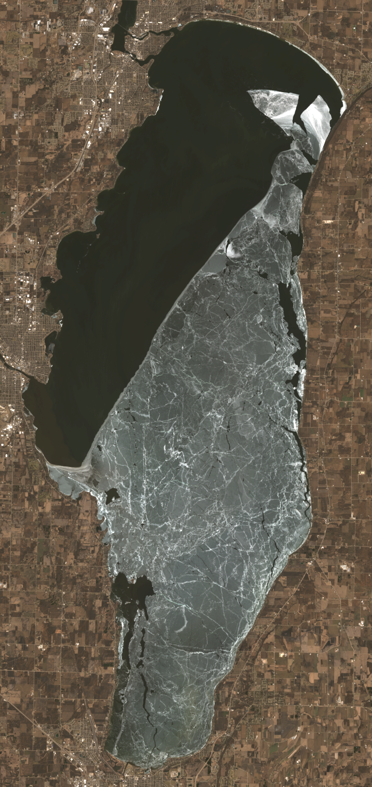
Lake Winnebago is a lake in the United States, with a mapped surface area of about 501 km².

Lake Winnebago (Menominee: Wenepekōw Nepēhsæh, Ojibwe: Wiinibiigoo-zaaga'igan, Oneida: kanyataláheleˀ) is a shallow freshwater lake in the north central United States, located in east central Wisconsin. At 137,700 acres (55,700 ha), it is the largest lake entirely within the state, covering an area of about 30 miles (48 km) by 10 miles (16 km) with 88 miles (142 km) of shoreline, an average depth of 15.5 feet (4.7 m), and a maximum depth of 21 feet (6.4 m). It has many shallow reefs along the west shore and a drop-off type shoreline on the east. There are several islands along the west shore.

The lake has two primary tributaries, the Wolf and Fox Rivers, which combine at Lake Butte des Morts. The Fox River flows east through Oshkosh and into Lake Winnebago at its west central shore, then flows out at the northwest shore, around Doty Island at Neenah-Menasha to Little Lake Butte des Morts. The river then flows northeast and empties into Green Bay and serves as part of the Fox-Wisconsin Waterway. Lake Winnebago is part of a larger system of lakes in Wisconsin known as the Winnebago Pool.

Adapted from Wikipedia: Lake Winnebago (CC BY-SA 4.0).

Surface area
501 km²
Area rank
#310 of 756 indexed
Type
Lake
Country
United States
Coordinates
43.9985°, -88.4224°

Among the 756 water bodies with a mapped extent in YearMaps, Lake Winnebago ranks #310 by surface area, after Lac Upemba (506 km²) and ahead of Sipiwesk Lac (496 km²). Areas are computed from the mapped outline and are approximate.

Settlements on the shore:
Oshkosh (10 km), Fond du Lac (25 km), Appleton (30 km)
Watercourses:
Wisconsin (River), Mississippi River (River)
Other water nearby:
Petenwell Lake (168 km²), Lake Michigan (58,387 km²)

View on the live map

More about Lake Winnebago

Lake Winnebago: Key Facts

Key facts about Lake Winnebago
Surface area557 km²
Maximum depth4.7 m
Surface elevation226 m
InflowsFox River, Fond du Lac River, De Neveu Creek
OutflowsFox River
Drainage systemFox River drainage basin

Facts from Wikidata Q1801110 (CC0).

Kentucky Lake
Image via Wikimedia Commons (author and licence on the file page).

Kentucky Lake

Reservoir · 492 km²

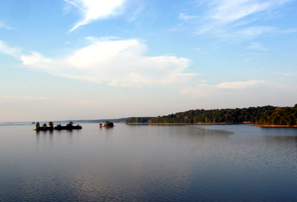
Kentucky Lake is an artificial reservoir in the United States, with a mapped surface area of about 492 km². It exists because of a dam rather than natural drainage, and was filled in 1944 behind Kentuckey Dam.

Kentucky Lake is a major navigable reservoir along the Tennessee River in Kentucky and Tennessee. It was created in 1944 by the Tennessee Valley Authority's impounding of the Tennessee River via Kentucky Dam for flood control and hydroelectric power. The 160,309-acre (649 km2) lake is the largest artificial lake by surface area in the United States east of the Mississippi River, with 2,064 miles (3,322 km) of shoreline. Kentucky Lake has a flood storage capacity of 4,008,000 acre⋅ft (4.944 km3), more than 2.5 times the next largest lake in the TVA system.

Kentucky Lake provides a source for hydro-electric power and is a recreational destination. Along with Lake Barkley, it is one of the lakes alluded to by the name of Land Between the Lakes National Recreation Area.

Adapted from Wikipedia: Kentucky Lake (CC BY-SA 4.0).

Surface area
492 km²
Area rank
#313 of 756 indexed
Type
Reservoir
Country
United States
Impounded
1944
Dam
Kentuckey Dam
Coordinates
36.3343°, -88.1108°

Among the 756 water bodies with a mapped extent in YearMaps, Kentucky Lake ranks #313 by surface area, after Presa Miguel Aleman (495 km²) and ahead of Gyaring Co (490 km²). Areas are computed from the mapped outline and are approximate.

Settlements on the shore:
Clarksville (71 km), Hopkinsville (81 km), Paducah (94 km)
Watercourses:
Cumberland (River), Tennessee (River)
Other water nearby:
Lake Barkley (286 km²), Wheeler Lake (291 km²)

View on the live map

More about Kentucky Lake

Kentucky Lake: Key Facts

Key facts about Kentucky Lake
Drainage systemTennessee River drainage basin

Facts from Wikidata Q2781219 (CC0).

Mille Lacs Lake
Image via Wikimedia Commons (author and licence on the file page).

Mille Lacs Lake

Lake · 488 km²

Mille Lacs Lake is a lake in the United States, with a mapped surface area of about 488 km².

Mille Lacs Lake ( mə-LAKS, also called Lake Mille Lacs or Mille Lacs) is a large, shallow lake in the U.S. state of Minnesota. It is located in the counties of Mille Lacs, Aitkin, and Crow Wing, roughly 75 miles (121 km) north of the Minneapolis-St. Paul metropolitan area.

Mille Lacs means "thousand lakes" in French. In the Ojibwe language of the people who historically occupied this area, the lake is called Misi-zaaga'igan ("grand lake").

Adapted from Wikipedia: Mille Lacs Lake (CC BY-SA 4.0).

Surface area
488 km²
Area rank
#315 of 756 indexed
Type
Lake
Country
United States
Coordinates
46.2655°, -93.6710°

Among the 756 water bodies with a mapped extent in YearMaps, Mille Lacs Lake ranks #315 by surface area, after Gyaring Co (490 km²) and ahead of Lake Tahoe (485 km²). Areas are computed from the mapped outline and are approximate.

Settlements on the shore:
Brainerd (42 km), St. Cloud (87 km), Superior (130 km)
Watercourses:
Namekagon (River), Minnesota (River)
Other water nearby:
Leech Lake (402 km²), Lake Winnibigoshish (214 km²)

View on the live map

More about Mille Lacs Lake

Mille Lacs Lake: Key Facts

Key facts about Mille Lacs Lake
Surface area536 km²
Surface elevation381 m
OutflowsRum River
Drainage systemMississippi River drainage basin

Facts from Wikidata Q1600016 (CC0).

Lake Tahoe
Image via Wikimedia Commons (author and licence on the file page).

Lake Tahoe

Lake · 485 km²

Lake Tahoe is a lake in the United States, with a mapped surface area of about 485 km².

Lake Tahoe () is a freshwater lake in the Sierra Nevada of the Western United States, straddling the border between California and Nevada. Lying at 6,225 ft (1,897 m) above sea level, Lake Tahoe is the largest alpine lake in North America, and at 122,160,280 acre⋅ft (150.7 km3) it trails only the five Great Lakes as the largest by volume in the United States. Its depth is 1,645 ft (501 m), making it the second deepest in the United States after Crater Lake in Oregon (1,949 ft or 594 m).

The lake was formed about two million years ago as part of the Lake Tahoe Basin, and its present extent was shaped during the ice ages. It is known for the clarity of its water and the panorama of surrounding mountains on all sides. The area surrounding the lake is also referred to as Lake Tahoe, or simply Tahoe; its English name is derived from its Washo name, Dáʔaw. More than 75% of the lake's watershed is national forest land, covered by the Lake Tahoe Basin Management Unit of the United States Forest Service.

Lake Tahoe is a major tourist attraction in both Nevada and California. It is home to winter sports, summer outdoor recreation, and scenery enjoyed throughout the year.

Adapted from Wikipedia: Lake Tahoe (CC BY-SA 4.0).

Surface area
485 km²
Area rank
#316 of 756 indexed
Type
Lake
Country
United States
Coordinates
39.1213°, -120.0387°

Among the 756 water bodies with a mapped extent in YearMaps, Lake Tahoe ranks #316 by surface area, after Mille Lacs Lake (488 km²) and ahead of Upper Red Lake (475 km²). Areas are computed from the mapped outline and are approximate.

Settlements on the shore:
Carson City (24 km), Reno (49 km), Yuba City (136 km)
Watercourses:
Feather (River), Stanislaus (River)
Other water nearby:
Lake Oroville (108 km²), Rye Patch Reservoir (42 km²)

View on the live map

More about Lake Tahoe

Lake Tahoe: Key Facts

Key facts about Lake Tahoe
Surface area502 km²
Maximum depth501 m
Volume150 km³
Surface elevation1,900 m
InflowsGriff Creek, Meeks Creek, Trout Creek, Upper Truckee River, Blackwood Creek, Taylor Creek
OutflowsTruckee River
Drainage systemLake Tahoe Basin Management Unit

Facts from Wikidata Q169962 (CC0).

Upper Red Lake
Image via Wikimedia Commons (author and licence on the file page).

Upper Red Lake

Lake · 475 km²

Upper Red Lake is a lake in the United States, with a mapped surface area of about 475 km².

Upper Red Lake is an unorganized territory in Beltrami County, Minnesota, U.S. It is a part of the Red Lake Indian Reservation. The population was 25 at the 2020 census.

Adapted from Wikipedia: Upper Red Lake, Minnesota (CC BY-SA 4.0).

Surface area
475 km²
Area rank
#317 of 756 indexed
Type
Lake
Country
United States
Coordinates
48.1299°, -94.7844°

Among the 756 water bodies with a mapped extent in YearMaps, Upper Red Lake ranks #317 by surface area, after Lake Tahoe (485 km²) and ahead of Torneträsk (471 km²). Areas are computed from the mapped outline and are approximate.

Settlements on the shore:
Grand Forks (169 km), Brainerd (202 km), Moorhead (203 km)
Watercourses:
Winnipeg (River), Namekagon (River)
Other water nearby:
Lower Red Lake (640 km²), Lake Winnibigoshish (214 km²)

View on the live map

Flathead Lake
Image via Wikimedia Commons (author and licence on the file page).

Flathead Lake

Lake · 452 km²

Flathead Lake is a lake in the United States, with a mapped surface area of about 452 km².

Flathead Lake (Salish: člq̓etkʷ, Ktunaxa: yawuʔnik̓ ʔa·kuq̓nuk) is a large natural lake in northwest Montana, United States.

The lake is a remnant of the ancient, massive glacial dammed lake, Lake Missoula, of the era of the last interglacial. Flathead Lake is a natural lake along the mainline of the Flathead River. It was dammed in 1930 by Kerr Dam at its outlet on Polson Bay, slightly raising the lake level; the dam generates electricity. The hydroelectric has been owned and operated by the Confederated Salish and Kootenai Tribes since 2015. It is one of the cleanest lakes in the populated world for its size and type.

Adapted from Wikipedia: Flathead Lake (CC BY-SA 4.0).

Surface area
452 km²
Area rank
#326 of 756 indexed
Type
Lake
Country
United States
Coordinates
47.8663°, -114.1080°

Among the 756 water bodies with a mapped extent in YearMaps, Flathead Lake ranks #326 by surface area, after Qusmuryn Köli (457 km²) and ahead of Liangzi Hu (451 km²). Areas are computed from the mapped outline and are approximate.

Settlements on the shore:
Kalispell (40 km), Missoula (111 km), Coeur d'Alene (201 km)
Watercourses:
Flathead (River), Clark Fork (River)
Other water nearby:
Lake Pend Oreille (353 km²), Canyon Ferry Lake (140 km²)

View on the live map

More about Flathead Lake

Flathead Lake: Key Facts

Key facts about Flathead Lake
Surface area510 km²
Maximum depth113 m
Surface elevation882 m
InflowsFlathead River, Swan River
OutflowsFlathead River
Drainage systemPend Oreille River basin

Facts from Wikidata Q1427364 (CC0).

Malheur Lake
Image via Wikimedia Commons (author and licence on the file page).

Malheur Lake

Alkaline Lake · 418 km²

Malheur Lake is a alkaline lake in the United States, with a mapped surface area of about 418 km².

Malheur Lake ( MAL-hure) is one of the lakes in the Malheur National Wildlife Refuge in Harney County in the U.S. state of Oregon. Located about 18 miles (29 km) southeast of Burns, the lake is marsh fed by the Donner und Blitzen River from the south and the Silvies River from the north. Malheur Lake periodically overflows into Mud Lake to the west and thence to Harney Lake, the sink of Harney Basin.

The western area of Malheur Lake consists of ponds separated by small islands and peninsulas. The lake's central and eastern sections are more open. The generally shallow water is suitable habitat for migratory birds, waterfowl, and aquatic plants.

As is typical of Great Basin lakes, Malheur Lake's surface area changes dramatically with the local weather, climate, and season because the lake is in a very flat basin. A large influence on the water volume is local snow melt, especially from Steens Mountain, south of the lake. For example, large snowpacks in the mid-1980s caused the lake to expand from approximately 67 to 160 square miles (170 to 410 km2) within three years, flooding usually dry areas and damaging a branch of the Oregon Eastern Railway.

Adapted from Wikipedia: Malheur Lake (CC BY-SA 4.0).

Surface area
418 km²
Area rank
#340 of 756 indexed
Type
Alkaline Lake
Country
United States
Coordinates
43.3411°, -118.8216°

Among the 756 water bodies with a mapped extent in YearMaps, Malheur Lake ranks #340 by surface area, after Split Lake (422 km²) and ahead of Lake Kipawa (418 km²). Areas are computed from the mapped outline and are approximate.

Settlements on the shore:
Caldwell (177 km), Boise (211 km), Bend (216 km)
Watercourses:
John Day (River), Snake (River)
Other water nearby:
Harney Lake (164 km²), Upper Klamath Lake (301 km²)

View on the live map

More about Malheur Lake

Malheur Lake: Key Facts

Key facts about Malheur Lake
Surface area201 km²
Volume0.1 km³
Surface elevation1,248 m
InflowsDonner und Blitzen River

Facts from Wikidata Q3215037 (CC0).

Leech Lake
Image via Wikimedia Commons (author and licence on the file page).

Leech Lake

Lake · 402 km²

Leech Lake is a lake in the United States, with a mapped surface area of about 402 km².

Leech Lake (translated from the Ojibwe language Gaa-zagaskwaajimekaag: Lake abundant with bloodsuckers) is a lake located in north central Minnesota, United States. It is southeast of Bemidji, located mainly within the Leech Lake Indian Reservation, and completely within the Chippewa National Forest. It is used as a reservoir. The lake is the third largest in Minnesota, covering 102,947.83 acres (416.6151 km2) with 195 miles (314 km) of shoreline and has a maximum depth of 156 feet (48 m).

Adapted from Wikipedia: Leech Lake (CC BY-SA 4.0).

Surface area
402 km²
Area rank
#350 of 756 indexed
Type
Lake
Country
United States
Coordinates
47.1228°, -94.3804°

Among the 756 water bodies with a mapped extent in YearMaps, Leech Lake ranks #350 by surface area, after Tarbela Dam (404 km²) and ahead of Kaliningradskiy Zaliv (400 km²). Areas are computed from the mapped outline and are approximate.

Settlements on the shore:
Brainerd (86 km), St. Cloud (174 km), Duluth (177 km)
Watercourses:
Namekagon (River), Minnesota (River)
Other water nearby:
Lake Winnibigoshish (214 km²), Lower Red Lake (640 km²)

View on the live map

More about Leech Lake

Leech Lake: Key Facts

Key facts about Leech Lake
Surface area451 km²
Maximum depth46 m
OutflowsLeech Lake River

Facts from Wikidata Q1812063 (CC0).

Lake Texoma
Image via Wikimedia Commons (author and licence on the file page).

Lake Texoma

Reservoir · 389 km²

Lake Texoma is an artificial reservoir in the United States, with a mapped surface area of about 389 km². It exists because of a dam rather than natural drainage, and was filled in 1944 behind Denison Dam.

Lake Texoma is one of the largest reservoirs in the United States, the 12th-largest US Army Corps of Engineers' (USACE) lake, and the largest in USACE Tulsa District. Lake Texoma is formed by Denison Dam on the Red River in Bryan County, Oklahoma, and Grayson County, Texas, about 726 miles (1,168 km) upstream from the mouth of the river. It is located at the confluence of the Red and Washita Rivers. The project was completed in 1944. The damsite is about 5 miles (8.0 km) northwest of Denison, Texas, and 15 miles (24 km) southwest of Durant, Oklahoma. Lake Texoma is the most developed and most popular lake within the USACE Tulsa District, attracting around 6 million visitors a year. Oklahoma has more of the lake within its boundaries than Texas.

Adapted from Wikipedia: Lake Texoma (CC BY-SA 4.0).

Surface area
389 km²
Area rank
#356 of 756 indexed
Type
Reservoir
Country
United States
Impounded
1944
Dam
Denison Dam
Coordinates
33.8877°, -96.6201°

Among the 756 water bodies with a mapped extent in YearMaps, Lake Texoma ranks #356 by surface area, after Mhisa (391 km²) and ahead of Lake Habbaniyah (388 km²). Areas are computed from the mapped outline and are approximate.

Settlements on the shore:
Sherman (28 km), Ardmore (57 km), Denton (88 km)
Watercourses:
Brazos (River), Canadian (River)
Other water nearby:
Toledo Bend Reservoir (811 km²), Lake Meredith (103 km²)

View on the live map

More about Lake Texoma

Lake Texoma: Key Facts

Key facts about Lake Texoma
Surface area360 km²
Surface elevation188 m
InflowsRed River
OutflowsRed River
Drainage systemRed River drainage basin

Facts from Wikidata Q3215230 (CC0).

Lake Francis Case
Image via Wikimedia Commons (author and licence on the file page).

Lake Francis Case

Reservoir · 372 km²

Lake Francis Case is an artificial reservoir in the United States, with a mapped surface area of about 372 km². It exists because of a dam rather than natural drainage, and was filled in 1952 behind Fort Randall Dam.

Lake Francis Case is a large reservoir impounded by Fort Randall Dam on the Missouri River in south-central South Dakota, United States. The lake has an area of 102,000 acres (410 km2) and a maximum depth of 140 ft (43 m). Lake Francis Case has a length of approximately 107 mi (172 km) and has a shoreline of 540 mi (870 km). The lake is the eleventh-largest reservoir in the United States and is located within the counties of: Charles Mix, Gregory, Lyman, Brule, and Buffalo. The lake stretches from Pickstown, South Dakota upstream to Big Bend Dam.

The reservoir is named for former United States Senator Francis Higbee Case, of South Dakota.

Adapted from Wikipedia: Lake Francis Case (CC BY-SA 4.0).

Surface area
372 km²
Area rank
#366 of 756 indexed
Type
Reservoir
Country
United States
Impounded
1952
Dam
Fort Randall Dam
Coordinates
43.1435°, -98.7544°

Among the 756 water bodies with a mapped extent in YearMaps, Lake Francis Case ranks #366 by surface area, after Lake Skadar (379 km²) and ahead of Lake Novillo (372 km²). Areas are computed from the mapped outline and are approximate.

Settlements on the shore:
Norfolk (164 km), Sioux Falls (170 km), Brookings (204 km)
Watercourses:
Missouri River (River), Platte (River)
Other water nearby:
Lake Oahe (1,922 km²), Lake C.W. McConaughy (109 km²)

View on the live map

More about Lake Francis Case

Lake Francis Case: Key Facts

Key facts about Lake Francis Case
InflowsMissouri River
OutflowsMissouri River
Drainage systemMissouri River drainage basin

Facts from Wikidata Q6475894 (CC0).

Lake Pend Oreille
Image via Wikimedia Commons (author and licence on the file page).

Lake Pend Oreille

Lake · 353 km²

Lake Pend Oreille is a lake in the United States, with a mapped surface area of about 353 km².

Lake Pend Oreille ( POND-ə-RAY) in the northern Idaho Panhandle is the largest lake in the U.S. state of Idaho and the 40th-largest lake by area in the United States, with a surface area of 148 square miles (380 km2). It is 69 kilometres (43 mi) long, and 1,152 feet (351 m) deep in some regions, making it the fifth-deepest in the nation and having a volume of 43,939,940 acre feet = 54 km3. The lake is fed by the Clark Fork River and the Pack River, and drains into the Pend Oreille River, as well as subsurfacely into the Spokane Valley–Rathdrum Prairie Aquifer.

It is surrounded by national forests and a few small towns, with the largest population on the lake at Sandpoint. The majority of the shoreline is non-populated and all but the southern tip of the lake is in Bonner County. The southern tip is in Kootenai County and is home to Farragut State Park, formerly the Farragut Naval Training Station during World War II, of which a small part is still active and conducts U.S. Navy acoustic underwater submarine research.

The surrounding forests consist of ponderosa pine, Douglas fir, red cedar, poplar, quaking aspen, hemlock, paper birch and western larch.

Adapted from Wikipedia: Lake Pend Oreille (CC BY-SA 4.0).

Surface area
353 km²
Area rank
#376 of 756 indexed
Type
Lake
Country
United States
Coordinates
48.1759°, -116.3216°

Among the 756 water bodies with a mapped extent in YearMaps, Lake Pend Oreille ranks #376 by surface area, after Ivankovo Reservoir (355 km²) and ahead of Lago di Garda (353 km²). Areas are computed from the mapped outline and are approximate.

Settlements on the shore:
Coeur d'Alene (65 km), Spokane (99 km), Kalispell (149 km)
Watercourses:
Flathead (River), Clark Fork (River)
Other water nearby:
Franklin D. Roosevelt Lake (119 km²), Flathead Lake (452 km²)

View on the live map

More about Lake Pend Oreille

Lake Pend Oreille: Key Facts

Key facts about Lake Pend Oreille
Surface area383 km²
Maximum depth351 m
Surface elevation630 m
InflowsClark Fork, Pack River
OutflowsPend Oreille River
Drainage systemPend Oreille River basin

Facts from Wikidata Q1632195 (CC0).

Moosehead Lake
Image via Wikimedia Commons (author and licence on the file page).

Moosehead Lake

Lake · 342 km²

Moosehead Lake is a lake in the United States, with a mapped surface area of about 342 km².

Moosehead Lake is a deep, coldwater lake located in Piscataquis County in Northwestern Maine. It is the largest lake in Maine and the largest lake wholly within New England, the second-largest lake in New England after Lake Champlain, and the largest mountain lake in the eastern United States. Situated in the mostly undeveloped Longfellow Mountains, the lake is the source of the Kennebec River. Several rural townships border the lake. Greenville is by far the largest town on the lake, with a small downtown area that has banks, shops, and restaurants. There are over 80 islands in the lake, the largest being Sugar Island and Deer Island to the west being the second largest.

Adapted from Wikipedia: Moosehead Lake (CC BY-SA 4.0).

Surface area
342 km²
Area rank
#381 of 756 indexed
Type
Lake
Country
United States
Coordinates
45.5929°, -69.6255°

Among the 756 water bodies with a mapped extent in YearMaps, Moosehead Lake ranks #381 by surface area, after Aqqikkol Hu (348 km²) and ahead of Lake Abbe (339 km²). Areas are computed from the mapped outline and are approximate.

Settlements on the shore:
Saint-Georges (99 km), Bangor (110 km), Waterville (116 km)
Watercourses:
Kennebec (River), Richelieu (River)
Other water nearby:
Chesuncook Lake (166 km²), Chiputneticook Lakes (176 km²)

View on the live map

More about Moosehead Lake

Moosehead Lake: Key Facts

Key facts about Moosehead Lake
Surface area305 km²
Maximum depth17 m
Surface elevation312 m

Facts from Wikidata Q2514433 (CC0).

Yellowstone Lake
Image via Wikimedia Commons (author and licence on the file page).

Yellowstone Lake

Lake · 329 km²

Yellowstone Lake is a lake in the United States, with a mapped surface area of about 329 km².

Yellowstone Lake is the largest body of water in Wyoming and the largest in Yellowstone National Park. The lake is 7,732 feet (2,357 m) above sea level and covers 136 square miles (350 km2) with 110 miles (180 km) of shoreline. While the average depth of the lake is 139 ft (42 m), its greatest depth is at least 394 ft (120 m). Yellowstone Lake is the largest freshwater lake above 7,000 ft (2,100 m) in North America.

In winter, ice nearly 3 ft (0.91 m) thick covers much of the lake except where shallow water covers hot springs. The lake freezes over by early December and can remain frozen until late May or early June.

Adapted from Wikipedia: Yellowstone Lake (CC BY-SA 4.0).

Surface area
329 km²
Area rank
#387 of 756 indexed
Type
Lake
Country
United States
Coordinates
44.4706°, -110.3436°

Among the 756 water bodies with a mapped extent in YearMaps, Yellowstone Lake ranks #387 by surface area, after Lago de Valencia (332 km²) and ahead of Zeta Lake (329 km²). Areas are computed from the mapped outline and are approximate.

Settlements on the shore:
Bozeman (145 km), Idaho Falls (175 km), Billings (204 km)
Watercourses:
Madison (River), Bighorn (River)
Other water nearby:
Hebgen Lake (57 km²), Boysen Reservoir (96 km²)

View on the live map

More about Yellowstone Lake

Yellowstone Lake: Key Facts

Key facts about Yellowstone Lake
Surface area354 km²
Maximum depth117 m
Surface elevation2,357 m
InflowsYellowstone River, Pelican Creek
OutflowsYellowstone River
Drainage systemYellowstone River basin

Facts from Wikidata Q923693 (CC0).

Lake Clark
Image via Wikimedia Commons (author and licence on the file page).

Lake Clark

Lake · 327 km²

Lake Clark is a lake in the United States, with a mapped surface area of about 327 km².

Lake Clark (Denaʼina: Qizhjeh Vena) is a lake in southwest Alaska. It drains through Six Mile Lake and the Newhalen River into Iliamna Lake. The lake is about 64 km (40 mi) long and about 8 km (5.0 mi) wide.

Lake Clark was named for John W. Clark, chief of the Nushagak trading post and the first American non-Native to see the lake, when an expedition financed by a weekly magazine reached it in February 1891. The Dena'ina Athabascan name is Qizjeh Vena which means "place where people gather lake". The lake is within Lake Clark National Park and Preserve.

Adapted from Wikipedia: Lake Clark (Alaska) (CC BY-SA 4.0).

Surface area
327 km²
Area rank
#391 of 756 indexed
Type
Lake
Country
United States
Coordinates
60.2505°, -154.2905°

Among the 756 water bodies with a mapped extent in YearMaps, Lake Clark ranks #391 by surface area, after Porttipahta Reservoir (328 km²) and ahead of Ozero Portnyagino (326 km²). Areas are computed from the mapped outline and are approximate.

Settlements on the shore:
Anchorage (262 km), Fairbanks (611 km), Whitehorse (1,052 km)
Watercourses:
Kuskokwim (River), Susitna (River)
Other water nearby:
Iliamna Lake (2,677 km²), Lake Minchumina (66 km²)

View on the live map

More about Lake Clark

Lake Clark: Key Facts

Key facts about Lake Clark
Surface area370 km²
Surface elevation77 m
InflowsTlikakila River, Chulitna River
OutflowsSixmile Lake

Facts from Wikidata Q1476428 (CC0).

Utah Lake
Image via Wikimedia Commons (author and licence on the file page).

Utah Lake

Lake · 312 km²

Utah Lake is a lake in the United States, with a mapped surface area of about 312 km².

Utah Lake is a shallow freshwater lake in the center of Utah County, Utah, United States. It lies in Utah Valley, surrounded by the Provo-Orem metropolitan area. The lake's only river outlet, the Jordan River, is a tributary of the Great Salt Lake. Evaporation accounts for 42% of the lake's outflow, which leaves the lake slightly saline. The elevation of the lake is at 4,489 feet (1,368 m) above sea level. If the lake's water level rises above that, the pumps and gates on the Jordan River are left open.

The first European to see Utah Lake was Father Silvestre Vélez de Escalante in 1776. He stayed with the Timpanogots band of Ute Tribe for three days. Mormon settlers later settled near the lake beginning in 1849, with the Timpanogots becoming mostly displaced from the area by 1872. The native fish species of the lake were overharvested by the settlers and subsequently restocked with non-native species.

Although thirteen species of fish were native to the lake, only the Utah sucker and the previously critically endangered, now threatened, June sucker remain. The dominant species in the lake is the common carp, introduced in 1883 as an alternative to the overharvested native fish.

Adapted from Wikipedia: Utah Lake (CC BY-SA 4.0).

Surface area
312 km²
Area rank
#400 of 756 indexed
Type
Lake
Country
United States
Coordinates
40.2318°, -111.7939°

Among the 756 water bodies with a mapped extent in YearMaps, Utah Lake ranks #400 by surface area, after Laguna Ragaguado (315 km²) and ahead of Ozero Mogotoyevo (312 km²). Areas are computed from the mapped outline and are approximate.

Settlements on the shore:
Provo (13 km), Salt Lake City (62 km), Ogden (112 km)
Watercourses:
Colorado (River), Snake (River)
Other water nearby:
Great Salt Lake (4,233 km²), Flaming Gorge Reservoir (151 km²)

View on the live map

More about Utah Lake

Utah Lake: Key Facts

Key facts about Utah Lake
Surface area392 km²
Maximum depth4.3 m
Surface elevation1,368 m
InflowsProvo River, Spanish Fork, American Fork, Hobble Creek, Dry Creek, Dry Creek
OutflowsJordan River

Facts from Wikidata Q729974 (CC0).

Upper Klamath Lake
Image via Wikimedia Commons (author and licence on the file page).

Upper Klamath Lake

Lake · 301 km²

Upper Klamath Lake is a lake in the United States, with a mapped surface area of about 301 km².

Upper Klamath Lake (sometimes called Klamath Lake) (Klamath-Modoc: ?ews, 'lake') is a large, shallow freshwater lake east of the Cascade Range in south-central Oregon in the United States. The largest body of fresh water by surface area in Oregon, it is approximately 25 miles (40 km) long and 8 miles (13 km) wide and extends northwest from the city of Klamath Falls. It sits at an average elevation of 4,140 feet (1,260 m).

In the early 20th century, most of the wetlands and marshes surrounding the lake were drained for agricultural purposes, damaging the larger habitat. The lake's water has been used to support the federal Klamath Project for irrigation by local farmers for a century. The lake depth fluctuates due to regulation of its water supply, averaging between 8 and 50 feet (2.4 and 15.2 m) deep. The lake level is kept within 4,137 to 4,143 ft (1,261 to 1,263 m) above sea level to ensure a viable fishery in the lake and to protect coho salmon in the Klamath River below the lake.

Adapted from Wikipedia: Upper Klamath Lake (CC BY-SA 4.0).

Surface area
301 km²
Area rank
#410 of 756 indexed
Type
Lake
Country
United States
Coordinates
42.4386°, -121.9282°

Among the 756 water bodies with a mapped extent in YearMaps, Upper Klamath Lake ranks #410 by surface area, after Umbozero Lake (301 km²) and ahead of J. Strom Thurmond Lake (300 km²). Areas are computed from the mapped outline and are approximate.

Settlements on the shore:
Klamath Falls (27 km), Medford (79 km), Grants Pass (115 km)
Watercourses:
Klamath (River), Pit (River)
Other water nearby:
Clair Engle Lake (99 km²), Shasta Lake (135 km²)

View on the live map

More about Upper Klamath Lake

Upper Klamath Lake: Key Facts

Key facts about Upper Klamath Lake
Surface area250 km²
Maximum depth15 m
Surface elevation1,262 m
InflowsWilliamson River
OutflowsLink River
Drainage systemKlamath Basin

Facts from Wikidata Q1972978 (CC0).

Wheeler Lake
Image via Wikimedia Commons (author and licence on the file page).

Wheeler Lake

Reservoir · 291 km²

Wheeler Lake is an artificial reservoir in the United States, with a mapped surface area of about 291 km². It exists because of a dam rather than natural drainage, and was filled in 1980 behind Wheeler Dam.

Wheeler Lake is located in the northern part of the state of Alabama in the United States, between Rogersville and Huntsville. Created by Wheeler Dam along the Tennessee River, it stretches 60 miles (97 km) from Wheeler Dam to Guntersville Dam. It is Alabama's second largest lake at 68,300 acres (276 km2), only a few hundred acres smaller than Alabama's Guntersville Lake, which is 69,100 acres (280 km2) and is separated by the Guntersville dam from the lake.

Decatur operates the busiest port along the Tennessee River on this lake, Port of Decatur.

Wheeler Lake is a major recreation and tourist center, attracting about four million visits a year. Along with camping, boating, and fishing, visitors enjoy the Wheeler National Wildlife Refuge several miles upstream from the dam.

The lake and dam are named for General Joseph "Joe" Wheeler.

Adapted from Wikipedia: Wheeler Lake (CC BY-SA 4.0).

Surface area
291 km²
Area rank
#419 of 756 indexed
Type
Reservoir
Country
United States
Impounded
1980
Dam
Wheeler Dam
Coordinates
34.6715°, -87.0374°

Among the 756 water bodies with a mapped extent in YearMaps, Wheeler Lake ranks #419 by surface area, after Tobin Lake (293 km²) and ahead of Achit Nuur (290 km²). Areas are computed from the mapped outline and are approximate.

Settlements on the shore:
Huntsville (39 km), Florence (60 km), Columbia (105 km)
Watercourses:
Tennessee (River), Tombigbee (River)
Other water nearby:
Logan Martin Lake (69 km²), Kentucky Lake (492 km²)

View on the live map

More about Wheeler Lake

Wheeler Lake: Key Facts

Key facts about Wheeler Lake
Surface area272 km²
InflowsElk River, Guntersville Lake, Limestone Creek
OutflowsWilson Lake
Drainage systemTennessee River drainage basin

Facts from Wikidata Q3561541 (CC0).

Lake Barkley
Image via Wikimedia Commons (author and licence on the file page).

Lake Barkley

Reservoir · 286 km²

Lake Barkley is an artificial reservoir in the United States, with a mapped surface area of about 286 km². It exists because of a dam rather than natural drainage, and was filled in 1963 behind Barkley Dam.

Lake Barkley, a 58,000-acre (230 km2) reservoir in Livingston County, Lyon County and Trigg County in Kentucky and extending into Stewart County and Houston County in Tennessee, was impounded by the U.S. Army Corps of Engineers in 1966 upon the completion of Barkley Dam. Both the lake and the dam are named for Vice President Alben Barkley, a Kentucky native.

The dam impounds the Cumberland River near Grand Rivers, Kentucky, approximately 38 miles (61 km) upstream from where the Cumberland empties into the Ohio River. One mile (1.6 km) above the dam is a canal connecting Lake Barkley with Kentucky Lake, forming one of the greatest freshwater recreational complexes in the country. The lakes run parallel courses for more than 50 miles (80 km), with the Land Between the Lakes National Recreation Area located between them.

Lake Barkley is 134 miles (216 km) long with a shoreline measuring 1,004 miles (1,616 km). The lake's level is maintained at different levels throughout the year for flood control purposes. Summer pool, 359 ft (109 m) above sea level, is normally reached by May 1.

Adapted from Wikipedia: Lake Barkley (CC BY-SA 4.0).

Surface area
286 km²
Area rank
#425 of 756 indexed
Type
Reservoir
Country
United States
Impounded
1963
Dam
Barkley Dam
Coordinates
36.8915°, -87.9908°

Among the 756 water bodies with a mapped extent in YearMaps, Lake Barkley ranks #425 by surface area, after Ozero Tenis (286 km²) and ahead of Laguna Huaitunas (284 km²). Areas are computed from the mapped outline and are approximate.

Settlements on the shore:
Hopkinsville (45 km), Paducah (58 km), Madisonville (65 km)
Watercourses:
Cumberland (River), Kaskaskia (River)
Other water nearby:
Kentucky Lake (492 km²), Wheeler Lake (291 km²)

View on the live map

More about Lake Barkley

Lake Barkley: Key Facts

Key facts about Lake Barkley
Drainage systemCumberland River drainage basin

Facts from Wikidata Q6474916 (CC0).

John H. Kerr Reservoir
Image via Wikimedia Commons (author and licence on the file page).

John H. Kerr Reservoir

Reservoir · 283 km²

John H. Kerr Reservoir is an artificial reservoir in the United States, with a mapped surface area of about 283 km². It exists because of a dam rather than natural drainage, and was filled in 1953.

The John H. Kerr Reservoir (often called Kerr Lake in North Carolina and Bugg's Island Lake in Virginia) is a reservoir along the border of the U.S. states of North Carolina and Virginia. The U.S. Army Corps of Engineers constructed the John H. Kerr Dam across the Roanoke River between 1947 and 1952 to produce hydroelectricity as well as for flood control. Kerr Lake is the largest lake in Virginia, with 850 miles (1,370 km) of shoreline located in Vance, Granville, and Warren counties in North Carolina, as well as Mecklenburg, Charlotte, and Halifax counties in Virginia. At its maximum capacity, it covers approximately 50,000 acres (200 km2) and is one of the largest reservoirs in the Southeastern United States. The name honors its Congressional sponsor, John H. Kerr, a North Carolina Democrat who supported creation of the lake. The lake supports recreational tourism in North Carolina and Virginia as described below.

Adapted from Wikipedia: Kerr Lake (CC BY-SA 4.0).

Surface area
283 km²
Area rank
#427 of 756 indexed
Type
Reservoir
Country
United States
Impounded
1953
Coordinates
36.5875°, -78.4739°

Among the 756 water bodies with a mapped extent in YearMaps, John H. Kerr Reservoir ranks #427 by surface area, after Laguna Huaitunas (284 km²) and ahead of Presa Nezahualcyotl (281 km²). Areas are computed from the mapped outline and are approximate.

Settlements on the shore:
Durham (77 km), Danville (82 km), Raleigh (87 km)
Watercourses:
Roanoke (River), Haw (River)
Other water nearby:
Lake Gaston (175 km²), Smith Mountain Lake (152 km²)

View on the live map

More about John H. Kerr Reservoir

John H. Kerr Reservoir: Key Facts

Key facts about John H. Kerr Reservoir
Surface area200 km²
Surface elevation71 m

Facts from Wikidata Q1700320 (CC0).

Lake Sidney Lanier
Image via Wikimedia Commons (author and licence on the file page).

Lake Sidney Lanier

Reservoir · 262 km²

Lake Sidney Lanier is an artificial reservoir in the United States, with a mapped surface area of about 262 km². It exists because of a dam rather than natural drainage, and was filled in 1958 behind Buford Dam.

Lake Lanier (officially Lake Sidney Lanier) is a reservoir in the northern portion of the U.S. state of Georgia. It was created by the completion of Buford Dam on the Chattahoochee River in 1956, and is also fed by the waters of the Chestatee River. The lake encompasses 38,000 acres (15,000 ha) or 59 mi2 (150 km2) of water, and 692 mi (1,114 km) of shoreline at normal level, a "full pool" of 1,071 ft (326 m) above mean sea level and the exact shoreline varies by resolution according to the coastline paradox. Named for Confederate veteran and poet Sidney Lanier, which has caused recent renaming controversies and public debate. It was built and is operated by the U.S. Army Corps of Engineers for flood control and water supplies. Its construction destroyed more than 50,000 acres (20,000 ha) of farmland and displaced more than 250 families, 15 businesses, and relocated 20 cemeteries along with their remains in the process.

It is patrolled by the Georgia Department of Natural Resources (GDNR), as well as local law enforcement. The states of Georgia, Alabama, and Florida all have rights to the water of the reservoir, as it feeds rivers going through those areas.

Adapted from Wikipedia: Lake Lanier (CC BY-SA 4.0).

Surface area
262 km²
Area rank
#441 of 756 indexed
Type
Reservoir
Country
United States
Impounded
1958
Dam
Buford Dam
Coordinates
34.3270°, -83.9202°

Among the 756 water bodies with a mapped extent in YearMaps, Lake Sidney Lanier ranks #441 by surface area, after Stora Lulevatten (264 km²) and ahead of Puma Yumco (257 km²). Areas are computed from the mapped outline and are approximate.

Settlements on the shore:
Athens (64 km), Atlanta (71 km), Marietta (71 km)
Watercourses:
Tugaloo (River), Chattooga (River)
Other water nearby:
Logan Martin Lake (69 km²), Wheeler Lake (291 km²)

View on the live map

More about Lake Sidney Lanier

Lake Sidney Lanier: Key Facts

Key facts about Lake Sidney Lanier
InflowsChestatee River
Drainage systemApalachicola River drainage basin

Facts from Wikidata Q3295796 (CC0).

Amistad Reservoir
Image via Wikimedia Commons (author and licence on the file page).

Amistad Reservoir

Reservoir · 251 km²

Amistad Reservoir is an artificial reservoir in Mexico and the United States, with a mapped surface area of about 251 km². About 44% of its surface lies in the United States, and the rest in Mexico. It exists because of a dam rather than natural drainage, and was filled in 1968 behind Internacional La Amistad.

Amistad Reservoir (Spanish: Presa Amistad) is a reservoir on the Rio Grande at its confluence with the Devils River 12 miles (19 km) northwest of Del Rio, Texas. The lake is bounded by Val Verde County on the United States side of the international border and by the state of Coahuila on the Mexican side of the border; the American shoreline forms the Amistad National Recreation Area. The reservoir was formed in 1969 by the construction of Amistad Dam. The dam and lake are managed jointly by the governments of the United States and Mexico through the International Boundary and Water Commission. The name of the dam and lake is the Spanish word for "friendship". The reservoir is also known as Lake Amistad.

Adapted from Wikipedia: Amistad Reservoir (CC BY-SA 4.0).

Surface area
251 km²
Area rank
#453 of 756 indexed
Type
Reservoir
Countries
Mexico, United States
Impounded
1968
Dam
Internacional La Amistad
Coordinates
29.5070°, -101.0150°

Among the 756 water bodies with a mapped extent in YearMaps, Amistad Reservoir ranks #453 by surface area, after Tikchik Lakes (251 km²) and ahead of Storavan (249 km²). Areas are computed from the mapped outline and are approximate.

Settlements on the shore:
Del Rio (25 km), Eagle Pass (107 km), San Angelo (222 km)
Watercourses:
Rio Grande (River), Double Mountain Fork Brazos (River)
Other water nearby:
Red Bluff Lake (50 km²), Brantley Lake (56 km²)

View on the live map

More about Amistad Reservoir

Amistad Reservoir: Key Facts

Key facts about Amistad Reservoir
InflowsRio Grande, Devils River
OutflowsRio Grande
Drainage systemRio Grande basin

Facts from Wikidata Q1634424 (CC0).

Lake Winnibigoshish
Image via Wikimedia Commons (author and licence on the file page).

Lake Winnibigoshish

Lake · 214 km²

Lake Winnibigoshish is a lake in the United States, with a mapped surface area of about 214 km².

Lake Winnibigoshish is a body of water in north central Minnesota in the Chippewa National Forest. Its name comes from the Ojibwe language Wiinibiigoonzhish, a diminutive and pejorative form of Wiinibiig, meaning "filthy water" (i.e., "brackish water"). The name is related in structure to Lake Winnipeg and to the Algonquian name for Lake Winnebago, which the Ho-chunk (Winnebago) Nation was named after.

The Lake's area of 67,000 acres makes it the fourth largest in Minnesota. The headwaters of the Mississippi River begin at Lake Itasca (see Mississippi River Basin map); where it flows through Winnibigoshish, the Mississippi is at its widest - more than 11 miles.

The former Winnibigoshish Township (now unorganized), located on the north shore of Lake Winnibigoshish, in Itasca County, Minnesota, was named after this lake.

Adapted from Wikipedia: Lake Winnibigoshish (CC BY-SA 4.0).

Surface area
214 km²
Area rank
#478 of 756 indexed
Type
Lake
Country
United States
Coordinates
47.4168°, -94.2469°

Among the 756 water bodies with a mapped extent in YearMaps, Lake Winnibigoshish ranks #478 by surface area, after Kenohan Jempang (216 km²) and ahead of Gobind Sagar Reservoir (214 km²). Areas are computed from the mapped outline and are approximate.

Settlements on the shore:
Brainerd (118 km), Duluth (177 km), Superior (180 km)
Watercourses:
Namekagon (River), Minnesota (River)
Other water nearby:
Leech Lake (402 km²), Lower Red Lake (640 km²)

View on the live map

More about Lake Winnibigoshish

Lake Winnibigoshish: Key Facts

Key facts about Lake Winnibigoshish
InflowsMississippi River
OutflowsMississippi River
Drainage systemMississippi River drainage basin

Facts from Wikidata Q6478519 (CC0).

American Falls Reservoir
Image via Wikimedia Commons (author and licence on the file page).

American Falls Reservoir

Reservoir · 203 km²

American Falls Reservoir is an artificial reservoir in the United States, with a mapped surface area of about 203 km². It exists because of a dam rather than natural drainage, and was filled in 1978.

The American Falls Dam is a concrete gravity-type dam in the western United States, located near American Falls, Idaho, on river mile 714.7 of the Snake River. The dam and reservoir are a part of the Minidoka Project on the Snake River Plain and are used primarily for flood control, irrigation, and recreation. When the original dam was built in the 1920s by the U.S. Bureau of Reclamation, the residents of American Falls were forced to relocate three-quarters of their town to make room for the reservoir.

A second dam was completed in 1978 and the original structure was demolished. Although the dam itself is located in Power County, its reservoir also stretches northeastward into both Bingham County and Bannock County.

Adapted from Wikipedia: American Falls Dam (CC BY-SA 4.0).

Surface area
203 km²
Area rank
#489 of 756 indexed
Type
Reservoir
Country
United States
Impounded
1978
Coordinates
42.9873°, -112.6767°

Among the 756 water bodies with a mapped extent in YearMaps, American Falls Reservoir ranks #489 by surface area, after Ozero Teke (205 km²) and ahead of Masinga Res (203 km²). Areas are computed from the mapped outline and are approximate.

Settlements on the shore:
Pocatello (23 km), Idaho Falls (75 km), Twin Falls (153 km)
Watercourses:
Snake (River), Madison (River)
Other water nearby:
Lake Walcott (34 km²), Great Salt Lake (4,233 km²)

View on the live map

Lake Moultrie
Image via Wikimedia Commons (author and licence on the file page).

Lake Moultrie

Reservoir · 202 km²

Lake Moultrie is an artificial reservoir in the United States, with a mapped surface area of about 202 km². It exists because of a dam rather than natural drainage, and was filled in 1940.

Lake Moultrie is a large man-made lake in South Carolina. Created in the 1940s by a state utility project to provide electricity to rural SC by damming the Santee River, it covers more than 60,000 acres (240 km2). The third largest lake in the state, it provides a wide variety of recreational opportunities, including fishing.

Adapted from Wikipedia: Lake Moultrie (CC BY-SA 4.0).

Surface area
202 km²
Area rank
#492 of 756 indexed
Type
Reservoir
Country
United States
Impounded
1940
Coordinates
33.3062°, -80.0564°

Among the 756 water bodies with a mapped extent in YearMaps, Lake Moultrie ranks #492 by surface area, after St. Marys River (202 km²) and ahead of Lake Winnipesaukee (200 km²). Areas are computed from the mapped outline and are approximate.

Settlements on the shore:
Charleston (57 km), Sumter (73 km), Orangeburg (78 km)
Watercourses:
Santee (River), Congaree (River)
Other water nearby:
Lake Sidney Lanier (262 km²), John H. Kerr Reservoir (283 km²)

View on the live map

More about Lake Moultrie

Lake Moultrie: Key Facts

Key facts about Lake Moultrie
Surface area243 km²

Facts from Wikidata Q6476999 (CC0).

Lake Winnipesaukee
Image via Wikimedia Commons (author and licence on the file page).

Lake Winnipesaukee

Lake · 200 km²

Lake Winnipesaukee is a lake in the United States, with a mapped surface area of about 200 km².

Lake Winnipesaukee () is the largest lake in the U.S. state of New Hampshire, located in the Lakes Region at the foothills of the White Mountains. It is approximately 21 miles (34 km) long (northwest-southeast) and from 1 to 9 miles (1.6 to 14.5 km) wide (northeast-southwest), covering 69 square miles (179 km2)—71 square miles (184 km2) when Paugus Bay is included—with a maximum depth of 180 feet (55 m). The center area of the lake is called The Broads.

The lake contains at least 264 islands, half of which are less than 0.25 acres (0.10 ha) in size, and is indented by several peninsulas, yielding a total shoreline of approximately 288 miles (463 km). The driving distance around the lake is 63 miles (101 km). It is 504 feet (154 m) above sea level. Winnipesaukee is the third-largest lake in New England after Lake Champlain and Moosehead Lake.

Outflow is regulated by the Lakeport Dam in Lakeport, New Hampshire, on the Winnipesaukee River.

Adapted from Wikipedia: Lake Winnipesaukee (CC BY-SA 4.0).

Surface area
200 km²
Area rank
#493 of 756 indexed
Type
Lake
Country
United States
Coordinates
43.6345°, -71.3579°

Among the 756 water bodies with a mapped extent in YearMaps, Lake Winnipesaukee ranks #493 by surface area, after Lake Moultrie (202 km²) and ahead of Oneida Lake (197 km²). Areas are computed from the mapped outline and are approximate.

Settlements on the shore:
Concord (50 km), Manchester (71 km), Portland (90 km)
Watercourses:
Merrimack (River), Connecticut (River)
Other water nearby:
Sebago Lake (111 km²), Lake Champlain (1,326 km²)

View on the live map

More about Lake Winnipesaukee

Lake Winnipesaukee: Key Facts

Key facts about Lake Winnipesaukee
Surface area185 km²
Maximum depth54.9 m
Surface elevation153 m
InflowsGunstock River, Merrymeeting River, Melvin River, Red Hill River
OutflowsWinnipesaukee River
Drainage systemMerrimack River watershed

Facts from Wikidata Q224872 (CC0).

Oneida Lake
Image via Wikimedia Commons (author and licence on the file page).

Oneida Lake

Lake · 197 km²

Oneida Lake is a lake in the United States, with a mapped surface area of about 197 km².

Oneida Lake is the largest lake entirely within New York state, with a surface area of 79.8 square miles (207 km2).

The lake is located northeast of Syracuse and near the Great Lakes. It feeds the Oneida River, a tributary of the Oswego River, which flows into Lake Ontario. From the earliest times until the opening of the Erie Canal in 1825, the lake was part of an important waterway connecting the Atlantic seaboard of North America to the continental interior.

The lake is about 21 miles (34 km) long and about 5 miles (8.0 km) wide with an average depth of 22 feet (6.7 m). The shoreline is about 55 miles (89 km). Portions of six counties and 69 communities are in the watershed. Oneida Creek, which flows past the cities of Oneida and Sherrill, empties into the southeast part of the lake, at South Bay. While not geologically considered one of the Finger Lakes, Oneida Lake, because of its proximity, is referred by some as their "thumb".

Adapted from Wikipedia: Oneida Lake (CC BY-SA 4.0).

Surface area
197 km²
Area rank
#494 of 756 indexed
Type
Lake
Country
United States
Coordinates
43.2174°, -75.9390°

Among the 756 water bodies with a mapped extent in YearMaps, Oneida Lake ranks #494 by surface area, after Lake Winnipesaukee (200 km²) and ahead of Ulansuhai Nur (196 km²). Areas are computed from the mapped outline and are approximate.

Settlements on the shore:
Syracuse (25 km), Utica (59 km), Watertown (84 km)
Watercourses:
Mohawk (River), Hudson (River)
Other water nearby:
Skaneateles Lake (45 km²), Owasco Lake (26 km²)

View on the live map

More about Oneida Lake

Oneida Lake: Key Facts

Key facts about Oneida Lake
Surface area207 km²
Maximum depth6.7 m
Surface elevation112 m
InflowsOneida Creek, Chittenango Creek, Wood Creek
OutflowsOneida River
Drainage systemOswego River Basin

Facts from Wikidata Q1247231 (CC0).

Lake Chelan
Image via Wikimedia Commons (author and licence on the file page).

Lake Chelan

Reservoir · 179 km²

Lake Chelan is an artificial reservoir in the United States, with a mapped surface area of about 179 km². It exists because of a dam rather than natural drainage, and was filled in 1927.

Lake Chelan ( shə-LAN) is a narrow, 50.5 mi (81.3 km) long lake in Chelan County, north-central Washington state, U.S. It is an overdeepened lake and resembles a fjord, with an average width of 1.3 mi (2.1 km). Near its upper end, the lake surface lies more than 6,600 ft (2,000 m) below peaks less than 3 mi (4.8 km) away. Before 1927, Lake Chelan was the largest natural lake in the state, in terms of both surface area and water volume. Upon the completion of Lake Chelan Dam in 1927, the elevation of the lake was increased by 21 ft (6.4 m) to its present maximum-capacity elevation of 1,100 ft (340 m).

With a maximum depth of 1,486 ft (453 m), Lake Chelan is the third deepest lake in the United States behind Crater Lake, the deepest, and Lake Tahoe, the second deepest. Because of overdeepening, the sides of this lake drop steeply to its bottom. The deepest part of Lake Chelan lies as much as 436 ft (133 m) below sea level. In places, the bedrock floor of the valley occupied by Lake Chelan, which is buried by Pleistocene glacial and lacustrine sediments, lies at least 1,529 ft (466 m) below sea level.

Adapted from Wikipedia: Lake Chelan (CC BY-SA 4.0).

Surface area
179 km²
Area rank
#514 of 756 indexed
Type
Reservoir
Country
United States
Impounded
1927
Coordinates
47.8744°, -120.0692°

Among the 756 water bodies with a mapped extent in YearMaps, Lake Chelan ranks #514 by surface area, after Ozero Shuryshkarskiy Sor (180 km²) and ahead of Lake Wanaka (178 km²). Areas are computed from the mapped outline and are approximate.

Settlements on the shore:
Wenatchee (53 km), Yakima (145 km), Everett (159 km)
Watercourses:
Columbia (River), Thompson (River)
Other water nearby:
Franklin D. Roosevelt Lake (119 km²), Lower Arrow Lake (173 km²)

View on the live map

More about Lake Chelan

Lake Chelan: Key Facts

Key facts about Lake Chelan
Surface area135 km²
Maximum depth453 m
Surface elevation335 m
InflowsStehekin River, Railroad Creek, Prince Creek, Rattlesnake Creek, Pioneer Creek, Rex Creek
OutflowsChelan River
Drainage systemChelan Basin

Facts from Wikidata Q1115201 (CC0).

Chiputneticook Lakes

Lake · 176 km²

Chiputneticook Lakes is a lake in the United States and Canada, with a mapped surface area of about 176 km². About 54% of its surface lies in the United States, and the rest in Canada.

The Chiputneticook Lakes are a group of several lakes along the international boundary between Maine and New Brunswick.

They are East Grand Lake, North Lake, Mud Lake, Spednic Lake, and Palfrey Lake.

This lake system forms the head waters of the St. Croix River which the International Boundary follows to Passamaquoddy Bay.

Chiputneticook comes from the Passamaquody Chiputneticook, "great fork river", a possible reference to the St. Croix River.

Adapted from Wikipedia: Chiputneticook Lakes (CC BY-SA 4.0).

Surface area
176 km²
Area rank
#518 of 756 indexed
Type
Lake
Countries
United States, Canada
Coordinates
45.6796°, -67.7320°

Among the 756 water bodies with a mapped extent in YearMaps, Chiputneticook Lakes ranks #518 by surface area, after Grand Lake (176 km²) and ahead of Songhua Hu (176 km²). Areas are computed from the mapped outline and are approximate.

Settlements on the shore:
Bangor (128 km), Waterville (197 km), Augusta (222 km)
Watercourses:
Miramichi (River), Kennebec (River)
Other water nearby:
Chesuncook Lake (166 km²), Moosehead Lake (342 km²)

View on the live map

More about Chiputneticook Lakes

Chiputneticook Lakes: Key Facts

Key facts about Chiputneticook Lakes
Surface elevation114 m

Facts from Wikidata Q3215856 (CC0).

Lake Gaston
Image via Wikimedia Commons (author and licence on the file page).

Lake Gaston

Reservoir · 175 km²

Lake Gaston is an artificial reservoir in the United States, with a mapped surface area of about 175 km². It exists because of a dam rather than natural drainage, and was filled in 1960.

Lake Gaston is a reservoir in the eastern United States. Part of the lake is in the North Carolina counties of Halifax, Northampton, and Warren. The part extending into Virginia lies in Brunswick and Mecklenburg counties. Lake Gaston is roughly 35 miles (56 km) long and covers over 20,000 acres (81 km2), with 350 miles (560 km) of shoreline.

The area surrounding the lake is home to more than 150,000 residents. The nearest towns are Littleton and Roanoke Rapids in North Carolina, and Clarksville and South Hill in Virginia.

The lake is not federally owned. It was formed in 1963 when the Virginia Electric Power Company (VEPCO) built Gaston Dam on the Roanoke River to generate hydroelectric power for Dominion Resources, which owns the lake. The dam is located on the North Carolina side and generates electricity for Dominion North Carolina Power, which is the North Carolina operating company of Dominion Resources. The dam includes four hydroelectric generators, with a total generating capacity of 224 megawatts.

Lake Gaston is fed by water from Kerr Lake upstream and supplies water to Roanoke Rapids Lake downstream, a smaller predecessor to Lake Gaston.

Adapted from Wikipedia: Lake Gaston (CC BY-SA 4.0).

Surface area
175 km²
Area rank
#520 of 756 indexed
Type
Reservoir
Country
United States
Impounded
1960
Coordinates
36.5107°, -77.9252°

Among the 756 water bodies with a mapped extent in YearMaps, Lake Gaston ranks #520 by surface area, after Songhua Hu (176 km²) and ahead of Ozero Neyto (174 km²). Areas are computed from the mapped outline and are approximate.

Settlements on the shore:
Rocky Mount (65 km), Petersburg (92 km), Raleigh (100 km)
Watercourses:
Roanoke (River), Haw (River)
Other water nearby:
John H. Kerr Reservoir (283 km²), Smith Mountain Lake (152 km²)

View on the live map

More about Lake Gaston

Lake Gaston: Key Facts

Key facts about Lake Gaston
Surface area80 km²
Maximum depth29 m
Surface elevation61 m

Facts from Wikidata Q732199 (CC0).

Petenwell Lake
Image via Wikimedia Commons (author and licence on the file page).

Petenwell Lake

Reservoir · 168 km²

Petenwell Lake is an artificial reservoir in the United States, with a mapped surface area of about 168 km². It exists because of a dam rather than natural drainage, and was filled in 1940.

Lake Petenwell is an artificial lake on the Wisconsin River in central Wisconsin. It is located in Adams, Juneau, and Wood counties next to Castle Rock Lake. It covers over 23,000 acres (93 km2) and is 42 feet (13 m) deep.

Lake Petenwell is Wisconsin's second largest lake entirely within its borders at 23,040 acres (93.2 km2) or approximately 36 square miles, behind Lake Winnebago. It was created in 1948 by the Wisconsin River Power Company with the construction of a dam across the Wisconsin River near Necedah. It has a maximum depth of 42 feet (13 m) and is used for water skiing, sailing and fishing. Private lakefront property is very limited as most of the virgin shoreline is undeveloped forest. Wildlife includes wintering bald eagles. Game fish include walleye, northern pike, largemouth bass, smallmouth bass, sturgeon, catfish, panfish, and muskellunge.

The area around the lake has restaurants, a community theater, a golf course and two casinos.

Adapted from Wikipedia: Petenwell Lake (CC BY-SA 4.0).

Surface area
168 km²
Area rank
#532 of 756 indexed
Type
Reservoir
Country
United States
Impounded
1940
Coordinates
44.1097°, -90.0018°

Among the 756 water bodies with a mapped extent in YearMaps, Petenwell Lake ranks #532 by surface area, after Lake Rossignol (169 km²) and ahead of Hornavan (167 km²). Areas are computed from the mapped outline and are approximate.

Settlements on the shore:
Wausau (99 km), La Crosse (105 km), Oshkosh (117 km)
Watercourses:
Wisconsin (River), Mississippi River (River)
Other water nearby:
Lake Winnebago (501 km²), Lake Michigan (58,387 km²)

View on the live map

Chesuncook Lake
Image via Wikimedia Commons (author and licence on the file page).

Chesuncook Lake

Lake · 166 km²

Chesuncook Lake is a lake in the United States, with a mapped surface area of about 166 km².

Chesuncook Lake is a reservoir in Piscataquis County, Maine, within the North Maine Woods. The lake was formed by the damming of the West Branch Penobscot River by dams built in 1835, 1903, and 1916 respectively. It is approximately 22 miles (35 km) long and 1–4 miles (1.6–6.4 km) wide, with a surface area of 25,183 acres (101.91 km2) and a maximum depth of 150 feet (46 m). It is the third-largest body of fresh water in Maine. The lake is on the Northern Forest Canoe Trail.

Adapted from Wikipedia: Chesuncook Lake (CC BY-SA 4.0).

Surface area
166 km²
Area rank
#536 of 756 indexed
Type
Lake
Country
United States
Coordinates
46.0867°, -69.3839°

Among the 756 water bodies with a mapped extent in YearMaps, Chesuncook Lake ranks #536 by surface area, after Vanderkloof Dam (166 km²) and ahead of Lake Koka (165 km²). Areas are computed from the mapped outline and are approximate.

Settlements on the shore:
Saint-Georges (99 km), Bangor (151 km), Québec (165 km)
Watercourses:
Kennebec (River), Miramichi (River)
Other water nearby:
Moosehead Lake (342 km²), Chiputneticook Lakes (176 km²)

View on the live map

More about Chesuncook Lake

Chesuncook Lake: Key Facts

Key facts about Chesuncook Lake
Surface area102 km²
Maximum depth46 m
Surface elevation287 m
OutflowsPenobscot River
Drainage systemPenobscot River basin

Facts from Wikidata Q3214801 (CC0).

Harney Lake
Image via Wikimedia Commons (author and licence on the file page).

Harney Lake

Alkaline Lake · 164 km²

Harney Lake is a alkaline lake in the United States, with a mapped surface area of about 164 km².

Harney Lake is a shallow alkali lake basin located in southeast Oregon, United States, approximately 30 miles (48 km) south of the city of Burns. The lake lies within the boundary of the Malheur National Wildlife Refuge and is the lowest point in the Blitzen Valley drainage.

Adapted from Wikipedia: Harney Lake (CC BY-SA 4.0).

Surface area
164 km²
Area rank
#542 of 756 indexed
Type
Alkaline Lake
Country
United States
Coordinates
43.2291°, -119.1152°

Among the 756 water bodies with a mapped extent in YearMaps, Harney Lake ranks #542 by surface area, after Lake Pukaki (164 km²) and ahead of Pyhjrvi (162 km²). Areas are computed from the mapped outline and are approximate.

Settlements on the shore:
Bend (200 km), Caldwell (203 km), Boise (237 km)
Watercourses:
John Day (River), Pit (River)
Other water nearby:
Malheur Lake (418 km²), Upper Klamath Lake (301 km²)

View on the live map

More about Harney Lake

Harney Lake: Key Facts

Key facts about Harney Lake
InflowsSilver Creek

Facts from Wikidata Q5659764 (CC0).

Lake Kissimmee
Image via Wikimedia Commons (author and licence on the file page).

Lake Kissimmee

Lake · 156 km²

Lake Kissimmee is a lake in the United States, with a mapped surface area of about 156 km².

Lake Kissimmee is a lake located about 15 mi (24 km) east of Lake Wales, Florida, US. The lake is almost entirely in Osceola County, but the western shore, and a small part of the lake, is in Polk County.

Lake Kissimmee State Park is rich with wildlife, including bald eagles, white tailed deer, alligators, ospreys, bobcats, turkeys, and sandhill cranes. The main attraction is its "cow camp" where visitors can learn about 1876 era Florida cowboys.

The Joe Overstreet Road access to the lake is an internationally known area for birdwatching, with sandhill cranes, introduced whooping cranes, bald eagles, black vultures, and shorebirds prominent.

There are at least five islands in the lake. The largest is Brahma Island in the south. It is followed in size by Sturm Island in the north, which is separated from the mainland only by a narrow waterway. The other islands are Bird Island, Rabbit Island and Ox Island in the eastern part of the lake. Also Ox Island is separated from the mainland only by a very narrow waterway.

Adapted from Wikipedia: Lake Kissimmee (CC BY-SA 4.0).

Surface area
156 km²
Area rank
#550 of 756 indexed
Type
Lake
Country
United States
Coordinates
27.9291°, -81.2704°

Among the 756 water bodies with a mapped extent in YearMaps, Lake Kissimmee ranks #550 by surface area, after Stanley Reservoir (157 km²) and ahead of Alesayqin Ha (156 km²). Areas are computed from the mapped outline and are approximate.

Settlements on the shore:
Kissimmee (43 km), Winter Haven (47 km), Orlando (66 km)
Watercourses:
Saint Johns (River), Suwannee (River)
Other water nearby:
Lake Istokpoga (108 km²), Lake Apopka (113 km²)

View on the live map

More about Lake Kissimmee

Lake Kissimmee: Key Facts

Key facts about Lake Kissimmee
Surface area154 km²

Facts from Wikidata Q3214981 (CC0).

Smith Mountain Lake
Image via Wikimedia Commons (author and licence on the file page).

Smith Mountain Lake

Reservoir · 152 km²

Smith Mountain Lake is an artificial reservoir in the United States, with a mapped surface area of about 152 km². It exists because of a dam rather than natural drainage, and was filled in 1963.

Smith Mountain Lake is a large reservoir in the Roanoke Region of Virginia, United States, located southeast of the City of Roanoke and southwest of Lynchburg. The lake was created in 1963 by the Smith Mountain Dam impounding the Roanoke River. The majority of the south shore of the lake lies in Franklin County while a small portion, including access to the dam, lies in Pittsylvania County. Bedford County makes up the northern half of the lake, with the Roanoke River as the dividing line. The lake has become a popular recreation spot and has also experienced significant development in the last decade. It is the largest lake contained entirely within the Commonwealth of Virginia.

Adapted from Wikipedia: Smith Mountain Lake (CC BY-SA 4.0).

Surface area
152 km²
Area rank
#554 of 756 indexed
Type
Reservoir
Country
United States
Impounded
1963
Coordinates
37.0622°, -79.5489°

Among the 756 water bodies with a mapped extent in YearMaps, Smith Mountain Lake ranks #554 by surface area, after Ozero Kokora (154 km²) and ahead of Ozero Soluntakh (152 km²). Areas are computed from the mapped outline and are approximate.

Settlements on the shore:
Roanoke (42 km), Lynchburg (53 km), Danville (55 km)
Watercourses:
Haw (River), Roanoke (River)
Other water nearby:
John H. Kerr Reservoir (283 km²), Lake Gaston (175 km²)

View on the live map

More about Smith Mountain Lake

Smith Mountain Lake: Key Facts

Key facts about Smith Mountain Lake
Surface area83 km²
InflowsBlackwater River

Facts from Wikidata Q7332083 (CC0).

Flaming Gorge Reservoir
Image via Wikimedia Commons (author and licence on the file page).

Flaming Gorge Reservoir

Reservoir · 151 km²

Flaming Gorge Reservoir is an artificial reservoir in the United States, with a mapped surface area of about 151 km². It exists because of a dam rather than natural drainage, and was filled in 1964.

Flaming Gorge Reservoir is the largest reservoir in Wyoming, on the Green River, impounded behind the Flaming Gorge Dam. Construction on the dam began in 1958 and was completed in 1964. The reservoir stores 3,788,900 acre-feet (4.6735×10⁹ m3) of water when measured at an elevation of 6,040 feet (1,841 m) above sea-level (maximum).

Adapted from Wikipedia: Flaming Gorge Reservoir (CC BY-SA 4.0).

Surface area
151 km²
Area rank
#557 of 756 indexed
Type
Reservoir
Country
United States
Impounded
1964
Coordinates
41.0095°, -109.5416°

Among the 756 water bodies with a mapped extent in YearMaps, Flaming Gorge Reservoir ranks #557 by surface area, after Ozero Agata (152 km²) and ahead of Lake Murray (148 km²). Areas are computed from the mapped outline and are approximate.

Settlements on the shore:
Provo (196 km), Salt Lake City (203 km), Ogden (205 km)
Watercourses:
Colorado (River), North Platte (River)
Other water nearby:
Utah Lake (312 km²), Great Salt Lake (4,233 km²)

View on the live map

More about Flaming Gorge Reservoir

Flaming Gorge Reservoir: Key Facts

Key facts about Flaming Gorge Reservoir
Surface elevation1,842 m

Facts from Wikidata Q176598 (CC0).

Cayuga Lake
Image via Wikimedia Commons (author and licence on the file page).

Cayuga Lake

Lake · 143 km²

Cayuga Lake is a lake in the United States, with a mapped surface area of about 143 km².

Cayuga Lake ( kə-YOO-ghə, kay-YOO-ghə, or kye-YOO-ghə) is a Finger Lake in central New York state. Spanning three counties - Cayuga, Seneca, and Tompkins - it is the longest, second largest (in surface area, marginally smaller than Seneca), and second largest in volume. It is just under 39 miles (63 km) long, with an average width of 1.7 miles (2.8 km), and is 3.5 mi wide (5.6 km) at its widest point, near Aurora. It is approximately 435 ft deep (133 m) at its deepest point, and has over 95 miles (153 km) of shoreline.

Adapted from Wikipedia: Cayuga Lake (CC BY-SA 4.0).

Surface area
143 km²
Area rank
#561 of 756 indexed
Type
Lake
Country
United States
Coordinates
42.7866°, -76.7510°

Among the 756 water bodies with a mapped extent in YearMaps, Cayuga Lake ranks #561 by surface area, after Wuchang Hu (146 km²) and ahead of Lake Seminole (143 km²). Areas are computed from the mapped outline and are approximate.

Settlements on the shore:
Ithaca (44 km), Syracuse (57 km), Elmira (78 km)
Watercourses:
Mohawk (River), Susquehanna (River)
Other water nearby:
Owasco Lake (26 km²), Skaneateles Lake (45 km²)

View on the live map

More about Cayuga Lake

Cayuga Lake: Key Facts

Key facts about Cayuga Lake
Surface area172 km²
Maximum depth133 m
Surface elevation116 m
InflowsCayuga Inlet, Fall Creek, Salmon Creek, Taughannock Creek, Six Mile Creek
OutflowsSeneca River
Drainage systemOswego River Basin

Facts from Wikidata Q731175 (CC0).

Lake Seminole
Image via Wikimedia Commons (author and licence on the file page).

Lake Seminole

Reservoir · 143 km²

Lake Seminole is an artificial reservoir in the United States, with a mapped surface area of about 143 km². It exists because of a dam rather than natural drainage, and was filled in 1952 behind Jim Woodruff Lock and Dam.

Lake Seminole (, SEM-i-nohl) is a reservoir located in the southwest corner of Georgia along its border with Florida, maintained by the U.S. Army Corps of Engineers. The Chattahoochee and Flint rivers join in the lake, before flowing from the Jim Woodruff Lock and Dam, which impounds the lake, as the Apalachicola River. The lake contains 37,500 acres (152 km2) of water, and has a shoreline of 376 mi (605 km). The fish in Lake Seminole include largemouth bass, crappie, chain pickerel, catfish, striped bass and other species. American alligators, snakes and various waterfowl are also present in the lake, which is known for its goose hunting.

Adapted from Wikipedia: Lake Seminole (CC BY-SA 4.0).

Surface area
143 km²
Area rank
#562 of 756 indexed
Type
Reservoir
Country
United States
Impounded
1952
Dam
Jim Woodruff Lock and Dam
Coordinates
30.7831°, -84.7951°

Among the 756 water bodies with a mapped extent in YearMaps, Lake Seminole ranks #562 by surface area, after Cayuga Lake (143 km²) and ahead of Lake Hawea (141 km²). Areas are computed from the mapped outline and are approximate.

Settlements on the shore:
Tallahassee (62 km), Dothan (75 km), Albany (107 km)
Watercourses:
Chattahoochee (River), Suwannee (River)
Other water nearby:
Logan Martin Lake (69 km²), Lake Apopka (113 km²)

View on the live map

More about Lake Seminole

Lake Seminole: Key Facts

Key facts about Lake Seminole
Surface area152 km²
Maximum depth9 m
OutflowsApalachicola River
Drainage systemApalachicola River drainage basin

Facts from Wikidata Q3215219 (CC0).

Canyon Ferry Lake
Image via Wikimedia Commons (author and licence on the file page).

Canyon Ferry Lake

Lake · 140 km²

Canyon Ferry Lake is a lake in the United States, with a mapped surface area of about 140 km².

Canyon Ferry Lake is a reservoir on the Missouri River 20 miles east of Helena, Montana near Townsend, Montana. It is Montana's third largest body of water, covers 33,534 acres (13,571 ha) and has 76 miles (122 km) of shore. It was formed by the building of Canyon Ferry Dam, which was completed in 1954 and has been used for electricity, irrigation, and flood control since.

Adapted from Wikipedia: Canyon Ferry Lake (CC BY-SA 4.0).

Surface area
140 km²
Area rank
#564 of 756 indexed
Type
Lake
Country
United States
Coordinates
46.4449°, -111.5105°

Among the 756 water bodies with a mapped extent in YearMaps, Canyon Ferry Lake ranks #564 by surface area, after Lake Hawea (141 km²) and ahead of Iken Aqsuat Kli (140 km²). Areas are computed from the mapped outline and are approximate.

Settlements on the shore:
Helena (43 km), Bozeman (93 km), Butte (93 km)
Watercourses:
Madison (River), Clark Fork (River)
Other water nearby:
Hebgen Lake (57 km²), Yellowstone Lake (329 km²)

View on the live map

More about Canyon Ferry Lake

Canyon Ferry Lake: Key Facts

Key facts about Canyon Ferry Lake
Drainage systemMissouri River drainage basin

Facts from Wikidata Q5034204 (CC0).

Shasta Lake
Image via Wikimedia Commons (author and licence on the file page).

Shasta Lake

Reservoir · 135 km²

Shasta Lake is an artificial reservoir in the United States, with a mapped surface area of about 135 km². It exists because of a dam rather than natural drainage, and was filled in 1945.

Shasta Lake, also popularly known as Lake Shasta, is a reservoir in Shasta County, California, United States. It began to store water in 1944 due to the impounding of the Sacramento River by Shasta Dam, the ninth-tallest dam in the U.S.

Shasta Lake is a key facility of the Central Valley Project and provides flood control for the Sacramento Valley, downstream of the dam. Water outflow generates power through the Shasta Powerplant and is subsequently used for irrigation and municipal purposes.

The reservoir lies within the Whiskeytown–Shasta–Trinity National Recreation Area, operated by the Shasta–Trinity National Forest.

The California Office of Environmental Health Hazard Assessment (OEHHA) has formed a safe-eating advisory for fish caught in the lake, based on levels of mercury and PCBs found in local species. The Shasta-Keswick Reservoir system is significantly contaminated with heavy metals, primarily due to contributions from four streams. Three of these streams contain acid mine drainage, with Spring Creek being the most notable contributor, releasing high concentrations of cadmium, copper and zinc into the water.

Adapted from Wikipedia: Shasta Lake (CC BY-SA 4.0).

Surface area
135 km²
Area rank
#571 of 756 indexed
Type
Reservoir
Country
United States
Impounded
1945
Coordinates
40.7526°, -122.4000°

Among the 756 water bodies with a mapped extent in YearMaps, Shasta Lake ranks #571 by surface area, after Lough Derg (136 km²) and ahead of Seminoe Reservoir (135 km²). Areas are computed from the mapped outline and are approximate.

Settlements on the shore:
Redding (18 km), Chico (124 km), Arcata (143 km)
Watercourses:
Pit (River), Sacramento (River)
Other water nearby:
Clair Engle Lake (99 km²), Lake Oroville (108 km²)

View on the live map

More about Shasta Lake

Shasta Lake: Key Facts

Key facts about Shasta Lake
Maximum depth158 m
InflowsSacramento River
OutflowsSacramento River
Drainage systemSacramento River basin

Facts from Wikidata Q14683954 (CC0).

Lake Apopka
Image via Wikimedia Commons (author and licence on the file page).

Lake Apopka

Lake · 113 km²

Lake Apopka is a lake in the United States, with a mapped surface area of about 113 km².

Lake Apopka is the fourth largest lake in the U.S. state of Florida. It is located 15 miles (24 km) northwest of Orlando, mostly within the bounds of Orange County, although the western part is in Lake County. Fed by a natural spring, rainfall and stormwater runoff, water from Lake Apopka flows through the Apopka-Beauclair Canal and into Lakes Beauclair and Dora. From Lake Dora, water flows into Lake Eustis, then into Lake Griffin and then northward into the Ocklawaha River, which flows into the St. Johns River. Multiple parks or nature trails are present around the lake including Magnolia Park, Lake Apopka Wildlife Drive, Ferndale Preserve, Oakland Nature Preserve, Dr. Bradford Memorial Park, and Newton Park, named for A. B. Newton.

Adapted from Wikipedia: Lake Apopka (CC BY-SA 4.0).

Surface area
113 km²
Area rank
#594 of 756 indexed
Type
Lake
Country
United States
Coordinates
28.6193°, -81.6154°

Among the 756 water bodies with a mapped extent in YearMaps, Lake Apopka ranks #594 by surface area, after Wular Lake (113 km²) and ahead of Sebago Lake (111 km²). Areas are computed from the mapped outline and are approximate.

Settlements on the shore:
Orlando (26 km), Leesburg (34 km), Sanford (38 km)
Watercourses:
Saint Johns (River), Suwannee (River)
Other water nearby:
Lake Kissimmee (156 km²), Lake Istokpoga (108 km²)

View on the live map

More about Lake Apopka

Lake Apopka: Key Facts

Key facts about Lake Apopka
Surface area124 km²
Volume0.2 km³

Facts from Wikidata Q455153 (CC0).

Sebago Lake
Image via Wikimedia Commons (author and licence on the file page).

Sebago Lake

Lake · 111 km²

Sebago Lake is a lake in the United States, with a mapped surface area of about 111 km².

Sebago Lake (Sih-BAY-Goh) is the deepest and second-largest lake in the U.S. state of Maine. The lake is 316 feet (96 m) deep at its deepest point, with a mean depth of 107 feet (33 m). Sebago is the deepest lake wholly contained within the entire New England region. Along with Lake Champlain, Sebago is one of the only lakes in the area that does not consistently freeze solid during the winter months, with total ice cover occurring for only a short period of time every few winters. Sebago covers about 50 square miles (129 km2) in surface area and the surface is around 270 feet (82 m) above sea level, so the deep bottom is below the present sea level. It is in Cumberland County, and bordered by the towns of Casco, Naples, Raymond, Sebago, Standish and Windham. The seasonally occupied town of Frye Island is on an island in the lake. Sebago Lake and the surrounding area is known for its erratic and sudden changes in weather during all seasons, likely due to its proximity to the Atlantic Ocean and to Mt. Washington, a very notorious extreme weather hotspot. The name comes from the Abenaki sobagoo, meaning "it is the sea" or "it resembles the sea".

Adapted from Wikipedia: Sebago Lake (CC BY-SA 4.0).

Surface area
111 km²
Area rank
#595 of 756 indexed
Type
Lake
Country
United States
Coordinates
43.8818°, -70.5725°

Among the 756 water bodies with a mapped extent in YearMaps, Sebago Lake ranks #595 by surface area, after Lake Apopka (113 km²) and ahead of Lough Ree (111 km²). Areas are computed from the mapped outline and are approximate.

Settlements on the shore:
Portland (35 km), Lewiston (38 km), Augusta (79 km)
Watercourses:
Merrimack (River), Kennebec (River)
Other water nearby:
Lake Winnipesaukee (200 km²), Moosehead Lake (342 km²)

View on the live map

More about Sebago Lake

Sebago Lake: Key Facts

Key facts about Sebago Lake
Surface area117 km²
Maximum depth96 m
Surface elevation82 m
OutflowsPresumpscot River

Facts from Wikidata Q1781818 (CC0).

Lake C.W. McConaughy
Image via Wikimedia Commons (author and licence on the file page).

Lake C.W. McConaughy

Reservoir · 109 km²

Lake C.W. McConaughy is an artificial reservoir in the United States, with a mapped surface area of about 109 km². It exists because of a dam rather than natural drainage, and was filled in 1941.

Lake McConaughy (known locally and affectionately as Lake Mac) is a reservoir on the North Platte River. It is located 9 miles (14 km) north of Ogallala, Nebraska, United States, near U.S. Highway 26 and Nebraska Highway 61. The reservoir was named for Charles W. McConaughy, a grain merchant and mayor of Holdrege, Nebraska, one of the leading promoters of the project. Although he did not live to see the completion of the project, his leadership and perseverance eventually culminated in a public power and irrigation project that helped Nebraska become one of the nation's leading agricultural states.

Adapted from Wikipedia: Lake McConaughy (CC BY-SA 4.0).

Surface area
109 km²
Area rank
#601 of 756 indexed
Type
Reservoir
Country
United States
Impounded
1941
Coordinates
41.2444°, -101.7143°

Among the 756 water bodies with a mapped extent in YearMaps, Lake C.W. McConaughy ranks #601 by surface area, after Ozero Untor (110 km²) and ahead of Lago di Bracciano (109 km²). Areas are computed from the mapped outline and are approximate.

Settlements on the shore:
North Platte (80 km), Scottsbluff (176 km), Kearney (229 km)
Watercourses:
North Platte (River), South Platte (River)
Other water nearby:
Glendo Reservoir (47 km²), Lake Francis Case (372 km²)

View on the live map

Lake Oroville
Image via Wikimedia Commons (author and licence on the file page).

Lake Oroville

Reservoir · 108 km²

Lake Oroville is an artificial reservoir in the United States, with a mapped surface area of about 108 km². It exists because of a dam rather than natural drainage, and was filled in 1968.

Lake Oroville is a reservoir formed by the Oroville Dam impounding the Feather River, located in Butte County, northern California. The lake is situated 5 miles (8 km) northeast of the city of Oroville, within the Lake Oroville State Recreation Area, in the western foothills of the Sierra Nevada. Known as the second-largest reservoir in California, Lake Oroville is treated as a keystone facility within the California State Water Project by storing water, providing flood control, recreation, freshwater releases to assist in controlling the salinity intrusion into the Sacramento-San Joaquin Delta and protecting fish and wildlife.

The lake is a popular nationally renowned bass fishing location, while coho salmon are stocked from the Feather River Fish Hatchery. This hatchery is a main component of Lake Oroville.

Adapted from Wikipedia: Lake Oroville (CC BY-SA 4.0).

Surface area
108 km²
Area rank
#605 of 756 indexed
Type
Reservoir
Country
United States
Impounded
1968
Coordinates
39.5696°, -121.4183°

Among the 756 water bodies with a mapped extent in YearMaps, Lake Oroville ranks #605 by surface area, after Ozero Baunt (109 km²) and ahead of Lake Istokpoga (108 km²). Areas are computed from the mapped outline and are approximate.

Impounding dam:
Oroville Dam (235 m)
Settlements on the shore:
Chico (40 km), Yuba City (51 km), Sacramento (110 km)
Watercourses:
Feather (River), Sacramento (River)
Other water nearby:
Lake Tahoe (485 km²), Shasta Lake (135 km²)

View on the live map

More about Lake Oroville

Lake Oroville: Key Facts

Key facts about Lake Oroville
Surface elevation275 m
InflowsNorth Fork Feather River, Middle Fork Feather River, West Branch Feather River, South Fork Feather River, Fall River
OutflowsFeather River
Drainage systemSacramento River basin

Facts from Wikidata Q6477226 (CC0).

Lake Istokpoga
Image via Wikimedia Commons (author and licence on the file page).

Lake Istokpoga

Lake · 108 km²

Lake Istokpoga is a lake in the United States, with a mapped surface area of about 108 km².

Lake Istokpoga is a 26,762.9-acre (108.306 km2) freshwater lake in Highlands County, Florida. It is fed by two creeks, Arbuckle Creek and Josephine Creek. The oblong-shaped lake is approximately 5 miles (8.0 km) wide by 10 miles (16 km) long. It is considered the fifth largest lake in the state of Florida. Despite its area, it is very shallow, with an average depth of only 4 feet (1.2 m). Maximum depth is 10 feet (3.0 m). As a result, boaters must be cautious to not become stranded in muck near the shore line. Bass and pontoon boats are the most commonly used watercraft, with some use of airboats. With such shallowness, this lake is extremely dangerous for boaters during windstorms, as the waves get quite high.

Boating and fishing are popular activities at this lake. There are at least half a dozen fish camps on Lake Istokpoga. Several of these fish camps book visitors for fishing trips and they also have cabins and hook up for campers, for overnight stays. The amenities on the lake are 5 public boat ramps and 2 public parks, one on the lake's north side and the other on the south east corner.

Adapted from Wikipedia: Lake Istokpoga (CC BY-SA 4.0).

Surface area
108 km²
Area rank
#606 of 756 indexed
Type
Lake
Country
United States
Coordinates
27.3804°, -81.2722°

Among the 756 water bodies with a mapped extent in YearMaps, Lake Istokpoga ranks #606 by surface area, after Lake Oroville (108 km²) and ahead of Ozero Bol'shoye Topol'noye (107 km²). Areas are computed from the mapped outline and are approximate.

Settlements on the shore:
Winter Haven (85 km), Vero Beach (92 km), Port Charlotte (93 km)
Watercourses:
Saint Johns (River), Suwannee (River)
Other water nearby:
Lake Kissimmee (156 km²), Lake Okeechobee (1,587 km²)

View on the live map

More about Lake Istokpoga

Lake Istokpoga: Key Facts

Key facts about Lake Istokpoga
Surface area113 km²
Maximum depth1.2 m
Surface elevation11.4 m

Facts from Wikidata Q1793276 (CC0).

Pathfinder Reservoir

Reservoir · 105 km²

Pathfinder Reservoir is an artificial reservoir in the United States, with a mapped surface area of about 105 km². It exists because of a dam rather than natural drainage, and was filled in 1909.

Pathfinder Reservoir is located in the U.S. state of Wyoming on the North Platte River between Casper and Rawlins. It sits 47 miles (76 km) southwest of Casper, in Carbon County and Natrona County. The reservoir was created by Pathfinder Dam and has a storage capacity of 1,016,000 acre-feet (1.253×10⁹ m3). The shoreline consists of 117 miles (188 km). Much of the water used to serve the 335,000 acre (1360 km2) North Platte Project is stored here. Some of the water in the reservoir is released to satisfy other water rights and to operate power plants downstream of the reservoir. Much of the Pathfinder Reservoir is included in the Pathfinder National Wildlife Refuge. Pathfinder Reservoir is the site of the only established population of the Macedonian Ohrid Trout (S. letnica) in the United States.

Adapted from Wikipedia: Pathfinder Reservoir (CC BY-SA 4.0).

Surface area
105 km²
Area rank
#609 of 756 indexed
Type
Reservoir
Country
United States
Impounded
1909
Coordinates
42.4154°, -106.9003°

Among the 756 water bodies with a mapped extent in YearMaps, Pathfinder Reservoir ranks #609 by surface area, after Mritz (105 km²) and ahead of Luoma Hu (105 km²). Areas are computed from the mapped outline and are approximate.

Settlements on the shore:
Casper (69 km), Laramie (164 km), Cheyenne (223 km)
Watercourses:
North Platte (River), Bighorn (River)
Other water nearby:
Boysen Reservoir (96 km²), Glendo Reservoir (47 km²)

View on the live map

More about Pathfinder Reservoir

Pathfinder Reservoir: Key Facts

Key facts about Pathfinder Reservoir
InflowsNorth Platte River
OutflowsNorth Platte River

Facts from Wikidata Q7144767 (CC0).

Lake Meredith
Image via Wikimedia Commons (author and licence on the file page).

Lake Meredith

Reservoir · 103 km²

Lake Meredith is an artificial reservoir in the United States, with a mapped surface area of about 103 km². It exists because of a dam rather than natural drainage, and was filled in 1965 behind Sanford Dam.

Lake Meredith is a reservoir formed by Sanford Dam on the Canadian River at Sanford, Texas. It is about 30 miles (48 km) northeast of Amarillo, Texas in the Texas Panhandle. It is named for A.A. Meredith, the former city manager of Borger, Texas. It historically was a major source of drinking water for Amarillo and Lubbock, Texas, located about 150 miles (240 km) to the south along with many other towns in between and nearby. Sanford Dam was constructed starting in 1962 with completion in 1965. In 2003, the Canadian River Municipal Water Authority announced that it would reduce allocations to its member cities due to an ongoing drought and a continued drop in the water level in the reservoir. As of 2008, the lake continued to hit record lows, and most of the water supplied by CRMWA is now coming from wells in Roberts County. In 2011, water withdrawals from Lake Meredith temporarily ceased and on August 7, 2013, the lake reached its all-time low 26.14 feet (7.97 m). The record high capacity was in April 1973 when the lake was 101.85 feet (31.04 m) deep. Lake depth as of October 14, 2017 was 73.12 feet (22.29 m) deep.

Lake depth as of June 17, 2025 was 78.27 feet (23.86 m) deep.

Adapted from Wikipedia: Lake Meredith (CC BY-SA 4.0).

Surface area
103 km²
Area rank
#613 of 756 indexed
Type
Reservoir
Country
United States
Impounded
1965
Dam
Sanford Dam
Coordinates
35.6182°, -101.6789°

Among the 756 water bodies with a mapped extent in YearMaps, Lake Meredith ranks #613 by surface area, after Tikchik Lakes (103 km²) and ahead of Uglich Reservoir (102 km²). Areas are computed from the mapped outline and are approximate.

Settlements on the shore:
Amarillo (45 km), Clovis (194 km), Lubbock (227 km)
Watercourses:
Prairie Dog Town Fork Red (River), Canadian (River)
Other water nearby:
Conchas Lake (91 km²), Brantley Lake (56 km²)

View on the live map

More about Lake Meredith

Lake Meredith: Key Facts

Key facts about Lake Meredith
InflowsCanadian River
OutflowsCanadian River
Drainage systemArkansas River basin

Facts from Wikidata Q1801005 (CC0).

Clair Engle Lake
Image via Wikimedia Commons (author and licence on the file page).

Clair Engle Lake

Reservoir · 99 km²

Clair Engle Lake is an artificial reservoir in the United States, with a mapped surface area of about 99 km². It exists because of a dam rather than natural drainage, and was filled in 1933.

Trinity Lake, previously called Clair Engle Lake, is a reservoir on the Trinity River formed by the Trinity Dam and located in Trinity County, California, United States. The dam was built by the U.S. Bureau of Reclamation. The lake's capacity is 2,447,650 acre⋅ft (3,019.13 GL), making it one of the largest reservoirs in California. The lake's surface is at 2,370 ft (720 m) above MSL. Trinity Lake captures and stores water for the Central Valley Project, which provides the Central Valley with water for irrigation and produces hydroelectric power. This lake is known for its many small arms, glassy inlets, and good water-skiing conditions.

After the death in office of California United States Senator Clair Engle in 1964, the lake was renamed after him. The name change never received wide popularity and the name was returned to the original name.

The lake is serviced by three marinas: Trinity Alps Marina located on the southern end in view of the Dam; Cedar Stock marina on the Stuart Fork arm on the west end of the lake; and Trinity Center marina at the northern end of the main arm of the lake. Most of the marinas rent houseboats to vacationers year round.

Adapted from Wikipedia: Trinity Lake (CC BY-SA 4.0).

Surface area
99 km²
Area rank
#618 of 756 indexed
Type
Reservoir
Country
United States
Impounded
1933
Coordinates
40.8601°, -122.7591°

Among the 756 water bodies with a mapped extent in YearMaps, Clair Engle Lake ranks #618 by surface area, after Ozero Bolshoy Sor (101 km²) and ahead of Ozero Gorkoye (99 km²). Areas are computed from the mapped outline and are approximate.

Settlements on the shore:
Redding (43 km), Arcata (112 km), Eureka (117 km)
Watercourses:
Klamath (River), Pit (River)
Other water nearby:
Shasta Lake (135 km²), Lake Oroville (108 km²)

View on the live map

More about Clair Engle Lake

Clair Engle Lake: Key Facts

Key facts about Clair Engle Lake
InflowsTrinity River
OutflowsTrinity River
Drainage systemKlamath Basin

Facts from Wikidata Q2453582 (CC0).

Boysen Reservoir
Image via Wikimedia Commons (author and licence on the file page).

Boysen Reservoir

Reservoir · 96 km²

Boysen Reservoir is an artificial reservoir in the United States, with a mapped surface area of about 96 km². It exists because of a dam rather than natural drainage, and was filled in 1952.

Boysen Reservoir is a reservoir formed by Boysen Dam, an earth-fill dam on the Wind River in the central part of the U.S. state of Wyoming. It is near the town of Shoshoni in Fremont County. The dam was constructed between 1947 and 1952 at the mouth of Wind River Canyon, just upstream from a previous dam that had been built by Asmus Boysen in 1908 on land he had leased from the Shoshone and Arapaho tribes. The dam and much of the reservoir are physically located on the Wind River Indian Reservation.

Adapted from Wikipedia: Boysen Reservoir (CC BY-SA 4.0).

Surface area
96 km²
Area rank
#627 of 756 indexed
Type
Reservoir
Country
United States
Impounded
1952
Coordinates
43.3682°, -108.1672°

Among the 756 water bodies with a mapped extent in YearMaps, Boysen Reservoir ranks #627 by surface area, after Yeren (96 km²) and ahead of Qalybek Kli (96 km²). Areas are computed from the mapped outline and are approximate.

Settlements on the shore:
Casper (161 km), Gillette (237 km), Billings (271 km)
Watercourses:
Bighorn (River), Yellowstone (River)
Other water nearby:
Pathfinder Reservoir (105 km²), Yellowstone Lake (329 km²)

View on the live map

More about Boysen Reservoir

Boysen Reservoir: Key Facts

Key facts about Boysen Reservoir
InflowsWind River
OutflowsWind River
Drainage systemYellowstone River basin

Facts from Wikidata Q896063 (CC0).

Conchas Lake
Image via Wikimedia Commons (author and licence on the file page).

Conchas Lake

Reservoir · 91 km²

Conchas Lake is an artificial reservoir in the United States, with a mapped surface area of about 91 km². It exists because of a dam rather than natural drainage, and was filled in 1939 behind Conchas Dam.

Conchas Lake is a 25-mile (40 km) long reservoir in northeastern New Mexico, behind Conchas Dam on the Canadian River. The lake has an elevation of 4,200 feet (1,300 meters) and a surface area of 9,600 acres.

Conchas Dam was completed in 1939 by the United States Army Corps of Engineers.

Adjacent to the lake is Conchas Lake State Park, which is divided into two separate areas, north and south. The state park has nine public boat ramps: five in the north area and four in the south area. The lake contains walleye, largemouth bass, white bass, shad, flathead catfish, channel catfish, bluegill, and crappie. The south area is located between the town of Conchas and Hooverville. Visitors can access the lake via New Mexico State Road 104, at mile marker 75, 29 miles (47 km) northwest of Tucumcari and 75 miles (121 km) southeast of Las Vegas.

The Conchas Lake Airport is located on NM 104 east of the lake, and Conchas Lake Seaplane Base is located 2 nautical miles (3.7 km) north of Conchas Dam.

Adapted from Wikipedia: Conchas Lake (CC BY-SA 4.0).

Surface area
91 km²
Area rank
#633 of 756 indexed
Type
Reservoir
Country
United States
Impounded
1939
Dam
Conchas Dam
Coordinates
35.5077°, -104.1938°

Among the 756 water bodies with a mapped extent in YearMaps, Conchas Lake ranks #633 by surface area, after Tikchik Lakes (91 km²) and ahead of Munduyskoye Ozero (91 km²). Areas are computed from the mapped outline and are approximate.

Settlements on the shore:
Clovis (152 km), Santa Fe (159 km), Amarillo (217 km)
Watercourses:
Prairie Dog Town Fork Red (River), Pecos (River)
Other water nearby:
Lake Meredith (103 km²), Brantley Lake (56 km²)

View on the live map

More about Conchas Lake

Conchas Lake: Key Facts

Key facts about Conchas Lake
Drainage systemArkansas River basin

Facts from Wikidata Q5158618 (CC0).

Lake Mohave
Image via Wikimedia Commons (author and licence on the file page).

Lake Mohave

Reservoir · 81 km²

Lake Mohave is an artificial reservoir in the United States, with a mapped surface area of about 81 km². It exists because of a dam rather than natural drainage, and was filled in 1950 behind Davis.

Lake Mohave is a reservoir on the Colorado River between the Hoover Dam and Davis Dam in Cottonwood Valley defining the border between Nevada and Arizona in the United States. This 67-mile (108 km) stretch of the Colorado River flows past Boulder City, Nelson, Searchlight, Cottonwood Cove, Cal-Nev-Ari, and Laughlin to the west in Nevada and Willow Beach and Bullhead City to the east in Arizona. A maximum width of 4 miles (6.4 km) wide and an elevation of 647 feet (197 m), Lake Mohave encompasses 28,260 acres (114.4 km2) of water. As Lake Mead lies to the north of the Hoover Dam, Lake Mohave and adjacent lands forming its shoreline are part of the Lake Mead National Recreation Area administered by the U.S. National Park Service.

Adapted from Wikipedia: Lake Mohave (CC BY-SA 4.0).

Surface area
81 km²
Area rank
#650 of 756 indexed
Type
Reservoir
Country
United States
Impounded
1950
Dam
Davis
Coordinates
35.4376°, -114.6411°

Among the 756 water bodies with a mapped extent in YearMaps, Lake Mohave ranks #650 by surface area, after Iken Zhbolat Lake (82 km²) and ahead of Laguna Chil (81 km²). Areas are computed from the mapped outline and are approximate.

Settlements on the shore:
Bullhead City (33 km), Kingman (60 km), Las Vegas (101 km)
Watercourses:
Colorado (River), Gila (River)
Other water nearby:
Lake Mead (787 km²), Lake Havasu (77 km²)

View on the live map

More about Lake Mohave

Lake Mohave: Key Facts

Key facts about Lake Mohave
Surface area107 km²
Maximum depth23 m
Volume0.25 km³
Surface elevation197 m
InflowsColorado River
OutflowsColorado River
Drainage systemColorado River drainage basin

Facts from Wikidata Q1801012 (CC0).

Lake Havasu
Image via Wikimedia Commons (author and licence on the file page).

Lake Havasu

Lake · 77 km²

Lake Havasu is a lake in the United States, with a mapped surface area of about 77 km².

Lake Havasu ( HAH-və-soo) is a large reservoir formed by Parker Dam on the Colorado River, on the border between San Bernardino County, California, and Mohave County, Arizona. Lake Havasu City sits on the Arizonan side of the lake with its Californian counterpart of Havasu Lake directly across the lake. The reservoir has an available capacity of 619,400 acre-feet (0.7640 km3). The concrete arch dam was built by the United States Bureau of Reclamation between 1934 and 1938. The lake's primary purpose is to store water for pumping into two aqueducts. Prior to the dam construction, the area was home to the Mojave people. The lake was named (in 1939) after the Mojave word for blue. In the early 19th century, it was frequented by beaver trappers. Spaniards also began to mine the areas along the river.

Lake Havasu is legally and structurally mandated to maintain a near-constant water elevation between 445 and 450 feet, even during severe Colorado River droughts. As a critical extraction point for major aqueducts, upstream reservoirs like Lake Mead and Lake Powell must absorb basin-wide water deficits to keep Lake Havasu functional.

Adapted from Wikipedia: Lake Havasu (CC BY-SA 4.0).

Surface area
77 km²
Area rank
#656 of 756 indexed
Type
Lake
Country
United States
Coordinates
34.4886°, -114.3777°

Among the 756 water bodies with a mapped extent in YearMaps, Lake Havasu ranks #656 by surface area, after Embalse de Buenda (78 km²) and ahead of Lake Xau (77 km²). Areas are computed from the mapped outline and are approximate.

Settlements on the shore:
Lake Havasu City (6 km), Bullhead City (75 km), Kingman (83 km)
Watercourses:
Gila (River), Colorado (River)
Other water nearby:
Lake Mohave (81 km²), Lake Mead (787 km²)

View on the live map

More about Lake Havasu

Lake Havasu: Key Facts

Key facts about Lake Havasu
Surface area78.1 km²
Maximum depth11 m
Volume0.76 km³
InflowsColorado River
OutflowsColorado River
Drainage systemColorado River drainage basin

Facts from Wikidata Q451522 (CC0).

Logan Martin Lake
Image via Wikimedia Commons (author and licence on the file page).

Logan Martin Lake

Reservoir · 69 km²

Logan Martin Lake is an artificial reservoir in the United States, with a mapped surface area of about 69 km². It exists because of a dam rather than natural drainage, and was filled in 1965 behind Logan Martin Dam.

Logan Martin Lake is a reservoir located in east central Alabama on the Coosa River approximately 30 miles (48 km) east of Birmingham, Alabama. This 17,000-acre (69 km2) reservoir was built in 1965 by Alabama Power Company. The lake, nicknamed Lake of a Thousand Coves by locals, has 275 miles (443 km) of shoreline along its 48.5-mile (78.1 km) length sandwiched between Logan Martin Dam on the south and Neely Henry Dam on the north. The depth of the lake is 35 to 110 feet (34 m) with only three feet average water level variance.

The lake borders St. Clair and Talladega counties. The reservoir extends 48.5 miles (78.1 km) from Logan Martin Dam upstream to Neely Henry Dam, and it contains 15,263 acres (61.77 km2). Logan Martin has roughly 273 miles (439 km) of shoreline.

Alabama has a lake of a similar name, the Lake Martin on the Tallapoosa River, but Lake Martin and Logan Martin Lake are not part of the same river system.

Adapted from Wikipedia: Logan Martin Lake (CC BY-SA 4.0).

Surface area
69 km²
Area rank
#667 of 756 indexed
Type
Reservoir
Country
United States
Impounded
1965
Dam
Logan Martin Dam
Coordinates
33.5059°, -86.2721°

Among the 756 water bodies with a mapped extent in YearMaps, Logan Martin Lake ranks #667 by surface area, after Yueliang Pao (69 km²) and ahead of Cass Lake (68 km²). Areas are computed from the mapped outline and are approximate.

Settlements on the shore:
Birmingham (51 km), Gadsden (62 km), Tuscaloosa (122 km)
Watercourses:
Alabama (River), Tennessee (River)
Other water nearby:
Wheeler Lake (291 km²), Lake Sidney Lanier (262 km²)

View on the live map

Keuka Lake
Image via Wikimedia Commons (author and licence on the file page).

Keuka Lake

Lake · 66 km²

Keuka Lake is a lake in the United States, with a mapped surface area of about 66 km².

Keuka Lake ( KEW-kə) is a Finger Lake in central New York state. Spanning Steuben and Yates counties, it is the third largest in the eleven-lake chain. It is unusual for its Y-shape, which contrasts with the other long and narrow Finger Lakes, earning it the historic name Crooked Lake. Keuka means 'canoe landing' or 'lake with an elbow' in the Seneca language.

The first white settlers to the lake region came after the Sullivan Expedition during the American Revolutionary War. In 1833 the Crooked Lake Canal was completed, connecting Keuka Lake with Seneca Lake, connecting with the Erie Canal. Beginning in the first half of the 19th century many steamboats operated on the lake which largely functioned as transports between Penn Yan and Hammondsport, often in service of the wine industry. In 1872 the Bath & Hammondsport Railroad, connecting to the Erie Railroad, went into operation, replacing the use of the canal.

Beginning in the mid 19th century the lake has since been surrounded by vineyards and wineries which earned it the title, the Cradle of the Wine Industry, in New York.

Adapted from Wikipedia: Keuka Lake (CC BY-SA 4.0).

Surface area
66 km²
Area rank
#674 of 756 indexed
Type
Lake
Country
United States
Coordinates
42.5193°, -77.1300°

Among the 756 water bodies with a mapped extent in YearMaps, Keuka Lake ranks #674 by surface area, after Lago Fontana (67 km²) and ahead of Lake Minchumina (66 km²). Areas are computed from the mapped outline and are approximate.

Settlements on the shore:
Ithaca (53 km), Elmira (55 km), Rochester (83 km)
Watercourses:
Niagara (River), Susquehanna (River)
Other water nearby:
Canandaigua Lake (51 km²), Cayuga Lake (143 km²)

View on the live map

More about Keuka Lake

Keuka Lake: Key Facts

Key facts about Keuka Lake
Surface area47.5 km²
Maximum depth55.8 m
Surface elevation218 m
InflowsKeuka Inlet, Glen Brook, Sugar Creek, Wagener Glen Creek
OutflowsKeuka Lake Outlet
Drainage systemOswego River Basin

Facts from Wikidata Q1335725 (CC0).

Lake Minchumina
Image via Wikimedia Commons (author and licence on the file page).

Lake Minchumina

Lake · 66 km²

Lake Minchumina is a lake in the United States, with a mapped surface area of about 66 km².

Lake Minchumina (Koyukon: Menchuh Mene’ [mənt͡ʃʰuh mənə]; Upper Kuskokwim: Minchu Mina’) is a census-designated place (CDP) in Yukon-Koyukuk Census Area, Alaska, United States. As of the 2022 data usa, the population of the CDP is 14.

Adapted from Wikipedia: Lake Minchumina, Alaska (CC BY-SA 4.0).

Surface area
66 km²
Area rank
#675 of 756 indexed
Type
Lake
Country
United States
Coordinates
63.9038°, -152.2062°

Among the 756 water bodies with a mapped extent in YearMaps, Lake Minchumina ranks #675 by surface area, after Keuka Lake (66 km²) and ahead of Lake Gemeri (66 km²). Areas are computed from the mapped outline and are approximate.

Settlements on the shore:
Fairbanks (240 km), Anchorage (321 km), Whitehorse (951 km)
Watercourses:
Yukon (River), Susitna (River)
Other water nearby:
Lake Clark (327 km²), Iliamna Lake (2,677 km²)

View on the live map

More about Lake Minchumina

Lake Minchumina: Key Facts

Key facts about Lake Minchumina
Surface area632 km²

Facts from Wikidata Q1837435 (CC0).

Lake Traverse
Image via Wikimedia Commons (author and licence on the file page).

Lake Traverse

Lake · 62 km²

Lake Traverse is a lake in the United States, with a mapped surface area of about 62 km².

Lake Traverse is an 11,200-acre (4,500 ha) lake along the border between the U.S. states of Minnesota and South Dakota, and is the southernmost body of water in the Hudson Bay watershed of North America. Lake Traverse is drained at its north end by the northward-flowing Bois de Sioux River, a tributary of the Red River of the North. A U.S. Army Corps of Engineers dam at the outflow regulates the lake's level. The Mustinka River flows into the lake just above the dam.

Lake Traverse Indian Reservation of the Dakota Sioux lies on the west shore of the lake.

Adapted from Wikipedia: Lake Traverse (CC BY-SA 4.0).

Surface area
62 km²
Area rank
#683 of 756 indexed
Type
Lake
Country
United States
Coordinates
45.7239°, -96.6974°

Among the 756 water bodies with a mapped extent in YearMaps, Lake Traverse ranks #683 by surface area, after Qiyakty Kli (63 km²) and ahead of Ozero Yakh-Tur (61 km²). Areas are computed from the mapped outline and are approximate.

Settlements on the shore:
Fargo (128 km), Moorhead (128 km), Aberdeen (142 km)
Watercourses:
Minnesota (River), Missouri River (River)
Other water nearby:
Leech Lake (402 km²), Mille Lacs Lake (488 km²)

View on the live map

More about Lake Traverse

Lake Traverse: Key Facts

Key facts about Lake Traverse
Surface elevation297 m
InflowsMustinka River
OutflowsBois de Sioux River
Drainage systemLake Winnipeg basin

Facts from Wikidata Q1493200 (CC0).

Elephant Butte Reservoir
Image via Wikimedia Commons (author and licence on the file page).

Elephant Butte Reservoir

Reservoir · 58 km²

Elephant Butte Reservoir is an artificial reservoir in the United States, with a mapped surface area of about 58 km². It exists because of a dam rather than natural drainage, and was filled in 1916 behind Elephant Butte Dam.

Elephant Butte Reservoir or Elephant Butte Lake is the largest reservoir in the U.S. state of New Mexico, 130 miles (289 km) from El Paso, Texas, and 5 miles (8.0 km) north of Truth or Consequences.

The reservoir began filling in 1915, and at full capacity became the largest man-made lake in the world. Built as part of the Rio Grande Project, it was intended to revive the fertility of farmland soil in the Rincon and Mesilla Valleys. Today, the reservoir's storage remains crucial to the Rio Grande, as it provides power and irrigation water to New Mexico, Texas, and Mexico.

It is impounded by Elephant Butte Dam and became part of the largest state park in New Mexico, Elephant Butte Lake State Park, in 1964. Before it was known as Elephant Butte, there were three prospective names — Lake Esperanza, Lake Hall, and Lake Engle. Ultimately, Elephant Butte Reservoir was named after the Elephant-shaped butte in its territory.

The reservoir can hold 2,065,010 acre-feet (2.54715×10⁹ m3) of water from a drainage of 28,900 square miles (74,850 km2). It provides irrigation to 178,000 acres (72,000 ha) of farmland.

Adapted from Wikipedia: Elephant Butte Reservoir (CC BY-SA 4.0).

Surface area
58 km²
Area rank
#689 of 756 indexed
Type
Reservoir
Country
United States
Impounded
1916
Dam
Elephant Butte Dam
Coordinates
33.2282°, -107.1830°

Among the 756 water bodies with a mapped extent in YearMaps, Elephant Butte Reservoir ranks #689 by surface area, after Ozero Sobachye (59 km²) and ahead of Ozero Beloye (58 km²). Areas are computed from the mapped outline and are approximate.

Settlements on the shore:
Las Cruces (109 km), Alamogordo (120 km), El Paso (173 km)
Watercourses:
Pecos (River), Bavispe (River)
Other water nearby:
Caballo Reservoir (50 km²), Brantley Lake (56 km²)

View on the live map

More about Elephant Butte Reservoir

Elephant Butte Reservoir: Key Facts

Key facts about Elephant Butte Reservoir
InflowsRio Grande
OutflowsRio Grande
Drainage systemRio Grande basin

Facts from Wikidata Q5359306 (CC0).

Hebgen Lake
Image via Wikimedia Commons (author and licence on the file page).

Hebgen Lake

Lake · 57 km²

Hebgen Lake is a lake in the United States, with a mapped surface area of about 57 km².

Hebgen Lake is a reservoir created by the Hebgen Dam, located in Gallatin County in southwest Montana. It is well known for the 1959 Hebgen Lake earthquake (magnitude 7.1 to 7.5) which occurred nearby on August 17, 1959, forming Quake Lake, which is located immediately downstream.

Adapted from Wikipedia: Hebgen Lake (CC BY-SA 4.0).

Surface area
57 km²
Area rank
#692 of 756 indexed
Type
Lake
Country
United States
Coordinates
44.7993°, -111.2253°

Among the 756 water bodies with a mapped extent in YearMaps, Hebgen Lake ranks #692 by surface area, after Kerey Kli (58 km²) and ahead of Presa Manuel vila Camacho (57 km²). Areas are computed from the mapped outline and are approximate.

Settlements on the shore:
Bozeman (99 km), Idaho Falls (162 km), Butte (168 km)
Watercourses:
Madison (River), Bighorn (River)
Other water nearby:
Yellowstone Lake (329 km²), Canyon Ferry Lake (140 km²)

View on the live map

More about Hebgen Lake

Hebgen Lake: Key Facts

Key facts about Hebgen Lake
Surface elevation1,993 m
InflowsMadison River
OutflowsMadison River
Drainage systemMadison River basin

Facts from Wikidata Q3214923 (CC0).

Brantley Lake

Reservoir · 56 km²

Brantley Lake is an artificial reservoir in the United States, with a mapped surface area of about 56 km². It exists because of a dam rather than natural drainage, and was filled in 1980 behind Brantley Dam.

Brantley Lake is a reservoir on the Pecos River located within Brantley Lake State Park (32.545115°N 104.374403°W / 32.545115; -104.374403) approximately 12 miles (19 km) north of Carlsbad, New Mexico off US 285.

It is impounded by Brantley Dam, completed in the 1980s as part of the Brantley Project of the United States Bureau of Reclamation. The project's main purpose was to replace the old McMillan Dam, which had been declared unsafe. Additional benefits include irrigation, flood control, fish and wildlife enhancement, and recreation.

Brantley Lake has a 335,054 acre-feet (413,283,000 m3) capacity assigned to flood control functions.

Brantley Lake State Park is located in the Chihuahuan Desert region of southeastern New Mexico.

Anglers can catch a variety of warm water fish such as largemouth bass, walleye, channel catfish, white bass, bluegill, and crappie.

Brantley Lake is part of the larger Brantley Wildlife area that stretches approximately 11 miles (18 km) North-South in south eastern New Mexico.

Adapted from Wikipedia: Brantley Lake (CC BY-SA 4.0).

Surface area
56 km²
Area rank
#695 of 756 indexed
Type
Reservoir
Country
United States
Impounded
1980
Dam
Brantley Dam
Coordinates
32.7158°, -104.2949°

Among the 756 water bodies with a mapped extent in YearMaps, Brantley Lake ranks #695 by surface area, after Ozero Samotlor (57 km²) and ahead of Lake Ohau (56 km²). Areas are computed from the mapped outline and are approximate.

Settlements on the shore:
Carlsbad (33 km), Roswell (78 km), Hobbs (108 km)
Watercourses:
Pecos (River), Double Mountain Fork Brazos (River)
Other water nearby:
Red Bluff Lake (50 km²), Elephant Butte Reservoir (58 km²)

View on the live map

More about Brantley Lake

Brantley Lake: Key Facts

Key facts about Brantley Lake
Surface elevation986 m
InflowsPecos River
OutflowsPecos River

Facts from Wikidata Q4957685 (CC0).

Canandaigua Lake
Image via Wikimedia Commons (author and licence on the file page).

Canandaigua Lake

Lake · 51 km²

Canandaigua Lake is a lake in the United States, with a mapped surface area of about 51 km².

Canandaigua Lake () is a Finger Lake in Ontario County in western New York. It is the westernmost of the major Finger Lakes, largest of the four Finger Lakes in the county, and fourth largest by size of the Finger Lakes. The City of Canandaigua is located at the northern end of the lake and the village of Naples is several miles south of the southern end.

The name Canandaigua is derived from the Seneca name spelled variously Kanandarque, Ganondagan, Ga-nun-da-gwa, or in a modern transcription, Tganödä:gwëh, which means "the chosen spot", or "at the chosen town".

Adapted from Wikipedia: Canandaigua Lake (CC BY-SA 4.0).

Surface area
51 km²
Area rank
#705 of 756 indexed
Type
Lake
Country
United States
Coordinates
42.7740°, -77.3226°

Among the 756 water bodies with a mapped extent in YearMaps, Canandaigua Lake ranks #705 by surface area, after Lake Waikaremoana (52 km²) and ahead of Guanting Shuiku (51 km²). Areas are computed from the mapped outline and are approximate.

Settlements on the shore:
Rochester (51 km), Ithaca (77 km), Elmira (87 km)
Watercourses:
Niagara (River), Allegheny (River)
Other water nearby:
Keuka Lake (66 km²), Cayuga Lake (143 km²)

View on the live map

More about Canandaigua Lake

Canandaigua Lake: Key Facts

Key facts about Canandaigua Lake
Surface area43 km²
Maximum depth84 m
Surface elevation210 m
InflowsSucker Brook
OutflowsCanandaigua Outlet

Facts from Wikidata Q1032768 (CC0).

Caballo Reservoir
Image via Wikimedia Commons (author and licence on the file page).

Caballo Reservoir

Reservoir · 50 km²

Caballo Reservoir is an artificial reservoir in the United States, with a mapped surface area of about 50 km². It exists because of a dam rather than natural drainage, and was filled in 1938 behind Caballo Dam.

Caballo Lake is a reservoir on the Rio Grande created by the Caballo Dam in southern New Mexico, United States. It is the fourth largest reservoir in New Mexico in terms of surface area and the fifth largest body of water in New Mexico in terms of volume. The lake is in Caballo Lake State Park, which is approximately 16 miles (26 km) south of Truth or Consequences.

The lake is used for recreational activities, such as boating, swimming, waterskiing, and fishing. Fish in the lake include walleye, bass, catfish, crappie, and bluegill.

Caballo Lake is also a birdwatching site. Many migratory birds use the lake as a rest stop during their travels, and eagles are often seen in the area.

Caballo Lake is named for the Caballo Mountains that border the lake to the northeast, east, and southeast, in which wild horses roamed; Caballo means "horse" in Spanish. The upper area of the lake is very shallow and, in times of low water, has been blocked from the lower, deeper end of the lake. The water has a slightly brownish hue from a distance, due to the shallow waters (usually about 75 feet (23 m) at the deepest point).

Adapted from Wikipedia: Caballo Lake (CC BY-SA 4.0).

Surface area
50 km²
Area rank
#708 of 756 indexed
Type
Reservoir
Country
United States
Impounded
1938
Dam
Caballo Dam
Coordinates
33.0962°, -107.2825°

Among the 756 water bodies with a mapped extent in YearMaps, Caballo Reservoir ranks #708 by surface area, after Upper Lough Erne (51 km²) and ahead of Red Bluff Lake (50 km²). Areas are computed from the mapped outline and are approximate.

Settlements on the shore:
Las Cruces (99 km), Alamogordo (125 km), El Paso (163 km)
Watercourses:
Pecos (River), Bavispe (River)
Other water nearby:
Elephant Butte Reservoir (58 km²), Brantley Lake (56 km²)

View on the live map

More about Caballo Reservoir

Caballo Reservoir: Key Facts

Key facts about Caballo Reservoir
Drainage systemRio Grande basin

Facts from Wikidata Q5015210 (CC0).

Red Bluff Lake
Image via Wikimedia Commons (author and licence on the file page).

Red Bluff Lake

Reservoir · 50 km²

Red Bluff Lake is an artificial reservoir in the United States, with a mapped surface area of about 50 km². It exists because of a dam rather than natural drainage.

Red Bluff Reservoir is a reservoir on the Pecos River 40 miles (64 km) north of Pecos, Texas. The reservoir extends into Loving and Reeves Counties in Texas, and Eddy County in New Mexico. The northern shoreline of the reservoir is the lowest point in the state of New Mexico. The reservoir was formed in 1936 by the construction of a dam by the Red Bluff Water Control District to provide water for irrigation and hydroelectric power. The reservoir is also used for recreational activities. With an elevation of 2,842 feet [866 m] above sea level, it is the lowest point in New Mexico.

Adapted from Wikipedia: Red Bluff Reservoir (CC BY-SA 4.0).

Surface area
50 km²
Area rank
#709 of 756 indexed
Type
Reservoir
Country
United States
Coordinates
31.9465°, -103.9035°

Among the 756 water bodies with a mapped extent in YearMaps, Red Bluff Lake ranks #709 by surface area, after Caballo Reservoir (50 km²) and ahead of Tikchik Lakes (50 km²). Areas are computed from the mapped outline and are approximate.

Settlements on the shore:
Carlsbad (61 km), Hobbs (111 km), Odessa (145 km)
Watercourses:
Pecos (River), Rio Grande (River)
Other water nearby:
Brantley Lake (56 km²), Elephant Butte Reservoir (58 km²)

View on the live map

More about Red Bluff Lake

Red Bluff Lake: Key Facts

Key facts about Red Bluff Lake
InflowsPecos River
OutflowsPecos River

Facts from Wikidata Q7303773 (CC0).

Glendo Reservoir
Image via Wikimedia Commons (author and licence on the file page).

Glendo Reservoir

Reservoir · 47 km²

Glendo Reservoir is an artificial reservoir in the United States, with a mapped surface area of about 47 km². It exists because of a dam rather than natural drainage, and was filled in 1957.

Glendo Reservoir is a reservoir located on the North Platte River in Platte County and Converse County in the U.S. State of Wyoming. The reservoir is formed by Glendo Dam. The earthfill dam is 2,096 feet (639 m) feet long and 190 feet (58 m) high and contains two hydroelectric turbines capable of generating 38 megawatts of power. The reservoir retains a maximum of 1,170,505 acre-feet (1.443797×10⁹ m3) of water used primarily for irrigation and flood control.

The reservoir is popular for water sports and fishing. It is located completely within Glendo State Park.

Adapted from Wikipedia: Glendo Reservoir (CC BY-SA 4.0).

Surface area
47 km²
Area rank
#715 of 756 indexed
Type
Reservoir
Country
United States
Impounded
1957
Coordinates
42.5521°, -104.9545°

Among the 756 water bodies with a mapped extent in YearMaps, Glendo Reservoir ranks #715 by surface area, after Ozero Bolshoy Shishkarym (49 km²) and ahead of Kauno marios (47 km²). Areas are computed from the mapped outline and are approximate.

Settlements on the shore:
Casper (116 km), Scottsbluff (131 km), Laramie (148 km)
Watercourses:
North Platte (River), Cheyenne (River)
Other water nearby:
Pathfinder Reservoir (105 km²), Lake Granby (27 km²)

View on the live map

More about Glendo Reservoir

Glendo Reservoir: Key Facts

Key facts about Glendo Reservoir
Surface elevation1,418 m
OutflowsNorth Platte River

Facts from Wikidata Q56873395 (CC0).

Skaneateles Lake
Image via Wikimedia Commons (author and licence on the file page).

Skaneateles Lake

Lake · 45 km²

Skaneateles Lake is a lake in the United States, with a mapped surface area of about 45 km².

Skaneateles Lake ( SKAN-ee-AT-ləs, locally SKIN-) is a Finger Lake in central New York state, United States. The name Sganya·daís means "long lake" in the Onondaga language. The lake spans three counties, and is sometimes referred to as "The Roof Garden of the Lakes" because its elevation (863.27 ft or 263.12 m) is higher than the other Finger Lakes. It is one of the cleanest lakes in the United States.

It is 16 mi (26 km) long (17 mi or 27 km long including the bogs at the south end of the lake) and on average 0.75 mi (1.21 km) wide, with a surface area of 13.6 sq mi (35 km2), and a maximum depth of 315 ft (96 m). The lake drains north via Skaneateles Creek, which flows into the Seneca River.

The cleanest of the Finger Lakes, its water is so pure that the city of Syracuse and other municipalities use it unfiltered. The City of Syracuse spends about $2.3 million a year to protect lake quality; sixteen people inspect (usually twice a year) each of the 2600 properties in the watershed, which is relatively small compared to other Finger Lakes. The lake is the second cleanest lake in the United States as measured by dissolved nitrogen, after Crater Lake in Oregon.

Adapted from Wikipedia: Skaneateles Lake (CC BY-SA 4.0).

Surface area
45 km²
Area rank
#720 of 756 indexed
Type
Lake
Country
United States
Coordinates
42.9039°, -76.4026°

Among the 756 water bodies with a mapped extent in YearMaps, Skaneateles Lake ranks #720 by surface area, after Baidagang Shuiku (46 km²) and ahead of Krishna Raja Sagar (45 km²). Areas are computed from the mapped outline and are approximate.

Settlements on the shore:
Syracuse (26 km), Ithaca (52 km), Elmira (96 km)
Watercourses:
Mohawk (River), Susquehanna (River)
Other water nearby:
Owasco Lake (26 km²), Cayuga Lake (143 km²)

View on the live map

More about Skaneateles Lake

Skaneateles Lake: Key Facts

Key facts about Skaneateles Lake
Maximum depth91.4 m
Surface elevation263 m
OutflowsSkaneateles Creek

Facts from Wikidata Q1333432 (CC0).

Rye Patch Reservoir
Image via Wikimedia Commons (author and licence on the file page).

Rye Patch Reservoir

Reservoir · 42 km²

Rye Patch Reservoir is an artificial reservoir in the United States, with a mapped surface area of about 42 km². It exists because of a dam rather than natural drainage, and was filled in 1936 behind Rye Patch Dam.

The Rye Patch Reservoir is a reservoir on the Humboldt River in the U.S. state of Nevada. It is located about 22 miles (35 km) northeast of the town of Lovelock, and is managed by the Pershing County Water Conservation District. The reservoir stores water for the agricultural area surrounding Lovelock, which is at the far downstream reach of the Humboldt, near the Humboldt Sink. Since the Lovelock area receives a mere 5.76 inches (146 mm) of rain annually, agriculture requires irrigation, but the high variability of the Humboldt (which often runs completely dry) means that water storage is necessary for irrigation to be feasible.

Adapted from Wikipedia: Rye Patch Reservoir (CC BY-SA 4.0).

Surface area
42 km²
Area rank
#723 of 756 indexed
Type
Reservoir
Country
United States
Impounded
1936
Dam
Rye Patch Dam
Coordinates
40.6997°, -118.2773°

Among the 756 water bodies with a mapped extent in YearMaps, Rye Patch Reservoir ranks #723 by surface area, after Ozero Maraldy (45 km²) and ahead of Loch Ness (41 km²). Areas are computed from the mapped outline and are approximate.

Settlements on the shore:
Reno (185 km), Carson City (213 km), Chico (321 km)
Watercourses:
Humboldt (River), Pit (River)
Other water nearby:
Lake Tahoe (485 km²), Harney Lake (164 km²)

View on the live map

Lake Walcott
Image via Wikimedia Commons (author and licence on the file page).

Lake Walcott

Lake · 34 km²

Lake Walcott is a lake in the United States, with a mapped surface area of about 34 km².

Lake Walcott is a reservoir in south central Idaho in the northwestern United States, impounded by Minidoka Dam. The damming of the Snake River by the Minidoka Project formed the 11,000 acre (45 km2) lake beginning in 1909. Bird Island is an island in the lake. The Idaho parks and recreation website lists many activities including fishing, boating, camping and swimming. The Minidoka National Wildlife Refuge and Lake Walcott State Park adjoin the lake and are major attractions in the region.

Adapted from Wikipedia: Lake Walcott (CC BY-SA 4.0).

Surface area
34 km²
Area rank
#734 of 756 indexed
Type
Lake
Country
United States
Coordinates
42.6806°, -113.3625°

Among the 756 water bodies with a mapped extent in YearMaps, Lake Walcott ranks #734 by surface area, after Lough Allen (36 km²) and ahead of Ozero Enetor (34 km²). Areas are computed from the mapped outline and are approximate.

Settlements on the shore:
Pocatello (78 km), Twin Falls (91 km), Idaho Falls (139 km)
Watercourses:
Snake (River), Humboldt (River)
Other water nearby:
American Falls Reservoir (203 km²), Great Salt Lake (4,233 km²)

View on the live map

More about Lake Walcott

Lake Walcott: Key Facts

Key facts about Lake Walcott
InflowsSnake River
OutflowsSnake River

Facts from Wikidata Q6478379 (CC0).

Lake Granby
Image via Wikimedia Commons (author and licence on the file page).

Lake Granby

Lake · 27 km²

Lake Granby is a lake in the United States, with a mapped surface area of about 27 km².

Lake Granby is the third largest body of water in Colorado.

It was created by the erection of Granby Dam, completed in 1950, as part of the Bureau of Reclamation's Colorado-Big Thompson Project. Water from Lake Granby is pumped via the Farr Pump plant though a pipeline that empties into a canal connected to Shadow Mountain Reservoir. The Bureau of Reclamation owns Farr Pump plant while Northern Water operates it. On its own, Lake Granby contains approximately 40 miles (64 km) of shoreline. The lake is popular with anglers and is continually stocked with rainbow trout and kokanee salmon.

The Lake is also home to the Lake Granby Yacht Club. At 8,280 feet (2,520 m), LGYC is one of the highest-elevation yacht clubs in the world, slightly beaten by Grand Lake Yacht Club at 8,369 feet (2,551 m) on nearby Grand Lake.

Adapted from Wikipedia: Lake Granby (CC BY-SA 4.0).

Surface area
27 km²
Area rank
#741 of 756 indexed
Type
Lake
Country
United States
Coordinates
40.1844°, -105.8613°

Among the 756 water bodies with a mapped extent in YearMaps, Lake Granby ranks #741 by surface area, after Lake Monowai (28 km²) and ahead of Owasco Lake (26 km²). Areas are computed from the mapped outline and are approximate.

Settlements on the shore:
Boulder (55 km), Fort Collins (80 km), Denver (89 km)
Watercourses:
South Platte (River), North Platte (River)
Other water nearby:
Pathfinder Reservoir (105 km²), Glendo Reservoir (47 km²)

View on the live map

More about Lake Granby

Lake Granby: Key Facts

Key facts about Lake Granby
Surface elevation2,525 m
InflowsColorado River
OutflowsColorado River
Drainage systemColorado River drainage basin

Facts from Wikidata Q6476029 (CC0).

Owasco Lake
Image via Wikimedia Commons (author and licence on the file page).

Owasco Lake

Lake · 26 km²

Owasco Lake is a lake in the United States, with a mapped surface area of about 26 km².

Owasco Lake is a Finger Lake in Cayuga County in central New York state, USA. It is the third easternmost and sixth largest of the chain.

Adapted from Wikipedia: Owasco Lake (CC BY-SA 4.0).

Surface area
26 km²
Area rank
#742 of 756 indexed
Type
Lake
Country
United States
Coordinates
42.8603°, -76.5221°

Among the 756 water bodies with a mapped extent in YearMaps, Owasco Lake ranks #742 by surface area, after Lake Granby (27 km²) and ahead of Lake Rotoroa (23 km²). Areas are computed from the mapped outline and are approximate.

Settlements on the shore:
Syracuse (37 km), Ithaca (47 km), Elmira (89 km)
Watercourses:
Mohawk (River), Susquehanna (River)
Other water nearby:
Skaneateles Lake (45 km²), Cayuga Lake (143 km²)

View on the live map

More about Owasco Lake

Owasco Lake: Key Facts

Key facts about Owasco Lake
Maximum depth54 m
Surface elevation217 m
InflowsOwasco Inlet
OutflowsOwasco River
Drainage systemOswego River Basin

Facts from Wikidata Q1339170 (CC0).

Millerton Lake
Image via Wikimedia Commons (author and licence on the file page).

Millerton Lake

Reservoir · 22 km²

Millerton Lake is an artificial reservoir in the United States, with a mapped surface area of about 22 km². It exists because of a dam rather than natural drainage, and was filled in 1942.

Millerton Lake is an artificial lake near the town of Friant, about 15 mi (24 km) north of downtown Fresno, California, United States. The reservoir was created by the construction of 319 ft (97 m) high Friant Dam on the San Joaquin River which, with the lake, serves as much of the county line between Fresno County to the south and Madera County to the north.

Part of the Central Valley Project, the dam was built by the United States Bureau of Reclamation (USBR) and was completed in 1942 with the exception of the drum gates being installed in 1947. The lake stores water for irrigation, which is distributed by the Madera and Friant-Kern Canals to the San Joaquin Valley. It has an instantaneous capacity of 520,528 acre⋅ft (0.642062 km3).

Secondary uses include flood control and recreation, including swimming, fishing, water skiing and camping. A 25 MW hydroelectric plant operated by the Friant Power Authority produces electricity from large releases and two smaller plants use water released for a fish hatchery and to maintain minimum-flow in the river.

Adapted from Wikipedia: Millerton Lake (CC BY-SA 4.0).

Surface area
22 km²
Area rank
#744 of 756 indexed
Type
Reservoir
Country
United States
Impounded
1942
Coordinates
37.0219°, -119.6494°

Among the 756 water bodies with a mapped extent in YearMaps, Millerton Lake ranks #744 by surface area, after Lake Rotoroa (23 km²) and ahead of Ozero Bolshaya Kharga (22 km²). Areas are computed from the mapped outline and are approximate.

Settlements on the shore:
Fresno (32 km), Merced (80 km), Visalia (83 km)
Watercourses:
San Joaquin (River), Stanislaus (River)
Other water nearby:
Lake Tahoe (485 km²), Lake Oroville (108 km²)

View on the live map

More about Millerton Lake

Millerton Lake: Key Facts

Key facts about Millerton Lake
InflowsSan Joaquin River
Drainage systemSan Joaquin River basin

Facts from Wikidata Q6859416 (CC0).

More on United States

Quick Answers

What is the largest lake in United States?
Lake Superior, at 84,920 km². Lake Huron is second at 64,004 km². Rankings cover the lakes indexed in YearMaps.
How many lakes are there in United States?
YearMaps lists 121 lakes for United States. This is the number mapped in the atlas, not an official national count.