
Cenozoic Era · Quaternary Period
Earth 20,000 Years Ago: The Last Ice Age
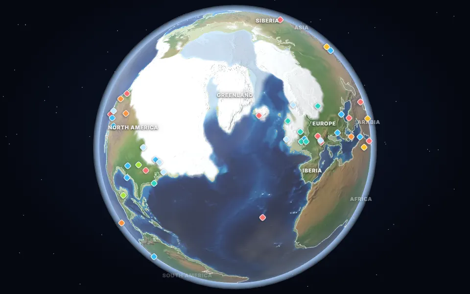
Ice age map of Earth 20,000 years ago: ice sheets over Canada and Europe, a sea 120 m lower and land bridges from Britain to Europe and Asia to America.
 Spin it in 3D and move through time
Map: Ancient maps: PALEOMAP PaleoDEMs (Scotese & Wright 2018), CC BY 4.0 · Ice-age ice sheets: PaleoMIST (Gowan et al. 2021), CC BY 4.0 · Natural Earth.
About 20,000 years ago, at the Last Glacial Maximum, ice sheets up to 3 km thick covered most of Canada, the northern United States, Scandinavia and the British Isles. So much water was locked in ice that the sea was about 120 to 125 m lower than today.
Land bridges joined Britain to Europe across Doggerland, Siberia to Alaska across Beringia, and many of Southeast Asia’s islands to the mainland. People crossed into the Americas over or along Beringia.
The average global temperature was about 6 °C colder than before the industrial era. Mammoths, woolly rhinos and giant deer roamed the cold grasslands south of the ice. The ice sheets and sea level shown come from the PaleoMIST reconstruction.
Events of the time
Panama closes
2.8 million years ago · Isthmus of Panama
The land bridge joined North and South America, let animals cross between them and rerouted ocean currents.
Doggerland
20,000 years ago · North Sea
Low sea levels exposed a land of hills and marshes between Britain and Europe, where people hunted until rising seas drowned it about 8,000 years ago.
▶ Watch it happen on the globeThe Bering land bridge
20,000 years ago · Bering Strait
A land bridge up to 1,000 km wide joined Siberia and Alaska; people crossed it into the Americas.
Part of the Cenozoic Era & The Quaternary Ice Ages.