Ancient and Medieval States of Eastern Europe: Map & History
18 states of Eastern Europe on one map, from 650 BCE to 1551 CE.The largest, Blue Horde, covered about 1,828,750 km²; the longest-lived, Cimmerian Bosporus, lasted 404 BCE – 372 CE. Each has its own section below with its rulers, capitals, wars and pictures where the records hold them.
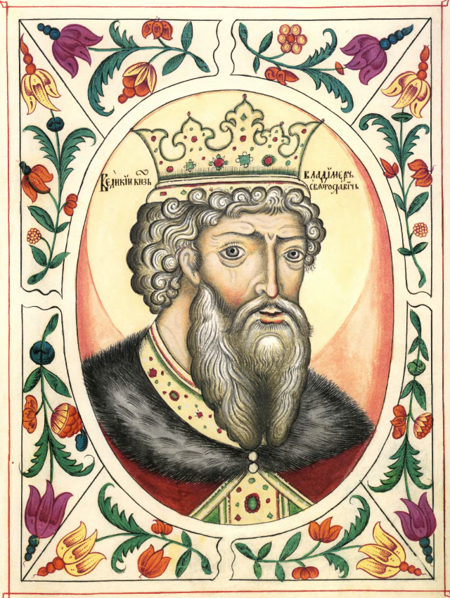
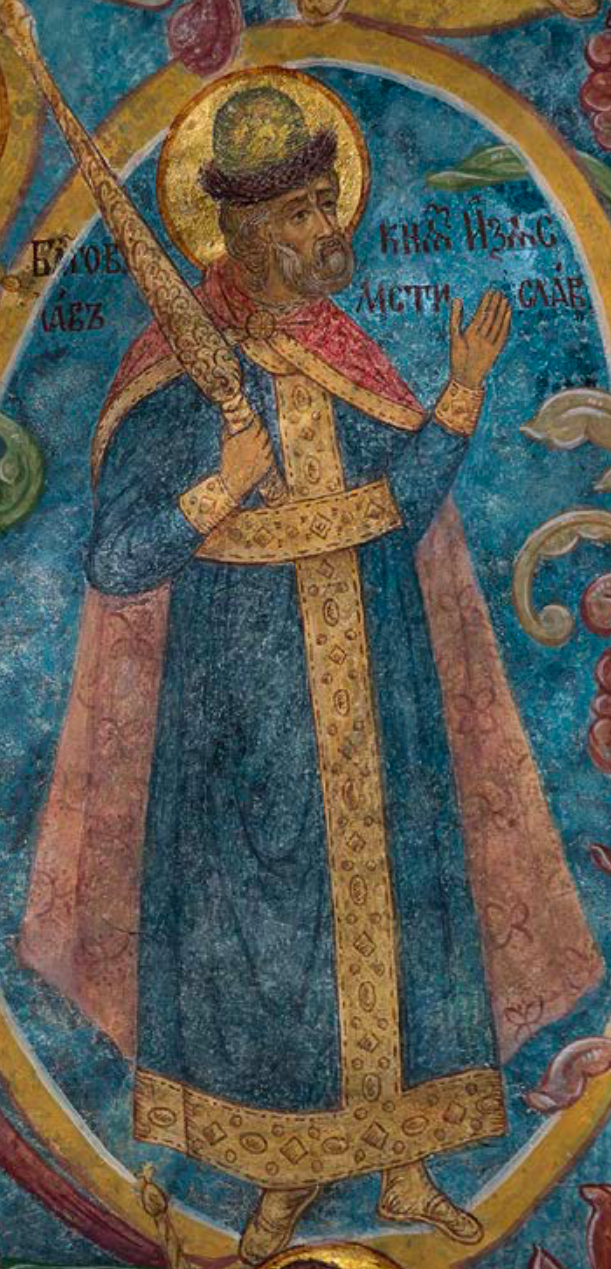
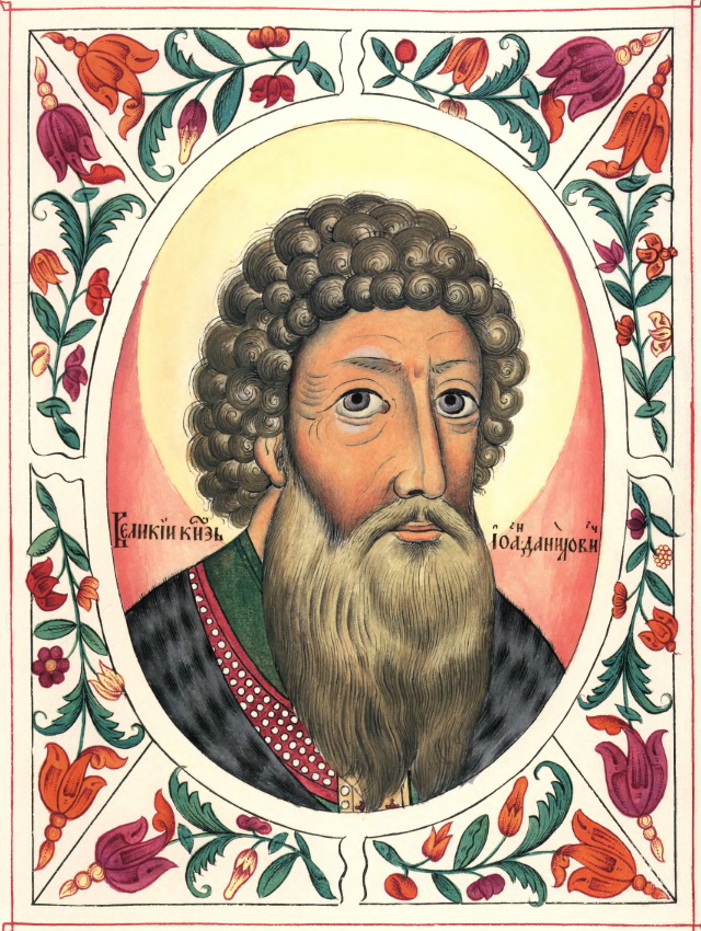
Unknown authorUnknown author · Public domain · CommonsDerevyagin Igor · CC BY-SA 3.0 · Commonskremlin.ru / Alexey Nikolsky · CC BY 4.0 · CommonsUnknown authorUnknown author · Public domain · Commons
Layers
HistoryChanges with the year
PlacesToday
Water
Land
1297 AD
Base map
An empire takes the map to its years and shows the borders.
Each state in its own colour. Move the timeline to see which existed in any year from 650 BC to 1551; select a territory to read about it. Borders: Cliopatria / Seshat (CC BY 4.0).
The Ancient and Medieval States of Eastern Europe Compared
650 BCE – 224 BCE · Capital: Kamianka (c. 6th century BC - c. 200 BC) · 1,687,837 km²
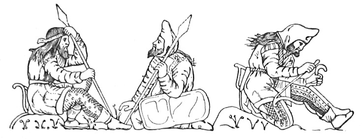
Scythian WarriorsUnknown authorUnknown author · Public domain · Commons
The Scythians or Scyths, also known as the Pontic Scythians, were an ancient Eastern Iranic equestrian nomadic people who migrated during the 9th to 8th centuries BC from Central Asia to the Pontic Steppe in modern-day Ukraine and Southern Russia, where they remained until the 3rd century BC.
Skilled in mounted warfare, the Scythians displaced the Agathyrsi and the Cimmerians as the dominant power on the western Eurasian Steppe in the 8th century BC. In the 7th century BC, the Scythians crossed the Caucasus Mountains and often raided West Asia along with the Cimmerians.
The Scythians as well as the Saka of Central Asia spoke a group of languages belonging to the eastern branch of the Iranic language family. A specific feature of the language was the transformation of the sound /δ/ (/ð/) into /l/. The Scythian languages may have formed a dialect continuum: "Scytho-Sarmatian" in the west and "Scytho-Khotanese" or Saka in the east. The Scythian languages were mostly marginalised and assimilated as a consequence of the late antiquity and early Middle Ages Slavic and Turkic expansions. The western (Sarmatian) group of ancient Scythian survived as the medieval language of the Alans and eventually gave rise to the modern Ossetian language.
The Scythians exported iron, grain and slaves to the Greek colonies, and animal products, grain, fish, honey, wax, forest products, furs, skins, wood, horses, cattle, sheep, and slaves to mainland Greece on both sides of the Aegean Sea. Also sold to the Greeks by the Scythians were beavers and beaver-skins, and rare furs that the Scythians had themselves bought from the populations living to their north and east such as the Thyssagetae and Iurcae of the Ural Mountains who hunted rare animals and sewed their skins into clothing. Other Scythian exports to Greece included the metallurgical production of Kamianka, Scythian horses, and Scythian mercenary mounted archers.
Their typical weapon was the very recurved or reflex composite bow that was easy to use for mounted warriors. Scythian bows were the most complex composite bows in both their recurved profiles and their cross-sections, highly engineered and made from wood, horn, sinew, and sturgeon fish glue through laborious craftsmanship, and were capable of delivering military draw weights. Although the shape of Scythian arrows changed with time, they maintained a basic structure. Scythian arrows had shafts made of reed or birch wood, with arrowheads mostly of bronze, and more rarely iron and bone. The shape of Scythian bows and the shape of their bronze arrowheads made them the most powerful firing weapon of their time, due to which they were adopted by West Asian armies in the 7th century BC.
Read more
When not used, Scythian bows and arrows were kept in a combined quiver-bowcase called a gōrytos.
Scythian society constited of kinship structures where clan groups formed the basis of the community and of political organisation. Clan elders wielded considerable power and were able to depose kings. As an extension of clan-based relations, a custom of blood brotherhood existed among the Scythians.
Read more
Scythian society was stratified along class lines. By the 5th to 4th centuries BC, the Scythian population was stratified into five different class groups: the aristocracy, very wealthy commoners, moderately wealthy commoners, the peasantry, who were the producer class and formed the mass of the populace, and the poor. The Scythian aristocracy were an elite class dominating all aspects of Scythian life consisting of property owners who possessed landed estates large enough that it sometimes took a whole day to ride around them. These freeborn Scythian rulers used the whip as their symbol.
The defeat against Philip II was followed by a series of military defeats which led to a significant decline during the late 4th century BC. Although the experience of Philip II's military dealings with the Scythians led his son Alexander the Great to choose to avoid attacking them, his conquests harmed trade networks Pontic Olbia depended on. In 331 or 330 BC, Alexander III's general Zopyrion campaigned against the Scythian kingdom. Although Zōpyriōn's army was defeated by the Scythians, his attack initiated the final decline of Olbia, and various tribes from the West such as the Celts started moving into its territories.
Read more
In 309 BC, the Scythian king Agaros participated in the Bosporan Civil War on the side of Satyros II against his half-brother Eumēlos.
The inroads of the Cimmerians and the Scythians into West Asia over the course of the 8th to 7th centuries BC, which were early precursors of the later invasions of West Asia by steppe nomads such as the Huns, various Turkic peoples, and the Mongols, in Late Antiquity and the Mediaeval Period, had destabilised the political balance which had prevailed in the region between the dominant great powers of Assyria, Urartu, and Phrygia, thus irreversibly changing the geopolitical situation of West Asia. These Cimmerians and Scythians also influenced the developments in West Asia through the spread of the steppe nomad military technology brought by them into this region.
404 BCE – 372 CE · Capital: Panticapaeum · 40,185 km²
Керч, вул. Рибакова, гора Мітрідат, північний та північно-східний схилиDerevyagin Igor · CC BY-SA 3.0 · Commons
The Bosporan Kingdom, also known as the Kingdom of the Cimmerian Bosporus (Ancient Greek: Βασιλεία τοῦ Κιμμερικοῦ Βοσπόρου, romanized: Basileía tou Kimmerikou Bospórou; Latin: Regnum Bospori), was an ancient Greco-Scythian state located in eastern Crimea and the Taman Peninsula on the shores of the Cimmerian Bosporus, centered in the present-day Strait of Kerch. It was the first truly 'Hellenistic' state, in the sense that a mixed population adopted the Greek language and civilization, under aristocratic consolidated leadership.
Greek colonization in the Black sea region dates back into the Greek Dark Ages, from which there is ample evidence of cultural and economic exchange as well as hostility between Greek and local populations, such as the Thracians, Dacians, and later Scythians.
Read more
Scythian expansion and unification in the fifth century BC led to many of these settlements being wiped out or turned into Scythian protectorates, as was the case in the city of Olbia. It has been suggested that this pressure allowed the Archeanactid dynasty to create the first Bosporan state, lasting from 480-438 BC, at which point it was overthrown by the Spartocid Dynasty, beginning a period of economic expansion.
The Black Sea Greeks before this period had dealt largely in goods like animals, slaves, furs, and fish, with grain playing a minor role.
The Bosporan kingdom under the Spartocid kings was heavily influenced by the mixing of local Scythian and Greeks at all levels of society, particularly in the nobility. In an internal conflict between Satyrus II and his brother Eumelus, the royal Bosporan army was said to contain no more than 2,000 Greeks, and an equal number of Thracians fighting as mercenaries. The vast majority of the army was Scythian, with 10,000 cavalry and over 20,000 infantry reported. Eumelus, allied with the Sirace king Aripharnes, brought 20,000 Scythian cavalry and even more infantry.
The Yenisei Kyrgyz (Old Turkic: 𐰶𐰃𐰺𐰴𐰕:𐰉𐰆𐰑𐰣, romanized: Qırqız bodun) were an ancient Turkic people who dwelled along the upper Yenisei in the southern portion of the Minusinsk Hollow from the 3rd century BCE to the 13th century CE. The heart of their homeland was the forested Tannu-Ola mountain range (known in ancient times as the Lao or Kogmen mountains), in modern-day Tuva, just north of Mongolia. The Sayan Mountains were also included in their territory at different times.
The Jiankun (堅昆) [Qirghiz] tribe, [unlike the Türks], is not of wolf descent. Their ancestors were born in a cave located to the north of the Quman Mountain. They themselves say that in the ancient times there was a god who mated with a cow in that cave. The people's hair is yellow, eyes are green, and beards are red.
Read more
In Chinese historical sources, the Kyrgyz are distinguished from the Uyghurs and other Tiele tribes. The Xin Tangshu, which contains detailed information about the Kyrgyz, describes their distinctive physical appearance: "The people are all tall and big and have red hair, white faces, and green eyes" (人皆長大,赤髮、皙面、綠瞳).
According to the Xin Tangshu, a neighboring tribe known as the Boma (駁馬) or Bila (弊剌) resembled the Kyrgyz, although their language was different.
The Tang Huiyao (961 CE), citing the Protector General of Anxi Ge Jiayun, states that the Kyrgyz, known to the Chinese as the Jiankun, all had red hair and green eyes. The ones with dark eyes and black hair were believed to be descended from Li Ling, a Han dynasty general whom the Kyrgyz claimed to have married a Kyrgyz woman and was sent to aid in their governance after he surrendered to the Xiongnu. The name Jiankun was later changed to Xiajiasi; according to a translation clerk, Xiajiasi meant "yellow head and red face" and this was what the Uyghurs called them; Pulleyblank (1990) proposes that "yellow head and red face" was a folk etymology based on Turkic qizqil ~ qïzïl "red".
633 CE – 681 CE · Capital: Phanagoria, (632–665) · 301,064 km²
Old Great Bulgaria (Medieval Greek: Παλαιά Μεγάλη Βουλγαρία, Palaiá Megálē Voulgaría), also often known by the Latin names Magna Bulgaria and Patria Onoguria ("Onogur land"), was a 7th-century Turkic nomadic empire formed by the Onogur-Bulgars on the western Pontic–Caspian steppe (modern southern Ukraine and southwest Russia). Great Bulgaria was originally centered between the Dniester and lower Volga.
The original capital was Phanagoria on the Taman Peninsula between the Black and Azov seas.
The etymology of the ethnonym Bulgar is not completely understood; it is difficult to trace the name back earlier than the 4th century AD. It is generally believed to derive from the Turkic verb bulğha (to "stir", "mix", "disturb", "confuse"), possibly suggesting that other Turkic peoples regarded the Bulgars as a "mixed" people, or as "rebellious".
Read more
Later Byzantine scholars implied that the Bulgars had previously been known as the Onogurs (Onoğur). Agathon wrote about the "nation of Onogur Bulğars", Nikephoros I stated that Kubrat was lord of the Onogundurs, Theophanes referred to them as Onogundur Bulgars and Constantine VII remarked that the Bulgars formerly called themselves Onogundurs. Variations of the name include Onoguri, Onoghuri, Onghur, Ongur, Onghuri, Onguri, Onogundur, Unogundur, and Unokundur. There are several theories about the origin of the name Onogur.
The events following Kubrat's death are described by the Byzantine Patriarch Nikephoros I. In the times of Emperor Constantine IV, he narrates, Kubrat died and Batbayan, the eldest of his five sons, was left in charge of the state. Under strong Khazar pressure, Kubrat's other sons disregarded their father's advice to stay together in order to resist the enemies and soon departed, taking their own tribes.
674 CE – 1235 CE · Capital: Bolghar, Bilär · 44,239 km²
Mosque in the museum-reserve of history and architecture in Bolgar, Republic of Tatarstankremlin.ru / Alexey Nikolsky · CC BY 4.0 · Commons
Volga Bulgaria or Volga–Kama Bulgaria (sometimes referred to as the Volga Bulgar Khanate and Volga Bulgar Emirate) was a historical Bulgar state that existed between the 9th and 13th centuries around the confluence of the Volga and Kama River, in what is now European Russia. Volga Bulgaria was a multi-ethnic state with large numbers of Bulgars, Finno-Ugrians, Varangians, and East Slavs. Its strategic position allowed it to create a local trade monopoly with Norse, Cumans, and Pannonian Avars.
The origin of the early Bulgars remains a topic of scholarly debate, as their precise beginnings are still unclear, but most researchers believe their homeland was likely situated somewhere in the vast region stretching between modern-day Kazakhstan and the North Caucasian steppes. Interaction with the Hunnic tribes, causing the migration, may have occurred there, and the Pontic–Caspian steppe seems the most likely location.
Read more
Some scholars propose that the Bulgars may have been a branch or offshoot of the Huns or perhaps Huns seem to have been absorbed by the Bulgars after Dengizich's death. Others however, argue that the Huns continued under Ernak, becoming the Kutrigur and Utigur Hunno-Bulgars. These conclusions remain a topic of ongoing debate and controversy among scholars.
The Bulgars were an Oghuric people who settled north of the Black Sea.
Комплекс памятников архитектуры XIII-XVIII вв. на территории Булгарского городища (архитектурный комплекс «Болгары») (Республика Татарстан, Болгар, село Болгары, городище)Indeikin · CC BY-SA 3.0 · Commons
The Bulgar language belonged to the Oghuric branch of the Turkic language family, whose only extant member is the Chuvash language. The language persisted in the Volga region up until the 13th or 14th century. Although there is no direct evidence, some scholars believe it gave rise to modern Chuvash language while others support the idea that Chuvash is another distinct Oghur Turkic language.
Read more
Italian historian and philologist Igor de Rachewiltz noted a significant distinction of the Chuvash language from other Turkic languages. According to him, the Chuvash language does not share certain common characteristics with Turkic languages to such a degree that some scholars consider Chuvash as an independent branch from Turkic and Mongolic. The Turkic classification of Chuvash was seen as a compromise solution for classification purposes.
Volga Bulgars left some inscriptions in tombstones.
Anillos iberorromanos, lingote, estátera escita (siglo I a. C.), dinar indio (325-345) e histamenon bizantino (1059-1067). Exposición permante de la Historia del dinero. Museo de Prehistoria de ValenciaDorieo · CC BY-SA 4.0 · Commons
From the beginning of the 13th century, the Volga Bulgars were subject to multiple raids from the East Slavic principalities as multiple skirmishes took place for control of the Unzha River which was an important commercial route. In 1220, the Grand Duke Yuri II of Vladimir captured Ustiug and besieged the important Bulgar town of Aşlı. The consequence of this was that Vladimir-Suzdal gained access to Volga Bulgaria's northern trade routes and hindered the means of the Bulgars acquiring fur. The Nikon Chronicle also details that following this, Yuri II began amassing a large force of Rus' for an even larger campaign against the Bulgars. The Bulgars would send entreaties and proposals for peace but these were all rejected. Yuri travelled with his army to Omut where further entreaties for peace were received from the Bulgars however these were still rejected.
Kievan Rus', also known as Kyivan Rus', was the first East Slavic state and, later, an amalgam of principalities, in Eastern Europe from the late 9th to the mid-13th century. Encompassing a variety of polities and peoples, including East Slavic, Norse, and Finnic, it was ruled by the Rurik dynasty, founded by the Varangian prince Rurik. The name was coined by Russian historians in the 19th century to describe the period when Kiev was preeminent.
Oleg's landing with the Varangians (A. de Neuville)Alphonse de Neuville · Public domain · Commons
Prior to the emergence of Kievan Rus' in the 9th century, most of the area north of the Black Sea was primarily populated by eastern Slavic tribes. In the northern region around Novgorod were the Ilmen Slavs and neighboring Krivichi, who occupied territories surrounding the headwaters of the West Dvina, Dnieper and Volga rivers. To their north, in the Ladoga and Karelia regions, were the Chud: various Baltic Finnic peoples. In the south, in the area around Kiev, were the Poliane, the Drevliane to the west of the Dnieper, and the Severiane to the east. To their north and east were the Vyatichi, and to their south was forested land settled by Slav farmers, giving way to steppelands populated by nomadic herdsmen. Some of the East Slavic tribes belonged to the Luka-Raikovetska culture, while others to the Volyntsevo culture.
The rapid expansion of the Rus' to the south led to conflict and volatile relationships with the Khazars and other neighbors on the Pontic steppe. The Khazars dominated trade from the Volga-Don steppes to eastern Crimea and the northern Caucasus during the 8th century, an era historians call the 'Pax Khazarica', trading and frequently allying with the Byzantine Empire against Persians and Arabs. In the late 8th century, the collapse of the Göktürk Khaganate led the Magyars and the Pechenegs to migrate west from Central Asia into the steppe region, leading to military conflict, disruption of trade, and instability within the Khazar Khaganate. The Rus' and Slavs had earlier allied with the Khazars against Arab raids on the Caucasus, but they increasingly worked against them to secure control of the trade routes.
The rival Principality of Polotsk was contesting the power of the Grand Prince by occupying Novgorod, while Rostislav Vladimirovich was fighting for the Black Sea port of Tmutarakan belonging to Chernigov. Three of Yaroslav's sons who first allied together found themselves fighting each other especially after their defeat to the Cuman forces in 1068 at the Battle of the Alta River.
Read more
The ruling Grand Prince Iziaslav fled to Poland asking for support and in a couple of years returned to establish the order. The affairs became even more complicated by the end of the 11th century driving the state into chaos and constant warfare. On the initiative of Vladimir II Monomakh in 1097 the Council of Liubech of Kievan Rus' took place near Chernigov with the main intention to find an understanding among the fighting sides.
Kievan Rus', also known as Kyivan Rus', was the first East Slavic state and, later, an amalgam of principalities, in Eastern Europe from the late 9th to the mid-13th century. Encompassing a variety of polities and peoples, including East Slavic, Norse, and Finnic, it was ruled by the Rurik dynasty, founded by the Varangian prince Rurik. The name was coined by Russian historians in the 19th century to describe the period when Kiev was preeminent.
Oleg's landing with the Varangians (A. de Neuville)Alphonse de Neuville · Public domain · Commons
Prior to the emergence of Kievan Rus' in the 9th century, most of the area north of the Black Sea was primarily populated by eastern Slavic tribes. In the northern region around Novgorod were the Ilmen Slavs and neighboring Krivichi, who occupied territories surrounding the headwaters of the West Dvina, Dnieper and Volga rivers. To their north, in the Ladoga and Karelia regions, were the Chud: various Baltic Finnic peoples. In the south, in the area around Kiev, were the Poliane, the Drevliane to the west of the Dnieper, and the Severiane to the east. To their north and east were the Vyatichi, and to their south was forested land settled by Slav farmers, giving way to steppelands populated by nomadic herdsmen. Some of the East Slavic tribes belonged to the Luka-Raikovetska culture, while others to the Volyntsevo culture.
The rapid expansion of the Rus' to the south led to conflict and volatile relationships with the Khazars and other neighbors on the Pontic steppe. The Khazars dominated trade from the Volga-Don steppes to eastern Crimea and the northern Caucasus during the 8th century, an era historians call the 'Pax Khazarica', trading and frequently allying with the Byzantine Empire against Persians and Arabs. In the late 8th century, the collapse of the Göktürk Khaganate led the Magyars and the Pechenegs to migrate west from Central Asia into the steppe region, leading to military conflict, disruption of trade, and instability within the Khazar Khaganate. The Rus' and Slavs had earlier allied with the Khazars against Arab raids on the Caucasus, but they increasingly worked against them to secure control of the trade routes.
The rival Principality of Polotsk was contesting the power of the Grand Prince by occupying Novgorod, while Rostislav Vladimirovich was fighting for the Black Sea port of Tmutarakan belonging to Chernigov. Three of Yaroslav's sons who first allied together found themselves fighting each other especially after their defeat to the Cuman forces in 1068 at the Battle of the Alta River.
Read more
The ruling Grand Prince Iziaslav fled to Poland asking for support and in a couple of years returned to establish the order. The affairs became even more complicated by the end of the 11th century driving the state into chaos and constant warfare. On the initiative of Vladimir II Monomakh in 1097 the Council of Liubech of Kievan Rus' took place near Chernigov with the main intention to find an understanding among the fighting sides.
The name Cumania originated as the Latin exonym for the Cuman–Kipchak confederation, which was a tribal confederation in the western part of the Eurasian Steppe, between the 10th and 13th centuries. The confederation was dominated by two Turkic nomadic tribes: the Cumans (also known as the Polovtsians or Folban) and the Kipchaks. Cumania was known in Islamic sources as Dasht-i Qipchaq (دشت قپچاق) which means "Steppe of the Kipchaks" or "Kipchak Plains" in Persian, and al-Qumāniyīn (القمانيين) which means "The Cumans" or "The Cuman people" in Arabic.
By the 11th and 12th centuries, the nomadic confederacy of the Cumans and (Eastern) Kipchaks (who were a distinct tribe with whom the Cumans created a confederacy, although other sources say that Cumans and Kipchak are simply different names for the same tribe) were the dominant force over the vast territories stretching from present-day Kazakhstan, southern Russia, Ukraine, to southern Moldavia and eastern Wallachia in present-day Romania. Considering the nomadic way of life of these peoples, these frontiers can be regarded only as approximate; hence there were various definitions of what Cumania meant over the course of time.
1056 CE – 1481 CE · Capital: Novgorod · 1,599,366 km²
Nienshantz fortress remains photographed from above. Saint Petersbirg, Russia.Nikolai Bulykin · CC BY-SA 4.0 · Commons
The Novgorod Republic (Russian: Новгородская республика, romanized: Novgorodskaya respublika), formally known as Lord Novgorod the Great, was a city-state that existed from the 12th to 15th centuries in northwestern Russia, stretching from the Gulf of Finland in the west to the Ural Mountains in the east. Its capital was the city of Novgorod. The republic prospered as the easternmost trading post of the Hanseatic League, and its people were much influenced by the culture of the Byzantines, with the Novgorod school of icon painting producing many fine works.
The area of Novgorod was populated by various East Slavic tribes that were constantly at war with one another for supremacy. According to the 12th-century Primary Chronicle, in 859, the Varangians began to levy tribute on these tribes, who chased out the Varangians three years later. Due to their inability to govern and maintain peace, the tribes requested the return of the Varangians. In 862, the Varangian brothers Rurik, Sineus and Truvor were each "invited" to reign in Novgorod, Beloozero, and Izborsk, respectively, in what is now northwestern Russia. As a result, Novgorod is traditionally viewed as the birthplace of the Russian monarchy in Russian historiography.
Read more
The Primary Chronicle states that when Oleg the Wise conquered Kiev in 882, which traditionally marks the beginning of Kievan Rus', he ordered Novgorod to pay tribute to the Varangian princes in Kiev.
Another important executive was the posadnik of Novgorod, who chaired the veche, co-chaired courts together with the prince, oversaw tax collection and managed current affairs of the city. Most of the prince's major decisions had to be approved by the posadnik. In the mid-14th century, instead of one posadnik, the veche began electing six. These six posadniki kept their status for their lifetimes, and each year elected among themselves a stepennoy posadnik. Posadniki were almost invariably boyars – the city's highest aristocracy. The precise makeup of the veche is also uncertain, although it appears to have comprised members of the urban population, as well as of the free rural population. Whether it was a democratic institution or one controlled by the boyars has been hotly debated.
The economy of the Novgorod Republic included farming and animal husbandry (e.g., the archbishops of Novgorod and others raised horses for the Novgorodian army), while hunting, beekeeping, and fishing were also widespread. In most of the regions of the republic, these different "industries" were combined with farming. Iron was mined on the coast of the Gulf of Finland. Staraya Russa and other localities were known for their saltworks. Flax and hop cultivation were also of significant importance. Countryside products, such as furs, beeswax, honey, fish, lard, flax, and hops, were sold on the market and exported to other Russian cities or abroad. Scholars have argued that Novgorod played a crucial role in revitalizing the Russian economy in the 14th century, especially by importing silver from the rest of Europe.
Read more
The real wealth of Novgorod came from the fur trade.
Ancient silver Hryvnia of Kievan Rus' in the updated exposition at the museumRuban2013 · CC BY-SA 3.0 · Commons
Currency
grivna
Wars and Battles
Like other Russian states, the military of Novgorod consisted of a levy and the prince's retinue (druzhina). While potentially all free Novgorodians could be mobilised, in reality the number of recruits depended on the level of danger faced by Novgorod. The professional formations included the retinues of the archbishop and prominent boyars, as well as the garrisons of fortresses. Firearms were first mentioned in 1394, and in the 15th century, fortress artillery was used, and cannons were installed on ships.
Chronicles are the earliest kind of literature known to originate in Novgorod, the oldest one being the Novgorod First Chronicle. Other genres appear in the 14th and 15th centuries: travel diaries (such as the account of Stephen of Novgorod's travel to Constantinople), legends about local posadniki, saints and Novgorod's wars and victories. The events of many byliny – traditional Russian oral epic poems – take place in Novgorod. Their protagonists include a merchant and adventurer Sadko and daredevil Vasily Buslayev.
Read more
Over one thousand birch bark manuscripts have been discovered in the city of Novgorod during archaeological excavations since the 1950s. Archeologists and scholars estimate that as much as 20,000 similar texts still remain in the ground and many more burned down during numerous fires.
1220 CE – 1449 CE · Capital: Vilnius · 815,401 km²
Mendog Storia della Polonia fino agli ultimi tempi. Vol. 1 Adres wydawniczy: Firenze : V. Batelli e Figli, 1831Bernard Zaydler · Public domain · Commons
The Grand Duchy of Lithuania was a sovereign state in northeastern Europe that existed from the 13th century, succeeding the Kingdom of Lithuania, to the late 18th century, when the territory was suppressed during the 1795 partitions of Poland–Lithuania. The state was founded by Lithuanians, who were at the time a polytheistic nation of several united Baltic tribes from Aukštaitija. By 1440 the grand duchy had become the largest European state, controlling an area from the Baltic Sea in the north to the Black Sea in the south.
The first mention of the name Lithuania is found in the Annals of Quedlinburg, which describes the missionary expedition of Bruno of Querfurt to Yotvingians. In the 12th century, Slavic chronicles refer to Lithuania as one of the areas attacked by the Rus'. Pagan Lithuanians initially paid tribute to Polotsk, but they soon grew in strength and organized their own small-scale raids. At some point between 1180 and 1183 the situation began to change, and the Lithuanians started to organize sustainable military raids on the Slavic provinces, raiding the Principality of Polotsk as well as Pskov, and even threatening Novgorod. The sudden spark of military raids marked consolidation of the Lithuanian lands in Aukštaitija. The Lithuanians are the only branch within the Baltic group that managed to create a state entity in premodern times.
The Grand Duchy's linguistic and ethnic situation, as well as the fusion of Lithuanian and Ruthenian elements in its culture, became the trigger for a long-running debate among historians from Lithuania, Belarus and Ukraine over whether the state was essentially Lithuanian or Ruthenian-Lithuanian, in which the more advanced Ruthenian culture played a central role.
Read more
Before the Lithuanian expansion into the Ruthenian lands, Lithuanian was the only language of public life. However, the conquests, already initiated by Mindaugas in 13th century, began the process of fusing Ruthenian and Lithuanian culture and, in the absence of its own writing tradition, adopting Ruthenian as the language of administration and written communication.
1 grosz gdański 1812 odbitka w srebrze awersGabinet Numizmatyczny Damian Marciniak · CC BY-SA 4.0 · Commons
Currency
groschen, złoty, Lithuanian long currency
Cours du Zloty face à l'Euro (en rouge) et au Dollar (en bleu) entre le 1er janvier 2004 et le 30 juin 2008.Brial10 · CC BY-SA 3.0 · Commons
So called "Lithuanian silver ingot" (Lietuviškas ilgasis) of the 12th or 13th century in the Vishchyn Treasure Trove CollectionFrantishak · CC BY-SA 3.0 · Commons
Royal banner of the Grand Duchy of LithuaniaSamhanin · CC0 · Commons
POL COA Grand Duchy of LithuaniaGuccee This W3C-unspecified vector image was created with Inkscape . · CC BY-SA 4.0 · Commons
Wars and Battles
The Army of the Grand Duchy of Lithuania was a key institution that shaped the state’s political and military power from the 13th to the 18th century. Its origins lay in early local militias formed by Lithuanian tribes, where all able-bodied men were called to defend their land. As the Grand Duchy emerged under Mindaugas, the army became more centralized, combining the forces of local dukes and their retinues (kariaunos). Throughout the 13th and 14th centuries, Lithuanian troops fought constant wars against the Teutonic and Livonian Orders, as well as against Rus’ principalities and the Golden Horde. This period saw the gradual transition from irregular tribal warfare to a structured military system, including permanent garrisons, fortifications along the Nemunas River, and organized cavalry units.
After the baptism in 1252 and coronation of King Mindaugas in 1253, Lithuania was recognized as a Christian state until 1260, when Mindaugas supported an uprising in Courland and (according to the German order) renounced Christianity. Up until 1387, Lithuanian nobles professed their own religion, which was polytheistic. Ethnic Lithuanians were very dedicated to their faith. The pagan beliefs needed to be deeply entrenched to survive strong pressure from missionaries and foreign powers. Until the 17th century, there were relics of old faith reported by counter-reformation active Jesuit priests, like feeding žaltys with milk or bringing food to graves of ancestors. The lands of modern-day Belarus and Ukraine, as well as local dukes (princes) in these regions, were firmly Orthodox Christian (Greek Catholic after the Union of Brest), though.
The occupation of the Polish–Lithuanian Commonwealth (union state of the Crown of the Kingdom of Poland and Grand Duchy of Lithuania) during The Deluge and Chmielnicki's UprisingUnknown author · CC BY-SA 3.0 · Commons
Ended
1449 CE
Last recorded ruler
Casimir IV Jagiellon
Legacy in the Modern World
Prussian tribes (of Baltic origin) were the subject of Polish expansion, which was largely unsuccessful, so Duke Konrad of Masovia invited the Teutonic Knights to settle near the Prussian area of settlement. The fighting between Prussians and the Teutonic Knights gave the more distant Lithuanian tribes time to unite. Because of strong enemies in the south and north, the newly formed Lithuanian state concentrated most of its military and diplomatic efforts on expansion eastward.
Read more
The rest of the former Ruthenian lands were conquered by the Grand Duchy of Lithuania. Some other lands in Ukraine were vassalized by Lithuania later. The subjugation of Eastern Slavs by two powers created substantial differences between them that persist to this day.
The Pskov Republic (Russian: Псковская республика, romanized: Pskovskaya respublika), formally known as Lord Pskov (Russian: Господин Псков), was a city-state in northwestern Russia. Its capital city was Pskov and its territory was roughly equivalent to modern-day Pskov Oblast.
Pskov gained its formal independence from the Novgorod Republic in 1348. As a sovereign republic, Pskov maintained complete internal self-governance, developed distinct legal system and defended its borders against external threats throughout the 14th century.
Following the establishment of the Novgorod Republic in northern Rus' during the 12th century, the city of Pskov and its dependent territory became part of the Novgorod Republic, but it continued to enjoy self-government under the supervision of a posadnik, or chief executive, that was appointed by Novgorod. Pskov had the status of a borough (Russian: пригород, romanized: prigorod), but was given the unique right to have boroughs of its own, with Izborsk being the most ancient among them. The first period of self-declared independence lasted from 1228 to 1242, ending when the city was temporarily annexed by the Livonian Order. After being liberated by Aleksandr Nevsky, the city pledged its fealty to the grand prince and Novgorod. Due to Pskov's leading role in the struggle against the Livonian Order, its influence grew significantly.
In contrast to the absolute power of princes in the structure of the Russian principalities, the republics of Novgorod and Pskov had structures that counterbalanced and complemented each other. The government of the Pskov Republic consisted of the veche (popular assembly), posadnichestvo (mayoralty) and the prince (directly or through a viceroy). Mayors (posadniki) from all parts of the city, together with one or more lord mayors and former mayors formed the Council of Lords (sovet gospod, boyarskiy sovet), which was the main executive organ of the state. The mayoral offices (posadniki) became a privilege of several noble (boyar) families. The first references to posadniki appear in the chronicle of Pskov in the early 14th century. Former posadniki kept their title, and so the incumbent posadnik was known as the stepennyi posadnik.
Pskov, along with Novgorod, was an important center of trade between Russia and Western Europe as it was one of the westernmost Russian cities. The main export was wax. The first mention of the Pskov wax trade was in the 1342 treaty between Novgorod and German merchants. Because Pskov did not have a vast hinterland, unlike Novgorod, fur was never a significant export. In 1448, Novgorod and Pskov signed a treaty with the cities of Livonia as equal partners for the first time.
Read more
Already in the 13th century, German merchants were present in the Zapskovye area of Pskov and the Hanseatic League had a trading post in the same area in the first half of the 16th century which moved to Zavelichye after a fire in 1562. Pskov's main trade partners were Riga, Reval and Dorpat.
The literature of Pskov land was an integral part of medieval Russian literature. The chronicle-writing started in the 13th century, at first dealing mostly with topics of local interest. By the 15th century, the chronicles became more detailed and described events in Moscow, Novgorod, Lithuania and the Golden Horde. The most important works written in Pskov are the Story of Dovmont describing the coming of Dovmont to the city, his baptism and subsequent victories, The Life of Saint Euphrosynus and The Address of Hegumen Pamfil which contains one of the earliest descriptions of Ivan Kupala rituals.
Read more
The downfall of Pskov is recounted in the Story of the Taking of Pskov (1510), which was lauded by D. S. Mirsky as "one of the most beautiful short stories of Old Russia. The history of the Muscovites' leisurely perseverance is told with admirable simplicity and art.
1294 CE – 1351 CE · Capital: Volodymyr, Halych, Chełm, (1241–1272), Lviv, (1272–1301) · 132,428 km²
Комплекс Успенського собору (12-17 ст.) - Успенський собор (ліворуч), будинок з дзвіницею (праворуч) - м.Володимир-Волинський (вул. Соборна) Волинська область УкраїнаViacheslav Galievskyi · CC BY-SA 4.0 · Commons
The Kingdom of Galicia–Volhynia, known as the Principality of Galicia–Volhynia before 1253, and also known as the Kingdom of Ruthenia or Kingdom of Rus', was a medieval state in Eastern Europe which existed from 1199 to 1349. Its territory was predominantly located in modern-day Ukraine, with parts in Belarus, Poland, Romania, Moldova, and Lithuania. Along with Novgorod and Vladimir-Suzdal, it was one of the three most important powers to emerge from the collapse of Kievan Rus'.
Roman the Great united the principalities of Galicia and Volhynia at the turn of the 13th century.
The Principality of Volhynia may have emerged as early as the late 10th century, with Vsevolod, a son of Vladimir I of Kiev, mentioned as a prince of the city of Volodymyr. Igor Yaroslavich reportedly briefly reigned as the prince of Volodymyr in the 1050s. Iaroslav Sviatopolkovich (r. 1100–1118) was the only prince in Kievan Rus' to oppose Vladimir II Monomakh's reign on the grounds of agnatic seniority, but after Vladimir ousted him in 1118, his Monomakhovichi descendants established a local dynastic branch. Roman Mstislavich, the great-great-grandson of Monomakh, inherited the throne of Volhynia in 1170.
Read more
The Principality of Galicia was formed in the years 1124–1144 by Vladimirko Volodarovich's unification of the principalities of Zvenyhorod, Peremyshl, and Terebovlia.
Both Volhynia and Galicia had experienced a remarkable economic development in the 12th century due to their commercial advantages. In part, this was because land trade routes in Asia Minor were severely disrupted due to the Byzantine–Seljuk wars (1046–1243), diverting numerous merchants coming from the east heading for Constantinople via Alexandria in Egypt, while others circumvented Anatolia via the port of Sudak (Sougdaia) in Crimea. The flourishing of the latter commercial hub soon attracted Kievan Rus' traders, who rerouted some of the would-be Byzantine goods (occasionally through itinerant Jewish merchants) to Poland, Hungary, Bohemia and Germany, via the towns of Volhynia and Galicia.
Yuri I of Galicia armsЛобачев Владимир · CC0 · Commons
Wars and Battles
In 1205, Roman's alliance with the Poles broke down, leading to a conflict with Leszek the White and Konrad of Masovia. Roman was subsequently killed by Polish forces in the Battle of Zawichost (1205), triggering a war of succession, while his dominion entered a period of rebellion and chaos that lasted almost 40 years. In this time, the Galician boyars made efforts to prevent the establishment of a hereditary princely dynasty, especially by Roman's son Daniel, and instead put all sorts of puppets on the throne which they could easily control. Thus weakened by war between Galician boyars and some appanage princes, Galicia–Volhynia also became an arena of rivalry between Poland and Hungary, which intervened in the region several times. Roman's successors would mostly use Halych (Galicia) as the designation of their combined kingdom.
By the 12th century, construction of new buildings was taking place at a faster rate in the emerging urban centres of Galicia–Volynia (as well as in Smolensk and Suzdalia) than in the older centres of princely power of Kiev, Chernigov, and Pereyaslavl. Galicia–Volynia and the Novgorod Republic were also prominent examples of regions that began to establish their own Rus' chronicle traditions, still starting with the Primary Chronicle (PVL), but increasingly focusing on their own lands rather than the wider Kievan Rus' realm. The Kievan Chronicle was supplemented by the Galician–Volhynian Chronicle (GVC), and as such copied, redistributed, and preserved in codices such as the Hypatian Codex and the Khlebnikov Codex.
In winter 1341 Tatars, Ruthenians led by Detko, and Lithuanians led by Liubartas were able to defeat the Poles, although they were not so successful in summer 1341. Finally, Detko was forced to accept Polish overlordship, as a starost of Galicia. After Detko's death, Casimir III mounted a successful invasion, capturing and annexing Galicia in 1349.The Romanovichi (branch of the Rurikid) dynasty of Daniel of Galicia attempted to gain support from Pope Benedict XII and broader European powers for an alliance against the Mongols, but ultimately proved unable to compete with the rising powers of the centralised Grand Duchy of Lithuania and the Kingdom of Poland. Only in 1349, after the occupation of Galicia–Volhynia by an allied Polish-Hungarian force, was Galicia–Volhynia finally conquered and incorporated into Poland.
Площадь Минина и Пожарского. Нижний НовгородAlexTref871 · CC BY-SA 4.0 · Commons
Nizhny Novgorod, colloquially shortened to Nizhny and from 1932 to 1990 known as Gorky, is the administrative centre and largest city of Nizhny Novgorod Oblast, and the administrative centre of the Volga Federal District, in Russia. The city is located at the confluence of the Oka and the Volga rivers in Central Russia, with a population of over 1.2 million residents, and roughly 1.7 million residents in the wider urban area. Nizhny Novgorod is the sixth-largest city in Russia, and the second-most populous city on the Volga and in the Volga Federal District.
From 1991 to 2009, the mayor of the city was elected by the townspeople for a term of 5 years. During this time, four people have been in this post: Dmitry Bednyakov, Ivan Sklyarov, Yuri Lebedev, Vadim Bulavinov (twice).
Read more
In recent years, the role of the regional government headed by the governor in city affairs has significantly increased.
On 25 October 2010, the position of mayor was abolished and instead two formal positions appeared—the head of the city and the head of the administration. Oleg Sorokin was elected mayor of the city. At an extraordinary meeting of the City Duma on 3 December 2010, Oleg Kondrashov was approved as the head of the administration of Nizhny Novgorod.
On 22 July 2015, by the decision of the City Duma of Nizhny Novgorod, Kondrashov was removed from his post. Since then, he has been wanted by the police.
Since the reign of Emperor Alexander III, Nizhny Novgorod has become the centre of all-Russian merchants. On 15 July 1822 the largest Nizhny Novgorod fair was solemnly opened on the left bank of the Oka. Then Nizhny Novgorod became the main city of all-Russian and international trade. In 1929, the Fair was closed, and the city's economy began to develop in a completely different direction.
Read more
The Soviet city of Gorky became one of the largest industrial centres in Russia, the leading role in which belonged to the enterprises of mechanical engineering, metalworking and information technology. At the same time, the first auto giant, the Gorky Automobile Plant, was built.
The very foundation of the city at the confluence of two navigable rivers predetermined both its military-strategic and commercial significance.
Flag of Nizhny NovgorodOriginal: Unknown author Vector: AlexTref871 · Public domain · Commons
Coat of Arms of Nizhny NovgorodAlexTref871 · Public domain · Commons
Achievements and Monuments
The art gallery in Nizhny Novgorod is a large and important art gallery and museums of human history and culture.
Read more
Nizhny Novgorod has an art gallery with more than 12,000 exhibits, as well as a large collection of works by Russian artists such as Viktor Vasnetsov, Karl Briullov, Ivan Shishkin, Ivan Kramskoi, Ilya Yefimovich Repin, Isaak Iljitsch Lewitan, Vasily Surikov and Ivan Aivazovsky. There are also collections of works by Boris Kustodiev and Nicholas Roerich, as well as Western European art including works by David Teniers the Younger, Bernardo Bellotto, Lucas Cranach the Elder, Pieter de Grebber, Giuseppe Maria Crespi and Giovanni Battista Piranesi.
The gallery also includes a collection of Russian avant-garde works including those by Kazimir Malevich, Wassily Kandinsky, Natalia Goncharova and Mikhail Larionov. There is also a collection of East Asian art.
1294 CE – 1343 CE · Capital: Beloozero · 10,010 km²
Church of the Assumption of the Mother of God. Belozersk, Russian Empire.Sergei Prokudin-Gorskii · Public domain · Commons
The Principality of Beloozero (Russian: Белозерское княжество, romanized: Belozerskoye knyazhestvo) was a Russian principality which flourished between the 13th and 15th centuries in the Russian North.
Its capital was Beloozero (now Belozersk), one of the five original towns mentioned in the Primary Chronicle. In terms of the current administrative division of Russia, the principality was located in the west of Vologda Oblast, around the south of Lake Beloye.
It was closely associated with Rostov until it became independent in 1238 during the Mongol invasions.
The chronicle suggests a high importance to Beloozero as it was the residence of Rurik's brother, yet the town did not develop into a major political center, however, it became a frequent port of call. Even though Beloozero was a small rural settlement, Scandinavian items such as combs have been excavated there, suggesting extensive trade networks. Furthermore, 10th-century fragments found in Beloozero suggest imports from the southern regions to the town. Kievan glassware was traded in Beloozero, indicating trade contacts between the towns.
Coat of Arms of Principality of BeloozeroThe original uploader was Yufereff at Russian Wikipedia. · Public domain · Commons
Tver
1294 CE – 1486 CE · 7,184 km²
Вид на площадь Михаила Тверского с телевизионной вышки. Сверху кадра видно место впадения Тверцы в ВолгуВетер Тверских Крыш · CC BY-SA 4.0 · Commons
Tver (Russian: Тверь, IPA: [tvʲerʲ]) is a city and the administrative centre of Tver Oblast, Russia. It is situated at the confluence of the Volga and Tvertsa rivers. Tver is located 180 kilometres (110 mi) northwest of Moscow. Population: 416,216 (2021 census).
The city is situated where three rivers meet, splitting the town into northern and southern parts by the Volga, and divided again into quarters by the Tvertsa river, which splits the left (northern) bank into east and west halves, and the Tmaka River which does the same along the southern bank.
The Tver City Duma, the local parliament, is composed of 33 deputies. The executive branch is the Administration of Tver. The structure consists of the mayor (since 2017 – Alexey Ogonkov), his deputies, industry bodies (departments of architecture and construction, housing and communal services, health and social policy, property management and land resources; economy, investment and industrial policy, a number of departments and divisions), as well as the administration of the four districts: Zavolzhsky, Moskovsky, Proletarsky and Tsentralny. A considerable part of the government buildings of the city of Tver and the Tver Oblast lay along Sovetskaya Street: the building on the square of St. Michael (Sovetskaya, 44) is the residence of the Governor of the Oblast, and a former Regional Party Committee (Sovetskaya, 33) is The Legislative Assembly of Tver Oblast.
Tver's most notable industries are rolling stock manufacturer Tver Carriage Works, opened in 1898, an excavator factory, and a glass factory. Tver is home to Migalovo, which is one of Russia's biggest military airlift facilities.
Read more
The Tver Garment Factory was established in 1918. As of 2016, the factory has 300 workers.
Flag of TverАвтор неизвестен. Векторизация Popadius · Public domain · Commons
Coat of arms of TverUnknown author · Public domain · Commons
Achievements and Monuments
Tver is home to Tver State University, the highest rated university in the region. It is also home to the Tver State technical university, medical university, agricultural academy, and more than twenty colleges and lyceums, branch campuses of some Moscow higher educational institutions and more than fifty high schools.
Read more
The Tver Branch of MESI. Moscow State University of Economics, Statistics, and Informatics – a university with more than 75 years of history.
Tver also has around fifty secondary schools, a private school (lycee), and the Suvorov military school.
The Blue Horde was a crucial component of the Mongol Empire established after Genghis Khan's demise in 1227. Functioning as the eastern part of the split Golden Horde, it contrasted with the White Horde's western segment (see the Turkic cardinal system), adhering to the Mongolian and Turkic tradition of cardinal direction colors.
The Blue Horde remained strong from its foundation (around 1240) until the 1350s. Problems in the west of the horde led to the eventual losses of Wallachia, Dobruja, Moldavia and the western Ukraine and the vassal principalities west of Kiev, losing those lands to Lithuania after being defeated by its army in the Battle of Blue Waters in 1362, and Poland. The death of Jani Beg led to the Blue Horde entering into a prolonged civil war, with concurrent khans fighting each other and holding no real power. At the same time, Mamai turned kingmaker in the Blue Horde. During this time, Vasily I of Moscow took advantage of the infighting and stopped paying tribute to the Horde, though the Horde still carried out some attacks on Moscow such as a raid in 1408.
Read more
It was not until the coming of Tokhtamysh that the concurrent khans were removed.
Presumably Jogaila's image from around 1475-1480.Unknown authorUnknown author · Public domain · Commons
The Jagiellonian dynasty (US:; US:; Lithuanian: Jogailaičių dinastija; Polish: dynastia jagiellońska), also known as the House of Jagiellon (Polish: Dom Jagiellonów) or simply the Jagiellons (Lithuanian: Jogailaičiai; Polish: Jagiellonowie; Latin: Iagellonidae), was a cadet branch of the Lithuanian ducal dynasty of Gediminids. The Jagiellons reigned in several European countries between the 14th and 16th centuries.
King Władysław II Jagiełło, detail of the Triptych of Our Lady of Sorrows in the Wawel Cathedral.Unknown authorUnknown author · Public domain · Commons
The rule of Piasts, the earlier Polish ruling house (c. 962–1370) had ended with the death of King Casimir III the Great. Gediminids, the immediate predecessors of the first Jagiellonian, were rulers of medieval Lithuania with the title of Grand Duke. Their realm, the Grand Duchy of Lithuania, was chiefly inhabited by Lithuanians and Ruthenians.
Read more
Jogaila, the eponymous first ruler of the Jagiellonian dynasty, started as the Grand Duke of Lithuania. As a result of the Union of Krewo he then converted to Christianity and married the 12-year-old Queen Jadwiga of Poland (daughter of King Louis I of Hungary from the Angevins Dynasty). Thereby he became King of Poland as her co-ruler.
The influence of the Jagiellonian dynasty in Central Europe had been on the rise. In 1471 Casimir's son Vladislaus II became a king of Bohemia, and in 1490 also of Hungary. The southern and eastern outskirts of Poland and Lithuania became threatened by Turkish invasions beginning in the late 15th century. Moldavia's involvement with Poland goes back to 1387, when Peter I, Hospodar of Moldavia, seeking protection against the Hungarians, paid Jagiełło homage in Lviv, which gave Poland access to the Black Sea ports. In 1485 King Casimir undertook an expedition into Moldavia, after its seaports were overtaken by the Ottoman Turks. The Turkish controlled Crimean Tatars raided the eastern territories in 1482 and 1487, until they were confronted by King John Albert, Casimir's son and successor. Poland was attacked in 1487–1491 by remnants of the Golden Horde.
The Polish "Golden Age", the period of the reigns of Sigismund I and Sigismund II, the last two Jagiellonian kings, or more generally the 16th century, is most often identified with the rise of the culture of Polish Renaissance. The cultural flowering had its material base in the prosperity of the elites, both the landed nobility and urban patriciate at such centers as Kraków and Gdańsk. As was the case with other European nations, the Renaissance inspiration came in the first place from Italy, a process accelerated to some degree by the marriage of Sigismund I to Bona Sforza. Many Poles traveled to Italy to study and to learn its culture. As imitating Italian ways became very trendy (the royal courts of the two kings provided the leadership and example for everybody else), many Italian artists and thinkers were coming to Poland, some settling and working there for many years.
Коллаж для статьи о КазаниA.Savin, Ilya Tsvetkov, Денис Петьовка, NoPlayerUfa, TY-214, AlexTref871 · CC BY-SA 4.0 · Commons
The Khanate of Kazan, also called the Kazan Khanate, was a Tatar state on the Middle Volga, in the territory of the former Volga Bulgaria, from the mid-15th century until 1552. It covered present-day Tatarstan, Mari El, Chuvashia, Mordovia, and parts of Udmurtia and Bashkortostan; its capital was Kazan.
The khanate was one of the successor states of the Golden Horde. Historians date its founding either to 1437 or 1438, when Ulugh Muhammad took power in Kazan, or to 1445, when his son Maxmud began to rule there.
During the reign of Ulugh Muhammad and his son Maxmud, Kazan forces raided Muscovy and its subject lands several times. In 1445 Maxmud and his brother Yakub defeated the army of Vasily II of Moscow near Suzdal and captured him. Vasily agreed to pay a large ransom and an annual tribute.
Read more
In July 1487, Grand Duke Ivan III of Moscow occupied Kazan and placed Möxämmädämin on the Kazan throne. During Möxämmädämin's reign (1487–1495), the khanate was in effect a Muscovite protectorate and followed a foreign policy shared with Moscow. In 1496, a conspiracy of the nobility, supported mainly by the Nogais and the Siberian Tatars, placed the Siberian Genghisid Mamuk on the throne, but he could not hold Kazan. Möxämmädämin returned in 1502, and in 1505 he broke with Moscow: he arrested the Russian envoy and imprisoned Russian merchants.
The territory of the khanate comprised the Muslim Bulgar-populated lands of the Bolğar, Cükätäw, Kazan, and Qaşan duchies and other regions that originally belonged to Volga Bulgaria. The Volga, Kama, and Vyatka were the main rivers of the khanate, as well as the major trade routes. The size of the Tatar population is disputed. The Chuvash encyclopedia describes the Tatars as a minority that formed the ruling class, and gives the tribute-paying Chuvash, about 200,000 people, as the largest group. Most of the population identified itself by religion, as Muslims, and people also called themselves "the people of Kazan" (qazanlılar). Sunni Islam of the Hanafi school was the state religion.
Read more
The local feudal nobility consisted of ethnic Bulgars, but the court and bodyguard of the Kazan khans were composed of steppe Tatars (Kipchaks, and later Nogais) who lived in Kazan.
The urban population worked in crafts, including pottery, woodworking, leatherworking, ironworking, arms-making, weaving, and jewelry. The main towns included Qazan, Alabuğa, Arça, Bolğar, Cükätaw, Qaşan, İske Qazan, Çallı, Alat, Cöri, and Täteş. The khanate traded locally with the upper Kama region and the southern Urals, and internationally with Russia, Central Asia, and the Caucasus. Its main exports were furs, leather goods, honey, and grain; its imports included luxury goods, expensive weapons, textiles, and spices. Slaves were also exported. The khanate minted no coins of its own and mainly used Russian coins. In spring 1525, at Russian insistence, Safa Giray agreed to move the trade fair from Kazan to Nizhny Novgorod.
The khanate was divided into large districts, the daruğas. Sources differ on their number. The 2008 Great Russian Encyclopedia lists five: Alat, Arça, Gäreç (Galich), Cöri, and Nuğay, the last created in the 1540s–1550s. The Tatar encyclopedia gives four at first, with the Nogai daruğa added later, and the Chuvash encyclopedia gives six or seven, each governed by an emir. Some feudal lords asserted independence from Kazan at times, but such attempts were suppressed.
Read more
The army was made up of levies from the daruğas and towns, the personal troops of the khan and the nobility, and allied troops. Estimates of its size differ: the Tatar encyclopedia gives 30,000 to 50,000 men, and the Chuvash encyclopedia gives up to 60,000. Firearms were used in field battles and in the defense of fortifications.
Khudyakov described the khanate as formed from two elements: an older Bulgar base, with its population and culture, and a Tatar element that brought the state organization. Cultural elements of the Golden Horde were also present among the nobility.
Read more
Literacy among the Tatars was fairly widespread, because every village with a mosque also had a school. Inscriptions on surviving household objects and gravestones give evidence of literacy. There was a large madrasa and library at the cathedral mosque in Kazan, and many madrasas had manuscript libraries. Kazan became a center of science and theology.
Although Islamic influence predominated, lay literature also developed. Known Old Tatar poets and writers include Möxämmädyar, Qolşärif, Möxämmädämin, and Ğärifbäk. The History of the Tatars calls Möxämmädyar the great poet of the Kazan Khanate.
In 1552, forces of Ivan the Terrible, operating from the Russian fortress of Sviyazhsk, built in 1551, laid siege to Kazan. The Russians defeated the Tatar inland troops and burnt Archa and some castles. After a siege of more than 40 days, the Russians blew up the walls near the Atalyk and Nogai gates and stormed the city on 2 October 1552 (Old Style; 12 October New Style). Yadegar Mokhammad was captured and taken to Moscow. Some defenders escaped, but most were killed, and the population was massacred.
Read more
After the fall of Kazan, territories such as Udmurtia and Bashkortostan joined Russia without a conflict. The administration of the khanate was wiped out; pro-Moscow and neutral nobles kept their lands, but others were executed. Tatars were then resettled far away from rivers, roads and Kazan. Free lands were settled by Russians and sometimes by pro-Russian Tatars.
Ancient and Medieval States of Eastern Europe: Frequently Asked Questions
Which states existed in Eastern Europe in this period?
This page maps 18 states of Eastern Europe founded between 650 BCE and 1440 CE: Scythia, Cimmerian Bosporus, Yenisei Kyrgyz, Old Great Bulgaria, Volga Bulgaria, Rus', Kievan Rus', Cuman-Kipchak Confederation, Novgorod Republic, Grand Duchy of Lithuania, Pskov Republic, Galicia-Volhynia and 6 more.
Which was the largest of the Ancient and Medieval States of Eastern Europe?
Blue Horde had the largest mapped extent, about 1,828,750 km².
Which of the Ancient and Medieval States of Eastern Europe lasted longest?
We use Google Analytics cookies to understand which pages are useful. Necessary storage only keeps your theme and this choice on your device. Privacy policy