Skip to content
YearMaps
13 states1450 CE – 1793 CE

Early Modern States of Eastern Europe: Map & History

13 states of Eastern Europe on one map, from 1450 CE to 1793 CE.The largest, House of Jagiellon, covered about 1,054,018 km²; the longest-lived, Crimean Khanate, lasted 1450 CE – 1782 CE. Each has its own section below with its rulers, capitals, wars and pictures where the records hold them.

Bakrhchisaray. Khan's Palace
Carlo Bossoli · Public domain · Commons
Presumably Jogaila's image from around 1475-1480.
Unknown authorUnknown author · Public domain · Commons
Machmud khan - reconstruction
Т. С. Балуева · CC BY-SA 4.0 · Commons
Andrei I Bogolyubsky, fresco of the Archangel Cathedral
Unknown authorUnknown author · CC BY-SA 4.0 · Commons
Base map
1450 AD
1706 AD
1793 AD
1450 AD
1525 AD
1625 AD
1700 AD
1793 AD
Epochs:
↗
↗
↗
↗
↗
↗
↗
↗

Each state in its own colour. Move the timeline to see which existed in any year from 1450 AD to 1793; select a territory to read about it. Borders: Cliopatria / Seshat (CC BY 4.0).

The Early Modern States of Eastern Europe Compared

StateYearsCapitalLargest extentRulers
Crimean Khanate1450 CE – 1782 CEChufut-Kale222,809 km²40
House of Jagiellon1450 CE – 1571 CE–1,054,018 km²–
Qasim Khanate1453 CE – 1551 CEKasimov24,701 km²14
Ryazan1453 CE – 1520 CEStaraya Ryazan17,389 km²2
Astrakhan Khanate1468 CE – 1768 CEAstrakhan (Xacitarxan)162,622 km²1
Duchy of Prussia1526 CE – 1618 CEKönigsberg38,518 km²1
Don Cossacks1552 CE – 1641 CE–126,354 km²–
Polish-Lithuanian Commonwealth1572 CE – 1793 CEubli950,896 km²16
Nalyvaiko Uprising1595 CE – 1599 CE–283,338 km²–
Kalmyk Khanate1632 CE – 1771 CEAyuka Khan's residence (1697–1724)175,318 km²2
Zaporozhian Cossacks1662 CE – 1774 CE–121,080 km²–
Sloboda Ukraine1670 CE – 1768 CEKharkiv98,599 km²–
Pro-Swedish Poland1706 CE – 1712 CE–758,657 km²–

Timeline of the Early Modern States of Eastern Europe

When each state existed, 1450 CE to 1793 CE. Select a year to see the map then.

  1. Crimean Khanate
    1450 CE – 1782 CE
  2. House of Jagiellon
    1450 CE – 1571 CE
  3. Qasim Khanate
    1453 CE – 1551 CE
  4. Ryazan
    1453 CE – 1520 CE
  5. Astrakhan Khanate
    1468 CE – 1768 CE
  6. Duchy of Prussia
    1526 CE – 1618 CE
  7. Don Cossacks
    1552 CE – 1641 CE
  8. Polish-Lithuanian Commonwealth
    1572 CE – 1793 CE
  9. Nalyvaiko Uprising
    1595 CE – 1599 CE
  10. Kalmyk Khanate
    1632 CE – 1771 CE
  11. Zaporozhian Cossacks
    1662 CE – 1774 CE
  12. Sloboda Ukraine
    1670 CE – 1768 CE
  13. Pro-Swedish Poland
    1706 CE – 1712 CE

The 13 States

Crimean Khanate

1450 CE – 1782 CE · Capital: Chufut-Kale · 222,809 km²

Bakrhchisaray. Khan's Palace
Bakrhchisaray. Khan's Palace Carlo Bossoli · Public domain · Commons

The Crimean Khanate, self-defined as the Throne of Crimea and Desht-i Kipchak, and in old European historiography and geography known as Little Tartary, was a Crimean Tatar state established by Hacı I Giray existing from 1441 to 1783. In the first half of the 16th century, the Crimean Khanate reached the height of its power and extended from Bessarabia in the west to the North Caucasus in the east.

From Wikipedia: Crimean Khanate (CC BY-SA 4.0)

Origins and Founding

The Crimean Khanate originated in the early 15th century when certain clans of the Golden Horde ceased their nomadic life in the Desht-i Kipchak (Kypchak Steppes of today's Ukraine and southern Russia) and decided to make Crimea their yurt (homeland). At that time, the Golden Horde of the Mongol Empire had governed the Crimean peninsula as an ulus since 1239, with its capital at Qirim (Staryi Krym). The local separatists invited a Genghisid contender for the Golden Horde throne, Hacı Giray, to become their khan. Hacı Giray accepted their invitation and travelled from exile in Lithuania. He warred for independence against the Horde from 1420 to 1441, in the end achieving success. But Hacı Giray then had to fight off internal rivals before he could ascend the throne of the khanate in 1449, after which he moved its capital to Qırq Yer (today part of Bahçeseray).

From Wikipedia: Crimean Khanate · History: Establishment (CC BY-SA 4.0)

Founded
1450 CE

Capitals

вид на старый город
вид на старый город Дмитрий Cкляренко · CC BY 3.0 · Commons
Bakhchysarai
1490–1783 CE
Chufut-Kale
1449–1490 CE

Rulers

Government, Society and Religion

The peninsula itself was divided by the khan's family and several beys. An estate controlled by a bey was called a beylik. Beys in the khanate were as important as the Polish Magnats. Directly to the khan belonged Cufut-Qale, Bakhchisaray, and Staryi Krym (Eski Qirim). The khan also possessed all the salt lakes and the villages around them, as well as the woods around the rivers Alma, Kacha, and Salgir. Part of his own estate included the wastelands with their newly created settlements.

Read more

Part of the main khan's estates were the lands of the Kalga who was next in the line of succession of the khan's family. He usually administered the eastern portion of the peninsula. The Kalga was also Chief Commander of the Crimean Army in the absence of the Khan. The next administrative position, called Nureddin, was also assigned to the khan's family.

From Wikipedia: Crimean Khanate · Regions and administration (CC BY-SA 4.0)

Government
Elective monarchy
Languages
Ottoman Turkish, Crimean Tatar
Religion
Sunni Islam

Economy and Trade

The nomadic part of the Crimean Tatars and all the Nogays were cattle breeders. Crimea had important trading ports where the goods arrived via the Silk Road were exported to the Ottoman Empire and Europe. Crimean Khanate had many large cities such as the capital Bahçeseray, Kezlev (Yevpatoria), Qarasu Bazar (Market on black water) and Aqmescit (White-mosque) having numerous hans (caravansarais and merchant quarters), tanners, and mills. Many monuments constructed under the Crimean Khanate were destroyed or left in ruins after the Russian invasion. Mosques, in particular were demolished or remade into Orthodox churches. The settled Crimean Tatars were engaged in trade, agriculture, and artisanry. Crimea was a center of wine, tobacco, and fruit cultivation.

From Wikipedia: Crimean Khanate · Economy (CC BY-SA 4.0)

Coins, Currency and Symbols

Currency
Akçe, Denga, Manghir, Kyrmis
  • Flag of the Crimean Khanate (15th century)
    Flag of the Crimean Khanate (15th century) Ultimete · CC BY-SA 4.0 · Commons
  • Coat of arms of Crimean Khanate
    Coat of arms of Crimean Khanate Unknown author · Public domain · Commons

Wars and Battles

The Crimeans had a complex relationship with Zaporozhian Cossacks who lived to the north of the khanate in modern Ukraine. The Cossacks provided a measure of protection against Tatar raids for Poland–Lithuania and received subsidies for their service. They also raided Crimean and Ottoman possessions in the region. At times Crimean Khanate made alliances with the Polish–Lithuanian Commonwealth and the Zaporizhian Sich. The assistance of İslâm III Giray during the Khmelnytsky Uprising in 1648 contributed greatly to the initial momentum of military successes for the Cossacks. The relationship with the Polish–Lithuanian Commonwealth was also exclusive, as it was the home dynasty of the Girays, who sought sanctuary in Lithuania in the 15th century before establishing themselves on the Crimean Peninsula.

From Wikipedia: Crimean Khanate · History: Alliances and conflicts with Poland and Zaporozhian Cossacks (CC BY-SA 4.0)

Achievements and Monuments

One of the notable constructors of Crimean art and architecture was Qırım Giray, who in 1764 commissioned the fountain master Omer the Persian to construct the Bakhchisaray Fountain. The Bakhchisaray Fountain or Fountain of Tears is a real case of life imitating art. The fountain is known as the embodiment of love of one of the last Crimean Khans, Khan Qırım Giray for his young wife, and his grief after her early death. The Khan was said to have fallen in love with a Polish girl in his harem. Despite his battle-hardened harshness, he was grievous and wept when she died, astonishing all those who knew him. He commissioned a marble fountain to be made, so that the rock would weep, like him, forever.

From Wikipedia: Crimean Khanate · Crimean art and architecture: Bakhchisaray Fountain (CC BY-SA 4.0)

Decline and Fall

The Turkish traveler writer Evliya Çelebi mentions the impact of Cossack raids from Azak upon the territories of the Crimean Khanate. These raids ruined trade routes and severely depopulated many important regions. By the time Evliya Çelebi had arrived almost all the towns he visited were affected by the Cossack raids. In fact, the only place Evliya Çelebi considered safe from the Cossacks was the Ottoman fortress at Arabat.

Read more

The decline of the Crimean Khanate was a consequence of the weakening of the Ottoman Empire and a change in Eastern Europe's balance of power favouring its neighbours. Crimean Tatars often returned from Ottoman campaigns without loot, and Ottoman subsidies were less likely for unsuccessful campaigns. Without sufficient guns, the Tatar cavalry suffered a significant loss against European and Russian armies with modern equipment.

From Wikipedia: Crimean Khanate · History: Decline (CC BY-SA 4.0)

Ended
1782 CE
Last recorded ruler
Şahin Giray

House of Jagiellon

1450 CE – 1571 CE · 1,054,018 km²

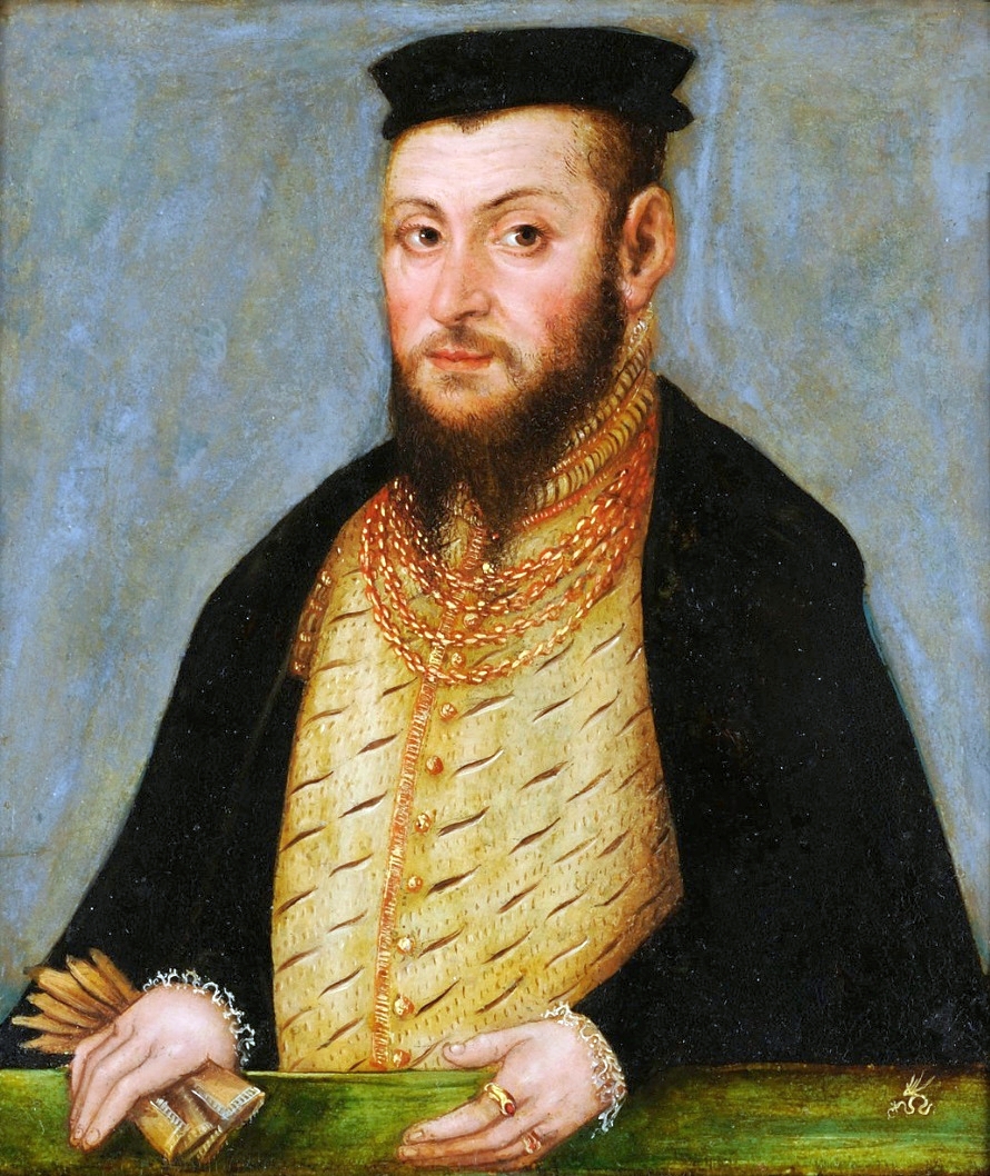
Presumably Jogaila's image from around 1475-1480.
Presumably Jogaila's image from around 1475-1480. Unknown authorUnknown author · Public domain · Commons

The Jagiellonian dynasty (US:; US:; Lithuanian: Jogailaičių dinastija; Polish: dynastia jagiellońska), also known as the House of Jagiellon (Polish: Dom Jagiellonów) or simply the Jagiellons (Lithuanian: Jogailaičiai; Polish: Jagiellonowie; Latin: Iagellonidae), was a cadet branch of the Lithuanian ducal dynasty of Gediminids. The Jagiellons reigned in several European countries between the 14th and 16th centuries.

From Wikipedia: Jagiellonian dynasty (CC BY-SA 4.0)

Origins and Founding

King Władysław II Jagiełło, detail of the Triptych of Our Lady of Sorrows in the Wawel Cathedral.
King Władysław II Jagiełło, detail of the Triptych of Our Lady of Sorrows in the Wawel Cathedral. Unknown authorUnknown author · Public domain · Commons

The rule of Piasts, the earlier Polish ruling house (c. 962–1370) had ended with the death of King Casimir III the Great. Gediminids, the immediate predecessors of the first Jagiellonian, were rulers of medieval Lithuania with the title of Grand Duke. Their realm, the Grand Duchy of Lithuania, was chiefly inhabited by Lithuanians and Ruthenians.

Read more

Jogaila, the eponymous first ruler of the Jagiellonian dynasty, started as the Grand Duke of Lithuania. As a result of the Union of Krewo he then converted to Christianity and married the 12-year-old Queen Jadwiga of Poland (daughter of King Louis I of Hungary from the Angevins Dynasty). Thereby he became King of Poland as her co-ruler.

From Wikipedia: Jagiellonian dynasty · Pre-dynasty background (CC BY-SA 4.0)

Founder
Władysław II Jagiełło
Founded
1450 CE

Coins, Currency and Symbols

Wars and Battles

The influence of the Jagiellonian dynasty in Central Europe had been on the rise. In 1471 Casimir's son Vladislaus II became a king of Bohemia, and in 1490 also of Hungary. The southern and eastern outskirts of Poland and Lithuania became threatened by Turkish invasions beginning in the late 15th century. Moldavia's involvement with Poland goes back to 1387, when Peter I, Hospodar of Moldavia, seeking protection against the Hungarians, paid Jagiełło homage in Lviv, which gave Poland access to the Black Sea ports. In 1485 King Casimir undertook an expedition into Moldavia, after its seaports were overtaken by the Ottoman Turks. The Turkish controlled Crimean Tatars raided the eastern territories in 1482 and 1487, until they were confronted by King John Albert, Casimir's son and successor. Poland was attacked in 1487–1491 by remnants of the Golden Horde.

From Wikipedia: Jagiellonian dynasty · Kingdom of Poland: Turkish and Tatar wars (CC BY-SA 4.0)

Achievements and Monuments

The Polish "Golden Age", the period of the reigns of Sigismund I and Sigismund II, the last two Jagiellonian kings, or more generally the 16th century, is most often identified with the rise of the culture of Polish Renaissance. The cultural flowering had its material base in the prosperity of the elites, both the landed nobility and urban patriciate at such centers as Kraków and Gdańsk. As was the case with other European nations, the Renaissance inspiration came in the first place from Italy, a process accelerated to some degree by the marriage of Sigismund I to Bona Sforza. Many Poles traveled to Italy to study and to learn its culture. As imitating Italian ways became very trendy (the royal courts of the two kings provided the leadership and example for everybody else), many Italian artists and thinkers were coming to Poland, some settling and working there for many years.

From Wikipedia: Jagiellonian dynasty · Kingdom of Poland: Golden Age of Polish culture (CC BY-SA 4.0)

Qasim Khanate

1453 CE – 1551 CE · Capital: Kasimov · 24,701 km²

Machmud khan - reconstruction
Machmud khan - reconstruction Т. С. Балуева · CC BY-SA 4.0 · Commons

The Qasim Khanate (also called Qasimov, Kasimov, or Kasim), also known as the Tsardom of Kasimov (Russian: Касимовское царство), was a Tatar-ruled khanate which existed from 1452 until 1681 in the territory of the Russian state. It was located within modern-day Ryazan Oblast with its capital at Kasimov, in the middle course of the Oka River. It was initially in the sphere of influence of the Grand Principality of Moscow and then was dependent on the Tsardom of Russia.

From Wikipedia: Qasim Khanate (CC BY-SA 4.0)

Origins and Founding

The original populations were the Volga Finnic tribes of the Meshchyora, Muroma and Mordvins. The lands were originally under the influence of Kievan Rus' and Volga Bulgaria. Local tribes were tributaries of Russian princes. Later, the area was incorporated into Vladimir-Suzdal. In 1152, Grand Prince Yuri Dolgoruky founded Gorodets-Meshchyorskiy. After the Mongol invasions, the territory was incorporated into the territory of the Golden Horde. Turkic settlers appeared in those areas, and most of them accepted Islam under the influence from the Volga Bulgars.

Read more

According to some historians, such as Mikhail Khudyakov, the defeated Muscovite prince Vasily executed the claim and Moxammat's son Qasim was crowned as a ruler of the Meshchyora lands. The area and capital were renamed after him.

From Wikipedia: Qasim Khanate · History: Origins (CC BY-SA 4.0)

Founded
1453 CE

Rulers

Government, Society and Religion

The land was inhabited mainly by Mordvins, some of them as well as other Volga Finnic peoples like the Meshchyora and Muroma have been assimilated by Tatars and became Mishar Tatars. Later, the land was settled by the Russians. Some Kazan Tatars resettled to Qasim lands, and were called Qasim Tatars. Most of the Qasim Tatars served at the khan's palace or served in the khan's military. This group had been assimilated into the Mishar Tatars, but nearly 1,000 Qasim Tatars are still living in the city of Kasimov.

Read more

The noble families were the Manghyt (Manğıt), Arghyn (Arğın), Jalair (Cälair), Qipchaq (Qıpçaq). Moscow's administrators elected the khans from ruling families of the Tatar khanates: Khanate of Kazan, the Crimean Khanate, and the Siberia Khanate.

From Wikipedia: Qasim Khanate · Population (CC BY-SA 4.0)

Government
elective monarchy
Languages
Kipchak languages

Decline and Fall

Ended
1551 CE
Last recorded ruler
Shahghali

Ryazan

1453 CE – 1520 CE · Capital: Staraya Ryazan · 17,389 km²

Andrei I Bogolyubsky, fresco of the Archangel Cathedral
Andrei I Bogolyubsky, fresco of the Archangel Cathedral Unknown authorUnknown author · CC BY-SA 4.0 · Commons

The Principality of Ryazan, later known as the Grand Principality of Ryazan, was a Russian principality from 1129 to 1521. Its capital was the city of Ryazan, now known as Old Ryazan, which was destroyed in 1237 during the Mongol invasions. The capital was moved to Pereyaslavl-Ryazansky, later renamed Ryazan. Initially a part of the Principality of Murom, it fully split off from the Principality of Chernigov by 1129 as Murom-Ryazan.

From Wikipedia: Principality of Ryazan (CC BY-SA 4.0)

Origins and Founding

Initially a part of the Principality of Chernigov, Murom-Ryazan became a separate principality under the reign of Yaroslav Sviatoslavich after he was ousted from Chernigov by Vsevolod Olgovich, which remained in possession of his descendants after he died in 1129.

Read more

The political centre of the principality was later moved to Ryazan. By the end of the 12th century, the principality waged wars with the neighbouring Grand Duchy of Vladimir. In the course of that stand-off, the city of Ryazan was burned twice in a span of twenty years from 1186 to 1208. In 1217, there was a culmination point in the history of Ryazan when during the civil war inside the Duchy six leaders of the state were killed by Gleb Vladimirovich who later defected to the Cumans.

From Wikipedia: Principality of Ryazan · History: Early history (CC BY-SA 4.0)

Founded
1453 CE

Capitals

Ансамбль Кремля (Рязанский историко-архитектурный музей-заповедник): Кремль, Рязань, Рязанская область
Ансамбль Кремля (Рязанский историко-архитектурный музей-заповедник): Кремль, Рязань, Рязанская область Ted.ns · CC BY-SA 4.0 · Commons
Ryazan
Capital
Staraya Ryazan
Capital

Rulers

Government, Society and Religion

Government
feudal monarchy
Languages
Church Slavonic

Wars and Battles

Astrakhan Khanate

1468 CE – 1768 CE · Capital: Astrakhan (Xacitarxan) · 162,622 km²

Conquest of the Astrakhan Khanate
Conquest of the Astrakhan Khanate Koryakov Yuri · CC BY 2.5 · Commons

The Khanate of Astrakhan was a Tatar rump state of the Golden Horde. The khanate existed in the 15th and 16th centuries in the area adjacent to the mouth of the Volga river, around the modern city of Astrakhan. Its khans claimed patrilineal descent from Toqa Temür, the thirteenth son of Jochi and grandson of Genghis Khan. Mahmud bin Küchük established the Khanate in the 1460s. The capital was the city of Xacitarxan, also known as Astrakhan in Russian chronicles.

From Wikipedia: Astrakhan Khanate (CC BY-SA 4.0)

Rulers

Government, Society and Religion

Most of the population of the Astrakhan khanate were Astrakhan Tatars and Nogais. Merchants carried on a transit trade between Muscovy, Kazan, Crimea, Central Asia, and the Transcaucasus region.

Read more

The nobility consisted of feudal ranks, which were, from highest to lowest: the khan, sultans, begs, and morzalar. The rest of the population were known as qara xalıq, ('black people', or more accurately in Old Turkic, "great creation" implying 'the creatures at large" or common folks, when "qara" stood for "big" and "great" not just black, and "aq" (white), stood also for delicate, small, dainty etc.), the standard Turkic designation for commoners.

The state religion was Sunni Islam. With its conquest by the Russians in 1556, Sunni Islam was largely replaced by Russian Orthodox Christianity, though the region to this day is home to a Sunni Muslim minority. The Kalmyks are largely Buddhist.

From Wikipedia: Astrakhan Khanate · Demography and society (CC BY-SA 4.0)

Government
Khanate
Languages
Kipchak languages
Religion
Sunni Islam

Wars and Battles

Duchy of Prussia

1526 CE – 1618 CE · Capital: Königsberg · 38,518 km²

Photo of old cathedral of Kaliningrad in Russia (former Prussian Königsberg)
Photo of old cathedral of Kaliningrad in Russia (former Prussian Königsberg) Gumerov Ildar · Public domain · Commons

The Duchy of Prussia (German: Herzogtum Preußen, Polish: Księstwo Pruskie, Lithuanian: Prūsijos kunigaikštystė) or Ducal Prussia (German: Herzogliches Preußen; Polish: Prusy Książęce) was a duchy in the region of Prussia established as a result of secularization of the Monastic Prussia, the territory that remained under the control of the State of the Teutonic Order until the Protestant Reformation in 1525.

From Wikipedia: Duchy of Prussia (CC BY-SA 4.0)

Origins and Founding

As Protestantism spread among the laity of the Teutonic Monastic State of Prussia, dissent began to develop against the Roman Catholic rule of the Teutonic Knights, whose Grand Master, Albert, Duke of Prussia, a member of a cadet branch of the House of Hohenzollern, lacked the military resources to assert the order's authority.

Read more

After losing a war against the Kingdom of Poland, and with his personal bishop, Georg von Polenz of Pomesania and of Samland, who had converted to Lutheranism in 1523, and a number of his commanders already supporting Protestant ideas, Albert began to consider a radical solution.

At Wittenberg in 1522, and at Nuremberg in 1524, Martin Luther encouraged him to convert the order's territory into a secular principality under his personal rule, as the Teutonic Knights would not be able to survive the Reformation.

From Wikipedia: Duchy of Prussia · History: Background (CC BY-SA 4.0)

Founded
1526 CE

Capitals

Königsberg Castle and Monument for the german Emperor William I. in Königsberg (Preußen) (nowadays Kaliningrad, Russia)
Königsberg Castle and Monument for the german Emperor William I. in Königsberg (Preußen) (nowadays Kaliningrad, Russia) Unknown authorUnknown author · Public domain · Commons
Kaliningrad
Capital
Königsberg
Capital

Rulers

Government, Society and Religion

Government
Feudal monarchy
Languages
Low German, German, Polish, Lithuanian, Old Prussian
Religion
Lutheranism

Coins, Currency and Symbols

Currency
Thaler
  • Flag of Ducal Prussia
    Flag of Ducal Prussia Orange Tuesday · Public domain · Commons
  • POL Prusy książęce COA
    POL Prusy książęce COA Bastianow · Public domain · Commons

Wars and Battles

Don Cossacks

1552 CE – 1641 CE · 126,354 km²

Донские казаки ст. Ново-Николаевской, начало ХХ века
Донские казаки ст. Ново-Николаевской, начало ХХ века not specified · Public domain · Commons

Don Cossacks (Russian: Донские казаки, romanized: Donskiye kazaki, Ukrainian: Донські козаки, romanized: Donski kozaky) or Donians (Russian: донцы, romanized: dontsy, Ukrainian: донці, romanized: dontsi), are Cossacks who settled along the middle and lower Don.

From Wikipedia: Don Cossacks (CC BY-SA 4.0)

Origins and Founding

The exact origins of Cossacks remain unclear. In the modern view, Don Cossacks descend from Slavic people connected with Russian lands like the Povolzhye, the Novgorod Republic, and the Principality of Ryazan, and Ukrainian lands like the Dnieper. As well as nomadic Turkic tribes inhabiting the Steppes. Gotho-Alans could also have played a role in forming Don Cossack culture, which originated in the western part of the North Caucasus.

From Wikipedia: Don Cossacks · Origins (CC BY-SA 4.0)

Founded
1552 CE

Government, Society and Religion

Most Don Cossacks are Russian Orthodox, who consider themselves guardians of the faith. However, a large percentage of Don Cossacks were Starovers. Even in 1903, a minimum of 150,000 from a total of the 2,500,000 parish members of the Don Eparchy were Starovers. Ataman count Matvei Platov was of a Popovtsy Old Believers Family. Don Cossacks were tolerant of other religions.

From Wikipedia: Don Cossacks · Religion (CC BY-SA 4.0)

Languages
Don Gutar (Southern Russian dialect)
Religion
Predominantly Russian Orthodox, Minority Old Believers
Population
0.2–2 million

Wars and Battles

In April 1936, the earlier ban on Cossacks serving in the Red Army was lifted. Later in 1936, two existing Red Army cavalry divisions were re-designated as Don Cossacks. In 1939, a number of these regiments were issued with traditional Cossack uniforms, in ceremonial and field service versions. The dress of the Don Cossack units included dark-blue breeches with broad red stripes which had distinguished them prior to the Revolution.

Read more

The Don Cossack Cavalry Corps saw extensive active service until 1943, after which its role diminished, as did that of the other remaining horse-mounted units in the Red Army. However Don Cossack cavalry was still in existence in 1945 and participated in the Victory Parade in Moscow.

From Wikipedia: Don Cossacks · History: Don Cossacks in World War II (CC BY-SA 4.0)

Achievements and Monuments

The Don Cossack Choir Serge Jaroff was a group of former officers of the Russian Imperial Army who were discovered singing in Çilingir (near Constantinople), where they had fled after the defeat of their army in the Crimea. They made their formal concert debut in Vienna in 1923, led by their founder, conductor and composer, Serge Jaroff.

Read more

The choir became popular in America, Japan and Europe, touring the world in the 1930s, 40s and 50s, till today. The men, dressed as Cossacks, sang a cappella in a repertory of Russian sacred and secular music, army, folk and art songs. Cossack dancing was eventually added to their programme.

From Wikipedia: Don Cossacks · Traditions and culture: Don Cossack Choir Serge Jaroff (CC BY-SA 4.0)

Polish-Lithuanian Commonwealth

1572 CE – 1793 CE · Capital: ubli · 950,896 km²

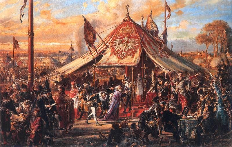
The Republic at Zenith of Power. Golden Liberty. Election A.D. 1573.
The Republic at Zenith of Power. Golden Liberty. Election A.D. 1573. Jan Matejko · Public domain · Commons

The Polish–Lithuanian Commonwealth, also referred to as Poland–Lithuania or the First Polish Republic (Polish: I Rzeczpospolita), was a federative real union between the Kingdom of Poland and the Grand Duchy of Lithuania, existing from 1569 to 1795. This state was among the largest, most populated countries of 16th- to 18th-century Europe. At its peak in the early 17th century, the Commonwealth spanned approximately 1,000,000 km2 (390,000 sq mi) and supported a multi-ethnic population of around 12 million as of 1618.

From Wikipedia: Polish–Lithuanian Commonwealth (CC BY-SA 4.0)

Origins and Founding

Founded
1572 CE

Capitals

Castle Square, Warsaw
Castle Square, Warsaw Rhododendrites · CC BY-SA 4.0 · Commons

Rulers

Government, Society and Religion

John Sobieski's death in 1696 arguably ended the period of national sovereignty, and Poland's relative authority over the region dwindled swiftly. By the 18th century, destabilization of its political system brought the Commonwealth to the brink of civil war and the state became increasingly susceptible to foreign influence. The remaining European powers perpetually meddled in the country's affairs. Upon the death of a king, several royal houses actively intruded in the hope of securing votes for their desired candidates. The practice was common and apparent, and the selection was often the result of hefty bribes directed at corrupt nobles. Louis XIV of France heavily invested in François Louis, Prince of Conti, in opposition to James Louis Sobieski, Maximilian Emanuel of Bavaria and Frederick Augustus of Saxony.

From Wikipedia: Polish–Lithuanian Commonwealth · History: Political turmoil and the enlightenment (1697–1771) (CC BY-SA 4.0)

Government
Noble's democracy with an elected monarch
Languages
ubl
Religion
ubl

Economy and Trade

The economy of the Commonwealth was predominantly based on agricultural output and trade, though there was an abundance of artisan workshops and manufactories – notably paper mills, leather tanneries, ironworks, glassworks and brickyards. Some major cities were home to craftsmen, jewellers and clockmakers. The majority of industries and trades were concentrated in the Kingdom of Poland; the Grand Duchy of Lithuania was more rural and its economy was driven by farming and clothmaking. Mining developed in the south-west region of Poland which was rich in natural resources such as lead, coal, copper and salt. The currency used in Poland–Lithuania was the złoty (meaning "the golden") and its subunit, the grosz. Foreign coins in the form of ducats, thalers and shillings were widely accepted and exchanged. The city of Gdańsk had the privilege of minting its own coinage.

From Wikipedia: Polish–Lithuanian Commonwealth · Economy (CC BY-SA 4.0)

Coins, Currency and Symbols

Powstanie listopadowe 5 złotych 1831
Powstanie listopadowe 5 złotych 1831 Unknown author · CC BY-SA 3.0 · Commons
Currency
złoty, Polish złoty
  • Cours du Zloty face à l'Euro (en rouge) et au Dollar (en bleu) entre le 1er janvier 2004 et le 30 juin 2008.
    Cours du Zloty face à l'Euro (en rouge) et au Dollar (en bleu) entre le 1er janvier 2004 et le 30 juin 2008. Brial10 · CC BY-SA 3.0 · Commons
  • Coat of arms of the Polish-Lithuanian Commonwealth
    Coat of arms of the Polish-Lithuanian Commonwealth Avalokitesvara This W3C-unspecified vector image was created with Inkscape . using , by Sodacan, by Orem and unpublished Orders and Postument created by Steifer · CC BY-SA 3.0 · Commons

Wars and Battles

The military in the Polish–Lithuanian Commonwealth evolved from the merger of the armies from the Polish Kingdom and from the Grand Lithuanian Duchy, though each state maintained its own division. The united armed forces comprised the Crown Army (armia koronna), recruited in Poland, and the Lithuanian Army (armia litewska) in the Grand Duchy. The military was headed by the Hetman, a rank equivalent to that of a general or supreme commander in other countries. Monarchs could not declare war or summon an army without the consent of the Sejm parliament or the Senate. The Polish–Lithuanian Commonwealth Navy never played a major role in the military structure from the mid-17th century onwards.

From Wikipedia: Polish–Lithuanian Commonwealth · Military (CC BY-SA 4.0)

Achievements and Monuments

The Warsaw Confederation signed on 28 January 1573 secured the rights of minorities and religions; it allowed all persons to practice any faith freely, though religious tolerance varied at times. As outlined by Norman Davies, "the wording and substance of the declaration of the Confederation of Warsaw of were extraordinary with regards to prevailing conditions elsewhere in Europe; and they governed the principles of religious life in the Republic for over two hundred years." Subsequently, the Catholic church initiated a Counter-Reformation in Poland, relying heavily on methods of persuasion and legal means. As a result, compared to many other European countries, the conflict between the Catholics and the Protestants in Poland was relatively peaceful.

Read more

Poland retained religious freedom laws during an era when religious persecution was an everyday occurrence in the rest of Europe.

From Wikipedia: Polish–Lithuanian Commonwealth · Culture: Religion (CC BY-SA 4.0)

Decline and Fall

Portret Marii Karoliny de Bouillon
Portret Marii Karoliny de Bouillon Unknown artist Details on Google Art Project · Public domain · Commons
Ended
1793 CE
Last recorded ruler
Stanisław August Poniatowski

Legacy in the Modern World

The Duchy of Warsaw, established in 1807 by Napoleon Bonaparte, traced its origins to the Commonwealth. Other revival movements appeared during the November Uprising (1830–31), the January Uprising (1863–64) and in the 1920s, with Józef Piłsudski's failed attempt to create a Polish-led Intermarium (Międzymorze) federation that, at its largest extent, would span from Finland in the north to the Balkans in the south.

From Wikipedia: Polish–Lithuanian Commonwealth · Legacy (CC BY-SA 4.0)

Nalyvaiko Uprising

1595 CE – 1599 CE · 283,338 km²

Nalyvaiko Uprising 1594-1596
Nalyvaiko Uprising 1594-1596 User:Mathiasrex, Maciej Szczepańczyk, based on layers of User:Halibutt · CC BY-SA 3.0 · Commons

The Nalyvaiko Uprising (Polish: powstanie Nalewajki, Ukrainian: повстання Наливайка) was a Cossack rebellion against the Polish–Lithuanian Commonwealth. Headed by Severyn Nalyvaiko, it lasted from 1594 to 1596. The second in a long series of Cossack uprisings, the conflict was ultimately won by the Crown of Poland, but two years of warfare and scorched-earth tactics employed by both sides left much of Right-bank Ukraine in ruins.

From Wikipedia: Nalyvaiko Uprising (CC BY-SA 4.0)

Origins and Founding

The steppe borderland between Poland–Lithuania, Muscovy, various Tatar states (under influence from the Ottomans), and the Black Sea was mostly under control of the Polish–Lithuanian Commonwealth, at least since the fall of Kievan Rus'. However, control over such a huge area was never direct and far from complete. The vast, scarcely populated areas of what is now Ukraine (the name itself could be translated as Borderlands) had been attracting all sorts of people, from adventurers to brigands, foreign merchants, landless gentry, and runaway serfs. Over time a certain common identity started to form among them, giving birth to the Cossacks.

From Wikipedia: Nalyvaiko Uprising · Background (CC BY-SA 4.0)

Founded
1595 CE

Kalmyk Khanate

1632 CE – 1771 CE · Capital: Ayuka Khan's residence (1697–1724) · 175,318 km²

The Kalmyk Khanate (Kalmyk: Хальмг хана улс, Xal'mg xana uls) was an Oirat Mongol khanate on the Eurasian steppe. It extended over modern Kalmykia and surrounding areas in the North Caucasus, including Stavropol and Astrakhan. During their independence, the Kalmyks both raided and allied with Russia in turn, engaging in numerous military expeditions against the Crimean Tatars, the Ottoman Empire, neighboring Muslim tribes, and the highlanders of the North Caucasus. The Khanate was annexed by the Russian Empire in 1771.

From Wikipedia: Kalmyk Khanate (CC BY-SA 4.0)

Rulers

  • Kho Orluk (first)
  • Ubashi Khan (last)

Government, Society and Religion

Government
Hereditary monarchy
Languages
Kalmyk, Russian
Religion
Tibetan Buddhism (Gelug and Karma Kagyu)

Wars and Battles

Zaporozhian Cossacks

1662 CE – 1774 CE · 121,080 km²

Zaporozhye Cossacks label QS:Lfr,"Les Cosaques zaporogues écrivant une lettre au sultan de Turquie"label QS:Len,"The Zaporozhye Cossacks Replying to the Sultan"label QS:Lde,"Saporoschzen schreiben dem türkischen Sultan…
Zaporozhye Cossacks label QS:Lfr,"Les Cosaques zaporogues écrivant une lettre au sultan de Turquie"label QS:Len,"The Zaporozhye Cossacks Replying to the Sultan"label QS:Lde,"Saporoschzen schreiben dem türkischen Sultan… Ilya Repin · Public domain · Commons

The Zaporozhian Cossacks or Zaporizhian Cossacks, also known as the Zaporozhian Cossack Army or the Zaporozhian Host, were Cossacks who lived beyond (that is, downstream from) the Dnieper Rapids. They were predominantly Ruthenians, but also included other ethnic groups (most notably their kish otaman Ivan Sirko was of Moldavian origin). Scientific studies conducted on the Zaporozhian Cossack genetics show that their Y-chromosomal genetic makeup forms the southern fragment of East Slavic population, with minimal levels to absence of Caucasian and Asian component in their paternal gene pool.

From Wikipedia: Zaporozhian Cossacks (CC BY-SA 4.0)

Origins and Founding

It is not clear when the first Cossack communities on the Lower Dnieper began to form. There are signs and stories of similar people living in the Eurasian Steppe as early as the 12th century. At that time they were not called Cossacks, since cossack is a word that also in Turkic language means a "free man" which shares its etymology with the ethnonym "Kazakh". It later became a Ruthenian (Middle Ukrainian) and Muscovite (Middle Russian) word for "freebooter." The steppes to the north of the Black Sea were inhabited by nomadic tribes such as the Cumans, Pechenegs and Khazars. The role of these tribes in the ethnogenesis of the Cossacks is disputed, although later Cossack sources claimed a Slavicised Khazar ancestry.

Read more

There were also groups of people who fled into these wild steppes from the cultivated lands of Kievan Rus' in order to escape oppression or criminal pursuit.

From Wikipedia: Zaporozhian Cossacks · Origins (CC BY-SA 4.0)

Founded
1662 CE

Government, Society and Religion

The most important items of the host were the Cossack Kleinody (always in plural; related to Imperial Regalia) that consisted of valuable military distinctions, regalia, and attributes of the Ukrainian Cossacks and were used until the 19th century. Kleinody were awarded to Zaporozhian Cossacks by the Polish king Stephen Báthory on 20 August 1576 to Bohdan Ruzhynsky, among which were khoruhva, bunchuk, bulawa "mace" and a seal with a coat of arms on which was depicted a cossack with a samopal "rifle". The kleinody were assigned to hetman's assistants for safekeeping, thus there have appeared such ranks as chorąży ("flag-bearer"), bunchuzhny ("staff-keeper"), etc. Later part of Cossack kleinody became pernaches, timpani (lytavry), kurin banners (badges), batons, and others.

Read more

The highest symbol of power was the bulawa or mace carried by hetmans and kish otamans.

From Wikipedia: Zaporozhian Cossacks · Organization: Cossack Regalia (Kleinody) (CC BY-SA 4.0)

Wars and Battles

Decline and Fall

With this we would like to let our Empire and our faithful subjects be known that the Zaporozhian Sich is now destroyed and the name of Zaporozhian Cossacks is to be no more as well, mentioning of whom will be considered no less as an affront to our Imperial Majesty for their deeds and insolence for disobeying the will of our Imperial Majesty.

Read more

On 5 June 1775 General Tekeli's forces divided into five detachments and surrounded the Sich with artillery and infantry. The lack of southern borders and enemies in the past years had a profound effect on the combat-ability of the Cossacks, who realised the Russian infantry would destroy them after they were surrounded. To trick the Cossacks, a rumour was spread that the army was crossing Cossack lands en route to guard the borders. The surprise encirclement was a devastating blow to the morale of the Cossacks.

From Wikipedia: Zaporozhian Cossacks · The end of the Zaporozhian Host (1775) (CC BY-SA 4.0)

Ended
1774 CE

Legacy in the Modern World

Although in 1775 the Zaporozhian Host formally ceased to exist, it left a profound cultural, political and military legacy on Ukraine, Russia, Poland, Turkey and other states that came in contact with it. The shifting alliances of the Cossacks have generated controversy, especially during the 20th century. For Russians, the Treaty of Pereyaslav gave the Tsardom of Russia and later Russian Empire the impulse to take over the Ruthenian lands, claim rights as the sole successor of the Kievan Rus', and for the Russian Tsar to be declared the protector of all Russias, culminating in the Pan-Slavism movement of the 19th century.

Read more

Today, most of the Kuban Cossacks, modern descendants of the Zaporozhians, remain loyal towards Russia.

From Wikipedia: Zaporozhian Cossacks · Legacy (CC BY-SA 4.0)

Sloboda Ukraine

1670 CE – 1768 CE · Capital: Kharkiv · 98,599 km²

Museum of folk architecture in Sloboda Ukraine. Village Prelesne. Donetsk region. Ukraine.
Museum of folk architecture in Sloboda Ukraine. Village Prelesne. Donetsk region. Ukraine. Yakudza · CC BY-SA 3.0 · Commons

Sloboda Ukraine, also known locally as Slobozhanshchyna or Slobozhanshchina, is a historical region in northeastern Ukraine and southwestern Russia. It developed from Belgorod Razriad and flourished in the 17th and 18th centuries on the southwestern frontier of the Tsardom of Russia. In 1765, it was converted into the Sloboda Ukraine Governorate.

From Wikipedia: Sloboda Ukraine (CC BY-SA 4.0)

Wars and Battles

During World War II, Polish prisoners-of-war was held in a Soviet POW camp in Starobilsk, and then some 3,900 were mass murdered by the NKVD in Kharkiv and secretly buried in Piatykhatky in 1940 (Katyn massacre). From 1941/1942 to 1943, the region was occupied by Germany. At Drobytsky Yar, German occupiers mass murdered an estimated 16,000 to 30,000 people, mostly Jews. In January 1944, the 1st Reserve Infantry Regiment of the 1st Corps of the Polish Armed Forces was stationed in Sumy, and soon the Main Formation Staff of the First Polish Army was established in Sumy. In 1944, about 30,000 Polish soldiers were stationed and underwent military training in Sumy before rejoining the fight against Germany.

From Wikipedia: Sloboda Ukraine · History: World War II (CC BY-SA 4.0)

Pro-Swedish Poland

1706 CE – 1712 CE · 758,657 km²

Victory for Charles XII of Sweden; Karl XII (1697-1718); against Saxony;
Victory for Charles XII of Sweden; Karl XII (1697-1718); against Saxony; Daniel Stawert · Public domain · Commons

The Swedish invasion of Poland (1701–1706), also known as Charles XII's invasion of Poland or the Polish front of the Great Northern War, was a conflict in eastern Europe overshadowed by the ongoing Great Northern War fought between Sweden, on the one side, and Russia, Denmark-Norway, Saxony and the Polish–Lithuanian Commonwealth on the other side. The Polish front was a major part of the greater conflict, and it included some decisive battles in favor of the Swedes that contributed to the length of the war (21 years).

From Wikipedia: Swedish invasion of Poland (1701–1706) (CC BY-SA 4.0)

Origins and Founding

Augustus the Strong had won the Polish crown by military force after a violent election. Among his opponents were the primates of Poland, most notably cardinal Michał Stefan Radziejowski, archbishop of Gniezno, as well as the powerful Sapieha family. Although these factions had promised not to work against Augustus, the agreement was very unstable. To increase his own authority and put down any rebellious elements within his country, the elected monarch considered an invasion of Swedish Livonia to be the best choice: not only would this restore a part of Poland's former territorial conquests, but it would also put down the Swedish Empire's ability to interfere with Polish affairs. With promised support from tsar Peter in Russia, and Sweden's ongoing conflict with Denmark-Norway in the west, the Polish monarch believed it was going to be an easy victory.

From Wikipedia: Swedish invasion of Poland (1701–1706) · Background (CC BY-SA 4.0)

Founded
1706 CE

Wars and Battles

When the fighting between Sweden and Poland had ceased the task remained for Charles XII to secure the new order against coup attempts from the Saxons and Augustus' ally tsar Peter. Throughout the time of the war Peter had been desperately trying to modernize his outdated army after the defeat at Narva, even though the Russian military was adequate to operate against poorly defended cities throughout the Swedish Baltic provinces. After Wolmar von Schlippenbach's failures in the battles of Erastfer and Hummelshof, the Russians had conquered Nöteborg and Nyenskans, as well as beginning the construction of Petersburg, which would become their first naval base in the Baltic sea. Throughout 1704 Dorpat and Narva had also been lost.

From Wikipedia: Swedish invasion of Poland (1701–1706) · War in Saxony (CC BY-SA 4.0)

Early Modern States of Eastern Europe: Frequently Asked Questions

Which states existed in Eastern Europe in this period?

This page maps 13 states of Eastern Europe founded between 1450 CE and 1706 CE: Crimean Khanate, House of Jagiellon, Qasim Khanate, Ryazan, Astrakhan Khanate, Duchy of Prussia, Don Cossacks, Polish-Lithuanian Commonwealth, Nalyvaiko Uprising, Kalmyk Khanate, Zaporozhian Cossacks, Sloboda Ukraine and 1 more.

Which was the largest of the Early Modern States of Eastern Europe?

House of Jagiellon had the largest mapped extent, about 1,054,018 km².

Which of the Early Modern States of Eastern Europe lasted longest?

Crimean Khanate lasted longest, 1450 CE – 1782 CE.

Sources

  • Reading text: Wikipedia articles on the group and each state, condensed (CC BY-SA 4.0).
  • Facts, rulers and wars: Wikidata (CC0).
  • Borders: Cliopatria, Seshat Global History Databank (CC BY 4.0).
  • Pictures: Wikimedia Commons; the author and licence are under each picture.

Largest state by mapped extent: House of Jagiellon.