Skip to content
YearMaps
3 states1547 CE – 1802 CE

Early Modern States of Mesoamerica and the Caribbean: Map & History

3 states of Mesoamerica and the Caribbean on one map, from 1547 CE to 1802 CE.The largest, English Colonial Empire, covered about 227,770 km². Each has its own section below with its rulers, capitals, wars and pictures where the records hold them.

View of Haiti taken during ISS Expedition 20.
Earth Science and Remote Sensing Unit, Lyndon B. Johnson Space Center · Public domain · Commons
Base map
1547 AD
1609 AD
1802 AD
1547 AD
1600 AD
1675 AD
1750 AD
1802 AD
Epochs:
↗
↗
↗
↗
↗
↗
↗
↗

Each state in its own colour. Move the timeline to see which existed in any year from 1547 to 1802; select a territory to read about it. Borders: Cliopatria / Seshat (CC BY 4.0).

The Early Modern States of Mesoamerica and the Caribbean Compared

StateYearsCapitalLargest extentRulers
Itza Mayans1547 CE – 1699 CE–33,237 km²–
English Colonial Empire1609 CE – 1779 CE–227,770 km²–
Haiti1792 CE – 1802 CEPort-au-Prince31,347 km²13

Timeline of the Early Modern States of Mesoamerica and the Caribbean

When each state existed, 1547 CE to 1802 CE. Select a year to see the map then.

  1. Itza Mayans
    1547 CE – 1699 CE
  2. English Colonial Empire
    1609 CE – 1779 CE
  3. Haiti
    1792 CE – 1802 CE

The 3 States

Itza Mayans

1547 CE – 1699 CE · 33,237 km²

The Itza are a Maya ethnic group. They are descendants of the Chanes from the Chontal region of Tabasco. They migrated to Bacalar and northern Yucatán during the 10th century, later arriving to Champotón and finally in the 15th century settling around Lake Petén Itzá where they remained independent until 1697. During the Spanish colonial era and later by the Guatemalan government, the Itza were victims of repressive policies that accelerated the extinction of the Itza culture and language, leading to the loss of much of their ethnic identity.

From Wikipedia: Itza people (CC BY-SA 4.0)

Government, Society and Religion

According to the census of 2002, there are 1,983 ethnic Itza, who retain some aspects of their indigenous culture. However, the Itza language is now almost extinct. Data taken from the Summer Institute of Linguistics (SIL) suggest there were only twelve fluent Itza speakers left in 1986 and 60 non-fluent speakers in 1991. According to a census of 2002, there were still 1094 speakers. However the number of speakers has decreased to only 36 native and fluent speakers, all of them elder people. The Mayan word itza means 'enchanted waters' and may have been adopted from the name of the lake itself.

From Wikipedia: Itza people · Numbers of ethnic group members and Itza speakers (CC BY-SA 4.0)

Languages
Spanish, formerly Itzaʼ
Religion
Christianity, (Roman Catholic, Evangelical)

Wars and Battles

English Colonial Empire

1609 CE – 1779 CE · 227,770 km²

The English overseas possessions, sometimes referred to as the English Empire, comprised a variety of overseas territories and colonies that were conquered or otherwise acquired by the Kingdom of England before 1707 when the Acts of Union joined England with the Kingdom of Scotland and created of the Kingdom of Great Britain. Formerly Scots were excluded from English overseas possessions, but following 1707 they could participate in the expanding British Empire.

From Wikipedia: English overseas possessions (CC BY-SA 4.0)

Origins and Founding

Spanish success in exploration and colonization in the Western Hemisphere, beginning in the late 1400s and early 1500s, were an inspiration and a model for the English. The voyages of Christopher Columbus began in 1492, sailing west into the unknown with hopes of reaching Asia. He sighted land in the West Indies on 12 October that year, and in 1493 returned to colonize one of the islands he mistook for "the Indies" and named the indigenous peoples "Indians". The Spanish colonists sought riches, but except for gold the indigenous fashioned into ornaments, there was no great treasure. The Spanish essentially enslaved the indigenous populations.

From Wikipedia: English overseas possessions · Origins: New World beginnings (CC BY-SA 4.0)

Founded
1609 CE

Economy and Trade

In 1621, following a downturn in overseas trade which had created financial problems for the Exchequer, King James instructed his Privy Council to establish an ad hoc committee of inquiry to look into the causes of the decline. This was called The Lords of the Committee of the Privy Council appointed for the consideration of all matters relating to Trade and Foreign Plantations. Intended to be a temporary creation, the committee, later called a 'Council', became the origin of the Board of Trade which has had an almost continuous existence since 1621. The Committee quickly took a hand in promoting the more profitable enterprises of the English possessions, and in particular the production of tobacco and sugar.

From Wikipedia: English overseas possessions · Council of Trade and Foreign Plantations (CC BY-SA 4.0)

Decline and Fall

Ended
1779 CE
Succeeded by
British Empire

Haiti

1792 CE – 1802 CE · Capital: Port-au-Prince · 31,347 km²

View of Haiti taken during ISS Expedition 20.
View of Haiti taken during ISS Expedition 20. Earth Science and Remote Sensing Unit, Lyndon B. Johnson Space Center · Public domain · Commons

Haiti, officially the Republic of Haiti, is a country in the Caribbean on the island of Hispaniola in the Caribbean Sea, east of Cuba and Jamaica and south of The Bahamas. It occupies the western side of the island, which it shares with the Dominican Republic. Haiti is the third largest country in the Caribbean by area, and with an estimated population of 11.4 million, it is the most populous Caribbean country. The capital and largest city is Port-au-Prince. Haiti was originally inhabited by Indigenous peoples, known as the Taíno.

From Wikipedia: Haiti (CC BY-SA 4.0)

Rulers

Government, Society and Religion

The government is a semi-presidential republic, a multiparty system wherein the president of Haiti is head of state and elected directly by popular elections held every five years. A president cannot serve two consecutive terms or more than two terms in total, but can be reelected for a second term after an interval. The prime minister of Haiti acts as head of government and is appointed by the president, chosen from the majority party in the National Assembly. Executive power is exercised by the president and prime minister who together constitute the government. The president is the nominal commander-in-chief of the Armed Forces of Haiti and the National Police.

Read more

Legislative power is vested in the two chambers of the National Assembly of Haiti, the Senate and the Chamber of Deputies.

From Wikipedia: Haiti · Government and politics (CC BY-SA 4.0)

Government
Semi-presidential republic (de jure)
Languages
French, Haitian Creole

Economy and Trade

The economy of Haiti declined dramatically after the 2010 earthquake and subsequent outbreak of cholera, with the country's nominal GDP falling by 8% (from US$12.15 billion to US$11.18 billion). Since then it has grown to US$33.55 billion in nominal GDP as of 2025, and during the same time period it grew from $26.88 billion to $38.2 billion in PPP-adjusted GDP. Despite its tourism industry, Haiti is one of the poorest countries in the Americas, with corruption, political instability, poor infrastructure, lack of health care and lack of education cited as the main causes. Haiti ranked 145th of 182 countries in the 2010 United Nations Human Development Index, with 57.3% of the population being deprived in at least three of the HDI's poverty measures. As of 2021, about 30% of the population lived in extreme poverty (making less than US$2.15 a day), and 87.6% made less than US$6.85.

From Wikipedia: Haiti · Economy (CC BY-SA 4.0)

Coins, Currency and Symbols

Kurzy měn - Haitský gourde - HTG
Kurzy měn - Haitský gourde - HTG Kurzycz, http://www.kurzy.cz · CC BY-SA 4.0 · Commons
Currency
gourde, Haitian livre
  • Flag of Haiti
    Flag of Haiti (colours and size changes of the now deleted versions) Madden, Vzb83, Denelson83, Chanheigeorge, Zscout370 and Nightstallion Coat of arms :Lokal_Profil and Myri · Public domain · Commons
  • Coat of arms of Haiti
    Coat of arms of Haiti Lokal_Profil and Myriam Thyes · Public domain · Commons

Wars and Battles

Achievements and Monuments

Haitian art is distinctive, particularly through its paintings and sculptures. Brilliant colors, naïve perspectives, and sly humor characterize Haitian art. Frequent subjects in Haitian art include big, foods, landscapes, market activities, jungle animals, rituals, dances, and gods. As a result of a deep history and strong African ties, symbols take on great meaning within Haitian society. Many artists cluster in 'schools' of painting, such as the Cap-Haïtien school, which features depictions of daily life in the city, the Jacmel School, which reflects the steep mountains and bays of that coastal town, or the Saint-Soleil School, which is characterized by abstracted human forms and is heavily influenced by Vodou symbolism.

Read more

In the 1920s the indigéniste movement gained international acclaim, with its expressionist paintings inspired by Haiti's culture and African roots.

From Wikipedia: Haiti · Culture: Art (CC BY-SA 4.0)

Decline and Fall

Ended
1802 CE
Last recorded ruler
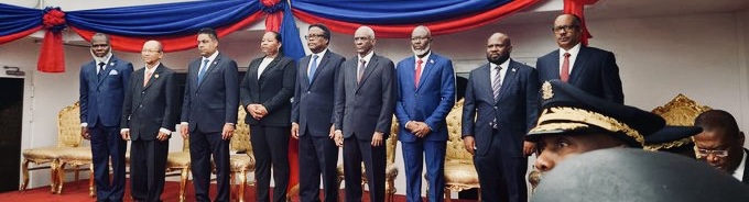
Transitional Presidential Council
Succeeded by
State of Haiti

Early Modern States of Mesoamerica and the Caribbean: Frequently Asked Questions

Which states existed in Mesoamerica and the Caribbean in this period?

This page maps 3 states of Mesoamerica and the Caribbean founded between 1547 CE and 1792 CE: Itza Mayans, English Colonial Empire, Haiti.

Which was the largest of the Early Modern States of Mesoamerica and the Caribbean?

English Colonial Empire had the largest mapped extent, about 227,770 km².

Which of the Early Modern States of Mesoamerica and the Caribbean lasted longest?

English Colonial Empire lasted longest, 1609 CE – 1779 CE.

Sources

  • Reading text: Wikipedia articles on the group and each state, condensed (CC BY-SA 4.0).
  • Facts, rulers and wars: Wikidata (CC0).
  • Borders: Cliopatria, Seshat Global History Databank (CC BY 4.0).
  • Pictures: Wikimedia Commons; the author and licence are under each picture.

Largest state by mapped extent: English Colonial Empire.