
Make a map of where you have been
Colour the countries you have visited, pin the cities you loved, draw the routes between them, and keep or share the map as a picture.
- Free
- No account
- Countries and cities
- Square picture for posts
Layers
Eraser
What it does
Erase from
Start with…
Colour the countries you have visited, pin the cities you loved, draw the routes between them, and keep or share the map as a picture.
What you can make
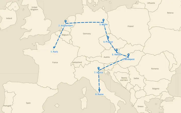 A rail trip across EuropeEight cities by train, with numbered markers and a dashed route.
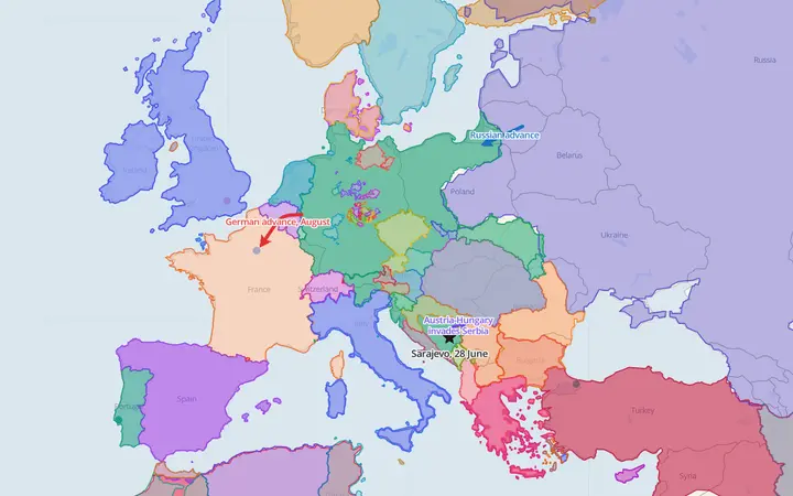 Europe in 1914The borders of 1914, with the first moves of the First World War drawn over them.
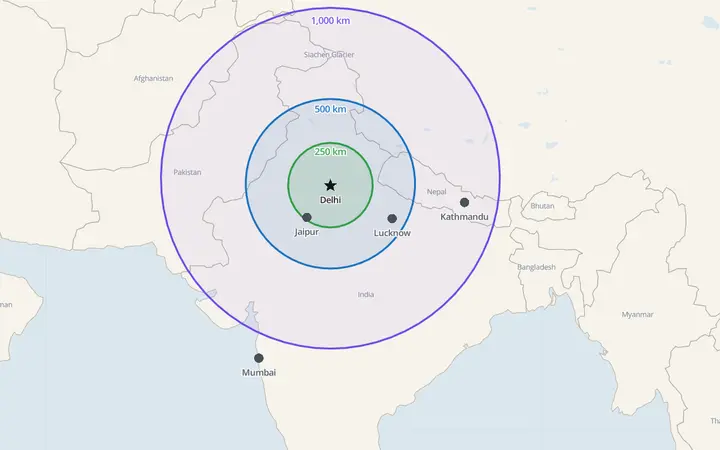 How far from Delhi?Circles of 250, 500 and 1,000 km measured on the globe, with the cities inside them.
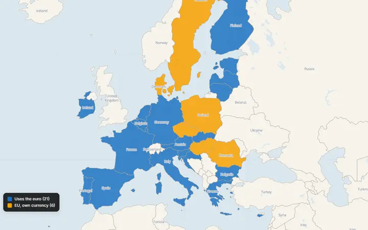 The euro area in 2026Countries coloured in with two legend colours: 21 use the euro, 6 EU members keep their own currency.
What you can do
Every drawing tool
Markers, text, lines, arrows, curved arrows, areas, boxes, circles, a freehand pen and a measuring tool.
Any year, 3000 BC to today
Move the timeline and the borders change with it. Give a drawing a start and end year and it appears only then.
Colour in countries
Tap countries, states, provinces or empires to colour them, with a legend of colours and patterns you can rename.
Real data underneath
Cities, rivers, voyages, World Heritage Sites, tectonic plates and more, ready to copy into your drawing.
True distances and areas
Circles of an exact radius, distances and areas, measured along the curve of the Earth.
Share and export
A link to share, PNG for slides, PDF for print, and GeoJSON, KML or GPX for other mapping tools.
How it works
Colour your countries
The world map is open: tap each country you have been to. Add a second colour, named "Want to go", for your list.
Pin your cities
Type a city in Add a place to drop a labelled marker on it, or tap the map with the Marker tool.
Draw the trips
Lines and curved arrows show the routes; a start and end year makes each trip appear on the timeline.
Share it
Export a square picture for social posts, or share a link friends can open and copy for their own map.
Data you can cite
- Natural EarthPublic domainCountries, coastlines and the simple base map
- Cliopatria (Seshat)CC BY 4.0Borders of 1,600+ states and empires, 3000 BC to today
- OpenStreetMapODbLStreets and places on the detailed base maps
- geoBoundariesOpen licences, per countryDistrict lines inside countries
Every exported picture prints the credits of the data on it. All sources: data sources.
Your maps stay yours
- Your map is saved in this browser as you draw. No account, no sign-in.
- Files you open (GeoJSON, KML, GPX, CSV) are read in your browser and never uploaded.
- A short link stores a copy of the map only when you make one, so the link works for anyone you send it to.
- What you draw is yours to use in lessons, articles, books and slides; keep the data credits on it.
Visit statistics and cookies are explained on the privacy page.
Questions
Does it count the countries I have coloured?
Yes. The Regions tab counts the coloured regions per legend colour, so the number of countries you have visited is always shown.
Can I keep my travel map private?
Yes. It is saved only in your browser until you share it. A short link stores a copy so the link works; a long link holds the whole map itself.
Is YearMaps Draw free?
Yes. Drawing, sharing links and exporting PNG, PDF, GeoJSON, KML and GPX files are all free, with no account. Exported pictures carry a small @yearmaps.com mark and the credits of the data on the map.
Do I need an account to save my map?
No. Your map is saved in your browser as you draw. To keep it elsewhere, share its link, or save a YearMaps file and open it again later from the File menu.
Can I use the maps I make?
Yes. The map belongs to you, in school work, articles, presentations and books. Keep the data credits printed on the picture: the borders come from Cliopatria (CC BY 4.0) and the base map from Natural Earth (public domain).
Can I import my own data?
Yes. Open or drop GeoJSON, KML, KMZ (Google Earth) and GPX (GPS) files onto the map. They are read in your browser and never uploaded.
More ways to use it
- Make a pin mapTap the map to drop pins, give each a label, an icon and a colour, or bring in a whole list of places from a spreadsheet with latitude and longitude.
- Draw a route on a mapTap stop after stop to draw a route, read its length as you go, then style it as a dashed trail, an arrow or a curve and add the stops as numbered markers.
- Colour a map of countriesTap countries to colour them, build a legend with names and patterns, and switch between the world, a continent or a country by its states.
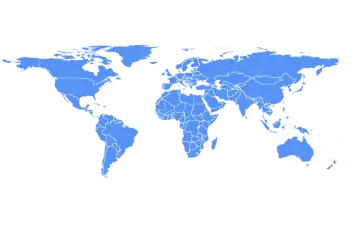 Blank world mapEvery country of the world, outlined and ready: print it blank for a quiz, or colour and label it online first.
- Make your own mapA free map maker in the browser.
- Draw on a mapMark places, draw routes and areas, measure distances, and sketch history over the borders of any year from 3000 BC to today.
Every map page on YearMaps has a Draw on this map button in its Share panel, which opens the same view here. See what's new in YearMaps Draw.