Early Modern and Modern States of East Africa and the Horn: Map & History
15 states of East Africa and the Horn on one map, from 1547 CE to 2024 CE.The largest, British East Africa, covered about 2,676,386 km²; the longest-lived, Federal Republic of Somalia, lasted 1960 CE – 2024 CE. Each has its own section below with its rulers, capitals, wars and pictures where the records hold them.
Each state in its own colour. Move the timeline to see which existed in any year from 1547 to 2024; select a territory to read about it. Borders: Cliopatria / Seshat (CC BY 4.0).
The Early Modern and Modern States of East Africa and the Horn Compared
1547 CE – 1578 CE · Capital: Dakkar (1415–1520), Harar (1520–1577), Aussa (1577) · 87,300 km²
Photo of the ancient mosque of en:Zeila in en:Somaliland.Walter Callens · CC BY 2.0 · Commons
The Adal Sultanate, also known as the Adal Empire or Barr Saʿad dīn, was a medieval Sunni Muslim empire which was located in the Horn of Africa. It was founded by Sabr ad-Din III on the Harar plateau in Adal after the fall of the Sultanate of Ifat. The kingdom flourished c. 1415 to 1577. At its height, the polity under Sultan Badlay controlled the territory stretching from Cape Guardafui in Somalia to the port city of Suakin in Sudan.
In 1415, Sabr ad-Din III, the eldest son of Sa'ad ad-Din II, would return to Adal from his exile in Arabia to restore his father's throne. He would proclaim himself "king of Adal" after his return from Yemen to the Harar plateau and established his new capital at Dakkar. Sabr ad-Din III and his brothers would defeat an army of 20,000 men led by an unnamed commander hoping to restore the "lost Amhara rule". The victorious king then returned to his capital, but gave the order to his many followers to continue and extend the war against the Christians. The Emperor of Ethiopia Tewodros I was soon killed by the Adal Sultanate upon the return of Sa'ad ad-Din's heirs to the Horn of Africa.
Ulrich Braukämper mentions that Adal was distinguished by its ethnic variety which included Somalis, Afars, Argobba, and Hararis. Ethiopian historian Taddesse Tamrat states that Adal's central authority in the fourteenth century consisted of the Argobba, Harari and Silt'e people. Professor Donald N. Levine, an important figure in Ethiopian Studies, described the Adal Sultanate as consisting of many ethnic groups, but primarily Somalis and Afars. Somali scholar Abdurahman Abdullahi Baadiyow notes that Somalis joined the Adal Sultanate in the 13th century and were instrumental in the ensuing conflicts with Abyssinia. The Somali tribes, already influential in Adal's politics, rose to greater prominence with the emergence of Garad Abun.
Sunni Islam (state), School: Shafi'i, Creed: Ashʿari
Economy and Trade
One of the empire's most wealthy provinces was Ifat it was well watered, by the large river Awash. Additionally, besides the surviving Awash River, at least five other rivers in the area between Harar and Shawa plateau existed. The general area was well cultivated, densely populated with numerous villages adjoining each other. Agricultural produce included three main cereals, wheat, sorghum and teff, as well as beans, aubergines, melons, cucumbers, marrows, cauliflowers and mustard. Many different types of fruit were grown, among them bananas, lemons, limes, pomegranates, apricots, peaces, citrons mulberries and grapes. Other plants included sycamore tree, sugar cane, from which kandi, or sugar was extracted and inedible wild figs.
Read more
The province also grew the stimulant plant Khat. Which was exported to Yemen. Adal was abundant in large numbers of cattle, sheep, and some goats.
Flag of Adal SultanateFDRMRZUSA · Public domain · Commons
Wars and Battles
The Military of Adal was divided into several sections such as the infantry consisting of swordsmen, archers and lancers that were commanded by various generals and lieutenants. These forces were complemented by a cavalry force and eventually, later in the empire's history, by matchlock-technology and cannons during the Conquest of Abyssinia. The various divisions were symbolised with a distinct flag.
Read more
And the Malasāy troop, who are people of raids and ğihād, worthy men of confidence, who could be trusted during the fighting, of the army chiefs who not only do not flee from the battlefield but who protect the retreat of his family.
The second wing consisted entirely of Somalis, commanded by the Imam's brother-in-law Matan. The third wing comprised troops from the Afar, Harla, Harari, and Argobba people, with each led by their hereditary leader.
In 1550 Nur ibn Mujahid became the Emir of Harar and the de facto ruler of Adal, he then began to strengthen the defenses of Harar, building a wall that still encircles the city to this day. In 1559, urged on by his wife, Nur once again took the offensive and invaded the Ethiopian Empire, killing Ethiopian Emperor Gelawdewos in the Battle of Fatagar. At the same time another Ethiopian army led by Dejazmatch Hamalmal attacked Harar. Sultan Barakat ibn Umar Din attempted to defend the city but was defeated and killed, thus ending the Walashma dynasty. Not long after this, Barentu Oromos who had been migrating north invaded the Adal Sultanate. This struggle, which was mentioned by the monk Bahrey, led to the devastation of many regions and Nur's army was defeated at the Battle of Hazalo.
The Adal Sultanate left behind many structures, artefacts and remains from its heyday. Numerous such historical edifices and items are found in the northwestern Awdal province of Somaliland, as well as other parts of the Horn region where the polity held sway. According to archaeologist Jorge Rodriguez, substances located in western northern Somalia indicate outposts were mainly established during the Adal Sultanate, and don't predate the ruins found in ancient Islamic regions of Ifat or Harar plateau, this he states reaffirms the notion that modern eastern Ethiopia is where the principal Muslim kingdoms materialized.
Omanis (Arabic: الشعب العماني, romanized: ash-shaʿb al-ʿUmāniyy) are the nationals of Sultanate of Oman, located in the southeastern coast of the Arabian Peninsula. Omanis have inhabited the territory that is now Oman. In the eighteenth century, an alliance of traders and rulers transformed Muscat (Oman's capital) into the leading port of the Persian Gulf. Omani people are ethnically diverse; the Omani citizen population consists of many different ethnic groups. The majority of the population consists of Arabs who speak Omani Arabic, and known as Omanis.
Hafun (Xaafuun) Peninsula, Northeast Somalia September 1995NASA · Public domain · Commons
The Majeerteen Sultanate (Somali: Suldanadda Majeerteen, lit. 'Boqortooyada Majerteen', Arabic: سلطنة مجرتين), or Majerteen Kingdom also known as Majeerteenia and/or Migiurtinia, was a Somali kingdom centered in the Horn of Africa. Ruled by Osman Mohamoud during its golden age, the sultanate controlled the areas corresponding to modern-day Puntland. The earliest mention of the kingdom is the late 15th or 16th century. The polity had all of the organs of an integrated modern state and maintained a robust trading network.
The Majeerteen Sultanate was established by Somalis from the Majeerteen sub-clan of the Darod clan. Charles Guillain places the origins of the state in 1420. Oral traditions describe its formation at the late 15th or early 16th century. Although the area handbook series puts its emergence at the mid-18th century. Francisco Álvares, a Portuguese missionary and explorer who spent six years at the Portuguese embassy in Abyssinia, wrote about a ruler in the Guardafui region subject to Adal.
Read more
The Kingdom of Adel (as they say) is a large kingdom, and it extends over the Cape of Guardafui, and there in that part another rules subject to Adel. He also describes a visit to the land between Cape Guardafui and the mountain of Felis for the purchasing of wethers and goats.
The Sultanate of Hobyo and the Majeerteen Sultanate exerted a strong centralized authority during its existence, and possessed all of the organs and trappings of an integrated modern state: a functioning bureaucracy, a hereditary nobility, titled aristocrats, a state flag, and a professional army. Both sultanates also maintained written records of their activities, which still exist.
Read more
The Majeerteen Sultanate's main capital was at Alula, with its seasonal headquarters at Bargal. It likewise had a number of castles and forts in various areas within its realm, including a fortress at Murcanyo.
Boqor Osman had residences in numerous cities across Majeerteenia, notably in Bareeda, Bosasoo, and Bargaal.
The Majeerteen Sultanate's ruler, however, commanded more power than was typical of other Somali leaders during the period.
The new Alula commissioner, presented Boqor Osman with an ultimatum to disarm and surrender. Meanwhile, Italian troops began to pour into the sultanate in anticipation of this operation. While landing at Haafuun and Alula, the sultanate's troops opened fire on them. Fierce fighting ensued and to avoid escalating the conflict and to press the fascist government to revoke their policy, Boqor Osman tried to open a dialogue. However, he failed, and again fighting broke out between the two parties. Following this disturbance, on 7 October the Governor instructed Coronaro to order the Sultan to surrender; to intimidate the people he ordered the seizure of all merchant boats in the Alula area. At Hafun, Arimondi bombarded and destroyed all the boats in the area.
Read more
On 13 October Coronaro was to meet Boqor Osman at Baargaal to press for his surrender.
1856 CE – 1889 CE · Capital: Zanzibar City · 28,456 km²
Zanzibar Island — off east coast of Tanzania.Paul Brockmeyer from Chicago, USA · CC BY 2.0 · Commons
The People's Republic of Zanzibar (Swahili: Jamhuri ya watu wa Zanzibar) was a short-lived African state founded in 1964, consisting of the islands of the Zanzibar Archipelago. It existed for less than six months before it merged with Tanganyika to create the "United Republic of Tanganyika and Zanzibar", which would be renamed the United Republic of Tanzania in November of that year.
Germany colonized Africa during two distinct periods. In the 1680s, the Margraviate of Brandenburg, then leading the broader realm of Brandenburg-Prussia, pursued limited imperial efforts in West Africa. The Brandenburg African Company was chartered in 1682 and established two small settlements on the Gold Coast of what is today Ghana. Five years later, a treaty with the king of Arguin in Mauritania established a protectorate over that island, and Brandenburg occupied an abandoned fort originally constructed there by Portugal.
The roots of German colonization in Africa trace back to the seventeenth and eighteenth centuries, when various German states, most notably Brandenburg-Prussia, made efforts to participate in overseas expansion, inspired by the activities of other European powers. The most notable of these early ventures was the establishment of the Brandenburg African Company (Brandenburger Afrikanische Compagnie), which operated between 1682 and 1721. The company founded trading posts, including Neufriedrichsburg along the Gold Coast in present-day Ghana, primarily for the purpose of trading gold, ivory, and slaves. However, these possessions remained minor, struggled with limited resources, and faced competition from Dutch, Danish, and British traders. The colonies were eventually sold to the Dutch in 1721.
When the Germans were in control of Tanganyika, two broad phases can summarize their rule. In the 1890s their aims were military security and political control; to achieve this the Germans used a mixture of violence and alliances with African leaders. These ‘local compromises’, as they may be called, had common characteristics. The Germans offered political and military support for their allies in exchange for the recognition of German authority, provision of labor and building materials, and the use of diplomacy instead of force in settling issues. Moreover, the imposition of tax in 1898 initiated the transition to the second phase of administration whose chief characteristic was the collapse of the compromises made earlier in the decade.
Before the outbreak of violence, the Herero and Nama peoples experienced increasing marginalization and exploitation under German colonial rule, which began officially in 1884. German settlers and colonial authorities expropriated land and cattle from indigenous communities, imposed harsh taxation and forced labor, and undermined traditional leadership structures. Tensions were exacerbated as German settlers encroached on grazing lands and water sources, leading to economic hardship and social disruption among the Herero and Nama. The colonial administration often responded to indigenous resistance with military reprisals and punitive expeditions, fostering deep resentment and hostility.
Read more
The origins of the genocide lay in this context of dispossession and repression.
Before the Treaty of Versailles was even signed, nations of the entente powers (Great Britain, France and Japan) had total control over the German colonies (In Africa and Asia) since 1915, except for East Africa. Great Britain and France had made secret arrangements splitting German territory and the Treaty of Versailles only cemented what had already taken place. The treaty only further confirmed that “Germany renounced to the Allied and Associated powers all rights and titles to her overseas territories”. After World War I, Germany did not just lose territory but lost commercial footholds, spheres of influence, and imperialistic ambitions of continued expansion. Germany was severely weakened by the Treaty of Versailles but attempted everything to regain their overseas empire.
Painting of a portrait of Yusuf Ali Kenadid by Luigi Robecchi Bricchetti.Luigi Robecchi Bricchetti · Public domain · Commons
The Sultanate of Hobyo (Somali: Saldanadda Hobyo, Arabic: سلطنة هوبيو), also known as the Sultanate of Obbia, was a 19th-century Somali Sultanate in present-day central and northeastern Somalia, and eastern Ethiopia. It was established between the 1870s and 1884 by Yusuf Ali Kenadid. In 1889, it became a protectorate of Italy and was eventually after the Campaign of the Sultanates, integrated into the colony of Italian Somaliland in 1927.
The sultanate of Hobyo originated from a rift within the Majeerteen. The election of Yusuf Ali as Sultan by Bah Lelkase and Bah Yaqub in Alula (which from the time of Boqor Xawaadane had been designated as the residence of the Bah Yaqubs) was the origin of a dynastic conflict.
Read more
Initially, Yusuf Ali Kenadid's goal was to seize control of the neighbouring Majeerteen Sultanate, which was then ruled by his cousin Boqor Osman Mahamud. However, he was unsuccessful in this endeavour, and was eventually forced into exile in Yemen. A decade later, in the 1870s, Kenadid returned from the Arabian Peninsula with a band of Hadhrami. With their assistance, he managed to overpower the local Habar Gidir clans and establish the Sultanate of Hobyo.
As with the Majeerteen Sultanate, the Sultanate of Hobyo exerted a strong centralised authority during its existence and possessed all of the organs and trappings of an integrated modern state: a functioning bureaucracy, a hereditary nobility, titled aristocrats, a state flag, and a professional army. Like the Majeerteen Sultanate, it was another example of the determination of the independent Somali states to maintain a state free from European colonialism. Both sultanates also maintained written records of their activities, which still exist.
The Cumar-Samatar Secondary School in central Galkacyo is named after Omar Samatar in remembrance of his struggles and sacrifices against the Italians.
Read more
What was left by the Sultanate of Hobyo, in terms of culture and political vision, continued Mogadishu. After the Second World War, former members of the Sultanate, under new conditions helped in creating Somali nationalism. The Osmanya script and foundation of the Somali Youth League (SYL) owes much regards to the former Hobyo Sultanate.
1960 CE – 2024 CE · Capital: Mogadishu · 646,088 km²
Pictures from an armed convoy trip in MogadishuCT Snow · CC BY 2.0 · Commons
Somalia, officially the Federal Republic of Somalia, is the easternmost country in continental Africa. Stretching across the Horn of Africa, it borders Ethiopia to the west, Djibouti to the northwest, Kenya to the southwest, the Gulf of Aden to the north, and the Indian Ocean to the east. Somalia has the longest coastline on Africa's mainland. Somalia has an estimated population over 19 million, of which 2.7 million live in the capital and largest city, Mogadishu. As one of Africa's most ethnically homogeneous countries, around 85% of its residents are ethnic Somalis.
Somalia was likely one of the first lands to be settled by early humans due to its location. Hunter-gatherers who would later migrate out of Africa likely settled here before their migrations. During the Stone Age, the Doian and Hargeisan cultures flourished here. The oldest evidence of burial customs in the Horn of Africa comes from cemeteries in Somalia dating back to the 4th millennium BC. The stone implements from the Jalelo site in the north were also characterised in 1909 as important artefacts demonstrating the archaeological universality during the Paleolithic between the East and the West.
Read more
According to linguists, the first Afroasiatic-speaking populations arrived in the region during the ensuing Neolithic period from the family's proposed urheimat ("original homeland") in the Nile Valley, or the Near East.
Sharif Sheikh Ahmed2009–2012 CESharif_Sheikh_Ahmed,_12th_AU_Summit,_090202-N-0506A-337.jpg: U.S. Navy photo by Mass Communication Specialist 2nd Class Jesse B. · Public domain · Commons
Somalia is a federal parliamentary representative democratic republic. The president of Somalia is the head of state and commander-in-chief of the Somali Armed Forces and selects the prime minister to lead as head of government.
Read more
The Federal Parliament of Somalia is the national parliament of Somalia. The bicameral National Legislature consists of the House of the People (lower house) and the Senate (upper house), whose members are elected to serve four-year terms. The parliament elects the President, Speaker of Parliament and Deputy Speakers. It also has the authority to pass and veto laws.
The Judiciary of Somalia is defined by the Provisional Constitution of the Federal Republic of Somalia.
Federal parliamentary republic under a Provisional Constitution
Languages
Somali
Religion
Sunni Islam (official)), 99.8% of the population in Somalia adheres to Islam, with the remaining 0.2% practising other faiths or unaffiliated.
Economy and Trade
Agriculture is the most important economic sector of Somalia. It accounts for about 65% of the GDP and employs 65% of the workforce. Livestock contributes about 40% to GDP and more than 50% of export earnings. Other principal exports include fish, charcoal and bananas; sugar, sorghum and corn are products for the domestic market. According to the Central Bank of Somalia, imports of goods total about US$460 million per year, surpassing aggregate imports prior to the start of the civil war in 1991. Exports, which total about US$270 million annually, have also surpassed pre-war aggregate export levels. Somalia has a trade deficit of about US$190 million per year, but this is exceeded by remittances sent by Somalis in the diaspora, estimated to be about US$1 billion.
Somali cuisine is a mixture of various culinary influences that is derived from Arab, Indian, and Italian flavours as a direct result of Somalia's extensive history of trade and commerce. Examples of Somali dishes include staples like rice and pasta, along with meats such as lamb, beef, and chicken. Aromatic spices such as cumin, cardamom, and coriander are often used to give distinct flavours to dishes.
Read more
Alongside stews, traditional flatbreads, and pastries, another Somali dish is the "Canjeero/Lahooh", a variation of fermented pancake-like flatbread that is savoured in Somalia and in neighbouring countries like Ethiopia, Eritrea, and Yemen. Additionally, camel meat and milk are considered a delicacy.
Somali rice, the usual staple for dinner or lunch, is typically seasoned and mixed with various ingredients such as meat, vegetables, and, in a somewhat unique manner, raisins.
East Africa Protectorate (also known as British East Africa) was a British protectorate in the African Great Lakes, occupying roughly the same area as present-day Kenya, from the Indian Ocean inland to the border with Uganda in the west part. Controlled by the United Kingdom in the late 19th century, it grew out of British commercial interests in the area in the 1880s and remained a protectorate until 1920 when it became the Colony of Kenya, save for an independent 16-kilometre-wide (10 mi) coastal strip that became the Kenya Protectorate.
European Christian missionaries began settling in the area from Mombasa to Mount Kilimanjaro in the 1840s, nominally under the protection of the Sultanate of Zanzibar. In 1886, the British government encouraged William Mackinnon, who already had an agreement with the Sultan and whose shipping company traded extensively in the African Great Lakes, to establish British influence in the region. He formed a British East Africa Association which led to the Imperial British East Africa Company being chartered in 1888 and given the original grant to administer the dependency. It administered about 240 kilometres (150 mi) of coastline stretching from the Jubba River via Mombasa to German East Africa which were leased from the Sultan. The British "sphere of influence", agreed at the Berlin Conference of 1885, extended up the coast and inland across the future Kenya.
President Nyerere van Tanzania, koppen, Bestanddeelnr 928-2879 (cropped)Rob Mieremet / Anefo · CC0 · Commons
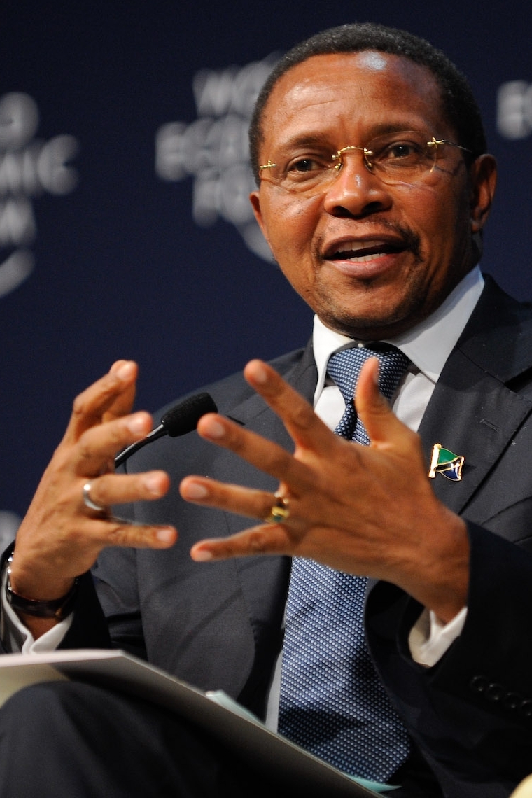
Tanzania, officially the United Republic of Tanzania, is a country in East Africa within the African Great Lakes region. It is bordered by Uganda to the northwest, Kenya to the northeast, the Indian Ocean to the east, Mozambique and Malawi to the south, Zambia to the southwest, and Rwanda, Burundi, and the Democratic Republic of the Congo to the west. According to a 2024 estimate, Tanzania has a population of around 67.5 million, making it the most populous country located entirely south of the equator.
Many important hominid fossils have been found in Tanzania.
Tanzania is a member of many international organizations such as the United Nations (UN), African Union (AU), East African Community (EAC), and Southern African Development Community (SADC) among many others. Additionally, due to the strength of Tanzania's non-alignment, unity and internal peace since independence, Tanzania frequently acts as a mediator and location of treaties and agreements between other nations, such as the Arusha Agreement with Europe, as well as the Arusha Accords with Rwanda (1993) and Burundi (2000).
Read more
The United Nations has a large current and historical presence in Tanzania and acts as an important partner in itself, and associated IGOs and NGOs, in many functions in the country, as well as functions based in Tanzania and implemented throughout the Great Lakes and Africa as a whole.
Industry and construction is a major and growing component of the Tanzanian economy, contributing 22.2 per cent of GDP in 2013. This component includes mining and quarrying, manufacturing, electricity and natural gas, water supply, and construction. Mining contributed 3.3 per cent of GDP in 2013. The vast majority of the country's mineral export revenue comes from gold, accounting for 89 per cent of the value of those exports in 2013. Tanzania's gold production is 46 metric tonnes in 2015. It also exports sizeable quantities of gemstones, including diamonds and tanzanite. All of Tanzania's coal production, which totalled 106,000 short tons in 2012, is used domestically.
Read more
Only 15 percent of Tanzanians had access to electric power in 2011, rising to 35.2 per cent in 2018.
As in other countries, the music in Tanzania is constantly changing, and varies by location, people, settings, and occasion. The five music genres in Tanzania, as defined by BASATA are, ngoma, dansi, kwaya, and taarab, with bongo flava being added in 2001. Singeli has since the mid-2000s been an unofficial music of uswahilini, unplanned communities in Dar es Salaam, and is the newest mainstream genre since 2020.
Read more
Ngoma (Bantu, meaning dance, drum and event) is a traditional dance music that has been the most widespread music in Tanzania. Dansi is urban jazz or band music. Taarab is sung Kiswahili poetry accompanied by a band, typically string, in which audience is often, but not always, encouraged to dance and clap. Kwaya was originally limited to church music during colonization, but is now a secular part of educational, social, and political events.
1963 CE – 2024 CE · Capital: Gitega (political), Bujumbura (economic) · 24,740 km²
Panoramic view of Gitega taken from the suburb of La Mushasha. Burundi.No machine-readable author provided. Tequendamia assumed (based on copyright claims). · Public domain · Commons
Burundi, officially the Republic of Burundi, is a landlocked country in East Africa. It is located in the Great Rift Valley at the junction between the African Great Lakes region and southeastern Africa, with a population of over 14 million people. It is bordered by Rwanda to the north, Tanzania to the east and southeast, and the Democratic Republic of the Congo to the west; Lake Tanganyika lies along its southwestern border. The political capital city is Gitega and the economic capital and largest city is Bujumbura.
Burundi is a presidential representative democratic republic based upon a multi-party state. The president is the head of state and head of government. There are currently 21 registered parties in Burundi. The 1992 constitution established a multi-party political process and reflected multi-party competition. The 1998 constitution broadened the National Assembly's seats and made provisions for two vice-presidents.
Read more
The legislative branch is a bicameral assembly, consisting of the National Assembly and the Senate. The National Assembly consists of 118 to 123 members. Burundi's constitution mandates representation to be consistent with 60% Hutu, 40% Tutsi, and 30% female members, as well as three Twa members. Members are elected by popular vote and serve five-year terms.
The Senate has fifty-one members, and three seats are reserved for former presidents.
Unitary dominant-party presidential republic under an authoritarian dictatorship
Languages
Kirundi, French, English
Religion
93.4% Christianity, 63.7% Catholicism, 25.2% Protestantism, 4.5% other Christian
Economy and Trade
Burundi is a landlocked, resource-poor country with an underdeveloped manufacturing sector. The economy of Burundi is predominantly agricultural, accounting for 50% of GDP in 2017, and employing more than 90% of the population. Subsistence agriculture accounts for 90% of agriculture. Primary exports are coffee and tea, which account for 90% of foreign exchange earnings, though exports are a relatively small share of GDP. Other agricultural products include cotton, maize, sorghum, sweet potatoes, bananas, manioc (tapioca); beef, milk and hides. Even though subsistence farming is highly relied upon, many people do not have the resources to sustain themselves. This is due to large population growth and no coherent policies governing land ownership. In 2014, the average farm size was about 0.40 hectares (1 acre).
Flag of BurundiSee File history below for details. · Public domain · Commons
Coat of arms of BurundiTonyjeff, based on national symbol. · Public domain · Commons
Wars and Battles
Reconstruction efforts started to practically take effect after 2006. The UN shut down its peacekeeping mission and focused on helping with reconstruction. Toward achieving economic reconstruction, Rwanda, D.R.Congo and Burundi relaunched the regional Economic Community of the Great Lakes Countries. Burundi and Rwanda joined the East African Community in 2007.
Read more
However, the terms of the September 2006 ceasefire between the government and the last remaining armed opposition group, the FLN (Forces for National Liberation, also called NLF or FROLINA), was not fully implemented, and senior FLN members subsequently left the truce monitoring team, claiming that their security was threatened. In September 2007, rival FLN factions clashed in the capital, killing 20 fighters and causing residents to flee. Rebel raids were reported in other parts of the country.
Burundi's culture is based on local tradition and the influence of neighbouring countries, though cultural prominence has been hindered by civil unrest. Since farming is the main industry, a typical Burundian meal consists of sweet potatoes, maize, rice and peas. Due to the expense, meat is eaten only a few times per month.
Read more
When several Burundians of close acquaintance meet for a gathering they drink impeke, a beer, together from a large container to symbolise unity. Another traditional alcoholic beverage widely consumed is isongo, a type of banana wine.
Crafts are an important art form in Burundi and are attractive gifts to many tourists. Basket weaving of inkoko and ibiseke is a popular craft for local artisans, as well as other crafts such as masks, shields, statues and pottery.
Drumming is an important part of the cultural heritage.
1963 CE – 2024 CE · Capital: Nairobi · 585,506 km²
Prime Minister Levi Eshkol and Kenya President Jomo Kenyatta at State House in Nairobi, Kenya.Pridan Moshe · Public domain · Commons
Kenya, officially the Republic of Kenya, is a country located in East Africa. With an estimated population of more than 54.2 million as of mid-2026, it is the 26th-most populous country in the world and the seventh-most populous in Africa. Kenya's capital and largest city is Nairobi. The second-largest and oldest city is Mombasa, a port city located on Mombasa Island. Other major cities within the country include Kisumu, Nakuru and Eldoret.
Hominid species, such as Homo habilis (fl. 1.8 to 2.5 million years ago) and Homo erectus (fl. 1.9 million to 350,000 years ago), possibly the direct ancestors of modern Homo sapiens, had lived in Kenya in the Pleistocene epoch. East Africa, including Kenya, is one of the earliest regions where modern humans (Homo sapiens) are believed to have lived. In 1984, during excavations at Lake Turkana palaeoanthropologist Richard Leakey, assisted by Kamoya Kimeu, discovered the Turkana Boy, a 1.6-million-year-old Homo erectus fossil. Further evidence of Kenya's prehistory was found in 2018, namely the early emergence of modern behaviours, including long-distance trade networks (involving goods such as obsidian), the use of pigments, and possibly the making of projectile points, about 320,000 years ago.
Kenya is a presidential representative democratic republic with a multi-party system. The president is head of state and head of government. Executive power is exercised by the government. Legislative power is vested in the government, the National Assembly and the Senate. The Judiciary is independent of the executive and the legislature. There has been growing concern, especially during former president Daniel arap Moi's tenure, that the executive was increasingly meddling with the affairs of the judiciary.
Read more
Kenya has high levels of corruption according to Transparency International's Corruption Perceptions Index (CPI), a metric which attempts to gauge the prevalence of public-sector corruption in various countries. In 2019, the nation placed 137th out of 180 countries in the index, with a score of 28 out of 100.
Kenya's macroeconomic outlook has steadily posted robust growth over the past few decades mostly from road, rail, air and water transport infrastructure projects as well as massive investments in Information and Communication Technology. The Kenyan economy is the largest in East Africa. After independence, Kenya promoted rapid economic growth through public investment, encouraged smallholder agricultural production and provided incentives for private industrial investment. Kenya is East Africa's regional transportation and financial hub. Kenya's financial sector is vibrant, well developed and diversified boasting the highest financial inclusion in the region and globally.
Read more
Foreign investments in Kenya remain relatively weak considering the size of its economy and its level of development.
Kenya is active in several sports, among them cricket, rallying, football, rugby, field hockey, and boxing. The country is known chiefly for its dominance in middle-distance and long-distance athletics, having consistently produced Olympic and Commonwealth Games champions in various distance events, especially in 800 m, 1,500 m, 3,000 m steeplechase, 5,000 m, 10,000 m, and the marathon. Kenyan athletes (particularly Kalenjin), continue to dominate the world of distance running, although competition from Morocco and Ethiopia has reduced this supremacy. Some of Kenya's best-known athletes include the four-time women's Boston Marathon winner and two-time world champion Catherine Ndereba, 800m world record holder David Rudisha, former marathon world record-holder Paul Tergat, and 5000m Olympic gold medalist John Ngugi.
An aerial of Kigali Convention Center on June 19, 2019. Photo by Emmanuel KwizeraEmmanuelkwizera · CC BY-SA 4.0 · Commons
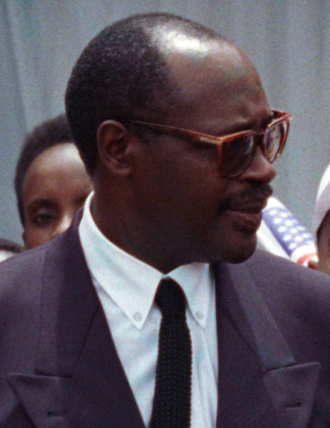
Rwanda, officially the Republic of Rwanda, is a landlocked country in East Africa. Its geography is dominated by mountains in the west and savanna in the southeast. The largest and most notable lakes are mainly in the western and northern regions of the country, and several volcanoes that form part of the Virunga volcanic chain are primarily in the northwest. The climate is considered tropical highland, with two rainy seasons and two dry seasons each year. Its capital and largest city is Kigali, located at the centre of the country, at 1,567 metres above sea level.
Modern human settlement of what is now Rwanda dates from, at the latest, the last glacial period, either in the Neolithic period around 8,000 BC, or in the long humid period which followed, up to around 3,000 BC. Archaeological excavations have revealed evidence of sparse settlement by hunter-gatherers in the late Stone Age, followed by a larger population of early Iron Age settlers, who produced dimpled pottery and iron tools. These early inhabitants were the ancestors of the Twa, aboriginal pygmy hunter-gatherers who remain in Rwanda today. Then by 3,000 BC, Central Sudanic and Kuliak farmers and herders began settling into Rwanda, followed by South Cushitic–speaking herders in 2,000 BC. The forest-dwelling Twa lost much of their habitat and moved to the mountain slopes. Between 800 BC and 1500 AD, a number of Bantu groups migrated into Rwanda, clearing forest land for agriculture.
Rwanda is a de facto one-party state ruled by the Rwandan Patriotic Front (RPF) and its leader Paul Kagame continuously since the end of the civil war in 1994. Although Rwanda is nominally democratic, elections are manipulated in various ways, which include banning opposition parties, arresting or assassinating critics, and electoral fraud. The RPF is a Tutsi-dominated party but receives support from other communities as well.
Read more
The constitution was adopted following a national referendum in 2003, replacing the transitional constitution which had been in place since 1994. The constitution mandates a multi-party system of government, with politics based on democracy and elections. However, the constitution places conditions on how political parties may operate.
Unitary semi-presidential republic under an authoritarian dictatorship
Languages
Kinyarwanda
Economy and Trade
The largest radio and television stations are state-run, and the majority of newspapers are owned by the government. Most Rwandans have access to radio; during the 1994 genocide, the radio station Radio Télévision Libre des Mille Collines broadcast across the country, and helped to fuel the killings through anti-Tutsi propaganda. As of 2015, the state-run Radio Rwanda was the largest station and the main source of news throughout the country. Television access was limited, with most homes not having their own set. The government rolled out digital television in 2014, and a year later there were seven national stations operating, up from just one in the pre-2014 analogue era. The press is tightly restricted, and newspapers routinely self-censor to avoid government reprisals.
Exchange rate chart of the Euro compared to the Rwandan Franc on 2009-2018 periodAlexmart · CC BY-SA 4.0 · Commons
Currency
Rwandan franc, Rwanda and Burundi franc
Flag of RwandaOriginal: Unknown Vector: Zscout370 · Public domain · Commons
Coat of arms of RwandaFischX and Zscout370 · Public domain · Commons
Wars and Battles
The cease-fire ended on 6 April 1994 when Habyarimana's plane was shot down near Kigali Airport, killing him. The shooting down of the plane served as the catalyst for the Rwandan genocide, which began within a few hours. Over the course of approximately 100 days, between 500,000 and 1,000,000 Tutsi and politically moderate Hutu were killed in well-planned attacks on the orders of the interim government. Many Twa were also killed, despite not being directly targeted.
Read more
The Tutsi RPF restarted their offensive, and took control of the country methodically, gaining control of the whole country by mid-July. The international response to the genocide was limited, with major powers reluctant to strengthen the already overstretched UN peacekeeping force.
Music and dance are an integral part of Rwandan ceremonies, festivals, social gatherings and storytelling. The most famous traditional dance is a highly choreographed routine consisting of three components: the umushagiriro, or cow dance, performed by women; the intore, or dance of heroes, performed by men; and the drumming, also traditionally performed by men, on drums known as ingoma. The best-known dance group is the National Ballet. It was established by President Habyarimana in 1974, and performs nationally and internationally. Traditionally, music is transmitted orally, with styles varying between the social groups. Drums are of great importance; the royal drummers enjoyed high status within the court of the King (Mwami). Drummers play together in groups of varying sizes, usually between seven and nine in number.
1963 CE – 2024 CE · Capital: Kampala · 210,012 km²
Sir. Edward Fredrick Mutesa, The President of Uganda. in a Uganda Independence Anniversary 1964 MagazineUnknown authorUnknown author · Public domain · Commons
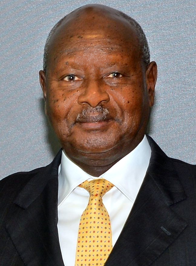
Uganda, officially the Republic of Uganda, is a landlocked country in East Africa. It is bordered to the east by Kenya, to the north by South Sudan, to the west by the Democratic Republic of the Congo, to the south-west by Rwanda, and to the south by Tanzania. The southern part includes a substantial portion of Lake Victoria, shared with Kenya and Tanzania. Uganda is in the African Great Lakes region, lies within the Nile basin, and has a varied equatorial climate. As of 2024, it had a population of 45.9 million, of whom 1.8 million live in the capital and largest city, Kampala.
Transparency International has rated Uganda's public sector as one of the most corrupt in the world. In 2016, Uganda ranked 151st best out of 176 and had a score of 25 on a scale from 0 (perceived as most corrupt) to 100 (perceived as clean).
Read more
The World Bank's 2015 Worldwide Governance Indicators ranked Uganda in the worst 12 percentile of all countries. In the United States Department of State's 2012 Human Rights Report on Uganda, "The World Bank's most recent Worldwide Governance Indicators reflected corruption was a severe problem" and that "the country annually loses 768.9 billion shillings ($286 million) to corruption."
In 2014, Ugandan parliamentarians earned 60 times what was earned by most state employees, and they sought a major increase.
Unitary presidential republic under an authoritarian dictatorship
Languages
See Languages of Uganda
Religion
81.7% Christianity, 42% Roman Catholic, 29% Protestant, 13.2% Islam, 3.3% unclassified, 1.6% others, 0.2% no religion
Economy and Trade
The Bank of Uganda is the central bank of Uganda and handles monetary policy along with the printing of the Ugandan shilling.
Read more
In 2015, Uganda's economy generated export income from the following merchandise: coffee (US$402.63 million), oil re-exports (US$131.25 million), base metals and products (US$120.00 million), fish (US$117.56 million), maize (US$90.97 million), cement (US$80.13 million), tobacco (US$73.13 million), tea (US$69.94 million), sugar (US$66.43 million), hides and skins (US$62.71 million), cocoa beans (US$55.67 million), beans (US$53.88 million), simsim (US$52.20 million), flowers (US$51.44 million), and other products (US$766.77 million).
Uganda has been experiencing consistent economic growth. In fiscal year 2015–16, Uganda recorded gross domestic product growth of 4.6 per cent in real terms and 11.6 per cent in nominal terms.
Football is the national sport in Uganda. The Uganda national football team, nicknamed "The Cranes", is controlled by the Federation of Uganda Football Associations. They have never qualified for the FIFA World Cup finals. Their best finish in the African Cup of Nations was second in 1978. Among clubs, SC Villa are the most successful, having won the national league 17 times and having reached the final of the African Cup of Champions Clubs in 1991, a feat also achieved by Simba SC in 1972. KCCA are second in national league wins with 13.
Read more
As of 2020, Uganda at the Olympics has won a total of two gold, three silver, and two bronze medals, four of which were in boxing and three in athletics. At the Commonwealth Games, Uganda has collected 13 gold medals and a total 49 medals, all in boxing and athletics.
The Uganda national boxing team is called The Bombers.
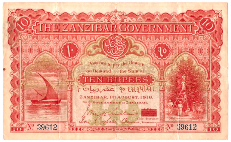
The Sultanate of Zanzibar (Swahili: Usultani wa Zanzibar, Arabic: سلطنة زنجبار, romanized: Sulṭanat Zanjībār), also known as the Zanzibar Sultanate, was an East African Muslim state controlled by the Sultan of Zanzibar, in existence between 1856 and 1964. The Sultanate's territories varied over time, and after a period of decline, the state had sovereignty over only the Zanzibar Archipelago and a 16-kilometre-wide (10 mi) strip along the Kenyan coast, with the interior of Kenya constituting the British Kenya Colony and the coastal strip administered as a de facto part of that colony.
According to the 16th-century explorer Leo Africanus, Zanzibar (Zanguebar) was the term used by Arabs and Persians to refer to the eastern African coast running from Kenya to Mozambique, dominated by five semi-independent Muslim kingdoms: Mombasa, Malindi, Kilwa, Mozambique, and Sofala. Africanus further noted that they all had standing agreements of loyalty with the major central African states, including the Kingdom of Mutapa.
Read more
In 1698, Zanzibar became part of the overseas holdings of Oman after Saif bin Sultan, the Imam of Oman, defeated the Portuguese in Mombasa, in what is now Kenya. In 1832 or 1840, Omani ruler Said bin Sultan moved his court from Muscat to Stone Town on the island of Unguja (that is, Zanzibar Island). He established a ruling Arab elite and encouraged the development of clove plantations, using the island's slave labour.
By 1964, the country was a constitutional monarchy within the Commonwealth ruled by Sultan Jamshid bin Abdullah. Zanzibar had a population of around 230,000 natives, some of whom claimed Persian ancestry and were known locally as Shirazis. It also contained significant minorities in the 50,000 Arabs and 20,000 South Asians who were prominent in business and trade. The various ethnic groups were becoming mixed and the distinctions between them had blurred; according to one historian, an important reason for the general support for Sultan Jamshid was his family's ethnic diversity. However, the island's Arab inhabitants, as the major landowners, were generally wealthier than the natives; the major political parties were organised largely along ethnic lines, with Arabs dominating the Zanzibar Nationalist Party (ZNP) and natives the Afro-Shirazi Party (ASP).
On 10 December 1963, the Protectorate that had existed over Zanzibar since 1890 was terminated by the United Kingdom. The United Kingdom did not grant Zanzibar independence, as such, because the UK never had sovereignty over Zanzibar. Rather, by the Zanzibar Act 1963 of the United Kingdom, the UK ended the Protectorate and made provision for full self-government in Zanzibar as an independent country within the Commonwealth. Upon the Protectorate being abolished, Zanzibar became a constitutional monarchy within the Commonwealth under the Sultan. Sultan Jamshid bin Abdullah was overthrown a month later during the Zanzibar Revolution. Jamshid fled into exile, and the Sultanate was replaced by the People's Republic of Zanzibar.
1979 CE – 2024 CE · Capital: Djibouti City · 22,222 km²
An aerial view of Djibouti City, the capital of Djibouti.Skilla1st · CC BY-SA 4.0 · Commons
Djibouti, officially the Republic of Djibouti, is a country in the Horn of Africa, bordered by Somalia to the south, Ethiopia to the southwest, Eritrea in the north, and the Red Sea and the Gulf of Aden to the east. The country has an area of 23,200 km2 (8,958 sq mi).
In antiquity, the territory, together with Ethiopia, Eritrea and Somaliland, was part of the Land of Punt. Nearby Zeila, now in Somaliland, was the seat of the medieval Adal and Ifat Sultanates.
The Bab-el-Mandeb region has often been considered a primary crossing point for early hominins following a southern coastal route from East Africa to South and Southeast Asia.
Read more
The Djibouti area has been inhabited since the Neolithic. According to linguists, the first Afroasiatic-speaking populations arrived in the region during this period from the family's proposed urheimat ("original homeland") in the Nile Valley, or the Near East. Other scholars propose that the Afroasiatic family developed in situ in the Horn, with its speakers subsequently dispersing from there.
Cut stones dated about 3 million years old have been collected in the area of Lake Abbe. In the Gobaad plain (between Dikhil and Lake Abbe), the remains of the extinct elephant Palaeoloxodon recki were also discovered, visibly butchered using basalt tools found nearby. These remains would date from 1.4 million years BCE.
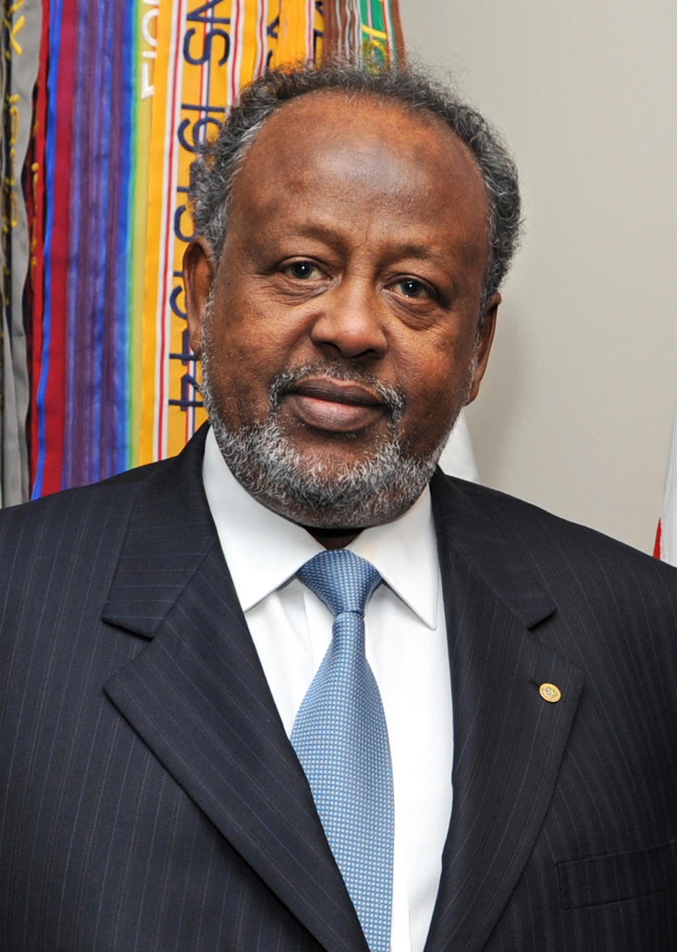
The president, Ismaïl Omar Guelleh, is the prominent figure in Djiboutian politics—the head of state and commander-in-chief. The president exercises their executive power assisted by their appointee, the prime minister, currently Abdoulkader Kamil Mohamed. The Council of Ministers (cabinet) is responsible to and presided over by the president.
Read more
The judicial system consists of courts of first instance, a High Court of Appeal, and a Supreme Court. The legal system is a blend of French civil law and customary law (Xeer) of the Somali and Afar peoples.
The National Assembly (formerly the Chamber of Deputies) is the country's legislature, consisting of 65 members elected every five years. Although unicameral, the Constitution provides for the creation of a Senate.
Djibouti's economy is largely concentrated in the service sector. Commercial activities revolve around the country's free trade policies and strategic location as a Red Sea transit point. Due to limited rainfall, vegetables and fruits are the principal production crops, and other food items require importation. The GDP (purchasing power parity) in 2013 was estimated at $2.505 billion, with a real growth rate of 5% annually. Per capita income is around $2,874 (PPP). The services sector constituted around 79.7% of the GDP, followed by industry at 17.3%, and agriculture at 3%.
Read more
As of 2013, the container terminal at the Port of Djibouti handles the bulk of the nation's trade. About 70% of the seaport's activity consists of imports to and exports from neighboring Ethiopia, which depends on the harbour as its main maritime outlet.
Djiboutian attire reflects the region's hot and arid climate. When not dressed in Western clothing such as jeans and T-shirts, men typically wear the macawiis, which is a traditional sarong-like garment worn around the waist. Many nomadic people wear a loosely wrapped white cotton robe called a tobe that goes down to about the knee, with the end thrown over the shoulder.
Read more
Women typically wear the dirac, which is a long, light, diaphanous voile dress made of cotton or polyester that is worn over a full-length half-slip and a bra. Married women tend to sport head-scarves referred to as shash and often cover their upper body with a shawl known as garbasaar. Unmarried or young women do not always cover their heads. Traditional Arabian garb such as the male jellabiya (jellabiyaad in Somali) and the female jilbāb is also commonly worn.
Early Modern and Modern States of East Africa and the Horn: Frequently Asked Questions
Which states existed in East Africa and the Horn in this period?
This page maps 15 states of East Africa and the Horn founded between 1547 CE and 1979 CE: Sultanate of Harar, Omani Slave Coast, Majeerteen Sultanate, People's Republic of Zanzibar, German Africa, Sultanate of Hobyo, Federal Republic of Somalia, British East Africa, Tanzania, Republic of Burundi, Republic of Kenya, Republic of Rwanda and 3 more.
Which was the largest of the Early Modern and Modern States of East Africa and the Horn?
British East Africa had the largest mapped extent, about 2,676,386 km².
Which of the Early Modern and Modern States of East Africa and the Horn lasted longest?
Federal Republic of Somalia lasted longest, 1960 CE – 2024 CE.
↑↓ to navigate↵ to open
12,754 Planetary Entities Indexed
We use Google Analytics cookies to understand which pages are useful. Necessary storage only keeps your theme and this choice on your device. Privacy policy