Early Modern States of the Indian Subcontinent: Map & History
21 states of the Indian Subcontinent on one map, from 1453 CE to 2024 CE.The largest, Durrani Empire, covered about 2,195,447 km²; the longest-lived, Kingdom of Bhutan, lasted 1636 CE – 2024 CE. Each has its own section below with its rulers, capitals, wars and pictures where the records hold them.
Map created from DEMIS Mapserver, which are public domain. Koba-chan. Reference: [1] Borders created by Noorullah21 · CC BY-SA 4.0 · CommonsPJeganathan · CC BY-SA 3.0 · CommonsCourt painters of Mughal emperor Akbar · Public domain · CommonsJan Huygen van Linschoten · CC0 · Commons
Layers
HistoryChanges with the year
PlacesToday
Water
Land
1777 AD
Base map
An empire takes the map to its years and shows the borders.
Each state in its own colour. Move the timeline to see which existed in any year from 1453 AD to 2024; select a territory to read about it. Borders: Cliopatria / Seshat (CC BY 4.0).
The Early Modern States of the Indian Subcontinent Compared
The Lodi dynasty was a dynasty that ruled the Sultanate of Delhi from 1451 to 1526. It was the fifth and final dynasty of the Delhi Sultanate, with three rulers ascending to throne, and was founded by Bahlul Lodi when he replaced the Sayyid dynasty.
Following the reign of the Sayyids, the Afghan or Turco-Afghan Lodi dynasty rose to power. The tribe was initially settled in an area between Gomal River and Sulaiman Mountains in what was then known as Roh. Lodis were significantly involved in the valuable horse trading between Turan and India.
Read more
The grandfather of Bahlul, Malik Bahram, was a horse merchant who took up service of Malik Mardan Daulat, the governor of Multan under Firuz Shah Tughlaq. His son Sultan Shah received the Iqta' of Sirhind and the title of Islam Khan from Khizr Khan due to his bravery in a battle. Islam Khan made Sirhind his centre and gathered a large following, mainly of his kinsmen. He had chosen his nephew and son-in-law Bahlul Khan Lodi (r. 1451–1489) as his successor but after his death in 1431, Lodis got divided into several camps, including that of Bahlul and his uncle Malik Feroz.
Despite both being Sunni Muslims, Babur wanted to annex Ibrahim's territory. Babur and his army of 24,000 men marched to the battlefield at Panipat armed with muskets and artillery. Ibrahim prepared for battle by gathering 100,000 men (well-armed but with no guns) and 1,000 elephants. Ibrahim was at a disadvantage because of his outmoded infantry and internecine rivalries. Even though he had more men, he had never fought in a war against gunpowder weapons and he did not know what to do strategically. Babur pressed his advantage from the start and Ibrahim perished on the battlefield in April 1526, along with 20,000 of his men. This marked the end of the Lodi dynasty and the rise of the Mughal Empire in India led by Babur (r. 1526–1530).
Like their predecessors, the Lodi sultans stylized themselves as the deputies of the Abbasid caliphs, and thus acknowledged the authority of a united caliphate over the Muslim world. They provided cash stipends and granted revenue-free lands (including entire villages) to the Muslim ulama, the Sufi shaikhs, the claimed descendants of Muhammad, and to the members of his Quraysh tribe. The Suhrawardi Sufi, Shaikh Sama' al-Din Kamboh, was the patron saint of Lodi dynasty, and his son Nasir al-Din Dehlawi remained Shaykh al-Islām during the reigns of Sikandar and Ibrahim.
Read more
Sikandar Khan Lodi, whose mother was daughter of a Hindu goldsmith, resorted to strong Sunni orthodoxy to prove his Islamic credentials as a political expediency. He destroyed Hindu temples, and under the pressure from the ulama, allowed the execution of a Brahman who declared Hinduism to be as veracious as Islam.
By the time Ibrahim ascended the throne, the political structure in the Lodi dynasty had dissolved due to abandoned trade routes and the depleted treasury. The Deccan was a coastal trade route, but in the late fifteenth century the supply lines had collapsed. The decline and eventual failure of this specific trade route resulted in cutting off supplies from the coast to the interior, where the Lodi empire resided. The Lodi dynasty was not able to protect itself if warfare were to break out on the trade route roads; therefore, they didn't use those trade routes, thus their trade declined and so did their treasury leaving them vulnerable to internal political problems.
Read more
In order to take revenge of the insults done by Ibrahim, the governor of Lahore, Daulat Khan Lodi asked the Timurid ruler of Kabul, Babur to invade his kingdom.
1529 CE – 1737 CE · Capital: ubli, Madurai, (1529–1616) · 48,190 km²
The Madurai Nayaks were a Telugu-speaking dynasty of Balija origin (warrior clans of present-day Andhra Pradesh) that ruled large parts of modern-day Tamil Nadu, India, between the 16th and 18th centuries, with Madurai as their capital. It was founded by Nagama Nayak's son Viswanatha Nayak around 1529 as a viceroyalty under the Vijayanagara Empire.
The Dalavay Agraharam Plates of Venkata I record that Virappa Nayaka, grandson of Madurai dynasty's founder Viswanatha Nayaka, held the title ''Lord of Ayyavalipura'' (Aihole). Inscriptions from Kolhapur and Miraj designate the Gavares as the lords of Ayyavalipura, while the merchant Balijas in the Tamil speaking region were historically known as Valanjiyars. The members of the guild were termed Vira Balanjas in Telugu, Vira Banajigas in Kannada, and Vira Valanjiyar in Tamil, all translating to "Valiant Mechants". These merchants acted as protectors of Vira Balanja Dharma with their historical capital based at Ayyavole (Aihole) in Bijapur district of Karnataka. A 1677 report compiled by an official of the Dutch East India Company notes that Viswanatha Nayaka belonged to the "Wellen Chetti" merchant community. Records in Mackenzie manuscripts gloss them as sellers of glass bangles.
The Madurai Nayak administration operated on a decentralized provincial structure. The ruler was advised primarily by the dalavi, an executive officer who directed both military campaigns and civil administration. Key holders of this office included Ariyanatha Mudaliar, Ramappayya and Narasappayya. Below the dalavi stood the pradhani (finance minister, overseeing revenue administration) and the rayasam (head of civil secretariat and scribal bureaucracy). The kingdom was subdivided into provinces (rajyas or mandalams), districts (nadus), and village settlements (gramams), with state revenue derived primarily from agriculturural land assessments and custom duties.
Read more
The kingdom was organized into 72 semi-feudal estates (palayams), each governed by a hereditary chieftain (palayakkarar, anglicized as polygar).
Nayak architectural activity focused primarily on rebuilding and expanding earlier Pandya and Vijayanagar shrines. Their most extensive project was the Meenakshi-Sundaraswarar temple complex in Madurai, which had been damaged during the 14th-century Madurai Sultanate and partially restored under early Vijayanagara governors. The Nayakas added multiple concentric enclosures (prakaras), pillared halls, and four outer gateway towers (Gopurams) rising up to 50 metres (160 feet) in height. Successive rulers expanded the complex to an area of 254 by 238 m (833 by 781 ft), adding monumental pavilions such as the Pudu Mandapa (notable for sculpted portrait statues of Nayak monarchs) and relief pillars depicting Shaivite iconography.
Tirumala was succeeded in 1659 by his son Muttu Alakadri, who died after a reign of four months, passing the throne to Chokkanatha Nayaka (r. 1659–1682). Chokkanatha suppressed internal mutinies by his senior ministers and retaliated against Thanjavur in 1673, capturing the city and installing his forster-brother as governor. However, Alagiri declared independence, and in 1675 the Maratha general Venkoji took Thanjavur, establishing the Thanjavur Maratha kingdom. Continuing conflict with Mysore eroded territorial control until Muttu Virappa III (r. 1682–1689) recovered lost border parts. Following his death, Rani Mangammal (r. 1689–1704), assumed regency on behalf of her infant grandson, Vijaya Ranga Chokkanatha.
Hussain Shahi dynasty of the Bengal SultanateMap created from DEMIS Mapserver, which are public domain. Koba-chan. Reference: [1] Borders created by Noorullah21 · CC BY-SA 4.0 · Commons
The Hussain Shahi dynasty (Middle Bengali: হোসেন শাহী খান্দান) was an Arab Sayyid royal family which ruled the late medieval Sultanate of Bengal from 1494 to 1538.
1534 CE – 1676 CE · Capital: Thanjavur · 14,694 km²
Marshal Hall Thanjavur (City in Tamil Nadu, India)PJeganathan · CC BY-SA 3.0 · Commons
The Thanjavur Nayak Dynasty, established by Sevappa Nayaka around 1532, was a ruling lineage that governed Thanjavur between 16th and 17th centuries. Hailing from Telugu Balijas ancestry, the Nayaks were initially appointed as provincial governors by the Vijayanagara Emperor in the early 16th century, alongside governorships based at Madurai, and Gingee. They governed with increasing autonomy following the decline of central Vijayanagara authority after 1565. They became known for their extensive architectural and literary patronage in Tamil, Telugu and Sanskrit.
The family traced its lineage to Balija merchant-warrior communities originating in the Telugu country (present-day Andhra Pradesh). Epigraphical studies by archaeologist Kudavayil Balasubramanian identified the dynasty as members of Kavarai community. A 1556 CE inscription at Arunachalesvara Temple in Tiruvannamalai identifies the founder's father, Timmappa Nayaka, as a member of kavarai community, also noting that his son Sevappa Nayaka governed Thanjavur. Kavarai is the traditional Tamil designation for Telugu-speaking Balijas settled in Tamil Nadu. The deity Rajagoplaswamy (locally known as Mannaru) at the Mannargudi temple was their kula deivam (tutelary family deity).
Ater the death of Emperor Venkata II in 1614, a succession dispute broke the Vijayanagara Empire. The rebel faction led by Gobburi Jagga Raya executed Emperor Sriranga II and his family in Vellore prison, supporting their putative son as claimant to the throne. The loyalist general Yachama Nayaka of Kalahasti smuggled Sriranga's surviving son, Rama Deva Raya, out of captivity and sought assistance from Raghunatha. Jagga Raya formed an alliance with the Nayak of Gingee and Muttu Virappa Nayaka of Madurai.
Read more
In late 1616, the opposing coalitions met at the Battle of Toppur. They fought on an open plain along the northern banks of the Kaveri River between Tiruchirappalli and Grand Anicut. Seventeenth-century Jesuit accounts, like those of Manuel Barradas, described the battle as one of the largest pitched in South Indian history.
Court patronage under the Thanjavur Nayaks saw a distinct literary tradition known in historiography as the Southern School of Telugu Literature, as well as they became known for their extensive literary patronage in Tamil and Sanskrit. The Royal court supported poets, dramatists, musicians, and Sanskrit scholars (pandits), with several rulers composing works themselves.
Read more
Raghunatha Nayaka (r. 1600-1634) was an accomplished scholar and a poet both in Telugu and Sanskrit. In Telugu, he composed the kavyas Valimiki Charitramu, Parijatapaharanamu, and Rukmini Parinaya Yakshaganamu. In Sanskrit, his court produced musical treatises Sangita Sudha (attributed to Raghunatha and his minister Govinda Dikshitar) and Bharata Sudha.
Vijaya Raghava Nayaka (r. 1634–1673) was the final ruler of the Thanjavur Nayak line. He was popularly known by the epithet Mannaru Dasa and had sponsored extensive construction projects at the Rajagopalaswamy Temple in Mannargudi. These included prakaras, gopurams, mandapams and tanks. He had authored over thirty Telugu works—primarily Yakshagana plays. His royal court supported with several vernacular and musical compositions.
Read more
Escalating conflicts with Madurai Nayaks ended up in the siege of Thanjavur by Chokkanatha Nayaka in 1673. When the defence of the fort became untenable, he ordered the royal women's quarters blown up with gunpowder to prevent capture. He died in the battle along with his son Chengamala Dasa. Madurai briefly ruled the city till 1675 when the Maratha general Venkoji (Ekoji I) captured Thanjavur, founding the Thanjavur Maratha Kingdom.
1540 CE – 1594 CE · Capital: Sasaram Delhi · 1,254,263 km²
Painting of Sher Shah Suri (colored) from a manuscript of Tarikh-i-Khandan-i-Timuriya, prepared by the court painters of Mughal emperor Akbar, circa 16th centuryCourt painters of Mughal emperor Akbar · Public domain · Commons
The Sur Empire was an empire ruled by the Afghan-origin Sur dynasty in northern India for nearly 16 or 18 years, between 1538/1540 and 1556, with Sasaram (in modern-day Bihar) serving as its capital. It was founded by Sher Shah Suri.
The Sur dynasty held control of nearly all the then-territories of Mughal Empire along the Indo-Gangetic Plain, from eastern Balochistan in the west of Indus River to modern-day Rakhine, Myanmar in the east.
The Sur empire consisted of many subdivisions, referred to as Iqtas. Some of these provinces were ruled by military governors, such as Haibat Khan, who governed the Punjab. Haibat Khan had control of over 30,000 men, and was able to give jagirs to his own soldiers. Khwas Khan was another military governor, who ruled over Rajasthan, and assembled over 20,000 men. The head of Iqtas were known by different names, such as Hakim, Faujdar, or Momin. These head of Iqtas had their own bodies of men, which were usually less than 5,000 men. The responsibility of these heads were instilling order and law in the subdivisions they controlled.
Read more
Iqtas themselves were divided into districts, named Sarkars. Sarkars had two chief officers, the Shiqar, and Munsif.
The Sur dynasty held control of nearly all the Mughal territories, from Balochistan in the west to modern-day Bangladesh in the east.
Read more
Despite its short reign, the Sur Empire significantly influenced Mughal administrative reforms when they returned to power, most notably under Mughal Emperor Akbar.
It was at the time of this bounty of Sultán Bahlul [Lodi], that the grandfather of Sher Sháh, by name Ibráhím Khán Súr,*The Súr represent themselves as descendants of Muhammad Súr, one of the princes of the house of the Ghorian, who left his native country, and married a daughter of one of the Afghán chiefs of Roh. with his son Hasan Khán, the father of Sher Sháh, came to Hindu-stán from Afghánistán, from a place which is called in the Afghán tongue "Shargarí",* but in the Multán tongue "Rohrí".
Right Street in the City of Goa, Portuguese India, between 1579 and 1592.Jan Huygen van Linschoten · CC0 · Commons
The Portuguese Empire was the first and longest lasting of the European colonial empires. Initiated during the Age of Discovery, at one point territories included parts of the Americas and Africa, along with ports and trading posts throughout Asia and Oceania.
In the wake of the Reconquista, Portuguese sailors began exploring the coast of Africa and the Atlantic archipelagos in 1418–1419, using recent developments in navigation, cartography, and maritime technology such as the caravel, with the aim of finding a sea route to the source of the lucrative spice trade.
Portrait of King John I of Portugal (1357-1433)anonymous · Public domain · Commons
The origin of the Kingdom of Portugal lay in the Reconquista, the gradual reconquest of the Iberian Peninsula from the Moors. After establishing itself as a separate kingdom in 1139, Portugal completed its reconquest of Moorish territory by reaching Algarve in 1249, but its independence continued to be threatened by neighboring Castile until the signing of the Treaty of Ayllón in 1411.
Read more
Free from threats to its existence and unchallenged by the wars fought by other European states, Portuguese attention turned overseas and towards a military expedition to the Muslim lands of North Africa. There were several probable motives for their first attack, on the Marinid Sultanate (in what would become Morocco).
In 1693, the Bandeirante Antônio Rodrigues de Arzão, Caipira from Taubaté, discovered gold in the interior of the Captaincy of São Vicente, an area currently corresponding to Minas Gerais, in Brazil. Major discoveries of gold and, later, diamonds in Minas Gerais, Mato Grosso and Goiás led to a "gold rush", with a large influx of migrants. The village became the new economic focal point of the empire, with rapid settlement and some conflicts. This gold cycle led to the creation of an internal market and attracted a large number of immigrants. In 1739, when Minas Gerais was already separated as a captaincy, its population was somewhere between 200,000 and 250,000.
Read more
The gold rush considerably increased the revenue of the Portuguese crown, who charged a fifth of all the ore mined, or the "fifth".
Flag of Portugal (official)Original: Columbano Bordalo Pinheiro Vector: Vítor Luís Rodrigues, António Martins-Tuválkin · Public domain · Commons
Portuguese shieldParutakupiu | contribs · Public domain · Commons
Wars and Battles
In 1914, the German Empire formulated plans to usurp Angola from Portuguese control. Skirmishes between Portuguese and German soldiers ensued, resulting in reinforcements being sent from the mainland. The main objective of these soldiers was to recapture the Kionga Triangle, in northern Mozambique, the territory having been subjugated by Germany.
Read more
In 1916, after Portugal interned German ships in Lisbon, Germany declared war on Portugal. Portugal followed suit, thus entering World War I.
Early in the war, Portugal was involved mainly in supplying the Allies positioned in France. In 1916, there was only one attack on the Portuguese territory, in Madeira. In 1917, one of the actions taken by Portugal was to assist Britain in its timber industry, imperative to the war effort.
Presently, the Community of Portuguese Language Countries (CPLP) serves as the cultural and intergovernmental successor of the Empire.
Read more
Macau was returned to China on 20 December 1999, under the terms of an agreement negotiated between People's Republic of China and Portugal twelve years earlier. Nevertheless, the Portuguese language remains co-official with Cantonese Chinese in Macau.
The Azores and Madeira (the latter administering the uninhabited Savage Islands) are the only overseas territories that remain politically linked to Portugal. Although Portugal began the process of decolonising East Timor in 1975, during 1999–2002 was sometimes considered Portugal's last remaining colony, as the Indonesian invasion of East Timor was not justified by Portugal.
Eight of the former colonies of Portugal have Portuguese as their official language.
1572 CE – 1799 CE · Capital: Mysore, Srirangapatna, Bangalore · 91,042 km²
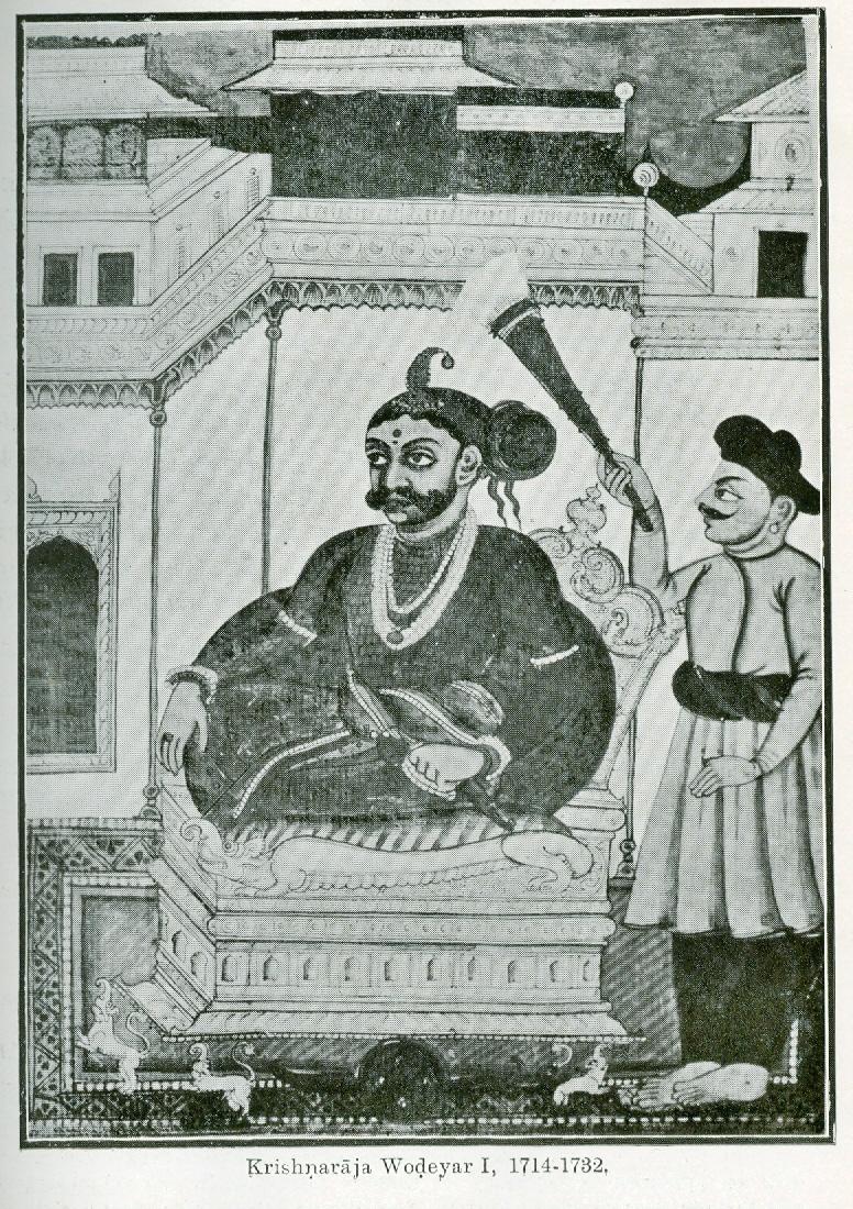
This is a photograph of early miniature of Mysore ruler, Kanthirava Narasaraja I.UnknownUnknown (both photographer and original artist) · Public domain · Commons
The Kingdom of Mysore was a geopolitical realm in southern India founded in around 1399 in the vicinity of the modern-day city of Mysuru. Existing until 1950, the territorial boundaries and the form of government transmuted substantially throughout the kingdom's lifetime. While originally a feudal vassal under the Vijayanagara Empire, it became a princely state in the British Raj from 1799 to 1947, marked in-between by major political changes.
The kingdom, which was founded and ruled for the most part by the Wadiyars, initially served as a feudal vassal under the Vijayanagara Empire.
Sources for the history of the kingdom include numerous extant lithic and copper plate inscriptions, records from the Mysore palace and contemporary literary sources in Kannada, Persian and other languages. According to traditional accounts, the kingdom originated as a small state based in the modern city of Mysore and was founded by two brothers, Yaduraya (also known as Vijaya) and Krishnaraya. Their origins are mired in legend and are still a matter of debate; while some historians posit a northern origin at Dwarka, others locate it in Karnataka. Yaduraya is said to have married Chikkadevarasi, the local princess and assumed the feudal title "Wodeyar" (Kannada: ಒಡೆಯರ್, romanized: Oḍeyar, lit. 'lord'), which the ensuing dynasty retained.
There are no records relating to the administration of the Mysore territory during the Vijayanagara Empire's reign (1399–1565). Signs of a well-organised and independent administration appear from the time of Raja Wodeyar I who is believed to have been sympathetic towards peasants (raiyats) who were exempted from any increases in taxation during his time. The first sign that the kingdom had established itself in the area was the issuing of gold coins (Kanthirayi phanam) resembling those of the erstwhile Vijayanagara Empire during Narasaraja Wodeyar's rule.
Read more
The rule of Chikka Devaraja saw several reforms effected. Internal administration was remodelled to suit the kingdom's growing needs and became more efficient. A postal system came into being. Far-reaching financial reforms were also introduced.
This system changed under the subsidiary alliance with the British, when tax payments were made in cash and were used for the maintenance of the army, police and other civil and public establishments. A portion of the tax was transferred to England as the "Indian tribute". Unhappy with the loss of their traditional revenue system and the problems they faced, peasants rose in rebellion in many parts of south India. After 1800, the Cornwallis land reforms came into effect. Reade, Munro, Graham and Thackeray were some administrators who improved the economic conditions of the masses. However, the homespun textile industry suffered while most of India was under British rule, except the producers of the finest cloth and the coarse cloth which was popular with the rural masses.
The architectural style of courtly and royal structures in the kingdom underwent profound changes during British rule – a mingling of European traditions with native elements. The Hindu temples in the kingdom were built in typical South Indian Dravidian style – a modest version of the Vijayanagara building idiom. When in power, Tipu Sultan constructed two places namely Lal Mahal Palace (later destroyed after the siege of Serirangpatnam in 1799), the Summer Palace and the famous Masjid e Aala in Srirangapatna, his capital. However, it is the city of Mysore that is best known for its royal palaces, earning it the nickname "City of Palaces". The city's main palace, the Mysore Palace, is also known as the Amba Vilas Palace. The original complex was destroyed by fire and a new palace was commissioned by the Queen-Regent and designed by the English architect Henry Irwin in 1897.
The Gorkha Kingdom (Nepali: गोरखा राज्य; Gōrakhā Rājya) was a independent hill kingdom in the central Himalayas established in 1559 CE when the prince Dravya Shah of Lamjung and Kaski Kingdom seized control of the region. Centered around the hilltop fortress of Gorkha Durbar, it was originally one of the Chaubisi independent kingdoms that emerged following the fragmentation of Khasa-Malla Empire. The kingdom embarked on a rapid campaign of territorial expansion under its tenth monarch, Prithvi Narayan Shah, beginning in 1743 CE.
The Gorkha Kingdom was governed as a hereditary monarchy under the Shah dynasty. The king exercised central authority, while military commanders, nobles and local officials played important roles in the administration of the kingdom. The central government included the king, a Chautariya, Kajis, Sardars, secretaries, a chamberlain and a treasurer.
Read more
During the reign of Prithvi Narayan Shah, the military and administrative institutions of Gorkha were organized to support the kingdom's expansion. The leading families of Gorkha played an important role in both government and the military, while loyalty to the king and the army formed important elements of the Gorkhali state.
The expansion of the kingdom brought different principalities and communities under Gorkhali rule.
From the 1730s, the Gorkha Kingdom began expanding under King Nara Bhupal Shah, although most of the significant conquests occurred during the reign of his son, Prithvi Narayan Shah, starting in 1743. His campaigns were later continued by his younger son, Bahadur Shah. Over time, they extended their control over large areas to the east and west of Gorkha.
Read more
Among their most important acquisitions was the wealthy Newar confederacy of Nepal Mandala, centered in the Kathmandu Valley. Beginning in the 1760s, the Gorkhalis imposed a blockade to weaken the valley’s kingdoms. In response, the Malla kings appealed to the British East India Company for assistance. In 1767, the Company sent an expedition led by Captain George Kinloch, which failed before reaching Kathmandu.
The three Newar capitals—Kathmandu, Lalitpur, and Bhaktapur—fell to the Gorkhalis between 1768 and 1769.
The Gurkhas are soldiers originally from Gorkha kingdom (later Kingdom of Nepal and now Nepal), who have served in the armies of the United Kingdom and India. British recruitment of Gurkha soldiers began during the Anglo-Nepalese War (1814–1816), when British forces encountered Gurkha troops serving the Kingdom of Nepal. Impressed by their military abilities, the British East India Company began recruiting Gurkhas during and after the war.
Read more
Gurkha recruitment has historically included soldiers from several ethnic groups and communities in Nepal, including the Gurung, Magar, Rai, Limbu, Tamang and Khas communities. The Gurkha regiments became part of the British Indian Army and later continued in the British Army and Indian Army after the independence of India in 1947. In 1948, four Gurkha regiments were transferred to the British Army, while six were allocated to the Indian Army.
King Ugyen Wangchuck — in Punakha, the old capital of Bhutan, in 1905. Ugyen Wangchuck was the first King of Bhutan, from 1907 to 1926.John Claude White · Public domain · Commons
Bhutan, officially the Kingdom of Bhutan, is a landlocked country in South Asia, located in the Eastern Himalayas, bordering China's Tibet Autonomous Region to the north and northwest and India to the south and southeast. With a population of over 800,000 (800,871) and a territory of 38,394 square kilometres (14,824 sq mi), Bhutan ranks 133rd in land area and 160th in population. It is a democratic constitutional monarchy with a king as the head of state and a prime minister as the head of government. The Je Khenpo is the head of the state religion, Vajrayana Buddhism.
In the early 20th century, Bhutan became a de facto protectorate of the British Empire under the Treaty of Punakha in 1910. British protection guarded Bhutan from Tibet and Qing China. In the aftermath of the Chinese Communist Revolution, Bhutan signed a friendship treaty with the newly independent Dominion of India in 1949. Its concerns were exacerbated after the annexation of Tibet by the People's Republic of China. However, Bhutan was never directly colonised.
Read more
Relations with Nepal remained strained due to Bhutanese refugees. Bhutan joined the United Nations in 1971. It was the first country to recognise Bangladesh's independence in 1971. It became a founding member of the South Asian Association for Regional Cooperation (SAARC) in 1985.
Bhutan's currency is the ngultrum, whose value is fixed to the Indian rupee. The Indian rupee is also accepted as legal tender in the country.
Read more
Though Bhutan's economy is one of the world's smallest, it has grown rapidly in recent years, by eight per cent in 2005 and 14 per cent in 2006. In 2007, Bhutan had the second-fastest-growing economy in the world, with an annual economic growth rate of 22.4 per cent. This was mainly due to the commissioning of the gigantic Tala Hydroelectric Power Station. As of 2012, Bhutan's per capita income was US$2,420. This figure increased to US$4,347.1 in 2024, according to a budget report released by Bhutan's Ministry of Finance in 2026.
Bhutan's economy is based on agriculture, forestry, tourism and the sale of hydroelectric power to India. Agriculture provides the main livelihood for 55.4 per cent of the population.
Bhutan has a rich and unique cultural heritage that has largely remained intact because of its isolation from the rest of the world until the mid-20th century. One of the main attractions for tourists is the country's culture and traditions. Bhutanese tradition is deeply steeped in its Buddhist heritage. Hinduism is the second most dominant religion in Bhutan, being most prevalent in the southern regions. The government is increasingly making efforts to preserve and sustain the current culture and traditions of the country. Because of its largely unspoiled natural environment and cultural heritage, Bhutan has been referred to as The Last Shangri-La.
Read more
While Bhutanese citizens are free to travel abroad, Bhutan is viewed as inaccessible by many foreigners. Another reason for it being an unpopular destination is the cost, which is high for tourists on tighter budgets.
1687 CE – 1795 CE · Capital: Galle (1640–1658), Colombo (1658–1796) · 44,235 km²
Dutch Ceylon (Sinhala: ලන්දේසි ලංකාව; Tamil: ஒல்லாந்த இலங்கை) was a governorate established in present-day Sri Lanka by the Dutch East India Company. Although the Dutch managed to capture most of the coastal areas in Sri Lanka, they were never able to control the Kingdom of Kandy located in the interior of the island. Dutch Ceylon existed from 1640 until 1796.
In the early 17th century, Sri Lanka was partly ruled by the Portuguese and partly by Sri Lankan (primarily of Sinhalese origin) kingdoms, who were constantly battling the Portuguese.
In the east, Portugal held territories not only in Ceylon but in India, in the Persian Gulf, and what is now Indonesia, then referred to as the East Indies.
Read more
From 1580 to 1640, the throne of Portugal was held by the Habsburg kings of Spain resulting in the biggest colonial empire until then (see Iberian Union). In 1583 Philip I of Portugal, II of Spain, sent his combined Iberian fleet to clear the French traders from the Azores, decisively hanging his prisoners-of-war from the yardarms and contributing to the "Black Legend". The Azores were the last part of Portugal to resist Philip's reign.
The Netherlands meanwhile were in open revolt against their Habsburg overlord and declared themselves a Republic in 1581. Prior to 1580 Dutch merchants had procured colonial produce mostly from Lisbon, but the Iberian Union cut off this supply.
When the Dutch language was introduced it also mingled with indigenous and Portuguese influences.
Read more
Nevertheless, there are many Dutch loanwords in the two official languages of Sri Lanka, Sinhala and Tamil. Nicoline van der Sijs reckons that there are some 230 Dutch loanwords in Sinhala. Many of these are in the fields of warfare, trade and agriculture. For example, the Sinhala word for 'potato', අර්තාපල් pronounced artapal,' hospital ' (ඉස්පිරිතාලෙ), ඉස්කුරුප්පුව and ඉස්තෝප්පුව comes from Dutch. In the modern Sri Lankan Tamil language, there are reckoned to be about 50 Dutch loanwords.
Sikhs (Gurmukhi: ਸਿੱਖ, romanized: Sikkh, Punjabi pronunciation: [sɪkkʰ]) are followers of Sikhism, a religion that originated in the late 15th century in the Punjab region of the Indian subcontinent, based on the teachings of Guru Nanak. The term Sikh has its origin in the Sanskrit word śiṣya, meaning 'seeker', 'disciple' or 'student'.
The initiation, known as the Amrit Sanchar, bequeathed by the tenth Guru and who does not owe allegiance to any other religion, is a Sikh.
Sikhs number about 26–30 million worldwide, of whom 24–28 million live in India, which thus represents around 90 percent of the total Sikh population. A 2020 estimate by Charles Preston gives a figure of 29,254,000 of Sikhs worldwide. About 76 percent of all Indian Sikhs live in the northern Indian state of Punjab, forming a majority of about 58 per cent of the state's population, roughly around 16 million. Substantial communities of Sikhs live in the Indian states or union territories of Haryana, where they number around 1.2 million and form 4.9 percent of the population, Rajasthan (872,000 or 1.3 percent of the population), Uttar Pradesh (643,000, 0.3 percent), Delhi (570,000, 3.4 percent), Uttarakhand (236,000, 2.3 percent), Jammu and Kashmir (234,000, 1.9 percent), Chandigarh (138,000, 13.1 percent) and Himachal Pradesh (86,000, 1.2 percent).
Contemporarily, Modern Punjabi • Hindustani • Pashto • English • French • Italian • Spanish • Dutch, Historically, Punjabi dialects • Khalsa bole • Sant Bhasha (liturgical)
Religion
15px Sikhism
Population
c. 25–30 millionrefn, cite web
Economy and Trade
Historically, most Indians have been farmers and 66 percent of the Indian population are engaged in agriculture. Indian Sikhs are employed in agriculture to a lesser extent; India's 2001 census found 39 per cent of the working population of the Punjab employed in this sector. According to the Swedish political scientist Ishtiaq Ahmad, a factor in the success of the Indian green revolution was the "Sikh cultivator, often the Jat and Kamboj or Kamboh, whose courage, perseverance, spirit of enterprise and muscle prowess proved crucial." However, Indian ecofeminist Vandana Shiva wrote that the green revolution made the "negative and destructive impacts of science (i.e., the green revolution) on nature and society" invisible and was a catalyst for Punjabi Sikh and Hindu tensions despite a growth in material wealth.
According to a 1994 estimate, Punjabi Sikhs and Hindus comprised 10 to 15% of all ranks in the Indian Army. The Indian government does not release religious or ethnic origins of a military personnel, but a 1991 report by Tim McGirk estimated that 20% of Indian Army officers were Sikhs. Together with the Gurkhas recruited from Nepal, the Maratha Light Infantry from Maharashtra and the Jat Regiment, the Sikhs are one of the few communities to have exclusive regiments in the Indian Army. The Sikh Regiment is one of the most-decorated regiments in the army, with 73 Battle Honours, 14 Victoria Crosses, 21 first-class Indian Orders of Merit (equivalent to the Victoria Cross), 15 Theatre Honours, 5 COAS Unit Citations, two Param Vir Chakras, 14 Maha Vir Chakras, 5 Kirti Chakras, 67 Vir Chakras and 1,596 other awards.
Sikh art and culture are nearly synonymous with that of Punjab, and Sikhs are easily recognised by their distinctive turban (Dastar). Punjab has been called India's melting pot, due to the confluence of invading cultures from the rivers from which the region gets its name. Sikh culture is therefore a synthesis of cultures. Sikhism has forged a unique architecture, which S. S. Bhatti described as "inspired by Guru Nanak's creative mysticism" and "is a mute harbinger of holistic humanism based on pragmatic spirituality". The American non-profit organisation United Sikhs has fought to have Sikh included on the United States census as well, arguing that Sikhs "self-identify as an ethnic minority" and believe "that they are more than just a religion".
At the time of the Indian independence movement, the Sikh ruler of the Kapurthala State fought to oppose the partition of India and advocated for a united, secular country. Sikh organisations, including the Chief Khalsa Dewan and Shiromani Akali Dal led by Master Tara Singh, condemned the Lahore Resolution and the movement to create Pakistan, viewing it as inviting possible persecution, with Akali Dal instead favouring an undivided Azad Punjab as an independent Sikh State or Khalistan, having passed the Sikh State Resolution in 1946. The Sikhs therefore strongly fought against the partition of Punjab. The months leading up to the 1947 partition of Punjab were marked by conflict in the Punjab between Sikhs and Muslims.
1713 CE – 1802 CE · Capital: Gingee (1692–1710), Arcot (1710–1768), Chepauk (1768–1855) · 137,876 km²
A view of the Rajagiri Citadel (atop the hill), Kalyana Mandapam (white tower) and the Mohabatkhan mosque (right) at the en:Gingee Fort complex.This Image was created by User:PlaneMad. If you are using the image under the creative commons share alike license please credit the photo CC-by-sa… · CC BY-SA 2.5 · Commons
The Carnatic Sultanate, also known as Carnatic State or Arcot State, was a kingdom in southern India between about 1690 and 1855, ruled by a Muslim nawab under the legal purview of the Nizam of Hyderabad, until their demise. They initially had their capital at Arcot in the present-day Indian state of Tamil Nadu. Their rule is an important period in the history of the Carnatic and Coromandel Coast regions, in which the Mughal Empire gave way to the rising influence of the Maratha India, and later the emergence of the British India.
The nawabs of Bengal were the hereditary rulers of Bengal Subah in Mughal India. In the early 18th century, the Nawab of Bengal was the de facto independent ruler of the three provinces of Bengal, Bihar and Orissa and they are often referred to as the nawabs of Bengal, Bihar and Orissa. The nawabs were based in Murshidabad which was centrally located within Bengal, Bihar, and Orissa. Their chief, a former prime minister, became the first nawab. The nawabs continued to issue coins in the name of the Mughal emperor, but for all practical purposes, the nawabs governed as independent monarchs.
Nawab Murshid Quli Khan was notorious for his repressive tax collection tactics, including torture for non-payment. Nawab Alivardi Khan's successor was Nawab Siraj-ud-Daulah. Nawab Siraj-ud-Daulah grew increasingly wary of the British presence in Bengal. He also feared invasions by the Durrani Empire from the north and Marathas from the west. On 20 June 1756, Nawab Siraj-ud-Daulah launched the siege of Calcutta, in which he won a decisive victory. The British were briefly expelled from Fort William, which came under the occupation of the Nawab's forces. The East India Company dispatched a naval fleet led by Robert Clive to regain control of Fort William. By January 1757, the British retook Fort William. The stalemate with the Nawab continued into June. The Nawab also began cooperating with the French East India Company, raising the ire of the British further.
1727 CE – 1947 CE · Capital: Aurangabad (1724–1763), Hyderabad (1763–1948) · 261,393 km²
Hyderabad State, also referred to as the Nizamate of Hyderabad, was a princely state in the Deccan region of south-central India with its capital at the city of Hyderabad. It is now divided into the present-day state of Telangana, the Kalyana-Karnataka region of Karnataka, and the Marathwada region of Maharashtra in the Republic of India.
The state was ruled from 1724 to 1948 by the Nizam, who was initially a viceroy of the Mughal Empire in the Deccan.
Hyderabad State was founded by Mir Qamar-ud-din Khan who was the governor of Deccan under the Mughals from 1713 to 1721. In 1724, following the Battle of Shakar Kheda, he resumed rule from the Mughal provincial capital of Aurangabad, under the title of Asaf Jah (granted by Mughal Emperor Muhammad Shah). His other title, Nizam ul-Mulk (Order of the Realm), became the title of his position "Nizam of Hyderabad". By the end of his rule, the Nizam had become independent from the Mughals, and had founded the Asaf Jahi dynasty.
Read more
Following the decline of the Mughal power, the region of Deccan saw the rise of the Maratha Empire. The Nizam himself saw many invasions by the Maratha Empire in the 1720s, which resulted in the Nizam paying a regular Chauth (tax) to the Marathas.
Asaf Jah VI of Hyderabadlived 1866–1911 CEthis website. The photograph was first published in the Illustrated London News in 1889. · Public domain · Commons
Wilfred Cantwell Smith states that Hyderabad was an area where the political and social structure from medieval Muslim rule had been preserved more or less intact into modern times. The last Nizam was reputed to be the wealthiest man in the world. He was supported by an aristocracy of 1,100 feudal lords who owned a further 30% of the state's land, with some 4 million tenant farmers. The state also owned 50% or more of the capital in all the major enterprises, allowing the Nizam to earn further profits and control their affairs.
Read more
Next in the social structure were the administrative and official classes, comprising about 1,500 officials. A number of them were recruited from outside the state. The lower-level government employees were also predominantly Muslim. Effectively, the Muslims of Hyderabad represented an 'upper caste' of the social structure.
Telugu (48.2%), Marathi (26.4%), Kannada (12.3%), Deccani (10.3%)
Religion
13% Islam (official), Sunni Islam, Shia Islam, Non-denominational Islam, 81% Hinduism, 6% Christianity and others
Economy and Trade
Various major industries emerged in various parts of the State of Hyderabad before its incorporation into the Union of India, especially during the first half of the twentieth century. Hyderabad city had a separate power plant for electricity. However, the Nizams focused on industrial development in the region of Sanathnagar, housing several industries there with transportation facilities by both road and rail.
The Royal arms of Hyderabad StateUnknown authorUnknown author · Public domain · Commons
Wars and Battles
Hyderabad's first ruler, Asaf Jah I (r. 1724–1748) was a talented commander and assembled a powerful army that allowed Hyderabad to become one of the preeminent states in southern India. After his death, the military was crippled by the succession wars of his sons. It was restored under Asaf Jah II (r. 1762–1803) who modernised the army. Notable units during his reign included British-trained battalions, the French-trained Corps Français de Raymond which was led by Michel Joachim Marie Raymond and fought under the French Tricolour, and the Victorious Battalion, an elite infantry unit entirely composed of women.
The National Anthem of Nizam's Dominion, better known as "O Osman", was the national anthem of the Hyderabad State until its annexation by India. It was composed by John Frederick during the time of 7th Nizam Mir Osman Ali Khan and the lyrics are as follows.
In 1956 during the reorganisation of the Indian States based along linguistic lines, the state of Hyderabad was split up among Andhra Pradesh and Bombay state (later Maharashtra) and Karnataka.
Read more
On 2 June 2014, the state of Telangana was formed splitting from the rest of Andhra Pradesh state and formed the 29th state of India, with Hyderabad as its capital.
The Nawab of Awadh or Nawab of Oudh was the title of the rulers of Kingdom of Awadh (anglicised as Oudh) in northern India during the 18th and 19th centuries. The Nawabs of Awadh belonged to an Iranian dynasty of Sayyid origin of Shia Islam. from Nishapur, Iran. In 1724, Nawab Sa'adat Khan established the Kingdom of Awadh with their capital in Faizabad and Lucknow.
1748 CE – 1827 CE · Capital: Kandahar (1747–1776), Kabul (1776–1823), Peshawar (1776–1823), Herat (1793–1863) · 2,195,447 km²
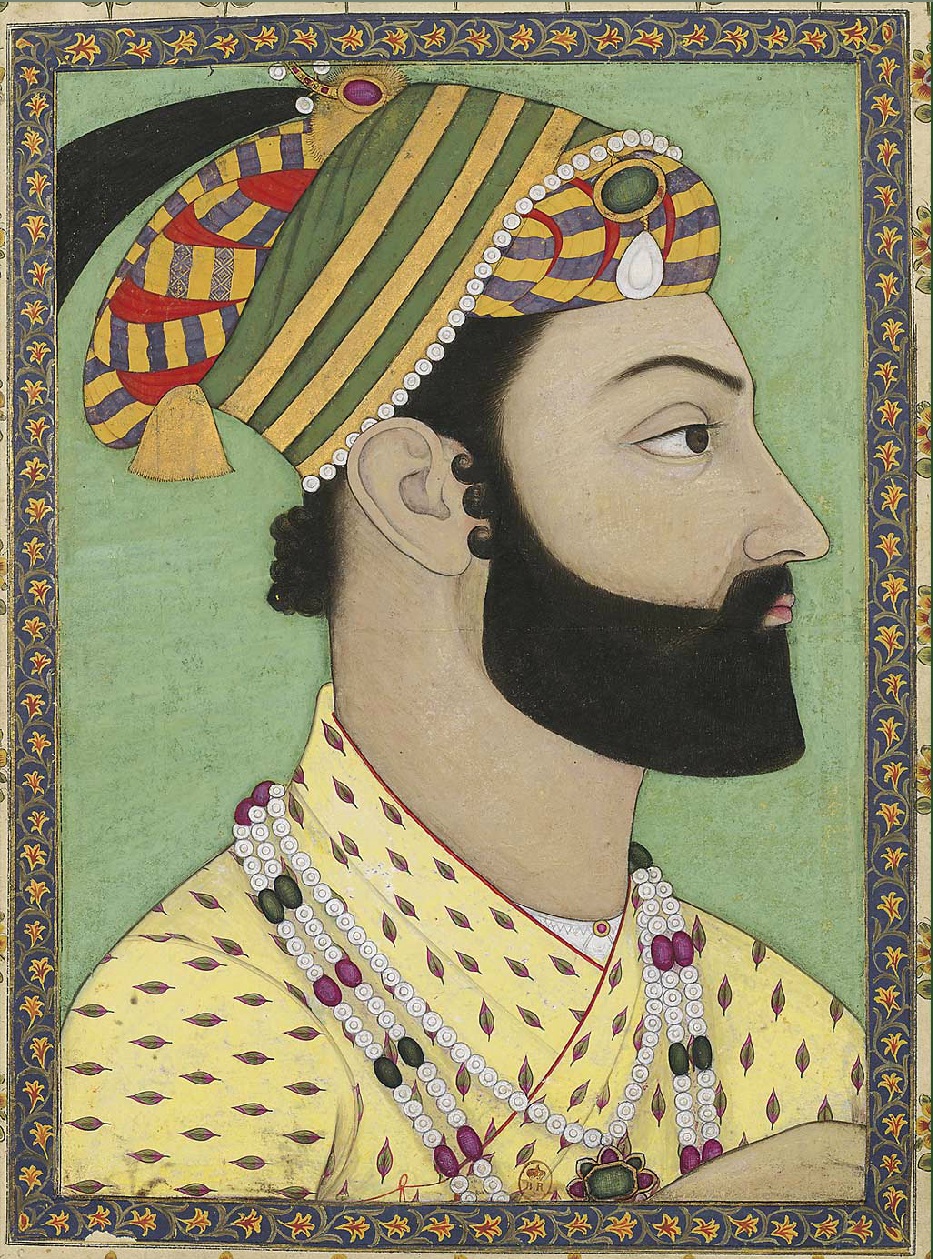
Portrait of Ahmad-Shah Durrani. Mughal miniature. ca. 1757, Bibliothèque nationale de FranceAnonymousUnknown author · Public domain · Commons
The Durrani Empire, colloquially known as the Kingdom of Afghanistan, the Afghan Empire, or the Sadozai Kingdom, was an Afghan empire founded in 1747 by Ahmad Shah Durrani, of the Pashtun Durrani tribe. The empire spanned parts of Central Asia, the Iranian plateau, and the Indian subcontinent. At its peak, it ruled over present-day Afghanistan, much of Pakistan, parts of northeastern and southeastern Iran, eastern Turkmenistan, and northwestern India.
In 1709, Mirwais Hotak, chief of the Ghilji tribe of Loy Kandahar, gained independence from the Safavid Persians. From 1722 to 1725, his son Mahmud Hotak briefly ruled large parts of Iran and declared himself as Shah of Persia. However, the Hotak dynasty came to a complete end in 1738 after being toppled and banished by the Afsharids who were led by Nader Shah Afshar of Persia.
Read more
Why all this verbose talk? God has created Ahmad Khan a much greater man than any of you; his life is the most noble of all the Afghan families. Maintain, therefore, God's work, for His wrath will weigh heavily upon you if you destroy it.
Ahmad Khan reputedly hesitated to accept the open decision of the jirga, so Sabir Khan again intervened. He placed some wheat or barley sheaves in Ahmad Khan's turban, and crowned him Pādshah, Durr-i-Durrān (Shah, Pearl of the Pearls).
Traveling by helicopter enables us to see the beauty of Kandahar province from the air. (USACE Photo by Karla Marshall)Karla Marshall · Public domain · Commons
Flag of Herat until 1842Orange Tuesday (talk) · Public domain · Commons
Wars and Battles
The Mughal power in northern India had been declining after the death of Emperor Aurangzeb, who died in 1707. In 1751–52, the Ahamdiya treaty was signed between the Marathas and Mughals, when Balaji Bajirao was the Peshwa. Through this treaty, the Marathas controlled virtually the whole of India from their capital at Pune and the Mughal rule was restricted only to Delhi (the Mughals remained the nominal heads of Delhi). Marathas were now straining to expand their area of control towards the Northwest of India. Ahmad Shah sacked the Mughal capital and withdrew with the booty he coveted. To counter the Afghans, Peshwa Balaji Bajirao sent Raghunathrao. He defeated the Rohillas and Afghan garrisons in Punjab and succeeded in ousting Timur Shah and his court from India and brought Lahore, Multan, Kashmir and other subahs on the Indian side of Attock under Maratha rule.
1757 CE – 1808 CE · Capital: Fort Dansborg · 2,222 km²
Danish India (Danish: Dansk Ostindien, lit. 'Danish East India') was the name given to the forts and factories of Denmark–Norway (Denmark after 1814) in the Indian subcontinent, forming part of the Danish overseas colonies. Denmark held colonial possessions in India for more than 200 years, including the town of Tharangambadi in present-day Tamil Nadu state, Serampore in present-day West Bengal, and the Nicobar Islands, currently part of India's union territory of the Andaman and Nicobar Islands.
The early years of the colony were arduous, with poor administration and investment, coupled with the loss of almost two-thirds of all the trading vessels dispatched from Denmark. The ships that did return made a profit on their cargo, but total returns fell well short of the costs of the venture. Moreover, the geographical location of the colony was vulnerable to high tidal waves that repeatedly destroyed what people built – roads, houses, administrative buildings, markets, etc. Although the intention had been to create an alternative to the English and Dutch traders, the dire financial state of the company and the redirection of national resources towards the Thirty Years' War led the colony to abandon efforts to trade directly for themselves and, instead, to become neutral third-party carriers for goods in the Bay of Bengal.
12 April 1732 – King Christian VI signs charter of new Asiatic Company with 40-year monopoly on Asian trade with India and China. Both previous companies had failed due to the lack of continuity in trade. This time, the intention of the investors was "to place this Asiatic Trade in Our Realms and Territories on a more constant footing in time to come."
Read more
1730s – Denmark's Chinese and Indian trade stabilises, with cargo from India dominated by cotton fabrics from the Coromandel Coast and Bengal.
November 1754 – A meeting of Danish-Norwegian officials is held in Tranquebar. A decision is made to colonise the Andaman and Nicobar Islands to plant pepper, cinnamon, sugarcane, coffee, and cotton.
December 1755 – Danish settlers arrive on Andaman Islands. The colony experiences outbreaks of malaria that saw the settlement abandoned periodically until 1848, when it was abandoned for good.
During the Napoleonic Wars, Denmark-Norway practiced a policy of armed neutrality whilst carrying French and Dutch goods from the Dutch East Indies to Copenhagen. This led to the English Wars during which Britain defeated the Danish-Norwegian fleet, cut off the Danish East India Company's India trade, and occupied Dansborg, Balasore and Frederiksnagore from 1801 to 1802, and again, from 1808 to 1815. In 1814 Norway gained independence from Denmark.
Read more
Italy made an attempt at buying the Nicobar Islands from Denmark between 1864 and 1868. In an attempt to gain colonies for the nascent kingdom, the Nicobar Islands were a prospect since it was about to be vacated by the Danes anyway.
After the Danish colony of Tranquebar was ceded to the British, it lost its special trading status and had its administrative roles transferred to Nagapattinam. The town rapidly dwindled in importance, although the expansion of the British into South India led to Tranquebar becoming a hub for missionary activity for some time and a place particularly known for training native priests. By the end of the 19th century, the mission established by Ziegenbalg was functioning entirely independently and lives on today as the Tamil Evangelical Lutheran Church.
Read more
Now primarily a fishing village, the legacy of the Danish colonial presence is entirely local but can be seen in the architecture of the small town that lies within the boundaries of the old (and long gone) city walls. Journalist Sam Miller describes the town as the most recognisably European of the former colonial settlements.
The Sikh Confederacy was a confederation of twelve sovereign Sikh states (each known as a Misl, derived from the Arabic word مِثْل meaning 'equal'; sometimes spelt as Misal) which rose during the 18th century in the Punjab region in the northwestern part of the Indian subcontinent. The misls were sovereign Sikh principalities originally formulated to defend the Darbar Sahib complex of Amritsar.
After the death of Banda Singh, the Sikhs were left without a main leader and entered in a period of hardship. The Sikhs managed to gain control of Amritsar and established it as their centre after evicting the Bandai Sikhs from it. Bhai Mani Singh was appointed as the custodian of the Darbar Sahib shrine. Other opponents to the Sikhs at the time aside from the Mughals were heretical sects, such as the Gulab Rahis and Gangu Shahis, that continued to follow a lineage of personal gurus, which mainstream Sikhs had stopped practicing after the death of Guru Gobind Singh. Whilst the majority of Sikhs in this period continued to live a civilian life in Mughal society, a proporation of Sikhs continued a rebellion against the Mughal authority, with these Sikhs being known as the Tat Khalsa.
The misls formed a commonwealth that was described by Swiss adventurer Antoine Polier as a natural "aristocratic republic". Each misl was a confederacy of Sikh horsemen that was headed by a leader known as a sardar, who held the position of misldar. Although the misls were unequal in strength, and each misl attempted to expand its territory and access to resources at the expense of others, they acted in unison in relation to other states. The misls held biannual meetings of their legislature, the Sarbat Khalsa in Amritsar. According to Hans Herrli, the various misls were not organized along the same lines as one another. Some were akin to large, family clans whilst others resembled brotherhoods (Nishanwalia Misl), or religious-orders (Shaheedan Misl). The size, prominence, and strength of each misl also varied considerably based on any particular point of time.
Each Misl was made up of members of soldiers, whose loyalty was given to the Misl's leader. A Misl could be composed of a few hundred to tens of thousands of soldiers. Any soldier was free to join whichever Misl he wished, and was free to cancel his membership of the Misl to whom he belonged. He could, if he wanted, cancel his membership of his old Misl and join another. The Barons would allow their armies to combine or coordinate their defences together against a hostile force if ordered by the Misldar Supreme Commander. These orders were only issued in military matters affecting the whole Sikh community. These orders would normally be related to defense against external threats, such as Afghan military attacks. The profits of a fighting action were divided by the misls to individuals based on the service rendered after the conflict using the sardari system.
Most of the Sikh principalities established in the 18th century survived until the 19th century, when they were either absorbed or subjugated by the Sukerchakias. The Sukerchakias under Ranjit Singh would finally gain pre-eminence amongst all of its contemporary misls, leading to all of their annexations by the Sukerchakias and the eventual formation of a Sikh Empire in 1799. Ranjit Singh of the Sukerchakia Misl managed to subdue most of the other misls by the end of the 18th century. However, the Phulkian Sikhs and their kingdoms escaped this fate and continued to be independent from the Sukerchakias. In the 19th century, the former misls had lost their political and martial functions, yet their names became caste-markers for certain communities, such as the Thokas adopting the Ramgarhia name and the Kalals adopting the name Ahluwalia.
1775 CE – 2024 CE · Capital: Kathmandu · 227,188 km²
Satellite image of Nepal in October 2002.Jacques Descloitres, MODIS Rapid Response Team, NASA/GSFC · Public domain · Commons
Nepal, officially Federal Democratic Republic of Nepal, is a landlocked country in South Asia. It is mainly situated in the Himalayas, but also includes parts of the Indo-Gangetic Plain. It borders the Tibet Autonomous Region of China to the north, and India to the south, east, and west, while it is narrowly separated from Bangladesh by the Siliguri Corridor, and from Bhutan by the Indian state of Sikkim.
By 55,000 years ago, the first modern humans had arrived on the Indian subcontinent from Africa. The earliest known modern human remains in South Asia date to about 30,000 years ago. The oldest discovered archaeological evidence of human settlements in Nepal dates to around the same time.
Read more
After 6500 BC, evidence for the domestication of food crops and animals, construction of permanent structures, and storage of agricultural surplus appeared in Mehrgarh and other sites in what is now Balochistan. These gradually developed into the Indus Valley Civilisation, the first urban culture in South Asia. Prehistoric sites of palaeolithic, mesolithic and neolithic origins have been discovered in the Siwalik hills of Dang district. The earliest inhabitants of modern Nepal and adjoining areas are believed to be people from the Indus Valley Civilisation.
Nepal depends on diplomacy for national defence. It maintains a policy of neutrality between its neighbours, has amicable relations with other countries in the region, and has a policy of non-alignment at the global stage. Nepal is a member of SAARC, UN, WTO, BIMSTEC and ACD, among others. It has bilateral diplomatic relations with 167 countries and the EU, has embassies in 30 countries and six consulates, while 25 countries maintain embassies in Nepal, and more than 80 others maintain non-residential diplomatic missions. Nepal is one of the major contributors to the UN peacekeeping missions, having contributed more than 119,000 personnel to 42 missions since 1958.
Nepal is one of the least developed countries, which ranks 165th in the world in nominal GDP per capita and 162nd in GDP per capita at PPP. Nepal's gross domestic product (GDP) for 2019 was $34.186 billion. Nepal has consistently been ranked as one of the poorest countries in the world. Nepal has been a member of WTO since 23 April 2004.
Read more
The 16.8-million-worker Nepali labour force is the 37th largest in the world. The primary sector makes up 27.59% of GDP, the secondary sector 14.6%, and the tertiary sector 57.81%. Nepal's foreign exchange remittances of US$8.1 billion in 2018, the 19th largest in the world and constituting 28.0% of GDP, were contributed to its economy by hundreds of thousands of workers primarily in Malaysia and the Middle East, almost all of them unskilled labourers.
By the late 1940s, pro-democracy movements and political parties in Nepal were critical of the Rana autocracy. Following the success of Indian independence movement which Nepalese activists had taken part in, with India's support and cooperation of King Tribhuvan, Nepali Congress was successful in toppling the Rana regime, establishing a parliamentary democracy. After a decade of power wrangling between the king and the government, King Mahendra (ruled 1955–1972) scrapped the democratic experiment in 1960, and a "partyless" panchayat system was made to govern Nepal. The political parties were banned and politicians imprisoned or exiled. The panchayat rule modernised the country, introducing reforms and developing infrastructure, but curtailed liberties and imposed heavy censorship.
The most widely worn traditional dress in Nepal, for both women and men, from ancient times until the advent of modern times, was draped. For women, it eventually took the form of a sari, a single long piece of cloth, famously six yards long, and of width spanning the lower body. The sari is tied around the waist and knotted at one end, wrapped around the lower body, and then over the shoulder. In its more modern form, it has been used to cover the head, and sometimes the face, as a veil, particularly in the Terai. It has been combined with an underskirt, or the petticoat, and tucked in the waistband for more secure fastening. It is worn with a blouse, or cholo, which serves as the primary upper-body garment, the sari's end, passing over the shoulder, now serving to obscure the upper body's contours, and to cover the midriff.
British Ceylon refers to the imperial possessions of the United Kingdom in the island of Ceylon, present-day Sri Lanka, between 1796 and 4 February 1948. Initially, the area it covered did not include the Kingdom of Kandy, which was a protectorate, but from 1817 to 1948 the British possessions included the whole island. The British Ceylon period is the history of Sri Lanka between 1815 and 1948. It follows the fall of the Kandyan Kingdom into the hands of the British Empire, ending over 2300 years of Sinhalese monarchy.
The first Europeans to visit Ceylon in modern times were the Portuguese: Lourenço de Almeida arrived in 1505, finding the island divided into seven warring kingdoms and unable to fend off intruders. The Portuguese founded a fort at the port city of Colombo in 1517 and gradually extended their control over the coastal areas. In 1592 the Sinhalese moved their capital to the inland city of Kandy, a location more secure against attack from invaders. Intermittent warfare continued through the 16th century. Many Lowland Ceylonese were forced to convert to Christianity while the coastal Moors were religiously persecuted and forced to retreat to the Central highlands while some of them desired to leave the country. The Buddhist majority disliked Portuguese occupation and its influences and welcomed any power who might rescue them and defeat the Portuguese.
The multiracial population of Ceylon was numerous enough to support the European colonists; the Portuguese and the Dutch offspring of the past 440 odd years of colonial history was large enough to run a stable government. Unlike the previous rulers, the British embarked on a plantation programme which initially brought coffee plantations to the island. These were later wiped out by coffee rust. Coffee plants were replaced by tea and rubber plantations. This made Ceylon one of the richest countries in Asia.
Read more
The British also brought Tamils from British India and made them indentured labourers in the Hill Country. This was in addition to the several hundred thousand Tamils already living in the Maritime provinces and another 30,000 Tamil Muslims. The linguistically bipolar island needed a link language and English became universal in Ceylon.
The Ceylon National Congress (CNC) was founded to agitate for greater autonomy. The party soon split along ethnic and caste lines. Prof. K. M. de Silva, the famous Peradeniya historian has pointed out that the refusal of the Ceylon Tamils to accept minority status to be one of the main causes which broke up the CNC. The CNC did not seek independence or "Swaraj". What may be called the independence movement broke into two streams, viz., the "constitutionalists", who sought independence by gradual modification of the status of Ceylon, and the more radical groups associated with the Colombo Youth League, Labour movement of Goonasinghe, and the Jaffna Youth Congress. These organisations were the first to raise the cry of Swaraj, or outright independence, following the Indian example, when Jawaharlal Nehru, Sarojini Naidu and other Indian leaders visited Ceylon in 1926.
In 1803, as soon as Great Britain gained the European-controlled parts of Sri Lanka from the Dutch, they wanted to expand their new sphere of influence by making the native Kingdom of Kandy a protectorate, an offer initially refused by the King of Kandy. Although the previous Dutch administration had not been powerful enough to threaten the reign of the Kandyan Kings, the British were much more powerful. The Kandyan refusal to accept a protectorate led eventually (1803) to the 1st Kandyan War, but was repulsed. In 1815 Kandy was captured in the Second Kandyan War, ending Sri Lankan independence.
Read more
The rule of King Sri Vikrama Rajasinghe was not favoured by his chieftains. The king, who was of South Indian ancestry, faced powerful chieftains and sought cruel measures to repress their popularity with the people.
1799 CE – 1848 CE · Capital: Gujranwala (1799–1802), Lahore (1802–1849) · 397,813 km²
Statue of Ranjit Singh in Lahore (Pakistan) in Lahore fort (Shahi Qila).Dawn · CC BY-SA 4.0 · Commons
The Sikh Empire was a regional power based in the Punjab region of South Asia. It existed from 1799, when maharaja Ranjit Singh captured Lahore, to 1849, when it was defeated and annexed by the British East India Company following the Second Anglo-Sikh War. At its peak in the mid-19th century, the empire extended from Gilgit and Tibet in the north to the deserts of Sindh in the south and from the Khyber Pass in the west to the Sutlej in the east, and was divided into 8 provinces.
Sikhism originated in the 16th-century Punjab with the teachings of Guru Nanak. Initially a pacifist faith, the followers of Sikhism (known as Sikhs) became increasingly militarised owing to their conflicts with the Mughal Empire and the killing of their gurus, Guru Arjan and Guru Tegh Bahadur, on the orders of Mughal emperors. With the decline of Mughal power after the death of Aurangzeb in 1707, the tenth and last Sikh guru Gobind Singh established a militia known as Khalsa Fauj. The first Sikh state led by Banda Singh Bahadur was short-lived, but by the mid-18th century a confederation of twelve Sikh states, known as misls, was firmly established in central and eastern Punjab. The Dal Khalsa armies of the twelve misls engaged in numerous conflicts with the Mughals as well as the invading Afghan armies, especially those led by Ahmad Shah Abdali.
The empire's ruling court based out of Lahore is termed the Lahore Darbar or Khalsa Darbar. Faqir Saifuddin of the Fakir Khana Museum prefers to use the term Punjab Darbar rather than "Khalsa Darbar", owing to the large role Muslims played in Ranjit Singh's court. The ruling court was diverse and under the ultimate command of the ruling maharaja, who was the "drum of the Khalsa". In-theory, the Sikh court was based on the Khalsa ideals propounded by Guru Gobind Singh yet the court was secular in-practice. As an example of this secularism, members of the court came from various religious background, including Sikhs, Hindus, Muslims, and Christians. Furthermore, the members also came from various ethnic, regional, and caste backgrounds, such as Dogras, Rajputs, Brahmins, Jats, and Europeans.
After the death of Ranjit Singh in 1839, the empire was severely weakened by internal divisions and political mismanagement. The leadership of the empire passed through a quick succession of rulers, namely Kharak Singh, Nau Nihal Singh, Chand Kaur, and Sher Singh, who kept being assassinated, with no ruler being able to rule for a sustained period of time, leading to unstability. After the murder of Sher Singh, Duleep Singh was appointed as the new ruler by the Panch (Military Council) with Jind Kaur as regnant since Duleep was a child. Due to internal divisions and factionalisms (include the British colluding with internal fifth-columnists), Jind Kaur was advised to go to war against the East India Company to distract the Sikh Army and decrease their power and influence in the affairs of the state, leading to the First Anglo-Sikh War.
Early Modern States of the Indian Subcontinent: Frequently Asked Questions
Which states existed in the Indian Subcontinent in this period?
This page maps 21 states of the Indian Subcontinent founded between 1453 CE and 1799 CE: Lodi Dynasty, Nayaks of Madurai, Hussain Shahi Dynasty, Nayaks of Thanjavur, Sur Empire, Portuguese Colonies, Kingdom of Mysore, Gorkha Kingdom, Kingdom of Bhutan, Dutch Ceylon, Sikhs, Carnatic Sultanate and 9 more.
Which was the largest of the Early Modern States of the Indian Subcontinent?
Durrani Empire had the largest mapped extent, about 2,195,447 km².
Which of the Early Modern States of the Indian Subcontinent lasted longest?
Kingdom of Bhutan lasted longest, 1636 CE – 2024 CE.
↑↓ to navigate↵ to open
12,754 Planetary Entities Indexed
We use Google Analytics cookies to understand which pages are useful. Necessary storage only keeps your theme and this choice on your device. Privacy policy