An Imperial Estate (Latin: Status Imperii; German: Reichsstand, plural: Reichsstände) was an entity or an individual of the Holy Roman Empire with representation and the right to vote in the Imperial Diet (Reichstag). Rulers of these Estates were able to exercise significant rights and privileges and were "immediate", meaning the only authority above them was that of the Holy Roman Emperor. They were thus able to rule their territories with a considerable degree of autonomy.
The system of imperial states replaced the more regular division of Germany into stem duchies in the early medieval period.
The old Carolingian stem duchies were retained as the major divisions of Germany under the Salian dynasty, but they became increasingly obsolete during the early high medieval period under the Hohenstaufen, and they were finally abolished in 1180 by Frederick Barbarossa in favour of more numerous territorial divisions. From 1489, the Imperial Estates represented in the Diet were divided into three chambers, the college of prince-electors (Kurfürstenkollegium/den Kurfürstenrat), the college of imperial princes (Reichsfürstenrat) and the college of imperial cities. Counts and nobles were not directly represented in the Diet in spite of their immediate status, but were grouped into "benches" (Grafenbänke) with a single vote each.
Each state in its own colour. Move the timeline to see which existed in any year from 990 AD to 1805; select a territory to read about it. Borders: Cliopatria / Seshat (CC BY 4.0).
990 CE – 1384 CE · Capital: Bruges, later Ghent and Lille · 36,834 km²
Kaart van Vlaanderen Nieuwe Kaart van Vlaanderen Nouvelle Carte du Comte de Flandre (titel op object), BI-B-FM-090-138Rijksmuseum · CC0 · Commons
The County of Flanders was one of the most powerful political entities in the medieval Low Countries, located on the North Sea coast of modern-day Belgium and north-eastern France. Unlike the neighbouring states of Brabant and Hainaut, it was within the territory of the Kingdom of France. The counts of Flanders held the northernmost part of the kingdom, and were among the original twelve peers of France.
Under Charles V, Holy Roman Emperor (born in the Flemish city Ghent), Flanders became a member of the Burgundian Circle. The county was later involved in the Guelders Wars.
Read more
Through the Pragmatic Sanction of 1549, the County of Flanders was officially detached from France. It became an independent territory of the Holy Roman Empire. This constitutional act made Flanders part of the Seventeen Provinces that constituted the Low Countries and from then on would be inherited as a whole.
The Low Countries held an important place in the Empire. For Charles personally, they were the region where he spent his childhood. Because of trade, industry and the rich cities, they were also important for the treasury. Lordship transferred to the Spanish branch of the House of Habsburg with Philip II of Spain, and after 1556 belonged to the Kings of Spain.
In 1789, a revolution broke out against emperor Joseph II. In 1790, the county of Flanders and a separate province called West Flanders, which constituted the territories returned to the Emperor by France, were two of the founding members of the United States of Belgium. Just like the other parts of the Austrian Netherlands, the county of Flanders declared its independence. This took place on the Friday-market at Ghent on 4 January 1790. The "Manifest van Vlaenderen" was drawn up by Charles-Joseph de Graeve and Jean-Joseph Raepsaet.
Read more
The county of Flanders was annexed by France in 1795, after the battle of Fleurus. The French republic abolished all political entities from the ancien régime and the county of Flanders officially ceased to exist. The title of count of Flanders became a symbolical title which was only used sporadicly ever after.
German: Kaiser Maximilian I. Emperor Maximilian Ititle QS:P1476,de:"Kaiser Maximilian I. "label QS:Lde,"Kaiser Maximilian I.Albrecht Dürer · Public domain · Commons
The Duchy of Burgundy (Latin: Ducatus Burgundiae; French: Duché de Bourgogne) was a medieval and early modern feudal polity in north-western regions of historical Burgundy. It belonged to the Kingdom of France, and was initially bordering the Kingdom of Burgundy to the east and south, thus being distinct from the neighboring Free County of Burgundy (modern region of Franche-Comté). The first duke of Burgundy (Latin: dux Burgundiae), attested in sources by that title, was Richard the Justiciar in 918.
The Duchy of Burgundy was a successor of the earlier Kingdom of the Burgundians, which evolved out of territories ruled by the Burgundians, an East Germanic tribe that arrived in Gaul in the 5th century. The Burgundians settled in the area around Dijon, Chalon-sur-Saône, Mâcon, Autun and Châtillon-sur-Seine, and gave the name to the region. The Kingdom of the Burgundians was annexed by the Merovingian King of the Franks, Childebert I, in 534, following their defeat by the Franks. It was recreated, however, on several occasions when Frankish territories were redivided between the sons on the death of a Frankish king.
Read more
As part of the Kingdom of the Franks, Burgundy maintained a semi-autonomous existence, with the Burgundians maintaining their own law code, the Loi Gombette. However, southern Burgundy was pillaged by the Saracen invasion of the 8th century.
The Landgraviate of Brabant (Modern Dutch: Landgraafschap Brabant, Modern French: Landgraviat de Brabant) was a small imperial fiefdom west of Brussels, consisting of the area between the Dender and Zenne rivers in the Low Countries, then part of the Holy Roman Empire.
Before 1085 the land had belonged to Hermann II, Count Palatine of Lotharingia. Upon his death, Emperor Henry IV assigned it to Henry III, Count of Louvain and Brussels, granting him the Landgraviate of Brabant. This is the earliest known use of the term landgrave.
1260 CE – 1362 CE · Capital: The Hague · 11,563 km²
A montage of important buildings and cityscapes in The Hague, Netherlands.Montage by Ætoms · CC BY-SA 4.0 · Commons
The County of Holland was a state of the Holy Roman Empire from its inception until 1433. From 1433 onward it was part of the Burgundian Netherlands, from 1482 part of the Habsburg Netherlands and from 1581 onward the leading province of the Dutch Republic until the Batavian Revolution in 1795. The territory of the County of Holland corresponds roughly with the current provinces of North Holland and South Holland in the Netherlands.
1260 CE – 1539 CE · Capital: Chambéry (from 1295) · 35,962 km²
Landscape of the French city of Chambéry and its surroundings, seen from Les Monts (mountain crossing the city), in Savoie.Florian Pépellin · CC BY-SA 3.0 · Commons
The County of Savoy was a feudal state of the Holy Roman Empire which emerged, along with the free communes of Switzerland, from the collapse of the Kingdom of Burgundy in the 11th century. It was the cradle of the future Savoyard state.
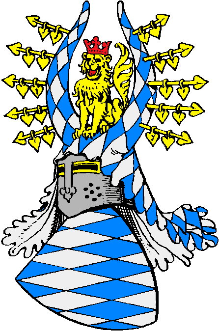
1260 CE – 1805 CE · Capital: Regensburg (until 1255), Munich (from 1505) · 97,158 km²
Old Town of Munich (Germany): on the left the Frauenkirche and on the right the New Town HallThomas Wolf, www.foto-tw.de · CC BY-SA 3.0 de · Commons
The Duchy of Bavaria (German: Herzogtum Bayern) was a frontier region in the southeastern part of the Merovingian kingdom from the sixth through the eighth century. It was settled by Bavarian tribes and ruled by dukes (duces) under Frankish overlordship. A new duchy was created from this area during the decline of the Carolingian Empire in the late ninth century. It became one of the stem duchies of the East Frankish realm, which evolved as the Kingdom of Germany and the Holy Roman Empire.
Portrait of Jadwiga Jagiellonkaanonymous · Public domain · Commons
Ended
1805 CE
Last recorded ruler
Maximilian I, Elector of Bavaria
House of Ascania
1260 CE – 1486 CE · 34,934 km²
The House of Ascania is a reigning family historically documented since the 11th century. It is also known as the House of Anhalt, which refers to its longest-held possession. Their ancestral seats, Ballenstedt, Anhalt, Aschersleben, and Bernburg, are located in the present-day Anhalt region in Saxony-Anhalt. The ruins of Anhalt Castle are situated in the Harz Mountains northeast of Harzgerode. The name "Askanier" derives from the Latinization of their seat at Aschersleben. Since the late 17th century, only the Anhalt branch has survived.
The Askanier are documented as Counts of Ballenstedt, originating from an area now part of the Harz district in Saxony-Anhalt. From the outset, the family held possessions in the present-day districts of Salzlandkreis and Anhalt-Bitterfeld. Ballenstedt, Aschersleben, and ultimately Anhalt Castle were the most significant ancestral seats, with Ballenstedt as the eponymous seat in the 11th and the 12th centuries. Those possessions, along with further holdings in present-day Anhalt, led to the emergence of several Anhalt principalities in the 13th century. Numerous land divisions caused concentrated ownership in a single hand to be the exception over the centuries.
Read more
The earliest-known Askanier, Esico of Ballenstedt, is reported in older literature to have built Anhalt Castle. The ruins of Anhalt Castle are located on a spur of the Great Hausberg on the right bank of the Selke.
Rauchbeinchronik Herzog Friedrich I. von SchwabenArtist: UnknownUnknown Scan: David Schnur · Public domain · Commons
The Hohenstaufen dynasty (US also, German: [ˌhoːənˈʃtaʊfn̩]), also known as the Staufer, was a noble family of German origin that rose to rule the Duchy of Swabia from 1079, and to royal rule in the Holy Roman Empire during the Middle Ages from 1138 until 1254. The dynasty's most prominent rulers – Frederick I (1155), Henry VI (1191) and Frederick II (1220) – ascended the imperial throne and also reigned over Italy and Burgundy.
The origin remains unclear, however, Staufer counts are mentioned in a document of emperor Otto III in 987 as descendants of counts of the region of Riesgau near Nördlingen in the Duchy of Swabia, who were related to the Bavarian Sieghardinger family. A local count Frederick (d. about 1075) is mentioned as progenitor in a pedigree drawn up by Abbot Wibald of Stavelot at the behest of Emperor Frederick Barbarossa in 1153. He held the office of a Swabian count palatine; his son Frederick of Büren (c. 1020–1053) married Hildegard of Egisheim (d. 1094–1095), a niece of Pope Leo IX. Their son Frederick I was appointed Duke of Swabia at Hohenstaufen Castle by the Salian king Henry IV of Germany in 1079.
Read more
At the same time, Duke Frederick I was engaged to the king's approximately seventeen-year-old daughter, Agnes.
Conrad IV was succeeded as duke of Swabia by his only son, two-year-old Conradin. By this time, the office of duke of Swabia had been fully subsumed into the office of the king, and without royal authority had become meaningless. In 1261, attempts to elect young Conradin king were unsuccessful. He also had to defend Sicily against an invasion, sponsored by Pope Urban IV (Jacques Pantaléon) and Pope Clement IV (Guy Folques), by Charles of Anjou, a brother of the French king. Charles had been promised by the popes the Kingdom of Sicily, where he would replace the relatives of Frederick II. Charles had defeated Conradin's uncle Manfred, King of Sicily, in the Battle of Benevento on 26 February 1266. The king himself, refusing to flee, rushed into the midst of his enemies and was killed.
The Kyffhäuser Monument was erected to commemorate Frederick I and was inaugurated in 1896. The Hohenstaufen arms were adopted by the German state of Baden-Württemberg in 1954. On 29 October 1968, the 700th anniversary of the death of Konradin, a society known as "Society for Staufer History" (de) was founded in Göppingen.
Read more
The Castel del Monte, Apulia, which was built during the 1240s by the Emperor Frederick II, was designated as a World Heritage Site in 1996.
The German artist, Hans Kloss, painted his Staufer-Rundbild depicting, in great detail, the history of the House of Hohenstaufen, in Lorch Monastery.
From 2000 to 2018, the Committee of Staufer Friends (de) has built thirty-eight Staufer steles (de) in Germany, France, Italy, Austria, Czech Republic and the Netherlands.
Fënster aus der Marienkapell vu Clairefontaine (Belsch).Pasbal · CC BY-SA 3.0 · Commons
The House of Luxembourg (Luxembourgish: D'Lëtzebuerger Haus; French: Maison de Luxembourg; German: Haus Luxemburg) or Luxembourg dynasty was a royal family of the Holy Roman Empire in the Late Middle Ages, whose members between 1308 and 1437 ruled as kings of Germany and Holy Roman emperors as well as kings of Bohemia, Hungary and Croatia. Their rule was twice interrupted by the rival House of Wittelsbach. The family takes its name from its ancestral county of Luxembourg, which passed to the House of Habsburg in 1443 following the extinction of the dynasty's male line.
The House of Wittelsbach (German: Haus Wittelsbach) is a former Bavarian dynasty, with branches that have ruled over territories including the Electorate of Bavaria, the Electoral Palatinate, the Electorate of Cologne, Holland, Zeeland, Sweden (with Swedish-ruled Finland), Denmark, Norway, Hungary, Bohemia, and Greece. Their ancestral lands of Bavaria and the Palatinate were prince-electorates, and the family had three of its members elected emperors and kings of the Holy Roman Empire. They ruled over the Kingdom of Bavaria which was created in 1805 and continued to exist until 1918.
1260 CE – 1414 CE · Capital: Brandenburg an der Havel (1157–1417), Berlin (1417–1806) · 80,542 km²
Berlin Cityscape seen from Victory ColumnThomas Wolf, www.foto-tw.de · CC BY-SA 3.0 · Commons
The Margraviate of Brandenburg (German: Markgrafschaft Brandenburg) was a major principality of the Holy Roman Empire from 1157 to 1806. Though initially an underdeveloped and economically modest territory, Brandenburg held electoral status within the Empire. Facing land division with Küstrin as recent as middle in the 16th century, it then quickly reunited and grew rapidly in importance after inheriting the Duchy of Prussia in 1618. Brandenburg came to play a pivotal role in both German and European history as the core of the Prussian kingdom.
Because of the sandy soil prevalent in Brandenburg, the agriculturally meager principality was denigrated as "the sandbox of the Holy Roman Empire". Albert invited colonists to settle the new territory, many of whom came from the Altmark ("Old March", a later name for the original Northern March), the Harz, Flanders (hence the Fläming region), and the Rhineland. After the capture of territory along the Elbe and Havel Rivers in the 1160s, Flemish and Dutch settlers from flooded regions in Holland used their expertise to build dikes in Brandenburg. Initially, the Ascanians protected the country by settling knights in villages; castles fortified with knights were mostly located in the border region of the Neumark. After a 14th century decline in imperial power, however, knights began constructing castles throughout the principality, granting them more independence.
Dominant confession among the population was Roman Catholic until the 1530s, then Lutheran., Elector was Roman Catholic until 1539, then Lutheran until 1613, and then Reformed.
Coins, Currency and Symbols
Flag of Brandenburg (1657-1701)Armoiries_électeur_Brandebourg.svg: Odejea derivative work: Amber and Black (talk) · CC BY-SA 3.0 · Commons
After Albert's death in 1170, his son succeeded him as Otto I, Margrave of Brandenburg. The Ascanians pursued a policy of expanding to the east and the northeast with the goal of connecting their territories through Pomerania to the Baltic Sea. This policy brought them into conflict with the Kingdom of Denmark. After the Battle of Bornhöved (1227), Margrave John I staked his claim to Pomerania, receiving it as a fief from Emperor Frederick II in 1231. The middle of the 13th century was a time of important developments for the Ascanian House, as it won Stettin (Szczecin) and the Uckermark (1250), although the former was later lost to the Duchy of Pomerania. Also around 1250 it took over Lubusz Land from then-fragmented Poland and subsequently conquered northwestern parts of the Duchy of Greater Poland in the late 13th century, moving the border east of the Oder river.
The Electorate of Trier (German: Kurfürstentum Trier or Kurtrier; French: Trèves) was an ecclesiastical principality of the Holy Roman Empire that existed from the end of the 9th to the early 19th century. It was the temporal possession of the prince-archbishop of Trier (Erzbistum Trier) who was, ex officio, a prince-elector of the empire. The other ecclesiastical electors were the archbishops (in the secular context called simply electors) of Cologne and Mainz.
The capital of the electorate was Trier; from the 16th century onward, the main residence of the Elector was in Koblenz.
French, Latin, Luxembourgish, Moselle Franconian German
Religion
Catholic Church
Coins, Currency and Symbols
Red St George's CrossZH2010 · Public domain · Commons
Electorate of Saxony
1363 CE – 1805 CE · Capital: Wittenberg (1356–1547), Dresden (1547–1806) · 35,177 km²
German: Bildnis Kurfürst Friedrich III. von Sachsen, genannt der Weise Portrait of Frederick the Wise, Elector of Saxonytitle QS:P1476,de:"Bildnis Kurfürst Friedrich III.Workshop of Lucas Cranach the Elder · Public domain · Commons
The Electorate of Saxony was an Electorate of the Holy Roman Empire. Centred on the Duchy of Saxe-Wittenberg with its capital at Dresden, Saxony was one of the most significant states within the empire. Formally known as the Prince-Elector of Saxony, its rulers came first from the House of Ascania from 1356 to 1422, then the House of Wettin until 1806, when it was replaced by the Kingdom of Saxony.
From the end of the 12th, a narrow circle of imperial electors emerged among highest princes, both secular and ecclesiastical, thus gradually excluding other, less powerful nobles from the electoral process. The dukes of Saxony had prominent roles in various imperial elections, and their electoral rights were affirmed both through practice and formal documents. Already before the Golden Bull of 1356, the Electoral College was reduced in practice to seven major princes: the archbishops of Mainz, Trier and Cologne, plus the king of Bohemia, the count palatine of the Rhine, the duke of Saxony, and the margrave of Brandenburg. Tying electoral rights to specific domains took place already in the early 13th century, and solidified from then on. In the case of the Saxon Electorate, the specific territory tied to was the Ascanian Duchy of Saxony, that emerged in 1180.
Johann Georg II., Achteltaler 1660, Dresden, CNGsee permissions · CC BY-SA 3.0 · Commons
Flag of Electoral SaxonySir Iain, crancelin by User:Sodacan from File:Arms of Albert of Saxe-Coburg and Gotha.svg. · Public domain · Commons
Blason Jean-Georges IV de SaxeUnknown author · CC BY 3.0 · Commons
Wars and Battles
The 1618 Defenestration of Prague, in which angry Protestants threw Catholic officials out of a window of Prague Castle, marked the end of a long period of religious peace. Elector John George I (r. 1611–1656) joined the emperor's side with the goal of preserving the status quo of the 1555 Peace of Augsburg. Initially he and the elector of Mainz tried to mediate between Emperor Matthias and the Bohemian estates that were behind the defenestration. After the death of the emperor in March 1619, the Bohemian estates deposed the newly crowned Ferdinand II and elected Frederick V of the Palatinate as their king. John George then agreed with Ferdinand II that Saxony should reconquer the two Bohemian tributary lands of Upper and Lower Lusatia for the emperor. In September 1620 Saxon troops marched into the two Lusatian territories and occupied them without major resistance.
The Margraviate of Moravia (Czech: Markrabství moravské; German: Markgrafschaft Mähren) was one of the Lands of the Bohemian Crown within the Holy Roman Empire, the Austrian Empire and Austria-Hungary, existing from 1182 to 1918. It was officially administered by a margrave in cooperation with a provincial diet. It was variously a de facto independent state, and also subject to the Duchy, later the Kingdom of Bohemia. It comprised the historical region called Moravia, which lies within the present-day Czech Republic.
The margrave held ultimate authority in Moravia, throughout the history of the margraviate. This meant that as its margraves became more foreign, so too did governance of the margraviate.
Read more
Moravia possessed a legislature, known as the Moravian Diet. The assembly has its origins in 1288, with the Colloquium generale, or curia generalis. This was a meeting of the upper nobility, knights, the Bishop of Olomouc, abbots and ambassadors from royal cities. These meetings gradually evolved into the diet.
The power of this diet waxed and waned throughout history. By the end of the margraviate, the diet was almost powerless. The diet consisted of three estates of the realm: the estate of upper nobility, the estate of the lower nobility, and the estate of prelates and burghers. With the February Patent of 1861, the diet was reformed into a more egalitarian body.
1422 CE – 1618 CE · Capital: Brandenburg an der Havel (1157–1417), Berlin (1417–1806) · 44,307 km²
Berlin Cityscape seen from Victory ColumnThomas Wolf, www.foto-tw.de · CC BY-SA 3.0 · Commons
The Margraviate of Brandenburg (German: Markgrafschaft Brandenburg) was a major principality of the Holy Roman Empire from 1157 to 1806. Though initially an underdeveloped and economically modest territory, Brandenburg held electoral status within the Empire. Facing land division with Küstrin as recent as middle in the 16th century, it then quickly reunited and grew rapidly in importance after inheriting the Duchy of Prussia in 1618. Brandenburg came to play a pivotal role in both German and European history as the core of the Prussian kingdom.
Because of the sandy soil prevalent in Brandenburg, the agriculturally meager principality was denigrated as "the sandbox of the Holy Roman Empire". Albert invited colonists to settle the new territory, many of whom came from the Altmark ("Old March", a later name for the original Northern March), the Harz, Flanders (hence the Fläming region), and the Rhineland. After the capture of territory along the Elbe and Havel Rivers in the 1160s, Flemish and Dutch settlers from flooded regions in Holland used their expertise to build dikes in Brandenburg. Initially, the Ascanians protected the country by settling knights in villages; castles fortified with knights were mostly located in the border region of the Neumark. After a 14th century decline in imperial power, however, knights began constructing castles throughout the principality, granting them more independence.
Dominant confession among the population was Roman Catholic until the 1530s, then Lutheran., Elector was Roman Catholic until 1539, then Lutheran until 1613, and then Reformed.
Coins, Currency and Symbols
Flag of Brandenburg (1657-1701)Armoiries_électeur_Brandebourg.svg: Odejea derivative work: Amber and Black (talk) · CC BY-SA 3.0 · Commons
After Albert's death in 1170, his son succeeded him as Otto I, Margrave of Brandenburg. The Ascanians pursued a policy of expanding to the east and the northeast with the goal of connecting their territories through Pomerania to the Baltic Sea. This policy brought them into conflict with the Kingdom of Denmark. After the Battle of Bornhöved (1227), Margrave John I staked his claim to Pomerania, receiving it as a fief from Emperor Frederick II in 1231. The middle of the 13th century was a time of important developments for the Ascanian House, as it won Stettin (Szczecin) and the Uckermark (1250), although the former was later lost to the Duchy of Pomerania. Also around 1250 it took over Lubusz Land from then-fragmented Poland and subsequently conquered northwestern parts of the Duchy of Greater Poland in the late 13th century, moving the border east of the Oder river.
1429 CE – 1449 CE · Capital: Luxembourg · 10,256 km²
Luxembourg City HallPierre Blaché from Paris, France · CC0 · Commons
The Duchy of Luxembourg (French: Luxembourg; German: Luxemburg; Luxembourgish: Lëtzebuerg) was a state of the Holy Roman Empire, the ancestral homeland of the noble House of Luxembourg. The House of Luxembourg became one of the most important political forces in the 14th century, competing against the Houses of Habsburg and Wittelsbach for supremacy in the Holy Roman Empire.
The first known reference to the territory was made by Julius Caesar in his Commentarii de Bello Gallico. The historical region of Luxembourg belonged to the Roman province of Belgica Prima. After the invasion of the Germanic tribes from the East, Luxembourg became part of the Frankish Empire. By the 843 Treaty of Verdun, it became part of the Lotharingian province of Middle Francia. According to the Treaty of Ribemont in 880, it had finally fallen to East Francia.
Read more
Modern historians explain the etymology of the word Luxembourg as coming from the word Letze, meaning fortification, which might have referred to either the remains of a Roman watchtower or a primitive refuge of the Early Middle Ages.
Army Colours of Luxembourg (Obverse)Proof02 (talk) (Transferred by Guerillero/Originally uploaded by Proof02) · CC BY-SA 3.0 · Commons
Armoiries Comtes de Luxembourg supersedingUnknown author · CC BY-SA 4.0 · Commons
Decline and Fall
Ended
1449 CE
Last recorded ruler
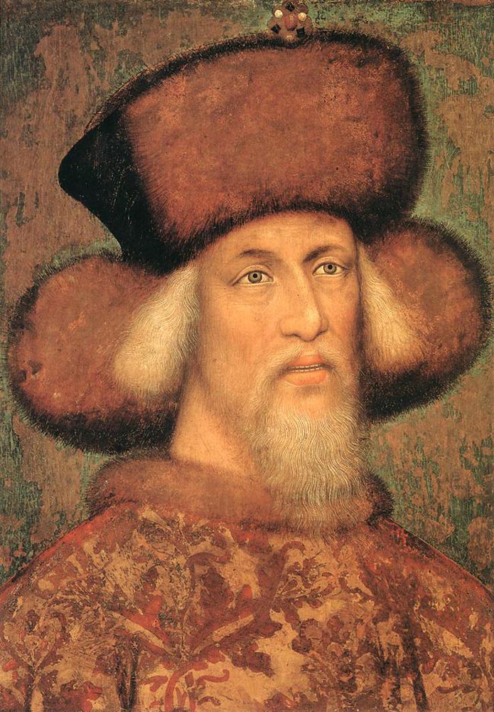
Sigismund
Electorate of Hanover
1709 CE – 1802 CE · Capital: Hanover · 47,681 km²
Portrait of King George II of Great Britain (1727-1760)John Shackleton · Public domain · Commons
The Electorate of Hanover (German: Kurfürstentum Hannover or simply Kurhannover) was an electorate of the Holy Roman Empire located in northwestern Germany that arose from the Principality of Calenberg. Although formally known as the Electorate of Brunswick-Lüneburg (German: Kurfürstentum Braunschweig-Lüneburg), it made Hanover its capital city. For most of its existence, the electorate was ruled in personal union with Great Britain and Ireland following the Hanoverian Succession.
The Duchy of Brunswick-Lüneburg had been split in 1269 between different branches of the House of Welf.
Coat of Arms of George I Louis, Elector of Hanover (1708-1714)Sodacan · CC BY-SA 3.0 · Commons
Wars and Battles
After the war ended, peace prevailed until the French Revolutionary Wars started. The War of the First Coalition against France (1792–1797) with Great Britain, Hanover and other war allies forming the coalition, did not affect Hanoverian territory since the first French Republic was fighting on several fronts, even on its own territory. Men were drafted to recruit the 16,000 Hanoverian soldiers fighting in the Low Countries under British command against France. In 1795, the Holy Roman Empire declared its neutrality, including Hanover, but a peace treaty with France was being negotiated until it failed in 1799.
States of the Holy Roman Empire: Frequently Asked Questions
What were the States of the Holy Roman Empire?
An Imperial Estate (Latin: Status Imperii; German: Reichsstand, plural: Reichsstände) was an entity or an individual of the Holy Roman Empire with representation and the right to vote in the Imperial Diet (Reichstag).
How many states were there among the States of the Holy Roman Empire?
The atlas maps 17 of them: County of Flanders, Duchy of Burgundy, County of Brabant, County of Holland, County of Savoy, Duchy of Bavaria, House of Ascania, House of Hohenstaufen, House of Luxembourg, House of Wittelsbach, Margraviate of Brandenburg, Electorate of Trier and 5 more.
Which was the largest of the States of the Holy Roman Empire?
Duchy of Burgundy had the largest mapped extent, about 119,644 km².
Which of the States of the Holy Roman Empire lasted longest?
Duchy of Bavaria lasted longest, 1260 CE – 1805 CE.
↑↓ to navigate↵ to open
12,754 Planetary Entities Indexed
We use Google Analytics cookies to understand which pages are useful. Necessary storage only keeps your theme and this choice on your device. Privacy policy


 Baldwin I of Constantinople1194–1205 CEArchives municipales et communautaires de Valenciennes · CC0 · Commons