The German Confederation (German: Deutscher Bund [ˈdɔʏtʃɐ ˈbʊnt]) was an association of 39 predominantly German-speaking sovereign states in Central Europe from 1815 to 1866. It was created by the Congress of Vienna to replace the Holy Roman Empire, which dissolved in 1806 as a result of the Napoleonic Wars.
The Confederation had only one organ, the Bundesversammlung, or Federal Convention (also Federal Assembly or Confederate Diet). The Convention consisted of the representatives of the member states. The most important issues had to be decided unanimously. The Convention was presided over by the representative of Austria, but this was a formality, as the Confederation had no head of state, since it was not a state.
The Confederation was a strong alliance among its member states because federal law was superior to state law. (The decisions of the Federal Convention were binding for the member states.) Additionally, the Confederation had been established for eternity and was impossible to dissolve (legally), with no member states able to leave it and no new member able to join without universal consent in the Federal Convention. But the Confederation was weakened by its very structure and member states, partly because its most important decisions required unanimity and the purpose of the Confederation was limited to security matters.
Each state in its own colour. Move the timeline to see which existed in any year from 1803 to 1870; select a territory to read about it. Borders: Cliopatria / Seshat (CC BY 4.0).
Where did the States of the German Confederation come from?
The War of the Third Coalition lasted from about 1803 to 1806. Following defeat at the Battle of Austerlitz by the French under Napoleon in December 1805, Francis II abdicated as Holy Roman Emperor on 6 August 1806, thus dissolving the Empire. In the aftermath of the Treaty of Pressburg Napoleon created the Confederation of the Rhine in July 1806, joining 16 of France's allies among the German states (including Bavaria and Württemberg). After the Battle of Jena–Auerstedt of October 1806 in the War of the Fourth Coalition, various other German states, including Saxony and Westphalia, also joined the Confederation. Only Austria, Prussia, Danish Holstein, Swedish Pomerania, and the French-occupied Principality of Erfurt stayed outside the Confederation of the Rhine. The War of the Sixth Coalition from 1812 to winter 1814 saw Napoleon's defeat and Germany's liberation.
What did the States of the German Confederation leave behind?
German artists and intellectuals, heavily influenced by the French Revolution, turned to Romanticism. At the universities, high-powered professors developed international reputations, especially in the humanities led by history and philology, which brought new historical perspective to the study of political history, theology, philosophy, language, and literature. With Georg Wilhelm Friedrich Hegel in philosophy, Friedrich Schleiermacher in theology, and Leopold von Ranke in history, the University of Berlin, founded in 1810, became the world's leading university. Von Ranke, for example, professionalized history and set the world standard for historiography. By the 1830s, mathematics, physics, chemistry, and biology had emerged with world-class science, led by Alexander von Humboldt in natural science and Carl Friedrich Gauss in mathematics.
How did the States of the German Confederation end?
A new generation of statesmen responded to popular demands for national unity for their own ends, continuing Prussia's tradition of autocracy and reform from above. Germany found an able leader to accomplish the seemingly paradoxical task of conservative modernization. In 1851, Bismarck was appointed by King Wilhelm I of Prussia (the future Kaiser Wilhelm I) to circumvent the liberals in the Landtag of Prussia, who resisted Wilhelm's autocratic militarism. Bismarck told the Diet, "The great questions of the day are not decided by speeches and majority votes... but by blood and iron"—that is, by warfare and industrial might. Prussia already had a great army; it was now augmented by rapid growth of economic power.
1803 CE – 1805 CE · Capital: Karlsruhe · 7,391 km²
The Electorate of Baden (German: Kurfürstentum Baden) was a State of the Holy Roman Empire from 1803 to 1806. In 1803, the Imperial diet bestowed the office of Prince-elector to Charles Frederick, but in 1806, Francis II dissolved the Empire. Baden then achieved sovereignty, and Charles Frederick became Grand Duke.
Blick vom Bergpark Wilhelmshöhe auf das Schloss Wilhelmshöhe und auf die Stadt Kassel. Im Hintergrund der Reinhardswald, der Kaufunger Wald und das Sölzinger Gebirge.W. Bulach · CC BY-SA 4.0 · Commons
The Electorate of Hesse (German: Kurfürstentum Hessen), also known as Hesse-Kassel or Kurhessen, was the title used for the former Landgraviate of Hesse-Kassel after an 1803 reform where Francis II, Holy Roman Emperor elevated its ruler to the rank of Elector, thus giving him a vote in any future elections to the emperorship. When the Holy Roman Empire was abolished in 1806, William I, Elector of Hesse, chose to retain the title of Elector, even though there was no longer an Emperor to elect.
Salzburg, Aussicht vom Mönchsberg Blick über die AltstadtPhoto: Andreas Praefcke · CC BY 3.0 · Commons
The Electorate of Salzburg (German: Kurfürstentum Salzburg or Kursalzburg) was an electoral principality of the Holy Roman Empire that existed from 1803 to 1805. It was established as the secular successor state to the Prince-Archbishopric of Salzburg following the German mediatisation of 1803 and was ruled by Ferdinand III, Grand Duke of Tuscany.
The electorate was created when the Prince-Archbishopric of Salzburg was secularized and its territory was reorganized as a secular principality within the Holy Roman Empire.
1803 CE – 1805 CE · Capital: Stuttgart · 10,032 km²
Neues Schloss (new palace), Schlossplatzspringbrunnen, Jubiläumssäule (Schlossplatz, Stuttgart, Germany).Julian Herzog (Website) · CC BY 4.0 · Commons
The Electorate of Württemberg was a short-lived state of the Holy Roman Empire on the right bank of the Rhine. In 1803, the Imperial diet raised the Duchy of Württemberg to an Electorate, the highest form of a princedom in the Holy Roman Empire. However, soon afterward, on 1 January 1806, the last Elector assumed the title of King of Württemberg. Later, the last Emperor, Francis II, abolished de facto the empire on 6 August 1806.
Flag of the Kingdom of Württemberg (1806 - 1816)Oinkuss · CC BY-SA 4.0 · Commons
Coat of arms of the Electorate of WürttembergSamhanin · CC BY-SA 3.0 · Commons
Kingdom of Hanover
1803 CE – 1865 CE · Capital: Hanover · 38,488 km²
George III (1738-1820) title QS:P1476,en:"George III (1738-1820) "label QS:Len,"George III (1738-1820) "label QS:Les,"Jorge III (1738-1820)"label QS:Lfr,"George III (1738-1820)"label QS:Last,"Xurde III (1738-1820)"label…Allan Ramsay · Public domain · Commons
The Kingdom of Hanover (German: Königreich Hannover) was established in October 1814 by the Congress of Vienna, with the restoration of George III to his Hanoverian territories after the Napoleonic era. Its capital was Hanover and it also ruled Gottingen and Osnabruck. It had access to the North Sea, and bordered on the Netherlands and the free German cities of Hamburg and Bremen. It succeeded the former Electorate of Hanover, and joined 38 other sovereign states in the German Confederation in June 1815.
The Lutheran church was the state church of the Kingdom of Hanover, with the King being summus episcopus (Supreme Governor of the Lutheran Church). Regional consistories supervised church and clergy. These were in Aurich, a simultaneously Lutheran and Calvinist consistory dominated by Lutherans (for East Frisia) and the Lutheran consistories in Hanover (for the former Electorate of Brunswick-Lüneburg proper), in Ilfeld (for the County of Hohenstein, a Hanoverian exclave in the Eastern Harz mountains), in Osnabrück (for the former Prince-Bishopric of Osnabrück), in Otterndorf (existed 1535–1885 for the Land of Hadeln) as well as in Stade (existed 1650–1903, until 1885 for the former Bremen-Verden proper without Hadeln, then including the complete Stade region). A general superintendent chaired each consistory.
The Kingdom of Hanover maintained an army after the Napoleonic Wars. In 1832, King William IV of Hanover and the United Kingdom issued his troops with British Army uniforms, but they differed slightly from their original British versions. When the personal union with the United Kingdom ended in 1837, and Ernst August ascended to the crown of Hanover, he replaced their uniforms with Prussian Army-style ones, which included the pickelhaube spiked helmet for his Guard Corps.
Read more
By 1866 they wore a more Austrian style of uniform, with only the guard corps keeping the Prussian one. During the Austro-Prussian War, the Hanoverian Army fought and defeated the Prussians during its march south towards Austria, at the Battle of Langensalza. However, it was later surrounded and forced to surrender to Prussia.
1806 CE – 1870 CE · Capital: Dessau (when united) · 1,990 km²
Aerial view of the townhall of DessauSven Scharr · CC BY 3.0 · Commons
The Duchy of Anhalt (German: Herzogtum Anhalt) was a historical German duchy. The duchy was located between the Harz Mountains in the west and the River Elbe and beyond to the Fläming Heath in the east. The territory was once ruled by the House of Ascania, and is now part of the federal state of Saxony-Anhalt.
1806 CE – 1870 CE · Capital: Schwerin · 11,341 km²
The Schwerin Palace, Mecklenburg-Vorpommern, Germany.Moahim · CC BY-SA 4.0 · Commons
The Duchy of Mecklenburg was a duchy within the Holy Roman Empire, located in the region of Mecklenburg. It existed during the Late Middle Ages and the early modern period, from 1471 to 1520, as well as 1695 to 1701. Its capital was Schwerin.
The state was formed in 1471, when duke Henry IV, had united the duchies of Mecklenburg-Stargard and Mecklenburg-Schwerin. The state existed until 7 May 1520, when it was partitioned into the duchies of Mecklenburg-Güstrow and Mecklenburg-Schwerin. It was again reestablished in 1695, with the unification of Mecklenburg-Güstrow and Mecklenburg-Schwerin.
1806 CE – 1865 CE · Capital: Weilburg, (1806–1816), Wiesbaden, (1816–1866) · 16,877 km²
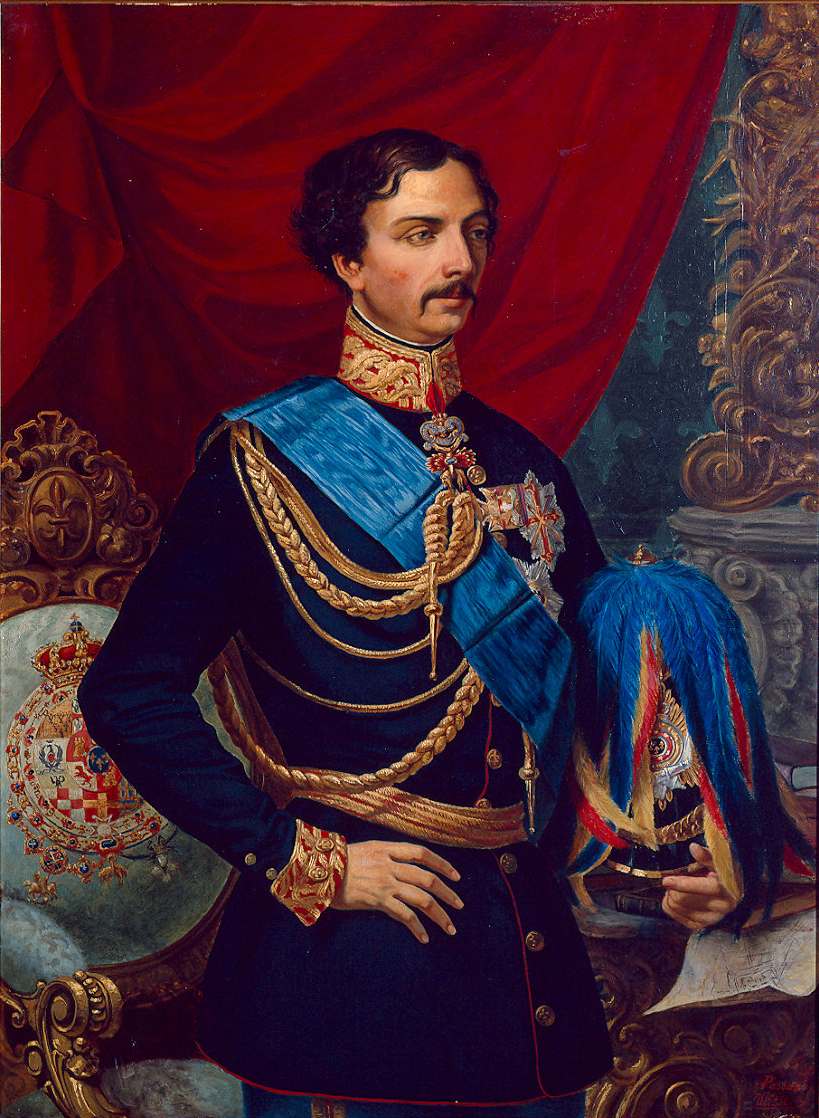
Grand-duc Adolphe de LuxembourgFerdinand d'Huart (1857-1919) · Public domain · Commons
The Duchy of Nassau (German: Herzogtum Nassau) was an independent state between 1806 and 1866, located in what became the German states of Rhineland-Palatinate and Hesse. It was a member of the Confederation of the Rhine and later of the German Confederation. Its ruling dynasty, later extinct, was the House of Nassau. The duchy was named after the Nassau Castle, itself after its historical core city, Nassau, although Wiesbaden rather than Nassau was its capital. In 1865, the Duchy of Nassau had 465,636 inhabitants.
The House of Nassau produced many collateral lines in the course of its nearly one-thousand-year history. Up to the 18th century, the three main lines were the small princedoms of Nassau-Usingen, Nassau-Weilburg, and Nassau-Dietz (later Orange-Nassau), with large, scattered territories in what is now the Netherlands and Belgium. From 1736, many treaties and agreements were made between the different lines (The Nassau Family Pact), which prevented further splitting of territories and enabled general political co-ordination between the branches. In this context, the administrative subdivisions of the individual territories were adjusted, laying the foundations for the later unification of the territories.
As a result of the disparate territories that were joined to form the Duchy, Nassau was not a religiously unified state. In 1820, the breakdown of religious groups was: 53% United Protestant, 45% Catholic, 1.7% Jewish, and 0.06% Mennonite. However, settlements with more than one religion were unusual. Most villages and cities were clearly dominated by the members of one of the two major Christian groups. As was common in Protestant parts of Germany, the constitution placed the church under state control. The Lutheran and Reformed churches agreed to unite into the single Protestant Church in Nassau in 1817, at the Unionskirche in Idstein, making it the first united Protestant church in the German Confederation.
The Duchy belonged the south German currency area. The most important denomination was therefore the guilder. This was minted for use as currency money. Up to 1837, there were 24 guilders to the Cologne silver marks (233.856 grammes). The guilder was divided into 60 kreutzer. Small change was minted in silver and copper, at 6, 3, 1, 0.5, and 0.25 grammes.
Read more
From 1816, there were also Kronenthaler of 162 kreutzer (i.e. 2.7 guilders). Between 1816 and 1828, the mint of the Duchy was located in buildings in Limburg, which are now the Bishop's curia. From 1837, the Duchy was one of the members of the Munich Currency Treaty, which set the silver mark (233.855 g) at 24.5 guilders. After the conclusion of the Dresden Coinage Convention in 1838, the Thaler was also legal tender and was minted in small quantities. Two dollars were equivalent to 3.5 guilders.
The Nassau Parliament met for the first time on 22 May 1848. Over the summer, groupings based on the Left-Right schema began to appear in the parliament. The unrest in Nassau was not calmed after the elections. In July 1848, it reached a new crisis point, with physical clashes on the right of the Duke to veto decisions of Parliament. While the left wing in the Parliament did not recognise this power, the right wing and the Ducal government insisted on it. Soon this dispute led to unrest among the general population. Finally, Hergenhahn called in Prussian and Austrian troops from Mainz, who put down the riots in Wiesbaden. In September, after fighting in the streets in Frankfurt, Federal troops occupied part of the Taunus.
1806 CE – 1870 CE · Capital: Oldenburg · 4,895 km²
Friedrich August von Schleswig-Holstein-GottorfConcord · CC BY-SA 4.0 · Commons
The Duchy of Oldenburg (German: Herzogtum Oldenburg), named for its capital, the town of Oldenburg, was a state in the north-west of present-day Germany.
On the death of Count Anthony Günther in 1667, the county of Oldenburg was inherited by King Frederick III of Denmark, a member of the Danish line of the House of Oldenburg. In 1773, the Treaty of Tsarskoye Selo transferred the county to Frederick August I of the junior Holstein-Gottorp branch. Subsequently, the county was elevated to a duchy.
After annexation by the French Empire in 1810, the duchy was restored as a grand duchy in 1815.
Blason Gérard VI (1430-1500), comte d'Oldenbourg et de DelmenhorstUnknown author · CC BY 3.0 · Commons
Free City of Bremen
1806 CE – 1870 CE · 517 km²
For most of its 1,200 year history, Bremen was an independent city within the confederal jurisdiction of the Holy Roman Empire. In the late Middle Ages, its governing merchant guilds were at the centre of the Hanseatic League, which sought to monopolise the North Sea and Baltic trade. To establish and confirm its independence, the city had to contend first with the Prince-Archbishop of Bremen, and then with the Swedes, who had become the masters of the surrounding, former episcopal, duchies after the Thirty Years' War.
The marshes and moraines near Bremen have been settled since about 12,000 BC. Burial places and settlements in Bremen-Mahndorf and Bremen-Osterholz date back to the 7th century AD. Since the Renaissance, chroniclers have assumed that Fabiranum or Phabiranon on Ptolemy's Fourth Map of Europe (dating from AD 150) refers to Bremen. However, Ptolemy's coordinates actually suggest a site northeast of the mouth of the river Visurgis (Weser). In Ptolemy's time the Chauci lived in the area now called North-Western Germany or Lower Saxony. By the end of the 3rd century they had merged with the Saxons.
Read more
During the Saxon Wars (772–804), Widukind led a prolonged resistance to the western advance of the Franks. The Frankish king Charlemagne ultimately prevailed: thousands of Saxon nobles were massacred, and conversion to Christianity was ordered by decree.
Soon after the beginning of the Thirty Years' War Bremen declared its neutrality. In 1623 it rejected the appeal of the Republic of the Seven United Netherlands to assist it in its struggle for independence against Habsburg Spain and imperial forces. Nonetheless, Imperial troops under Albrecht von Wallenstein and those of the Catholic League headed north. Wallenstein had visions of breaking-up the Hanseatic League, and of establishing new Baltic trade monopolies to benefit imperial favourites. In 1628, Bremen paid Wallenstein a hefty ransom to spare itself a siege, and by such means it was able to avoid occupation throughout the war.
Read more
In 1629 an imperial Edict of Restitution ordered Bremen to restore properties and rights within the city, including control of the cathedral, to a once again Catholic Prince-Archbishop.
Holstentor in Lübeck, Germany. View from Holstenplatz. Next to the gate (right) the historical Salzspeicher.Christian Wolf (www.c-w-design.de) · CC BY-SA 3.0 de · Commons
The Free and Hanseatic City of Lübeck (German: Freie und Hansestadt Lübeck) was a German city-state from 1226 to 1937, in what is now the federal state of Schleswig-Holstein.
1806 CE – 1870 CE · Capital: Karlsruhe · 14,354 km²
Grand Duke Ludwig I. von Baden (1763-1830)Unidentified painter · Public domain · Commons
The Grand Duchy of Baden (German: Großherzogtum Baden) was a German polity on the east bank of the Rhine. It originally existed as a sovereign state from 1806 to 1871 and later as part of the German Empire until 1918.
The duchy's 12th-century origins were as a margraviate that eventually split into two, Baden-Durlach and Baden-Baden, before being reunified in 1771.
Frederick II, Grand Duke of Badenlived 1857–1928 CEThis image was catalogued by Generallandesarchiv Karlsruhe of the Landesarchiv Baden-Württemberg under ID: 69 Baden, Sammlung 1995 F I Nr. 94, 41. · CC BY 4.0 · Commons
Government, Society and Religion
A constitution was adopted on 22 August 1814, and existed with some changes until the end of the duchy. The Grand Duchy of Baden was a hereditary monarchy with executive power vested in the Grand Duke; legislative authority was shared between him and a representative assembly (Landtag) consisting of two chambers.
Read more
The upper chamber included all the princes of the ruling family of full age, the heads of all the mediatized families, the Archbishop of Freiburg, the president of the Protestant Evangelical Church of Baden, a deputy from each of the universities and the technical high school, eight members elected by the territorial nobility for four years, three representatives elected by the chamber of commerce, two by that of agriculture, one by the trades, two mayors of municipalities, and eight members (two of them legal functionaries) nominated by the Grand Duke.
Around 1910, 56.8% of the region's land mass was cultivated and 38% was forested. Before 1870, the agricultural sector was responsible for the bulk of the grand duchy's wealth, but this was superseded by industrial production. The chief products were machinery, woollen and cotton goods, silk ribbons, paper, tobacco, china, leather, glass, clocks, jewellery, and chemicals. Beet sugar was also manufactured on a large scale, as were wooden ornaments and toys, music boxes and organs.
Read more
The exports of Baden consisted mostly of the above goods and were considerable, but the bulk of its trade consisted of transit. The grand duchy had many railways and roads, as well as the Rhine for transporting goods by ship. Railways were run by the state as the Grand Duchy of Baden State Railway (Großherzoglich Badische Staatseisenbahnen).
There were numerous educational institutions in Baden. There were three universities, one Protestant in Heidelberg, one Roman Catholic in Freiburg im Breisgau, and a research university in Karlsruhe.
Read more
The grand-duke was a Protestant; under him, the Evangelical Church was governed by a nominated council and a synod consisting of a prelate, 48 elected and 7 nominated lay and clerical members. The Roman Catholic Archbishop of Freiburg is Metropolitan of the Upper Rhine.
After World War II the French military government created the State of Baden, at first called South Baden, out of the southern half of the former duchy, with Freiburg as its capital; this area was declared in its 1947 constitution to be the true successor of the duchy. The northern half was combined with northern Württemberg, becoming part of the American-occupied zone and forming the state of Württemberg-Baden. Both Baden and Württemberg-Baden became states of West Germany upon the latter's formation in 1949, but in 1952 they merged with each other and with Württemberg-Hohenzollern, which was southern Württemberg and a former Prussian exclave, to form Baden-Württemberg – still the only merger of states to have taken place in the history of the Federal Republic of Germany.
The Grand Duchy of Hesse and by Rhine (German: Großherzogtum Hessen und bei Rhein) was a grand duchy in western Germany that existed from 1806 to 1918. The grand duchy originally formed from the Landgraviate of Hesse-Darmstadt in 1806 as the Grand Duchy of Hesse (German: Großherzogtum Hessen). It assumed the name Hesse and by Rhine in 1816 to distinguish itself from the Electorate of Hesse, which had formed from the neighbouring Landgraviate of Hesse-Kassel. Colloquially, the grand duchy continued to be known by its former name of Hesse-Darmstadt.
During the Napoleonic Wars, Louis X, Landgrave of Hesse-Darmstadt, initially sought Prussian protection against Napoleonic France, but after the Battle of Austerlitz, this policy became untenable. At the last minute, Louis X switched sides and supplied troops to Napoleon. Along with fifteen other states, the Landgraviate of Hesse-Darmstadt left the Holy Roman Empire and joined the Confederation of the Rhine. The Landgraviate of Hesse-Darmstadt was promoted to a grand duchy and Louis X thereafter styled himself Grand Duke Louis I (German: Großherzog Ludewig I., with an extra 'e') and announced not only the promotion, but also the territories he had received under the Treaty of the Confederation of the Rhine in an edict on 13 August 1806. Along with the promotion to the rank of grand duchy, Hesse was also rewarded with territorial gains, such as the Electorate of Cologne.
After its territorial augmentation, the grand duchy consisted of numerous territories with different administrative systems. To regularise this, it was urgently necessary to integrate the various regions. At the lower levels, the administrative system of these regions was still based on the Amt system which had become obsolete centuries earlier. As well as being the lowest level administrative subdivision, the Ämter were also the courts of first instance. Preliminary work on reforming this system began by 1816, and from 1821, the court system and the administrative system were separated at the lowest level in Starkenburg and Upper Hesse provinces. In Rheinhessen, this had already been done around twenty years earlier, while the area was under French control.
A number of companies with global reach were founded in the Grand Duchy of Hesse, with the support of the Hessian Chamber of Commerce. In 1842, the First German Industrial Exhibition took place in Mainz. However, industrialisation occurred relatively late and was relatively restrained. In 1847 there were 24 steam engines in the grand duchy; in 1854 there were 83, and in 1862 there were 240, with a total combined strength of only 2,227 horse power. One of the most important "industries" of the state was the production of cigarettes, with around two hundred workshops. At the Great Exhibition in London in 1851, 74 companies from the grand duchy were present, and at the 1862 International Exhibition, also in London, there were a hundred Hessian companies. In 1908, the air transport pioneer, August Euler built a workshop at the edge of Darmstadt's firing range which became Griesheim Airport.
Flagge Großherzogtum Hessen mit WappenSir Iain · Public domain · Commons
Coat of Arms of the Grand Duchy of Hesse 1806-1918Glasshouse using elements by Sodacan, Heralder and Trondivers · CC BY-SA 4.0 · Commons
Wars and Battles
While Baden advocated "armed neutrality" in the brewing conflict between Austria and Prussia, von Dalwigk entered the war on the Austrian side immediately after hostilities broke out in June 1866. Initially, the Landstände refused to grant the government the right to issue war bonds, but they backed down in the face of popular opposition, once the government reduced its request from 4 million guilder to 2.5 million.
Read more
In anticipation of the Austro-Prussian War, command of the 8th Army of the confederation (around 35,000 men) was entrusted to Prince Alexander, brother of Grand Duke Louis III. Although he was a Russian general and an Austrian lieutenant field marshal, he had no actual military experience. The ultimate military disaster was not attributed to him in the end. Mobilisation in Hesse began on 16 May 1866.
In the cultural sphere, the Kulturkampf was of great significance in the first years of the German Empire. After some delay, the grand duchy brought the Prussian measures into force. The duchy's Catholic bishop, Wilhelm Emmanuel von Ketteler of Mainz, a strict conservative, had worked closely with von Dalwigk and was fiercely opposed to the liberals. The Darmstadt government sought to gain a higher level of control over the Roman Catholic church and the bishop led opposition to this. A whole bundle of laws were put forward by the government in 1875 to achieve this. The bishop sought to maintain the highest possible level of autonomy by all means at his disposal, but in 1876 he had to close the seminary in Mainz and the church was not able to open it again until 1887.
Under the German Empire's military constitution, Hessian troops participated in World War I as part of the Imperial German Army. Grand Duke Ernest Louis was nominally an infantry general, but he did not exercise an active command. He did visit the headquarters of the Grand Ducal Hessian (25th) Division in France several times. A total of 32,000 men from this unit died during the war. In summer 1918, Darmstadt was hit by allied airstrikes.
Read more
During the November Revolution, Grand Duke Ernest Louis was removed from power on 9 November 1918 by the Darmstadt Workers' and Soldiers' Council. In 1919, the Grand Duke released the officials of Hesse from their oaths of service to him, but he never issued an explicit abdication. The grand duchy received a republican constitution and was renamed the People's State of Hesse (Volksstaat Hessen).
The government in Darmstadt only implemented the Karlsbad Decrees in a moderate manner, to the displeasure of the great powers, Prussia and Austria. On the other hand, the government continually persecuted the opposition (although without much long-term success in the courts), since they feared a revolution.
Read more
A political crisis was already broiling in Hesse at the time of the July Revolution in 1830: when Louis II succeeded as grand duke after the death of his father in 1830, he had a total debt of two million guilder, which he expected the state to pay for. The liberal opposition in the Landstände considered this outrageous and rejected the proposal with a resounding vote of 41:7.
In Upper Hesse province, a revolt broke out in September 1830, whose members expressed a general dissatisfaction with the state.
Portrait of Carl Friedrich I, Grand Duke of Saxe-Weimar-EisenachJohann Friedrich August Tischbein · Public domain · Commons
Saxe-Weimar-Eisenach (German: Sachsen-Weimar-Eisenach) was a German state, created as a duchy in 1809 by the merger of the Ernestine duchies of Saxe-Weimar and Saxe-Eisenach, which had been in personal union since 1741. It was raised to a grand duchy in 1815 by resolution of the Congress of Vienna. In 1903, it officially changed its name to the Grand Duchy of Saxony (German: Großherzogtum Sachsen), but this name was rarely used. The grand duchy came to an end in the German Revolution of 1918–19 with the other monarchies of the German Empire.
Under the Constitution of 5 May 1816 (revised 15 October 1850), Saxe-Weimar-Eisenach was a constitutional monarchy, hereditary in the male line. Under the Electoral Act of 1852, the Landtag had 31 members, of whom 21 were elected in general elections. One member was elected by the landed former Imperial Knights, four were elected by other wealthy landowners, and five by voters who had an annual income exceeding 1000 Thaler from other sources. The latter group of voters were popularly called "thousand thaler men". The Electoral Act of 17 April 1896 enlarged the parliament to 33 members. The grand duchy had one vote in the Imperial Bundesrat and three members in the Reichstag.
Read more
In 1909, general suffrage was introduced, under the auspices of Alfred Appelius, the later Speaker of the Landtag.
A versatile array of manufacturing industries developed in the grand duchy. For example, in Bürgel and Ilmenau, there were porcelain factories (in all, there were 39 such factories in the country).
Read more
In Ilmenau and Jena, glass was made (in particular, in the Schott factories). The glass industry was specialized in industrial glass (for example measuring devices such as thermometers in the area around Ilmenau) and optical products, around Jena. In 1846, Carl Zeiss found a precision engineering and optical company that quickly developed into a world leader. In 1917, the company had 10000 employees. In 1889, Ernst Abbe founded the Carl-Zeiss-Stiftung, which became the sole share holder of the companies Carl Zeiss AG and Schott AG.
The textile industry was also important. It was concentrated in Apolda (mostly hosiery knitting mills) and Neustadt an der Orla.
Saxon thaler (to 1857), Saxon Vereinsthaler, German gold mark (1873–1918)
Flagge Großherzogtum Sachsen-Weimar-Eisenach (1813-1897)David Liuzzo · Public domain · Commons
Coat of Arms of the Grand Duchy of Saxe-Weimar-EisenachGlasshouse using elements by Sodacan, Trondivers and katepanomegas · CC BY-SA 4.0 · Commons
Achievements and Monuments
There was one state university in the grand duchy, the University of Jena, which was funded by Saxe-Weimar-Eisenach together with the other Thuringian states. There were several art and music schools in Weimar, and in Ilmenau, there was the Technische Universität Ilmenau, a privately owned university providing technical and scientific education. Gymnasiums existed in Weimar, Eisenach and Jena; Realschules were found in Weimar, Apolda, Jena, Eisenach, Neustadt and Ilmenau. In 1895, there were 462 primary schools, and any child would receive at least four years of primary education. Large libraries of 200000 volumes each were maintained in Weimar and Jena. In 1869, a State Museum was founded in Weimar.
Flag of the Grandduchy of WurzburgSir Iain · Public domain · Commons
Coat of Arms of the Grand Duchy of WürzburgBasque mapping · CC BY-SA 4.0 · Commons
Kingdom of Bavaria
1806 CE – 1870 CE · Capital: Munich · 90,319 km²
König Max I. von BayernMoritz Kellerhoven · Public domain · Commons
The Kingdom of Bavaria was a German state that succeeded the former Electorate of Bavaria in 1806 and continued to exist until 1918. With the unification of Germany into the German Empire in 1871, the kingdom became a federated state of the new empire and was second in size, power, and wealth only to the leading state, the Kingdom of Prussia.
The polity's foundation dates back to the ascension of Elector Maximilian IV Joseph of the House of Wittelsbach as King of Bavaria in 1806. The crown continued to be held by the Wittelsbachs until the kingdom came to an end in 1918.
On 30 December 1777, the Bavarian line of the Wittelsbachs became extinct, and the Electorate of Bavaria passed to Charles Theodore, the Elector Palatine. After a separation of four and a half centuries, the Electoral Palatinate, to which the duchies of Jülich and Berg had been added, was thus reunited with Bavaria. In 1793, the French Revolutionary Army overran the Palatinate; in 1795, the French, under Moreau, invaded Bavaria itself, advanced to Munich — where they were received with joy by the long-suppressed Liberals — and laid siege to Ingolstadt. Charles Theodore, who had done nothing to prevent the war or to resist the invasion, fled to Saxony, leaving a regency, the members of which signed a convention with Moreau, by which he granted an armistice in return for a heavy contribution (7 September 1796). Between the French and the Austrians, Bavaria was now in a bad situation.
When Napoleon established the Confederation of the Rhine, and Bavaria became a kingdom in 1806, its land area doubled. Tyrol (1806–1814) and Salzburg (1810–1816) were temporarily united with Bavaria but then returned (Tyrol) or ceded (Salzburg) to Habsburg/Austrian rule. In return the Rhenish Palatinate and Franconia were annexed to Bavaria in 1815.
Read more
After the founding of the kingdom the state was totally reorganised and, in 1808, divided into 15 administrative government districts (Regierungsbezirke, singular Regierungsbezirk) in Bavaria called Kreise (singular Kreis). They were created in the fashion of the French departements, quite even in size and population, and named after their main rivers: Altmühl-, Eisack-, Etsch-, Iller-, Inn-, Isar-, Lech-, Main-, Naab-, Oberdonau-, Pegnitz-, Regen-, Rezat-, Salzach- and Unterdonaukreis.
Flag of Bavaria (striped)Digitized by User:Boris23, · Public domain · Commons
Coat of Arms of the Kingdom of Bavaria 1835-1918Glasshouse, using elements by Sodacan and Heralder · Public domain · Commons
Wars and Battles
In 1864, Maximilian II died early, and his eighteen-year-old son, Ludwig II, became King of Bavaria as tensions between Austria and Prussia escalated steadily. Prussian Minister-President Otto von Bismarck, recognizing the immediate likelihood of war, tried to keep Bavaria neutral. Ludwig II refused Bismarck's offers and continued Bavaria's alliance with Austria. In 1866, the Austro-Prussian War began. Bavaria and most of the south German states allied with Austria, but contributed far less to the war against Prussia.
Read more
Prussia quickly defeated the Kingdom of Hanover, then won the Battle of Königgrätz (3 July 1866) against Austria, which sued for peace shortly afterward. The states of the German Confederation had not agreed on a common strategy in the war. Their separate armies were therefore defeated in succession by Prussia.
In 1914, a clash of alliances occurred over Austria-Hungary's invasion of Serbia following the assassination of Austrian Archduke Franz Ferdinand by a Bosnian Serb militant. Germany went to the side of its former rival-turned-ally, Austria-Hungary, and declared war on France and Russia. Following the German invasion of neutral Belgium the United Kingdom declared war on Germany. Initially, in Bavaria and all across Germany, many recruits flocked enthusiastically to the Army. At the outbreak of the war, King Ludwig III sent an official dispatch to Berlin, to express Bavaria's solidarity. Later Ludwig even claimed annexations for Bavaria (Alsace and the city of Antwerp in Belgium, to receive access to the sea). His hidden agenda was to maintain the balance of power between Prussia and Bavaria within the German Empire after a victory.
Portrait of Anton I of Saxony (1755-1836), husband of Maria Theresa of Austria, Queen of Saxony (1767–1827).Carl Christian Vogel von Vogelstein · Public domain · Commons
The Kingdom of Saxony (German: Königreich Sachsen) was a German monarchy in Central Europe between 1806 and 1918, the successor of the Electorate of Saxony. It joined the Confederation of the Rhine after the dissolution of the Holy Roman Empire, later joining the German Confederation after Napoleon was defeated in 1815. Beginning in 1871, it was part of the German Empire. It became a free state of the Weimar Republic in 1918 after the end of World War I and the abdication of King Frederick Augustus III. Its capital was Dresden, and its modern successor is the Free State of Saxony.
The Diet, or legislature was divided into two houses, which were constitutionally equal in their rights and status, and neither house was to meet without the other.
Read more
Six other town magistrates chosen by the king, with the provision that the monarch should try to see that all sections of the kingdom were represented.
Members of this house held their seats so long as they remained qualified to do so under the constitution, or in certain cases until they had reached the age of sixty or participated in three sessions of the Diet.
A proxy was to also be chosen for each representative, who would take the representative's place, should they be incapacitated, absent, resign or be removed.
Standard German (written; educated speech), Upper Saxon German (colloquial), Upper Sorbian (in Upper Lusatia)
Religion
Lutheran (state religion), but monarchs were Catholic
Coins, Currency and Symbols
Currency
Saxon thaler
Flagge Königreich Sachsen (1815-1918)David Liuzzo Public domainPublic domainfalsefalse This image of simple geometry is ineligible for copyright and therefore in the public domain, because it consi · Public domain · Commons
Coat of Arms of the Kingdom of Saxony 1806-1918Glasshouse, using elements by Sodacan, Trondivers and katepanomegas · CC BY-SA 4.0 · Commons
Wars and Battles
During the 1866 Austro-Prussian War, Saxony sided with Austria, and the Royal Saxon Army was generally seen as the only ally to bring substantial aid to the Austrian cause, having abandoned the defence of Saxony itself to join up with the Austrian army in Bohemia. This effectiveness probably allowed Saxony to escape the fate of other north German states allied with Austria – notably the Kingdom of Hanover – which were annexed by Prussia after the war. The Austrians and French insisted as a point of honour that Saxony must be spared, and the Prussians acquiesced. Saxony nevertheless joined the Prussian-led North German Confederation the next year. With Prussia's victory over France in the Franco-Prussian War of 1871, the members of the confederation were organised by Otto von Bismarck into the German Empire, with Wilhelm I as its emperor.
Wilhelm I's grandson Kaiser Wilhelm II abdicated in 1918 as a result of a revolution set off in the days before Germany's defeat in World War I. King Frederick Augustus III of Saxony followed him into abdication when workers' and soldiers' councils were set up in the cities of Dresden, Chemnitz and Leipzig. Within the newly formed Weimar Republic, on 1 November 1920, the Kingdom of Saxony was reorganized into the Free State of Saxony.
1806 CE – 1870 CE · Capital: Stuttgart · 16,916 km²
König Wilhelm I. von Württemberg (1816-1864)Joseph Karl Stieler · Public domain · Commons
The Kingdom of Württemberg (German: Königreich Württemberg [ˌkøːnɪkʁaɪç ˈvʏʁtəmbɛʁk]) was a German state that existed from 1806 to 1918, occupying territory in what is now the southern German federal state of Baden-Württemberg. The kingdom emerged during the period of territorial reorganisation that followed the dissolution of the Holy Roman Empire in 1806, when the Electorate of Württemberg was elevated to royal status as part of Napoleon’s restructuring of the German lands.
The Kingdom of Württemberg functioned as a constitutional monarchy within the German Empire, with four votes in the Federal Council (German: Bundesrat) and 17 in the Imperial Diet (Reichstag). The constitution rested on a law of 1819, amended in 1868, 1874, and 1906. The king received a civil list (annual grant) equivalent to 103,227 pounds sterling in the early 20th century.
Read more
The king appointed the president of the upper chamber; after 1874, the lower chamber elected its own chairman. Members of each house had to be over 25 years of age. Württemberg parliamentary terms lasted six years and all male citizens over 25 had the right to vote in the ballots.
Textile manufacturers produced linen, woolen, and cotton fabrics, particularly at Esslingen and Göppingen, and paper making was prominent in Ravensburg, Heilbronn, and throughout Lower Swabia.
Read more
Assisted by the government, manufacturing industries developed rapidly during the later years of the 19th century, notably metal working, especially branches that required skilled workmanship. Particular importance attached to iron and steel goods, locomotives (for which Esslingen enjoyed a good reputation), machinery, cars, bicycles, small arms (in the Mauser factory at Oberndorf am Neckar), scientific and artistic appliances, pianos (at Stuttgart), organs and other musical instruments, photographic apparatus, clocks (in the Black Forest), electrical apparatus, and gold and silver goods.
1806 CE – 1852 CE · Capital: Sigmaringen · 1,310 km²
Charles II de Hohenzollern-SigmaringenUnknown authorUnknown author · Public domain · Commons
Hohenzollern-Sigmaringen (German: Fürstentum Hohenzollern-Sigmaringen) was a principality in southwestern Germany. Its rulers belonged to the junior Swabian branch of the House of Hohenzollern. The Swabian Hohenzollerns were elevated to princes in 1623. The small sovereign state with the capital city of Sigmaringen was annexed to the Kingdom of Prussia in 1850 following the abdication of its sovereign in the wake of the revolutions of 1848, then became part of the newly created Province of Hohenzollern.
Detmold castle in Detmold, district of Lippe, North Rhine-Westphalia, Germany.Nikater (talk · contribs) · CC BY-SA 4.0 · Commons
Lippe (later Lippe-Detmold and then again Lippe) was a state in Germany, ruled by the House of Lippe. It was located between the Weser river and the southeast part of the Teutoburg Forest. It originated as a state during the Holy Roman Empire, and was promoted to the status of principality in 1789. During this period the ruling house split into a number of branches, with the main line residing at Detmold. During the Reformation, Lippe had converted to Lutheranism in 1538 and then to Calvinism in 1604.
An 1819/20 attempt to establish a constitution failed and the first basic law was passed in 1836. It was liberalised in 1849, restored in 1853 and then steadily modernised in 1853, 1876, and 1912. The 1876 electoral law abolished an estates-based system and introduced the three-class franchise, which did not offer a general, equal, or democratic possibility of participation to the citizens. Lippe increasingly developed into a constitutional monarchy. In 1836, a Landtag (parliament) was established, which gave moderate legislative power to the landed nobility. The highest national authority was the cabinet, headed by the State Minister, which oversaw the top-level administrative and legal authorities. The top-level administrative authority was German: Regierungsollegium (governing college). In 1868, the property of the princes and the property of the state were separated.
On the whole, Lippe was always an agrarian state and, in economic terms, was one of the weakest states in the German Empire. The loess floodplains of the Werre and the Bega always enabled intensive agriculture. In the less fertile sandy soils of the Senne region, on the other hand, intensive agriculture was not possible. Instead, activity focussed on animal husbandry and the breeding of Senner horses at Jagdschloss Lopshorn.
Read more
Industry existed only on a limited scale and was mostly based on the direct extraction of the land's mineral and forest resources. This was partially a consequence of the power of the landed nobility and the unfriendly attitude of the monarchs towards economic undertakings at the beginning of the Industrial Revolution.
Flagge Fürstentum LippeDavid Liuzzo · Public domain · Commons
Coat of Arms of the Principality of LippeGlasshouse · CC BY-SA 4.0 · Commons
Wars and Battles
A Lippe battalion was formed on 5 May 1807, the 2nd battalion of the 5th infantry regiment of the Prince's Division of the Confederation of the Rhine. It also included a company from Schaumburg-Lippe. In 1867, Lippe concluded a military convention with Prussia, becoming part of the catchment area for Prussia's 26th Infantry brigade of the 13th Division (VII Corps). Following the integration of Lippe into the Prussian Army, the Prince's Division was dissolved on 27 May 1867. The Lippe soldiers were mainly employed in the 55th (6th Westphalian) Infantry Regiment "Count Bülow von Dennewitz". The regiment's headquarters and its 3rd battalion were based in Detmold by 1918.
Read more
A white-blue-red uniform based on that of France was introduced for the Lippe soldiers in 1815.
1806 CE – 1813 CE · Capital: Regensburg · 6,179 km²
Beschreibung: Regensburg Uferpanorama Quelle: selbst fotografiert Datum: August 2006 Fotograf: Karsten Dörre (grizurgbg)No machine-readable author provided. Grizurgbg assumed (based on copyright claims). · CC BY-SA 3.0 · Commons
The Principality of Regensburg (German: Fürstentum Regensburg) was a principality of the Holy Roman Empire that was created in 1803. Its capital was Regensburg. Following the dissolution of the Empire in 1806, the principality became a member state of the Confederation of the Rhine until 1810.
Wappen RegensburgUnknown author · Public domain · Commons
Principality of Reuss-Gera
1806 CE – 1870 CE · Capital: Gera · 3,180 km²
Heinrich LXVII. Fürst Reuß jüngere Linie (1789–1867)Unknown authorUnknown author · Public domain · Commons
The Principality of Reuss-Gera (German: Fürstentum Reuß-Gera), officially called the Principality of Reuss Junior Line (German: Fürstentum Reuß jüngerer Linie) after 1848, was a sovereign state in modern Germany, ruled by members of the House of Reuss. It was one of the successor states of the Imperial County of Reuss. The Counts Reuss, with their respective capitals and Residenzen at Gera, Schleiz, Lobenstein, Köstritz and Ebersdorf, were all elevated to the title of prince (Fürst) in 1806.
Flagge Fürstentum Reuß jüngere LinieDavid Liuzzo Public domainPublic domainfalsefalse This image of simple geometry is ineligible for copyright and therefore in the public domain, because it consi · Public domain · Commons
Coat of Arms of the Principality of Reuss-Greiz, Younger LineGlasshouse using elements by Sodacan, Tom-L and Katepanomegas · CC BY-SA 4.0 · Commons
The County of Waldeck (later the Principality of Waldeck and Principality of Waldeck and Pyrmont) was a state of the Holy Roman Empire and its successors from the late 12th century until 1929. In 1349 the county gained Imperial immediacy and in 1712 was raised to the rank of principality. After the dissolution of the Holy Roman Empire in 1806 it was a constituent state of its successors: the Confederation of the Rhine, the German Confederation, the North German Confederation, and the German Empire.
United Protestant: Evangelical State Church of Waldeck and Pyrmont
Coins, Currency and Symbols
Flag of Waldeck before 1830derivative work: Orange Tuesday (talk) Flag_of_Germany_(2-3).svg: Dbenbenn · Public domain · Commons
Coat of Arms of the Principality of Waldeck and PyrmontGlasshouse with elements by Sodacan, Tom-L and katepanomegas · CC BY-SA 4.0 · Commons
Wars and Battles
Waldeck had raised a battalion of infantry in 1681 but for much of the subsequent history leading up to the Napoleonic Wars, Waldeckers generally served as what is commonly described as 'mercenaries', but was actually 'auxiliaries' hired out by the rulers of Waldeck for foreign service. Such was the demand that the single battalion became two in 1740 (the 1st Regiment), three battalions in 1744, four in 1767 (forming a 2nd Regiment). Most notably the foreign service was with the Dutch (the 1st and 2nd Regiments) and British (after an agreement was signed with Great Britain in 1776 to supply troops for the American War of Independence, the 3rd Waldeck Regiment, of a single battalion, was raised). The 3rd Waldeck Regiment thus served in America, where they were known under the 'umbrella term' used during that conflict for all Germans—'Hessians'.
Blick vom Bergpark Wilhelmshöhe auf das Schloss Wilhelmshöhe und auf die Stadt Kassel. Im Hintergrund der Reinhardswald, der Kaufunger Wald und das Sölzinger Gebirge.W. Bulach · CC BY-SA 4.0 · Commons
The Kingdom of Westphalia was a client state of France in present-day Germany that existed from 1807 to 1813. While formally independent, it was ruled by Napoleon's brother Jérôme Bonaparte. It was named after Westphalia, but this was a misnomer since the kingdom had little territory in common with that area. The region mostly covered territory formerly known as Eastphalia.
Napoleon imposed the first written modern constitution in Germany, a French-style central administration, and agricultural reform.
The Kingdom of Westphalia was created by Napoleon in 1807 by merging territories ceded by the Kingdom of Prussia in the Peace of Tilsit (including the Altmark, the part of the Duchy of Magdeburg west of the Elbe river, Paderborn, Hildesheim), the territories of Hanover, Brunswick-Wolfenbüttel, and the Electorate of Hesse. Hesse's capital Cassel (modern spelling Kassel) then fulfilled the same function for Westphalia, and the king kept his court at the palace of Wilhelmshöhe, renamed Napoleonshöhe. The state was a member of the Confederation of the Rhine.Napoleon chose to make his brother Jérôme the king of Westphalia.
Read more
Intended as a model Napoleonic state, a constitution was promulgated on 15 November 1807 and enacted by King Jérôme on 7 December 1807 shortly after his arrival in Cassel. The constitution has often been regarded as the first modern-style constitution in a German monarchy.
A significant burden on the kingdom was the requirement to supply troops and financial support for the Napoleonic Wars. A Westphalian contingent took part in the Russian campaign of 1812. King Jérôme initially had a key role as the commander of the right wing for the invasion, but was reprimanded by Napoleon for his poor performance at the Battle of Smolensk, so he abandoned his command and returned to Westphalia. By the end of the campaign, his troops had been practically wiped out: out of the initial 25,000 soldiers and 800 officers of the Kingdom of Westphalia, only 600 and 18 returned, with 600 others defecting to Russia. In January 1813, revolts against conscription broke out in Düsseldorf and Hanau.
The Duchy of Brunswick (German: Herzogtum Braunschweig) was a historical German state that ceased to exist in 1918. Its capital was the city of Brunswick (Braunschweig). It was established as the successor state of the Principality of Brunswick-Wolfenbüttel by the Congress of Vienna in 1815. In the course of the 19th-century history of Germany, the duchy was part of the German Confederation, the North German Confederation and from 1871 the German Empire. It was disestablished after the end of World War I, its territory incorporated into the Weimar Republic as the Free State of Brunswick.
According to the 1885 census, 84.90% (316,208 people) of the Duchy's inhabitants held citizenship of Brunswick, while 54,738 people (14.70%) were citizens of other German states. 1506 people (0.40%) were foreign nationals, among those 785 came from Austria-Hungary, 133 from the United Kingdom, 112 from the United States, 91 from Italy, 83 from the Russian Empire, and 81 from Switzerland.
In 1905, out of 1,000 residents 455 were working in the industrial sector, mining or construction, 289 were working in agriculture and forestry, 121 in commerce, 57.3 were employed in the civil service and 70 were working in miscellaneous other professions.
View of Hamburg from St. Nikolai church tower.kallerna · CC BY-SA 4.0 · Commons
Hamburg, officially the Free and Hanseatic City of Hamburg, is the second-largest city in Germany after Berlin and sixth-largest city in the European Union, with a population of over 1.9 million. The Hamburg Metropolitan Region has a population of over 5.1 million and is the tenth-largest metropolitan region by GDP in the European Union. At the base of the Jutland Peninsula, the 110 km (68 mi)-long Elbe estuary begins in Hamburg, at the confluence of the Alster and Bille.
Johannes Versmann1859–1861 CEThe original uploader was Flo Beck at German Wikipedia. (Original text: unbekannt) · Public domain · Commons
Government, Society and Religion
Hamburg is made up of seven boroughs (German: Bezirke), which are subdivided into 104 quarters (German: Stadtteile). There are 181 localities (German: Ortsteile). The urban organisation is regulated by the Constitution of Hamburg and several laws. Most of the quarters were former independent cities, towns or villages annexed into Hamburg proper. The last large annexation was done through the Greater Hamburg Act of 1937, when the cities Altona, Harburg, and Wandsbek were merged into the state of Hamburg. The Act of the Constitution and Administration of Hanseatic city of Hamburg established Hamburg as a state and a municipality. Some of the boroughs and quarters have been rearranged several times.
Read more
Each borough is governed by a Borough Council (German: Bezirksversammlung) and administered by a Municipal Administrator (German: Bezirksamtsleiter).
Media businesses employ over 70,000 people. The Norddeutscher Rundfunk, which includes the television station NDR Fernsehen, is based in Hamburg, including the news program Tagesschau, as are the commercial television station Hamburg 1, the Christian television station Bibel TV, and the civil media outlet Tide TV. There are regional radio stations such as Radio Hamburg. Some of Germany's largest publishing companies, Axel Springer AG, Gruner + Jahr, and Bauer Media Group, are located in the city. Many national newspapers and magazines, such as Der Spiegel and Die Zeit, are produced in Hamburg, as well as some special-interest newspapers such as Financial Times Deutschland. Hamburger Abendblatt and Hamburger Morgenpost are daily regional newspapers with a large circulation.
Flag of HamburgGreentubing · Public domain · Commons
DEU Hamburg COAFreie und Hansestadt Hamburg · Public domain · Commons
Wars and Battles
Hamburg was a Gau within the administrative division of Nazi Germany from 1934 until 1945. The bombing of Hamburg in World War II devastated much of the city and the harbour. On 23 July 1943, the Royal Air Force (RAF) and United States Army Air Force firebombing created a firestorm which spread from the Hauptbahnhof (main railway station) and quickly moved south-east, completely destroying entire boroughs such as Hammerbrook, Billbrook and Hamm South. Thousands of people perished in these densely populated working class boroughs. The raids, codenamed Operation Gomorrah by the RAF, killed at least 42,600 civilians; the precise number is not known. About one million civilians were evacuated in the aftermath of the raids.
Hamburg State Opera is a leading opera company. Its orchestra is the Philharmoniker Hamburg. The city's other major orchestra is the NDR Elbphilharmonie Orchestra. The main concert venue is the new concert hall Elbphilharmonie. Before it was the Laeiszhalle, Musikhalle Hamburg. The Laeiszhalle also houses a third orchestra, the Hamburger Symphoniker. György Ligeti and Alfred Schnittke taught at the Hochschule für Musik und Theater Hamburg.
Read more
Hamburg is the birthplace of Johannes Brahms, who spent his formative early years in the city, and the birthplace and home of waltz composer Oscar Fetrás, who wrote the "Mondnacht auf der Alster" waltz.
Since the German premiere of Cats in 1986, there have always been musicals running, including The Phantom of the Opera, The Lion King, Dirty Dancing, and Dance of the Vampires.
The Duchy of Modena and Reggio (Italian: Ducato di Modena e Reggio; Latin: Ducatus Mutinae et Regii; Emilian: Duchêt ed Mòdna e Rèz) was an Italian state created in 1452 located in Northwestern Italy, in the present-day region of Emilia-Romagna. It was ruled since its establishment by the noble House of Este, and from 1814 by the Austria-Este branch of the family. The Este dynasty was a great sponsor of the arts, making the Duchy a cultural reference during the Renaissance and Baroque periods.
1815 CE – 1859 CE · Capital: Parma, Piacenza · 7,460 km²
Portrait of Charles III, Duke of Parma (1823-1854)Ulisse Passani (1848-1933) · Public domain · Commons
The Duchy of Parma and Piacenza (Italian: Ducato di Parma e Piacenza, Latin: Ducatus Parmae et Placentiae) was an Italian state created in 1545 and located in northern Italy, in the current region of Emilia-Romagna.
Originally a realm of the Farnese family after Pope Paul III made it a hereditary duchy for his son, Pier Luigi Farnese, it was ruled by the dynasty until 1731, when the last duke, Antonio Farnese, died without direct heirs. After a decade of Habsburg rule, the duchy passed to the House of Bourbon-Parma.
1815 CE – 1845 CE · Capital: Cracow (Kraków) · 1,734 km²
Town Hall Tower in Kraków (Poland).Lestat (Jan Mehlich) · CC BY-SA 3.0 · Commons
The Free City of Cracow (Polish: Wolne Miasto Kraków), also known as the Republic of Cracow (Polish: Rzeczpospolita Krakowska), and officially the Free, Independent, and Strictly Neutral City of Cracow and its District, was a nominally independent city-state that existed from 1815 to 1846. It was established by the Congress of Vienna using territory from the former Duchy of Warsaw, which had been divided among the Russian, Prussian and Austrian empires after the Congress in 1815. The Free City comprised the Polish city of Cracow (Kraków) and its surrounding district.
The free city received an initial constitution in 1815, which had mainly been devised by Prince Adam Jerzy Czartoryski. The constitution was revised and expanded in 1818, establishing significant autonomy for the city. Legislative power was vested in the Assembly of Representatives (Izba Reprezentantów), and the executive power was given to a Governing Senate.
Read more
In 1833, in the aftermath of the November Uprising and the foiled plan by some Polish activists to start an uprising in Cracow, the partitioning powers issued a new, much more restrictive constitution: the number of senators and deputies was lowered and their competences limited, while the commissars of the partitioning powers had their competences expanded. Freedom of the press was also curtailed.
The Free City of Cracow was created from the southwest part of the Duchy of Warsaw (part of the former Kraków Department on the left bank of the Vistula river). At its smallest, the city encompassed an area of 1,164 to 1,234 km2 (sources vary). It bordered the Russian Empire, the Kingdom of Prussia and the Austrian Empire. It comprised the city of Kraków and its environs; the other settlements in the area administered by the Free City included 224 villages and three towns (Chrzanów, Trzebinia and Nowa Góra).
Read more
In 1815, its population was 95,000; as of 1843, it had a population of 146,000. 85% of them were Catholics, 14% Jews, while other religions comprised 1%. The most notable szlachta family was the Potocki family of magnates, who had a mansion in Krzeszowice.
The Free City was a duty-free area, allowed to trade with Russia, Prussia and Austria.
1820 CE – 1865 CE · Capital: Frankfurt am Main · 178 km²
Frankfurt was a major city of the Holy Roman Empire, serving as the seat of imperial elections since 885 and as the site of imperial coronations from 1562 (previously held in the Free Imperial City of Aachen) until 1792. Frankfurt was declared an Imperial Free City (Freie und Reichsstadt) in 1372, giving it the status of Imperial immediacy, meaning it was directly subordinate to the Holy Roman Emperor rather than to any territorial prince.
Due to its imperial significance, Frankfurt survived mediatisation in 1803.
Until 1803 there had only existed one municipal school in Frankfurt, the Municipal grammar school which was founded in 1520 and which was reserved exclusively for sons of Lutheran citizens. Beside the grammar school there still existed nine "Quartierschulen" from the Middle Ages, these were private schools with municipal concession that could be bequeathed and sold. In general, every school had only one teacher. All teachers had united in a kind of guild. Since the school fees they levied were hardly enough to make a living, they often had to do additional work, e.g. the cutting of quills. As each of them had to take care of several hundred pupils, the quality of the education in the "Quartiersschulen" was expectably low.
During the years in which Frankfurt was a "Free City", the traditional Frankfurt Trade Fair was of little importance. Nevertheless, Frankfurt rose to be one of the major centres for trade and finances in Europe. The most important banking house in Frankfurt belonged to the Rothschild family, who established banking and finance houses all over Europe. The only other banking house that was comparable to the Rothschild bank was the Christian-owned Bethmann Bank. Both of these banks dominated the trading of bonds for different European countries.
Read more
There were several significant uprisings against plans to develop a Prussian Tariff Union because they threatened to undermine Frankfurt's role as a centre of transport and trade. In 1828 the city joined Middle Germany's trade association which was against Prussian activities.
Gulden und Halbgulden nach dem Münchner MünzvertragHermann Junghans · CC BY-SA 3.0 de · Commons
Currency
South German gulden
Flag of the Free City of FrankfurtSir Iain · Public domain · Commons
Wappen Frankfurt am Main nach Klemens StadlerWappen in der Darstellung nach Stadler; Vektorisierung: N3MO · Public domain · Commons
Wars and Battles
The military in the Free City of Frankfurt of which the city placed 579 men to the federal contingent, consisted of a 700-strong line battalion under the command of a lieutenant colonel. The line military consisted of mercenaries from southern Germany. Its six companies stayed in their barracks and guard rooms when Frankfurt was occupied on 16 July 1866. In the evening, the main guard passed on the line battalion to the Prussian Army with full military honors. Ten days later, on 26 July 1866, the battalion was dissolved after a last muster and the soldiers were released from duty. Depending on their term of service they received a gratuity between 50 and 250 guilders. Many of them let themselves be recruited by the French Foreign Legion afterwards.
After the break-up of the national assembly and the re-establishment of the German Confederation in 1850, the democratic opposition continued to advocate their demands, despite the senate's restorative politics that were considerate of the German princes. Nevertheless, the city's antiquated constitution was gradually reformed. In 1853, an electoral reform entitled the residents of the rural district to vote. By withdrawing the senators from courts and legislative meetings, the 1856 judicial and administrative reform established the separation of powers. Trials were henceforth held in public and verbal hearings and the elsewhere already common jury court was established.
Read more
The Prussian ambassador, Otto von Bismarck represented the interests of Prussia at the German Bundestag in Frankfurt from 1851 to 1859.
1820 CE – 1827 CE · Capital: Sankt Wendel · 179 km²
Missionshaus St. WendelMyName (SecretDisc) · Public domain · Commons
The Principality of Lichtenberg (German: Fürstentum Lichtenberg) on the Nahe River was an exclave of the Duchy of Saxe-Coburg-Saalfeld from 1816 to 1826 and the Duchy of Saxe-Coburg and Gotha from 1826 to 1834, when it was sold to the Kingdom of Prussia. Today its territories lie in two States of Germany: the District of St. Wendel in Saarland and the District of Birkenfeld in Rhineland-Palatinate.
The House of Schwarzburg was one of the oldest noble families of Thuringia, which is located in modern-day Central Germany. Upon the death of Prince Friedrich Günther in 1971, a claim to the headship of the house passed under Semi-Salic primogeniture to his elder sister, Princess Marie Antoinette of Schwarzburg who married Friedrich Magnus V, Count of Solms-Wildenfels.
The Duchy of Holstein (German: Herzogtum Holstein; Danish: Hertugdømmet Holsten) was the northernmost state of the Holy Roman Empire, located in the present German state of Schleswig-Holstein. It originated when King Christian I of Denmark had his County of Holstein-Rendsburg elevated to a duchy by Emperor Frederick III in 1474. Members of the Danish House of Oldenburg ruled Holstein – jointly with the Duchy of Schleswig – for its entire existence.
Adolf VIII, the last Count of Holstein-Rendsburg and Duke of Schleswig had died without heirs in 1459. As Schleswig had been a Danish fief, it had to fall back to King Christian I of Denmark, who, himself a nephew of Adolf, also sought to enter into possession of Holstein. He was backed by the local nobility, who supported the continued common administration of both lands and by the 1460 Treaty of Ribe proclaimed him as the new Count of Holstein.
Read more
Nevertheless, the comital Holstein lands south of the Eider River officially remained a mediate fief held by the Ascanian dukes of Saxe-Lauenburg. In 1474 Emperor Frederick III conferred Imperial immediacy to Christian by elevating him to a Duke of Holstein.
The royal part, held by Christian III and his successors (identical with the Kings of Denmark). From 1648 the royal parts of Schleswig and Holstein were administered out of Glückstadt and became known as the Duchy of Schleswig-Holstein-Glückstadt. Before 1773 its Holstein territory consisted of the following Ämter: Rendsburg, South Dithmarschen, Steinburg, Segeberg, and Plön.
Read more
The Duchy of Schleswig-Holstein in Haderslev, held by Duke Hans the Elder. Hans had no issue and after his death in 1580, his territories were divided among his brothers.
The Duchy of Schleswig-Holstein in Gottorp, held by Duke Adolf and his successors.
In addition, significant parts of Holstein were jointly administered by the dukes of Holstein-Glückstadt and the dukes of Holstein-Gottorp, mainly on the Baltic Sea coast.
States of the German Confederation: Frequently Asked Questions
What were the States of the German Confederation?
The German Confederation (German: Deutscher Bund [ˈdɔʏtʃɐ ˈbʊnt]) was an association of 39 predominantly German-speaking sovereign states in Central Europe from 1815 to 1866.
How many states were there among the States of the German Confederation?
The atlas maps 33 of them: Electorate of Baden, Electorate of Hesse, Electorate of Salzburg, Electorate of Württemberg, Kingdom of Hanover, Duchy of Anhalt, Duchy of Mecklenburg, Duchy of Nassau, Duchy of Oldenburg, Free City of Bremen, Free City of Lübeck, Grand Duchy of Baden and 21 more.
Which was the largest of the States of the German Confederation?
Kingdom of Bavaria had the largest mapped extent, about 90,319 km².
Which of the States of the German Confederation lasted longest?
Electorate of Hesse lasted longest, 1803 CE – 1867 CE.
↑↓ to navigate↵ to open
12,754 Planetary Entities Indexed
We use Google Analytics cookies to understand which pages are useful. Necessary storage only keeps your theme and this choice on your device. Privacy policy