
UNESCO World Heritage Sites in Greece
Greece has 21 sites on the UNESCO World Heritage List (18 cultural and 3 mixed), the first inscribed in 1986 (Temple of Apollo Epicurius in Bassae). The map below plots every one of them alongside the rest of the List, and each site is written up in full further down the page.
- World Heritage Sites
- 21
- Cultural
- 18
- Natural and Mixed
- 3
- First Inscribed
- 1986
Map of World Heritage Sites in Greece
CulturalNaturalMixedIn DangerLarge dots are in Greece. Click a dot to read about the site.

Temple of Apollo Epicurius in Bassae
Greece · 37.4297° N, 21.9004° E · 43 km from Tripoli
Bassae (Latin: Bassae, Ancient Greek: Βάσσαι – Bassai, meaning "little vale in the rocks") is an archaeological site in Oichalia, a municipality in the northeastern part of Messenia, Greece. In classical antiquity, it was part of Arcadia. Bassae lies at an elevation of 1,131 m above sea level on the slopes of Cotylion Mountain. near the village of Skliros, northeast of Figaleia, south of Andritsaina and west of Megalopolis. It is famous for the well-preserved mid- to late-5th century BC Temple of Apollo Epicurius.
Although this temple is geographically remote from major polities of ancient Greece, it is one of the most studied ancient Greek temples because of its multitude of unusual features, and because it has remained almost complete to the present day
and, next to the Theseum at Athens, the best preserved of the temples of Greece or elsewhere. The architecture of the temple is strikingly unusual for the period, departing significantly from the norms of Doric and Ionic practice and including what is perhaps the first use of the Corinthian order, and the first temple to have a continuous frieze around the interior of the naos.
Adapted from Wikipedia: Bassae (CC BY-SA 4.0).
Why Temple of Apollo Epicurius in Bassae Is Listed
- (i)
- A masterpiece of human creative genius.
- (ii)
- An important interchange of human values.
- (iii)
- A unique testimony to a cultural tradition or civilisation.
More about Temple of Apollo Epicurius in Bassae
UNESCO's Description
This famous temple to the god of healing and the sun was built towards the middle of the 5th century B.C. in the lonely heights of the Arcadian mountains. The temple, which has the oldest Corinthian capital yet found, combines the Archaic style and the serenity of the Doric style with some daring architectural features.
From the UNESCO World Heritage Centre (CC BY-SA IGO 3.0).
History of the Temple of Apollo Epicurius
In the Archaic period (7th BC) the people of Phigaleia, helped by their neighbour Oresthasium, retrieved their land from the Spartans and erected a temple in a sanctuary dedicated to Apollo worshipped as "Epikourios", which means "assistant in evils of war". Archaeology has found some architectural pieces in the area probably belonging to the Archaic temple which was in continuous use since the archaic period, and had one or two building phases around 600 and 500 BC while the present temple of Apollo is the last of four on the site and designated Apollo IV.
The temple in its present form was built between 450 and 400 BC during the Peloponnesian War by the Phigaleians in consequence of the relief afforded by Apollo probably during the plague of Athens of 430 BC.
Sections adapted from Wikipedia: Bassae (CC BY-SA 4.0).
Key Facts
| Area | 0.2 km² |
|---|
Facts from Wikidata Q464923 (CC0).

Acropolis of Athens
Greece · 37.9717° N, 23.7261° E · 2 km from Athens
The Acropolis of Athens (Ancient Greek: Ἡ Ἀκρόπολις τῶν Ἀθηνῶν, romanized: Hē Akropolis tōn Athēnōn; Modern Greek: Η Ακρόπολη των Αθηνών, romanized: I Akrópoli ton Athinón) is an ancient citadel located on a rocky outcrop above the city of Athens, Greece, and contains the remains of several ancient buildings of great architectural and historical significance, the most famous being the Parthenon. The word Acropolis is from Greek ἄκρον (akron) 'highest point, extremity' and πόλις (polis) 'city'. The term acropolis is generic and there are many other acropoleis in Greece. During ancient times the Acropolis of Athens was also more properly known as Cecropia (Κεκροπία), after the legendary serpent-man Cecrops, the supposed first Athenian king.
While there is evidence that the hill was inhabited as early as the 4th millennium BC, it was Pericles (c. 495–429 BC) in the fifth century BC who coordinated the construction of the buildings whose present remains are the site's most important ones, including the Parthenon, the Propylaea, the Erechtheion and the Temple of Athena Nike.
Adapted from Wikipedia: Acropolis of Athens (CC BY-SA 4.0).
Why Acropolis of Athens Is Listed
- (i)
- A masterpiece of human creative genius.
- (ii)
- An important interchange of human values.
- (iii)
- A unique testimony to a cultural tradition or civilisation.
- (iv)
- An outstanding example of a type of building or landscape.
- (vi)
- A direct association with events, ideas or beliefs of universal significance.
More about Acropolis of Athens
UNESCO's Description
The Acropolis of Athens and its monuments are universal symbols of the classical spirit and civilization and form the greatest architectural and artistic complex bequeathed by Greek Antiquity to the world. In the second half of the fifth century bc, Athens, following the victory against the Persians and the establishment of democracy, took a leading position amongst the other city-states of the ancient world. In the age that followed, as thought and art flourished, an exceptional group of artists put into effect the ambitious plans of Athenian statesman Pericles and, under the inspired guidance of the sculptor Pheidias, transformed the rocky hill into a unique monument of thought and the arts. The most important monuments were built during that time: the Parthenon, built by Ictinus, the Erechtheon, the Propylaea, the monumental entrance to the Acropolis, designed by Mnesicles and the small temple Athena Nike.
From the UNESCO World Heritage Centre (CC BY-SA IGO 3.0).
Geology
The Acropolis is a klippe consisting of two lithostratigraphic units: the Athens schist and the overlying Acropolis limestone. The Athens schist is a soft reddish rock dating from the late Cretaceous period. The original sediments were deposited in a river delta approximately 72 million years ago. The Acropolis limestone dates from the late Jurassic period, predating the underlying Athens schist by about 30 million years. The Acropolis limestone was thrust over the Athens schist by compressional tectonic forces, forming a nappe or overthrust sheet. Erosion of the limestone nappe led to the eventual detachment of the Acropolis, forming the present-day feature. Where the Athens schist and the limestone meet there are springs and karstic caves.
History
The Acropolis is located on a flattish-topped rock that rises 150 m (490 ft) above sea level in the city of Athens, with a surface area of about 3 ha (7.4 acres). While the earliest artifacts date to the Middle Neolithic era, there have been documented habitations in Attica from the Early Neolithic period (6th millennium BC).
There can be little doubt that a Mycenaean megaron palace stood upon the hill during the late Bronze Age. Nothing of this structure survives except, probably, a single limestone column base and pieces of several sandstone steps. Soon after the palace was constructed, a massive Cyclopean circuit wall was built, 760 m (2,490 ft) long, up to 10 m (32 ft 10 in) high, and ranging 3.5 m (11 ft 6 in) to 6 m (19 ft 8 in) thick.
Sections adapted from Wikipedia: Acropolis of Athens (CC BY-SA 4.0).
Key Facts
| Established | 5th century BCE |
|---|---|
| Area | 0 km² |
Facts from Wikidata Q131013 (CC0).

archaeological Site of Delphi
Greece · 38.4820° N, 22.5002° E · 1 km² · 47 km from Lamia
The pan-Hellenic sanctuary of Delphi, where the oracle of Apollo spoke, was the site of the omphalos, the 'navel of the world'. Blending harmoniously with the superb landscape and charged with sacred meaning, Delphi in the 6th century B.C. was indeed the religious centre and symbol of unity of the ancient Greek world.
Description from the UNESCO World Heritage Centre (CC BY-SA IGO 3.0).
Why archaeological Site of Delphi Is Listed
- (i)
- A masterpiece of human creative genius.
- (ii)
- An important interchange of human values.
- (iii)
- A unique testimony to a cultural tradition or civilisation.
- (iv)
- An outstanding example of a type of building or landscape.
- (vi)
- A direct association with events, ideas or beliefs of universal significance.
Archaeological Record: Sanctuary of Delphi
The omphalos ('navel of the earth') beneath Mount Parnassus where the Pythia delivered enigmatic hexameter prophecies inspired by Apollo.
- Site type
- Panhellenic Oracle
- Ancient name
- Pytho / Delphi
- Ancient province
- Achaea (Phocis)
- Occupation
- 800 BCE to 393 CE
Pleiades gazetteer: 540774

Medieval City of Rhodes
Greece · 36.4431° N, 28.2269° E · 1 km² · 0 km from Rodos
The Medieval City of Rhodes was constructed around 1309 to 1523 and is part of the modern capital city of Rhodes on the Island of Rhodes in Greece. The site was added to the UNESCO World Heritage list in 1988.
The Medieval city consists of the high town to the north and the lower town south-southwest. The high town was entirely built by the Hospitaller Rhodes. The Medieval city is located within a 4 km long wall.
Adapted from Wikipedia: Medieval City of Rhodes (CC BY-SA 4.0).
Why Medieval City of Rhodes Is Listed
- (ii)
- An important interchange of human values.
- (iv)
- An outstanding example of a type of building or landscape.
- (v)
- An outstanding example of traditional human settlement or land use.
More about Medieval City of Rhodes
UNESCO's Description
The Order of St John of Jerusalem occupied Rhodes from 1309 to 1523 and set about transforming the city into a stronghold. It subsequently came under Turkish and Italian rule. With the Palace of the Grand Masters, the Great Hospital and the Street of the Knights, the Upper Town is one of the most beautiful urban ensembles of the Gothic period. In the Lower Town, Gothic architecture coexists with mosques, public baths and other buildings dating from the Ottoman period.
From the UNESCO World Heritage Centre (CC BY-SA IGO 3.0).

Meteora
Greece · 39.7125° N, 21.6267° E · 3 km² · 67 km from Ioanina
Meteora (; Greek: Μετέωρα, pronounced [meˈteora]) is a rock formation in the regional unit of Trikala, in Thessaly, in northwestern Greece, hosting one of the most prominent complexes of Eastern Orthodox monasteries, viewed locally as second in importance only to Mount Athos. Their height is more than 20 metres (66 ft).
Twenty-four monasteries were established atop the giant natural pillars and hill-like rounded boulders that dominate the local area, mainly from the second half of the 14th century under the local rule of self-proclaimed Emperor of Serbs, Greeks and Albanians, Simeon Uroš. As of December 2025, four of the original monasteries were occupied, in active use as monasteries that are managed by monks, and open to visitors: the monasteries of Great Meteoron (est. 1356), Varlaam, Holy Trinity, and Saint Stephen – the latter became a convent run by a community of nuns in 1961. Two other former monasteries are extant, yet no longer in active use as monasteries: the Saint Nicholas Anapausas and Rousanou monasteries.
Adapted from Wikipedia: Meteora (CC BY-SA 4.0).
Why Meteora Is Listed
- (i)
- A masterpiece of human creative genius.
- (ii)
- An important interchange of human values.
- (iv)
- An outstanding example of a type of building or landscape.
- (v)
- An outstanding example of traditional human settlement or land use.
- (vii)
- Superlative natural phenomena or exceptional natural beauty.
More about Meteora
UNESCO's Description
In a region of almost inaccessible sandstone peaks, monks settled on these 'columns of the sky' from the 11th century onwards. Twenty-four of these monasteries were built, despite incredible difficulties, at the time of the great revival of the eremetic ideal in the 15th century. Their 16th-century frescoes mark a key stage in the development of post-Byzantine painting.
From the UNESCO World Heritage Centre (CC BY-SA IGO 3.0).
Geology
Beside the Pindos Mountains, in the western region of Thessaly, these unusual columns of rock rise precipitously from the ground. But their unusual form is not easy to explain geologically. However, they are not like the typical volcanic plugs of igneous rock found elsewhere, as they are composed of a mixture of sandstone and conglomerate.
The conglomerate was formed of deposits of stone, sand, and mud from streams flowing into a delta at the edge of a lake, over millions of years. About 60 million years ago during the Paleogene period a series of earth movements pushed the seabed upward, creating a high plateau and causing many vertical fault lines in the thick layer of sandstone.
History
Theopetra Cave is located 4 kilometres (2.5 mi) from Kalambaka. Its uniqueness from an archeological perspective is that a single site contains records of two greatly significant cultural transitions: the replacement of Neanderthals by modern humans and later, the transition from hunting-gathering to farming after the end of the last Ice Age. The cave consists of an immense 500 square metres (5,400 sq ft) rectangular chamber at the foot of a limestone hill, which rises to the northeast above the village of Theopetra, with an entrance 17 metres (56 ft) wide by 3 metres (9.8 ft) high.
Sections adapted from Wikipedia: Meteora (CC BY-SA 4.0).
Visiting Meteora
The monastery-crowned pillars of Meteora (Greek: Μετέωρα, Metéora) are among the most striking geological and cultural gems of Greece. The formation consists of a number of steep and narrow rock pinnacles near the town of Kalambaka (Καλαμπάκα, Kalabáka) in northwestern Thessaly, topped with a total of 24 monasteries, 6 of which are still in use and open to visitors.
Travel notes adapted from Wikivoyage: Meteora (CC BY-SA 4.0).

Mount Athos
Greece · 40.1583° N, 24.3272° E · 330 km² · 87 km from Kavala
An Orthodox spiritual centre since 1054, Mount Athos has enjoyed an autonomous statute since Byzantine times. The 'Holy Mountain', which is forbidden to women and children, is also a recognized artistic site. The layout of the monasteries (about 20 of which are presently inhabited by some 1,400 monks) had an influence as far afield as Russia, and its school of painting influenced the history of Orthodox art.
Description from the UNESCO World Heritage Centre (CC BY-SA IGO 3.0).
Why Mount Athos Is Listed
- (i)
- A masterpiece of human creative genius.
- (ii)
- An important interchange of human values.
- (iv)
- An outstanding example of a type of building or landscape.
- (v)
- An outstanding example of traditional human settlement or land use.
- (vi)
- A direct association with events, ideas or beliefs of universal significance.
- (vii)
- Superlative natural phenomena or exceptional natural beauty.

Paleochristian and Byzantine monuments of Thessaloniki
Greece · 40.6386° N, 22.9478° E · 9 km from Thessaloniki
The city of Thessaloniki in Macedonia, Greece, for several centuries the second-most important city of the Byzantine Empire, played an important role for Christianity during the Middle Ages and was decorated by impressive buildings. Because of Thessaloniki's importance during the early Christian and Byzantine periods, the city contains several Paleochristian monuments that have significantly contributed to the development of Byzantine art and architecture throughout the Byzantine Empire and Serbia. The evolution of Imperial Byzantine architecture and the prosperity of Thessaloniki go hand in hand, especially during the first years of the Empire, when the city continued to flourish. Despite the capture of Thessaloniki by the Ottoman Empire in 1430, the Christian monuments were not destroyed, and travelers such as Paul Lucas and Abdulmejid I document the city's wealth in Christian monuments during the Ottoman control of the city.
In 1988, fifteen monuments of Thessaloniki were listed as UNESCO World Heritage Sites:
Adapted from Wikipedia: Paleochristian and Byzantine monuments of Thessaloniki (CC BY-SA 4.0).
Why Paleochristian and Byzantine monuments of Thessaloniki Is Listed
- (i)
- A masterpiece of human creative genius.
- (ii)
- An important interchange of human values.
- (iv)
- An outstanding example of a type of building or landscape.
More about Paleochristian and Byzantine monuments of Thessaloniki
UNESCO's Description
Founded in 315 B.C., the provincial capital and sea port of Thessalonika was one of the first bases for the spread of Christianity. Among its Christian monuments are fine churches, some built on the Greek cross plan and others on the three-nave basilica plan. Constructed over a long period, from the 4th to the 15th century, they constitute a diachronic typological series, which had considerable influence in the Byzantine world. The mosaics of the rotunda, St Demetrius and St David are among the great masterpieces of early Christian art.
From the UNESCO World Heritage Centre (CC BY-SA IGO 3.0).
Key Facts
| Area | 0.1 km² |
|---|---|
| Architectural style | Byzantine architecture |
Facts from Wikidata Q732708 (CC0).
Sanctuary of Asclepius, Epidaurus
Greece · 37.5986° N, 23.0744° E · 14 km² · 62 km from Tripoli
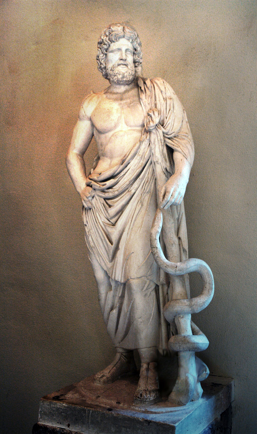
The Sanctuary of Asclepius was a sanctuary in Epidaurus dedicated to Asclepius. Especially in the Classical and Hellenistic periods, it was the main holy site of Asclepius. The sanctuary at Epidaurus was the rival of such major cult sites as the Sanctuary of Zeus at Olympia and Apollo at Delphi. The temple was built in the early 4th century BC. If still in use by the 4th century AD, the temple would have been closed during the persecution of pagans in the late Roman Empire, when the Christian Emperors issued edicts prohibiting non-Christian worship. In 1988, the temple was inscribed on the UNESCO World Heritage List because of its exceptional architecture and its importance in the development and spread of healing sanctuaries (asclepeia) throughout classical antiquity. It was excavated between 1881 and 1928 by Panagiotis Kavvadias (and, from 1887, Valerios Stais), and between 1948 and 1951 by John Papadimitriou.
Adapted from Wikipedia: Sanctuary of Asclepius, Epidaurus (CC BY-SA 4.0).
Why Sanctuary of Asclepius, Epidaurus Is Listed
- (i)
- A masterpiece of human creative genius.
- (ii)
- An important interchange of human values.
- (iii)
- A unique testimony to a cultural tradition or civilisation.
- (iv)
- An outstanding example of a type of building or landscape.
- (vi)
- A direct association with events, ideas or beliefs of universal significance.
More about Sanctuary of Asclepius, Epidaurus
UNESCO's Description
In a small valley in the Peloponnesus, the shrine of Asklepios, the god of medicine, developed out of a much earlier cult of Apollo (Maleatas), during the 6th century BC at the latest, as the official cult of the city state of Epidaurus. Its principal monuments, particularly the temple of Asklepios, the Tholos and the Theatre - considered one of the purest masterpieces of Greek architecture – date from the 4th century. The vast site, with its temples and hospital buildings devoted to its healing gods, provides valuable insight into the healing cults of Greek and Roman times.
From the UNESCO World Heritage Centre (CC BY-SA IGO 3.0).
History
In the 4th and 3rd centuries BC, the Greeks embarked on an ambitious building program for enlarging and reconstructing monumental buildings. Fame and prosperity continued throughout the Hellenistic period. In the third century BC, the poet Isyllus established a new procession to celebrate the birthday of Asclepius, including a new sacred hymn, which he had inscribed in the Sanctuary of Apollo Maleatas on Kynortion hill, which was believed to be Asclepius' birthplace.
During the Achaean War in 146 BC, the Achaians converted the sanctuary into a stronghold. After Lucius Mummius defeated the Achaians and destroyed Corinth in 146 BC, he visited the sanctuary and left two dedications there.
In 87 BC, the sanctuary was looted by the Roman general Sulla.
Description
The main sanctuary consisted of the Temple and a number of structures clustered around it. The Theatre of Epidaurus is located on the hillside northwest of the sanctuary. To the west of the sanctuary was a sacred grove. Beyond the grove on Kynortion hill was the subsidiary sanctuary of Apollo Maleatas.
The temple was Doric, six columns by eleven, measuring ca. 80 feet in length. An inscription excavated near the temple (Inscriptiones Graecae IV2 no. 102) gives a public record of the temple's construction. The inscription names Theodotus as architect. The project took nearly five years to complete. The temple had pedimental sculpture, front and back, and figural acroteria.
Sections adapted from Wikipedia: Sanctuary of Asclepius, Epidaurus (CC BY-SA 4.0).

Mystras
Greece · 37.0740° N, 22.3673° E · 1 km² · 23 km from Kalamata
Mystras or Mistras (Greek: Μυστρᾶς/Μιστρᾶς), also known in the Chronicle of the Morea as Myzethras or Myzithras (Μυζηθρᾶς), is a fortified town and a former municipality in Laconia, Peloponnese, Greece. Situated in the Taygetus range, above ancient Sparta, and below a "Frankish" castle, it served as the capital of the Byzantine Despotate of the Morea in the 14th and 15th centuries, experiencing a period of prosperity and cultural flowering during the Palaeologan Renaissance, attracting artists, architects, and intellectuals such as Gemistos Plethon. The last Byzantine emperor, Constantine XI Palaiologos, was despot of Mystras before coming to the throne of Constantinople.
Mystras remained inhabited throughout the Ottoman period, when foreign travellers mistook it for ancient Sparta. In the 1830s, it was abandoned and the new town of Sparta was built, approximately eight kilometres to the east. The 2011 local government reform attached it to the municipality of Sparta.
As an exceptionally well-preserved example of a Byzantine city and because of its testimony to the development of Late Byzantine and Post-Byzantine art, Mystras was inscribed on the UNESCO World Heritage List in 1989.
Adapted from Wikipedia: Mystras (CC BY-SA 4.0).
Why Mystras Is Listed
- (ii)
- An important interchange of human values.
- (iii)
- A unique testimony to a cultural tradition or civilisation.
- (iv)
- An outstanding example of a type of building or landscape.
More about Mystras
UNESCO's Description
Mystras, the 'wonder of the Morea', was built as an amphitheatre around the fortress erected in 1249 by the prince of Achaia, William of Villehardouin. Reconquered by the Byzantines, then occupied by the Turks and the Venetians, the city was abandoned in 1832, leaving only the breathtaking medieval ruins, standing in a beautiful landscape.
From the UNESCO World Heritage Centre (CC BY-SA IGO 3.0).
History
In late 1248, William II of Villehardouin, ruler of the Frankish Principality of Achaea, captured Monemvasia, the last remaining Byzantine outpost on the Morea. This success was soon followed by the submission of the restive Tsakones on Mount Parnon, the Slavic Melingoi tribe of Mount Taygetos, and the inhabitants of the Mani peninsula, thereby extending his sway over all of Laconia and completing the conquest of the peninsula, which had begun in 1205, in the aftermath of the Fourth Crusade.
Description
Mystras is situated on a slope of the Taygetos mountains. The archaeological site stands above the modern village of Mystras and the city of Sparta. The greenery surrounding the area is composed mainly of pines and cypresses. There are small rivers and lakes nearby. The city's architecture was influenced by the "Helladic" school of Byzantine architecture, and many structures were informed by the architecture of Constantinople. Its overall urban planning though was shaped by the steeply sloping topography, with distinct upper and lower city zones. The slope made wheeled vehicles impractical, so many of the streets are best characterized as footpaths.
Sections adapted from Wikipedia: Mystras (CC BY-SA 4.0).
Key Facts
| Area | 0.5 km² |
|---|---|
| Architectural style | Byzantine architecture |
Facts from Wikidata Q19053 (CC0).
Visiting Mystras
Mystras is a fortress town and archaeological site in Laconia, Peloponnese, Greece, known for its ruins from the Byzantine era. During its heyday as a medieval city, it was the capital of the Despotate of Morea.
Travel notes adapted from Wikivoyage: Mystras (CC BY-SA 4.0).

Olympia
Greece · 37.6383° N, 21.6300° E · 1 km² · 17 km from Pirgos
Olympia (Modern Greek: Ολυμπία [oli(m)ˈbi.a]; Ancient Greek: Ὀλυμπία [olympí.aː]), officially Archaia Olympia (Greek: Αρχαία Ολυμπία lit. 'Ancient Olympia'), is a small town in Elis on the Peloponnese peninsula in Greece, famous for the nearby archaeological site of the same name. The site was a major Panhellenic religious sanctuary of ancient Greece, where the ancient Olympic Games were held every four years throughout classical antiquity, from the 8th century BC to the 4th century AD. They were restored on a global basis in 1894 in honor of the ideal of peaceful international contention for excellence.
The sacred precinct, named the Altis, was primarily dedicated to Zeus, although other gods were worshipped there. The games conducted in his name drew visitors from all over the Greek world as one of a group of such "Panhellenic" centres, which helped to build the identity of the ancient Greeks as a nation. Despite the name, it is nowhere near Mount Olympus in northern Greece, where the twelve Olympians, the major deities of ancient Greek religion, were believed to live.
Adapted from Wikipedia: Olympia, Greece (CC BY-SA 4.0).
Why Olympia Is Listed
- (i)
- A masterpiece of human creative genius.
- (ii)
- An important interchange of human values.
- (iii)
- A unique testimony to a cultural tradition or civilisation.
- (iv)
- An outstanding example of a type of building or landscape.
- (vi)
- A direct association with events, ideas or beliefs of universal significance.
Archaeological Record: Sanctuary of Olympia
Sacred site of the ancient Olympic Games held every four years in honor of Zeus; once housed Phidias's colossal chryselephantine Statue of Zeus.
- Site type
- Panhellenic Games & Temple of Zeus
- Ancient name
- Olympia
- Ancient province
- Achaea (Elis)
- Occupation
- 776 BCE to 393 CE
Pleiades gazetteer: 570532
More about Olympia
UNESCO's Description
The site of Olympia, in a valley in the Peloponnesus, has been inhabited since prehistoric times. In the 10th century B.C., Olympia became a centre for the worship of Zeus. The Altis – the sanctuary to the gods – has one of the highest concentrations of masterpieces from the ancient Greek world. In addition to temples, there are the remains of all the sports structures erected for the Olympic Games, which were held in Olympia every four years beginning in 776 B.C.
From the UNESCO World Heritage Centre (CC BY-SA IGO 3.0).
History
It used to be thought that the site had been occupied since about 1500 BC, with a religious cult of Zeus developing around 1000 BC. It may be that instead there was only a sanctuary from the 9th or 8th centuries, though the question remains in debate. Others believe that remains of food and burnt offerings dating back to the 10th century BC give evidence of a long history of religious activity at the site. No buildings have survived from this earliest period of use.
The first Olympic festival was organized on the site by the authorities of Elis in the 8th century BC – with tradition dating the first games at 776 BC. Major changes were made to the site around 700 BC, including levelling land and digging new wells.
Sections adapted from Wikipedia: Olympia, Greece (CC BY-SA 4.0).

Delos
Greece · 37.3895° N, 25.2690° E · 4 km² · 133 km from Hios
Delos or Dilos (; Greek: Δήλος [ˈðilos]; Attic Greek: Δῆλος Dêlos, Doric Greek: Δᾶλος Dâlos), is a small Greek island near Mykonos, close to the centre of the Cyclades archipelago. Though only 3.43 km2 (1.32 sq mi) in area, it is one of the most important mythological, historical, and archaeological sites in Greece. The ongoing excavations in the island are among the most extensive in the Mediterranean, and many of the artefacts found are displayed at the Archaeological Museum of Delos and the National Archaeological Museum of Athens.
Delos had a position as a holy sanctuary for a millennium before Olympian Greek mythology made it the birthplace of Apollo and Artemis. From its Sacred Harbour are visible the three conical mounds that have identified landscapes sacred to a goddess (presumably Athena). Another site, retaining its Pre-Greek name Mount Cynthus, is crowned with a sanctuary of Zeus.
In 1990, UNESCO added Delos to the World Heritage List, citing its exceptional archaeological site which "conveys the image of a great cosmopolitan Mediterranean port", its influence on the development of Greek architecture, and its sacred importance throughout Ancient Greece.
Adapted from Wikipedia: Delos (CC BY-SA 4.0).
Why Delos Is Listed
- (ii)
- An important interchange of human values.
- (iii)
- A unique testimony to a cultural tradition or civilisation.
- (iv)
- An outstanding example of a type of building or landscape.
- (vi)
- A direct association with events, ideas or beliefs of universal significance.
More about Delos
UNESCO's Description
According to Greek mythology, Apollo was born on this tiny island in the Cyclades archipelago. Apollo's sanctuary attracted pilgrims from all over Greece and Delos was a prosperous trading port. The island bears traces of the succeeding civilizations in the Aegean world, from the 3rd millennium B.C. to the palaeochristian era. The archaeological site is exceptionally extensive and rich and conveys the image of a great cosmopolitan Mediterranean port.
From the UNESCO World Heritage Centre (CC BY-SA IGO 3.0).
History
Investigation of ancient stone huts found on the island indicate that it has been inhabited since the third millennium BC. Thucydides claims that the original inhabitants were piratical Carians who were eventually expelled by King Minos of Crete. By the writing of the Odyssey, the island was already famous as the birthplace of the twin gods Apollo and Artemis (although some confusion seems to exist of Artemis' birthplace being either Delos or the island of Ortygia).
Between 900 BC and 100 AD, Delos was a major cult centre, where the gods Dionysus and Leto, mother of the twin deities Apollo and Artemis, were revered. Eventually acquiring Panhellenic religious significance, Delos was initially a religious pilgrimage for the Ionians.
Sections adapted from Wikipedia: Delos (CC BY-SA 4.0).

Monasteries of Daphni, Hosios Loukas and Nea Moni of Chios
Greece · 38.4000° N, 22.7500° E · 62 km from Lamia
Although geographically distant from each other, these three monasteries (the first is in Attica, near Athens, the second in Phocida near Delphi, and the third on an island in the Aegean Sea, near Asia Minor) belong to the same typological series and share the same aesthetic characteristics. The churches are built on a cross-in-square plan with a large dome supported by squinches defining an octagonal space. In the 11th and 12th centuries they were decorated with superb marble works as well as mosaics on a gold background, all characteristic of the 'second golden age of Byzantine art'.
Description from the UNESCO World Heritage Centre (CC BY-SA IGO 3.0).
Why Monasteries of Daphni, Hosios Loukas and Nea Moni of Chios Is Listed
- (i)
- A masterpiece of human creative genius.
- (iv)
- An outstanding example of a type of building or landscape.
Pythagoreion and Heraion of Samos
Greece · 37.6720° N, 26.8866° E · 7 km² · 47 km from Söke
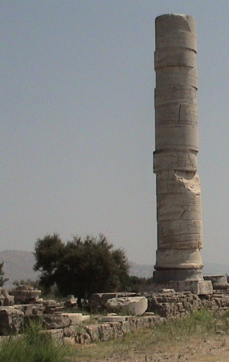
Many civilizations have inhabited this small Aegean island, near Asia Minor, since the 3rd millennium B.C. The remains of Pythagoreion, an ancient fortified port with Greek and Roman monuments and a spectacular tunnel-aqueduct, as well as the Heraion, temple of the Samian Hera, can still be seen.
Description from the UNESCO World Heritage Centre (CC BY-SA IGO 3.0).
Why Pythagoreion and Heraion of Samos Is Listed
- (ii)
- An important interchange of human values.
- (iii)
- A unique testimony to a cultural tradition or civilisation.

Aigai
Greece · 40.4780° N, 22.3228° E · 14 km² · 27 km from Katerini
Aegae or Aigai (Ancient Greek: Αἰγαί, Aigaí, Latinized: Aegae, Greek: Αιγές, romanized: Aiges) was the original capital of Macedon, the ancient Greek kingdom of the Argead Makedones in Lower Macedonia. Aigai was located in the Haliacmon valley on the foothills of the Pierian Mountains, between the modern towns of Vergina and Palatitsia, overlooking the central Macedonian plain, in northern Greece. Alexander the Great was proclaimed king of Macedon at Aigai when his father Philip II was assassinated at the city's theatre.
The city was abandoned in the 3rd century AD and was rediscovered in the 19th. Three major archaeological missions have been carried out at Aigai. The first was led by Léon Heuzey of the French School at Athens in the 1860s; Manolis Andronikos led excavations over a century later and made many important discoveries, including the tomb of Philip II of Macedon and the Golden Larnax bearing the Vergina Sun; and Angeliki Kottaridi led restoration efforts in the 2000s. Today it is the site of an archaeological site and two museums.
Adapted from Wikipedia: Aegae (Macedonia) (CC BY-SA 4.0).
Why Aigai Is Listed
- (i)
- A masterpiece of human creative genius.
- (iii)
- A unique testimony to a cultural tradition or civilisation.
More about Aigai
UNESCO's Description
The city of Aigai, the ancient first capital of the Kingdom of Macedonia, was discovered in the 19th century near Vergina, in northern Greece. The most important remains are the monumental palace, lavishly decorated with mosaics and painted stuccoes, and the burial ground with more than 300 tumuli, some of which date from the 11th century B.C. One of the royal tombs in the Great Tumulus is identified as that of Philip II, who conquered all the Greek cities, paving the way for his son Alexander and the expansion of the Hellenistic world.
From the UNESCO World Heritage Centre (CC BY-SA IGO 3.0).
History
In the 7th century BC, the Temenids' dominance led to the Macedonians expanding and subduing local populations until the end of the 6th century BC, and establishing the dynasty at Aigai. Ancient sources give conflicting accounts of the origins of the Argead dynasty. Alexander I is the first truly historic figure and, based on the line of succession, the beginnings of the Macedonian dynasty have been traditionally dated to 750 BC. Herodotus says that the Argead dynasty was an ancient Greek royal house led by Perdiccas I who fled from Argos in about 650 BC.
Sections adapted from Wikipedia: Aegae (Macedonia) (CC BY-SA 4.0).

Archaeological Sites of Mycenae and Tiryns
Greece · 37.7333° N, 22.7500° E · 41 km from Tripoli
The archaeological sites of Mycenae and Tiryns are the imposing ruins of the two greatest cities of the Mycenaean civilization, which dominated the eastern Mediterranean world from the 15th to the 12th century B.C. and played a vital role in the development of classical Greek culture. These two cities are indissolubly linked to the Homeric epics, the Iliad and the Odyssey , which have influenced European art and literature for more than three millennia.
Description from the UNESCO World Heritage Centre (CC BY-SA IGO 3.0).
Why Archaeological Sites of Mycenae and Tiryns Is Listed
- (i)
- A masterpiece of human creative genius.
- (ii)
- An important interchange of human values.
- (iii)
- A unique testimony to a cultural tradition or civilisation.
- (iv)
- An outstanding example of a type of building or landscape.
- (vi)
- A direct association with events, ideas or beliefs of universal significance.

The Historic Centre (Chorá) with the Monastery of Saint-John the Theologian and the Cave of the Apocalypse on the Island of Pátmos
Greece · 37.3000° N, 26.5500° E · 91 km from Söke
The small island of Pátmos in the Dodecanese is reputed to be where St John the Theologian wrote both his Gospel and the Apocalypse. A monastery dedicated to the ‘beloved disciple’ was founded there in the late 10th century and it has been a place of pilgrimage and Greek Orthodox learning ever since. The fine monastic complex dominates the island. The old settlement of Chorá, associated with it, contains many religious and secular buildings.
Description from the UNESCO World Heritage Centre (CC BY-SA IGO 3.0).
Why The Historic Centre (Chorá) with the Monastery of Saint-John the Theologian and the Cave of the Apocalypse on the Island of Pátmos Is Listed
- (iii)
- A unique testimony to a cultural tradition or civilisation.
- (iv)
- An outstanding example of a type of building or landscape.
- (vi)
- A direct association with events, ideas or beliefs of universal significance.

Old town of Corfu
Greece · 39.6247° N, 19.9219° E · 1 km² · 1 km from Kerkira
The Old Town of Corfu, on the Island of Corfu off the western coasts of Albania and Greece, is located in a strategic position at the entrance of the Adriatic Sea, and has its roots in the 8th century BC. The three forts of the town, designed by renowned Venetian engineers, were used for four centuries to defend the maritime trading interests of the Republic of Venice against the Ottoman Empire. In the course of time, the forts were repaired and partly rebuilt several times, more recently under British rule in the 19th century. The mainly neoclassical housing stock of the Old Town is partly from the Venetian period, partly of later construction, notably the 19th century. As a fortified Mediterranean port, Corfu’s urban and port ensemble is notable for its high level of integrity and authenticity.
Description from the UNESCO World Heritage Centre (CC BY-SA IGO 3.0).
Why Old town of Corfu Is Listed
- (iv)
- An outstanding example of a type of building or landscape.

Philippi
Greece · 41.0121° N, 24.2846° E · 1 km² · 13 km from Kavala
Philippi (; Ancient Greek: Φίλιπποι, Phílippoi) was a major mainland Greek city northwest of the nearby island, Thasos. Its original name was Crenides (Ancient Greek: Κρηνῖδες, Krēnĩdes "Fountains"). The city was renamed by Philip II of Macedon in 356 BC and abandoned in the 14th century after the Ottoman conquest. The present village of Filippoi is located near the ruins of the ancient city within the modern city of Kavala, in turn a
part of the administrative region of East Macedonia and Thrace. The archaeological site was classified as a UNESCO World Heritage Site in 2016 because of its exceptional Roman architecture, its urban layout as a smaller reflection of Rome itself, and its importance in early Christianity. Philippi is also the place where the Battle of Philippi took place in 42 BC.
Adapted from Wikipedia: Philippi (CC BY-SA 4.0).
Why Philippi Is Listed
- (iii)
- A unique testimony to a cultural tradition or civilisation.
- (iv)
- An outstanding example of a type of building or landscape.
More about Philippi
UNESCO's Description
The remains of this walled city lie at the foot of an acropolis in north-eastern Greece, on the ancient route linking Europe and Asia, the Via Egnatia . Founded in 356 BC by the Macedonian King Philip II, the city developed as a “small Rome” with the establishment of the Roman Empire in the decades following the Battle of Philippi, in 42 BCE. The vibrant Hellenistic city of Philip II, of which the walls and their gates, the theatre and the funerary heroon (temple) are to be seen, was supplemented with Roman public buildings such as the Forum and a monumental terrace with temples to its north . Later the city became a centre of the Christian faith following the visit of the Apostle Paul in 49-50 CE. The remains of its basilicas constitute an exceptional testimony to the early establishment of Christianity.
From the UNESCO World Heritage Centre (CC BY-SA IGO 3.0).
History
Thasian colonists established a settlement at Crenides in Thrace in 360/359 BC near the head of the Aegean Sea at the foot of Mount Orbelos, now called Mount Lekani, about 13 km (8.1 mi) north-west of Kavala, on the northern border of the marsh that, in antiquity, covered the entire plain separating it from the Pangaion Hills to the south. In 356 BC, King Philip II of Macedon conquered the city and renamed it to Philippi.
The Macedonian conquerors of the town aimed to take control of the neighbouring gold mines and to establish a garrison at a strategic passage: the site controlled the route between Amphipolis and Neapolis, part of the great royal route which runs east-west across Macedonia which the Roman Republic reconstructed in the 2nd century BC as part of the Via Egnatia.
Sections adapted from Wikipedia: Philippi (CC BY-SA 4.0).

Zagori
Greece · 39.8667° N, 20.7000° E · 26 km from Ioanina
Zagori (Greek: Ζαγόρι; Aromanian: Zagori) is a region, a municipality, and a designated UNESCO World Heritage Site, in the Pindus mountains in Epirus, in northwestern Greece. The seat of the municipality is the village Asprangeloi. It has an area of some 1,000 square kilometres (390 mi2) and contains 46 villages known as Zagori villages (or Zagorochoria or Zagorohoria), and is in the shape of an upturned equilateral triangle.
Ioannina, the capital of the administrative region of that name, borders the southern point of the triangle, while the southwestern side is formed by Mount Mitsikeli (1,810m). The Aoos river running north of Mount Tymphe forms the northern boundary, while the southeastern side runs along the Varda river to Mount Mavrovouni (2,100m) near Metsovo. The municipality has an area of 989.796 km2. The population of the area is about 3,400, which gives a population density of 3.4 inhabitants per square kilometer, very sparse when compared to an average of 73.8 for Greece as a whole.
Adapted from Wikipedia: Zagori (CC BY-SA 4.0).
Why Zagori Is Listed
- (v)
- An outstanding example of traditional human settlement or land use.
More about Zagori
UNESCO's Description
Located in a remote rural landscape in northwestern Greece, small stone villages known as Zagorochoria extend along the western slopes of the northern part of the Pindus mountain range. These traditional villages, typically organized around a central square containing a plane tree and surrounded by sacred forests maintained by local communities, showcase a traditional architecture adapted to the mountain topography. A network of stone-arched bridges, stone cobbled paths, and stone staircases linking the villages formed a system that served as a political and social unit connecting the communities of the Vikos and the Voïdomatis River basin.
From the UNESCO World Heritage Centre (CC BY-SA IGO 3.0).
Geography
Zagori is an area of great natural beauty, with striking geology and two National Parks, one including the river Aoos and the Vikos Gorge, the other around Valia Kalda, to the east of the imposing snow-capped Mt Tymphe. The 46 or so villages of Zagori were interconnected by mountain roads and traditional arched stone bridges until modern roads were opened in the 1950s. The stone arched bridges were built by benefactions from expatriate merchants in the 18th century and replaced older wooden bridges.
History
The region has been historically difficult to access due to its mountainous terrain which likely contributed to its unique character. The Sarakatsani people who can be found in this area use several Greek words of a Northern Greek dialect not commonly found in Greek elsewhere. They are consequently considered by some as indigenous to the area.
The first evidence of human presence in the area is dated between 17,000 and 10,000 years ago. Important epipaleolithic artifacts have been unearthed from Kleidi Cave on the banks of Voidomatis. In antiquity, the region of Zagori was inhabited by the Tymphaeans and formed a part of the ancient kingdom of the Molossians, a Greek tribe of Epirus that gained control over all of Epirus in classical times.
Sections adapted from Wikipedia: Zagori (CC BY-SA 4.0).
Visiting Zagori
Zagori, also called Zagorochoria (The Zagori Villages) is a historical area and a municipality in Epirus, Greece, with an area of some 1,000 km², including 46 villages. Since 2023 the Zagori Cultural Landscape has been a UNESCO World Heritage Site.
Travel notes adapted from Wikivoyage: Zagori (CC BY-SA 4.0).

Minoan Palatial Centres
Greece · 35.2972° N, 25.1625° E · 4 km from Iraklio
Minoan palaces were massive building complexes built on Crete during the Bronze Age. They are often considered emblematic of the Minoan civilization and are modern tourist destinations. Archaeologists generally recognize five structures as palaces, namely those at Knossos, Phaistos, Malia, Galatas, and Zakros. Minoan palaces consisted of multistory wings surrounding an open rectangular central court. They shared a common architectural vocabulary and organization, including distinctive room types such as the lustral basin and the pillar crypt. However, each palace was unique, and their appearances changed dramatically as they were continually remodeled throughout their lifespans.
The palaces' function is a topic of continuing debate in Minoan archaeology. Despite the modern term "palace", it is generally agreed that they did not primarily serve as royal residences. They are known to have contained shrines, open areas for communal festivals, industrial workshops, as well as storage magazines for large agricultural surpluses. Archives of Linear A and Linear B tablets suggest that they served in part as local administrative centers.
Adapted from Wikipedia: Minoan palaces (CC BY-SA 4.0).
Why Minoan Palatial Centres Is Listed
- (ii)
- An important interchange of human values.
- (iii)
- A unique testimony to a cultural tradition or civilisation.
- (iv)
- An outstanding example of a type of building or landscape.
- (vi)
- A direct association with events, ideas or beliefs of universal significance.
More about Minoan Palatial Centres
UNESCO's Description
This serial property comprises six archaeological sites on Crete dating from 1900 to 1100 BCE. These sites represent the Minoan civilization, a major prehistoric Mediterranean culture. The palatial centres served as administrative, economic, and religious hubs, featuring advanced architecture, urban planning, and vibrant frescoes. They reveal early writing systems, maritime networks, and cultural exchanges. The property highlights the complexity of the Minoans’ social structure and their enduring influence on Mediterranean history.
From the UNESCO World Heritage Centre (CC BY-SA IGO 3.0).

The wider area of Mount Olympus
Greece · 40.0783° N, 22.3489° E · 189 km² · 25 km from Katerini
Mount Olympus is situated in northern Greece and is the highest mountain in the country. Its microclimate, resulting from its proximity to the sea and abrupt elevation, produces a remarkable diversity in terrain, climate, and vegetation. In this landscape, the ancient Greeks situated the abode of their Twelve Olympian Gods, with Zeus as their sovereign, as well as the Muses and Graces. Through the writings of Hesiod and Homer, Mount Olympus became a central point of reference for Greek mythology throughout the Greek and Roman worlds, rendering Mount Olympus an enduring emblem of Greek civilisation. The serial property features striking landforms, including glacial cirques, limestone cliffs, karstic sinkholes, and olistolith fields, while sharp ridges like the Mytikas-Stefani complex and deep gorges such as the Enipeas illustrate ongoing neotectonic activity. Mount Olympus has served as a glacial refugium for forest species and is also a Mediterranean plant biodiversity and endemism hotspot.
Description from the UNESCO World Heritage Centre (CC BY-SA IGO 3.0).
Why The wider area of Mount Olympus Is Listed
- (vi)
- A direct association with events, ideas or beliefs of universal significance.
- (x)
- The most important natural habitats for conserving biodiversity.
World Heritage in Greece: Quick Answers
- How many UNESCO World Heritage Sites are in Greece?
- Greece has 21 World Heritage Sites: 18 cultural and 3 mixed.
- What was the first World Heritage Site in Greece?
- Temple of Apollo Epicurius in Bassae, inscribed in 1986. The most recent is The wider area of Mount Olympus, inscribed in 2026.
- What are the natural World Heritage Sites in Greece?
- Meteora (mixed), Mount Athos (mixed), The wider area of Mount Olympus (mixed).
- Are any World Heritage Sites in Greece in danger?
- None of the World Heritage Sites in Greece is on UNESCO's List of World Heritage in Danger.