
Angles
387 CE – 479 CE · 1,293 km²
Angles is mapped in the atlas for 387 CE – 479 CE, with a peak mapped extent of about 1,293 km².
The Heptarchy was the division of Anglo-Saxon England between the sixth and eighth centuries into petty kingdoms, conventionally the seven kingdoms of East Anglia, Essex, Kent, Mercia, Northumbria, Sussex, and Wessex. The term originated with the twelfth-century historian Henry of Huntingdon and has been widely used ever since, but it has been questioned by historians as the number of kingdoms fluctuated, and there was never a time when the territory of the Anglo-Saxons was divided into seven kingdoms, each ruled by one king. The period of petty kingdoms came to an end in the eighth century, when England was divided into the four dominant kingdoms of East Anglia, Mercia, Northumbria, and Wessex.
From Wikipedia: Heptarchy (CC BY-SA 4.0)
Each state in its own colour. Move the timeline to see which existed in any year from 387 AD to 935 AD; select a territory to read about it. Borders: Cliopatria / Seshat (CC BY 4.0).
| State | Years | Capital | Largest extent | Rulers |
|---|---|---|---|---|
| Angles | 387 CE – 479 CE | – | 1,293 km² | – |
| Kingdom of Kent | 490 CE – 762 CE | Canterbury | 4,349 km² | 11 |
| Kingdom of Sussex | 490 CE – 771 CE | – | 5,701 km² | 2 |
| Kingdom of East Anglia | 534 CE – 869 CE | – | 12,502 km² | 5 |
| Kingdom of Essex | 534 CE – 665 CE | London | 4,045 km² | 7 |
| Kingdom of Mercia | 534 CE – 925 CE | Tamworth | 96,899 km² | 28 |
| Kingdom of Wessex | 534 CE – 935 CE | Winchester | 96,899 km² | 15 |
| Kingdom of Northumbria | 612 CE – 935 CE | – | 85,405 km² | 40 |
When each state existed, 387 CE to 935 CE. Select a year to see the map then.
387 CE – 479 CE · 1,293 km²
Angles is mapped in the atlas for 387 CE – 479 CE, with a peak mapped extent of about 1,293 km².
490 CE – 762 CE · Capital: Canterbury · 4,349 km²

The Kingdom of the Kentish, today referred to as the Kingdom of Kent, was an early medieval English kingdom in present-day South East England. It existed from either the fifth or the sixth century AD until it was fully absorbed into the Kingdom of Wessex in the mid-9th century and later into the Kingdom of England in the early 10th century. Under the preceding Romano-British administration the area of Kent faced repeated attacks from seafaring raiders during the fourth century AD. It is likely that Germanic-speaking foederati were invited to settle in the area as mercenaries.
From Wikipedia: Kingdom of Kent (CC BY-SA 4.0)


In the seventh century, Kent's power waned as that of Mercia and Northumbria grew, but it remained the fourth wealthiest kingdom in England, according to the Tribal Hidage with 15,000 hides of land recorded in the seventh or eighth century. However the period was tumultuous for the Kentish royal family; Kent was ruled by Ecgberht from 664 to 673, but between 664 and 667 two royal cousins, Æthelred and Æthelberht, were killed at Eastry royal hall, perhaps because they were a threat to Ecgberht. Ecgberht was succeeded by his brother, Hlothere, who ruled from 674 to 686 before being overthrown and killed by one of Ecgberht's sons, Eadric, who had allied with the South Saxons; Eadric then ruled until 687.
In the late seventh century, Kent gradually came to be dominated by Mercia.
From Wikipedia: Kingdom of Kent · Middle and late Anglo-Saxon Kent: Decline and Mercian domination: 650–825 (CC BY-SA 4.0)
490 CE – 771 CE · 5,701 km²

The Kingdom of the South Saxons, today referred to as the Kingdom of Sussex, was an early medieval English kingdom, constituting one of the seven traditional kingdoms of Anglo-Saxon England. On the south coast of the island of Great Britain, it was originally a sixth-century Saxon colony and later an independent kingdom. The kingdom remains one of the least known of the Anglo-Saxon polities, with no surviving king-list, several local rulers and less centralisation than other Anglo-Saxon kingdoms.
From Wikipedia: Kingdom of Sussex (CC BY-SA 4.0)
Archaeology gives a different settlement picture to that indicated by the South Saxon foundation story. Germanic tribes probably first arrived in Sussex earlier in the 5th century than 477. The archaeological evidence that we do have indicates the area of settlement by the location of cemeteries of the period. The origins of the settlers can be derived by comparing the design of grave goods and pottery with the designs of similar items in the German homelands. The principal area of settlement in the 5th century has been identified as between the lower Ouse and Cuckmere rivers in East Sussex, based on the number of Anglo-Saxon cemeteries there. However, there are two cemeteries in West Sussex at Highdown, near Worthing and Apple Down, 11 km (7 mi.) northwest of Chichester.
From Wikipedia: Kingdom of Sussex · History: Early period (c. 450 – 600) (CC BY-SA 4.0)
After the departure of the Roman army, the Saxons arrived in Sussex in the 5th century and brought with them their polytheistic religion. The Saxon pagan culture probably caused a reversal of the spread of Christianity. Wilfrid's biographer records that in the year 666 Wilfrid's ship ran aground on the Sussex coast near Selsey where it was attacked and a pagan priest sought to cast magic spells from a high mound. Bede also refers to a mass suicide committed by groups of 40 or 50 men who jumped from cliffs during a time of famine. It is probable that these suicides represented sacrifices to appease the god Woden.
Æðelwealh became Sussex's first Christian king when he married Eafe, the daughter of Wulfhere, the Christian king of Mercia.
From Wikipedia: Kingdom of Sussex · Life and society: Religion (CC BY-SA 4.0)
There is significant evidence for Frankish cultural influence on the kingdom of Sussex as well as the neighbouring kingdom of Kent; occasional references in Continental works suggest that Frankish kings may at one point have thought of the people of Sussex and other south eastern kingdoms as their political dependants.
According to Gabor Thomas, there are clear cultural differences between how wealth and status were expressed in South Saxon society compared with Anglo Saxon kingdoms to the north. In the kingdom of Sussex and the neighbouring kingdom of Kent the range of ornamented dress accessories metalwork is significantly more austere and limited that in kingdoms to the north. However alternative status symbols were used fully in Sussex by those with higher status.
From Wikipedia: Kingdom of Sussex · Culture (CC BY-SA 4.0)
534 CE – 869 CE · 12,502 km²

The Kingdom of the East Angles (/ˈæŋ.ɡli.ə/; Old English: Ēastengla Rīċe; Latin: Regnum Orientalium Anglorum), informally known as the Kingdom of East Anglia or East Anglia, was an early medieval English kingdom of the Angles during the Anglo-Saxon period, existing from the 6th century to 918 CE. It comprised the territory which now constitutes the English counties of Norfolk and Suffolk and perhaps the eastern part of the Fens; the area is still known as East Anglia.
From Wikipedia: Kingdom of East Anglia (CC BY-SA 4.0)


534 CE – 665 CE · Capital: London · 4,045 km²

The Kingdom of the East Saxons, referred to as the Kingdom of Essex, was an early medieval English kingdom, constituting one of the seven traditional kingdoms of the Anglo-Saxon period. It was founded in the 6th century and covered the territory later occupied by the counties of Essex, Middlesex, much of Hertfordshire and (for a short while) west Kent. The last king of Essex was Sigered of Essex, who in 825 ceded the kingdom to Ecgberht, King of Wessex.
From Wikipedia: Kingdom of Essex (CC BY-SA 4.0)
534 CE – 925 CE · Capital: Tamworth · 96,899 km²
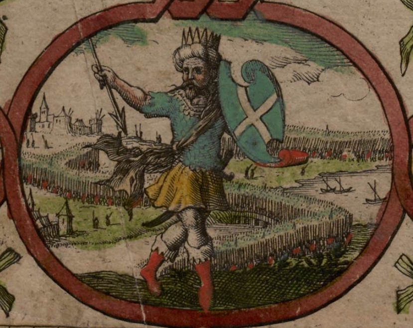
Mercia was an early medieval Anglo-Saxon kingdom, one of the seven kingdoms of the Anglo-Saxon period. It was centred on the River Trent and its tributaries, in a region now known as the Midlands of England. The royal court moved around the kingdom without a fixed capital city. Early in its existence Repton seems to have been the location of an important royal estate. According to the Anglo-Saxon Chronicle, the Great Heathen Army deposed the King of Mercia from Repton in 873–874. Slightly earlier, King Offa seems to have favoured Tamworth.
From Wikipedia: Mercia (CC BY-SA 4.0)
Mercia's exact evolution at the start of the Anglo-Saxon era remains more obscure than that of Northumbria, Kent, or even Wessex. Mercia developed an effective political structure and was Christianised later than the other kingdoms. Archaeological surveys show that Angles settled the lands north of the River Thames by the 6th century. The name "Mercia" is Mercian Old English for "boundary folk" (see Welsh Marches), and the traditional interpretation is that the kingdom originated along the frontier between the native Brythonic-speaking Romano-British Welsh and the Anglo-Saxon invaders. However, Peter Hunter Blair argued an alternative interpretation: that they emerged along the frontier between Northumbria and the inhabitants of the Trent river valley.
From Wikipedia: Mercia · History: Early history (CC BY-SA 4.0)


The first kings of Mercia were pagans, and they resisted the encroachment of Christianity longer than other kingdoms in the Anglo-Saxon Heptarchy.
Mercian rulers remained resolutely pagan until the reign of Peada in 656, although this did not prevent them joining coalitions with Christian Welsh rulers to resist Northumbria. The first appearance of Christianity in Mercia, however, had come at least thirty years earlier, following the Battle of Cirencester of 628, when Penda incorporated the formerly West Saxon territories of Hwicce into his kingdom.
The conversion of Mercia to Christianity occurred in the latter part of the 7th century, and by the time of Penda's defeat and death, Mercia was largely surrounded by Christian states. Diuma, an Irish monk and one of Oswiu's missionaries, was subsequently ordained a bishop – the first to operate in Mercia.
From Wikipedia: Mercia · Mercian religion (CC BY-SA 4.0)
534 CE – 935 CE · Capital: Winchester · 96,899 km²

The Kingdom of the West Saxons, also known as the Kingdom of Wessex, was an Anglo-Saxon kingdom in the south of Great Britain, from around 519 until around 927. In about 886, Alfred the Great adopted the title 'King of the Anglo-Saxons' as the ruler of all Anglo-Saxons not under Danish rule. Over the next thirty years Alfred's son, Edward the Elder and grandson Æthelstan conquered the Danish kingdoms, and when Æthelstan conquered the last surviving one, York, in 927, he adopted the title 'King of the English'.
From Wikipedia: Wessex (CC BY-SA 4.0)


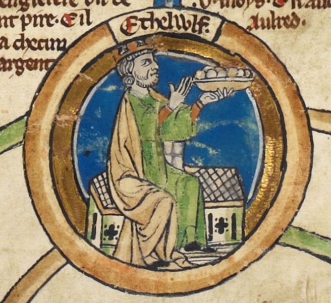
Thomas Hardy used a fictionalised Wessex as a setting for many of his novels, adopting his friend William Barnes' term Wessex for their home county of Dorset and its neighbouring counties in the south and west of England.
In the book and television series The Last Kingdom, Wessex is the primary setting, focusing on the rule of Alfred the Great and the war against the Vikings.
Wessex remains a common term for the area. Many organisations that cover the area of Dorset, Somerset, Hampshire, and Wiltshire use the name Wessex in their company or organisation name; for example Wessex Bus, Wessex Water, and Wessex Institute of Technology. The Wessex Constitutional Convention and Wessex Regionalists (political party) are minor groups seeking increased political autonomy for the region.
From Wikipedia: Wessex · Cultural and political identity in modern times (CC BY-SA 4.0)


612 CE – 935 CE · 85,405 km²

Northumbria was an early medieval English kingdom, existing between 654 and 1066 AD, at its height spanning modern-day Northern England and Southern Scotland. The name derives from the Old English Norþhymbre meaning "the people or province north of the Humber", as opposed to the people south of the Humber Estuary. What was to become Northumbria started as two kingdoms, Deira in the south and Bernicia in the north. Conflict in the first half of the seventh century ended with the murder of the last king of Deira in 651, and Northumbria was thereafter unified under Bernician kings.
From Wikipedia: Northumbria (CC BY-SA 4.0)
The Anglo-Saxon kingdom of Northumbria was originally two kingdoms divided approximately around the River Tees: Bernicia was to the north of the river and Deira to the south. It is possible that both regions originated as native Celtic British kingdoms, which the Germanic settlers later conquered, although there is very little information about the infrastructure and culture of the British kingdoms themselves. Much of the evidence for them comes from regional names that are British rather than Anglo-Saxon in origin. The names Deira and Bernicia are likely British in origin, for example, indicating that some British place names retained currency after the Anglo-Saxon migrations to Northumbria. There is also some archaeological evidence to support British origins for the polities of Bernicia and Deira.
From Wikipedia: Northumbria · Kingdom (654–954): Possible Celtic British origins (CC BY-SA 4.0)


The monastery at Lindisfarne was founded by Aidan in 635 and was based on the practices of the Columban monastery in Iona, Scotland. The location of the bishopric shifted to Lindisfarne, and it became the centre for religion in Northumbria. The bishopric would not leave Lindisfarne and shift back to its original location at York until 664. Throughout the eighth century, Lindisfarne was associated with important figures. Aidan, the founder, Wilfrid, a student, and Cuthbert, a member of the order and a hermit, all became bishops and later Saints. Aidan assisted Hieu to found her double monastery at Hartlepool. She too came to be venerated as a saint.
The Christian culture of Northumbria was influenced by the continent as well as Ireland. In particular, Wilfrid travelled to Rome and abandoned the traditions of the Celtic church in favour of Roman practices.
From Wikipedia: Northumbria · Religion: Monasteries and figures of note (CC BY-SA 4.0)
Northumbria's economy centred around agriculture, with livestock and land being popular units of value in local trade. By the mid 800s, the Open field system was likely the pre-eminent mode of farming. Like much of eastern England, Northumbria exported grain, silver, hides, and slaves. Imports from Frankia included oil, luxury goods, and clerical supplies in the 700s. Especially after 793, raids, gifts, and trade with Scandinavians resulted in substantial economic ties across the North Sea.
When coinage (as opposed to bartering) regained popularity in the late 600s, Northumbrian coins featured kings' names, indicating royal control of currency. Royal currency was unique in Britain for a long time. King Aldfrith (685–705) minted Northumbria's earliest silver coins, likely in York.
From Wikipedia: Northumbria · Economy (CC BY-SA 4.0)

Between 737 and 806, Northumbria had ten kings, all of whom were murdered, deposed, or exiled or became monks. Between Oswiu, the first king of Northumbria in 651, and Eric Bloodaxe, the last king of Northumbria in 954, there were forty-five kings, meaning that the average length of reign during the entire history of Northumbria is only six and a half years. Of the twenty-five kings before the Danish rule of Northumbria, only four died of natural causes. Of those that did not abdicate for a holy life, the rest were either deposed, exiled, or murdered. Kings during the Danish rule of Northumbria (see Danelaw) were often either kings of a larger North Sea or Danish empire, or were installed rulers.
Succession in Northumbria was hereditary, which left princes whose fathers died before they could come of age particularly susceptible to assassination and usurpation.
From Wikipedia: Northumbria · Kingdom (654–954): Politics and war (CC BY-SA 4.0)
From around 800, there had been waves of Danish raids on the coastlines of the British Isles. These raids terrorized the populace, but exposure to Danish society brought new opportunities for wealth and trade. In 865, instead of raiding, the Danes landed a large army in East Anglia, and had conquered a territory known as the Danelaw, including Northumbria, by 867. At first, the Scandinavian minority, while politically powerful, remained culturally distinct from the English populace. For example, only a few Scandinavian words, mostly military and technical, became part of Old English. By the early 900s, however, Scandinavian-style names for both people and places became increasingly popular, as did Scandinavian ornamentation on works of art, featuring aspects of Norse mythology, and figures of animals and warriors.
From Wikipedia: Northumbria · Culture: Scandinavians and the Danelaw (CC BY-SA 4.0)
The Heptarchy was the division of Anglo-Saxon England between the sixth and eighth centuries into petty kingdoms, conventionally the seven kingdoms of East Anglia, Essex, Kent, Mercia, Northumbria, Sussex, and Wessex.
The atlas maps 8 of them: Angles, Kingdom of Kent, Kingdom of Sussex, Kingdom of East Anglia, Kingdom of Essex, Kingdom of Mercia, Kingdom of Wessex, Kingdom of Northumbria.
Kingdom of Mercia had the largest mapped extent, about 96,899 km².
Kingdom of Wessex lasted longest, 534 CE – 935 CE.