Medieval States of the British Isles: Map & History
34 states of the British Isles on one map, from 523 CE to 1708 CE.The largest, Kingdom of England, covered about 569,446 km². Each has its own section below with its rulers, capitals, wars and pictures where the records hold them.
Each state in its own colour. Move the timeline to see which existed in any year from 523 AD to 1708; select a territory to read about it. Borders: Cliopatria / Seshat (CC BY 4.0).
Wihtwara (Old English: Wihtware or Wihtsætan) were the Early Medieval inhabitants of the Isle of Wight, a 147-square-mile (380 km2) island off the south coast of England. Writers such as Bede attribute their origin to Jutes who migrated to the island during the Anglo-Saxon settlement of Britain. They formed an independent kingdom at points in the Early Middle Ages, with their last king Arwald dying as the last heathen Anglo-Saxon king. After this point, the island became a part of Wessex and later England.
According to the Anglo-Saxon Chronicle, in 661 Wulfhere of Mercia conquered the Isle of Wight and gave the overlordship to his godson, King Æthelwealh of Sussex, to convert the islanders to Christianity. Bede, however, records that the island was converted after an invasion in 686 by King Cædwalla of Wessex, which the Anglo-Saxon Chronicle states was conducted together with his brother Mul of Kent. The final Jutish king of the Wihtwara, Arwald, was purportedly killed while resisting Cædwalla. Arwald's two younger brothers, after attempting to escape Cædwalla, were captured, baptised, then executed by him.
The Deira Kingdom in s. V-VII (Anglo-Saxon period)Luigimalatesta · CC BY-SA 3.0 · Commons
Deira (DY-rə, DAIR-ə; Old Welsh/Cumbric: Deywr or Deifr; Old English: Dere or Dera rice) was an area of Post-Roman Britain, and a later Anglian kingdom.
Lincoln Cathedral viewed from the Brayford Pool area of Lincoln, where the Foss Dyke meets the River Witham.Chris McKenna (user:Thryduulf) · CC BY-SA 4.0 · Commons
The Lindsey (Old English: Lindesege) was a lesser Anglo-Saxon kingdom in what is now north Lincolnshire in the sixth and seventh centuries, possibly extending into the early eighth century. The name Lindsey derives from the Old English toponym Lindesege, meaning "Isle of Lind". Lindum Colonia was the Roman name of the settlement which is now the City of Lincoln in Lincolnshire. (Lindum Colonia was shortened in Old English to Lindocolina and then Lincylene.)
An 18th century depiction of KennethAlexander Bannermann · Public domain · Commons
Dál Riata or Dál Riada (also Dalriada) was a Gaelic kingdom that encompassed the western seaboard of Scotland and northeastern Ireland, on each side of the North Channel. At its height in the 6th and 7th centuries, it covered what is now Argyll ("Coast of the Gaels") in Scotland and part of County Antrim in Northern Ireland. After a period of expansion, Dál Riata eventually became associated with the Gaelic Kingdom of Alba.
It has been proposed that some of the more obscure kings of Dál Riata mentioned in the Annals of Ulster, such as Fiannamail ua Dúnchado and Donncoirce, may have been kings of Irish Dál Riata.
Read more
The after-effect of the Battle of Moira (Mag Rath) in regards to Scottish Dál Riata appears to have resulted in its becoming tributary to Northumbrian kings, which lasted until the Pictish king Bruide mac Bili defeated Ecgfrith of Northumbria at Dun Nechtain in 685. It is not certain that this subjection ended in 685, although this is usually assumed to be the case. However, it appears that Eadberht Eating made some effort to stop the Picts under Óengus mac Fergusa crushing Dál Riata in 740. Whether this means that the tributary relationship had not ended in 685, or if Eadberht sought only to prevent the growth of Pictish power, is unclear.
No written accounts exist for pre-Christian Dál Riata, and the earliest-known records come from the chroniclers of Iona and Irish monasteries. During the time of Saint Patrick, Dál Riatan kings thought they were descended from Celtic gods, and pagans in the region viewed certain springs and "spirit-inhabited groves of trees" as sacred groves.
Read more
Adomnán's Life of St Columba implies a Christian Dál Riata. Whether this is true cannot be known. The figure of Columba looms large in any history of Christianity in Dál Riata. Adomnán's Life, although useful as a record, was not intended to serve as history, but rather as hagiography. Because the writing of the lives of the saints in Adomnán's day had not reached the stylised formulas of the High Middle Ages, the Life contains a great deal of historically valuable information.
Brycheiniog was an independent kingdom in South Wales in the Early Middle Ages. It often acted as a buffer state between England to the east and the south Welsh kingdom of Deheubarth to the west. It was conquered and pacified by the Normans between 1088 and 1095, though it remained Welsh in character. It was transformed into the Lordship of Brecknock and later formed the southern and larger part of the historic county of Brecknockshire. To its south was the Kingdom of Morgannwg.
The main legacy of the kingdom of Brycheiniog is etymological and geographical.
During this era, the Irish raiders had begun to invade various western parts of Britain, with Triffyn Farfog (son of Aed Brosc, a Deisi magnate) already having taken over Dyfed from Edynfed's heirs. Traditional Welsh accounts claim that Triffyn had gained his power by peaceably marrying Edynfed's heiress (they do not indicate whether this was under duress). The power of Irish raiders, particularly the Uí Liatháin, grew increasingly strong, and was not weakened until it was reduced by the sons of Cunedda, as reported in the Historia Brittonum. However Irish presence remained in the south leaving many historians to theorise Cunedda faced strong resistance in the south.
Many Welsh princes had been vassals or allies of the Saxon kings, so actively supported the rebellion of Eadric the Wild against the Norman presence in England. In 1070, after suppressing Eadric's forces in England, William FitzOsbern, 1st Earl of Hereford, attacked South Wales, defeating three of its kings (but notably, he is not described as having defeated a king of Brycheiniog). This past behaviour of Welsh princes naturally made the Normans ill-disposed towards them when an anti-Norman revolt broke out in Northern England ten years later.
Read more
Over the previous century, Deheubarth had been contested between the heirs of Maredudd ab Owain's brother Einion (such as Hywel ab Edwin), those of his daughter Angharad (such as Gruffydd ap Llywelyn), and the rulers of Morgannwg. Rhys was of Einion's line.
540 CE – 1055 CE · Capital: Caerwent, Porth-is-Coed · 1,443 km²
Gwent (Old Welsh: Guent) was a medieval Welsh kingdom, lying between the Rivers Wye and Usk. It existed from the end of Roman rule in Britain in about the 5th century until the Norman invasion of Wales in the 11th century. Along with its neighbour Glywysing, it seems to have had a great deal of cultural continuity with the earlier Silures, keeping their own courts and diocese separate from the rest of Wales until their conquest by Gruffydd ap Llywelyn.
The area has been occupied since the Paleolithic, with Mesolithic finds at Goldcliff and evidence of growing activity throughout the Bronze and Iron Age.
Read more
Gwent came into being after the Romans had left Britain, and was a successor state drawing on the culture of the pre-Roman Silures tribe and ultimately a large part of their Iron Age territories. It took its name from the civitas capital of Venta Silurum, perhaps meaning "Market of the Silures". In the post Roman period, the territory around Venta became the successor kingdom of Guenta, later Gwent, deriving its name directly from the town through the normal sound change in the Brythonic languages from v to gu. The town itself became Caerwent, "Fort Venta".
Despite the extinction of the kingdom by 1091, the name Gwent remained in use for the area by the Welsh throughout this period and later centuries. It was traditionally divided by the forested hills of Wentwood (Welsh: Coed Gwent) into Gwent Uwch-coed ("beyond the wood") and Gwent Is-coed ("below the wood"). These terms were translated into English as Overwent and Netherwent, the entire area sometimes being known as "Wentland" or "Gwentland".
Read more
The Marcher Lordships were the basic units of administration for the next 450 or so years, until Henry VIII passed the Laws in Wales Act 1535. This Act abolished the Marcher Lordships and established the County of Monmouth, combining the Lordships east of the Usk with Newport (Gwynllŵg or Wentloog) and Caerleon to the west of it.
540 CE – 1284 CE · Capital: None, with a 'chief' court at Aberffraw · 23,247 km²
Photograph of Aberconwy Abbey, Conwy, Conwy County Borough, WalesJohnArmagh · Public domain · Commons
The Kingdom of Gwynedd was a Welsh kingdom which first appeared at the turn of the sixth century. Based in northwest Wales, the rulers of Gwynedd repeatedly rose to dominance and were acclaimed as "King of the Britons" before losing their power in civil wars or invasions.
The background involving the Kingdom of Gwynedd starts with the history of Wales. After the last ice age, Wales was settled during the prehistoric times. Neolithic sites have been discovered with tools made from flint, such as near Llanfaethlu, a long house excavated from 6000 years ago. Further examples of human activity in Gwynedd and Anglesey are involved in places such as Bryn Celli Ddu on Anglesey, which was built in phases starting 5000 years ago. Archeological findings from the Bronze Age, millennia ago, include findings such as the Arthog cauldron, a bronze cauldron from 1100 BC found near the Merioneth border, also named 'The Nannau Bucket' (similar to the Dowris bucket). And the Moel Hebog shield which is also 3,000 years old (similar to the Rhyd-y-gors example), and more recently the Trawsfynydd tankard, which was used to drink mead and beer between 100 BC and 75 AD.
In early times Gwynedd (or Venedotia) may have been ruled from Chester, which is shown in the subsidiary title of the current Prince of Wales, Earl of Chester. After the Battle of Chester in 613 when the city fell to the Anglo-Saxons the royal court moved west to the stronghold at Deganwy Castle near modern Conwy. This site was destroyed by lightning in 812, rebuilt and destroyed again by Saxons in 822. Afterwards Aberffraw on Anglesey became the principal power base, with exceptions such as Gruffydd ap Llywelyn's court at Rhuddlan.
Welsh manuscripts and Annals state the events which unfolded during the end of the 12th century. This story of the Royal court of Gwynedd suffering an uprising stems from the Norman invasion of Wales a century prior to the civil strife of Owain Gwynedd and his immediate family. The internal wranglings for the crown of Gwynedd began with two sons, Rhun ab Owain Gwynedd and Hywel ab Owain Gwynedd, who were illegitimate, by Owain's Irish wife Pyfog. Owain and his father, Gruffudd ap Cynan, both had a Norse-Irish connection in their immediate family and would have used this allegiance to their advantage, especially Gruffudd who hired and army fleets of ships to invade North Wales himself. In 1146, Hywel and Cadell ap Gruffydd of Deheubarth had combined their forces to battle against invading Normans who had built castles in west Wales, they took Carmarthen, Llanstephan, and Wiston castles.
Following Edward's conquest, the lands of Gwynedd proper were divided among the English counties of Anglesey, Caernarfonshire, Merionethshire, Denbighshire, and Flintshire. The Local Government Act 1972 reformed these, creating a new county (now called a "preserved county") of Gwynedd which comprised Anglesey and Llyn, Arfon, Dunoding, and Meirionydd on the mainland. The modern principal area of Gwynedd established by the Local Government (Wales) Act 1994 no longer includes Anglesey.
Morgannwg (now Glamorgan) was a kingdom in south-east Wales. It was a name for the Kingdom of Glywysing which came into use at the end of the tenth century and ended with conquest by the Normans around 1091.
With Gwent increasingly overrun by the Norman conquest of Wales, the last native King of Morgannwyg was Iestyn ap Gwrgan (1081–1090), who was subsequently deposed by Robert Fitzhamon. Iestyn's sons became Lords of Afan, while Owain ap Caradog ap Gruffudd contented himself with Gwynllwg and founded the line of the Lords of Caerleon.
Read more
The name Morgannwg is still used in Wales for the former Marcher Lordship and county of Glamorgan (itself a corruption of the term Gwlad Morgan) and its successor counties.
Viroconium Cornoviorum - fourth largest Roman city in BritainDavid and Rachel Landin · CC BY-SA 2.0 · Commons
The Kingdom of Powys (Welsh pronunciation: [ˈpowɪs]; Latin: Regnum Poysiae) was a Welsh successor state, petty kingdom and principality that emerged during the Middle Ages following the end of Roman rule in Britain. It very roughly covered the northern two-thirds of the modern county of Powys and part of today's English West Midlands (see map).
Denarius van Antoninus Pius in zilver, 140 tot 143 NC, vindplaats: Onbekend, collectie Gallo-Romeins Museum Tongeren, S-175http://exploratorium.galloromeinsmuseum.be/Default.aspx?query=search=deeplink%7C/record/uniqid=obj_46165&showtype=record · Public domain · Commons
Rhys ap Gruffydd, prince of Deheubarth, had tried to change the law to exclude his eldest son, Maelgwn, born out of wedlock, from the succession; traditional Welsh law differed from that in England and Europe, which disinherited illegitimate children. Maelgwn was forced into exile. In 1197, when Rhys died, Gwenwynwyn loaned troops to Maelgwn to help him take the throne of Deheubarth. Loyal vassals of Rhys, like the ruler of Arwystli, had sided with Gruffydd, the eldest son of Rhys to be born in wedlock, so Gwenwynwyn attacked and subjugated Arwystli; Arwystli (at that time including Cedewain) thenceforth became part of Powys Wenwynwyn.
Read more
Rhys had been the most powerful of the Welsh princes at the time, but now the princes of Gwynedd sought hegemony, gaining it under Owain Gwynedd, Llywelyn Fawr, and Dafydd ap Llywelyn.
Ida of BerniciaJohn Speed · Public domain · Commons
Bernicia (Old English: Bernica rice, Beornica rice) was an Anglo-Saxon kingdom established by Anglian settlers of the 6th century in what is now southeastern Scotland and North East England.
The Anglian territory of Bernicia was approximately equivalent to the modern English counties of Northumberland, Tyne and Wear, and Durham, as well as the Scottish counties of Berwickshire and East Lothian, stretching from the Forth to the Tees. In the early 7th century, it merged with its southern neighbour, Deira, to form the kingdom of Northumbria, and its borders subsequently expanded considerably.
The Brythonic kingdom of the area was formed from what had once been the southern lands of the Votadini, possibly as part of the division of a supposed 'great northern realm' of Coel Hen in c. 420. This northern realm is referred to by Welsh scholars as Yr Hen Ogledd or, literally, "The Old North". The kingdom may have been ruled from the site that later became the English Bamburgh, which certainly features in Welsh sources as Din Guardi. Near this high-status residence lay the island of Lindisfarne (formerly known, in Welsh, as Ynys Medcaut), which became the seat of the Bernician bishops. It is unknown when the Angles finally conquered the whole region, but around 604 is likely.
Gloucester cathedral, Gloucester, England - King Osric of Mercia--the founder of the churchMattana · Public domain · Commons
Hwicce (Old English: [ˈʍittʃe]) was a kingdom in Anglo-Saxon England. According to the Anglo-Saxon Chronicle, the kingdom was established in 577, after the Battle of Deorham. After 628, the kingdom became a client or sub-kingdom of Mercia as a result of the Battle of Cirencester.
The Tribal Hidage assessed Hwicce at 7,000 hides, an agricultural economy akin to either the kingdom of Essex or Sussex.
Criccieth castle and beach. Taken by James@hopgrove, May 2006James@hopgrove at English Wikipedia · Public domain · Commons
Dunoding was an early sub-kingdom within the Kingdom of Gwynedd in north-west Wales which existed between the 5th and 10th centuries. According to tradition, it was named after Dunod, a son of the founding father of Gwynedd – Cunedda Wledig – who drove the Irish settlers from the area in c. 460. The territory existed as a subordinate realm within Gwynedd until the line of rulers descended from Dunod expired in c. 925. Following the end of the House of Dunod, it was split into the cantrefi of Eifionydd and Ardudwy and fully incorporated into Gwynedd.
An aerial photograph of Carlisle, Cumbria, England.Alex · CC BY-SA 2.0 · Commons
Rheged (Welsh pronunciation: [ˈr̥ɛɡɛd]) was one of the kingdoms of the Hen Ogledd ('Old North'), the Brittonic-speaking region of what is now Northern England and southern Scotland, during the post-Roman era and Early Middle Ages. It is recorded in several poetic and bardic sources, although its borders are not described in any of them. Archaeological work from 2012 onwards on a site in Galloway in Scotland is interpreted by the excavators as showing that it is a royal centre of Rheged. Rheged possibly extended into Lancashire and other parts of northern England.
According to the University of Oxford's People of the British Isles project, the original population of Rheged has left a distinct genetic heritage amongst the people of Cumbria. The research compared the DNA of over 2000 people across the British Isles whose grandparents were all born within 50 miles (80 km) of each other, and found a number of cases, including Rheged, where genetic clusters of people matched the location of historical kingdoms (other examples included Bernicia and Elmet).
602 CE – 709 CE · Capital: Isca Dumnoniorum (Exeter) (before c. 400), Tintagel · 14,349 km²
Photo of various items from Isca Dumnoniorum at the Royal Albert Memorial MuseumGeni · CC BY-SA 4.0 · Commons
Dumnonia (Ancient Greek: Δαμνόνιον, romanized: Damnónion, in the adjective form), a Latinised name, was a Brythonic kingdom that existed in Sub-Roman Britain between the 6th century CE and the 7th century CE in the more westerly parts of present-day South West England.
Its predecessor, the pre-Roman Dumnonii territory, was centred in the area of modern Devon, but also included modern Cornwall and part of Somerset; its eastern boundary was moved westward over time with the gradual expansion of the neighbouring Anglo-Saxon kingdom of Wessex.
The cultural connections of the pre-Roman Dumnonii, as expressed in their ceramics, are thought to have been with the peninsula of Armorica across the Channel, and with Wales and Ireland, rather than with the south-east of Britain. The people of Dumnonia would have spoken a Brythonic dialect, the ancestor of modern Cornish and Breton. Irish immigrants, the Déisi, are evidenced by the inscribed stones they have left behind—sometimes written in Ogham, sometimes in Latin, sometimes in both, confirmed and supplemented by place-name studies.
Read more
Apart from fishing and agriculture, the main economic resource of the Dumnonii was tin mining, the tin having been exported since ancient times from the port of Ictis (St Michael's Mount or Mount Batten). Tin working continued throughout Roman occupation and appears to have reached a peak during the 3rd century CE.
Flag of CornwallJon Harald Søby · Public domain · Commons
Wars and Battles
In 577 Ceawlin of Wessex's victory at the Battle of Deorham caused the Britons of Dumnonia to be cut off by land from their Welsh allies, but since sea travel was not difficult this may not have been a severe loss. Clemen is thought to have been king when the Britons fought the Battle of Beandun in 614. This is most likely to have been at Bindon near Axmouth in Devon. Bampton, Oxfordshire has also been proposed as the site, but the claim lacks evidence.
Read more
According to the Flores Historiarum, attributed incorrectly to Matthew of Westminster, the Britons were still in possession of Exeter in 632, when it was bravely defended against Penda of Mercia until relieved by Cadwallon, who engaged and, according to Geoffrey of Monmouth, defeated the Mercians with "great slaughter to their troops". However, since the late 19th century this siege has not been considered a historical fact.
Strathclyde (Srath Chluaidh [s̪t̪ɾa ˈxl̪ˠɯi] in Gaelic, meaning 'strath [valley] of the River Clyde') was one of nine former local government regions of Scotland created in 1975 by the Local Government (Scotland) Act 1973 and abolished in 1996 by the Local Government etc. (Scotland) Act 1994. The Strathclyde region had 19 districts. The region was named after the early medieval Kingdom of Strathclyde centred on Govan, but covered a broader geographic area than its namesake by including Argyll and various Western islands in addition to its Southwestern core.
Politics in the region were dominated by the Labour Party. The first regional council convener was the Reverend Geoff Shaw, who died in 1978. It was largely due to his leadership that the regional council forged its innovative strategy on multiple deprivation, which remained its central commitment to the end of the region's life through "Social Strategy for the Eighties" (1982) and "SS for the 90s".
Cornwall (Cornish: Kernow [ˈkɛrnɔʊ] or [ˈkɛrnɔ]) is a ceremonial county in South West England. It is one of the Celtic nations and the homeland of the Cornish people. The county is bordered by the Atlantic Ocean to the north and west, Devon to the east, and the English Channel to the south. The largest urban area is the Redruth and Camborne conurbation.
The county is predominantly rural, with an area of 1,375 square miles (3,562 km2) and an estimated population of 585,655 in 2024.
Humans reoccupied Britain after the last Ice Age. The area now known as Cornwall was first inhabited in the Palaeolithic and Mesolithic periods. It continued to be occupied by Neolithic and then by Bronze Age people.
Read more
Cornwall in the Late Bronze Age formed part of a maritime trading-networked culture which researchers have dubbed the Atlantic Bronze Age system, and which extended over most of the areas of present-day Ireland, England, Wales, France, Spain, and Portugal.
During the British Iron Age, Cornwall, like all of Britain (modern England, Scotland, Wales, and the Isle of Man), was inhabited by a Celtic-speaking people known as the Britons with distinctive cultural relations to neighbouring Brittany. The Common Brittonic spoken at this time eventually developed into several distinct tongues, including Cornish, Welsh, Breton, Cumbric and Pictish.
The ceremonial county of Cornwall is made up of two local government districts; mainland Cornwall, governed by Cornwall Council, and the Isles of Scilly. Cornwall Council, formerly Cornwall County Council until 2009, is a unitary authority based at Lys Kernow in Truro. The Isles of Scilly are governed by the sui generis Council of the Isles of Scilly based in Hugh Town, and have been administered by their own unitary authority since 1890. They are grouped with Cornwall for other administrative purposes, such as the National Health Service and Devon and Cornwall Police. The county's Crown Court is based at the Courts of Justice in Truro. Magistrates' Courts are found in Truro (but at a different location to the Crown Court) and at Bodmin.
Cornwall is one of the poorest parts of the United Kingdom in terms of per capita GDP and average household incomes. At the same time, parts of the county, especially on the coast, have high house prices, driven up by demand from relatively wealthy retired people and second-home owners. The GVA per head was 65% of the UK average for 2004. The GDP per head for Cornwall and the Isles of Scilly was 79.2% of the EU-27 average for 2004, the UK per head average was 123.0%. In 2011, the latest available figures, Cornwall's (including the Isles of Scilly) measure of wealth was 64% of the European average per capita.
Read more
Historically mining of tin (and later also of copper) was important in the Cornish economy. The first reference to this appears to be by Pytheas: see above.
Flag of CornwallJon Harald Søby · Public domain · Commons
Wars and Battles
The Battle of Deorham in 577 saw the separation of Dumnonia (and therefore Cornwall) from Wales, following which the Dumnonii often came into conflict with the expanding English kingdom of Wessex. Centwine of Wessex "drove the Britons as far as the sea" in 682, and by 690 St Bonifice, then a Saxon boy, was attending an abbey in Exeter, which was in turn ruled by a Saxon abbot. The Carmen Rhythmicum written by Aldhelm contains the earliest literary reference to Cornwall as distinct from Devon. Religious tensions between the Dumnonians (who celebrated Celtic Christian traditions) and Wessex (who were Roman Catholic) are described in Aldhelm's letter to King Geraint. The Annales Cambriae report that in AD 722 the Britons of Cornwall won a battle at "Hehil".
Cornwall has a strong culinary heritage. Surrounded on three sides by the sea amid fertile fishing grounds, Cornwall naturally has fresh seafood readily available; Newlyn is the largest fishing port in the UK by value of fish landed, and is known for its wide range of restaurants. Television chef Rick Stein has long operated a fish restaurant in Padstow for this reason, and Jamie Oliver chose to open his second restaurant, Fifteen, in Watergate Bay near Newquay. MasterChef host and founder of Smiths of Smithfield, John Torode, in 2007 purchased Seiners in Perranporth. One famous local fish dish is Stargazy pie, a fish-based pie in which the heads of the fish stick through the piecrust, as though "star-gazing". The pie is cooked as part of traditional celebrations for Tom Bawcock's Eve, but is not generally eaten at any other time.
Vikings were a seafaring people originally from Scandinavia (present-day Denmark, Norway, and Sweden), who from the late 8th to the late 11th centuries raided, pirated, traded, and settled throughout parts of Europe. They voyaged as far as the Mediterranean, North Africa, the Middle East, Greenland, and Vinland (present-day Newfoundland in Canada, North America).
By the late 11th century, royal dynasties were legitimised by the Catholic Church (which had had little influence in Scandinavia 300 years earlier) which were asserting their power with increasing authority and ambition, with the three kingdoms of Denmark, Norway, and Sweden taking shape. Towns appeared that functioned as secular and ecclesiastical administrative centres and market sites, and monetary economies began to emerge based on English and German models. By this time the influx of Islamic silver from the East had been absent for more than a century, and the flow of English silver had come to an end in the mid-11th century.
Spices were obtained from Chinese and Persian traders, who met with the Viking traders in Russia. Vikings used homegrown spices and herbs like caraway, thyme, horseradish and mustard, but imported cinnamon.
Read more
Glass was much prized by the Norse. The imported glass was often made into beads for decoration and these have been found in the thousands. Åhus in Scania and the old market town of Ribe were major centres of glass bead production.
Silk was a very important commodity obtained from Byzantium (modern day Istanbul) and China. It was valued by many European cultures of the time, and the Vikings used it to indicate status such as wealth and nobility. Many of the archaeological finds in Scandinavia include silk.
Wine was imported from France and Germany as a drink of the wealthy, augmenting the regular mead and beer.
Knowledge about the arms and armour of the Viking age is based on archaeological finds, pictorial representation, and to some extent on the accounts in the Norse sagas and Norse laws recorded in the 13th century. According to custom, all free Norse men were required to own weapons and were permitted to carry them at all times. These arms indicated a Viking's social status: a wealthy Viking had a complete ensemble of a helmet, shield, mail shirt, and sword. However, swords were rarely used in battle; they were probably not sturdy enough for combat and most likely only used as symbolic or decorative items.
Read more
A typical bóndi (freeman) was more likely to fight with a spear and shield, and most also carried a seax as a utility knife and side-arm. Bows were used in the opening stages of land battles and at sea, but they tended to be considered less "honourable" than melee weapons.
The sagas tell about the diet and cuisine of the Vikings, but first-hand evidence, like cesspits, kitchen middens and garbage dumps have proved to be of great value and importance. Undigested remains of plants from cesspits at Coppergate in York have provided much information in this respect. Overall, archaeo-botanical investigations have been undertaken increasingly in recent decades, as a collaboration between archaeologists and palaeoethno-botanists. This new approach sheds light on the agricultural and horticultural practices of the Vikings and their cuisine.
Read more
The combined information from various sources suggests a diverse cuisine and ingredients. Meat products of all kinds, such as cured, smoked and whey-preserved meat, sausages, and boiled or fried fresh meat cuts, were prepared and consumed.
Margaryan et al. 2020 analysed 442 Viking world individuals from various archaeological sites in Europe. They were found to be closely related to modern Scandinavians. The Y-DNA composition of the individuals in the study was also similar to that of modern Scandinavians. The most common Y-DNA haplogroup was I1 (95 samples), followed by R1b (84 samples) and R1a, especially (but not exclusively) of the Scandinavian R1a-Z284 subclade (61 samples). The study showed what many historians have hypothesised: that it was common for Norseman settlers to marry foreign women. Some individuals from the study, such as those found in Foggia, displayed typical Scandinavian Y-DNA haplogroups but also southern European autosomal ancestry, suggesting that they were the descendants of Viking settler males and local women. The five individual samples from Foggia were likely Normans.
The Danelaw (Danish: Danelagen; Norwegian: Danelagen; Old English: Dena lagu) was the part of England between the late ninth century and the Norman Conquest under Anglo-Saxon rule in which Danish laws applied. The Danelaw originated in the conquest and occupation of large parts of eastern and northern England by Danish Vikings in the late ninth century.
From around 800, there had been waves of Norse raids on the coastlines of Britain and Ireland. In 865, instead of raiding, the Danes landed a large army in East Anglia, with the intention of conquering the four Anglo-Saxon kingdoms of England. The armies of various Danish leaders had collaborated to make one combined force under a leadership that included Halfdan Ragnarsson and Ivar the Boneless, the sons of the legendary Viking leader Ragnar Lodbrok. The combined army was described in the annals as the Great Heathen Army. In 867 they captured Northumbria and its capital, York ("Jórvík"), defeating both the recently deposed King Osberht of Northumbria and the usurper Ælla of Northumbria. The Danes then placed an Englishman, Ecgberht I of Northumbria, on the throne of Northumbria as a puppet ruler.
The Danelaw was an important factor in the establishment of a civilian peace in the neighbouring Anglo-Saxon and Viking communities. It established, for example, equivalences in areas of legal contentiousness, such as the amount of reparation that should be payable in wergild.
Read more
Many of the legalistic concepts were compatible; for example, the Viking wapentake, the standard for land division in the Danelaw, was effectively interchangeable with the hundred. The use of the execution site and cemetery at Walkington Wold in east Yorkshire suggests a continuity of judicial practice.
Under the Danelaw, between 30% and 50% of the population in the countryside had the legal status of 'sokeman', occupying an intermediate position between the free tenants and the bond tenants. This tended to provide more autonomy for the peasants. A sokeman was a free man within the lord's soke, or jurisdiction.
The influence of this period of Scandinavian settlement can still be seen in the North of England and the East Midlands, and is particularly evident in place-names, endings such as -howe, -by (meaning "village") or -thorp ("hamlet") having Old Norse origins. There seems to be a remarkable number of Kirby/Kirkby names, thought to stem from Old Norse kirk ("church", compare Old English: cirice, cyrice for church) and -by ("village"), some with remains of Anglo-Saxon buildings, indicating both a Norse origin and early church building.
Read more
Old East Norse and Old English were still somewhat mutually comprehensible. The contact between these languages in the Danelaw caused the incorporation of many Norse words into the English language, including the word law itself, sky and window, and the third person pronouns they, them and their.
Seisyllwg (Welsh: [sɛiˈsəɬʊɡ]) was a petty kingdom of medieval Wales. It is unclear when it emerged as a distinct unit, but according to later sources it consisted of the former Kingdom of Ceredigion plus the region known as Ystrad Tywi. Thus it covered the modern county of Ceredigion, part of Carmarthenshire, and the Gower Peninsula. It is evidently named after Seisyll, king of Ceredigion in the 7th or early 8th century, but it is unknown if he was directly responsible for its establishment.
It is unclear when Seisyllwg emerged as a distinct unit. It is assumed to have been named for Seisyll ap Clydog, King of Ceredigion in the 7th or early 8th century, and as such he is traditionally regarded as its founder. Seisyll appears in the Harleian genealogies for the Kings of Ceredigion, but no early sources attribute the foundation of Seisyllwg to him, and the name Ceredigion continues to be used into the 9th century. The name Seisyllwg appears in some later sources, such as the Book of Llandaff, the Welsh Triads, and the Welsh laws, the latter of which describes it as one of the three principal subdivisions of South Wales, along with Morgannwg and Reinwg (probably Dyfed).
The Kingdom of Alba (Latin: Scotia; Scottish Gaelic: Alba) was the Kingdom of Scotland between the deaths of Donald II in 900 and of Alexander III in 1286. The latter's death led indirectly to an invasion of Scotland by Edward I of England in 1296 and the First War of Scottish Independence.
Alba included Dalriada, but initially excluded large parts of the present-day Scottish Lowlands, which were then divided between Strathclyde and Northumbria as far north as the Firth of Forth. Fortriu, a Pictish kingdom in the north, was added to Alba in the tenth century.
Tumba del rey AthelstanArpingstone · Public domain · Commons
The Kingdom of England was a sovereign state on the island of Great Britain from 927, when all of the Anglo-Saxon kingdoms were united under the rule of Æthelstan, until 1 May 1707, when it relinquished its sovereignty along with Scotland to form the Kingdom of Great Britain, which would later become the United Kingdom. The Kingdom of England was among the most powerful states in Europe during the medieval and early modern periods.
The political unification of England was a complex process that took place over many decades.
The counties of England were established for administration by the Normans, in most cases based on earlier shires established by the Anglo-Saxons. They ceased to be used for administration only with the creation of the administrative counties in 1889.
Read more
Unlike the partly self-governing boroughs that covered urban areas, the counties of medieval England existed primarily as a means of enforcing central government power, enabling monarchs to exercise control over local areas through their chosen representatives – originally sheriffs and later the lord-lieutenants – and their subordinate justices of the peace.
Counties were used initially for the administration of justice, collection of taxes and organisation of the military, and later for local government and electing parliamentary representation.
The Stuart kings overestimated the power of the English monarchy, and were cast down by Parliament in 1645 and 1688. In the first instance, Charles I's introduction of new forms of taxation in defiance of Parliament led to the English Civil War (1641–1645), in which the king was defeated, and to the abolition of the monarchy under Oliver Cromwell during the Interregnum of 1649–1660.
Read more
After the trial and execution of Charles I in January 1649, the Rump Parliament passed an act declaring England to be a Commonwealth on 19 May 1649. The monarchy and the House of Lords were abolished, and so the House of Commons became a unitary legislative chamber with a new body, the Council of State becoming the executive. However the Army remained the dominant institution in the new republic and the most prominent general was Oliver Cromwell.
1018 CE – 1039 CE · Capital: Winchester, England · 484,573 km²
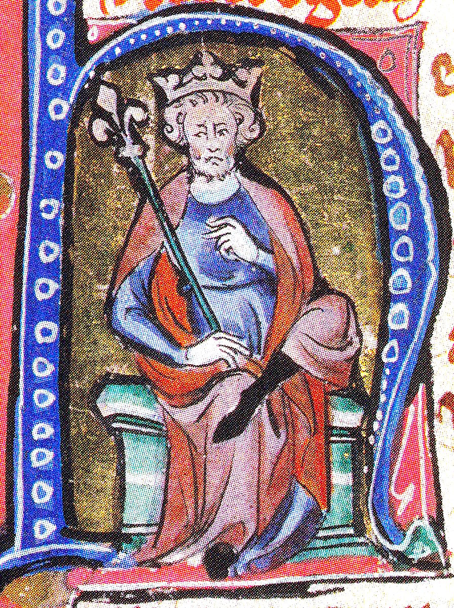
Canute the Great illustrated in an Initial of a medieval mansucriptUnknown authorUnknown author · Public domain · Commons
The North Sea Empire, also known as the Anglo-Scandinavian Empire, was the personal union of the kingdoms of England, Denmark and Norway for most of the period between 1013 and 1042 towards the end of the Viking Age. This ephemeral Norse-ruled empire was a thalassocracy, its components only connected by and dependent upon the sea.
The first king to unite all three kingdoms was Sweyn Forkbeard, king of Denmark since 986 and of Norway since 1000, when he conquered England in 1013. He died in the following year, and his realm was divided.
In early 1014 Sweyn and the Danes were in the midst of invading England. Cnut joined the expedition, and was given command of the fleet in the River Trent during one of Sweyn's visit to the south.
Read more
Sweyn died on 3 February, and Cnut had the early support of his Danish troops. But the invasion fell apart as the men of the Kingdom of Lindsey failed to supply horses they had promised. English nobles then reinstalled King Æthelred—whom they had previously deposed and exiled—after he promised reforms, and Cnut returned to Denmark.
Cnut's brother Harald succeeded Sweyn as King of Denmark. With the Danish throne out of his grasp, Cnut decided to invade England in his own right. He raised a fleet by promising shares of spoils and embarked for England in the summer of 1015; Eric Haakonsson of Norway provided.
Early in 1017, probably because he was king by right of conquest not more normal means, Cnut divided England into four earldoms on the Scandinavian model: Wessex he governed directly, and of his allies Thorkell the Tall became Earl of East Anglia, Eric Haakonsson retained Northumbria, which Cnut had already given him, and Eadric Streona became Earl of Mercia. But the last was disgraced and executed within a year. In 1018, Cnut revived at least two earldoms in Wessex and at a meeting at Oxford, his followers and representatives of the English agreed that he would govern under the laws of King Edgar.
Read more
Anglo-Saxon historian Frank Stenton points out that the Anglo-Saxon Chronicle has relatively little to say about Cnut's reign except to note his frequent travels abroad, indicating that he was in strong control of England.
There were two Danish attacks on Norman England. The first was an invasion in 1069–1070 conducted in alliance with various English rebels which succeeded in taking first York and then Ely before the Danes finally accepted a bribe to leave the country. The second was a large-scale raid in 1075, intended to support the Revolt of the Earls, in which the Lincolnshire coast and York were both ravaged. A third attack was planned in 1085, and a large invasion fleet composed of Danish, Flemish, and Norwegian vessels was assembled which never sailed.
Sweyn Estridson was the nephew of Cnut the Great, king over an empire that included England, Denmark and Norway, and the first cousin of Harthacnut, king of England and Denmark. On Harthacnut's death Edward the Confessor became king of England, but when Sweyn visited Edward shortly thereafter he was, according to his own rather implausible claim reported by the later writer Adam of Bremen, given a promise that he would succeed to the English throne after Edward's death. For many years he was distracted from English concerns by a series of wars in Denmark, where he disputed the throne with first Magnus the Good and then Harald Hardrada; he could not rule his Danish kingdom in peace until 1064.
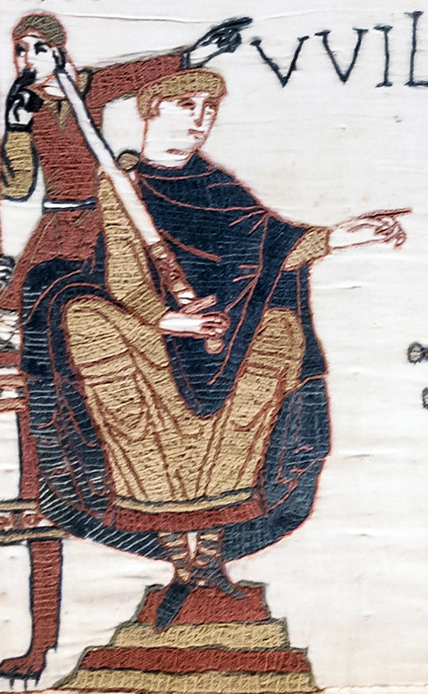
The Norman Conquest of England (or the Conquest) was an 11th-century invasion by an army made up of thousands of Norman, French, Flemish, and Breton troops, all led by the Duke of Normandy, later styled William the Conqueror.
William's claim to the English throne derived from his familial relationship with the childless Anglo-Saxon king Edward the Confessor, who may have encouraged William's hopes for the throne. Edward died in January 1066 and was succeeded by his brother-in-law Harold Godwinson.
In 911, the Carolingian French ruler Charles the Simple allowed a group of Vikings under their leader Rollo to settle in Normandy as part of the Treaty of Saint-Clair-sur-Epte. In exchange for the land, the Norsemen under Rollo were expected to provide protection along the coast against further Viking invaders. Their settlement proved successful, and the Vikings in the region became known as the "Northmen" from which "Normandy" and "Normans" are derived. The Normans quickly adopted the local culture as they became assimilated by the French, renouncing Norse paganism and converting to Christianity. They adopted the Old French language of their new home and added features from their own Old Norse language, transforming it into the Norman language.
The impact of the conquest on the lower levels of English society is difficult to assess. The major change was the elimination of slavery in England, which had disappeared by the middle of the 12th century. There were about 28,000 slaves listed in the Domesday Book in 1086, fewer than had been enumerated for 1066. In some places, such as Essex, the decline in slaves was 20 per cent over the 20 years. The main reasons for the decline in slaveholding appear to have been the disapproval of the Church and the cost of supporting slaves who, unlike serfs, had to be maintained entirely by their owners. The practice of slavery was not outlawed, and the Leges Henrici Primi from the reign of King Henry I continue to mention slaveholding as legal.
Read more
Many of the free peasants of Anglo-Saxon society appear to have lost status and become indistinguishable from the non-free serfs.
The battle began at about 9 am on 14 October 1066 and lasted all day, but while a broad outline is known, the events are obscured by contradictory accounts in the sources. Although the numbers on each side were probably about equal, William had both cavalry and infantry, including many archers, while Harold had only foot soldiers and few archers. The English soldiers formed up as a shield wall along the ridge, and were at first so effective that William's army was thrown back with heavy casualties. Some of William's Breton troops panicked and fled, and some of the English troops appear to have pursued the fleeing Bretons. Norman cavalry then attacked and killed the pursuing troops. While the Bretons were fleeing, rumours swept the Norman forces that William had been killed, but William rallied his troops.
1085 CE – 1176 CE · Capital: Castletown · 14,607 km²
Date: 2018-08-31 Sensor: MSI on Sentinel-2A Resolution: 10m RGB Composites: True color, Band 4-3-2Copernicus Sentinel-2, ESA · CC BY-SA 3.0 igo · Commons
The Kingdom of the Isles was a Norse–Gaelic kingdom comprising the Isle of Man, the Hebrides and the islands of the Clyde from the 9th to the 13th centuries. It is also called Sodor or the Sudreys, from its Old Norse name Suðreyjar, or "Southern Isles"; as distinct from the Norðreyjar or Northern Isles of Orkney and Shetland. Some of its later rulers were referred to as kings of Mann and the Isles. The historical record is incomplete, and the kingdom was not a continuous entity throughout the whole period.
In 870 Dumbarton was besieged by Amlaíb Conung and Ímar, "the two kings of the Northmen", who "returned to Dublin from Britain" the following year with numerous captives. It is therefore likely that Scandinavian hegemony was already significant on the western coasts of Scotland by then. Amlaíb Conung is described as the "son of the king of Lochlainn" in the Fragmentary Annals of Ireland and Ó Corráin (1998) argues that Lochlainn "is Viking Scotland and probably includes Man" at this time suggesting an early date for an organised Kingdom of the Isles. In the same source Amlaíb Conung is also recorded as having gone to the aid of his father Gofraidh, who was under assault from Vikings in Lochlainn in about 872. Gofraidh died in 873 and may have been succeeded briefly by Ímar who also died that year. Amlaíb probably died in 874.
Castle Rushen, seen from across Castletown Harbour at low tide. Also in view to the left is the Gluepot Pub. Picture by Paul Dyer, June 2005.Padyer at English Wikipedia · Public domain · Commons
Perhaps as a result of general disorder in the islands, and to counter Irish influence there, Magnus Barefoot had re-established direct Norwegian overlordship by 1098. He first took Orkney, the northern Scottish mainland and the Hebrides, where he "dyed his sword red in blood" in the Uists. According to the Heimskringla, Magnus had his longship dragged across the isthmus north of Kintyre in 1093 as part of his campaign. By taking command of his ship's tiller and "sailing" across the isthmus he was able to claim the entire peninsula was an island, and it remained under Norwegian rule for more than a dozen years as a result.
Read more
In 1098, Edgar of Scotland signed a treaty with Magnus that settled much of the boundary between the Scots and Norwegian claims in the islands. Edgar formally acknowledged the existing situation by giving up his claims to the Hebrides and Kintyre.
1147 CE – 1209 CE · Capital: No official capital. Court was generally held at Angers and Chinon. · 426,192 km²
The Angevin Empire (French: Empire Plantagenêt) was the collection of territories held by the House of Plantagenet during the 12th and 13th centuries, when they ruled over an area covering roughly all of present-day England, half of France, and parts of Ireland and Wales, and claiming overlordship and some influence over the remaining parts of Wales, Scotland and Ireland. It may be described as an early example of a composite monarchy.
In 1106, Henry I of England had defeated his brother Robert Curthose and angered Robert's son, William Clito, Count of Flanders. Henry used his paternal inheritance to take the Duchy of Normandy and the Kingdom of England and then tried to establish an alliance with Anjou by marrying his only legitimate son, William, to Fulk the Younger's daughter, Matilda. However, William died in the White Ship disaster in 1120. As a result, Henry then married his daughter Matilda to Geoffrey "Plantagenet", Fulk's son and successor; however, Henry's subjects had to accept Matilda's inheritance to the throne of England. There had been only one occurrence of a medieval European queen regnant before, Urraca of León and Castile, and it was not an encouraging precedent; nevertheless, in January 1127 the Anglo-Normans barons and prelates recognized Matilda as heiress to the throne in an oath.
All of the continental domains ruled by the Angevin kings were governed by a seneschal at the top of the hierarchical system, with lesser government officials such as baillis, vicomtes, and prévôts. However, all counties and duchies would differ to an extent.
Read more
Greater Anjou is a modern term to describe the area consisting of Anjou, Maine, Touraine, Vendôme, and Saintonge. Here, prévôts, the seneschal of Anjou, and other seneschals governed. However, the constituent counties, such as Maine, were often administered by the officials of the local lords, rather than their Angevin suzerains. Maine was initially largely self-governing and lacked centralized administration until the Angevin kings made efforts to improve governance by installing new officials, such as the seneschal of Le Mans.
Following the news of King Richard I's death in 1199, John attempted to seize the Angevin treasury at Chinon in order to impose his control of the Angevin government. Angevin custom, however, gave John's nephew Duke Arthur, son of Geoffrey of Brittany, a stronger claim on Richard's throne, and the nobles of Anjou, Maine, and Touraine declared in favour of Arthur on 18 April 1199. Philip II had taken Évreux and the Vexin, and a Breton army had seized Angers by this point. Le Mans refused to declare allegiance to John, so John ran to Normandy, where he was invested as duke in Rouen on 25 April. He returned to Le Mans with an army where he punished its citizens and then left for England. England had declared its support for John thanks to William Marshal and Archbishop of Canterbury Hubert Walter's support. He was crowned on 27 May in Westminster Abbey.
The hypothetical continuation and expansion of the Angevin Empire over several centuries has been the subject of several tales of alternate history. English and French historians had viewed the juxtaposition of England and French lands under Angevin control as something of an aberration and an offence to national identity. To English historians, the lands in France were an encumbrance, but French historians considered the union to be an English empire.
Read more
The 12th century brought about Gothic architecture, first known as opus francigenum, from the work of Abbot Suger at Saint Denis in 1140. The Early English Period began around 1180 or 1190, but this religious architecture was independent of the Angevin Empire. Gillingham suggests that it was only "perhaps in kitchen design" that there was a distinctively Angevin style.
1169 CE – 1215 CE · Capital: Castell Dinas Brân · 1,294 km²
Castell Dinas Bran, Llangollen - AUOB (Dyffryn Ddyfrdwy (Dee Valley); WalesLlywelyn2000 · CC BY-SA 4.0 · Commons
Northern Powys or Powys Fadog (Welsh for 'Madog's Powys'), was the northern portion of the Kingdom of Powys following that kingdom's dissolution in 1160. The lords of northern Powys had their royal seat at Castell Dinas Brân and their religious center at Valle Crucis Abbey. Some of its lordships included those of Maelor, Mochnant, Glyndyfrdwy, Yale, and Bromfield and Yale.
Following the division of Powys, their cousin branch, the princes of Powys Wenwynwyn, had their seat at Powis Castle.
1169 CE – 1209 CE · Capital: Welshpool · 3,122 km²
High Street, Welshpool, near to Welshpool/Y Trallwng, Powys, Great Britain. A general view of the High Street. Welshpool is a wonderful place to visit if you have an interest in old architecture.OLU · CC BY-SA 2.0 · Commons
Southern Powys or Powys Wenwynwyn (Welsh for 'Gwenwynwyn's Powys'), was a Welsh lordship which existed during the high Middle Ages. The realm was the southern portion of the former princely state of Powys which split following the death of Madog ap Maredudd and the killing of his heir Llywelyn in 1160: the northern portion (Maelor) went to Gruffydd Maelor and eventually became known as Powys Fadog; while the southern portion (Cyfeiliog) going to Owain Cyfeiliog and becoming known, eventually, as Powys Wenwynwyn after Prince Gwenwynwyn ab Owain, its second ruler.
Owain ap Gruffydd ap Gwenwynwyn (alias Owen de la Pole) allegedly surrendered the principality of Powys to Edward I at the Parliament held in Shrewsbury in 1283 (Dafydd ap Gruffudd, his rival in Powys Fadog was tried at the same Parliament, he was deposed for fighting on the wrong side and executed for treason against Edward).
1177 CE – 1271 CE · Capital: Castletown · 6,003 km²
Date: 2018-08-31 Sensor: MSI on Sentinel-2A Resolution: 10m RGB Composites: True color, Band 4-3-2Copernicus Sentinel-2, ESA · CC BY-SA 3.0 igo · Commons
The Kingdom of the Isles was a Norse–Gaelic kingdom comprising the Isle of Man, the Hebrides and the islands of the Clyde from the 9th to the 13th centuries. It is also called Sodor or the Sudreys, from its Old Norse name Suðreyjar, or "Southern Isles"; as distinct from the Norðreyjar or Northern Isles of Orkney and Shetland. Some of its later rulers were referred to as kings of Mann and the Isles. The historical record is incomplete, and the kingdom was not a continuous entity throughout the whole period.
In 870 Dumbarton was besieged by Amlaíb Conung and Ímar, "the two kings of the Northmen", who "returned to Dublin from Britain" the following year with numerous captives. It is therefore likely that Scandinavian hegemony was already significant on the western coasts of Scotland by then. Amlaíb Conung is described as the "son of the king of Lochlainn" in the Fragmentary Annals of Ireland and Ó Corráin (1998) argues that Lochlainn "is Viking Scotland and probably includes Man" at this time suggesting an early date for an organised Kingdom of the Isles. In the same source Amlaíb Conung is also recorded as having gone to the aid of his father Gofraidh, who was under assault from Vikings in Lochlainn in about 872. Gofraidh died in 873 and may have been succeeded briefly by Ímar who also died that year. Amlaíb probably died in 874.
Castle Rushen, seen from across Castletown Harbour at low tide. Also in view to the left is the Gluepot Pub. Picture by Paul Dyer, June 2005.Padyer at English Wikipedia · Public domain · Commons
Perhaps as a result of general disorder in the islands, and to counter Irish influence there, Magnus Barefoot had re-established direct Norwegian overlordship by 1098. He first took Orkney, the northern Scottish mainland and the Hebrides, where he "dyed his sword red in blood" in the Uists. According to the Heimskringla, Magnus had his longship dragged across the isthmus north of Kintyre in 1093 as part of his campaign. By taking command of his ship's tiller and "sailing" across the isthmus he was able to claim the entire peninsula was an island, and it remained under Norwegian rule for more than a dozen years as a result.
Read more
In 1098, Edgar of Scotland signed a treaty with Magnus that settled much of the boundary between the Scots and Norwegian claims in the islands. Edgar formally acknowledged the existing situation by giving up his claims to the Hebrides and Kintyre.
The County of Boulogne was a county within the Kingdom of France during the 9th to 15th centuries, centred on the city of Boulogne-sur-Mer. It was ruled by the counts of Flanders in the 10th century, but a separate House of Boulogne emerged during the 11th century. It was merged into the County of Artois by Philip II of France in 1212 and eventually annexed to the royal domain itself in 1477.
1294 CE – 1608 CE · Capital: ), Dunfermline, Edinburgh (after) · 92,365 km²
Scotland-2016-Aerial-Stirling-Stirling CastleGodot13 · CC BY-SA 4.0 · Commons
The Kingdom of Scotland was a sovereign state in northwest Europe, traditionally said to have been founded in 843. Its territories expanded and shrank, but it came to occupy the northern third of the island of Great Britain, sharing a land border to the south with the Kingdom of England. During the Middle Ages, Scotland engaged in intermittent conflict with England, most prominently the Wars of Scottish Independence, which saw the Scots maintain and assert their independence from the English.
From the 5th century on, north Britain was divided into a series of petty kingdoms. Of these, the four most important were those of the Picts in the north-east, the Scots of Dál Riata in the west, the Britons of Strathclyde in the south-west and the Anglian kingdom of Bernicia (which united with Deira to form Northumbria in 653) in the south-east, stretching into modern northern England.
Read more
In 793, ferocious Viking raids began on monasteries such as those at Iona and Lindisfarne, creating fear and confusion across the kingdoms of north Britain. Orkney, Shetland and the Western Isles eventually fell to the Norsemen. In a decisive battle in 839, the king of the Picts, Uuen, and the king of Dál Riata, Áed, were killed by Vikings.
Scots law developed into a distinctive system in the Middle Ages and was reformed and codified in the 16th and 17th centuries. Knowledge of the nature of Scots law before the 11th century is largely speculative, but it was probably a mixture of legal traditions representing the different cultures inhabiting the land at the time, including Celtic, Britonnic, Irish and Anglo-Saxon customs. The legal tract, the Leges inter Brettos et Scottos, set out a system of compensation for injury and death based on ranks and the solidarity of kin groups. There were popular courts or comhdhails, indicated by dozens of place names in eastern Scotland. In Scandinavian-held areas, Udal law formed the basis of the legal system and it is known that the Hebrides were taxed using the Ounceland measure.
There are mentions in medieval records of fleets commanded by Scottish kings including William the Lion and Alexander II. The latter took personal command of a large naval force which sailed from the Firth of Clyde and anchored off the island of Kerrera in 1249, intended to transport his army in a campaign against the Kingdom of the Isles, but he died before the campaign could begin. Records indicate that Alexander had several large oared ships built at Ayr, but he avoided a sea battle. Defeat on land at the Battle of Largs and winter storms forced the Norwegian fleet to return home, leaving the Scottish Crown as the major power in the region and leading to the ceding of the Western Isles to Alexander in 1266.
Read more
Part of the reason for Robert I's success in the Wars of Independence was his ability to call on naval forces from the Islands.
The Earldom of Ulster was an Anglo-Norman lordship in north-eastern Ireland during the Middle Ages, ruled by the Earls of Ulster and part of the Lordship of Ireland. The Norman knight John de Courcy invaded the Gaelic Irish kingdom of Ulaid in 1177 and conquered most of its territory over the following few years. In 1181 he was made earl palatine of Ulster by Henry II of England. The earldom was the most important Anglo-Norman lordship in the north of Ireland. It covered most of what are now the Ulster counties of Antrim and Down, and briefly extended west to Lough Foyle.
Earl of Desmond is a title of nobility created by the English monarch in the peerage of Ireland. The title has been created four times. It was first awarded in 1329 to Maurice FitzGerald, 4th Baron Desmond, a Hiberno-Norman lord in Southwest Ireland, and it was held by his descendants until 1583 when they rose against the English crown in the Desmond Rebellions. Following two short-lived recreations of the title in the early 1600s, the title has been held since 1628 by the Feilding family of Warwickshire, England. The current holder is Alexander Feilding, 12th Earl of Denbigh and 11th Earl of Desmond. The earldom held by the Fitzgerald family historically comprised what is now the entirety of County Limerick with large swathes of County Cork, County Kerry and County Waterford also being included. It bordered the Kingdom of Desmond, Kingdom of Thomond and the Earldom of Ormond
Date: 2018-08-31 Sensor: MSI on Sentinel-2A Resolution: 10m RGB Composites: True color, Band 4-3-2Copernicus Sentinel-2, ESA · CC BY-SA 3.0 igo · Commons
The Isle of Man (Manx: Mannin [ˈmanɪnʲ], also Ellan Vannin [ˈɛlʲan ˈvanɪnʲ]), also known simply as Man or Mann (man), is a self-governing British Crown Dependency in the Irish Sea, between Great Britain and Ireland. As head of state, Charles III holds the title Lord of Mann and is represented by a Lieutenant Governor. The government of the United Kingdom is responsible for the Isle of Man's military defence and represents it abroad, but the Isle of Man still has a separate international identity.
Humans have lived on the island since before 6500 BC.
The Isle of Man is not part of the United Kingdom; however, the UK is responsible for its defence and external affairs. There are no independent military forces on the Isle of Man, although HMS Ramsey was affiliated with the town of the same name. From 1938 to 1955, there existed the Manx Regiment of the British Territorial Army (TA), which saw extensive action during the Second World War. During the English Civil War, the 7th Earl of Derby, who was also the Lord of Mann, conscripted 10 men from each parish (170 in total) to fight for the Royalist cause; the majority were killed at the Battle of Wigan Lane in 1651. In 1779, the Manx Fencible Corps, a fencible regiment of three companies, was raised; it was disbanded in 1783 at the end of the American War of Independence. Later, the Royal Manx Fencibles was raised at the time of the French Revolutionary Wars and Napoleonic Wars.
The Isle of Man has no capital gains tax, wealth tax, stamp duty, or inheritance tax and a top rate of income tax of 22% (as of April 2024). A tax cap is in force: the maximum amount of tax payable by an individual is £200,000 or £400,000 for couples choosing to have their incomes jointly assessed. Personal income is assessed and taxed on a worldwide income basis rather than a remittance basis. This means that all income earned throughout the world is assessable for Manx tax rather than only income earned in or brought into the island. The standard rate of corporation tax for residents and non-residents is 0%. Retail business profits above £500,000 and banking business income are taxed at 10%, while rental (or other) income from land and buildings situated on the Isle of Man is taxed at 20%.
This coin is listed in the Standard Catalogue of British Coins under the ID J001.Abxbay · CC BY-SA 4.0 · Commons
Currency
pound sterling, Manx pound
This coin is listed in the Standard Catalogue of British Coins under the ID 7417.Welkinridge · Public domain · Commons
A banknote issued to circulate on Kangaroo Island, Australia.Kangaroo Island · Public domain · Commons
Flag of the Isle of ManEdited by Reisio, Alkari, e.a. · CC0 · Commons
Coat of arms of the Isle of ManFXXX · Public domain · Commons
Achievements and Monuments
In the past, the basic national dish of the island was spuds and herrin, boiled potatoes and herring. This plain dish was supported by the subsistence farmers of the island, who for centuries crofted the land and fished the sea. A more recent claimant for the title of national dish is the ubiquitous chips, cheese and gravy, which is found in most of the island's fast-food outlets. It consists of thick-cut chips, covered in shredded Cheddar cheese and topped with a thick gravy. However, as of the Isle of Man Food & Drink Festival 2018, queen scallops (queenies) have been crowned the Manx national dish with many restaurants, hotels and pubs serving local wild queen scallops.
Read more
Seafood has traditionally accounted for a large proportion of the local diet.
Medieval States of the British Isles: Frequently Asked Questions
Which states existed in the British Isles in this period?
This page maps 34 states of the British Isles founded between 523 CE and 1344 CE: Wihtgar, Kingdom of Deira, Kingdom of Lindsey, Dál Riata, Kingdom of Brycheiniog, Kingdom of Gwent, Kingdom of Gwynedd, Kingdom of Morgannwg, Kingdom of Powys, Kingdom of Bernicia, Hwicce, Kingdom of Dunoting and 22 more.
Which was the largest of the Medieval States of the British Isles?
Kingdom of England had the largest mapped extent, about 569,446 km².
Which of the Medieval States of the British Isles lasted longest?
Kingdom of England lasted longest, 936 CE – 1708 CE.
↑↓ to navigate↵ to open
12,754 Planetary Entities Indexed
We use Google Analytics cookies to understand which pages are useful. Necessary storage only keeps your theme and this choice on your device. Privacy policy