Early Modern States of Maritime Southeast Asia: Map & History
14 states of Maritime Southeast Asia on one map, from 1475 CE to 1907 CE.The largest, Mataram Sultanate, covered about 65,741 km²; the longest-lived, Blambangan Kingdom, lasted 1519 CE – 1743 CE. Each has its own section below with its rulers, capitals, wars and pictures where the records hold them.
Each state in its own colour. Move the timeline to see which existed in any year from 1475 AD to 1907; select a territory to read about it. Borders: Cliopatria / Seshat (CC BY 4.0).
The Early Modern States of Maritime Southeast Asia Compared
Semboro (1478–1489), Lamajang (1489–1501), Kedawung (Menak Lumpat until Wilabrata period), Macanputih (Tawang Alun II period), Muncar (Prabu Danurejo until Pangeran Agung Wilis period), Lateng (IGNK Dewa Kabakaba period)
1475 CE – 1551 CE · Capital: Bintara, Demak · 45,552 km²
The Demak Sultanate (کسلطانن دمق) was a Javanese Muslim state located on Java's north coast in Indonesia, at the site of the present-day city of Demak. A port fief to the Hindu-Buddhist Majapahit kingdom thought to have been founded in the last quarter of the 15th century, it was influenced by Islam brought by Muslim traders from China, Gujarat, Arabia and also Islamic kingdoms in the region, such as Samudra Pasai, Malacca and Bani (Muslim) Champa. The sultanate was the first Muslim state in Java, and once dominated most of the northern coast of Java and southern Sumatra.
During the reign of Wikramawardhana of Majapahit, during the period from 1405 to 1433, a series of Ming armadas naval expeditions led by Zheng He, a Muslim Chinese admiral, arrived in Java. This Chinese expedition supported the establishment of the Muslim state of Malacca in the first half of the 15th century, later assisted by the establishment of Muslim Chinese, Arab and Malay communities in northern ports of Java such as Semarang, Demak, Tuban, and Ampel; thus Islam began to gain a foothold on the northern coast of Java.
Read more
According to later Javanese tradition, Sunan Ampel ordered Raden Patah to establish an Islamic learning center in the Glagah Wangi village in coastal Central Java. Soon the village grew to become the center for dawah activities among distinguished Islamic proselytizers, traditionally known as Wali Songo or "the nine saints".
Before the emergence of Demak, the northern coast of Java was the seat of many Muslim communities, both foreign merchants and local Javanese. The Islamization process gained momentum from the decline of the Hindu-Buddhist Majapahit Empire. Following the fall of the Majapahit capital to a usurper from Kediri, Raden Patah declared Demak's independence from Majapahit overlordship, and almost all northern Javanese ports later followed suit. However, the Demak royal family regarded themselves as descendants of Majapahit. Demak symbols continued to use the Surya Majapahit, an eight-pointed sun, while modifying it to remove Hindu associations. This modified symbol can be seen as decoration inside the Grand Mosque of Demak.As the first Islamic polity in Java, Demak has a venerated status among Indonesian Muslims.
Demak derived its income from trade, importing spices and exporting rice to Malacca and the Maluku Islands. It was a busy port located at the end of a then navigable channel separating Java and Muria Island. The channel subsequently filled, joining Muria to Java; from the 15th to the 18th century until the 18th century, it was a major waterway for ships traveling along the northern Javanese coast to the Spice Islands and, via the Serang River, to the rice-producing interior of Java. This strategic location enabled Demak to become a leading trading center in Java.According to Tomé Pires, Demak had more inhabitants than any other port in Sunda or Java, and was the primary exporter of rice to Malacca. Demak's prominence grew with that of Malacca, and was also enhanced by Raden Patah's claim of direct descent from Majapahit royalty and his marriage ties with neighboring city-states.
1497 CE – 1571 CE · Capital: Singhapala (Modern Mabolo district in Cebu City) · 6,669 km²
Cebu, also called Sugbu, informally referred to as the Rajahnate of Cebu, was an Indianized mandala (polity) monarchy on the island of Cebu in the Philippines prior to the arrival of the Spanish conquistadors. It is known in ancient Chinese records as the nation of Sokbu (束務) (Hokkien) or Suwu (Mandarin). According to Visayan oral legend, it was founded by Sri Lumay or Rajamuda Lumaya, a half-Malay and half-Tamil from Sumatra.
A kingdom called Suwu was mentioned in the 1225 Chinese Annals, the Zhufan Zhi (諸蕃志), and during the 17th Century this was the same name used for Cebu among Chinese traders to the Philippines thus it is presumed to be the same location.
Read more
Selingaan Island), Shimiao (Simmiu/Simbio), Rili (Jatlai/Jitleh, possibly Jelai), Hulumantou (Wulomantau/Holobantau), Suwu (Somat/Sobut), Lima (Leima/Libeh), Danyu (Damjyu/Tamu), and Manuo (Manok/Belok) are located on islands in the sea. Their people travel to and fro in small boats, and their clothing and diet are the same as those of Boni. They produce sheng agarwood, lakawood, beeswax, and tortoiseshell. Merchants can trade for these with white porcelain ware, wine, rice, coarse salt, white spun silk, and trade-quality gold.
Below the rulers were the Timawa, the feudal warrior class of the ancient Visayan societies of the Philippines who were regarded as higher than the uripon (commoners, serfs, and slaves) but below the tumao (royal nobility) in the social hierarchy. They were roughly similar to the Tagalog Maharlika class.
Syncretic form of Hinduism, Buddhism and Animism (see also Polytheism), Roman Catholicism (since 1521)
Economy and Trade
The port-kingdom of Cebu was founded as early as the 10th Century, early Spanish-era contact descriptions show that it was a long, lineal, sea-side port-kingdom stretching up to 8 kilometers composed of 300 houses and buildings and at its center was a King's (Rajah's) Palace where the Rajah lives and an open square or plaza, in front of it. It is noted that there were no large temples, but had many wooded oratories. The scholar Wang Dayuan at 1350 published in the Daoyi Zhilüe, Zhifu Zhai Congshu edition as well as the book Zhinan Zhengfa (“The True Art of Pointing South) which had maritime logs compiled from 1471-1588 show a maritime shipping lane from the Kingdom of Manila to the Rajahnate of Cebu.
Indianization, although it was superseded by Hispanization, left markers in the Cebuano language and culture, such as religious practices and common vocabulary words whose origins are from Sanskrit and Tamil. There is also genetic evidence of South Asian or Indian Hindu influence in Cebu as according to genetic studies, the people of Cebu and Bohol have as much as 10-20% of their genetics taken from South Asian admixture.
1519 CE – 1686 CE · Capital: Bedulu (Warmadewa period), Samprangan (Majapahit period), Gelgel (Gelgel period), Klungkung (Nine Kingdoms period) · 22,062 km²
The Bali Kingdom (Balinese: ᭚ᬓᭂᬭᬚ᭡ᬦ᭄ᬩᬮᬶ, romanized: Kĕrajaan Bali) was a series of Hindu-Buddhist kingdoms that once ruled some parts of the volcanic island of Bali, in Lesser Sunda Islands, Indonesia. With a history of native Balinese kingship spanning from the early 10th to early 20th centuries, Balinese kingdoms demonstrated sophisticated Balinese court culture where native elements of spirit and ancestral reverence combined with Hindu influences—adopted from India through ancient Java intermediary—flourished, enriched and shaped Balinese culture.
Bali has been inhabited by humans since Paleolithic times (1 Million BCE to 200,000 BCE), testified by the finding of ancient tools such as hand axes in Sembiran and Trunyan villages in Bali, followed by the Mesolithic period (200,000–3,000 BCE). However, the ancestors of the current Balinese inhabitants reached the island around 3,000 to 600 BCE during the Neolithic period, characterised by rice-growing technology and speaking Austronesian languages. The Bronze Age period followed, from around 600 BCE to 800 CE.
1519 CE – 1743 CE · Capital: Semboro (1478–1489), Lamajang (1489–1501), Kedawung (Menak Lumpat until Wilabrata period), Macanputih (Tawang Alun II period), Muncar (Prabu Danurejo until Pangeran Agung Wilis period), Lateng (IGNK Dewa Kabakaba period) · 27,732 km²
The Blambangan Kingdom (Indonesian: Kerajaan Blambangan, Javanese: ꦑꦫꦠꦺꦴꦤ꧀ꦨ꧀ꦭꦩ꧀ꦧꦔꦤ꧀) was the last Javanese Hindu kingdom that flourished between the 15th and 18th centuries, based in the eastern corner of Java. The capital was at Banyuwangi. It had a long history of its own, developing contemporaneously with the largest Hindu kingdom in Java, Majapahit (1293–1527). At the time of the collapse of Majapahit in the late fifteenth century, Blambangan stood on its own as the one solitary Hindu state left in Java, controlling the larger part of Java’s Oosthoek.
During the Majapahit period c. 13th century, the eastern realm was regarded as a peripheral area of the Javanese kingdom, which centered in Trowulan, Majapahit, and surrounding Brantas River basin, whereas the eastern salient areas such as Lumajang were regarded as outlying provinces.
Read more
The Majapahit kingdom was established in 1293 by Raden Wijaya with the help of the cunning and able Arya Wiraraja, the Regent of Madura. As a reward of Wiraraja's support, in 1295, Raden Wijaya agreed to give the eastern salient of Java, which includes Blambangan areas with Lumajang as its capital.
The Nagarakretagama, composed in 1365, mentioned that the central part of the eastern corner of Java was visited by King Hayam Wuruk in his royal tour in 1359. The poem contains interesting information about the region.
The Balinese kingdoms used Blambangan as a vassal and buffer against the Islamic expansion initiated by Mataram from the west and also found it useful to bolster the economy of Bali which was heavily overshadowed by endemic warfare.
Read more
In the second half of the 16th century, a few Roman Catholic missionaries from the Portuguese colony in Malacca arrived in East Java to try to convert the local people. They visited Panarukan and Blambangan and reported that the port of Panarukan was contested between the Muslim rulers of Pasuruan allied with Surabaya, against the Hindu King of Blambangan and Panarukan. The Balinese chronicle Babad Gumi, which was first composed around the early 18th century, ascribed the fall of Blambangan around this period in the year 1520 śaka or 1598 AD.
The Lontara script (ᨒᨚᨈᨑ), also known as the Bugis script, Bugis-Makassar script, or Urupu Sulapaʼ Eppaʼ "four-cornered letters", is one of Indonesia's traditional scripts developed in the South Sulawesi and West Sulawesi region. The script is primarily used to write the Buginese language, followed by Makassarese and Mandar. Closely related variants of Lontara are also used to write several languages outside of Sulawesi such as Bima, Ende, and Sumbawa.
Buginese, Makassarese, Mandar, (slightly modified for Bima, Ende, and Sumbawa)
Mataram Sultanate
1588 CE – 1743 CE · Capital: Pleret · 65,741 km²
Painting of Anyakrakusuma by Basuki Bawono, 2008Basuki Bawono · CC BY-SA 3.0 · Commons
The Sultanate of Mataram was an early modern state based on the island of Java that lasted from the late 16th century to the 18th century. At its peak, Mataram was one of the most powerful kingdoms in the Indonesian archipelago and Southeast Asia. Along with Aceh and Makassar, it has been referred to as one of Southeast Asia's major "gunpowder empires." At its greatest extent, Mataram's territory spanned most of mainland Java and Madura, with vassals in Palembang, Sukadana, and Jambi.
Senapati assumed royal status by wearing the title "Panembahan" (literally "one who is worshipped/sembah"). He revealed the expansive nature of his reign and began the fateful campaign to the East along the course of Solo River that would bring endless conflicts. In 1586, the wealthy port city of Surabaya rose against Panembahan Senapati. Senapati however was unable to penetrate Surabayan defence. He then conquered Madiun in 1590-1 instead, and turned east from Madiun to conquer Kediri in 1591 and Ponorogo. Perhaps during the same time he also conquered Jipang (present day Bojonegoro) and Jagaraga (north of present-day Magetan). He reached east as far as Pasuruan, who may have used his threat to reduce pressure from the then powerful Surabaya.
One of the gates of Kota Gede, the former capital of Mataram Sultanate, Yogyakarta. The complex includes mosque, pool and bathing place, and Mataram royal cemetery.Gunawan Kartapranata · CC BY-SA 3.0 · Commons
Members of the royal family did not normally hold administrative positions. They might at times be appointed supreme authority or viceroy of a region, but the tedium of day-to-day administration was usually delegated to the priyayi, an official class of professional bureaucrats who were nonetheless bound to the aristocratic class by intermarriage and links of economic advantage. The sovereign's family and their courtiers received for their maintenance royal apanages (lungguh) derived from the revenues of lands in the Negaragung, whose sizes corresponded with the rank of the holder in the hierarchy of the court. These lands were administered, and taxes collected, by officials appointed by the landholder. When the landholder passed, these apanage fields were reverted to the Crown to be handed out again.
Khazar coin, the so called 'Moses coin', from the Spillings Hoard at Gotland Museum, Visby, Gotland, Sweden, cropped photo.W.carter · CC BY-SA 4.0 · Commons
Currency
dinar, Dirham, Netherlands Indies guilder
Anillos iberorromanos, lingote, estátera escita (siglo I a. C.), dinar indio (325-345) e histamenon bizantino (1059-1067). Exposición permante de la Historia del dinero. Museo de Prehistoria de ValenciaDorieo · CC BY-SA 4.0 · Commons
Flag of the Mataram SultanateInayubhagya · CC0 · Commons
Wars and Battles
Amangkurat II died in 1703 and was briefly succeeded by his son, Amangkurat III. However, this time the Dutch believed they had found a more reliable client, and hence supported his uncle Pangeran Puger, formerly Susuhunan ing Alaga, who had previously been defeated by the VOC and Amangkurat II. Before the Dutch, he accused Amangkurat III of planning an uprising in East Java. Unlike Pangeran Puger, Amangkurat III inherited family connection with Surabayan ruler, Jangrana II, from Amangkurat II and this lent credibility to the allegation that he cooperated with the now powerful Untung Suropati in Pasuruan. Panembahan Cakraningrat II of Madura, the VOC's most trusted ally, persuaded the Dutch to support Pangeran Puger.
Despite being an Islamic Sultanate, Mataram had never adopted Islamic culture, systems and institutions thoroughly. Its political system was more like a syncretism of earlier Javanese Hindu civilisation merged with Islamic elements. The major formation took place during Sultan Agung's reign as he adapted Islam to the Hindu-Javanese tradition and introduced a new calendar in 1633 based on Islamic and Javanese practice. The arts during Sultan Agung's reign were a mixture of Islamic and Hindu-Javanese elements. The mainstream belief system was the Kejawen tradition, while the Islamic beliefs was held by a handful of kiyai or ulama religious elite clustering around Kauman area near court's mosque. The Javanese court ceremonies, culture and rituals of Mataram still bears Hindu-Buddhist elements.
The Mataram Sultanate was the last major native polity in Java prior the kingdom broke into of courts of Surakarta and Yogyakarta, and the princedom of Mangkunegaran and Pakualaman, and prior the island was completely ruled by the Dutch. For some Central Javanese, especially those hailed from Yogyakarta and Surakarta city, the Mataram Sultanate, especially Sultan Agung's era, was remembered with pride as a glorious past, as Mataram become the regional hegemon after Majapahit, almost completely unified Java island, and almost succeed to drive the Dutch out of Java. However, for those of former Mataram's rivals or vassals; East Javanese Surabayan, Madurese and Blambangan, also Priangan and Cirebon of West Java, Mataram era is remembered as the era of Central Javanese overlordship over them, marked with authoritarianism and arbitrariness of feudal Javanese regime.
Kutai is a historical region in what is now the Indonesian province of East Kalimantan on the island of Borneo. The region shares its name with the native ethnic group of the region (known as Urang Kutai 'the Kutai people'), with a total population around 300,000, who have their own language known as the Kutainese language which accompanies their own rich history.
The Kutai Martadipura Kingdom (399–1635) was the earliest Hindu kingdom in the East Indies. It was later succeeded by the Muslim sultanate of Kutai Kartanegara (1300–1844).
On 4 October 1999, the territory once belonging to the Sultanate of Kutai Kartanegara, until then composing the single Kutai Regency, was divided between a reduced Kutai Regency (renamed the Kutai Kartanegara Regency on 23 March 2002), new East Kutai and West Kutai regencies, and the independent city of Bontang; on 14 December 2012 the western districts of West Kutai Regency were split off to create a separate Mahakam Ulu Regency. Each regency was and is headed by a regent (known locally as Bupati) and forms a part of East Kalimantan|East Kalimantan. Meanwhile, the position of Sultan of Kutai Kartanegara still exists and resides in the Kutai Palace (Kedaton) in Tenggarong but administratively, the governance is conducted by the regional government of the Republic of Indonesia, not the sultanate. The Sultan holds an honorary status in Kutai and is highly respected by Kutai people.
Bali (English:; Indonesian: ['bali]; Balinese: ᬩᬮᬶ) is an Indonesian island and province and the westernmost of the Lesser Sunda Islands. East of Java and west of Lombok, the province includes the island of Bali and a few smaller offshore islands, notably Nusa Penida, Nusa Lembongan, and Nusa Ceningan to the southeast. The provincial capital, Denpasar, is the most populous city in the Lesser Sunda Islands and the second-largest, after Makassar, in Eastern Indonesia. The Denpasar metropolitan area is the extended metropolitan area around Denpasar.
From wikipedia: Bajra Sandhi Monument is a monument to Balinese people struggle from time to time. The monument is located in front of the Bali Governor's Office in Renon, Denpasar, Bali.trezy humanoiz from Denpasar, indonesia · CC BY 2.0 · Commons
The governor is the highest officeholder in the Bali provincial government with the vice governor being the second highest officeholder. The Governor of Bali is responsible for the territory of the Province of Bali. The current governor in office in the province of Bali is I Wayan Koster who was first being elected in the 2018 Bali gubernatorial election accompanied by his first running mate at that time Tjokorda Oka Artha Ardana Sukawati (Cok Ace). Koster is the 8th governor of Bali, since the province was formed into the province of Bali in 1958 based on Law Number 64 of 1958. Koster and Cok Ace were inaugurated by the president of the Republic of Indonesia at that time Joko Widodo, at the State Palace, Jakarta on September 5, 2018, for the five years term of office (2018–2023).
In 2025, Bali received 6,948,754 international tourists, an increase of 9.72% compared to 2024.
Read more
In 1963, the Bali Beach Hotel in Sanur was built by Sukarno and boosted tourism in Bali. Before the Bali Beach Hotel construction, there were only three significant tourist-class hotels on the island. Construction of hotels and restaurants began to spread throughout Bali. Tourism further increased in Bali after the Ngurah Rai International Airport opened in 1970. The Buleleng regency government encouraged the tourism sector as one of the mainstays for economic progress and social welfare.
The tourism industry is primarily focused in the south, while also significant in the other parts of the island.
Flag of BaliAnonyLogGunkartaMuffin Wizard This W3C-unspecified vector image was created with Inkscape . · Public domain · Commons
Coat of arms of BaliGunkarta · Public domain · Commons
Achievements and Monuments
Bali is renowned for its diverse and sophisticated art forms, such as painting, sculpture, woodcarving, handcrafts, and performing arts. Balinese cuisine is also distinctive, and unlike the rest of Indonesia, pork is commonly found in Balinese dishes such as Babi Guling. Balinese percussion orchestra music, known as gamelan, is highly developed and varied. Balinese performing arts often portray stories from Hindu epics such as the Ramayana but with heavy Balinese influence. Famous Balinese dances include pendet, legong, baris, topeng, barong, gong kebyar, and kecak (the monkey dance). Bali boasts one of the most diverse and innovative performing arts cultures in the world, with paid performances at thousands of temple festivals, private ceremonies, and public shows.
1734 CE – 1747 CE · Capital: Busang Arau (1555–1695), Limbu (1695–1731), Salim Batu (1731–1777), Tanjung Palas (1777–1928, 1933–1959), Tarakan (1928–1933) · 20,247 km²
The Sultanate of Bulungan (Jawi: کسلطانن بولوڠن, Indonesian: Kesultanan Bulungan) was a former independent sultanate and later a special territory of Indonesia located in the then existing Bulungan Regency (at that time covering all the territory that now comprises the North Kalimantan province of Indonesia) in the east of the island of Borneo. Its territory spanned the eastern shores of North Kalimantan and Tawau, Malaysia.
Bulungan was founded by a Kayan group, the Uma Apan, also known as the Dayak Hupan, who originated from the interior region of Apo Kayan (Kayan Highland Plateau), before settling near the coast in the 16th or 17th century. According to a local legend, Kuwanyi was the leader of the Dayak Hupan, which was a small ethnic group with a village of only 80 people on the banks of the Payang River, a branch of the Pujungan River. Due to the poor quality of life on the region, they moved downstream of a large river called the Kayan.
Read more
One day Kuwanyi went hunting in the forest, but he did not catch a single animal, except for a large bamboo called bamboo betung and an egg that lay on a Jemlay tree stump. He brought the bamboo and the egg home. A boy emerged from the bamboo and when the egg was broken a girl also emerged. These two children were considered gifts from the gods.
Flag of BulunganUnknown authorUnknown author · Public domain · Commons
Wars and Battles
In February 1849, the residents of the three villages (kampong) along the Sebuku River declared their allegiance not to Bulungan but to Sulu, which led to Bulungan using military force to subjugate the area, driving the people of Sebuku to Atas, leaving Sebuku uninhabited. Bulungan gave support to the Sesayap Tidung against Sulu and the Iranun pirates. Since this point, Bulungan forbid its Tidung vassals from trading to Sulu directly, forcing them to trade only through Bulungan. By means of political marriage, Tarakan and other states in the Tidung Lands became subjects of Bulungan. During this period, the jurisdiction of Bulungan extended all the way towards Tawau, entering into a dispute with the Sultan of Sulu, who also had a claim in the region.
Hamengkubuwono (Javanese: ꦲꦩꦼꦁꦑꦸꦨꦮꦟ) is the current ruling royal house of the Yogyakarta Sultanate in the Special Region of Yogyakarta of Indonesia. The reigning Sultan of Yogyakarta is the hereditary Governor of the Special Region (Act No. 13 of 2012, article 18 paragraph 1c) with terms of 5 years (article 25 paragraph 1) without bounded by periodic provision (article 25 paragraph 2), as normally applied to such public office. The current Sultan is Hamengkubuwono X.
Yogyakarta Sultanate Hamengkubhuwono X EmblemGunawan Kartapranata · CC BY-SA 3.0 · Commons
Surakarta Sunanate
1744 CE – 1829 CE · Capital: Surakarta · 3,694 km²
General infographic about the Surakarta SunanateSam Hidayat · CC BY-SA 4.0 · Commons
Surakarta Sunanate (Javanese: ꦟꦒꦫꦶꦑꦱꦸꦤꦤ꧀ꦤꦤ꧀ꦯꦸꦫꦏꦂꦠꦲꦢꦶꦤꦶꦁꦫꦠ꧀, romanized: Nagari Kasunanan Surakarta Hadiningrat; Indonesian: Kesunanan Surakarta) is a Javanese monarchy centred in the city of Surakarta, in the province of Central Java, Indonesia.
The Surakarta Kraton was established in 1745 by Pakubuwono II. Surakarta Sunanate and Yogyakarta Sultanate are together the successors of Mataram Sultanate. Unlike their counterparts in Yogyakarta, who use the title of sultan, the rulers of Surakarta use the title of sunan. The Dutch name was used during Dutch colonial rule until 1942.
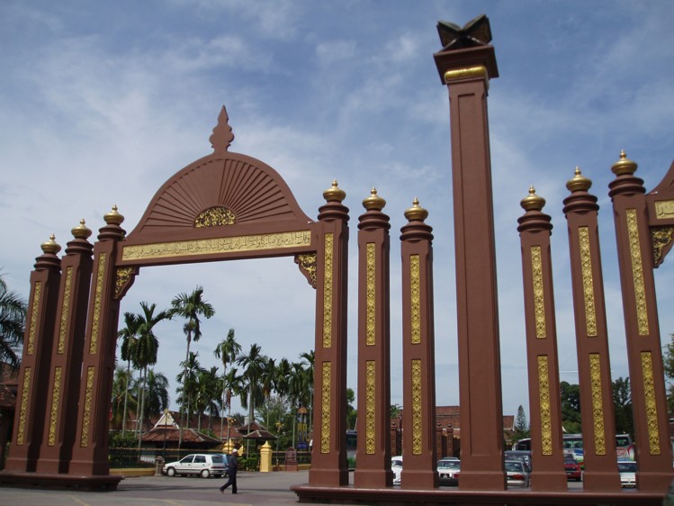
Kelantan (Malay pronunciation: [kəˈlantan]; Kelantanese Malay: Klate; Kelantanese Malay pronunciation: [kläˈtɛ]) is a state in Malaysia. The capital, Kota Bharu, includes the royal seat of Kubang Kerian. The honorific name of the state is Darul Naim ("The Blissful Abode"). Kelantan is located in the north-eastern corner of Peninsular Malaysia. Kelantan is an agrarian state with paddy fields, fishing villages and casuarina-lined beaches. Kelantan is home to some of the most ancient archaeological discoveries in Malaysia, including several prehistoric aboriginal settlements.
A part of the conservative Malay heartland, Kelantan has been ruled by the Malaysian Islamic Party (PAS) since 1990. It is one of four Malaysian states led by PAS after the 2022 elections, the others being Terengganu, Kedah, and Perlis.
Read more
Almost all PAS members are Malay Muslims, as are about 97% of Kelantan's population.
For years, the PAS has attempted to impose a strict interpretation of Islamic Law on Kelantan. It has successfully imposed certain social strictures such as single-sex supermarket queues, separate public benches for men and women, and limiting entertainment centers to prohibit "salacious behavior."
95.5% Sunni Islam (official), 2.8% Buddhism, 0.9% No religion, 0.4% Christianity, 0.2% Hinduism, 0.2% Others
Economy and Trade
Kelantan has a chiefly agrarian economy dominated by rice, rubber and tobacco. Fishing along its 96-kilometre coastline is also an important economic activity. Cottage industries which employ traditional skills in handicraft production such as batik, woodcarving and songket weaving are also evident. Logging activities are active given the vast remaining area of forest. In recent years, tourism, especially to offshore islands, has increased in importance. A few reputable hotels have been established and more modern shopping malls have been opened to cater to urban populations.
Read more
Kota Bharu, the capital, is the major urban centre, and there are also plans to open up the southern portion of the state under an ambitious multimillion-dollar development project. The main market at the city centre is a top attraction.
Coat of arms of KelantanThe State Government of Kelantan · Public domain · Commons
Achievements and Monuments
The culture of Kelantan has been influenced by Thai culture due to its location on the Thai border. Among the popular cultural practices are Dikir Barat, Wayang Kulit Kelantan, Wayang Kulit Melayu, Mak Yong, Menora, Main Puteri, Wau Bulan (kite-flying), Gasing (top-spinning), Silat, Tomoi, bird-singing competition and handicrafts. The unique Kelantan culture, Mak Yong is recognized by UNESCO. This ancient theatre form created by Malaysia's Malay communities combines acting, vocal and instrumental music, gestures and elaborate costumes. Specific to the villages of Kelantan in northwest Malaysia, where the tradition originated, Mak Yong is performed mainly as entertainment or for ritual purposes related to healing practices.
Read more
Among the handicraft products that are produce in Kelantan are songket, batik, silverware and mengkuang.
The Pontianak Kadriyah Sultanate (Jawi: کسلطانن قدرية ڤنتيانق) was a Arab-Malay state that existed on the western coast of the island of Borneo from the late 18th century until its disestablishment in 1950. It was founded in 1771 by Sultan Syarif Abdurrahman Ibni Alhabib Husein bin Ahmad Alkadrie, a descendant of Husayn ibn Ali, in the area of the mouth of the triple junction of the small Kapuas River and the porcupine river which included a small area ceded by the Sultan of Banten to the Dutch VOC.
The Pontianak Sultanate was founded in 1771 by explorers from Hadhramaut led by al-Sayyid Syarif Abdurrahman al-Kadrie, a son of a Hadramaut Arab cleric from the Mempawah Kingdom and descendant of Imam Ali al-Uraidhi ibn Ja'far al-Sadiq, on Wednesday, 23 October 1771 (14 Rajab 1185 H) which was marked by clearing the forest at the junction of the Landak River, Kapuas Kecil River, and Kapuas Besar River to build a hall and house as a residence. He had two political marriages in Kalimantan, first with the daughter of Panembahan Mempawah and then with the daughter of the sultan of Banjar.
Read more
In 1778 (1192 AH), Syarif Abdurrahman was confirmed as the Sultan of Pontianak.
Flag of Pontianak SultanateDre.comandante · Public domain · Commons
Coat of Arms of the Sultanate of Pontianak (1945)Aldontknow This W3C-unspecified vector image was created with Inkscape . · CC BY-SA 4.0 · Commons
Decline and Fall
Ended
1827 CE
Last recorded ruler
Sultan Syarif Usman Alkadrie
Negeri Sembilan
1775 CE – 1894 CE · Capital: Seremban · 5,900 km²
Title:Seri Menanti palace in Negeri Sembilan, Malaysia. Taken by: Adiput Date taken: March 31, 2006Adiput at English Wikipedia · Public domain · Commons
Negeri Sembilan (Malay pronunciation: [nəgəˈri səmbiˈlan], Negeri Sembilan Malay: Nogoghi Sombilan, Nismilan), historically spelled as Negri Sembilan and also known by the shorthand N9, is a state in Malaysia which lies on the western coast of Peninsular Malaysia. It borders Selangor on the north, Pahang in the east, and Malacca and Johor to the south. The Arabic honorific title of the state is Darul Khusus (دار الخصوص; "The Special Abode").
The capital of Negeri Sembilan is Seremban. The royal capital is Seri Menanti in Kuala Pilah District.
The earliest possible human settlement in Negeri Sembilan can be traced back around 14,000 years to the Pasoh Caves, a complex of karst caves near Simpang Pertang in the Jelebu district. Artefacts found around the caves include stone tools and food remains, estimated to date from 12,000 BCE based on carbon dating. The early inhabitants of Negeri Sembilan were the ancestors of the Semelai, Semai, Semang, and Jakun peoples, who lived either as hunter-gatherer nomads or as subsistence farmers.
Read more
According to the Malay Annals, Parameswara reportedly visited the settlement of Sening Ujong, which was located in what is now Seremban.
The Minangkabaus from Sumatra settled in what is today Negeri Sembilan in the 15th century, under the protection of the Malacca Sultanate and later the Sultanate of Johor.
The official constitutional title of the Ruler of the state is Duli Yang Maha Mulia Yang di-Pertuan Besar Negeri Sembilan, (currently Duli Yang Maha Mulia Yang di-Pertuan Besar Negeri Sembilan Darul Khusus Tuanku Muhriz ibni Almarhum Tuanku Munawir). The four Undangs of Sungei Ujong, Jelebu, Johol, and Rembau and the Tunku Besar Tampin, each bear the style of Yang Teramat Mulia. These offices are held for life, subject to the abdication and removal provisions of the state constitution and, in the of Undangs, the adat of the respective Luak.
Read more
The state's constitution proclaims the Yang di-Pertuan Besar, Undang of Sungei Ujong, Undang of Jelebu, Undang of Johol, Undang of Rembau and Tengku Besar Tampin are vested with the Executive Power of the state, are the Head of the Religion of Islam in the state and are the fountain of all honour and dignity for the state.
The state's manufacturing sector contributes almost half of the state's gross domestic product (GDP), followed by services and tourism (40.3%), agriculture (6%), construction (2.2%) and mining (0.3%). Manufacturing activities include electrical supplies and electronics, textiles, furniture, chemicals, machinery, metal works and rubber products. The main industrial areas in Negeri Sembilan include Senawang, Bandar Sri Sendayan, Sungai Gadut, Bandar Enstek and Nilai in Seremban, Tanah Merah in Port Dickson and Chembong in Rembau. Notable companies also set up plants in Negeri Sembilan, such as Kellogg's, Dutch Lady, Ajinomoto and Coca-Cola in Bandar Enstek, Hino Motors in Bandar Sri Sendayan, Yakult in Seremban 2, Samsung SDI, Onsemi and NXP Semiconductors in Senawang, and Nestlé in Chembong.
Flag of Negeri SembilanHimasaram · Public domain · Commons
Coat of arms of Negeri SembilanThe State Government of Negeri Sembilan · Public domain · Commons
Wars and Battles
After the Battle of Paroi, the British waited for Gurkha reinforcements, which arrived on 10 December 1875. The Malays fortified Bukit Putus, a mountain pass on the boundary between Sungai Ujong and Terachi. The British attacked Bukit Putus from both the front and back. The Gurkhas successfully captured the Malay stockade at Bukit Putus. The Malays retreated after the surprise appearance of Sungai Ujong Resident P.J. Murray's forces from behind. The inhabitants of the Terachi Valley fled, villages were burned, and Yamtuan Antah's palace in Seri Menanti was destroyed.
The Minangkabau influence in the state can be found in dances and food as well.
Read more
Traditional buildings in Negeri Sembilan are grouped into two different architectures: one directly Minangkabau with familiar lengkung or gonjong ("curved") buffalo horn motifs, and another featuring flatter or lentik roofs in villages of a "Malay" motif adopted by Minangkabau generations intermarrying with Jakun tribes; the lentik houses were based on traditional houses found in Kampar, Riau where the Minangkabau migrants stopped first.
Early Modern States of Maritime Southeast Asia: Frequently Asked Questions
Which states existed in Maritime Southeast Asia in this period?
This page maps 14 states of Maritime Southeast Asia founded between 1475 CE and 1775 CE: Demak Sultanate, Rajahnate of Cebu, Balinese Kingdom, Blambangan Kingdom, Kingdom of Pajana, Mataram Sultanate, Kutai Kingdom, Bali, Kingdom of Bulungan, Sultan of Yogyakarta, Surakarta Sunanate, Kelantan and 2 more.
Which was the largest of the Early Modern States of Maritime Southeast Asia?
Mataram Sultanate had the largest mapped extent, about 65,741 km².
Which of the Early Modern States of Maritime Southeast Asia lasted longest?
Blambangan Kingdom lasted longest, 1519 CE – 1743 CE.
↑↓ to navigate↵ to open
12,754 Planetary Entities Indexed
We use Google Analytics cookies to understand which pages are useful. Necessary storage only keeps your theme and this choice on your device. Privacy policy