Medieval States of Mainland Southeast Asia: Map & History
21 states of Mainland Southeast Asia on one map, from 546 CE to 1768 CE.The largest, Ayutthaya Kingdom, covered about 450,375 km²; the longest-lived, Lavo Kingdom, lasted 638 CE – 1394 CE. Each has its own section below with its rulers, capitals, wars and pictures where the records hold them.
Ms Sarah Welch · CC0 · CommonsThis Photo was taken by Supanut Arunoprayote. Feel free to use any of my images, but please mention me as the author and may send me a message. · CC BY 4.0 · CommonsMs Sarah Welch · CC0 · CommonsMs Sarah Welch · CC0 · Commons
Layers
HistoryChanges with the year
PlacesToday
Water
Land
1368 AD
Base map
An empire takes the map to its years and shows the borders.
Each state in its own colour. Move the timeline to see which existed in any year from 546 AD to 1768; select a territory to read about it. Borders: Cliopatria / Seshat (CC BY 4.0).
The Medieval States of Mainland Southeast Asia Compared
The Early Lý dynasty (Vietnamese: nhà Tiền Lý; chữ Nôm: 茹前李), also known in historiography as the Former Lý dynasty or Anterior Lý dynasty, officially Vạn Xuân (chữ Hán: 萬春; "Myriad Spring") or Nam Việt (chữ Hán: 南越; "Southern Việt"), was a dynasty of Vietnam that existed from AD 544 to 602. Its founder Lý Bí assumed the title of "Emperor of Southern Việt", which was later shortened to "Southern Emperor" (Lý Nam Đế). The capital was located at Long Biên within modern-day Hanoi.
Shortly after Lý Thiên Bảo died, a Lý family member, Lý Phật Tử (Lý Thiên Bảo's cousin) made claim to the imperial throne and challenged Triệu Quang Phục. Both sides vied against one another and civil war broke out for the throne with no decisive victory. Wary about engaging in internal fighting that would only frustrate the people, Triệu Việt Vương negotiated a truce and peace. From Long Biên northward would be under Lý Phật Tử's rule and the land south of Long Biên would belong to Triệu Việt Vương.
Read more
In 571, Lý Phật Tử broke the truce and attacked Triệu Quang Phục's domain. Since Triệu Quang Phục's domain was not prepared or imagined Lý Phật Tử would attack, therefore they were easily defeated. His capital was sacked and burned by Lý Phật Tử's forces, however he managed to escape. During his retreat, Triệu Quang Phục committed suicide.
555 CE – 717 CE · Capital: Shrestapura, Isanapura, Sambhupura · 427,021 km²
600 CE Ashram Maha Rishi Hindu temple, N17 Kuk Vihear Prasat Asram Maha Rusei, Sambour Kuk Cambodia 01Ms Sarah Welch · CC0 · Commons
Chenla or Zhenla (Chinese: 真臘; pinyin: Zhēnlà; Wade–Giles: Chen-la; Khmer: ចេនឡា, romanized: Chénla, Khmer pronunciation: [ceːnlaː]) is the Chinese designation for the vassal of the kingdom of Funan preceding the Khmer Empire that existed from around the late 6th to the early 9th century in Indochina. The name was still used in the 13th century by the Chinese envoy Zhou Daguan, author of The Customs of Cambodia. It appears on the Mao Kun map. However, modern historiography applies the name exclusively to the period from the late 6th to the early 9th century.
Most of the Chinese recordings on Chenla, including that of Chenla conquering Funan have been contested since the 1970s as they are generally based on single remarks in the Chinese annals. The History of the Chinese Sui dynasty contains entries of a state called Chenla, a vassal of the Kingdom of Funan, which had sent an embassy to China in 616 or 617, yet under its ruler, Citrasena Mahendravarman, conquered Funan after Chenla had gained independence.
Read more
Like its superior Funan, Chenla occupied a strategic position where the maritime trade routes of the Indosphere and the East Asian cultural sphere converged, resulting in prolonged socio-economic and cultural influence and the adoption of the epigraphic system of the south Indian Pallava dynasty and Chalukya dynasty.
The origins of Chenla's aristocracy, whom author Michael Vickery called the "Dângrêk Chieftains", are obscure.
According to George Cœdès, Champasak was the origin of the ruling dynasty of Chenla and Vat Phou its spiritual center. Coedès and contemporary scholars refer to the historical annals of the Sui dynasty, which mention Chenla and identify its royal residence to be near a mountain named Ling-jia-bo-po or Lingaparvata, a temple was constructed on its summit. Vat Phou is an enormously impressive Khmer Hindu temple located at the base of Mount Phu Kao in Laos, which leads theorists to speculate that Phu Kao is the mountain that is referenced in the passage and that Wat Phou could be the temple mentioned; however this view is not accepted by modern scholarship.
Read more
Authors Claude Jacques and Michael Vickery question the identification of Phu Kao as Lingjiabopo/Lingaparvata because there are a number of hills in Cambodia that apply to the vague descriptions.
The number of inscriptions declined sharply during the eighth century. However, some theorists, who have examined the Chinese transcripts, claim that Chenla started falling during the 700s as a result of both internal divisions and external attacks by the Shailendra dynasty of Java, who eventually took over and joined under the Angkor kingdom of Jayavarman II. According to the Sdok Kak Thom inscription (1053), Jayavarman II and his son Indrayudha defeated a Cham army in 790, then moved to north of the Tonle Sap, established the city of Hariharalaya, 15 kilometers south of Angkor.
Read more
Individually, historians reject a classical decline scenario, arguing there was no Chenla to begin with, rather a geographic region had been subject to prolonged periods of contested rule, with turbulent successions and an obvious incapability to establish a lasting centre of gravity.
The Lavo Kingdom (Thai: อาณาจักรละโว้) was a mandala in the lower Chao Phraya basin from the 7th century until 1388. Its centre was Lavapura until the 1080s, when it moved to Ayodhya (Xiān). Ayodhya and Lavo sent separate embassies to the Chinese court in the late 1200s, so the two may have been distinct states.
Before the 9th century Lavo was one of the supra-regional centres of the mandala-style polities of Dvaravati, with Si Thep, Sema, Phimai and Nakhon Pathom.
Conflict between the Dvaravati and Qian monarchies is traced to the 6th century. Siddhijaya Brahmadeva of Manohana, commonly identified with Ayojjhapura and further equated with Si Thep, the principal centre of Qiān Zhī Fú, relocated westward in 590 to establish his authority in the western Menam Valley, in the vicinity of modern Nakhon Pathom. This brought him into conflict with the Brahmanical leadership under Kakabhadra, who had ruled the polity since 569.
Read more
In 629 Kakabhadra's son Kalavarnadisharaja commissioned Brahmans to build a new settlement in the eastern valley, south of Si Thep. Following Kakabhadra's death, Kalavarnadisharaja succeeded to power at Nakhon Pathom in 641. He then reduced Tou Yuan (Si Mahosot) to vassal status in 647.
The Northern Thai Chronicles give the founding from another tradition. In them Lavo is founded by Kalavarnadisharaja, who came from Takkasila in 648, a year after Dvaravati made Tou Yuan its vassal. He was a son of Kakabhadra, king of Takkasila, a city assumed to be Nakhon Chai Si of Kamalanka, who set the Chula Sakarat era in 638, which the Siamese and Burmese kept until the 19th century.
Read more
Stone inscriptions in ancient Mon script from northern and central Thailand indicate that the Lavo and Haripuñjaya mandalas were probably populated by the same group, the "Mon" or another Austroasiatic-speaking people. Dynastic ties kept the two on good terms for the first 300 years.
The only native language attested in early Lavo is Old Mon. The migration of the Tai peoples into the Chao Phraya valley is thought to have taken place during the kingdom's lifetime.
Archaeological survey counts Lopburi among the secondary centres of the 107 Dvaravati-associated urban sites recorded in present-day Thailand, below Nakhon Pathom, Suphanburi and Phraek Si Racha. The Tongdian credits Dvaravati with six markets, and Lopburi is one of the places proposed for them.
Read more
Chinese accounts of the 13th and 14th centuries treat Lavo as the agricultural base of the lower valley. The Xin Yuanshi contrasts the dry ground of Xiān with Lavo's broad and well-watered plain, on which Xiān was said to depend. It describes the method of cultivation. A large river ran from Xiān through Lavo to the sea, and each summer sea water pushed up into its inland reaches, so that seed sown at that season rose with the water, a foot of growth for every foot the river rose, and ripened as the water fell.
Isanavarman I (r. 616–637) of Chenla extended Khmer influence into the Menam valley by marriage and by campaign in the 7th century, but exercised no political control there.
Read more
During the Sui period (581–618), two sister kingdoms, Zhū Jiāng, identified as a Dvaravati-influenced polity, and Cān Bàn, made royal intermarriages with Chenla. They then fought several wars against Dvaravati Tou Yuan to the northwest. Tou Yuan later became a vassal of Dvaravati in 647, and known as Lavo in 648. The warfare between Chenla and Dvaravati continued into the Tang period, drawing in Qiān Zhī Fú, Xiū Luó Fēn and Gān Bì. The New Book of Tang groups the three as alike in customs and credits 20,000 warriors each to the first two, 40,000 to the pair, and 5,000 to Gān Bì. Some of these battles may belong to the wars between Lavo and the neighbouring Mon kingdom of Haripuñjaya in the early 10th century.
After Chenla fragmented early in the 8th century, Si Thep was the principal power left in the Menam basin. Chinese records place Qiān Zhī Fú (千支弗) there, its first tribute to the Chinese court falling about 656–661. From the 8th century the sources add Gē Luó Shě Fēn (歌羅舍分), placed west of Dvaravati and tentatively identified with Qiān Zhī Fú on a phonological match with Jiā Luó Shě Fú (迦逄舍佛), which Tatsuo Hoshino centres at Si Thep.
Read more
Two readings of Si Thep's reach differ over whether Lavo fell inside it. On Hoshino's, the change of name marks Si Thep spreading across much of the lower valley, Nakhon Pathom included, while Lavo to the east stayed within the older Dvaravati network. Hiram Woodward reaches a comparable picture from art history rather than the Chinese texts, and from a different premise, that Si Thep itself lay within Wen Dan.
661 CE – 1293 CE · Capital: Haripuñjaya (Lamphun) · 143,044 km²
Phra Nang Chamathewi Monument, Mueang Lamphun District, Lamphun province.This Photo was taken by Supanut Arunoprayote. Feel free to use any of my images, but please mention me as the author and may send me a message. · CC BY 4.0 · Commons
Haripuñjaya (Mon: ဟရိဘုဉ္ဇယ; Northern Thai: ᩉᩁᩥᨷᩩᨬᨩᩮᨿ᩠ᨿ; Thai: หริภุญชัย, RTGS: Hariphunchai), also spelled Haribhuñjaya, was an ancient Mon kingdom in what is now Northern Thailand, existing from the 7th or 8th to 13th century CE. Its capital was at Lamphun, which at the time was also called Haripuñjaya. In 1292 the city was besieged and captured by Mangrai of the Tai kingdom of Lan Na. The chronicle tradition credits the foundation to Camadevi, a princess invited from Lavo, and the kingdom's art and epigraphy are treated as part of the Dvaravati world of the Mon city-states.
Material older than the foundation the chronicles describe has been dated in the same basin. Three burial grounds with grave goods give 500 BCE–100 CE at Yang Thong Tai, 138–618 CE at San Pa Kha and 478–578 CE at Wang Hai, and a site producing iron tools at Ban Hong gives 554–595 CE. Saiklang Jindasu, who reports them, states that the people who left this material are not definitely identified, and only that they were likely a group holding the lowland before the Dvaravati population arrived from Lavapura.
Read more
According to the Cāmadevivaṃsa, Jinakalamali and Singhanavati chronicles, the city was founded between 629–57 AD by four hermits named Sudeva, Sukatanata, Tapanana, and Chantasikatungka. Hermit Sukatanata requested the Mon ruler of the Lavo Kingdom (present-day Lopburi) to send his daughter, Jamadevi, to become the first queen of the city.
In the twelfth century Haripuñjaya was ruled by King Adityaraja. The Jinakalamali dates a stupa of his to 1063, which Woodward would place, probably, in the twelfth century. On Phra Borihan Thepthani's account, Adityaraja and his brother Chadachota (จันทรโชติ) had been princes of Suphannabhum and fled to Haripuñjaya after that kingdom was annexed by Lavo under Tambralinga's prince Kampoch. They then came into conflict with the Khmers who had taken over Lavo from Tambralinga in 1002. With an assist from Suphannabhum, Adityaraja annexed Lavo in 1052 and appointed his brother the king of Lavo. The Yonok Chronicle presents this as the end of Khmer influence in the Menam valley.
718 CE – 805 CE · Capital: Shrestapura, Isanapura, Sambhupura · 183,796 km²
600 CE Ashram Maha Rishi Hindu temple, N17 Kuk Vihear Prasat Asram Maha Rusei, Sambour Kuk Cambodia 01Ms Sarah Welch · CC0 · Commons
Chenla or Zhenla (Chinese: 真臘; pinyin: Zhēnlà; Wade–Giles: Chen-la; Khmer: ចេនឡា, romanized: Chénla, Khmer pronunciation: [ceːnlaː]) is the Chinese designation for the vassal of the kingdom of Funan preceding the Khmer Empire that existed from around the late 6th to the early 9th century in Indochina. The name was still used in the 13th century by the Chinese envoy Zhou Daguan, author of The Customs of Cambodia. It appears on the Mao Kun map. However, modern historiography applies the name exclusively to the period from the late 6th to the early 9th century.
Most of the Chinese recordings on Chenla, including that of Chenla conquering Funan have been contested since the 1970s as they are generally based on single remarks in the Chinese annals. The History of the Chinese Sui dynasty contains entries of a state called Chenla, a vassal of the Kingdom of Funan, which had sent an embassy to China in 616 or 617, yet under its ruler, Citrasena Mahendravarman, conquered Funan after Chenla had gained independence.
Read more
Like its superior Funan, Chenla occupied a strategic position where the maritime trade routes of the Indosphere and the East Asian cultural sphere converged, resulting in prolonged socio-economic and cultural influence and the adoption of the epigraphic system of the south Indian Pallava dynasty and Chalukya dynasty.
The origins of Chenla's aristocracy, whom author Michael Vickery called the "Dângrêk Chieftains", are obscure.
According to George Cœdès, Champasak was the origin of the ruling dynasty of Chenla and Vat Phou its spiritual center. Coedès and contemporary scholars refer to the historical annals of the Sui dynasty, which mention Chenla and identify its royal residence to be near a mountain named Ling-jia-bo-po or Lingaparvata, a temple was constructed on its summit. Vat Phou is an enormously impressive Khmer Hindu temple located at the base of Mount Phu Kao in Laos, which leads theorists to speculate that Phu Kao is the mountain that is referenced in the passage and that Wat Phou could be the temple mentioned; however this view is not accepted by modern scholarship.
Read more
Authors Claude Jacques and Michael Vickery question the identification of Phu Kao as Lingjiabopo/Lingaparvata because there are a number of hills in Cambodia that apply to the vague descriptions.
The number of inscriptions declined sharply during the eighth century. However, some theorists, who have examined the Chinese transcripts, claim that Chenla started falling during the 700s as a result of both internal divisions and external attacks by the Shailendra dynasty of Java, who eventually took over and joined under the Angkor kingdom of Jayavarman II. According to the Sdok Kak Thom inscription (1053), Jayavarman II and his son Indrayudha defeated a Cham army in 790, then moved to north of the Tonle Sap, established the city of Hariharalaya, 15 kilometers south of Angkor.
Read more
Individually, historians reject a classical decline scenario, arguing there was no Chenla to begin with, rather a geographic region had been subject to prolonged periods of contested rule, with turbulent successions and an obvious incapability to establish a lasting centre of gravity.
718 CE – 805 CE · Capital: Shrestapura, Isanapura, Sambhupura · 243,130 km²
600 CE Ashram Maha Rishi Hindu temple, N17 Kuk Vihear Prasat Asram Maha Rusei, Sambour Kuk Cambodia 01Ms Sarah Welch · CC0 · Commons
Chenla or Zhenla (Chinese: 真臘; pinyin: Zhēnlà; Wade–Giles: Chen-la; Khmer: ចេនឡា, romanized: Chénla, Khmer pronunciation: [ceːnlaː]) is the Chinese designation for the vassal of the kingdom of Funan preceding the Khmer Empire that existed from around the late 6th to the early 9th century in Indochina. The name was still used in the 13th century by the Chinese envoy Zhou Daguan, author of The Customs of Cambodia. It appears on the Mao Kun map. However, modern historiography applies the name exclusively to the period from the late 6th to the early 9th century.
Most of the Chinese recordings on Chenla, including that of Chenla conquering Funan have been contested since the 1970s as they are generally based on single remarks in the Chinese annals. The History of the Chinese Sui dynasty contains entries of a state called Chenla, a vassal of the Kingdom of Funan, which had sent an embassy to China in 616 or 617, yet under its ruler, Citrasena Mahendravarman, conquered Funan after Chenla had gained independence.
Read more
Like its superior Funan, Chenla occupied a strategic position where the maritime trade routes of the Indosphere and the East Asian cultural sphere converged, resulting in prolonged socio-economic and cultural influence and the adoption of the epigraphic system of the south Indian Pallava dynasty and Chalukya dynasty.
The origins of Chenla's aristocracy, whom author Michael Vickery called the "Dângrêk Chieftains", are obscure.
According to George Cœdès, Champasak was the origin of the ruling dynasty of Chenla and Vat Phou its spiritual center. Coedès and contemporary scholars refer to the historical annals of the Sui dynasty, which mention Chenla and identify its royal residence to be near a mountain named Ling-jia-bo-po or Lingaparvata, a temple was constructed on its summit. Vat Phou is an enormously impressive Khmer Hindu temple located at the base of Mount Phu Kao in Laos, which leads theorists to speculate that Phu Kao is the mountain that is referenced in the passage and that Wat Phou could be the temple mentioned; however this view is not accepted by modern scholarship.
Read more
Authors Claude Jacques and Michael Vickery question the identification of Phu Kao as Lingjiabopo/Lingaparvata because there are a number of hills in Cambodia that apply to the vague descriptions.
The number of inscriptions declined sharply during the eighth century. However, some theorists, who have examined the Chinese transcripts, claim that Chenla started falling during the 700s as a result of both internal divisions and external attacks by the Shailendra dynasty of Java, who eventually took over and joined under the Angkor kingdom of Jayavarman II. According to the Sdok Kak Thom inscription (1053), Jayavarman II and his son Indrayudha defeated a Cham army in 790, then moved to north of the Tonle Sap, established the city of Hariharalaya, 15 kilometers south of Angkor.
Read more
Individually, historians reject a classical decline scenario, arguing there was no Chenla to begin with, rather a geographic region had been subject to prolonged periods of contested rule, with turbulent successions and an obvious incapability to establish a lasting centre of gravity.
850 CE – 1293 CE · Capital: Pagan (849–1287) · 439,571 km²
Tharaba Gate, the only remaining gate of Old Pagan (Pagan)Hybernator · CC BY-SA 3.0 · Commons
The Pagan Kingdom (Burmese: ပုဂံပြည် Băgam pyi [bəɡàɰ̃ pji]; lit. 'Bagan state'), also called Bagan Empire (ပုဂံဧကရာဇ်နိုင်ငံတော်) or the First Burmese Empire, was the first Burmese kingdom to unify the regions that would later constitute modern-day Myanmar. Pagan's 250-year rule over the Irrawaddy valley and its periphery laid the foundation for the ascent of Burmese language and culture, the spread of Bamar ethnicity in Upper Myanmar, and the growth of Theravada Buddhism in Myanmar and in mainland Southeast Asia.
Anawrahta proved an energetic king. His acts as king were to strengthen his kingdom's economic base. In the first decade of his reign, he invested much effort into turning the arid parched lands of central Myanmar into a rice granary, successfully building/enlarging weirs and canals, mainly around the Kyaukse district, east of Pagan. The newly irrigated regions attracted people, giving him an increased manpower base. He graded every town and village according to the levy it could raise. The region, known as Ledwin (လယ်တွင်း, lit. "rice country"), became the granary, the economic key of the north country. History shows that one who gained control of Kyaukse became kingmaker in Upper Myanmar.
Read more
By the mid-1050s, Anawrahta's reforms had turned Pagan into a regional power, and he looked to expand.
Pagan's military was the origin of the Royal Burmese Army. The army was organised into a small standing army of a few thousand, which defended the capital and the palace, and a much larger conscript-based wartime army. Conscription was based on the kyundaw system (called the ahmudan system by later dynasties), which required local chiefs to supply their predetermined quota of men from their jurisdiction on the basis of population in times of war. This basic system of military organisation was largely unchanged down to the precolonial period, although later dynasties, especially the Toungoo dynasty, did introduce standardisation and other modifications.
Read more
The early Pagan army consisted mainly of conscripts raised just before or during the times of war.
Agriculture was the primary engine of the kingdom from its beginnings in the 9th century. Burman immigrants are believed to have either introduced new water management techniques or greatly enhanced existing Pyu system of weirs, dams, sluices, and diversionary barricades. At any rate, the Kyaukse agricultural basin's development in the 10th and 11th centuries enabled the kingdom of Pagan to expand beyond the dry zone of Upper Myanmar, and to dominate its periphery, including the maritime Lower Myanmar.
Read more
As reconstructed by Michael Aung-Thwin, G.H. Luce and Than Tun, the main driver for this agriculture-based economic expansion was the practice of donating tax-free lands to the Buddhist clergy.
One of the most enduring developments in Burmese history was the gradual emergence of Theravada Buddhism as the primary faith of the Pagan Empire. A key turning point came c. 1056 when the Buddhist school won the royal patronage of an ascendant empire with Anawrahta's conversion from his native Tantric Buddhism. According to mainstream scholarship, Anawrahta proceeded to revitalise Theravada Buddhism in Upper Myanmar with help from the conquered kingdom of Thaton in 1057 in Lower Myanmar. More recently, however, Aung-Thwin has argued forcefully that Anawrahta's conquest of Thaton is a post-Pagan legend without contemporary evidence, that Lower Myanmar in fact lacked a substantial independent polity prior to Pagan's expansion, and that the Mon influence on the interior is greatly exaggerated.
After their 1287 invasion, the Mongols continued to control down to Tagaung but refused to fill the power vacuum they had created farther south. Indeed, Emperor Kublai Khan never sanctioned an actual occupation of Pagan. His real aim appeared to have been "to keep the entire region of Southeast Asia broken and fragmented." At Pagan, one of Narathihapate's sons Kyawswa emerged as king of Pagan in May 1289. But the new "king" controlled just a small area around the capital, and had no real army. The real power in Upper Myanmar now rested with three brothers, who were former Pagan commanders, of nearby Myinsaing. When the Hanthawaddy kingdom of Lower Myanmar became a vassal of Sukhothai in 1293/94, it was the brothers, not Kyawswa, that sent a force to reclaim the former Pagan territory in 1295–96.
The kingdom of Pagan, the "charter polity" of Myanmar, had a lasting impact on Burmese history and the history of mainland Southeast Asia. The success and longevity of Pagan's dominance over the Irrawaddy valley enabled the ascent of Burmese language and culture, and the spread of Bamar ethnicity in Upper Myanmar and laid the foundation for their continued spread elsewhere in later centuries. The 250-year rule left a proven system of administrative and cultural norms that would be adopted and extended by successor kingdoms—not only by the Burmese-speaking Ava Kingdom but also by the Mon-speaking Hanthawaddy Kingdom and Shan-speaking Shan states.
Read more
Continued cultural integration in an otherwise politically fragmented post-Pagan Myanmar set the stage for a resurgence of a unified Burmese state in the 16th century.
The Chandra dynasty was a Buddhist dynasty, originating from the South-east Bengal region of Indian subcontinent, which ruled the Samatata area of Bengal, as well as parts of Arakan Later it was a neighbour to the Pala Empire to the north. Rulers of Chandra kingdom were adherents of Buddhism. The Kings of Chandra dynasty were identified as the kings of Vangaladesha in the Tirumulai inscription of Chola dynasty. The dynasty was founded around the 4th century AD.
Verse 12 of the Sylhet plate informs us that Sricandra conquered Kamrupa. The description of the land of Kmarupa with its pigeons, monkeys, plantain tress, deers and black aloe-woods, as given in the verse, shows us that the composer was familiar with the country.
Read more
The next verse indicates that his victorious army went beyond the Lohitya(Brahmaputra) river to the north of Gauhati, where flows the puspabhadra river and proceeded through Uttarapatha to the mountainous region.
Chandrapur University in Shrihatta was as large as other religious institutions like Nalanda, Taxila, Mahasthangarh or Odantapuri and was established before Oxford, and Cambridge universities or even the Jagaddala Vihara. It was made by king Srichandra. Its exact location has not been found. Chandrapur university was unique in contrast with other universities and the viharas established by Buddhist kings in India. Its curriculum included almost all of the subjects from the Hindu Shastra except the grammar of Chandragomin who was Buddhist by religion. Moreover, the students of this university were also Hindu Brahmins. The nine monasteries were overseen mainly by Hindu Brahmins. This is because the Buddhist king, Srichandra, granted lands in Paschimbhag in the name of Buddha for nine Brahmin monasteries where the Chaturvedas were mainly taught.
Mausoleum of the King Ngo Quyen in Duong Lam commune, Son Tay town, Ha NoiNgokhong at Vietnamese Wikipedia · CC BY 3.0 · Commons
The Ngô dynasty (Vietnamese: Nhà Ngô; Chữ Nôm: 茹吳), officially Tĩnh Hải quân (chữ Hán: 靜海軍), was a semi-independent Vietnamese dynasty from 939 to 968. The dynasty was founded by Ngô Quyền, who led the Vietnamese forces in the Battle of Bạch Đằng River against the Chinese Southern Han dynasty in 938.
Around 930, as Ngô Quyền rose to power, northern Vietnam was militarily occupied by the Southern Han and was treated as an autonomous province and vassal state of the Later Tang Dynasty, referred to as Tĩnh Hải quân.
After defeating the Sui dynasty, the Tang dynasty adjusted its administrative divisions and provinces, maintaining Chinese rule in Vietnam. In the late 9th century, however, civil unrest increased and the rebellion of Huang Chao weakened the Tang dynasty. At the beginning of the 10th Century in 905, a member of the Khúc clan of Vietnam, Khúc Thừa Dụ took advantage of the continuing turmoil in China, seized power from the weakened Tang, and appointed himself Jiedushi (Vietnamese: Tiết độ sứ) establishing a degree of autonomy for Vietnam.
Read more
In 906, the Tang recognized Jiaozhi as an autonomous state, however a year later the Tang dynasty ended when Zhu Wen overthrew Tang rule establishing the Later Liang Dynasty for himself and ushered in the division of China into the short-lived empires of the Five Dynasties and Ten Kingdoms period.
The weakening of the Ngô dynasty's influence caused the revolt of some governors against the royal court. In 951, Duke Đinh Bộ Lĩnh of Hoa Lư district and son of the Governor of Hoan district Đinh Công Trứ, relied heavily on the difficult geography of his local mountainous region and started his rebellion against the Ngô dynasty. Both kings of Tĩnh Hải quân, Ngô Xương Văn & Ngô Xương Ngập launched military campaigns against Đinh Bộ Lĩnh. However, after more than a month, the Royal troops failed to succeed and returned to the capital and tried persuading Duke Đinh to give up.
Read more
In 954, Ngô Xương Ngập died and the leader of Thao Gian district Chu Thái also started to betray Ngô dynasty. The King of Ngo, Ngô Xương Văn had used force to suppress the revolt and beheaded Chu Thái. In 965 Ngô Xương Văn was shot by a barrage of and so perished.
1241 CE – 1458 CE · Capital: Sukhothai Historical Park · 395,252 km²
Sukhothai, Wat Traphang Ngoen, Lake, ThailandVyacheslav Argenberg · CC BY 4.0 · Commons
The Sukhothai Kingdom was a post-classical Siamese kingdom (maṇḍala) in Mainland Southeast Asia surrounding the ancient capital city of Sukhothai in present-day north-central Thailand. The kingdom was founded by Si Inthrathit in 1238 and existed as an independent polity until 1438, when it fell under the influence of the neighboring Ayutthaya after the death of Borommapan (Maha Thammaracha IV).
According to the legend, the city of Sukhothai was founded in 494 BCE followed by its twin city of Chaliang (เชลียง) after Tai-speaking people migrated southward from the upper Mekong basin. Later in 500 CE, after the establishment of the Lavo Kingdom, a nobel from Lavo named Phalirat (Thai: พาลีราช) became the first Sukhothai governor. The following rulers after Phalirat remain unclear. It was expected that the city would be abandoned in the late 6th century due to the invasion of another Austroasiatic-speaking people from Umongasela (อุโมงคเสลา) in the present-day Fang and was then re-established in 957 by Aphai Kamini (อภัยคามินี) who evacuated from Haripuñjaya after the capital Haripuñjaya was sacked by Kuy people from Umongasela.
Buddhist stupas on the lake. The Kingdom of Sukhothai, a powerful early kingdom in north central Thailand. Sukhothai, Thailand.Vyacheslav Argenberg · CC BY 4.0 · Commons
By the beginning of the fourteenth century, Sukhothai controlled the Chao Phraya plain, with spurs West to the Hanthawaddy Kingdom and South to the Nakhon Si Thammarat Kingdom. After the death of Ram Khamhaeng, he was succeeded by his son Loe Thai.
Read more
Tributary states of Sukhothai began to break away rapidly after the death of Ram Khamhaeng. To the north, Uttaradit and the Lao kingdoms of Muang Sua and Vieng Chan Vieng Kham (present-day Vientiane) liberated themselves from their Sukhothai overlords. In 1319, Martaban in the west broke away. In 1321, Lan Na (the successor state to Ngoenyang) annexed Tak, one of the oldest towns in Sukhothai. To the south, Suphan Buri also broke free early in the reign of Loe Thai. Thus, the kingdom was quickly reduced to its former status as merely a local power.
In 1323, Loe Thai was succeeded by his cousin, Ngua Nam Thum.
The Silajaruek of Sukhothai are hundreds of stone inscriptions that form a historical record of the period. Among the most important inscriptions are the Ram Khamhaeng Inscription (also known as Inscription No. 1), Silajaruek Wat Srichum (an account on the history of the region itself and of Sri Lanka), and Silajaruek Wat Pamamuang (a politico-religious record of Loe Thai).
Read more
Mongkut (Rama IV) is considered the champion of Sukhothai narrative history due to his discovery of Inscription No. 1, the "first evidence" of the history of Sukhothai. Mongkut said that he found a "first stone inscription" in Sukhothai which told of heroic kings such as Ram Khamhaeng, the administrative system, and other developments in what was considered the "prosperous time" of the kingdom.
The Hanthawaddy Kingdom (Mon: ဍုၚ် ဟံသာဝတဳ, [hɔŋsawətɔe]; Burmese: ဟံသာဝတီ နေပြည်တော်; also Hongsawatoi or simply Pegu), classical name Ham̥sāvatī ("Realm of Hamsa"), was the major polity that ruled lower Burma (Myanmar) from 1287 to 1539 and briefly from 1550 to 1552, before serving as the imperial capital of the Burmese Toungoo dynasty.
Golden Hintar flag of BurmaHistoric flag of Burma-Myanmar.svg: The original uploader was Renetus at English Wikipedia. derivative work: User:Zscout370 (Return fire) · CC BY-SA 3.0 · Commons
1294 CE – 1563 CE · Capital: Chiang Mai (1296-1775) · 78,969 km²
Wat Pa Sak, Chiang Saen, northern ThailandKesaputta at English Wikipedia · CC BY-SA 3.0 · Commons
The Lanna Kingdom, also spelled Lan Na, was a kingdom centered in present-day Northern Thailand which existed from the 13th to 18th centuries.
The cultural development of the Northern Thai people began earlier, in the kingdoms that preceded it. Lanna grew out of Ngoenyang and by the 15th century was strong enough to fight the Ayutthaya Kingdom on equal terms. It weakened thereafter and became a vassal state of the Toungoo dynasty in 1558. A succession of vassal kings followed, some of them with considerable autonomy.
Mangrai, the 25th king of Ngoenyang (modern Chiang Saen) of the Lavachangkaraj dynasty, whose mother was a princess of a kingdom in Sipsongpanna ("the twelve nations"), centralized the mueangs of Ngoenyang into a unified kingdom or mandala and allied with the neighboring Phayao Kingdom. In 1262, Mangrai moved the capital from Ngoenyang to the newly founded Chiang Rai, naming the city after himself. Mangrai then expanded to the south and subjugated the Mon kingdom of Hariphunchai (centered on modern Lamphun) in 1281. Mangrai moved his capital several times. Flooding drove him from Lamphun, and he built Wiang Kum Kam in 1286 or 1287 and stayed there until 1292. He founded Chiang Mai in 1296 and made it the capital.
Kham Mueang or Phasa Mueang (Thai: ภาษาเมือง) is the modern spoken form of the old Lanna language. Kham Mueang means "language of the principalities" (Kham, language or word; mueang, town, principality, kingdom) as opposed to the languages of many hill tribe peoples in the surrounding mountainous areas. The language may be written in the old Lanna script, which somewhat resembles that of the Thai, but differs significantly in spelling rules. Due to the influence of the latter, it also differs significantly from the modern pronunciation of Kham Mueang.
Lanna, Tai Lue, Tai Khuen, Shan, Siamese Thai, Burmese, Mon
Religion
Theravada Buddhism
Economy and Trade
Lanna law required the Lua to render forest produce to the crown, and the royal government held a monopoly on it, which allowed prices to be kept high. In exchange the Lua were exempted from labour service and from military service. The goods named in early Rattanakosin-period accounts are deer skin, rhinoceros horn, ivory, teak, frankincense, honey, beeswax, lac and lacquer.
Read more
Chiang Mai served as the collecting point, trading north to the Shan States and Yunnan and south to Sukhothai and Ayutthaya and to the Burmese ports of Moulmein and Martaban, so that the kingdom worked as an overland corridor between the sea ports and the inland towns. The earliest outside account of that trade is by the London merchant Ralph Fitch, who reached Chiang Mai in 1586, when Lanna was under Burmese rule, and met Yunnanese merchants bringing gold, silver and civet.
Temple Architecture: To reach Lanna forms as they stood before Bangkok influence, scholars looked to temples such as Wat Xieng Thong in Luang Prabang, which share the architecture of the upper Mekong region.
Read more
Textiles and Royalty: In his textile work Phanichphant holds that the gold-threaded tinsin borders and the ways of draping the sabai seen at modern Lanna festivals are imports from the Lao aristocratic tradition, and that the reintroduction of Luang Prabang silk helped people see their culture as courtly rather than rustic.
After Tilokaraj the kingdom fell into princely struggles that left it unable to defend itself against its growing neighbours, and the Shan states broke free of the control he had established. The last strong ruler was King Kaew who was the great-grandson of Tilokaraj. In 1507, Kaew invaded Ayutthaya but was repelled, and was invaded in turn in 1513 by Ramathibodi II and Lampang was sacked. In 1523, a dynastic struggle occurred in Kengtung State. One faction sought Lanna support while another faction went for Hsipaw. Kaew then sent Lanna armies to re-exert control there but was readily defeated by Hsipaw armies. The defeat was heavy enough that Lanna never recovered that dominance.
Read more
In 1538, King Ket, son of Kaew, was overthrown by his own son Thao Saikham.
1294 CE – 1313 CE · Capital: Myinsaing, Mekkhaya, Pinle · 193,597 km²
The Myinsaing Kingdom (Burmese: မြင်စိုင်းခေတ် [mjɪ̀ɰ̃záɪɰ̃ kʰɪʔ]) was the kingdom that ruled central Burma (Myanmar) from 1297 to 1313. It was founded by three brothers—Athinkhaya, Yazathingyan and Thihathu from Myinsaing— and was one of many small kingdoms that emerged following the collapse of the Pagan Empire in 1287. Myinsaing successfully fended off the second Mongol invasion in 1300–1301, and went on to unify central Burma from Tagaung in the north to Prome (Pyay) in the south.
On 1 July 1287, the newly minted Mongol vassal Narathihapate was assassinated by one of his sons. All the regions in the country, which had not already revolted, broke away. The Mongols invaded central Burma to reinstate their vassal state but were driven back by the brothers' small but disciplined army. Without a king on the Pagan throne, the brothers were now the de facto leaders of central Burma. It was only in May 1289 that one of Narathihapate's sons, Kyawswa, emerged as king. But Kyawswa, the former viceroy of Dala (modern Yangon), had no power base in the upcountry, and controlled little outside of Pagan.
Read more
King Kyawswa tried to make the best of the situation. To win their loyalty, the king appointed Athinkhaya, Yazathingyan and Thihathu viceroys of Myinsaing, Mekkhaya and Pinle, respectively. The appointments made little impression.
Myinsaing was primarily an agrarian economy. Unlike Pagan, it possessed no coastal ports, and could not conduct any maritime trade. The brothers tried to rebuild the dry zone's agrarian base. First, after the evacuation of Mongols in 1303, the brothers were able to bring all three main granaries of the country, Kyuakse, Minbu and Mu, under their rule. Secondly, they attempted to tackle the problem they inherited from Pagan kings: too much valuable land was donated to religion, and the crown could not collect revenue. They followed the tactic first used by King Kyaswa (r. 1235–51), which checked the accuracy of the donation records of the lands. To be sure, they could not solve the problem overnight. Six decades later, King Thado Minbya, a great grandson of Thihathu, would still be dealing with the issue.
Myinsaing was the first central Burmese polity that arose out of the ashes of the fallen Pagan Empire. Its main legacies were keeping middle Burma independent, and preserving Pagan's cultural traditions. Unlike elsewhere in mainland Southeast Asia, the Tai-Shan peoples and languages did not come to dominate central Burma. Athinkhaya, Yazathingyan and Thihathu, who might have been half-Shan, nonetheless saw themselves as the heirs of Pagan kings, propagated Pagan's cultural traditions, and rebuilt a state, albeit a fragile one, stretching from Tagaung in the north to Prome to the south. The fragile state would break up soon after but the Ava Kingdom, which would reunify the middle country in the 1360s, had its origins in Myinsaing.
The Phayao Kingdom (Northern Thai: ᨾᩮᩬᩥᨦᨻᩕ᩠ᨿᩣ᩠ᩅ), also known as Phukamyao (Northern Thai: ᨽᩪᨠᩣ᩠ᨾᨿᩣ᩠ᩅ), is a Tai kingdom centred around the city of Phayao from around the 11th-14th century AD.
News of Sakkawanrajathani’s empty throne reached the kingdom of Ngoenyang, ruled by Lao Ngoenrueang. To prevent future succession conflicts, Lao Ngoenrueang made his older son, Lao Chin, an heir to the Ngoenyang throne, and sent his younger son, Chomtham (also called Chom Pharueang in some chronicle traditions), to take empty throne of Phukamyao and found a new dynasty in Phayao.
Read more
Lao Ngoenrueang and Khun Chomtham gathered soldiers and commoners and traveled from Ngoenyang for 7 days to the city of Sakkawanrajathani. Some traditions of the Phayao Chronicle say they found the old capital abandoned. They decided to restore the old capital, as well as creating a new capital next to it, designing it off their home city Ngoenyang. The “two capitals of Phayao” would later be known as Wiang Namtao and Wiang Phayao respectively, now both parts of Phayao city.
1294 CE – 1563 CE · Capital: Taunggyi · 387,847 km²
The Shan States were a collection of Shan (Tai) principalities called möng whose rulers bore the title saopha (sawbwa). The term "Shan States" was first used during the British rule in Burma as a geopolitical designation for certain autonomous areas of Burma, analogous to the princely states of British India. The terms "Siamese Shan States" and "Chinese Shan States" were also used to refer to the Tai principalities in northern Thailand and southern Yunnan, which instead came under the suzerainty of the Kingdom of Siam or Qing dynasty.
The Pinya kingdom (Burmese: ပင်းယခေတ်, pronounced [pɪ́ɰ̃ja̰ kʰɪʔ]) or Kingdom of Pinya was the kingdom that ruled Central Myanmar (Burma) from 1313 to 1365. It was the successor state of Myinsaing, the polity that controlled much of Upper Burma between 1297 and 1313. Founded as the de jure successor state of the Pagan empire by Thihathu, Pinya faced internal divisions from the start. The northern province of Sagaing led by Thihathu's eldest son Saw Yun successfully fought for autonomy in 1315−17, and formally seceded in 1325 after Thihathu's death.
The court, Hluttaw, was the center of administration, representing at once executive, legislative and judiciary branches of the government. The court administered the kingdom at three general levels: taing (တိုင်း, province), myo (မြို့, town), and ywa (ရွာ, village). Unlike the Pagan government, the Pinya court's reach was limited mainly to the Kyaukse region and its vicinity. The majority of the vassal states reported in the chronicles lay within a 250 km radius from Pinya. Indeed, during the rivalry between Uzana I and Kyawswa I, Pinya did not even control all of the core region. Judging by where Uzana I's battalions were stationed, Pinya's effective power extended no more than 150 km from Pinya.
Read more
The following table is a list of key vassal states mentioned in the chronicles.
The latest Maw invasion left Upper Burma in tatters. Narathu's eldest brother, Uzana II (r. 1364) succeeded the Pinya throne. At Sagaing, a young prince named Thado Minbya (r. 1364–67), a great grandson of Thihathu, seized the throne. Unlike Uzana II, Thado Minbya proved an able and ambitious ruler. He quickly consolidated his hold on the Sagaing vassals, and looked to reunify all of Upper Burma. He took Pinya in September 1364. Over the next six months, he feverishly built a new citadel at a more strategic location at the confluence of the Irrawaddy and the Myitnge in order to defend against the Maw raids. On 26 February 1365, the king proclaimed the foundation of the city of Ava (Inwa), as the capital of the successor state of Pinya and Sagaing kingdoms.
Sagaing with numerous Buddhist monasteries is an important religious and monastic centre in Myanmar. Sagaing, Zeyapura, Myanmar.Vyacheslav Argenberg · CC BY 4.0 · Commons
The Sagaing kingdom (Burmese: စစ်ကိုင်းပြည်, [zəɡáɪɰ̃ nèpjìdɔ̀]), classical pali name Jeyyapura (ဇေယျပုရ, "Victorious City"), was a small kingdom ruled by a junior branch of the Myinsaing dynasty from 1315 to 1365. Originally the northern province of Sagaing of the Pinya kingdom, it became de facto independent after Prince Saw Yun successfully fought for autonomy from his father King Thihathu in 1315–17. Sagaing formally seceded from Pinya in 1325 after Thihathu's death.
The northern petty state stayed independent for the next four decades mainly due to Pinya's internal divisions.
Sagaing kings employed Pagan's administrative model of solar polities in which the high king ruled the core while semi-independent tributaries, autonomous viceroys, and governors actually controlled day-to-day administration and manpower. To be sure, Sagaing used the system in a far smaller scale than Pagan as its effective territory was small. (Although Sagaing claimed all the way to the border of Manipur, its effective control may have been no more than half today's Sagaing Region, without the Shan state of Kalay in the upper Chindwin region or anything beyond Tagaung, 225 km from Sagaing, the northernmost fort mentioned in the chronicles.) Unlike with its larger neighbor to the south, Sagaing, according to the chronicles, did not have any governor-level rulers in districts (except for Tagaung). The kings may have dealt with local headmen of the districts directly.
One main reason for the truce may have been the northern Shan state of Maw (Mong Mao). The large Shan state led by Tho Chi-Bwa (Si Kefa; r. 1335–69) had been in revolt of its Mongol overlords since the early 1340s, and had successfully fought off three Mongol campaigns (1342–48). Maw troops also breached northern Sagaing territory in 1342 but they were driven back. By 1355, the Maw Shans had effectively achieved independence, and gazed southward to the Irrawaddy valley. In 1356−57, Maw troops again raided northern Sagaing territory. While Sagaing defenses held this time, both Sagaing and Pinya leadership recognized the eminent danger. The agreed to an alliance through a marriage of state between Princess Shin Saw Gyi of Sagaing and King Kyawswa II of Pinya (r. 1350–59).
The Ayutthaya Kingdom or the Empire of Ayutthaya was a Thai kingdom that existed in Southeast Asia from 1351 to 1767, centered around the city of Ayutthaya, in Siam, or present-day Thailand. European travellers in the early 16th century called Ayutthaya one of the three great powers of Asia alongside Vijayanagara and Ming China. Ayutthaya is considered the precursor of modern Thailand.
The name derives from the Sanskrit Ayodhya, by way of the Ramakien, Thailand's national epic.
Uthong V, son of Baramaraja, held Phetchaburi and Ayodhya by direct descent and acquired Suphannabhum and Lavo through marriage, bringing four major centres under one ruler. 4 March 1351 is conventionally given as the foundation of the Ayutthaya Kingdom. Persian merchants knew the new centre as shahr-i naw (شهر نو), "new city", a name recorded on the Venetian Fra Mauro map of 1459. The settlement may have predated 1351: an analysis of the principal stupa of Wat Mahathat, based on photographs taken before its collapse, suggests a 12th- or 13th-century date, although the dating remains uncertain.
Read more
The union did not immediately produce a stable dynasty. In the Lavo account, Uthong V co-founded the city with the ruler of Suphannabhum, later Borommarachathirat I, and the two lines contested the throne for much of the following half-century.
With ample land available for cultivation, the realm depended on securing sufficient manpower for agriculture and defense. Ayutthaya's expansion involved constant warfare, and because no regional power possessed a decisive technological advantage, battles were usually determined by army size. Victorious campaigns brought conquered people into Ayutthaya, where they were assimilated into the labour force. Ramathibodi II (r. 1491–1529) established a corvée system requiring every freeman to register as a phrai (servant) under a local lord, chao nai (เจ้านาย). A clause of the Law on the Institution of Litigation shows freemen already registered under a mun nai in 1356. In wartime, male phrai could be conscripted. Above the phrai was a nai (นาย), who was responsible for military service and corvée labour on public works and the land of his assigned official.
Majority: Theravada Buddhism, Minority: Hinduism, Roman Catholicism, Islam
Economy and Trade
In 1511, immediately after having conquered Malacca, the Portuguese sent a diplomatic mission headed by Duarte Fernandes to the court of King Ramathibodi II of Ayutthaya. Having established amicable relations between the Kingdom of Portugal and the Kingdom of Siam, they returned with a Siamese envoy who carried gifts and letters to the King of Portugal. The Portuguese were the first Europeans to visit the country. Portuguese mercenaries would also play a major role in the invasion of Lanna in 1539 by King Chairachathirat, and Portuguese soldiers would be considered a respected fighting force for the Kingdom across its existence. Five years after that initial contact, Ayutthaya and Portugal concluded a treaty granting the Portuguese permission to trade in the kingdom. A similar treaty in 1592 gave the Dutch a privileged position in the rice trade.
Flag of Thailand (Ayutthaya period)Xiengyod · Public domain · Commons
Seal of Ayutthaya (King Narai) goldStamp bgredUnknown authorUnknown author , Remaster by me th:user:thanyakij · Public domain · Commons
Wars and Battles
Starting in the mid-16th century, the kingdom came under repeated attacks by the Taungoo dynasty of Burma. The Burmese–Siamese War (1547–1549) ended with a failed Burmese siege of Ayutthaya. A second siege (1563–1564) led by King Bayinnaung forced King Maha Chakkraphat to surrender in 1564. The royal family was taken to Pegu (Bago), while his second son Mahinthrathirat was installed as vassal king. In 1568, Mahinthrathirat revolted when his father returned from Pegu as a Buddhist monk. The ensuing third siege captured Ayutthaya in 1569, and Bayinnaung made Maha Thammarachathirat (also known as Sanphet I) his vassal king, establishing the Sukhothai dynasty. The chronicles leave the captured city with 10,000 inhabitants and 100 officials.
Read more
In May 1584, less than three years after Bayinnaung's death, Uparaja Naresuan (or Sanphet II), son of Sanphet I, proclaimed Ayutthaya's independence.
The myth and epic stories of Ramakien provide the Siamese with a rich source of dramatic materials. The royal court of Ayutthaya developed classical dramatic forms of expression called khon (โขน) and lakhon (ละคร). Ramakien played a role in shaping these dramatic arts. During the Ayutthaya period, khon, or a dramatized version of Ramakien, was classified as lakhon nai or a theatrical performance reserved only for aristocratic audience. The Siamese drama and classical dance later spread throughout mainland Southeast Asia and influenced the development of high-culture art in most countries, including Burma, and Laos.
Read more
The Siamese have three sorts of Stage Plays: That which they call Cone [khôn] is a figure dance, to the sound of the violin and some other instruments. The dancers are masked and armed, and represent rather a combat than a dance.
The weakened Burmese Toungoo dynasty was overthrown by the Mons of Restored Hanthawaddy Kingdom in 1752. Aung Zeiya, a local Burmese leader, rebelled against the Mons, reconquered Upper Burma, proclaimed himself King Alaungpaya, and established the militaristic Konbaung dynasty. He conquered the Mons of Lower Burma in 1757, unifying Burma under his rule. In 1758, the Mons rebelled in Lower Burma against Alaungpaya but were defeated and took refuge in Siamese-held Tenasserim Coast. Alaungpaya demanded their repatriation, but Ayutthaya refused. Convinced that Siam supported the rebels, Alaungpaya also sought to expand his power and prestige in accordance with the Chakravartin ideology of universal rule.
1363 CE – 1708 CE · Capital: Luang Prabang (1353–1560), Vientiane (1560–1707) · 377,339 km²
Idealised image of Fā Ngum, founder of the Kingdom of Lān Xāng (National History Museum, Vientiane)en:User:Adam Carr · Public domain · Commons
Lan Xang (Lao: ລ້ານຊ້າງ, pronounced [lâːn sâːŋ]), also spelled Lan Sang, was a Lao kingdom that held the area of present-day Laos from 1353 to 1707. For three and a half centuries, Lan Xang was one of the largest kingdoms in Southeast Asia. The kingdom is the basis for Laos's national historic and cultural identity.
The kingdom is conventionally dated from its foundation by Fa Ngum in 1353. Its capital was Luang Prabang until 1560 and Vientiane thereafter. Theravada Buddhism was the state religion, and the Phra Bang was adopted as the kingdom's palladium.
The geography Lan Xang would occupy had been originally settled by indigenous Austroasiatic-speaking tribes, such as Khmuic peoples and Vietic peoples which gave rise to the Bronze Age cultures in Ban Chiang (today part of Isan, Thailand) and the Đông Sơn culture as well as Iron Age peoples near Xiangkhoang Plateau on the Plain of Jars, Funan, and Chenla (near Vat Phou in Champasak Province).
Read more
The Han dynasty's chronicles of the southward expansion of the Han dynasty provide the first written accounts of Tai–Kadai speaking peoples or Ai Lao who inhabited the areas of modern Yunnan and Guangxi, China. The Tai peoples migrated south in a series of waves beginning in the 7th century and accelerated following the Mongol conquest of Yunnan (1253–1256) into the northern reaches of what would become the kingdom of Lan Xang.
The Mekong River formed the political and economic arteries for the Kingdom of Lan Xang, so much so that the Chinese name for the river Lán Cāng 瀾滄 is synonymous with the Lao kingdom. The river provided the means for the people, commerce and armies of Lan Xang to move between regional power centers, but also formed important geographic and defensive barriers. Major rapids formed the boundaries between the areas (and subsequent kingdoms) of Luang Prabang, Vientiane and Champasak. The Khone Falls and Si Phan Don region were not navigable and provided a natural defense for Lan Xang from invasion coming upriver.
Lan Xang was at the center of the overland trade routes in Southeast Asia. In the north and northwest the overland trade routes from Burma and Lanna passed through Lan Xang and Sipsong Panna (Xishuangbanna) toward Yunnan, where they would join with the Chinese Tea-Horse Road. Trade in Luang Prabang flowed down the Mekong to Vientiane where it then was transported overland to the headwaters of the Nan and Chao Praya rivers, or overland by ox cart or elephant over the Khorat Plateau to Roi Et.
Read more
In the east the Annamite Range formed a barrier, but the areas of Muang Phuan and Xam Neua were regular points of commerce with Vietnam. Trade from Thakhek and Champasak flowed down the Mekong to the Island of Khong, where the goods would then be portaged past Si Phan Don and the Khone Falls to join with the Mekong again and on to the Khmer in the south.
The traditional court histories of Lan Xang begin in the Year of the Nāga 1316 (the nāga a mythical serpent of the Mekong and a protector spirit of the kingdom) with the birth of Fa Ngum. Fa Ngum's Grandfather Souvanna Khampong was king of Muang Sua and his father Chao Fa Ngiao was the crown prince. As a youth Fa Ngum was sent into exile, to a place the Chronicles of Lan Xang name as Mueang Inthapat (เมืองอินทปัต) and modern accounts identify with the Khmer Empire, where he entered the service of a ruler the same chronicle calls Phraya Siri Chunthrarat and is elsewhere named Jayavarman IX, and where he was given princess Keo Kang Ya. In 1343 King Souvanna Khampong died, and a succession dispute for Muang Sua took place.
Read more
In 1349 Fa Ngum was granted an army known as the "Ten Thousand" to take the crown.
Through subsequent kings Lan Xang would repair the damage of the war with Đại Việt, which led to a blossoming of culture and trade. King Visoun (1500–1520) was a major patron of the arts and during his reign the classical literature of Lan Xang was first written. The Theravada Buddhist monks and monasteries became centers of learning and the sangha grew in both cultural and political power. The Nithan Khun Borom (Story of Khun Borom) first appeared in written form, along with several transcriptions of the Jataka Tales which recall previous lives of the Buddha. The Tripitaka was transcribed from Pali to Lao, and the Lao version of the Ramayana or Pra Lak Pra Lam was also written. The earliest and continuously used Theravada temple, Wat Visoun was built in 1513 by King Visoun.
Read more
Epic poems were written along with treatises on medicine, astrology and law.
The Lao developed a distinct cultural, linguistic, religious, and political history during the four hundred-year period of Lan Xang. The monarchy in Laos, which was a direct continuation from the traditions of Lan Xang would continue for seven hundred and fifty years through the Khun Lo Dynasty until 1975. The decline of Lan Xang vis-à-vis their neighboring kingdoms was primarily due to geography, weak internal political structures, limited agricultural production, and the international arms trade.
Read more
Despite its relative size, Lan Xang was landlocked throughout its history. The Mekong River, which formed the major means of transportation in the kingdom, is navigable only along certain stretches. Surrounding Lan Xang were populous and powerful neighboring states: Ming China, Burma, Ayutthaya, Sukhothai, Lanna, the Đại Việt and the Khmer.
1375 CE – 1528 CE · Capital: Sagaing, Pinya, Ava · 193,597 km²
Ruins in Ancient City of Ava (Innwa), Mandalay Division, BurmaSarahDepper · CC BY 2.0 · Commons
The Ava Kingdom (Burmese: အင်းဝပြည်, pronounced [ʔɪ́ɰ̃wa̰ kʰɪʔ]; INN-wa pyi) also known as Inwa Kingdom or Kingdom of Ava was the dominant kingdom that ruled upper Burma (Myanmar) from 1365 to 1555. Founded in 1365, the kingdom was the successor state to the petty kingdoms of Myinsaing, Pinya and Sagaing that had ruled central Burma since the collapse of the Pagan Kingdom in the late 13th century.
Like the small kingdoms that preceded it, Ava may have been led by Bamarised Shan kings who claimed descent from the kings of Pagan.
Ava's most notable legacy was its contribution to Burmese vernacular literature which flourished during this period. Literature moved from being written predominantly in Pali to using the vernacular Burmese language. Ava was a highly literate society with poetry being composed by people from all levels of society, such as a village headman of Palaung in 1355, who inscribed verse onto stone. Inscriptions in classical Burmese during both the Bagan and Ava periods written by commoners and nobles appear at a ratio of 3:1 in favour of the commoners.
Read more
The maiden I marry shall be a forest dwelling, one that befits a hermit, far from the approach of men; she will tend to all my needs and will always keep me fed, with forest fruits for rice, and forest fruits for curry.
1429 CE – 1571 CE · Capital: Đông Kinh (1428–1527 and 1592–1789), Tây Kinh (temp) (1543–1592) · 190,463 km²
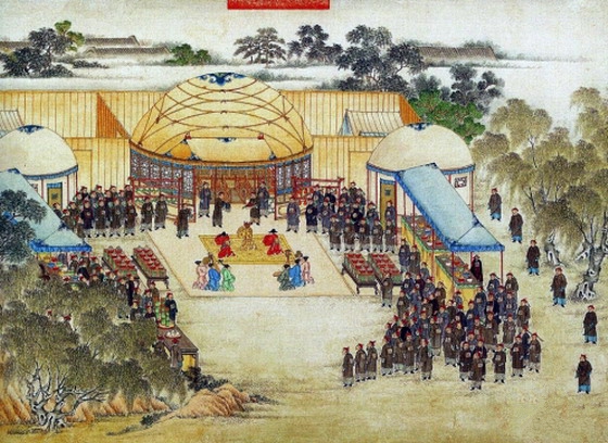
The depossed Vietnamese Emperor Lê Chiêu Thống meeting with officials from the Chinese Army around modern Hanoi, 1789.Unknown authorUnknown author · Public domain · Commons
The Lê dynasty, also known in historiography as the Later Lê dynasty (Vietnamese: Nhà Hậu Lê or Triều Hậu Lê, chữ Hán: 朝後黎, chữ Nôm: 茹後黎), was the longest-ruling Vietnamese dynasty, having ruled Đại Việt (chữ Hán: 大越) from 1428 to 1789 with an interregnum between 1527 and 1533.
Absolute monarchy (1428-1527) Absolute monarchy under hereditary military dictatorship (1533-1788)
Languages
Middle VietnameseOther local languages
Religion
Vietnamese folk religion, Confucianism (state ideology), Buddhism, Taoism, Islam, Roman Catholicism
Economy and Trade
Đông Kinh (present-day Hanoi) has been the capital of Vietnam since the 11th century. During the Later Lê dynasty it was divided into 13 districts and 239 wards (with 36 main business-trading wards) and communes. Since the mid-16th century, Đông Kinh became the silk and ceramic manufacturing center of Southeast Asia. Vietnamese merchants exported to the Ottoman Empire and Safavid Empire, these exports include Tonkinese octagonal bottles with underglaze-cobalt decoration or dishes with peony sprays painted in underglaze-cobalt were considered as good as Chinese products. Vietnamese ceramics from Bát Tràng villages produced famous high-quality pottery and dishes.
In 1471, Lê Thánh Tông conquered Champa and captured the Cham capital Vijaya, ending independent Cham rule in the south. The Kingdom of Champa was reduced to a small enclave near Panduranga (modern day Phan Rang–Tháp Chàm) and Kauthara (now Nha Trang) with many Chams fleeing to Cambodia. Lê Thánh Tông created a new province out of former Cham land and allowed ethnic Vietnamese settlers to settle it. The conquest of the Cham kingdoms started a rapid period of expansion by the Vietnamese southwards into this newly conquered land. The government used a system of land settlement called đồn điền (屯田).
Read more
From 1478 to 1480, Lê Thánh Tông led an expedition against the kingdoms of Lan Xang and Lanna in today Laos and Northern Thailand. Laotians were overwhelmed, their capital Luang Prabang was captured.
European missionaries had occasionally visited Vietnam for short periods of time, with little impact, beginning in the early sixteenth century. Khâm định Việt sử Thông giám cương mục recorded the first Christian missionary's name Inácio in the first year of Nguyên Hoà Emperor (1533) in Nam Định. From 1580 to 1586, two Portuguese and French missionaries Luis de Fonseca and Grégoire de la Motte worked in Quảng Nam and Quy Nhơn region under lord Nguyễn Hoàng. After the Lê–Mạc War ended and peace was restored in 1593, more missionaries from Spain, Portugal France, Italy and Poland came to Vietnam to spread Christianity. The best known of the early missionaries was Alexandre de Rhodes, a French Jesuit who was sent to Hanoi in 1627, where he quickly learned the language and began preaching in Vietnamese.
With the death of Lê Thánh Tông, the Lê dynasty fell into a swift decline (1497–1527).
Read more
Prince Lê Tăng, the eldest of Lê Thánh Tông's 14 sons, succeeded his father as Lê Hiến Tông (黎憲宗). He was 38 years old at the time of his father's death. He was an affable, meek and mild-mannered person. Due to his short period of rule and that he didn't pass many significant reforms, his reign is considered to be an extension of Lê Thánh Tông's rule. The new emperor was known to historical annals as Lê Hiến Tông. In early 1499, several high-ranking officials including Lê Vĩnh and Lê Năng Nhượng persuaded Hiến Tông to choose an heir in order to maintain the dynasty's and the nation's security and sustainability.
Medieval States of Mainland Southeast Asia: Frequently Asked Questions
Which states existed in Mainland Southeast Asia in this period?
This page maps 21 states of Mainland Southeast Asia founded between 546 CE and 1429 CE: Early Lý Dynasty, Chenla, Lavo Kingdom, Haripuñjaya, Land Chenla, Water Chenla, Pagan Kingdom, Chandra Dynasty, Ngô Dynasty, Sukhothai Kingdom, Hanthawaddy Kingdom, Lan Na Kingdom and 9 more.
Which was the largest of the Medieval States of Mainland Southeast Asia?
Ayutthaya Kingdom had the largest mapped extent, about 450,375 km².
Which of the Medieval States of Mainland Southeast Asia lasted longest?
Lavo Kingdom lasted longest, 638 CE – 1394 CE.
↑↓ to navigate↵ to open
12,754 Planetary Entities Indexed
We use Google Analytics cookies to understand which pages are useful. Necessary storage only keeps your theme and this choice on your device. Privacy policy