Modern States of Central and Southern Africa: Map & History
32 states of Central and Southern Africa on one map, from 1803 CE to 2024 CE.The largest, British Africa, covered about 10,639,583 km²; the longest-lived, Estado Novo, lasted 1926 CE – 2024 CE. Each has its own section below with its rulers, capitals, wars and pictures where the records hold them.
Each state in its own colour. Move the timeline to see which existed in any year from 1803 to 2024; select a territory to read about it. Borders: Cliopatria / Seshat (CC BY 4.0).
The Modern States of Central and Southern Africa Compared
1803 CE – 1805 CE · Capital: Castle of Good Hope (1st), Kaapstad (2nd) · 278,665 km²
The Dutch Cape Colony (Dutch: Nederlandse Kaapkolonie), officially known as the Cape of Good Hope Waystation (Dutch: Tussenstation Kaap de Goede Hoop), was a colony of the Dutch East India Company (VOC) and Batavian Republic in Southern Africa. Centered on the Cape of Good Hope, from where it derived its name, it was founded in 1652 by a VOC expedition under Jan van Riebeeck to serve as a re-supply and layover port for VOC vessels trading with Asia. The Cape was under VOC rule from 1652 to 1795 and Batavian rule from 1803 to 1806.
During this period a significant proportion of marriages were interracial, this is at least partially attributed to a lack of 'White' or 'Christian' women within the colony. What later became the racial division between 'White' and 'non-White' populations originally began as a division between Christian and non-Christian populations. The Geslags-registeers estimated that seven percent of the Afrikaner gene pool in 1807 was non-White.
Flag of the Dutch East India CompanyHimasaram · Public domain · Commons
Wars and Battles
In 1795, France occupied the Dutch Republic. This prompted Great Britain, at war with France, to occupy the territory that same year as a way to better control the seas on the way to India. The British sent a fleet of nine warships which anchored at Simon's Town and, following the defeat of the Dutch militia at the Battle of Muizenberg, took control of the territory. The United East India Company transferred its territories and claims to the Batavian Republic (the Dutch sister republic established by France) in 1798, then ceased to exist in 1799. Improving relations between Britain and Napoleonic France, and its vassal state the Batavian Republic, led the British to hand the Cape Colony over to the Batavian Republic in 1803, under the terms of the Treaty of Amiens.
The Zulu Kingdom (ZOO-loo; Zulu: KwaZulu), sometimes referred to as the Zulu Empire, was a monarchy in Southern Africa. During the 1810s, Shaka established a standing army that consolidated rival clans and built a large following which ruled a wide expanse of Southern Africa that extended along the coast of the Indian Ocean from the Tugela River in the south to the Pongola River in the north, centred on the present KwaZulu-Natal province of South Africa.
A civil war in the mid-19th century erupted which culminated in the 1856 Battle of Ndondakusuka between the brothers Cetshwayo and Mbuyazi.
Shaka was the illegitimate son of Senzangakhona, Chief of the Zulus. He was born c. 1787. He and his mother, Nandi, were exiled by Senzangakhona, and found refuge with the Mthethwa. Shaka fought as a warrior under Dingiswayo, leader of the Mthethwa Paramountcy. When Senzangakona died, Dingiswayo helped Shaka become king of the Zulu. After Dingiswayo's death at the hands of Zwide, king of the Ndwandwe, around 1816, Shaka assumed leadership of the entire Mthethwa alliance.
Read more
Shaka expanded the Zulu Kingdom through war and diplomacy. Shaka's clan at first numbered no more than a few thousands, but eventually grew in size to 45,000 after absorbing neighbouring clans. His military reforms included new battle techniques, training, and tough discipline, as well as the replacement of long throwing spears in exchange for the more effective short stabbing spears.
Cetshwayo kaMpandelived 1826–1884 CEOriginal uploader was Humansdorpie at en.wikipedia · Public domain · Commons
Coins, Currency and Symbols
Conjectural flag of Zululand (1884-1897) by Roberto Breschi taken from The South African Flag Book by A.P.BurgersSpringbokSam · CC BY-SA 4.0 · Commons
Wars and Battles
On 11 December 1878, with the intent of instigating a war with the Zulu, Sir Henry Bartle Frere, on his own initiative and without the approval of the British government, presented an ultimatum to the Zulu king Cetshwayo in terms with which he could not possibly comply: that the Zulu army be disbanded and the Zulus accept a British resident. British forces crossed the Tugela river at the end of December 1878. Initially, the British suffered a heavy defeat at the Battle of Isandlwana on 22 January 1879 where the Zulu army killed more than 1,000 British soldiers in a single day.
Read more
The Zulu deployment at Isandhlwana showed the well-organized tactical system that had made the Zulu kingdom successful for many decades. This constituted the worst defeat the British army had ever suffered at the hands of a native African fighting force.
1840 CE – 1910 CE · Capital: Pietermaritzburg · 62,052 km²
Downtown Pietermaritzburg from Chase ValleyVasiliymeshko · CC BY 3.0 · Commons
The Natalia Republic was a short-lived Boer republic founded in 1839 after a Voortrekker victory against the Zulus at the Battle of Blood River. The area was previously named Natália by Portuguese sailors, due to its discovery on Christmas ("Natal" is the Portuguese word for Christmas). The republic came to an end in 1843 when British forces annexed it to form the Colony of Natal. After the British annexation of the Natalia Republic, most local Voortrekkers trekked northwest into Transorangia, later known as the Orange Free State, and the South African Republic.
On 1 April 1842 Captain T. C. Smith with a force of 263 men left his camp at the Umgazi, on the eastern frontier of Cape Colony, and marching overland reached Durban without opposition, and encamped, on 4 May, at the base of the Berea hills. The Boers, cut off from their port, called out a commando of some 300 to 400 men under Andries Pretorius and gathered at Congella at the head of the bay. On the night of 23 May, Smith made an unsuccessful attack on the Boer camp, losing his guns and fifty men were killed or wounded. On 26 May the Boers captured the harbour and settlement, and on 31 May blockaded the British camp, the women and children being removed, on the suggestion of Pretorius, to a ship in the harbour of which the Boers had taken possession.
Flag of Natalia RepublicHimasaram · Public domain · Commons
Wars and Battles
Toward the end of the year, the Boers received reinforcements. In December 460 men set out under Boer general Andries Pretorius to take on the Zulus. Andries Pretorius selected Jan Gerritze Bantjes (1817-1887) as his scribe and secretary in recording events of the campaign and coming retaliation battle with the Zulus. Bantjes documented daily in his journal the progress of the commando, from their start on 27 November 1838 until they reached their selected battle site on 15 December 1838. They avoided being led into a trap as happened on the previous attempt to attack the Zulus in April which ended in disaster. On the journey, they had small skirmishes with various kraals but the main Zulu army had not arrived yet to attack. Boer and Zulu scouts were constantly monitoring each other's whereabouts.
1856 CE – 1899 CE · Capital: Bloemfontein · 133,104 km²
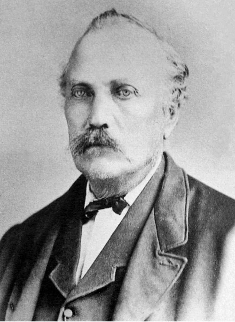
Portrait of Jacobus Nicolaas Boshof, second State President of the Orange Free State, in office 1857-1859. Lithography from photograph.Unknown authorUnknown author · Public domain · Commons
The Orange Free State (Dutch: Oranje Vrijstaat [oːˈrɑɲə ˈvrɛistaːt]; Afrikaans: Oranje-Vrystaat [uˈraɲə ˈfrəistɑːt]) was a landlocked independent Boer republic in Southern Africa during the second half of the 19th century, which ceased to exist after it was defeated and surrendered to the British Empire at the end of the Second Boer War in 1902. It is one of the three historical precursors to the present-day Free State province.
The Orange Free State was one of two Boer Republics, alongside the Transvaal, able to persist and prosper long enough to gain international recognition. The Orange Free State would eventually establish diplomatic relations with the Netherlands, France, Germany, Belgium, the United States, and the United Kingdom.
Read more
In addition to connections with the Great Powers, the Orange Free State maintained political ties, manifested in varying forms with neighboring Transvaal and regularly sent and received official missions to and from regional significant native African tribes.
Despite the republic's small size, immense distance and relative historical poverty, the Orange Free State established consuls of official representation in several European states and in the United States of America between 1855 and 31 May 1902, when the republic ceased to exist.
Flag of the Orange Free StateDavid Benbennick wrote this file · Public domain · Commons
Coat of arms of the Orange Free StateNanin7 · Public domain · Commons
Wars and Battles
Distracted among themselves, with the formidable Basotho power on their southern and eastern flank, the troubles of the infant state were speedily added to by the action of the Transvaal Boers of the South African Republic. Marthinus Pretorius, who had succeeded to his father's position as commandant general of Potchefstroom, wished to bring about a confederation between the two Boer states. Peaceful overtures from Pretorius were declined, and some of his partisans in the Orange Free State were accused of treason in February 1857. Thereupon Pretorius, aided by Paul Kruger, conducted a raid into the Orange Free State's territory. On learning of the invasion, President Jacobus Nicolaas Boshoff proclaimed martial law throughout the country. The majority of the burghers rallied to his support, and on 25 May, the two opposing forces faced one another on the banks of the Rhenoster.
1856 CE – 1899 CE · Capital: Pretoria · 316,808 km²
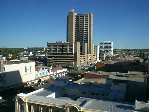
Pretoria CBD as seen from Muckleneuk Hill (Lukasrand) on 15 April 2006Petrus Potgieter, Petrus at en.wikipedia · Public domain · Commons
The South African Republic (Dutch: Zuid-Afrikaansche Republiek, abbreviated ZAR; Afrikaans: Suid-Afrikaanse Republiek), also known as the Transvaal Republic, was a landlocked independent Boer republic in Southern Africa which existed from 1852 to 1902, when it was annexed into the British Empire as a result of the Second Boer War.
The ZAR was established as a result of the 1852 Sand River Convention, in which the British government agreed to formally recognise the independence of the Boers living north of the Vaal River.
The Boer republics emerged when the British had annexed the Cape Colony from the Dutch in 1806, in order to prevent the sea routes to the East (India etc.) from falling to Napoleon. This area was inhabited by the Boers, who, dissatisfied with British rule, decided to leave the colony and move into the hinterland of South Africa in what became the Great Trek. These Boers then settled these lands, becoming farmers.
Read more
The South African Republic came into existence on 17 January 1852, when the British signed the Sand River Convention treaty with about 40,000 Boer people, recognising their independence in the region to the north of the Vaal River, which had previously been under British annexation as the Orange Rivers Sovereignty.
The language spoken and written by the citizens of the ZAR was a variant of Dutch, locally referred to as Hooghollands. On 3 October 1884, the Volksraad stated that they had reason to believe that in certain schools impure Dutch (in fact an early form of Afrikaans) was being used. The Volksraad issued Proclamation 207 and compelled the Superintendent of Education to apply the language law enforcing the exclusive use of Dutch. On 30 July 1888, Dutch language was declared the sole official language, in court as well as education, trade and general use. All other languages were declared "foreign".
Read more
These changes to the ZAR laws made the use of all other foreign languages illegal in the ZAR. On 1 October 1895 Alfred Fernandez Harington was appointed English master at the Staats Model School in Pretoria.
The discovery of gold during the Witwatersrand Gold Rush in 1886 changed the economic fortunes of the formerly impoverished ZAR. The city of Johannesburg was founded as a gold mining town in the same year. Within 10 years it grew into the largest city in Southern Africa at about 100.000 inhabitants, surpassing Cape Town and becoming one of the fastest-growing cities ever.
Read more
The discovery of gold allowed the construction of a railway network in the ZAR. The east–west railways in the ZAR, and notably the line from Pretoria to Lourenço Marques in Portuguese East Africa, were constructed by the Netherlands-South African Railway Company. The construction of the Pretoria-Lourenço Marques line allowed the ZAR access to harbour facilities not controlled by the British Empire, a key policy of Paul Kruger who deemed it vital to the country's long-term survival.
Hendrik Potgieter was elected at the assembly of 1849 as commandant general for life and it became necessary, to avoid strife, to appoint three commandants general all possessing equal powers. Commandant General Andries Pretorius became commandant general of the Potchefstroom and Rustenburg districts. On 16 December 1852, Andries died and his son, Piet Pretorius, was appointed as commandant general of the Lydenburg and Zoutpansberg districts in his stead.
Read more
There were some disputes over cattle which Mapela was raising on behalf of Potgieter and earlier Commandant Scholtz had confiscated a large number of rifles and amounts of ammunition, rifle repair equipment and materials of war from the home of an English missionary, the Reverend Livingstone.
Njoya of BamunUnknown author · Public domain · Commons
Kamerun was a Central African colony of the German Empire from 1884 to 1916 in the region of today's Republic of Cameroon. Kamerun also included northern parts of Gabon and the Congo with western parts of the Central African Republic, southwestern parts of Chad and far northeastern parts of Nigeria.
The Rhodes Colossus: Caricature of Cecil John Rhodes, after he announced plans for a telegraph line and railroad from Cape Town to Cairo.Edward Linley Sambourne · Public domain · Commons
The Scramble for Africa was the invasion, conquest, and colonisation of most of Africa by seven Western European powers, which were driven by the Second Industrial Revolution during the late 19th and early 20th centuries through the era of "New Imperialism". Belgium, France, Germany, Italy, Portugal, Spain and the United Kingdom were the contending powers.
The 1884–1885 Berlin Conference regulated European colonisation and trade in Africa, and is seen as emblematic of the "scramble".
By 1841, businessmen from Europe had established small trading posts along the coasts of Africa, but they seldom moved inland, preferring to stay near the sea. They primarily traded with locals. Large parts of the continent were essentially uninhabitable for Europeans because of their high mortality rates from tropical diseases such as malaria. In the middle of the 19th century, European explorers mapped much of East Africa and Central Africa.
Read more
As late as the 1870s, Europeans controlled approximately 10% of the African continent, with all their territories located near the coasts. The most important holdings were Angola and Mozambique, held by Portugal; the Cape Colony, held by the United Kingdom; and Algeria, held by France.
Britain's administration of Egypt and the Cape Colony contributed to a preoccupation over securing the source of the Nile river. Egypt was taken over by the British in 1882, leaving the Ottoman Empire in a nominal role until 1914, when London made it a protectorate. Egypt was never an actual British colony. Sudan, Nigeria, Kenya, and Uganda were subjugated in the 1890s and early 20th century; and in the south, the Cape Colony (first acquired in 1795) provided a base for the subjugation of neighbouring African states and the Dutch Afrikaner settlers who had left the Cape to avoid the British and then founded their republics. Theophilus Shepstone annexed the South African Republic in 1877 for the British Empire, after it had been independent for 20 years. In 1879, after the Anglo-Zulu War, Britain consolidated its control of most of the territories of South Africa.
The Berlin Conference established the principle of "effective occupation" but national outrage at the 1890 British Ultimatum, a declining financial situation at home caused by worldwide recession and the rising tide of the "scramble" spurred Portugal towards territorial acquisition. The Portuguese beneffited from the most familiarity with the continent out of all the European powers, while the native polities were by the late 19th century wracked by long-standing internal issues and severely disunited, with many of its elites willing to cooperate in exchange for aid against their rivals and an advantageous position in the new order.
By the end of World War I the colonial empires had become very popular almost everywhere in Europe: public opinion had been convinced of the needs of a colonial empire, although most of the metropolitans would never see a piece of it. Colonial exhibitions were instrumental in this change of popular mentalities brought about by the colonial propaganda, supported by the colonial lobby and by various scientists. Thus, conquests of territories were inevitably followed by public displays of the indigenous people for scientific and leisure purposes.
Read more
Carl Hagenbeck, a German merchant in wild animals and a future entrepreneur of most Europeans zoos, decided in 1874 to exhibit Samoa and Sami people as "purely natural" populations. In 1876, he sent one of his collaborators to the newly conquered Egyptian Sudan to bring back some wild beasts and Nubians.
Kerk Street, the main street of Vryheid in northern KwaZulu-NatalJMK · CC BY-SA 3.0 · Commons
The Nieuwe Republiek ("New Republic") was a small Boer republic which existed from 1884 to 1888 in present-day South Africa. It was recognised only by Germany and the South African Republic. Its independence was proclaimed on 16 August 1884, with land donated by the Zulu Kingdom through a treaty. It covered 13,600 square kilometres (5,300 sq mi) and the capital was Vryheid or Vrijheid ("Freedom" in Afrikaans or Dutch, respectively), both being alternative names of the state.
Eswatini, formally the Kingdom of Eswatini (historically called KaNgwane), also known by its former official names Swaziland and the Kingdom of Swaziland, is a landlocked country in Southern Africa. It is bordered by South Africa on all sides except the east, where it shares a border with Mozambique. At no more than 200 km (120 mi) north to south and 130 km (81 mi) east to west, Eswatini is the second smallest country in continental Africa. However, its climate and topography are diverse, ranging from a cool and mountainous highveld to a hot and dry lowveld.
Eswatini is an absolute monarchy with constitutional provision and Swazi law and customs. The head of state is the king or ngwenyama (lit. 'lion'), currently King Mswati III, who ascended to the throne in 1986 after the death of his father King Sobhuza II in 1982 and a period of regency. According to the country's constitution, the ngwenyama is a symbol of unity and the eternity of the Swazi nation. By tradition, the king reigns along with his mother (or a ritual substitute), the ndlovukati (lit. 'she-elephant'). The former was viewed as the administrative head of state and the latter as a spiritual and national head of state, with real power counterbalancing that of the king, but during the long reign of Sobhuza II, the role of the ndlovukati became more symbolic.
Eswatini's economy is diverse, with agriculture, forestry and mining accounting for about 13% of GDP, manufacturing (textiles and sugar-related processing) representing 37% of GDP and services – with government services in the lead – constituting 50% of GDP. Title Deed Lands, where the bulk of high value crops are grown (sugar, forestry, and citrus), are characterised by high levels of investment and irrigation, and high productivity. About 75% of the population is employed in subsistence agriculture upon Swazi Nation Land (SNL). In contrast with the commercial farms, SNL suffers from low productivity and investment.
Read more
The cultivation of sugarcane, the country's largest export, has involved forced evictions of rural communities to build plantations, child labour and work weeks of up to 60 hours.
Take from German WikipediaThe original uploader was SDC at English Wikipedia. · CC BY-SA 3.0 · Commons
Currency
lilangeni
Flag of EswatiniSobhuza II · Public domain · Commons
Coat of arms of EswatiniRoyFocker 12 · Public domain · Commons
Achievements and Monuments
The principal Swazi social unit is the homestead, a traditional beehive hut thatched with dry grass. In a polygamous homestead, each wife has her own hut and yard surrounded by reed fences. There are three structures for sleeping, cooking, and storage (brewing beer). Larger homesteads also have structures used as bachelors' quarters and guest accommodation. Central to the traditional homestead is the cattle byre, a circular area enclosed by large logs, interspersed with branches. The cattle byre has ritual as well as practical significance as a store of wealth and symbol of prestige. It contains sealed grain pits. Facing the cattle byre is the great hut which is occupied by the mother of the headman. The headman is central to all homestead affairs, and he is often polygamous.
1890 CE – 1962 CE · Capital: Boma (1908–1923), Léopoldville (1923–1960) · 2,358,485 km²
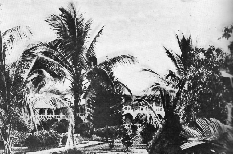
Catholic Jesuits' mission at Kisantu, Belgian CongoUnknown authorUnknown author · Public domain · Commons
The Belgian Congo (French: Congo belge, pronounced [kɔ̃ɡo bɛlʒ]; Dutch: Belgisch-Congo) was a Belgian colony in Central Africa from 1908 until independence in 1960. It is today the Democratic Republic of the Congo (DRC).
Colonial rule in the Congo began in the late 19th century. King Leopold II of Belgium attempted to persuade the Belgian government to support colonial expansion around the then-largely unexploited Congo Basin. Their ambivalence resulted in Leopold establishing a colony himself.
The participation of Congolese people in the Second World War and news of changes in other colonies resulted in their organising to gain more power. As a result of the inability of the colonial government to introduce radical and credible changes, the Congolese elites began to organise themselves socially and soon also politically. In the 1950s, two markedly different forms of nationalism arose among the Congolese elites. The nationalist movement—to which the Belgian authorities, to some degree, turned a blind eye—promoted territorial nationalism, wherein the Belgian Congo would become one politically united state after independence.
Read more
In opposition to this was the ethno-religious and regional nationalism that took hold in the Bakongo territories of the west coast, Kasaï and Katanga. The first political organisations were of the latter type.
Unitary monarchy, Unitary constitutional monarchy (19 May–30 June 1960)
Languages
French (official), Also: Dutch, LingalaKongo, SwahiliTshiluba
Religion
Roman Catholicism (de facto)
Economy and Trade
Two distinct periods of investment in the Congo's economic infrastructure stand out during the period of Belgian rule: the 1920s and the 1950s.
Read more
In 1921, the Belgian government provided 300 million francs of loans to the Belgian Congo, to fund public infrastructure projects in support of the boom of the private companies in the colony. The Belgian government also privatised many of the government-owned companies that were active in the colony (e.g. the Kilo-Moto mines, La Société Nationale des transport fluviaux). After the First World War, priority was given to investments in transport infrastructure (such as the rail lines between Matadi and Léopoldville and Elisabethville and Port Francqui). From 1920 to 1932, 2,450 km of railroads were constructed. The government also invested heavily in harbour infrastructure in the cities of Boma, Matadi, Léopoldville and Coquilhatville.
Belgium, obverse coin 5 francs 1847. Brass, weight 7.9 g, diameter 27 mm, thickness 2.0 mm. The file is based on the Wikimedia file - Congo 5F.jpg, available under license 4.0. Rotated image of the coin.Петров Эдуард · CC BY-SA 4.0 · Commons
Currency
Congolese franc
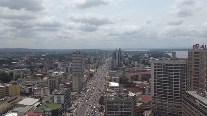
Vendeuse de Chikwange, Kinshasa - République Démocratique du Congo - 2013Antoine Moens de Hase · CC BY 2.0 · Commons
Flag of the Congo Free StateSee file history below for details. · Public domain · Commons
Greater Coat of Arms of the Belgian CongoLesser coat of arms of Belgium.svg: Katepanomegas und Sodacan gemeinsam; Schild Kongo Freistaat.svg: MS05L. The original uploader was MS05L at German Wikipedia. · CC BY-SA 3.0 · Commons
Wars and Battles
The Belgian Congo was directly involved in the two world wars. During World War I, an initial stand-off between the Force Publique and the German colonial army in German East Africa (Tanganyika) turned into open warfare with a joint Anglo-Belgian invasion of German colonial territory in 1916 and 1917 during the East African campaign. By 1916, the Belgian commander of the Force Publique, Lieutenant-General Charles Tombeur, had assembled an army of 15,000 men supported by local bearers – Reybrouck indicated that during the war no less than 260,000 native bearers were called upon – and advanced to Kigali (now the capital of Rwanda). Kigali was taken by 6 May 1916, and the army went on to take Tabora (now part of Tanzania) on 19 September after heavy fighting.
The educational system was dominated by the Catholic Church—as was the case for the rest of Belgium at the time—and, in some rare cases, by Protestant churches. Curricula reflected Christian and Western values. Even in 1948, 99.6% of educational facilities were run by Christian missions. Indigenous schooling was mainly religious and vocational. Children received basic education such as learning how to read, write and some mathematics. The Belgian Congo was one of the few African colonies in which local languages (Kikongo, Lingala, Tshiluba and Swahili) were taught at primary school. Even so, language policies and colonial domination often went hand in hand, as evidenced by the preference given to Lingala—a semi-artificial language spread through its common use in the Force Publique—over more local (but also more ancient) indigenous languages such as Lomongo and others.
1926 CE – 2024 CE · Capital: Lisbon · 2,202,098 km²
Antigo Campo de Concentração do Tarrafal, Ilha de Santiago - Cabo Verde / Old Concentration Camp in Tarrafal, Santiago Island - Cape VerdeGagum from Lisbon, Portugal · CC BY 2.0 · Commons
The Estado Novo (European Portuguese pronunciation: [(ɨ)ʃˈtaðu ˈnovu], lit. 'New State') was the corporatist Portuguese state installed in 1933. It evolved from the Ditadura Nacional ("National Dictatorship") formed after the coup d'état of 28 May 1926 against the unstable First Republic. Together, the Ditadura Nacional and the Estado Novo are recognised by historians as the Second Portuguese Republic (Portuguese: Segunda República Portuguesa).
Presidential republicefn, Though Salazar controlled the country as Prime Minister by convention, he was technically subordinated to the President under the constitution of 1933, which gave the President sweeping executive powers and allowed them to dismiss the Prime Minister at will. From 1959 onwards, the president was elected by the National Assembly instead of by popular vote
Languages
Portuguese
Religion
Roman Catholicism (majority)
Economy and Trade
Portugal's overriding problem in 1926 was its enormous public debt. Several times between 1926 and 1928, Salazar turned down appointments to the finance ministry. He pleaded ill-health, devotion to his aged parents and a preference for the academic cloisters. In 1927, under the ministry of Sinel de Cordes, the public deficit kept on growing. The government tried to obtain loans from Baring Brothers under the auspices of the League of Nations, but the conditions were considered unacceptable. With Portugal under the threat of an imminent financial collapse, Salazar finally agreed to become its 81st finance minister on 26 April 1928 after Óscar Carmona was elected president. However, before accepting the position, he personally secured from Carmona a categorical assurance that as finance minister he would have a free hand to veto expenditure in all government departments, not just his own.
Graph showing Japanese yen and Portuguese escudo exchange rate from January, 1989 to December, 1998.Monaneko · CC BY-SA 3.0 · Commons
Currency
Portuguese escudo
Flag of Portugal (official)Original: Columbano Bordalo Pinheiro Vector: Vítor Luís Rodrigues, António Martins-Tuválkin · Public domain · Commons
Coat of arms of PortugalTonyjeff, based on national symbol · Public domain · Commons
Wars and Battles
After World War II (1939–1945), however, the corporatist economic model was less and less applicable. And after decolonisation in the 1950s and 1960s, the Portuguese regime became also a source of criticism and dissent by most of the international community. Nevertheless, Salazar clung to it, thereby slowing the nation's long-term economic development. Salazar's postwar policy allowed some liberalisation in politics, in terms of organised opposition with more freedom of the press. Opposition parties were tolerated to an extent, but they were also controlled, limited, and manipulated, with the result that they split into factions and never formed a united opposition. He permitted the formation of Movement of Democratic Unity (Movimento de Unidade Democrática) in 1945. It boycotted the election and Salazar won handily on 18 November 1945. In 1949 Portugal became a founding member of NATO.
In 1936, António Carneiro Pacheco (then rector of the University of Lisbon) was nominated as the minister of the public instruction. In the same year, his ministry issued a law that altered the ministry's name to Ministry of National Education, and included a National Board of Education (Junta Nacional da Educação). This National Board of Education aimed to study and inform the minister in all matters of both education and culture. Parents and educators were to be represented in all sections of this board, except for the cultural relations and scientific research section. This board replaced the Superior Council for Public Instruction, which had existed since 1835, along with other consulting boards, such as the National Board of Excavations and Antiques.
After India achieved independence in 1947 under the Attlee government, pro-Indian residents of the Portuguese overseas territory of Dadra and Nagar Haveli, with the support of the Indian government and the help of pro-independence organisations, liberated Dadra and Nagar Haveli from Portuguese rule in 1954. In 1961, the Fort of São João Baptista de Ajudá's annexation by the Republic of Dahomey was the start of a process that led to the final dissolution of the centuries-old Portuguese Empire. According to the census of 1921 São João Baptista de Ajudá had 5 inhabitants and, at the moment of the ultimatum by the Dahomey Government, it had only 2 inhabitants representing Portuguese sovereignty. Another forcible retreat from overseas territories occurred in December 1961 when Portugal refused to relinquish the territories of Goa and Daman and Diu.
1940 CE – 1944 CE · Capital: Paris (de jure)London (de facto) (until November 1942) Brazzaville (de jure and de facto) (1940–1942) Algiers (de facto) (after November 1942) · 2,377,926 km²
500px provided description: London Skyline [#sunset ,#architecture ,#cityscape ,#london ,#uk ,#skyline ,#financial district ,#thames ,#london bridge ,#london shard]Ilya Grigorik · CC BY-SA 3.0 · Commons
Free France (French: France libre) was a resistance government claiming to be the legitimate government of France following the dissolution of the Third Republic during World War II. Led by General Charles de Gaulle, Free France was established as a government-in-exile in London in June 1940 after the Fall of France to Nazi Germany.
Despite de Gaulle's call to continue the struggle, few French forces initially pledged their support. By the end of July 1940, only about 7,000 soldiers had joined the Free French Army in Britain. Three-quarters of French servicemen in Britain requested repatriation.
Read more
"For us Frenchmen, the fact is that a government still exists in France, a government supported by a Parliament established in non-occupied territory and which in consequence cannot be considered irregular or deposed. The establishment elsewhere of another government, and all support for this other government would clearly be rebellion."
Equally, few Frenchmen believed that Britain could stand alone. In June 1940, Pétain and his generals told Churchill that "in three weeks, England will have her neck wrung like a chicken".
Flag of Free France (1940-1944)See File history below for details. · Public domain · Commons
Emblem of Free France (1940-1944) Cross of LorraineFDRMRZUSA · Public domain · Commons
Wars and Battles
By September 1944, the Free French forces stood at 560,000 (including 176,500 White French from North Africa, 63,000 metropolitan French, 233,000 Maghrebis and 80,000 from Black Africa). The GPRF set about raising new troops to participate in the advance to the Rhine and the invasion of Germany, using the FFI as military cadres and manpower pools of experienced fighters to allow a very large and rapid expansion of the French Liberation Army. It was well equipped and well supplied despite the economic disruption brought by the occupation thanks to Lend-Lease, and their number rose to 1 million by the end of the year.
The Free French Memorial on Lyle Hill in Greenock, in western Scotland, in the shape of the Cross of Lorraine combined with an anchor, was raised by subscription as a memorial to sailors on the Free French Naval Forces vessels that sailed from the Firth of Clyde to take part in the Battle of the Atlantic.
Read more
The memorial is also associated, locally, with the memory of the French destroyer Maillé Brézé (1931) which sank at the Tail of the Bank.
To this day, General de Gaulle's Appeal of 18 June 1940 remains one of the most famous speeches in French history.
1960 CE – 2024 CE · Capital: Antananarivo · 616,267 km²
Satellite image of Madagascar in September 2003Unknown authorUnknown author · Public domain · Commons
Madagascar, officially the Republic of Madagascar, is an island country in the Indian Ocean that includes the island of Madagascar and numerous smaller peripheral islands. Lying off the southeastern coast of Africa, it is the world's fourth-largest island, the second-largest island country, and the 46th-largest country overall. Its capital and largest city is Antananarivo.
The period from 1500 to 1800 saw Madagascar's populations go from being mobile and unsettled to being organized largely into states. On the northern coast, Mahilaka was abandoned and replaced by Vohemar in the 15th century as one of the island's main trading ports, accompanied by Mazalagem Nova in the late 16th century. Portuguese navigators reached Madagascar around 1500, and sacked the port city of Sada (part of the Guingemaro kingdom) in 1506. Over the following centuries, the slave trade grew in importance as slaves were traded for firearms. In the late 17th century, Madagascar had an influx of pirates who had been expelled from the Caribbean, some of whom participated in local wars and married local women, although they were routed by the British navy in the 1720s.
Since Madagascar's independence from France in 1960, the island's political transitions have been marked by numerous popular protests, several disputed elections, an impeachment, two military coups, and an assassination. The country's recurrent political crises have often been prolonged, with detrimental effects on the local economy, international relations, and Malagasy living standards. For example, the eight-month standoff between incumbent Ratsiraka and challenger Ravalomanana following the 2001 presidential elections cost Madagascar millions of dollars in lost tourism and trade revenue as well as damage to infrastructure, such as bombed bridges and buildings damaged by arson. A series of protests led by Andry Rajoelina against Ravalomanana in early 2009 became violent, with more than 170 people killed.
Unitary semi-presidential republic under a military junta
Languages
fr
Economy and Trade
In 2010, Madagascar had approximately 7,617 km (4,730 mi) of paved roads, 854 km (530 mi) of railways, and 432 km (270 mi) of navigable waterways. The majority of roads in Madagascar are unpaved, with many impassable in the rainy season. Largely paved national routes connect the six largest regional towns to Antananarivo, with minor paved and unpaved routes providing access to other population centers in each district. As of 2023, the World Bank estimated that 17 million people in Madagascar's rural areas live more than 2 km away from an all-season road.
Read more
Construction of the Antananarivo–Toamasina toll highway, the country's first toll highway, began in December 2022. The approximately US$1 billion infrastructure project, which would connect Madagascar's capital to its largest seaport, was expected to take four years to complete.
Flag of MadagascarUnknown author · Public domain · Commons
Seal of MadagascarNdriana · Public domain · Commons
Achievements and Monuments
All the many ethnic subgroups in Madagascar adhere to their own set of beliefs, practices, and ways of life that have historically contributed to their unique identities. However, a number of core cultural features are common throughout the island, creating a strongly unified Malagasy cultural identity. In addition to a common language and shared traditional religious beliefs around a creator god and veneration of ancestors, the traditional Malagasy worldview is shaped by values that emphasize fihavanana (solidarity), vintana (destiny), tody (karma), and hasina, a sacred life force that traditional communities believe imbues and thereby legitimates authority figures within the community or family.
1960 CE – 2024 CE · Capital: Yaoundé · 465,691 km²
On July 26, 1982, President Ahmadou Ahidjo of the United Republic of Cameroon visited the White House during a visit to the United States and met with President Ronald Reagan.Series: Reagan White House Photographs, 1/20/1981 - 1/20/1989 Collection: White House Photographic Collection, 1/20/1981 - 1/20/1989 · Public domain · Commons
Cameroon, officially the Republic of Cameroon, is a country in Central Africa. It shares boundaries with Nigeria to the west and north, Chad to the northeast, the Central African Republic to the east, and Equatorial Guinea, Gabon, and the Republic of the Congo to the south. Its coastline lies on the Bight of Biafra, part of the Gulf of Guinea, and the Atlantic Ocean. Due to its strategic position at the crossroads between West Africa and Central Africa, it has been categorized as being in both geostrategic locations.
Evidence from archaeological excavations at Shum Laka in the Northwest Region shows human occupation in Cameroon dating back 30,000 years. The longest continuous inhabitants are groups such as the Baka (Pygmies). From there, Bantu migrations into eastern, southern and central Africa are believed to have occurred about 2,000 years ago. The Sao culture arose around Lake Chad, c. 500 CE, and gave way to the Kanem and its successor state, the Bornu Empire. Kingdoms, fondoms, and chiefdoms arose in the west.
Read more
Portuguese sailors reached the coast in 1472. They noted an abundance of the ghost shrimp Lepidophthalmus turneranus in the Wouri River and named it Rio dos Camarões (Shrimp River), which became Cameroon in English. Over the following few centuries, European interests regularised trade with the coastal peoples, and Christian missionaries pushed inland.
Paul Biya1982 CEUnited States Department of State Africa U.S.-Africa Leaders Summit: Photos and Videos · Public domain · Commons
Government, Society and Religion
Cameroon is viewed as rife with corruption at all levels of government. In 1997, Cameroon established anti-corruption bureaus in 29 ministries, but only 25% became operational, and in 2012, Transparency International placed Cameroon at number 144 on a list of 176 countries ranked from least to most corrupt. On 18 January 2006, Biya initiated an anti-corruption drive under the direction of the National Anti-Corruption Observatory. There are several high corruption risk areas in Cameroon, for instance, customs, public health sector and public procurement. However, the corruption has gotten worse, regardless of the existing anti-corruption bureaus, as Transparency International ranked Cameroon 152 on a list of 180 countries in 2018.
Read more
President Biya's Cameroon People's Democratic Movement (CPDM) was the only legal political party until December 1990.
Unitary presidential republic under an authoritarian dictatorship
Languages
French English
Economy and Trade
Cameroon's per capita GDP (Purchasing power parity) was estimated at US$5.760 in 2025. Major export markets include the Netherlands, France, China, Belgium, Italy, Algeria, and Malaysia.
Read more
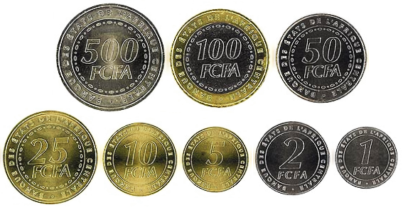
Cameroon has its GDP growing at an average of 4% per year. During the 2004–2008 period, public debt was reduced from over 60% of GDP to 10% and official reserves quadrupled to over US$3 billion. Cameroon is part of the Bank of Central African States (of which it is the dominant economy), the Customs and Economic Union of Central Africa (UDEAC) and the Organization for the Harmonization of Business Law in Africa (OHADA). Its currency is the CFA franc.
Unemployment was estimated at 3.38% in 2019, and 23.8% of the population was living below the international poverty threshold of US$1.90 a day in 2014.
Music and dance are integral parts of Cameroonian ceremonies, festivals, social gatherings, and storytelling. Traditional dances are highly choreographed with men and women often participating separately. The dances' purposes range from pure entertainment to religious devotion. Traditionally, music is transmitted orally. In a typical performance, a chorus of singers echoes a soloist.
Read more
Musical accompaniment may be as simple as clapping hands and stamping feet, but traditional instruments include bells worn by dancers, clappers, drums, and talking drums, flutes, horns, rattles, scrapers, stringed instruments, whistles, and xylophones; combinations of these vary by ethnic group and region. Some performers sing complete songs alone, accompanied by a harplike instrument.
The city centre of Bangui, at PK0 roundabout level. The Democratic Republic of the Congo is on the other side of the Oubangui river, upper left of the photo.Alllexxxis · CC BY-SA 4.0 · Commons
The Central African Republic (CAR) is a landlocked country in Central Africa. It is bordered by Chad to the north, Sudan to the northeast, South Sudan to the east, the Democratic Republic of the Congo to the south, the Republic of the Congo to the southwest, and Cameroon to the west. The CAR covers a land area of about 620,000 square kilometres (240,000 sq mi). As of 2024, it has a population of 5,357,744, consisting of about 80 ethnic groups. Having been a French colony under the name Ubangi-Shari, Sango is its national language and was also its co-official language alongside French.
Approximately 10,000 years ago, desertification forced hunter-gatherer societies south into the Sahel regions of northern Central Africa, where some groups settled. Farming began as part of the Neolithic Revolution. Initial farming of white yam progressed into millet and sorghum, and before 3000 BCE the domestication of African oil palm improved the groups' nutrition and allowed for expansion of the local populations. This agricultural revolution, combined with a "Fish-stew Revolution", in which fishing began to take place and the use of boats, allowed for the transportation of goods. Products were often moved in ceramic pots.
Read more
The Bouar Megaliths in the western region indicate an advanced level of habitation dating to the late Neolithic (c. 3500–2700 BCE). Ironwork developed in the region around 1000 BCE.
Politics of the Central African Republic formally take place in a framework of a presidential republic. In this system, the president is the head of state, with a prime minister as head of government. Executive power is exercised by the government. Legislative power is vested in both the government and parliament.
Read more
Changes in government have occurred in recent years by three methods: violence, negotiations, and elections. A new constitution was approved by voters in a referendum held on 5 December 2004. The government was rated 'Partly Free' from 1991 to 2001 and from 2004 to 2013. V-Dem Democracy Indices described Central African Republic as autocratizing in 2024.
The president is elected by popular vote for a six-year term, and the prime minister is appointed by the president.
The per capita income of the Republic is often listed as being approximately $400 per year, one of the lowest in the world, but this figure is based mostly on reported sales of exports and largely ignores the unregistered sale of foods, locally produced alcoholic beverages, diamonds, ivory, bushmeat, and traditional medicine. The annual growth rate of real GDP is slightly above 3%. The primary import partner is France (17.1%). Other imports come from the United States (12.3%), India (11.5%), and China (8.2%). Its largest export partner is France (31.2%), followed by Burundi (16.2%), China (12.5%), Cameroon (9.6%), and Austria (7.8%). The currency is the CFA franc, which is accepted across the former countries of French West Africa and trades at a fixed rate to the euro.
Iron currency used in city of LoggunDixon Denham · Public domain · Commons
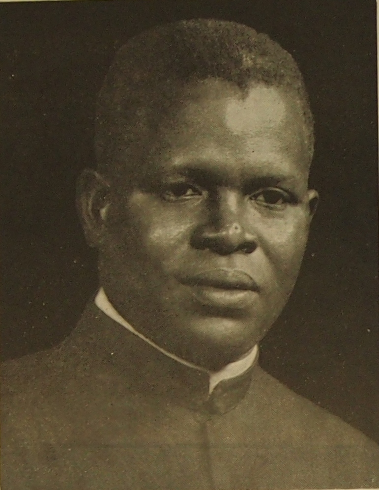
Flag of the Central African RepublicBarthélemy Boganda · Public domain · Commons
Coat of arms of Central African RepublicUnknown · Public domain · Commons
Wars and Battles
Bozizé suspended the constitution and named a new cabinet, which included most opposition parties. Abel Goumba was named vice-president. Bozizé established a broad-based National Transition Council to draft a new constitution and announced that he would step down and run for office once the constitution was approved.
Read more
In 2004, the Central African Bush War began as forces opposed to Bozizé took up arms against his government. In May 2005, Bozizé won the presidential election, which excluded Patassé, and in 2006 fighting continued between the government and the rebels. In November 2006, Bozizé's government requested French military support to help them repel rebels who had taken control of towns in the country's northern regions.
Football is the country's most popular sport. The national football team is governed by the Central African Football Federation and stages matches at the Barthélemy Boganda Stadium. Basketball is also popular and its national team won the African Championship twice and was the first Sub-Saharan African team to qualify for the Basketball World Cup, in 1974.
Dzanga-Ndoki National ParkMassa B (2020) Revision of the Afrotropical genus Leiodontocercus (Orthoptera, Tettigoniidae, Phaneropterinae) with a description of four new species. · CC0 · Commons
Decline and Fall
Ended
2024 CE
Last recorded ruler
Faustin-Archange Touadéra
Gabon
1961 CE – 2024 CE · Capital: Libreville · 264,939 km²
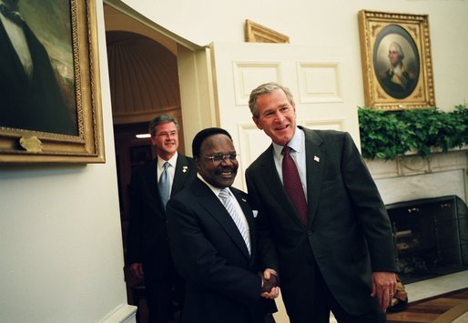
President of Gabon Leon M'ba (R) with prime minister David Ben-Gurion, Jerusalem.Israeli GPO photographer · Public domain · Commons
Gabon, officially the Gabonese Republic, is a country on the Atlantic coast of Central Africa, lying on the equator. It is bordered by Equatorial Guinea to the northwest, Cameroon to the north, the Republic of the Congo to the east and south, while sharing a maritime border with São Tomé and Príncipe to the west in the Gulf of Guinea. It has an area of 270,000 square kilometres (100,000 sq mi) and a population of 2.6 million people. There are coastal plains, mountains (the Cristal Mountains and the Chaillu Massif in the centre), and savanna in the east.
The presidential republic form of government is stated under the 1961 constitution (revised in 1975, rewritten in 1991, and revised in 2003). The president is elected by universal suffrage for a seven-year term; a 2003 constitutional amendment removed presidential term limits. The president can appoint and dismiss the prime minister, the cabinet, and judges of the independent Supreme Court. The president has other powers, such as the authority to dissolve the National Assembly, declare a state of siege, delay legislation, and conduct referendums. The parliament of Gabon is bicameral with a National Assembly and Senate. The National Assembly has 120 deputies who are popularly elected for a five-year term. The Senate is composed of 102 members who are elected by municipal councils and regional assemblies and serve for six years.
Gabon's economy is heavily dependent on oil and other natural resources, leaving it exposed to global market shifts and climate-related risks. Oil revenue constitutes roughly 46% of the government's budget, 43% of the gross domestic product (GDP), and 81% of exports. The rich Grondin Oil Field was discovered in 1971 in 50 m (160 ft) water depths 40 km (25 mi) offshore in an anticline salt structural trap in Batanga sandstones of Maastrichtian age, but about 60% of its estimated reserves had been extracted by 1978. As of 2023, Gabon produces about 200,000 barrels per day of crude oil.
Read more
"Overspending" on the Trans-Gabon Railway, the CFA franc devaluation of 1994, and periods of lower oil prices caused debt problems.
Iron currency used in city of LoggunDixon Denham · Public domain · Commons
Flag of GabonLéon Augé and Pierre Claver Eyeghe · Public domain · Commons
Coat of arms of GabonOriginal by Louis Mühlemann, vectorised by user:Fenn-O-maniC · Public domain · Commons
Achievements and Monuments
Gabonese cuisine is influenced by indigenous Central African and French cuisine. Traditional staples include cassava, rice, beans, taro, yam, plantain, fish, shellfish, and poultry. Seafood is particularly prevalent in coastal cities, including Libreville. Grilled tilapia, barracuda, and captain fish are common courses, usually served with fried plantains and spicy pepper sauces. Brochettes or skewers of grilled beef, chicken, or goat meat and vegetables paired with hot chili sauce are popular street foods. Poulet Nyembwe, spiced chicken cooked and flavoured in palm nut sauce, is considered the national dish. The palm nut sauce used in the dish is known as nyembwe, which means palm oil in the Myènè language.
Read more
Tropical fruits like mangoes, pineapples, bananas, guavas, papayas, and coconuts are widely consumed.
Albert Schweitzer HospitalGerelateerd persoon / related constituent: Prof. Dr. A. (Albert) Schweitzer (1875 - 1965) Fotograaf / photographer: niet bekend / unknown · CC BY-SA 3.0 · Commons
1961 CE – 2024 CE · Capital: Brazzaville · 345,888 km²
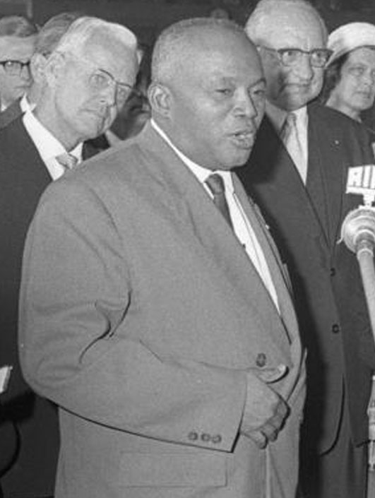
Abbe Fulbert Youlou and his governmentRepublic of the Congo, Ministry of Information · Public domain · Commons
The Republic of the Congo, also known as the Congo Republic, Congo-Brazzaville, or simply the Congo, is a country located on the western coast of Central Africa to the west of the Congo River. It is bordered to the west by Gabon, to the northwest by Cameroon, to the northeast by the Central African Republic, to the southeast by the Democratic Republic of the Congo, to the south by the Angolan exclave of Cabinda, and to the southwest by the Atlantic Ocean.
The region was dominated by Bantu-speaking tribes at least 3,000 years ago, who built trade links leading into the Congo River basin.
The government of the republic is a semi-presidential system with an elected president who appoints the Council of Ministers, or Cabinet. The council, including the prime minister, is selected from the elected representatives in Parliament. Since the 1990s, the country has had a multi-party political system that is dominated by President Denis Sassou Nguesso. Sassou Nguesso is backed by his own Congolese Labour Party (French: Parti Congolais du Travail) as well as a range of smaller parties.
Read more
Sassou's regime has seen corruption revelations, with attempts to censor them. One French investigation found over 110 bank accounts and dozens of "lavish properties" in France. Sassou denounced embezzlement investigations as "racist" and "colonial". Denis Christel Sassou-Nguesso, son of Denis Sassou Nguesso, has been named in association with the Panama Papers.
Unitary semi-presidential republic under an authoritarian dictatorship
Languages
French
Economy and Trade
The economy is a mixture of village agriculture and handicrafts, an industrial sector based mainly on petroleum, support services, and a government characterized by budget problems and "overstaffing". Petroleum extraction has supplanted forestry as the mainstay of the economy. In 2008, the oil sector accounted for 65% of the GDP, 85% of government revenue, and 92% of exports. The country has untapped mineral wealth.
Read more
In the 1980s, rising oil revenues enabled the government to finance larger-scale development projects. GDP grew an average of 5% annually. The government has mortgaged a portion of its petroleum earnings, contributing to a "shortage of revenues". On 12 January 1994, the devaluation of Franc Zone currencies by 50% resulted in an inflation of 46% in 1994, and inflation has subsided since.
Between 1994 and 1996, the economy underwent a difficult transition.
Rural Congolese often receive their news via state-run radio; broadcast media is the main source of news for the majority of Congolese. Government-owned and private media are usually pro-government. Programs are broadcast in a variety of languages. Print media is often circulated in Brazzaville and Pointe-Noire. Important news papers include Le Choc, Les Echos du Congo, L'Observateur, and Le Semaine Africaine.
Koning Moshoeshoe II van Lesotho op bezoek in het Rijksmuseum, Amsterdam, tijdens zijn korte ballingschap in Nederland 14 april 1970Joost Evers / Anefo · CC BY-SA 3.0 nl · Commons
Lesotho (lih-SOO-too; Sotho pronunciation: [lɪˈsʊːtʰʊ]), officially the Kingdom of Lesotho, is a landlocked country in Southern Africa. Surrounded by South Africa, it is the largest of the three sovereign, non-exclave enclaves in the world. Lesotho is located in the Maloti Mountains, with the highest peak in southern Africa. It has an area of over 30,000 km2 (11,600 mi2), with a population of about 2.3 million. Its capital and largest city is Maseru.
Lesotho is a parliamentary constitutional monarchy. The prime minister, currently Sam Matekane, is the head of government and has executive authority. The King of Lesotho, Letsie III, is the head of state and serves a "largely ceremonial function"; he no longer possesses any executive authority and is prohibited from actively participating in political initiatives.
Read more
The Revolution for Prosperity leads a coalition government in the National Assembly, the lower house of parliament. The upper house of parliament, the Senate, is composed of 22 principal chiefs whose membership is hereditary, and 11 appointees of the king, acting on the advice of the prime minister. The constitution provides for an independent judicial system, made up of the High Court, the Court of Appeal, Magistrate's Courts, and traditional courts that exist predominantly in rural areas.
The economy of Lesotho is based on agriculture, livestock, manufacturing and mining, and depends workers' remittances and receipts from the SACU. Most of the population is involved in subsistence farming. The other main areas of employment are the clothing industry, mining in South Africa, and employment by the Lesotho government. The western lowlands form the main agricultural zone. Almost 50% of the population earn income through informal crop cultivation or animal husbandry with nearly two-thirds of the country's income coming from the agricultural sector. The percentage of the population living below USD Purchasing Power Parity US$1.25/day fell from 48% to 44% between 1995 and 2003.
Read more
Lesotho has taken advantage of the African Growth and Opportunity Act to become the largest exporter of garments to the US from sub-Saharan Africa.
Old banknotes and coins of South Africa, replaced by the iconic "Big Five" notes which were futher updated to the current notes depicting the Big Five and the late Nelson Mandela.NJR ZA · CC BY-SA 3.0 · Commons
Currency
rand, loti
An ATM withdrawal of South African money (R50 and R100s)Tasneem Jaffer · CC BY 4.0 · Commons
Flag of LesothoSee File history below for details. · Public domain · Commons
Coat of arms of LesothoVectorised by user:Fenn-O-maniC · Public domain · Commons
Achievements and Monuments
The cuisine of Lesotho includes African traditions and British influences. The national dish of Lesotho is Motoho, a fermented sorghum porridge. Some staple foods include pap, or 'mealies', a cornmeal porridge covered with a sauce consisting of vegetables. Tea and locally brewed beer are choices for beverages. Lesotho is famed for its fermented ginger beer. Chesanyama is regularly sold independently throughout Lesotho with side-dishes such as cabbage, pap and baked bean salad.
Read more
The national dress revolves around the Basotho blanket, a covering made originally of wool. Most of the Basotho blanket is now made out of acrylic fibres. The main manufacturer of the Basotho blanket is Aranda, which has a factory over the border in South Africa.
British influence in Lesotho is visible through the remnants of trading posts that were operated from the 18th century into the 20th century.
1967 CE – 2024 CE · Capital: Lilongwe · 93,031 km²
Dr HK Banda, first president of MalawiNational Archives of Malawi · CC BY-SA 4.0 · Commons
Malawi, officially the Republic of Malawi, is a landlocked country in Southeast Africa. It is bordered by Zambia to the west, Tanzania to the north and northeast, and Mozambique to the east, south, and southwest. Malawi spans over 118,484 km2 (45,747 sq mi) and has a population of 22,224,282 (as of July 2025). Lilongwe is its capital and largest city.
The part of Africa now known as Malawi was settled around the 10th century by the Akafula, also known as the Abathwa.
view east into Area 2 of Old Town Lilongwe, Malawi. View is from a pedestrian overpass. The Lilongwe River runs north-south 100 or 150 meters behind the camera. Altimeter 1055 meters.Brian Dell · Public domain · Commons
Malawi is a unitary presidential republic under the leadership of President Peter Mutharika since 2025. The current constitution was put into place on 18 May 1995. The branches of the government consist of executive, legislative, and judicial. The executive includes a president who is both head of state and head of government, first and second vice presidents, and the Cabinet of Malawi. The president and vice president are elected together every five years. A second vice president may be appointed by the president if so chosen, although they must be from a different party. The president appoints the members of the Cabinet, and they can be from inside or outside of the legislature.
82.3% Christianity, 58.5% Protestantism, 17.2% Catholicism, 6.6% other Christian
Economy and Trade
The economy is predominantly agricultural. Over 80% of the population is engaged in subsistence farming, even though agriculture only contributed to 27% of GDP in 2013. The services sector accounts for more than half of GDP (54%), compared to 11% for manufacturing and 8% for other industries, including natural uranium mining. Malawi invests more in agriculture (as a share of GDP) than any other African country: 28% of GDP.
Read more
Beginning in 2006, the country began mixing unleaded petrol with 10% ethanol, produced in-country at two plants, to reduce dependence on imported fuel. In 2006, in response to low agricultural harvests, Malawi began a programme of fertilizer subsidies, the Fertiliser Input Subsidy Programme (FISP). It has been reported that this programme, championed by the country's president, is causing Malawi to become a net exporter of food to nearby countries.
Malawi maintains a small standing military of approximately 25,000. It consists of army, navy and air force elements. The Malawi Army originated from British colonial units formed before independence. It is made of two rifle regiments and one parachute regiment. The Malawi Air Force was established with German help in 1976, and operates a small number of transport aircraft and multi-purpose helicopters. The Malawian Navy was established in the early 1970s with Portuguese support, presently having three vessels operating on Lake Malawi, based in Monkey Bay. In 2017, Malawi signed the UN Treaty on the Prohibition of Nuclear Weapons.
The name "Malawi" comes from the Maravi, a Bantu ethnic group who emigrated from the southern Congo around 1400 AD. Over the past century, ethnic distinctions have diminished to the point where there is no significant inter-ethnic friction, although regional divisions still occur. The concept of a Malawian nationality has begun to form around predominantly rural people who are generally conservative and traditionally nonviolent. The "Warm Heart of Africa" nickname was given to the country due to the perceived loving nature of the Malawian people.
Read more
The flag of Malawi is made up of three equal horizontal stripes of black, red, and green with a red rising sun superimposed in the center of the black stripe.
1967 CE – 2024 CE · Capital: Gaborone · 577,461 km²
Okavango Delta, BotswanaJoachim Huber from Switzerland · CC BY-SA 2.0 · Commons
Botswana, officially the Republic of Botswana, is a landlocked country in Southern Africa. Botswana is topographically flat, with approximately 70% of its territory being a part of the Kalahari Desert. It is bordered by South Africa to the south and southeast, Namibia to the west and north, Zambia to the north, and Zimbabwe to the northeast. Its total area is 581,730 square kilometres (224,610 sq mi). Gaborone, in the South-East District, is the country's capital and largest city.
Botswana is one of the most sparsely populated countries in the world.
Seretse Khama1966–1980 CEEuropean Communities Director: Allan Watson Architect: Jean Polak,Jean Gilson,Lucien De Vestel,André Polak · CC BY 4.0 · Commons
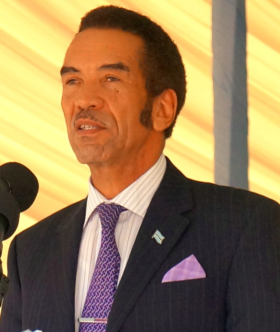
Duma Boko2024 CEU.S. Department of State · Public domain · Commons
Government, Society and Religion
Botswana is a parliamentary republic governed by the Constitution of Botswana. It is the longest uninterrupted democracy in Africa. Its seat of government is in Gaborone. Botswana's governing institutions were established after it became an independent nation in 1966. Botswana's governmental structure is based on both the United Kingdom's Westminster system and the Tswana people's tribal governments. Botswana has a centralised government in which national law supersedes local law. Local laws are developed by local councils and district councils. They are heavily influenced by tribal governments, which are led by the tribe's chief.
Read more
The Parliament of Botswana consists of the President and the National Assembly, which serves as the nation's formal and sole legislature, while the Ntlo ya Dikgosi serves an advisory body made up of tribal chiefs and other appointed members.
Unitary parliamentary republic with an executive presidency
Languages
Tswana
Economy and Trade
Since independence, Botswana has had one of the fastest growth rates in per capita income in the world. Formerly one of the world's poorest countries—with a GDP per capita of about US$70 per year in the late 1960s—Botswana has transformed itself into an upper middle-income country. GDP per capita grew from $439 in 1950 to $15,842 in 2018. Although Botswana was resource-abundant, a good institutional framework allowed the country to reinvest resource-income to generate stable future income. By one estimate, it has the fourth-highest gross national income at purchasing power parity in Africa, giving it a relatively high standard of living in Africa, around that of Mexico. As of 2022, the unemployment rate stood at 25.4%, while youth unemployment reached 45.41% in 2023.
Football is the most popular sport in Botswana. Qualifying for the 2012 and 2025 Africa Cup of Nations are the national team's highest achievement to date. Other popular sports are softball, cricket, tennis, rugby, badminton, handball, golf and track and field. Botswana is an associate member of the International Cricket Council. Botswana became a member of the International Badminton Federation and Africa Badminton Federation in 1991. The Botswana Golf Union has an amateur golf league in which golfers compete in tournaments and championships. Runner Nijel Amos won Botswana its first Olympic medal in 2012, taking silver in the 800 metres.
Read more
In 2011, Amantle Montsho became world champion in the 400 metres and won Botswana's first athletics medal at the world level. High jumper Kabelo Kgosiemang is a three-time African champion.
Rhodesia, officially the Republic of Rhodesia from 1970 onwards, was an unrecognised state in Southern Africa that existed from 1965 to 1979. Rhodesia was the de facto successor to the self-governing colony of Southern Rhodesia following its unilateral declaration of independence (UDI) from the United Kingdom in 1965. Throughout this fourteen-year period, Rhodesia faced internal conflict and political unrest.
Until after the Second World War the landlocked British possession of Southern Rhodesia was not developed as an indigenous African territory, but rather as a unique state that reflected its multiracial character. This situation made it different from other lands that existed under colonial rule, as many Europeans had arrived to make permanent homes, populating the towns as traders or settling to farm the most productive soils. In 1922, faced with the decision to join the Union of South Africa as a fifth province or accept nearly full internal autonomy, the electorate cast its vote against South African integration.
Read more
In view of the outcome of the referendum, the territory was annexed by the United Kingdom on 12 September 1923. Shortly after annexation, on 1 October 1923, the first constitution for the new Colony of Southern Rhodesia came into force.
voters to be British subjects, male, 21 years of age and older, able to write their address and occupation, and then to fulfil the following financial requirements: (a) ownership of a registered mining claim in Southern Rhodesia, or (b) occupying immovable property worth £75, or (c) receiving wages or salary of £50 per annum in Southern Rhodesia. Six months' continuous residence was also required for qualifications (b) and (c).
Read more
Following Cecil Rhodes's dictum of "equal rights for all civilised men", there was an implicit, albeit not an overt, racial component to the franchise, which effectively excluded a majority of native black people from the electorate via such means as property qualifications.
Economically, Southern Rhodesia developed an economy that was narrowly based on the production of a few primary products, notably, chromium and tobacco. It was therefore vulnerable to the economic cycle. The deep recession of the 1930s gave way to a post-war boom. This boom prompted the immigration of about 200,000 whites between 1945 and 1970, taking the white population up to 307,000. A large number of these immigrants were of British working-class origin, with others coming from the Belgian Congo, Kenya, Tanzania, and later Angola and Mozambique. They established a relatively balanced economy, transforming what was once a primary producer dependent on backwoods farming into an modest industrial power which spawned a strong manufacturing sector, iron and steel industries, and modern mining ventures.
Flag of Rhodesia (1968–1979)Actarux (original) · Public domain · Commons
Coat of arms of Southern Rhodesia (1924–1981)LadyofHats · Public domain · Commons
Wars and Battles
By December 1972, ZANLA had cached arms and established a vast underground network of informants and supporters in northeastern Rhodesia. As a result of the erosion of Portuguese authority in Mozambique's border provinces due to the Mozambican War of Independence, ZANLA was also able to establish external sanctuaries there. It was also in the process of cultivating a military alliance with the leading black nationalist movement in Mozambique, the Front for the Liberation of Mozambique (FRELIMO). On 21 December, a group of ZANLA insurgents under Rex Nhongo crossed into Rhodesia from Mozambique and raided an isolated commercial farm. In the successive months, this attack was followed by a succession of raids on white farmers throughout the northeastern districts of the country and resulted in several casualties among the security forces.
As Rhodesia was a former colony of the United Kingdom, all of the sports that were born in the United Kingdom enjoyed considerable popularity in Rhodesia; especially cricket, rugby, water polo, football, netball, golf, tennis (including the Rhodesian Open Tennis Championships), lawn bowls, field hockey, etc. Just like neighbouring South Africa, Rhodesia was barred from both competing against and participating with Commonwealth member countries.
Read more
One of the biggest triumphs in Rhodesia sports history was when the team defeated the New Zealand national rugby team 10-8 while the All Blacks were touring South Africa. They are 1 of 8 nations to ever defeat the All Blacks and the only non-test nation to have ever beaten them.
Rhodesia began to lose vital economic and military support from South Africa, which, while sympathetic to the white minority government, never accorded it diplomatic recognition. The South African government placed limits on the fuel and munitions they supplied to the Rhodesian military. They also withdrew the personnel and equipment that they had previously provided to aid the war effort, though covert military support continued.
Read more
In 1976, the South African government and United States governments worked together to place pressure on Smith to agree to a form of majority rule. In response to the initiative of United States Secretary of State Henry Kissinger, in 1976 Ian Smith accepted the principle of black majority rule within two years.
The years following Rhodesia's UDI saw an unfolding series of economic, military, and political pressures placed on the country that eventually brought about majority rule, a totality of these factors rather than any one the reason for introducing change. In 2005, a conference at the London School of Economics that discussed Rhodesia's independence concluded that UDI was sparked by an existing racial conflict complicated by Cold War intrigues.
Read more
Critics of UDI maintained that Ian Smith intended to safeguard the privileges of an entrenched colonial ruling class at the expense of the impoverished black population. Smith defended his actions by claiming that the black Rhodesian majority was too inexperienced at the time to participate in the complex administrative process of what was, by contemporary African standards, a reasonably industrialised state.
The President of Zambia Kenneth David KaundaUnknown photographer · Public domain · Commons
Zambia, officially the Republic of Zambia, is a landlocked country in Southern Africa. It is bordered to the north by the Democratic Republic of the Congo, Tanzania to the northeast, Malawi to the east, Mozambique to the southeast, Botswana (via a tiny border of Chobe District) and Zimbabwe to the south, Namibia (via the Caprivi Strip) to the southwest, and Angola to the west. The capital city of Zambia is Lusaka, located in the south-central part of Zambia.
The Bantu people originally lived in West and Central Africa around what is today Cameroon and Nigeria. Approximately 5000 years ago, they began a millennia-long expansion into much of the continent. This event has been called the Bantu expansion; it was one of the largest human migrations in history. The Bantu are believed to have been the first to have brought iron working technology into large parts of Africa. The Bantu Expansion happened primarily through two routes: a western one via the Congo Basin and an eastern one via the African Great Lakes.
Politics in Zambia takes place in a framework of a presidential representative democratic republic, whereby the president of Zambia is head of state and head of government in a pluriform multi-party system. The government exercises executive power, while legislative power is vested in the government and parliament.
Read more
Zambia became a republic upon attaining independence in October 1964. From 2011 to 2014, Zambia's president had been Michael Sata, until Sata died on 28 October 2014. After Sata's death, Vice President Guy Scott, a Zambian of Scottish descent, became acting president. Presidential elections were held on 22 January 2015. A total number of 11 presidential candidates contested in the election and On 24 January 2015, it was announced that Edgar Chagwa Lungu had won the election to become the 6th President.
In 2022, Zambia averages between $7.5 billion and $8 billion of exports annually. It totalled $9.1 billion worth of exports in 2018. In 2015, about 54.4% of Zambians lived below the recognised national poverty line, improved from 60.5% in 2010. Rural poverty rates were about 76.6% and urban rates at about 23.4%. The national poverty line was ZMK 214 (US$12.85) per month. As of the latest estimate in 2018 by the United Nations Development Programme, 47.9 percent of the population continued to be affected by multidimensional poverty. Unemployment and underemployment in urban areas are serious problems. Most rural Zambians are subsistence farmers.
Read more
Zambia was ranked 112th in the Global Innovation Index in 2025. Social indicators continue to decline, particularly in measurements of life expectancy at birth (about 40.9 years) and maternal mortality (830 per 100,000 pregnancies) in 2007.
Sports and games are common social aspects of Zambian culture(s) that bring people together for learning, development of skills, fun and joyous moments. Sports and games in Zambia include but are not limited to football, athletics, netball, volleyball and indigenous games such as nsolo, chiyenga, waida, hide and seek, walyako, and sojo. These are some of the indigenous games that support socialisation. All these sports and games are part of the Zambian culture(s). The fact that the games are played by more than one person makes them social and edutainment events. The history of some of these games is as old as Zambians themselves. However, Zambia started taking part in popular global sports and games mainly in 1964 Summer olympics.
Equatorial Guinea, officially the Republic of Equatorial Guinea, is a country on the west coast of Central Africa and the only Spanish-speaking country in Africa. It has an area of 28,000 square kilometres (11,000 sq mi). Formerly the colony of Spanish Guinea, its post-independence name refers to its location both near the Equator and in the African region of Guinea. As of 2025, the country has a population of 1,853,559, over 85% of whom are members of the Fang people, the country's dominant ethnic group.
The current president of Equatorial Guinea is Teodoro Obiang. The 1982 constitution of Equatorial Guinea gives him extensive powers, including naming and dismissing members of the cabinet, making laws by decree, dissolving the Chamber of Representatives, negotiating and ratifying treaties and serving as commander in chief of the armed forces. The constitution defines the nation as a unitary state. According to Human Rights Watch, the dictatorship of President Obiang used an oil boom to entrench and enrich itself further at the expense of the country's people. Since August 1979, some 12 perceived unsuccessful coup attempts have occurred. According to a March 2004 BBC profile, politics within the country were dominated by tensions with Obiang's son, Teodoro Nguema Obiang Mangue.
Unitary presidential republic under a hereditary dictatorship
Languages
Spanish, French, Portuguese
Economy and Trade
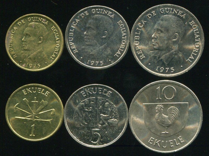
Before the nation's independence from Spain, Equatorial Guinea exported cocoa, coffee and timber, mostly to its colonial ruler, Spain, but also to Germany and the UK. On 1 January 1985, the country became the first non-Francophone African member of the franc zone, adopting the CFA franc as its currency. The national currency, the ekwele, had previously been linked to the Spanish peseta.
Read more
The discovery of large oil reserves in 1996 and its subsequent exploitation contributed to a dramatic increase in government revenue. As of 2004, Equatorial Guinea is the third-largest oil producer in Sub-Saharan Africa. Its oil production has risen to 360,000 barrels per day (57,000 m3/d), up from 220,000 only two years earlier. Oil companies operating in Equatorial Guinea include ExxonMobil, Marathon Oil, Kosmos Energy and Chevron.
Equatorial Guinean peseta, Central African CFA franc, Equatorial Guinean ekwele
This series of ekwele coins was only minted in 1975 but was in use until 1981.Faerie ixi · CC BY-SA 4.0 · Commons
Iron currency used in city of LoggunDixon Denham · Public domain · Commons
Flag of Equatorial GuineaSee File history below for details. · Public domain · Commons
Coat of arms of Equatorial GuineaSzczepan dyskusja Mail 08:10, 2 April 2007 (UTC) · Public domain · Commons
Achievements and Monuments
The principal means of communication within Equatorial Guinea are three state-operated FM radio stations: the BBC World Service, Radio France Internationale and Gabon-based Africa No 1 broadcast on FM in Malabo. There is also an independent radio option called Radio Macuto; it is a web-based radio and news source known for publishing news that calls out Obiang's regime. There are also five shortwave radio stations. Televisión de Guinea Ecuatorial, the television network, is state-operated. The international TV programme RTVGE is available via satellites in Africa, Europe, and the Americas and worldwide via the Internet. There are two newspapers and two magazines.
Read more
Equatorial Guinea ranked 161st out of 179 countries in the 2012 Reporters Without Borders press freedom index. The watchdog says the national broadcaster obeys the orders of the information ministry.
Eswatini, formally the Kingdom of Eswatini (historically called KaNgwane), also known by its former official names Swaziland and the Kingdom of Swaziland, is a landlocked country in Southern Africa. It is bordered by South Africa on all sides except the east, where it shares a border with Mozambique. At no more than 200 km (120 mi) north to south and 130 km (81 mi) east to west, Eswatini is the second smallest country in continental Africa. However, its climate and topography are diverse, ranging from a cool and mountainous highveld to a hot and dry lowveld.
Eswatini is an absolute monarchy with constitutional provision and Swazi law and customs. The head of state is the king or ngwenyama (lit. 'lion'), currently King Mswati III, who ascended to the throne in 1986 after the death of his father King Sobhuza II in 1982 and a period of regency. According to the country's constitution, the ngwenyama is a symbol of unity and the eternity of the Swazi nation. By tradition, the king reigns along with his mother (or a ritual substitute), the ndlovukati (lit. 'she-elephant'). The former was viewed as the administrative head of state and the latter as a spiritual and national head of state, with real power counterbalancing that of the king, but during the long reign of Sobhuza II, the role of the ndlovukati became more symbolic.
Eswatini's economy is diverse, with agriculture, forestry and mining accounting for about 13% of GDP, manufacturing (textiles and sugar-related processing) representing 37% of GDP and services – with government services in the lead – constituting 50% of GDP. Title Deed Lands, where the bulk of high value crops are grown (sugar, forestry, and citrus), are characterised by high levels of investment and irrigation, and high productivity. About 75% of the population is employed in subsistence agriculture upon Swazi Nation Land (SNL). In contrast with the commercial farms, SNL suffers from low productivity and investment.
Read more
The cultivation of sugarcane, the country's largest export, has involved forced evictions of rural communities to build plantations, child labour and work weeks of up to 60 hours.
Take from German WikipediaThe original uploader was SDC at English Wikipedia. · CC BY-SA 3.0 · Commons
Currency
lilangeni
Flag of EswatiniSobhuza II · Public domain · Commons
Coat of arms of EswatiniRoyFocker 12 · Public domain · Commons
Achievements and Monuments
The principal Swazi social unit is the homestead, a traditional beehive hut thatched with dry grass. In a polygamous homestead, each wife has her own hut and yard surrounded by reed fences. There are three structures for sleeping, cooking, and storage (brewing beer). Larger homesteads also have structures used as bachelors' quarters and guest accommodation. Central to the traditional homestead is the cattle byre, a circular area enclosed by large logs, interspersed with branches. The cattle byre has ritual as well as practical significance as a store of wealth and symbol of prestige. It contains sealed grain pits. Facing the cattle byre is the great hut which is occupied by the mother of the headman. The headman is central to all homestead affairs, and he is often polygamous.
1973 CE – 1995 CE · Capital: Kinshasa (named "Léopoldville" until 1966) · 2,307,837 km²
U.S. Secretary of Defense Caspar W. Weinberger meets with President Mobutu of Zaire in his Pentagon office, Room 3E880.Frank Hall · Public domain · Commons
Zaire (spelt Zaïre in French, and sometimes in English), officially the Democratic Republic of the Congo from 1965 to 1971 and the Republic of Zaire from 1971 to 1997, was the Congolese state in Central Africa headed by Mobutu Sese Seko from 1965 to 1997. It was, by area, the third-largest country in Africa after Sudan and Algeria, and the 11th-largest country in the world from 1965 to 1991. With a population of over 23 million, Zaire was the most populous Francophone country in Africa.
The country was governed by the Popular Movement of the Revolution as a unitary one-party state as the only legally permitted party in the country, though the Congo had effectively been a one-party state since the MPR's formation. Despite the constitution nominally allowing for the existence of two parties, the MPR was the only party that was allowed to nominate a candidate for the 1 November 1970 presidential election. Mobutu was confirmed in office by an implausible margin of over 10,131,000 votes against only 157 who voted "no." At parliamentary elections held two weeks later, voters were presented with a single MPR list that was approved with over 99 per cent support.
Read more
Zaire utilised a presidential system with the president served as the head of state whose role was to appoint and dismiss cabinet members and determine their areas of responsibility.
Unitary Mobutist one-party presidential republic under a totalitarian military dictatorship
Languages
French
Economy and Trade
The zaïre was introduced to replace the franc as the new national currency. 100 makuta (singular likuta) equaled one zaïre. The likuta was also divided into 100 sengi. However this unit was worth very little, so the smallest coin was for 10 Sengi. The currency and the cities named above had actually already been renamed between 1966 and 1971.
Read more
While the country began to stabilise after Mobutu took control, the economic situation began to decline, and by 1979, the purchasing power was only 4% of that in 1960. Starting in 1976 the IMF provided stabilising loans to his regime. Much of this money was embezzled by Mobutu and his circle.
Flag of Zaire (1971–1997)User:Moyogo · Public domain · Commons
Coat of arms of Zaire (1971–1997)Tadpole9, Д.Ильин · Public domain · Commons
Wars and Battles
In 1977 and 1978, Katangan rebels based in Angola launched two invasions, Shaba I and Shaba II, into the Katanga Province (renamed "Shaba" in 1972). The rebels were driven out with military assistance from the Western Bloc, particularly from the Safari Club.
Read more
The Battle of Kolwezi, fought in May 1978, resulted in an airborne operation in an aim of rescuing Zairian, Belgian and French miners held as hostages by pro-Communist Katangan guerrillas.
Pope John Paul II made a papal trip to Zaire on 2 May 1980, on the centenary of Catholic evangelisation. During his tour, he greeted over a million people, making him the first pontiff to visit Africa as a "messenger of peace". He left Zaire four days later on 6 May shortly after 9 people were trampled to death trying to attend mass.
The concept of authenticity was derived from the MPR's professed doctrine of "authentic Zairian nationalism and condemnation of regionalism and tribalism". Mobutu defined it as being conscious of one's own personality and one's own values and of being at home in one's culture. In line with the dictates of authenticity, the name of the country was changed to the Republic of Zaire on 27 October 1971, and that of the armed forces to Zairian Armed Forces (Forces Armées Zaïroises—FAZ).
Read more
This decision was curious, given that the name Congo, which referred both to the river Congo and to the mediaeval Kongo Empire, was fundamentally authentic to pre-colonial African roots, while Zaire is in fact a Portuguese corruption of another African word, Nzadi ("river", by Nzadi o Nzere, "the river that swallows all the other rivers", another name of the Congo river).
By 1996, tensions from the neighbouring Rwandan Civil War and genocide had spilled over to Zaire (see History of Rwanda). Rwandan Hutu militia forces (Interahamwe), who had fled Rwanda following the ascension of an RPF-led government, had been using Hutu refugee camps in eastern Zaire as bases for incursion against Rwanda. These Hutu militia forces soon allied with the Zairian armed forces (FAZ) to launch a campaign against Congolese ethnic Tutsis in eastern Zaire, known as the Banyamulenge. In turn, these Zairian Tutsis formed a militia to defend themselves against attacks. When the Zairian government began to escalate its massacres in November 1996, the Tutsi militias erupted in rebellion against Mobutu, triggering the First Congo War.
Read more
The Tutsi militia was soon joined by various opposition groups and supported by several countries, including Rwanda and Uganda.
After the collapse of Zaire, its legacy was claimed and partially continued by various factions which emerged from Mobutu's former supporter and loyalist network. These factions were headed by former "barons" of the regime as well as Mobutu's family members, and included political parties such as the Union of Mobutist Democrats and the MPR-Fait privé. Several of these groups continued to use Zaire's symbols and invoke its traditions. In 2024, opposition politician Christian Malanga led a coup attempt against the Congolese government in the name of his self-proclaimed "New Zaire", raising the old flag of Zaire in Kinshasa. The coup attempt was defeated, and Malanga was killed.
President of Mozambique Samora Moisés Machel speaks with the state department officials and a colonel before departing the United States.Department of Defense. American Forces Information Service. Defense Visual Information Center. 1994 · Public domain · Commons
Mozambique, officially the Republic of Mozambique, is a country in Southeast Africa bordered by the Indian Ocean to the east, Tanzania to the north, Malawi and Zambia to the northwest, Zimbabwe to the west, and Eswatini and South Africa to the south and southwest. The sovereign state is separated from the Comoros, Mayotte, and Madagascar through the Mozambique Channel to the east. The capital and largest city is Maputo.
Between the 7th and 11th centuries, a series of Swahili port towns developed in the area, which contributed to the development of a distinct Swahili culture and dialect.
While allegiances dating back to the liberation struggle remain relevant, Mozambique's foreign policy has become increasingly pragmatic. The twin pillars of Mozambique's foreign policy are maintenance of good relations with its neighbours and maintenance and expansion of ties to development partners.
Read more
During the 1970s and the early 1980s, Mozambique's foreign policy was inextricably linked to the struggles for majority rule in Rhodesia and South Africa as well as superpower competition and the Cold War. Mozambique's decision to enforce UN sanctions against Rhodesia and deny that country access to the sea led Ian Smith's government to undertake overt and covert actions to oppose the country. Although the change of government in Zimbabwe in 1980 removed this threat, the government of South Africa continued to destabilise Mozambique. Mozambique also belonged to the Frontline States.
Unitary dominant-party semi-presidential republic under an authoritarian government
Languages
Portuguese
Economy and Trade
There are over 30,000 km (19,000 mi) of roads, but much of the network is unpaved. Like its Commonwealth neighbours, traffic circulates on the left, in spite of not having been colonised by the British. There is an international airport at Maputo, 21 other paved airports, and over 100 airstrips with unpaved runways. There are 3,750 km of navigable inland waterways. There are rail links serving principal cities and connecting the country with Malawi, Zimbabwe and South Africa.
Read more
The Mozambican railway system developed over more than a century from three different ports on the coast that served as terminals for separate lines to the hinterland. The railroads were major targets during the Mozambican Civil War, were sabotaged by RENAMO, and are being rehabilitated.
The government under President Samora Machel established a one-party state based on Marxist principles. It received diplomatic and some military support from Cuba and the Soviet Union and proceeded to crack down on opposition. Shortly after independence, the country was plagued from 1977 to 1992 by a long and violent civil war between the opposition forces of anti-communist Mozambican National Resistance (RENAMO) rebel militias and the FRELIMO regime. This conflict characterised the first decades of Mozambican independence, combined with sabotage from the neighbouring states of Rhodesia and South Africa, ineffective policies, failed central planning, and the resulting economic collapse.
The Makonde are known for their wood carving and elaborate masks, which are commonly used in traditional dances. There are two different kinds of wood carvings: shetani, (evil spirits), which are mostly carved in heavy ebony, tall, and elegantly curved with symbols and nonrepresentational faces; and ujamaa, which are totem-type carvings which illustrate lifelike faces of people and various figures. These sculptures are usually referred to as "family trees" because they tell stories of many generations.
Read more
During the last years of the colonial period, Mozambican art reflected the oppression by the colonial power and became a symbol of resistance. After independence in 1975, modern art came into a new phase. The two best known and most influential contemporary Mozambican artists are the painter Malangatana Ngwenya and the sculptor Alberto Chissano.
1976 CE – 2024 CE · Capital: Luanda · 1,257,376 km²
President MPLA, heer Neto door Den Uyl ontvangen premier Den Uyl en A Neto (r), Bestanddeelnr 927-8518 (cropped)Rob Mieremet / Anefo · CC0 · Commons
Angola, officially the Republic of Angola, is a country on the western coast of Southern Africa. It is the second-largest Portuguese-speaking (Lusophone) country after Brazil in both total area and population and is the seventh-largest country in Africa. It is bordered by Namibia to the south, the Democratic Republic of the Congo to the north, Zambia to the east, and the Atlantic Ocean to the west. The Angolan province of Cabinda is an exclave on the Atlantic coast, bordering the Republic of the Congo and the Democratic Republic of the Congo. The capital and most populous city is Luanda.
The Angolan government is composed of three branches of government: executive, legislative and judicial. Executive authority is exercised by the President with the assistance of the Vice-President and the Council of Ministers.
Read more
The legislative branch comprises a 220-seat unicameral legislature, the National Assembly of Angola, elected from multi-member province-wide and nationwide constituencies using party-list proportional representation. For decades, political power has been concentrated in the presidency. After 38 years of rule, in 2017 President dos Santos stepped down from MPLA leadership. The leader of the winning party at the parliamentary elections in August 2017 would become the next president of Angola. The MPLA selected the former Defence Minister João Lourenço as Santos' chosen successor.
79.1% Christianity, 44.2% Catholic, 34.9% Protestant, 11.5% no religion, 9.4% other
Economy and Trade
Angola has diamonds, oil, gold, copper, a rich wildlife (which was dramatically depleted during the civil war), forests, and fossil fuels. Since independence, oil and diamonds have been the most important economic resources. Smallholder and plantation agriculture dramatically dropped during the Angolan Civil War, but began to recover after 2002.
Read more
Angola's economy has in recent years moved on from the disarray caused by a quarter-century of Angolan civil war to become the fastest-growing economy in Africa and one of the fastest-growing in the world, with an average GDP growth of 20% between 2005 and 2007. In the period 2001–10, Angola had the world's highest annual average GDP growth, at 11.1%.
Flag of AngolaOriginal: Henrique de Carvalho Santos Vector: SKopp · Public domain · Commons
Emblem of AngolaUnknown author · Public domain · Commons
Wars and Battles
Throughout the war of independence, the three rival nationalist movements were severely hampered by political and military factionalism, as well as their inability to unite guerrilla efforts against the Portuguese. Between 1961 and 1975 the MPLA, UNITA, and the FNLA competed for influence in the Angolan population and the international community. The Soviet Union and Cuba became especially sympathetic towards the MPLA and supplied that party with arms, ammunition, funding, and training. They also backed UNITA militants until it became clear that the latter was at irreconcilable odds with the MPLA.
Read more
The collapse of Portugal's Estado Novo government following the 1974 Carnation Revolution suspended all Portuguese military activity in Africa and the brokering of a ceasefire pending negotiations for Angolan independence.
Angolan culture has been heavily influenced by Portuguese culture, especially in language and religion, and the culture of the indigenous ethnic groups of Angola, predominantly Bantu culture.
Read more
The diverse ethnic communities—the Ovimbundu, Ambundu, Bakongo, Chokwe, Mbunda and other peoples—to varying degrees maintain their own cultural traits, traditions and languages, but in the cities, where slightly more than half of the population now lives, a mixed culture has been emerging since colonial times; in Luanda, since its foundation in the 16th century.
In this urban culture, Portuguese heritage has become more and more dominant. African roots are evident in music and dance and is moulding the way in which Portuguese is spoken. This process is well reflected in contemporary Angolan literature, especially in the works of Angolan authors.
「聖宏專案」訪團抵達聖多美普林西比,馬英九總統於聖國總統府與賓多總統舉行聯合記者會,說明兩國未來合作關係展望。總統府 · CC BY 2.0 · Commons
São Tomé and Príncipe, officially the Democratic Republic of Sao Tome and Principe, is an island country in the Gulf of Guinea, off the western equatorial coast of Central Africa. It consists of two archipelagos around the two main islands of São Tomé and Príncipe, about 81 nautical miles (150 km; 93 mi) apart and about 135 and 121 nautical miles (250 and 224 km; 155 and 139 mi) off the northwestern coast of Gabon. With a population of 201,800 (2018 official estimate), São Tomé and Príncipe is the second-smallest and second-least populous African sovereign state after Seychelles.
São Tomé and Príncipe is a unitary state operating under a semi-presidential system. The president of the republic is elected to a five-year term by direct universal suffrage and a secret ballot, and must gain an outright majority to be elected. The president may hold up to two consecutive terms. The prime minister is appointed by the president, and the 14 members of the cabinet are chosen by the prime minister.
Read more
The National Assembly, the supreme organ of the state and the highest legislative body, is made up of 55 members, who are elected for a four-year term and meet semiannually. Justice is administered at the highest level by the Supreme Court. The judiciary is independent under the current constitution.
São Tomé and Príncipe has functioned under a multiparty system since 1990.
São Tomé saw significant economic development following the introduction of a water-powered sugar mill in 1515, which led to the mass cultivation of sugar: "The fields are expanding and the sugar mills, too. At this time, only two sugar mills are here and another three are being built, counting the mill of the contractors, which is large. Similarly, the necessary conditions exist, such as streams and timber, to be able to build many more. And the [sugar] canes are the biggest I have ever seen in my life." Sugar plantations were organized with slave labor, and by the mid-16th century, the Portuguese settlers had turned the islands into Africa's foremost exporter of sugar.
Read more
Slaves in São Tomé were brought from the Slave Coast of West Africa, the Niger Delta, the island of Fernando Po, and later from the Kongo and Angola.
São Tomé and Príncipe's Portuguese-language literature and poetry is considered some of the richest in Lusophone Africa. Other literature from the country has been written in Forro Creole, English and Caué Creole. Francisco José Tenreiro is considered one of the country's most influential writers. Other notable literary figures include Manuela Margarido, Alda Espírito Santo, Olinda Beja and Conceição Lima.
Seychelles (French: [sɛʃɛl] or [seʃɛl]), officially the Republic of Seychelles (French: République des Seychelles; Seychellois Creole: Repiblik Sesel), is an archipelagic country consisting of 115 islands in the Indian Ocean. Its capital and largest city, Victoria, is 1,500 kilometres (800 nautical miles) east of mainland Africa. Nearby island countries and territories include the Maldives, Comoros, Madagascar, Mauritius, and the French overseas departments of Mayotte and Réunion to the south; and the Chagos Archipelago to the east.
Seychelles was uninhabited throughout most of recorded history, although simulations of Austronesian migration patterns indicate a good probability that they visited the islands. Tombs visible until 1910 at Anse Lascars on Silhouette Island have also been conjectured to belong to later Maldivian and Arab traders visiting the archipelago. Vasco da Gama and his 4th Portuguese India Armada discovered the Seychelles on 15 March 1503; the first sighting was made by Thomé Lopes aboard Rui Mendes de Brito. Da Gama's ships passed close to an elevated island, probably Silhouette Island, and the following day Desroches Island. Later, the Portuguese mapped a group of seven islands and named them The Seven Sisters. The earliest recorded landing was in January 1609, by the crew of the Ascension under Captain Alexander Sharpeigh during the fourth voyage of the British East India Company.
Seychelles' long-term president France-Albert René came to power after his supporters overthrew the first president James Mancham on 5 June 1977 in a coup d'état and installed him as president. René was at that time the prime minister. René ruled as a strongman under a socialist one-party system until 1993, when he was forced to introduce a multi-party system. He stepped down in 2004 in favour of his vice-president, James Michel, who was re-elected in 2006, 2011 and again in 2015. On 28 September 2016, the Office of the President announced that Michel would step down effective 16 October, and that Vice President Danny Faure would complete the rest of Michel's term.
Read more
On 26 October 2020, Wavel Ramkalawan, a 59-year-old Anglican priest, was elected the fifth President of the Republic of Seychelles. Ramkalawan was an opposition MP from 1993 to 2011, and from 2016 to 2020.
During the plantation era, cinnamon, vanilla and copra were the chief exports. In 1965, during a three-month visit to the islands, futurist Donald Prell prepared for the crown colony's Governor General an economic report containing a scenario for the future of the economy. Quoting from his report, in the 1960s, about 33% of the working population worked at plantations, and 20% worked in the public or government sector. The Indian Ocean Tracking Station on Mahé used by the United States' Air Force Satellite Control Network was closed in August 1996 after the Seychelles government attempted to raise the rent to more than $10,000,000 per year.
Read more
Since independence in 1976, per capita output has expanded to roughly seven times the old near-subsistence level.
Flag of SeychellesUser:Vxb83 · Public domain · Commons
Coat of arms of SeychellesSodacan iThe source code of this SVG is valid. This vector image was created with Inkscape by v . · Public domain · Commons
Achievements and Monuments
Seychelles has the highest literacy rate of any country in sub-Saharan Africa. According to The World Factbook of the Central Intelligence Agency, as of 2018, 95.9% of the population aged 15 and over can read and write in the Seychelles.
Read more
Until the mid-19th century, little formal education was available in Seychelles. The Catholic and Anglican churches opened mission schools in 1851. The Catholic mission later operated boys' and girls' secondary schools with religious brothers and nuns from abroad even after the government became responsible for them in 1944.
A teacher training college opened in 1959, when the supply of locally trained teachers began to grow, and in short time many new schools were established. Since 1981 a system of free education has been in effect, requiring attendance by all children in grades one to nine, beginning at age six.
Zimbabwe Rhodesia, alternatively known as Zimbabwe-Rhodesia, also informally known as Zimbabwe or Rhodesia, was a short-lived sovereign state that existed from 1 June 1979 to 18 April 1980, though it lacked international recognition. Zimbabwe Rhodesia was preceded by another state named the Republic of Rhodesia and was briefly under a British-supervised transitional government sometimes referred to as a reestablished Southern Rhodesia, which according to British constitutional theory had remained the lawful government in the area after Unilateral Declaration of Independence (UDI) in 1965.
Under pressure from the international community, an "Internal Settlement" was drawn up between the Smith administration of Rhodesia and moderate African nationalist parties. Meanwhile, the government continued to battle armed resistance from the Patriotic Front, a coalition of two African Leadership parties: the Zimbabwe African Peoples Union (ZAPU) and the Zimbabwe African National Union (ZANU).
Read more
The "Internal Settlement", signed in March 1978, led to the creation of an interim government in which Africans were included in leading positions for the first time, while creating an independent civil service, judiciary, police force, and army. The settlement also created an executive council composed of Ian Smith and three black individuals (Muzorewa, Sithole, and Chirau), and a ministerial council, while Smith retained his title as prime minister.
Of the 100 members of the House of Assembly, 72 were "common roll" members for whom the electorate was every adult citizen. All of these members were black Africans. Those on the previous electoral roll of Rhodesia (due to education, property and income qualifications for voter rolls) elected 20 members; although this did not in theory exclude non-whites, very few black Africans met the qualification requirements. A delimitation commission sat in 1978 to determine how to reduce the previous 50 constituencies to 20. The remaining eight seats for old voter role non-constituency members were filled by members chosen by the other 92 members of the House of Assembly once their election was complete.
Zimbabwe, officially the Republic of Zimbabwe, is a landlocked country in Southeast Africa, between the Zambezi and Limpopo River, bordered by South Africa to the south, Botswana to the southwest, Zambia to the north, and Mozambique to the east. The capital and largest city is Harare, and the second largest is Bulawayo.
A country of roughly 17.3 million people per 2026 estimates, Zimbabwe's largest ethnic groups are the Northern Ndebele and Shona, who make up 95% of the population, followed by the other smaller minorities.
During the 1995 parliamentary elections, most opposition parties, including the ZUM, boycotted the voting, resulting in a near sweep by the ruling party. When the opposition returned to the polls in 2000, they won 57 seats, only five fewer than ZANU-PF. Presidential elections were again held in 2002 amid allegations of vote-rigging, intimidation and fraud. The 2005 Zimbabwe parliamentary elections were held on 31 March, and multiple claims of vote rigging, election fraud and intimidation were made by the Movement for Democratic Change party and Jonathan Moyo, calling for investigations into 32 of the 120 constituencies. Moyo participated in the elections despite the allegations and won a seat as an independent member of Parliament.
The main foreign exports of Zimbabwe are minerals, gold, and agriculture. Zimbabwe is crossed by two trans-African automobile routes: the Cairo-Cape Town Highway and the Beira-Lobito Highway. Zimbabwe is the largest trading partner of South Africa on the continent. Taxes and tariffs are high for private enterprises, while state enterprises are strongly subsidised. State regulation is costly to companies; starting or closing a business is slow and expensive. Tourism also plays a key role in the economy but has been failing in recent years. The Zimbabwe Conservation Task Force released a report in June 2007, estimating that 60% of Zimbabwe's wildlife had died since 2000 as a result of poaching and deforestation. The report warns that the loss of life combined with widespread deforestation is potentially disastrous for the tourism industry.
Japanese coin (硬貨)original photo is uploaded by User:Misogi. Sorted horizontally by was_a_bee. · CC BY-SA 3.0 · Commons
Currency
Indian rupee, euro, yen, United States dollar, rand, Zimbabwean dollar, pound sterling, Zimbabwe ZiG, Australian dollar, renminbi
Old banknotes and coins of South Africa, replaced by the iconic "Big Five" notes which were futher updated to the current notes depicting the Big Five and the late Nelson Mandela.NJR ZA · CC BY-SA 3.0 · Commons
This coin is listed in the Standard Catalogue of British Coins under the ID J001.Abxbay · CC BY-SA 4.0 · Commons
Flag of ZimbabweSee File history below for details. · Public domain · Commons
Coat of arms of ZimbabweFischX, Meul · Public domain · Commons
Wars and Battles
The United Kingdom deemed the Rhodesian declaration an act of rebellion but did not re-establish control by force. The British government petitioned the United Nations for sanctions against Rhodesia pending unsuccessful talks with Smith's administration in 1966 and 1968. In December 1966, the organisation complied, imposing the first mandatory trade embargo on an autonomous state. These sanctions were expanded again in 1968.
Read more
A civil war ensued when Joshua Nkomo's Zimbabwe African People's Union (ZAPU) and Robert Mugabe's Zimbabwe African National Union (ZANU), supported actively by communist powers and neighbouring African nations, initiated guerrilla operations against Rhodesia's predominantly white government.
Traditional arts in Zimbabwe include pottery, basketry, textiles, jewellery and carving. Among the distinctive qualities are symmetrically patterned woven baskets and stools carved out of a single piece of wood. Shona sculpture, which has a long cultural history, began evolving into its modern form in the mid-20th century and gained increasing international popularity. Most subjects of carved figures of stylised birds and human figures among others are made with sedimentary rock such as soapstone, as well as harder igneous rocks such as serpentine and the rare stone verdite. Zimbabwean artefacts can be found in countries like Singapore, China and Canada—for example, Dominic Benhura's statue in the Singapore Botanic Gardens.
Read more
Shona sculpture has survived through the ages, and the modern style is a fusion of African folklore with European influences.
1990 CE – 2024 CE · Capital: Windhoek · 832,435 km²
Huge dune in Km 39, Sossusvlei, Namibia.Diego Delso · CC BY-SA 4.0 · Commons
Namibia, officially the Republic of Namibia, is a country in Southern Africa. It borders the Atlantic Ocean to the west, Zambia (via the Caprivi Strip) and Angola to the north, Botswana to the east, and South Africa to the south; in the northeast, approximating a quadripoint, Zimbabwe lies less than 200 metres (660 ft) away along the Zambezi river near Kazungula, Zambia. Namibia's capital and largest city is Windhoek.
Namibia is the driest country in sub-Saharan Africa, and has been inhabited since prehistoric times by the Khoi, San, Damara and Nama people.
Namibia is one of the most free and democratic countries in Africa, with a government that maintains and protects human rights and freedoms. Namibia was ranked first on mainland Africa in the Human Freedom Index 2025, bettered only by the three island nations of Cape Verde, Mauritius, and Seychelles. However, significant issues include government corruption, policy inertia and prison overcrowding. Also, refugees are not permitted free movement.
Read more
Homosexual acts were formerly illegal in Namibia, although the respective law was not enforced. Discrimination, as well as intolerance, against LGBT people is widespread, specifically in rural areas. Urban areas are generally neutral or supportive with a few LGBT-dedicated clubs and events.
87.9% Christianity, 43.7% Lutheranism, 22.8% Catholicism, 17.0% Anglicanism, 4.4% Other Christian, 10.5% Other, 1.6% No religion
Economy and Trade
The trans-African automobile route – the Tripoli-Cape Town Highway and the Trans-Kalahari Corridor pass through Namibia. Namibia's economy is tied closely to South Africa's due to their shared history. In Q3 2023, the largest economic sectors were mining (18.0% of GDP), public administration (12.9%), manufacturing (10.1%), and education (9.2%).
Read more
Namibia has a highly developed banking and financial services sector with modern infrastructures, such as online banking and cellphone banking. The Bank of Namibia (BoN) is the central bank of Namibia responsible for performing all other functions ordinarily performed by a central bank. There are five BoN authorised commercial banks in Namibia: Bank Windhoek, First National Bank, Nedbank, Standard Bank and Small and Medium Enterprises Bank.
Old banknotes and coins of South Africa, replaced by the iconic "Big Five" notes which were futher updated to the current notes depicting the Big Five and the late Nelson Mandela.NJR ZA · CC BY-SA 3.0 · Commons
Currency
Namibian dollar, rand
Namibia, Money Nick Roux 2006.User: (WT-shared) NJR ZA at wts wikivoyage · CC BY-SA 3.0 · Commons
An ATM withdrawal of South African money (R50 and R100s)Tasneem Jaffer · CC BY 4.0 · Commons
Flag of NamibiaSVG by Vzb83~commonswiki et al. · Public domain · Commons
Coat of arms of NamibiaUnknown author · Public domain · Commons
Compared to neighbouring countries, Namibia has a large degree of media freedom. Over the past years, the country usually ranked in the upper quarter of the Press Freedom Index of Reporters without Borders, reaching position 21 in 2010, being on par with Canada and the best-positioned African country. The African Media Barometer shows similarly positive results. However, as in other countries, there is still mentionable influence of representatives of state and economy on media in Namibia. In 2009, Namibia dropped to position 36 on the Press Freedom Index. In 2013, it was 19th, 22nd in 2014 and 23rd in 2019, meaning that it is currently the highest ranked African country in terms of press freedom.
Modern States of Central and Southern Africa: Frequently Asked Questions
Which states existed in Central and Southern Africa in this period?
This page maps 32 states of Central and Southern Africa founded between 1803 CE and 1990 CE: Napoleonic Batavia Republic, Zululand, Natalia Republic, Free Orange State, South African Republic, Kamerun, British Africa, Nieuwe Republiek, Swaziland, Belgian Congo, Estado Novo, Free French and 20 more.
Which was the largest of the Modern States of Central and Southern Africa?
British Africa had the largest mapped extent, about 10,639,583 km².
Which of the Modern States of Central and Southern Africa lasted longest?
Estado Novo lasted longest, 1926 CE – 2024 CE.
↑↓ to navigate↵ to open
12,754 Planetary Entities Indexed
We use Google Analytics cookies to understand which pages are useful. Necessary storage only keeps your theme and this choice on your device. Privacy policy