Modern States of Mesoamerica and the Caribbean: Map & History
33 states of Mesoamerica and the Caribbean on one map, from 1805 CE to 2024 CE.The largest, First Mexican Empire, covered about 3,628,049 km²; the longest-lived, Guatemala, lasted 1840 CE – 2024 CE. Each has its own section below with its rulers, capitals, wars and pictures where the records hold them.
U.S. Navy photo by Mass Communication Specialist 2nd Class Meranda Keller · Public domain · CommonsAvigai · CC BY-SA 4.0 · CommonsGobierno CDMX · CC0 · CommonsGobierno CDMX · CC0 · Commons
Layers
HistoryChanges with the year
PlacesToday
Water
Land
1983 AD
Base map
An empire takes the map to its years and shows the borders.
Each state in its own colour. Move the timeline to see which existed in any year from 1805 to 2024; select a territory to read about it. Borders: Cliopatria / Seshat (CC BY 4.0).
The Modern States of Mesoamerica and the Caribbean Compared
1805 CE – 1915 CE · Capital: Port-au-Prince · 83,656 km²
US Navy 100221-N-5787K-002 An aerial view of the logistical area near the port in Port-au-Prince (cropped)U.S. Navy photo by Mass Communication Specialist 2nd Class Meranda Keller · Public domain · Commons
The First Empire of Haiti, officially known as the Empire of Haiti (French: Empire d'Haïti; Haitian Creole: Anpi an Ayiti), was an elective monarchy in North America. Haiti was controlled by France before declaring independence on 1 January 1804. The Governor-General of Haiti, Jean-Jacques Dessalines, created the empire on 22 September 1804.
Habitantes de Zitlala apoyan para cargar la cruz hacia el cerro del cruzco en Zitlala como antes del ritual para la petición de lluviasAvigai · CC BY-SA 4.0 · Commons
Mexicans (Spanish: Mexicanos) are the citizens and nationals of the United Mexican States. The Mexican people have varied origins with the most spoken language being Spanish, but many also speak languages from 68 different Indigenous linguistic groups and other languages brought to Mexico by expatriates or recent immigration. In 2020, 19.4% of Mexico's population identified as Indigenous. There are currently about 12 million Mexican nationals residing outside Mexico, with about 11.7 million living in the United States.
The 2003 General Law of Linguistic Rights of the Indigenous Peoples recognizes 62 indigenous languages as "national languages" which have the same validity as Spanish in all territories in which they are spoken. The recognition of indigenous languages and the protection of indigenous cultures is granted not only to the ethnic groups indigenous to modern-day Mexican territory, but also to other North American indigenous groups that migrated to Mexico from the United States, such as the Kikapú in the 19th century and those who immigrated from Guatemala in the 1980s. The category of indigena (indigenous) in Mexico has been defined based on different criteria through history; this means that the percentage of the Mexican population defined as "indigenous" varies according to the definition applied.
Spanish, numerous indigenous languages, English, other languages of Mexico
Religion
Predominantly Catholic; religious minorities including: Protestants, atheists, agnostics and others exist
Population
Mexican diaspora: 1.9% of the world's population
Achievements and Monuments
Mexican culture reflects the complexity of the country's history through the blending of indigenous cultures and the culture of Spain, imparted during Spain's 300-year colonization of Mexico. Exogenous cultural elements mainly from the United States have been incorporated into Mexican culture.
Read more
The Porfirian era (el Porfiriato), in the last quarter of the 19th century and the first decade of the 20th century, was marked by economic progress and peace. After four decades of civil unrest and war, Mexico saw the development of philosophy and the arts, promoted by President Díaz himself. Since that time, as accentuated during the Mexican Revolution, cultural identity has had its foundation in the mestizaje, of which the indigenous (i.e. Amerindian) element is the core.
1822 CE – 1823 CE · Capital: Mexico City · 3,628,049 km²
Fotografías de la Ciudad de México desde el aire.Gobierno CDMX · CC0 · Commons
The Mexican Empire (Spanish: Imperio Mexicano, pronounced [imˈpeɾjo mexiˈkano]) was a constitutional monarchy and the first independent government of Mexico. It was also the only former viceroyalty of the Spanish Empire to establish a monarchy after gaining independence. The empire existed from 1821 to 1823, making it one of the few modern-era independent monarchies in the Americas. To distinguish it from the later Second Mexican Empire (1864–1867) under Emperor Maximilian, this historical period is commonly referred to as the First Mexican Empire.
The Spanish Empire disintegrated in the wake of Napoleon's invasion of Spain and the overthrow of the Spanish Bourbons in 1808. Throughout Spain and its viceroyalties there was a widespread refusal to recognize Napoleon's brother Joseph I as the new French-backed king of Spain. In New Spain cleric Miguel Hidalgo y Costilla, who had long been part of a circle of intellectuals who sought to reform the colonial system, triggered the Mexican War of Independence in 1810, a decade of warfare between insurgents for independence from Spain and royalists seeking to maintain the existing colonial order. The insurgency was initially led by Hidalgo, who was captured and executed in 1811, then succeeded by Father José María Morelos, who was likewise captured and executed in 1815. Remaining insurgents, including Vicente Guerrero, waged guerrilla warfare in the countryside of southern Mexico.
Afterwards followed controversies over reconstituting Congress. The convocation that had established congress had also directed it to divide itself into two chambers, which had not been done. The body remained united on the pretext of drafting a new constitution and it considered itself a sovereign constitutional congress. It did not view itself bound in any way by the 1812 Spanish Constitution which remained the de facto constitution of Mexico. At this point no consistent relationship had been established between population and the number of deputies, and the congress as it stood was starting to become a burdensome expense. Deputy Lorenzo de Zavala brought up these concerns and proposed to reduce the number of deputies and also to divide the body into two chambers, a proposal which the emperor found very agreeable.
1824 CE – 1865 CE · Capital: Mexico City · 3,188,401 km²
Fotografías de la Ciudad de México desde el aire.Gobierno CDMX · CC0 · Commons
The First Mexican Republic, known also as the First Federal Republic (Spanish: Primera República Federal), existed from 1824 to 1835. It was a federated republic, established by the Constitution of 1824, the first constitution of independent Mexico, and officially designated the United Mexican States (Spanish: Estados Unidos Mexicanos,). It ended in 1835, when conservatives under Antonio López de Santa Anna transformed it into a unitary state, the Centralist Republic of Mexico.
The Spanish Empire disintegrated in the wake of Napoleon's invasion of Spain and the overthrow of the Spanish Bourbons in 1808. Throughout Spain and her colonies there was a widespread refusal to recognize Napoleon's brother Joseph II as the new French-backed king of Spain. The cleric Miguel Hidalgo y Costilla, who had long been part of a circle of intellectuals who sought to reform the colonial system triggered the Mexican War of Independence in 1810 by accusing the Spanish ruling classes of seeking to recognize Joseph Bonaparte, while proclaiming loyalty to the imprisoned Ferdinand VII. The subsequent uprising would go on to seriously threaten the capital yet it was ultimately defeated within a year and Hidalgo was captured and executed.
Read more
The war would continue and be organized under Jose Maria Morelos who would gain control over much of southern New Spain.
The provisional government was led by a triumvirate consisting of Nicolas Bravo, Pedro Negrete, and Guadalupe Victoria, the latter who would eventually go on to become the first president of Mexico. Congress organized elections for a new Constituent Congress that was meant to draft a new constitution, and the newly elected body met on 7 November 1823.
Read more
Controversy now raged over whether the new republic was going to be a federal system or a unitary system. A certain level of local autonomy had already been granted through a system of provincial deputations introduced through the Spanish Constitution of 1812. A de facto state of federalism to a degree already existed when the constituent congress met. The most prominent opponent of sustaining and expanding the federal system however was Father Mier who had previously made a name for himself as a critic of Iturbide.
Spanish (official), Nahuatl, Yucatec Maya, Mixtecan languages, Zapotec languages
Religion
Catholicism (official religion)
Economy and Trade
The First Mexican Republic found itself inheriting a bankrupt treasury and was forced to mortgage public property to raise funds. Corruption among financial officers also moved congress to entirely reorganize the governments revenue departments.
Read more
In November 1824, congress dissolved the old revenue department and organized a new more thorough one led by the newly established office of the treasury general of the federation. Separate local auditing offices for different branches of the military were abolished and replaced with a more centrally organized system, and an office was established for keeping track of military financial data. All offices connected with revenue had to keep track of financial accounts and send copies to the treasury general. There some impact on corruption, but the government still struggled to meet its obligations.
In Alta California during the late colonial era the Franciscans had established missions from San Diego in the south to the San Franciscan bay area in the north. In 1824, indigenous in four central coast missions revolted against ill-treatment by non-indigenous authorities. The Chumash revolt was suppressed, the mission indigenous pardoned and urged to return to the missions, but the revolt was serious and challenged the narrative of peaceful mission indigenous.
Read more
The republic would largely adopt Spanish colonial policy with regard to the Apache, establecimiento, or the system by which the Spanish sought to settle the Apache and make them sedentary by offering these Apaches de Paz (Peaceful Apaches) goods and land in exchange for peace and abandonment of nomadic lifestyle.
Throughout the First Republic, jurisdiction over education tended to move around the ministries of the Mexican government, which themselves were in the process of often being reorganized. At one point education fell under the Ministry of Inner and Outer Relations, and at another time under Justice and Ecclesiastical Affairs, and later under a newly formed Ministry of Justice.
Read more
A Lancasterian Society had been founded in 1822 by the editors of the Mexican Paper El Sol to teach at an institution going by the same name, and several Mexican states founded analogous institutions.
In 1823 Minister of Relations, Alaman wrote a report establishing that the basis of national education was to be primary instruction, and argued that without education there could be no liberty.
As part of his revolution Santa Anna dissolved the national congress, state congresses, and replaced state governors and municipal governments with loyalists. He however, also maintained that the Constitution of 1824 was still in effect and held elections for a new congress before the end of the year. Santa Anna at this point retired as he had during the Gomez Farias administration and he was replaced by Miguel Barragan.
Read more
On 23 October 1835, the bicameral congress decreed to unite and turn itself into a constituent congress tasked with drafting a new constitution. The resulting centralist document came to be known as the Siete Leyes, and was formally promulgated in December, 1836. Now would begin the Centralist Republic of Mexico, a decade of conservative and centralist rule, whose first president was expected to be Santa Anna.
1824 CE – 1839 CE · Capital: Guatemala City (until 1834), Sonsonate (1834), San Salvador (from 1834) · 443,683 km²
Vicente FilisolaJulio Michaud y Thomas · Public domain · Commons
The Federal Republic of Central America (Spanish: República Federal de Centro América), initially known as the United Provinces of Central America (Provincias Unidas del Centro de América), was a sovereign state in Central America that existed between 1823 and 1839/1841. The republic was composed of five states (Costa Rica, El Salvador, Guatemala, Honduras, and Nicaragua), and a Federal District from 1835 to 1839. Guatemala City was its capital city until 1834, when the seat of government was relocated to San Salvador.
The Spanish king Ferdinand VII was overthrown in 1808 by the French emperor Napoleon, who installed his brother Joseph as king of Spain. Spain's colonies in the Americas (including the Captaincy General of Guatemala) did not recognize Joseph as the legitimate king and established provisional governments, known as juntas, which continued to recognize Ferdinand as king. Although the Central American colonial government remained loyal to Ferdinand, some criollo leaders in Central America wanted greater autonomy. In November 1811, José Matías Delgado and Manuel José Arce launched a rebellion in San Salvador against Spanish rule which was defeated by loyalist forces. Additional independence rebellions occurred in December 1811 in Nicaragua; in 1813 in Guatemala; and in 1814 in San Salvador.
According to the federal constitution, the government of the Federal Republic of Central America was "popular, representative, and federal". All elected officials were appointed with indirect elections; voters chose electors who would vote on their behalf, rather than voting directly for candidates seeking public office. In presidential, vice-presidential and legislative elections, there were three rounds of voting; voters chose electors in the first round, electors voted for a further set of electors in the second round, and those electors voted for candidates seeking public office in the third round. Voting was compulsory.
Read more
The federal republic's government was divided into legislative, executive and judicial branches, with no term limits. The Federal Congress was its bicameral legislative branch.
Thomas L. Karnes, a history professor at Arizona State University, described the Federal Republic of Central America's economy as "chaotic". The federal republic constantly struggled to have enough money to finance its governmental obligations. In 1826, Williams wrote to United States Secretary of State Henry Clay that Central America's economic situation was "most unpromising". Robert S. Smith, an economics professor at Duke University, described the federal treasury as "chronically empty". When Arce assumed the presidency in 1825, the treasury contained only 600 pesos.
Read more
Under Spanish colonial rule, Central America's economy was reliant on agriculture because the region lacked abundant natural resources; the Federal Republic of Central America continued to rely on an agricultural economy.
Flag of the Federal Republic of Central AmericaHuhsunqu · CC BY-SA 2.5 · Commons
Escudo de la República Federal de Centro AméricaFlag_of_the_Federal_Republic_of_Central_America.svg: Huhsunqu derivative work: K21edgo (talk) · CC BY-SA 2.5 · Commons
Wars and Battles
In October 1826, Arce called for a special election to install a new Guatemalan government; the conservatives won, and Mariano Aycinena became governor of Guatemala on 1 March 1827. After the election, many liberals fled Guatemala for El Salvador in search of assistance from its liberals to regain power. They spread rumors that Arce was controlled by the Guatemalan conservatives and that would establish a centralized government. Arce called for an extraordinary congress to convene in Cojutepeque on 10 October to reestablish constitutional order, since the Federal Congress consistently failed to reach a quorum after Juan Barrundia's arrest. The call for an extraordinary congress was unconstitutional, because it exceeded Arce's presidential duties.
On 30 May 1838, the Federal Congress convened and declared that each of the federal republic's five states was free to establish any form of republican government. Nicaragua seceded from the Federal Republic of Central America on 30 April 1838. Honduras did the same on 26 October, followed by Costa Rica on 15 November. On 2 February 1839, all of Central America's federally elected government officials (including Morazán) left office. They had no successors, since no federal election was held. On 17 April, Guatemalan President Rafael Carrera issued a decree dissolving the Federal Republic of Central America; the Federal Congress accepted his decree on 14 July. On 30 January 1841, El Salvador declared independence from the Federal Republic of Central America.
As early as 1842, some Central Americans sought to reunite the region. Several attempts have been made at reunification by diplomacy or force during the 19th and 20th centuries, but none lasted longer than a few months or involved all five former members of the Federal Republic of Central America. According to Guatemalan historian Julio César Pinto Soria, Central America has failed to achieve reunification primarily due to the power of oligarchs in the federal republic's former states who see reunification as an impediment to their goals.
Read more
Delegations from El Salvador, Honduras, and Nicaragua proclaimed Antonio José Cañas the president of a new federal government on 17 March 1842, but the governments of Costa Rica and Guatemala did not recognize the proclamation.
1836 CE – 1847 CE · Capital: Mexico City · 2,144,956 km²
Fotografías de la Ciudad de México desde el aire.Gobierno CDMX · CC0 · Commons
The Centralist Republic of Mexico (Spanish: República Centralista de México), or in the anglophone scholarship, the Central Republic, officially the Mexican Republic (Spanish: República Mexicana), was a unitary political regime established in Mexico on 23 October 1835, under a new constitution known as the Siete Leyes (lit. 'seven laws') after conservatives repealed the federalist Constitution of 1824 and ended the First Mexican Republic. It would ultimately last until 1846, when the Constitution of 1824 was restored at the beginning of the Mexican–American War.
The First Mexican Empire fell in 1823, without having produced a constitution for the newly independent nation. Such a responsibility now fell upon the Supreme Executive Power, which was serving as a provisional government.
Read more
The controversy between centralism and federalism first notably emerged during the debates regarding the new constitution, through factions which would eventually become the Liberal Party and the Conservative Party.
Federalism prevailed, through the Constitution of 1824, but the newly established First Mexican Republic proved to be unstable, and presidential administrations were regularly interrupted by military coups. By 1833, the progressive Valentín Gómez Farías was president of the republic, sharing power with Antonio López de Santa Anna, who at this point supported the liberals.
The Siete Leyes involved a change from the federal system of the First Republic to a unitary arrangement in which the states of Mexico were changed into departments subject to the direct control of Mexico City. State legislatures were reduced to departmental assemblies, small committees made up of only seven men, nonetheless popularly elected. Departmental governors were appointed by the central government from nominees provided by the departmental assemblies.
Read more
The bicameral legislature of the First Republic was preserved, although deputies and senators had to meet respective income requirements. Candidates to the presidency had to meet an even higher income requirement. The popular franchise was also restricted only to men earning a certain income.
Spanish (official), Nahuatl, Yucatec Maya, Mixtecan languages, Zapotec languages
Religion
Catholic (official religion)
Economy and Trade
The national debt increased throughout the Centralist republic as it generally did in Mexico throughout the nineteenth century. In June 1839, an understanding was reached with London bond holders to restructure Mexico's debt as the grounds for issuing new bonds.
Read more
The Banco de Avío, which had been founded in 1830, during the First Republic had limited success during the Centralist Republic, mainly in the field of textiles. The foundation of a national bank was further decreed in 1837. Its charter would eventually be annulled in 1841.
In 1842, a corporation of brokers known as the Colegio de Corredores was established as a liaison between brokers and merchants.
Bandera de la República Central MexicanaLudovicus Ferdinandus Can have elements by Sodacan and Heralder · Public domain · Commons
Escudo de la República Central MexicanaLudovicus Ferdinandus can have elements by Sodacan and Heralder · Public domain · Commons
Wars and Battles
France had long been attempting to negotiate settlements of damages experienced by its citizens during Mexican conflicts. The claims of a French baker based in Mexico City would end up giving the subsequent conflict its name.
Read more
Diplomatic talks over the matter broke down in January 1838, and French warships arrived in Veracruz on March. A French ultimatum was rejected and France declared that it would now blockade the Mexican ports. Another round of negotiations broke down and the French began to bombard Veracruz on 27 November. The Fortress of San Juan de Ulúa could not withstand the French artillery and surrendered the following day, and the Mexican government responded by declaring war.
The Centralist Republic involved a constitutional change for Mexico from a federal to a unitary republic, and hence Mexico City now had direct jurisdiction over every state educational institution in the country. President Santa Anna personally had a strong commitment to education. In 1836, the centralist government declared that every department should establish schools in all of its villages. In 1843 they decreed the nationalization of every college receiving state funding. A directory general for primary instruction was established along with a board of directors for higher education. There were 1,310 primary schools by 1843 in comparison to the 10 such schools which existed in 1794 under Spanish Colonial administration.
1840 CE – 2024 CE · Capital: Guatemala City · 109,196 km²
Satellite image of Guatemala in April 2002.Jacques Descloitres, MODIS Land Rapid Response Team, NASA/GSFC · Public domain · Commons
Guatemala, officially the Republic of Guatemala, is a country in northern Central America. It is bordered to the north and west by Mexico, to the northeast (in the adjacency zone) by Belize, to the east by Honduras, and to the southeast by El Salvador. It is bounded by the Pacific Ocean to the south and the Gulf of Honduras to the northeast.
The territory of modern Guatemala hosted the core of the Maya civilization, which extended across Mesoamerica; in the 16th century, most of this was conquered by the Spanish and claimed as part of the viceroyalty of New Spain.
Retired general Otto Pérez Molina was elected president in 2011 along with Roxana Baldetti, the first woman ever elected vice-president in Guatemala; they began their term in office on 14 January 2012. But on 16 April 2015, a United Nations (UN) anti-corruption agency report implicated several high-profile politicians including Baldetti's private secretary, Juan Carlos Monzón, and the director of the Guatemalan Internal Revenue Service (SAT). The revelations provoked more public outrage than had been seen since the presidency of General Kjell Eugenio Laugerud García. The International Commission against Impunity in Guatemala (CICIG) worked with the Guatemalan attorney-general to reveal the scam known as "La Línea", following a year-long investigation that included wire taps.
Guatemala had a nominal GDP of US$113.7 billion and a PPP-adjusted GDP of $264.8 billion as of 2024, making it the largest economy in Central America. It has averaged 3.5% GDP annual growth over the past decade. However, Guatemala faces many social problems and is one of the poorest countries in Latin America. The income distribution is highly unequal, with 56% of the population living in poverty and 16.2% living in extreme poverty as of 2024.
Read more
Unstable and low-paying informal jobs are the main source of employment, and only 29% of Guatemalans have formal jobs. Guatemala's exports include fruits, vegetables, flowers, handicrafts, and cloths. It is a leading exporter of cardamom and coffee. The United States and China are its largest trade partners, despite the fact that Guatemala is one of the few countries that has formal diplomatic relations with Taiwan.
Flag of GuatemalaK21edgo · Public domain · Commons
Coat of arms of GuatemalaUser:K21edgo · Public domain · Commons
Wars and Battles
Despite their popularity within the country, the reforms of the Guatemalan Revolution were disliked by the United States government, which was predisposed by the Cold War to see it as communist, and by the UFCO, whose hugely profitable business had been affected by the end to brutal labor practices. The attitude of the US government was also influenced by a propaganda campaign carried out by the UFCO.
Read more
US President Harry Truman authorized Operation PBFortune to topple Árbenz in 1952, with the support of Nicaraguan dictator Anastasio Somoza García, but the operation was aborted when too many details became public. Dwight D. Eisenhower was elected US president in 1952, promising to take a harder line against communism; the close links that his staff members John Foster Dulles and Allen Dulles had to the UFCO also predisposed him to act against Árbenz.
Guatemalan music comprises a number of styles and expressions. Guatemalan social change has been empowered by music such as nueva cancion, which blends together histories, present-day issues, and the political values and struggles of common people. The Maya had an intense musical practice, as documented by their iconography. Guatemala was also one of the first regions in the New World to be introduced to European music, from 1524 on. Many composers from the Renaissance, baroque, classical, romantic, and contemporary music styles have contributed works of all genres. The marimba, which is like a wooden xylophone, is the national instrument and its music is widely found in Guatemala. It has developed a large repertoire of very attractive pieces that have been popular for more than a century.
1840 CE – 2024 CE · Capital: Tegucigalpa · 115,148 km²
World Heritage Site of CopanAdalberto Hernandez Vega from Copan Ruinas, Honduras · CC BY 2.0 · Commons
Honduras, officially the Republic of Honduras, is a country in Central America. It is bordered to the west by Guatemala, to the southwest by El Salvador, to the southeast by Nicaragua, to the south by the Pacific Ocean at the Gulf of Fonseca, and to the north by the Gulf of Honduras, a large inlet of the Caribbean Sea. Its capital and largest city is Tegucigalpa.
Honduras was home to several important Mesoamerican cultures, most notably the Maya, before Spanish colonization in the 16th century.
Honduras and Nicaragua had tense relations throughout 2000 and early 2001 due to a boundary dispute off the Atlantic coast. Nicaragua imposed a 35% tariff against Honduran goods due to the dispute.
Read more
In June 2009 a coup d'état ousted President Zelaya; he was taken in a military aircraft to Costa Rica. The General Assembly of the United Nations voted to denounce the coup and called for the restoration of Zelaya. Several Latin American nations, including Mexico, temporarily severed diplomatic relations with Honduras. In July 2010, full diplomatic relations were once again re-established with Mexico. The United States sent out mixed messages after the coup; U.S. President Obama called the ouster a coup and expressed support for Zelaya's return to power.
Levels of income inequality are higher than in any other Latin American country. Unlike other Latin American countries, inequality steadily increased between 1991 and 2005. Between 2006 and 2010 inequality saw a decrease but increased again in 2010.
Read more
When the Human Development Index is adjusted for inequality (known as the IHDI) Honduras's development index is reduced to.443. The levels of inequality in each aspect of development can also be assessed. In 2015 inequality of life expectancy at birth was 19.6%, inequality in education was 24.4% and inequality in income was 41.5% The overall loss in human development due to inequality was 29.2.
The IHDI for Latin America and the Caribbean overall is 0.575 with an overall loss of 23.4%. In 2015 inequality of life expectancy at birth was 22.9%, inequality in education was 14.0%, and inequality in income was 34.9%.
Flag of Honduras (1949–2022, 2026–present)Kes47 · Public domain · Commons
Coat of arms of HondurasKes47 · Public domain · Commons
Wars and Battles
In 1969, Honduras and El Salvador fought what became known as the Football War. Border tensions led to acrimony between the two countries after Honduran President Oswaldo López Arellano blamed the deteriorating economy on immigrants from El Salvador. The relationship reached a low when El Salvador met Honduras for a three-round football elimination match preliminary to the World Cup. On 14 July the Salvadoran army invaded Honduras. The Organization of American States negotiated a cease-fire which took effect on 20 July and brought about a withdrawal of Salvadoran troops in early August. Contributing factors to the conflict were a boundary dispute and the presence of thousands of Salvadorans living in Honduras illegally. After the week-long war, as many as 130,000 Salvadoran immigrants were expelled.
The flag of Honduras is composed of three equal horizontal stripes. The blue upper and lower stripes represent the Pacific Ocean and the Caribbean Sea. The central stripe is white. It contains five blue stars representing the five states of the Central American Union. The middle star represents Honduras, located in the center of the Central American Union.
Read more
The coat of arms was established in 1945. It is an equilateral triangle, at the base is a volcano between three castles, over which is a rainbow and the sun shining. The triangle is placed on an area that symbolizes being bathed by both seas. Around all of this an oval containing in golden lettering: "Republic of Honduras, Free, Sovereign and Independent".
The "National Anthem of Honduras" is a result of a contest carried out in 1914 during the presidency of Manuel Bonilla.
1840 CE – 1841 CE · Capital: Quetzaltenango · 35,593 km²
Quetzaltenango Guatemala Xela to Lake Atitlan Trek (Guatemala, February 2020) - 8Bruno Rijsman · CC BY-SA 2.0 · Commons
The State of Los Altos (Spanish: Estado de Los Altos), commonly known as Los Altos, was the 6th state of the Federal Republic of Central America from 1838 to 1840 and a short-lived independent republic from 1848 to 1849. Its capital was Quetzaltenango. Los Altos occupied eight departments in the west of present-day Guatemala as well as the Soconusco region in the Mexican state of Chiapas.
The state originated from the political differences and tensions between Guatemala City on one side, and Quetzaltenango and other parts of western Central America on the other.
Flag of the State of Los AltosSamhanin · Public domain · Commons
Coat of arms of the State of Los AltosSamhanin · Public domain · Commons
Republic of Costa Rica
1840 CE – 2024 CE · Capital: San José · 56,087 km²
Braulio Carrillo Colina, Jefe de Estado de Costa RicaLex.mercurio · Public domain · Commons
Costa Rica, officially the Republic of Costa Rica, is a country in Central America. It borders Nicaragua to the north, the Caribbean Sea to the northeast, Panama to the southeast, and the Pacific Ocean to the southwest, sharing a maritime border with Ecuador to the south of Cocos Island. It has a population of around five million in a land area of nearly 51,180 km2 (19,760 sq mi); the capital and largest city is San José, home to around 350,000 residents and two million people in the surrounding metropolitan area.
Humans have been in Costa Rica since between 7,000 and 10,000 BC.
Costa Rica is an active member of the United Nations and the Organization of American States. The Inter-American Court of Human Rights and the United Nations University of Peace are based in Costa Rica. It is also a member of many other international organizations related to human rights and democracy, such as the Community of Democracies. The main foreign policy objective of Costa Rica is to foster human rights and sustainable development as a way to secure stability and growth.
Read more
Costa Rica is a member of the International Criminal Court, without a Bilateral Immunity Agreement of protection for the United States military (as covered under Article 98). Costa Rica is an observer of the Organisation internationale de la Francophonie.
72.6% Christianity, 47.5% Catholicism (official), 22.5% Protestantism, 2.6% other Christian
Economy and Trade
Costa Rica has free trade agreements with many countries, including the US. There are no significant trade barriers that would affect imports and the country has been lowering its tariffs to other Central American countries. The country's Free Trade Zones (FTZ) provide incentives for manufacturing and service industries to operate in Costa Rica. In 2015, the zones supported over 82 thousand direct jobs and 43 thousand indirect jobs 2015, and average wages in the FTZ were 1.8 times greater than the average for private enterprise work in the rest of the country. In 2016, Amazon.com for example, had some 3,500 employees in Costa Rica and planned to increase that by 1,500 in 2017, making it an important employer.
Read more
The central location provides access to American markets and direct ocean access to Europe and Asia.
Costa Rica banknotes 10 Colones banknote of 1967, Banco Central de Costa Rica, Portrait of Aquileo J. Echeverría Zeledón, printed by Thomas De La Rue & Company, Limited, London.Banco Central de Costa Rica, Thomas De La Rue & Company, Limited, London. · CC BY-SA 3.0 · Commons
Currency
Costa Rican colón, Costa Rican peso
Costa-Rica 20 Pesos banknote of 1899, Printed by American Bank Note Company, New York.American Bank Note Company, New York. · CC BY-SA 3.0 · Commons
Mint of Costa Rica in 1923Unknown authorUnknown author · Public domain · Commons
Flag of Costa RicaSee File history below for details. · Public domain · Commons
Coat of arms of Costa Ricaoriginal from xrmap flag collection 2.9, HansenBCN · Public domain · Commons
Achievements and Monuments
Costa Rica was the point where the Mesoamerican and South American native cultures met. The northwest of the country, the Nicoya peninsula, was the southernmost point of Nahuatl cultural influence when the Spanish conquerors (conquistadores) came in the 16th century. The central and southern portions of the country had Chibcha influences. The Atlantic coast, meanwhile, was populated with African workers during the 17th and 18th centuries.
Read more
As a result of the immigration of Spaniards, their 16th-century Spanish culture and its evolution marked everyday life and culture until today, with the Spanish language and the Catholic religion as primary influences.
The Department of Culture, Youth, and Sports is in charge of the promotion and coordination of cultural life.
Presidente de la República (1894-1898, 1898-1902). Tomado de la galería de expresidentes y expresidentas de la Asamblea Legislativa.Carlos Sanabria Gonzalez · CC BY-SA 4.0 · Commons
Ended
2024 CE
Last recorded ruler
Laura Fernández Delgado
Republic of El Salvador
1840 CE – 2024 CE · Capital: San Salvador · 21,708 km²
Remains of maya village of Joya de Cerén buried by volcano eruption around A.D. 600. Tamazcal (Structure 9) excavated at Area 2. Located in San Andres, Departament of Santa Ana, El SalvadorMariordo (Mario Roberto Durán Ortiz) · CC BY-SA 3.0 · Commons
El Salvador, officially the Republic of El Salvador, is a sovereign nation in Central America. Situated along the Pacific coast, it is bounded by Guatemala to the northwest and Honduras to the northeast. The country's political, economic, and cultural center is its capital and largest municipality, San Salvador. As of 2024, El Salvador's population was estimated at approximately 6 million inhabitants.
The Executive Branch, headed by the President of the Republic, who is elected by direct vote and remains in office for five years with no re-election but can be elected after sitting out one electoral period. The president has a Cabinet of Ministers whom he appoints, and is also the Commander-in-Chief of the Armed Forces.
Read more
The Legislative Branch, called El Salvador's Legislative Assembly (unicameral), consisting of 60 deputies.
The Judiciary, headed by the Supreme Court, which is composed of 15 judges, one of them being elected as President of the Judiciary.
The political framework of El Salvador is a presidential representative democratic republic with a multiform, multi-party system. The president, currently Nayib Bukele, is both head of state and head of government. Executive power is exercised by the government.
El Salvador's economy has been hampered at times by natural disasters such as earthquakes and hurricanes, by government policies that mandate large economic subsidies, and by official corruption. Subsidies became such a problem that in April 2012, the International Monetary Fund suspended a $750 million loan to the central government. President Funes' chief of cabinet, Alex Segovia, acknowledged that the economy was at the "point of collapse".
Read more
Gross domestic product (GDP) in purchasing power parity estimate for 2021 is US$57.95 billion growing real GDP at 4.2% for 2021. The service sector is the largest component of GDP at 64.1%, followed by the industrial sector at 24.7% (2008 est.) and agriculture represents 11.2% of GDP (2010 est.). The GDP grew after 1996 at an annual rate that averaged 3.2% real growth.
Bitcoin, United States dollar, Salvadoran real, Salvadoran colón
Ladislav Mecir. The first Trezor hardware wallet.The original uploader was Ladislav Mecir at English Wikipedia. · CC BY-SA 3.0 · Commons
Flag of El SalvadorSee File history below for details. · Public domain · Commons
Coat of arms of El SalvadorSee File history below for details. · Public domain · Commons
Wars and Battles
In 1524, after participating in the conquest of the Aztec Empire, Pedro de Alvarado, his brother Gonzalo, and their men crossed the Rio Paz southwards into Cuzcatlec territory. Upon their arrival, Spaniards were disappointed to discover that the Pipil had little gold compared to what they had found in Guatemala or Mexico. The small amount of gold that was available had to be panned so that it could be obtained. Eventually, the Spaniards recognized the richness of the land's volcanic soil. Following this discovery, the Spanish crown began granting land based on the terms of the encomienda system.
Read more
Pedro Alvarado led the first incursion to extend their dominion to the domain of Cuzcatlan in June 1524. When he arrived at the borders of the kingdom, he saw that civilians had been evacuated. Cuzcatlec warriors moved to the coastal city of Acajutla and waited for Alvarado and his forces.
One of El Salvador's notable dishes is the pupusa. Pupusas are handmade maize tortillas (made of masa de maíz or masa de arroz, a maize or rice flour dough used in Latin American cuisine) stuffed with one or more of the following: cheese (usually a soft Salvadoran cheese such as quesillo, similar to mozzarella), chicharrón, or refried beans. Sometimes the filling is queso con loroco (cheese combined with loroco, a vine flower bud native to Central America). Pupusas revueltas are pupusas filled with beans, cheese and pork. There are also vegetarian options. Some adventurous restaurants even offer pupusas stuffed with shrimp or spinach. The name pupusa comes from the Pipil-Nahuatl word, pupushahua. The origins of the pupusa are debated, although its presence in El Salvador is known to predate the arrival of the Spaniards.
Coronel Osmin Aguirre, presidente de El Salvador entre 1944 y 1945.Brigadier044 · Public domain · Commons
Ended
2024 CE
Last recorded ruler
Nayib Bukele
Republic of Nicaragua
1840 CE – 2024 CE · Capital: Managua · 132,580 km²
Old Cathedral of Managua. Photo from the book "200 Days in Latin America", V. Pinchuk, ISBN 978-5-9909912-0-0Viktor Pinchuk / Виктор Пинчук · CC BY-SA 4.0 · Commons
Nicaragua, officially the Republic of Nicaragua, is a country in Central America, comprising 130,370 square kilometers (50,340 sq mi). With a population of 7,097,329 as of 2026, it is the third-most populous country in Central America after Guatemala and Honduras, and the largest by area in all of Central America.
Nicaragua is bordered by Honduras to the north, the Caribbean Sea of the Atlantic Ocean to the east, Costa Rica to the south, and the Pacific Ocean to the west. The country also shares maritime borders with El Salvador to the west and Colombia to the east.
Politics of Nicaragua takes place in a framework of a presidential representative democratic republic, whereby the President of Nicaragua is both head of state and head of government, and of a multi-party system. Executive power is exercised by the government. Legislative power is vested in both the government and the national assembly. The judiciary makes up the third branch of government.
Read more
Since Daniel Ortega's election in 2006, liberal democratic norms and individual rights in practice have deteriorated, a process known as democratic backsliding. Parties other than the ruling FSLN have been repressed through arbitrary arrest and detention of opposition candidates and activists. Most government jobs de facto require membership in the FSLN. Opposition media has been repressed through arrests of journalists and seizure of broadcasting and printing materials.
Unitary diarchic presidential socialist republic under an authoritarian dictatorship
Languages
Spanish
Economy and Trade
Nicaragua is one of the poorest countries in the Americas, only ahead of Haiti in terms of nominal per capita GDP. Its gross domestic product (GDP) in purchasing power parity (PPP) in 2023 was estimated at US$56.7 billion. In 2020, agriculture represented 15.5% of GDP, the highest percentage in Central America. Remittances account for over 15% of its GDP. Almost one billion dollars are sent annually to the country by Nicaraguans living abroad. The economy grew at a rate of about 4% in 2011. By 2019, given restrictive taxes and a civil conflict, it recorded a negative annual growth rate of −3.9%.
Read more
Nicaragua is known for its high-quality, high demand, and fine-flavor cocoa, and is the largest producer and exporter of cocoa in Central America, producing between 10,000 and 14,000 metric tons annually.
Flag of NicaraguaC records · Public domain · Commons
Wars and Battles
In the 1990 Nicaraguan general election, a coalition of anti-Sandinista parties from both the left and right of the political spectrum led by Violeta Chamorro, the widow of Pedro Joaquín Chamorro Cardenal, defeated the Sandinistas. The defeat shocked the Sandinistas, who had expected to win.
Read more
Exit polls of Nicaraguans reported Chamorro's victory over Ortega was achieved with a 55% majority. Chamorro was the first woman president of Nicaragua. Ortega vowed he would govern desde abajo (from below). Chamorro came to office with an economy in ruins, primarily because of the financial and social costs of the Contra War with the Sandinista-led government. In the 1996 general election, Daniel Ortega and the Sandinistas of the FSLN lost again, this time to Arnoldo Alemán of the Constitutional Liberal Party (PLC).
Baseball is the most popular sport in Nicaragua. Although some professional Nicaraguan baseball teams have recently folded, the country still enjoys a strong tradition of American-style baseball.
Read more
Baseball was introduced to Nicaragua during the 19th century. In the Caribbean coast, locals from Bluefields were taught how to play baseball in 1888 by Albert Addlesberg, a retailer from the United States. Baseball did not catch on in the Pacific coast until 1891 when a group of mostly college students from the United States formed "La Sociedad de Recreo" (Society of Recreation) where they played various sports, baseball being the most popular.
1840 CE – 1841 CE · Capital: Claimed Laredo; working seats Guerrero, Tamaulipas, then Victoria, Texas · 300,402 km²
This is an image of a place or building that is listed on the National Register of Historic Places in the United States of America. Its reference number is 01000516 (Wikidata).JoshDavid Photos · CC BY-SA 4.0 · Commons
The Republic of the Rio Grande (Spanish: República del Río Grande) is the name given in Anglo‐American newspapers, and in later histories, to a federalist revolt on the lower Rio Grande in 1838–1840. A junta at Casa Blanca on 23 January 1840, headed by Antonio Canales Rosillo, Jesús de Cárdenas, and others withheld recognition from the centralist government in Mexico City and set up a provisional government until a convention of all the states of Mexico could meet. The revolt ended with the convention of Camargo on 6 November 1840, ratified by Canales and approved by General Mariano Arista.
After a decade of strife, Mexico won its independence from the Spanish Empire in 1821. After a failed attempt at a monarchy, Mexico adopted a new constitution, the 1824 Constitution. This new constitution established los Estados Unidos Mexicanos, or "the United Mexican States," as a federal republic.
Read more
Congress, sitting as a constituent body after the Plan of Cuernavaca, abolished the federal system on 23 October 1835. The Siete Leyes, the centralist constitution, were published on 30 December 1836 under the interim president José Justo Corro. States became departments, with appointed governors and departmental juntas.
On the lower Bravo the grievances were the loss of local fiscal control and little help against Comanche and Lipan raids. Northern federalists wanted the appointed officials out and the charter of 1824 back.
The Casa Blanca text does not found a new country. It denies that the government in Mexico City is legitimate over states and pledges that “The inhabitants of the Mexican Republic's frontier will not stop fighting” until a convention of all the Mexican states settles the system; and it sets up a provisional junta with a president and a council, with power to raise an army and a navy. A convention of delegates from all the states was called for 28 May, or sooner.
Read more
Laredo was named capital; Guerrero, which had the press, did the work.
The name “Republic of Rio Grande” was derived from Anglo-American newspapers. In August 1839 the New Orleans Louisianan proposed that Texas “give birth to a new federative republic… la República Norte Mexicana,” a barrier between itself and Mexico. George Fisher took up that project in the Texas press.
Federal presidential republicefn, The 1824 constitution of Mexico that these sources refer to established Mexico as a federation under the presidential system, thus making the Republic of the Rio Grande a federal presidential republic.cite web
In Texas, Canales rebuilt a mixed force at San Patricio; Mexican recruits, Carrizo, and Texians under Jordan and recrossed, taking Laredo, Guerrero, Mier, and Camargo.
Read more
He then sent some 350 men. Texians under Jordan and Mexicans under Juan Nepomuceno Molano to acquire horses and take more towns in the interior. They took Ciudad Victoria on 29 September 1840, put up a local authority, and marched on Saltillo. Molano, writing to the prefect at Linares on 20 September, said he had restored “the federal constitutional order.” On 12 October he answered to Arista that the alliance with the Texians was the worst of the federalists’ acts, and that he and his officers hated them. An agreement dated Victoria, 14 October, provided that the Mexicans under his command would separate from “the adventurous strangers.”
Zapata County, Texas, as well as the city of Zapata are named in honor of cavalry commander, Colonel José Antonio Serapio Zapata Rocha.
Read more
The purported capital building now housing the Republic of the Rio Grande Capitol Building Museum is located in Laredo, Texas.
As an addition to the historical six flags over Texas, the Laredo Morning Times newspaper adds a seventh flag to its banner: the flag for the Republic of the Rio Grande.
The Mosquito Coast (also known as Mosquitia or Mosquito Shore) is an area along the coast of eastern Nicaragua and southeastern Honduras. It was named after the local Miskito nation and was long dominated by British interests and known as the Mosquito Kingdom or Moskito Kingdom.
From 1860 suzerainty of the area was transferred to Nicaragua with the name Mosquito Reserve. In November 1894 the Mosquito Coast was militarily incorporated into Nicaragua. In 1960 the northern part was granted to Honduras by the International Court of Justice.
The Mosquito Coast was initially annexed (or from the Spanish point of view, re-annexed) to the Captaincy General of Guatemala. Since the beginning, however, poor land communication with Guatemala City made easier for the Miskito elites to sail to Cartagena de Indias and swear fealty to Spain before the Viceroy of New Granada instead. Viceroy Francisco Gil de Taboada even suggested that government over the Mosquito Coast should be transferred to Havana, Cuba, mirroring the long-standing relation that the Mosquito Kingdom had earlier with British Jamaica, but this idea was rejected by the Spanish Crown.
The Miskito kings admitted foreign settlers as long as their sovereignty was respected, an opportunity that was seized by British merchants and Garifuna people from Trujillo, Honduras. Between 1820 and 1837 the Scottish con man Gregor MacGregor pretended to have been named "Cacique of Poyais" by George Frederic Augustus I and sold forged land rights to eager settlers and investors in Britain and France. Most settlers suffered from the lack of infrastructure and died from tropical diseases, MacGregor having led them to believe that the area was already developed and just in need of skilled workers. In the 1830s and 40s King Robert Charles Frederic also appointed small traders, notably William Hodgson and brothers Peter and Samuel Shepherd, as his agents to administer his claims to tribute and taxes from lands as far south as Panama.
The Republic of Baja California, also known in Spanish as the República de Baja California, was a proposed state from 1853 to 1854, after American private military leader William Walker failed to invade Sonora from Arizona. Walker wanted to appropriate Sonora, and his claims had both the support of tycoons and government complacency in the United States.
The Conservative Party (Spanish: Partido Conservador) was a political faction in Mexico between 1830 and 1867, which became a loosely organized political party after 1849. They were opposed by, and fought several civil wars against, the Liberal Party.
At various times and under different circumstances they were known as escoceses, centralists, royalists, imperialists, or conservatives, but they tended to be united by the theme of preserving colonial Spanish values, while not being opposed to the economic development and modernization of the nation.
Tomás Mejía Clerical general and a member of the Otomi people, who supported the conservatives during the Reform War and later the Second Mexican Empire. After the triumph of the liberals he was executed by firing squad next to the Emperor, and his fellow conservative general Miguel Miramón.
Read more
Luis G. Osollo A leading conservative general during the Reform War. He died of typhoid fever before the war had ended.
Leonardo Márquez Supported the conservatives during the Reform War and remained at large even after the liberals had won the war. He succeeded in assassinating the liberal statesman Melchor Ocampo and then killed the leading liberal general Santos Degollado who had been sent after Marquez in response.
1865 CE – 1867 CE · Capital: Mexico City · 2,006,419 km²
Fotografías de la Ciudad de México desde el aire.Gobierno CDMX · CC0 · Commons
The Second Mexican Empire (Spanish: Segundo Imperio mexicano), officially known as the Mexican Empire (Spanish: Imperio Mexicano), was a constitutional monarchy established in Mexico by Mexican monarchists with the support of the Second French Empire. This period is often referred to as the Second French intervention in Mexico. The French Emperor, Napoleon III, with backing from Mexican conservatives, the clergy, and nobility, aimed to establish a monarchist ally in the Americas as a counterbalance to the growing power of the United States.
The international situation shifted making a French invasion and establishment of a monarchy in Mexico a real possibility. Conservative Mexican politicians Estrada and Hidalgo managed to get the attention of Emperor Napoleon III of the French, who came to support the idea of reviving the Mexican monarchy and re-establishing a French imperial presence in the Americas. During this time the Second French Empire was establishing a going through a period of colonial expansion. Napoleon III's conquest of Algeria was unpopular and tied with the establishment of an Empire in Mexico. Prior to 1861 any interference in the affairs of Mexico by European powers would have been viewed in the U.S. as a challenge to the Monroe Doctrine.
The Second French intervention in Mexico was a much more complex social process than popularly believed, this is because the conservative side and the Empire received great support, not only because of the known participation of the power groups (the clergy and the mostly Criollo landowning oligarchy), but also of a large part of the Indigenous Nations and other popular communities (especially of a rural nature), a phenomenon little studied in the dominant Mexican Historiography.
One of the main challenges encountered by the Emperor was the lack of sufficient infrastructure to link the different parts of the realm. The main goal was connecting the port of Veracruz and the capital in Mexico City. In 1857, Don Antonio Escandón secured the right to build a line from the port of Veracruz to Mexico City and on to the Pacific Ocean. Revolution and political instability stifled progress on the financing or construction of the line until 1864, when, under the regime of Emperor Maximilian, the Imperial Mexican Railway Company began construction of the line. Political upheaval continued to stifle progress, and the initial segment from Veracruz to Mexico City was inaugurated nine years later on 1 January 1873 by President Sebastián Lerdo de Tejada.
Southwest Border Photos Photographer: Josh DenmarkU.S. Customs and Border Protection · Public domain · Commons
Currency
peso
Hugh Henry Hanna expresses his willingness to serve on the commission seeking to establish “a fixed relationship between the monies of gold standard countries and silver using countries in bills of exchange.”Hugh Henry Hanna · Public domain · Commons
Flag of the Second Mexican Empire (1865-1867)Elementos de Ludovicus Ferdinandus y Sarumo74 · Public domain · Commons
Coat of arms of Mexico (1864–1867)Keepscases · Public domain · Commons
Wars and Battles
French troops had been able to take considerable Mexican territory from republican forces while the U.S. was embroiled in its civil war, but in April 1865, Union forces defeated the secessionist Confederate States of America after four years of bloody combat. The U.S. government was reluctant to enter a direct conflict with France to enforce the Monroe Doctrine prohibiting European powers in the Americas, but official U.S. government sympathy remained with Mexican president Benito Juárez. The U.S. government had refused to recognize the Empire and also ignored Maximilian's correspondence. In December 1865, a $30 million private American loan was approved for Juárez, indicating a confidence that he would return to power, and American volunteers joined the Mexican republican troops.
As France withdrew its military, Maximilian's empire was headed toward collapse. In October 1866 Maximilian moved his cabinet from the capital to Orizaba, near the Gulf Coast port of Veracruz. He was widely rumored to be leaving Mexico. He contemplated abdication, and on 25 November held a council of his ministers to address the crisis faced by the Empire. They narrowly voted against abdication and Maximilian headed back towards the capital. He intended to appeal to the nation in order to hold a national assembly which would then decide what form of government the Mexican nation was to take. Such a measure however would require a ceasefire from Juárez. The president of the republic would never consider an offer from the foreigner placed on the throne by Juárez's Mexican political enemies with the aid of a foreign power.
In spite of the Empire lasting only a few years, the results of Maximilian's construction projects survived him and remain prominent Mexico City landmarks in the present day.
Read more
For his royal residence, Maximilian decided to renovate a former viceregal villa in Mexico City, which was also notable for being the site of a battle during the U.S. invasion of Mexico. The result would be Chapultepec Castle, the only castle in North America ever to be used by a monarch. After the fall of the empire, Chapultepec Castle served as the official residence of the Mexican president up until 1940, when it was converted into a museum.
In order to connect the palace to the government offices in Mexico City, Maximilian also built a prominent road which he called Paseo de la Emperatriz (The Empress' Promenade).
The Republic of Cuba in Arms (Spanish: República de Cuba en Armas) was the government that occupied the revolutionary pre-republican era of Cuba that existed in two periods, the first period occurring during the Ten Years' War from 1868 to 1878, governed by the Guáimaro Constitution, and the second period, following the Little War, occurring during the Cuban War of Independence from 1895 to 1899, governed by the Jimaguayú Constitution. The first President of the Cuban Republic in Arms was Carlos Manuel de Céspedes.
Coat of arms of Cuba (19th century)Samhanin · CC BY 4.0 · Commons
Wars and Battles
On 16 September 1895, delegates from the five main military commands of the Liberation Army forces adopted a constitution in Jimaguayú, and set it to be reviewed in two years by a representative assembly. It described relations between civil and military authority. The Republic in Arms was re-established with the Constitution.
Read more
The constitution also established a Government Council (Consejo de Gobierno) with both legislative and executive powers, aiming to unify the civil and military leadership of the revolutionary movement. Salvador Cisneros Betancourt was re-appointed as President, with Bartolomé Masó as Vice President. The military command was entrusted to General-in-Chief Máximo Gómez and Lieutenant General Antonio Maceo, reflecting a strategic effort to balance political governance with military operations.
Carlos Manuel de Céspedes, in his correspondence, articulated the Cuban War of Independence as a struggle for dignity and self-determination rather than a rejection of Spanish heritage. He viewed Cuba’s emancipation as a natural step in its development, necessitated by its unique conditions and progress. His presidency, however, was marked by internal strife, particularly opposition from Salvador Cisneros Betancourt, who sought to undermine him. Céspedes faced increasing challenges from within the revolutionary movement, including efforts to weaken his authority and ultimately remove him from power. Despite these obstacles, he remained committed to the rule of law and the ideals of independence, rejecting any descent into dictatorship or fratricidal conflict.
Panama, officially the Republic of Panama, is a country located at the southern end of Central America in North America, bordering South America. It is bordered by Costa Rica to the west, Colombia to the southeast, the Caribbean Sea to the north, and the Pacific Ocean to the south. Its capital and largest city is Panama City, whose metropolitan area is home to nearly half of the country's over 4 million inhabitants.
Before the arrival of Spanish colonists in the 16th century, Panama was inhabited by a number of different Indigenous peoples.
Guillermo Endara1989–1994 CEDepartment of Defense. American Forces Information Service. Defense Visual Information Center. 1994- · Public domain · Commons
Panama's politics take place in a framework of a presidential representative democratic republic, whereby the President of Panama is both head of state and head of government, and of a multi-party system. Executive power is exercised by the government. Legislative power is vested in both the government and the National Assembly. The judiciary is independent of the executive and the legislature.
Read more
National elections are universal for all citizens 18 years and older. National elections for the executive and legislative branches take place every five years. Members of the judicial branch (justices) are appointed by the head of state. Panama's National Assembly is elected by proportional representation in fixed electoral districts, so many smaller parties are represented.
As of 2025 Panama had a GDP of 90.41 billion USD. This equated to 19,800 USD per capita. In 2025, Panama also had an unemployment rate of 8%, an increase from 2.7 percent in 2012. In more recent years, Panama's economy has experienced a boom, with growth in real gross domestic product (GDP) averaging over 10.4 percent in 2006–2008. Panama's economy was among the fastest growing and best managed in Latin America. The Latin Business Chronicle predicted that Panama would be the fastest growing economy in Latin America during the five-year period from 2010 to 2014. In 2025, Panama ranked as the second fastest-growing economy in Latin America.
Read more
On the Human Development Index, Panama ranked 59th in 2025. Even though Panama is regarded as a high-income country, it still remains a country of stark contrasts perpetuated by dramatic educational disparities.
Flag of PanamaZscout370 et al. · Public domain · Commons
Coat of arms of PanamaMilenioscuro · Public domain · Commons
Wars and Battles
Rodrigo de Bastidas sailed westward from Venezuela in 1501 in search of gold, and became the first European to explore the isthmus of Panama. A year later, Christopher Columbus visited the isthmus, and established a short-lived settlement in the province of Darien. Vasco Núñez de Balboa's tortuous trek from the Atlantic to the Pacific in 1513 demonstrated that the isthmus was indeed the path between the seas, and Panama quickly became the crossroads and marketplace of Spain's empire in the New World. King Ferdinand II assigned Pedro Arias Dávila as Royal Governor. He arrived in June 1514 with 19 vessels and 1,500 men. In 1519, Dávila founded Panama City. Gold and silver were brought by ship from South America, hauled across the isthmus, and loaded aboard ships for Spain.
In a 2024 survey, 48% of Panamanians said baseball was their favorite sport, 30% said football (soccer), 4% boxing, chess and tennis.
Read more
Baseball is the most popular sport in Panama. The Panamanian Professional Baseball League is the country's professional winter league. It was first held in 1946, but had multiple interruptions spanning several decades. The Panama national baseball team has earned one silver medal and two bronze medals at the Baseball World Cup. At least 140 Panamanian players have played professional baseball in the United States, more than any other Central American country.
Football is the second most popular sport in Panama. The top tier of domestic Panamanian football, Liga Panameña de Fútbol, was founded in 1988. The men's national team appeared at the FIFA World Cup for the first time in 2018, appearing in group G, facing Belgium, England and Tunisia.
This is a list of factions in the Mexican Revolution.
Republic of Haiti
1936 CE – 2024 CE · Capital: Port-au-Prince · 31,292 km²
View of Haiti taken during ISS Expedition 20.Earth Science and Remote Sensing Unit, Lyndon B. Johnson Space Center · Public domain · Commons
Haiti, officially the Republic of Haiti, is a country in the Caribbean on the island of Hispaniola in the Caribbean Sea, east of Cuba and Jamaica and south of The Bahamas. It occupies the western side of the island, which it shares with the Dominican Republic. Haiti is the third largest country in the Caribbean by area, and with an estimated population of 11.4 million, it is the most populous Caribbean country. The capital and largest city is Port-au-Prince.
Haiti was originally inhabited by Indigenous peoples, known as the Taíno.
The government is a semi-presidential republic, a multiparty system wherein the president of Haiti is head of state and elected directly by popular elections held every five years. A president cannot serve two consecutive terms or more than two terms in total, but can be reelected for a second term after an interval. The prime minister of Haiti acts as head of government and is appointed by the president, chosen from the majority party in the National Assembly. Executive power is exercised by the president and prime minister who together constitute the government. The president is the nominal commander-in-chief of the Armed Forces of Haiti and the National Police.
Read more
Legislative power is vested in the two chambers of the National Assembly of Haiti, the Senate and the Chamber of Deputies.
The economy of Haiti declined dramatically after the 2010 earthquake and subsequent outbreak of cholera, with the country's nominal GDP falling by 8% (from US$12.15 billion to US$11.18 billion). Since then it has grown to US$33.55 billion in nominal GDP as of 2025, and during the same time period it grew from $26.88 billion to $38.2 billion in PPP-adjusted GDP. Despite its tourism industry, Haiti is one of the poorest countries in the Americas, with corruption, political instability, poor infrastructure, lack of health care and lack of education cited as the main causes. Haiti ranked 145th of 182 countries in the 2010 United Nations Human Development Index, with 57.3% of the population being deprived in at least three of the HDI's poverty measures. As of 2021, about 30% of the population lived in extreme poverty (making less than US$2.15 a day), and 87.6% made less than US$6.85.
Flag of Haiti(colours and size changes of the now deleted versions) Madden, Vzb83, Denelson83, Chanheigeorge, Zscout370 and Nightstallion Coat of arms :Lokal_Profil and Myri · Public domain · Commons
Coat of arms of HaitiLokal_Profil and Myriam Thyes · Public domain · Commons
Haitian art is distinctive, particularly through its paintings and sculptures. Brilliant colors, naïve perspectives, and sly humor characterize Haitian art. Frequent subjects in Haitian art include big, foods, landscapes, market activities, jungle animals, rituals, dances, and gods. As a result of a deep history and strong African ties, symbols take on great meaning within Haitian society. Many artists cluster in 'schools' of painting, such as the Cap-Haïtien school, which features depictions of daily life in the city, the Jacmel School, which reflects the steep mountains and bays of that coastal town, or the Saint-Soleil School, which is characterized by abstracted human forms and is heavily influenced by Vodou symbolism.
Read more
In the 1920s the indigéniste movement gained international acclaim, with its expressionist paintings inspired by Haiti's culture and African roots.
The Communist Party of Cuba (Spanish: Partido Comunista de Cuba, PCC) is the sole ruling party of Cuba. It was founded on 3 October 1965 as the successor to the United Party of the Cuban Socialist Revolution, which was in turn made up of the 26th of July Movement and Popular Socialist Party that seized power in Cuba after the 1959 Cuban Revolution. The party governs Cuba as an authoritarian one-party state where dissidence and political opposition are prohibited and repressed. The Cuban constitution ascribes the role of the party to be the "leading force of society and of the state."
For the first fifteen years of its formal existence, the Communist Party was almost completely inactive outside of the Politburo. The 100 person Central Committee rarely met and it was ten years after its founding that the first regular party Congress was held. In 1969, membership of the party was only 55,000 or 0.7% of the population, making the PCC the smallest ruling communist party in the world. In the 1970s, the party's apparatus began to develop. By the time of the first party Congress in 1975, the party had grown to just over two hundred thousand members, the Central Committee was meeting regularly and provided the organizational apparatus giving the party the leading role in society that ruling Communist parties generally hold. By 1980, the party had grown to over 430,000 members and it grew further to 520,000 by 1985.
After the Cuban Revolution, the Party nationalized nearly all private enterprises, establishing a state socialist command economy. Historically, the party has been more reluctant in engaging in market reforms than communist parties leading other Marxist–Leninist states, but it has been pressured to accept some market measures since the dissolution of the Soviet Union and the resultant loss of economic subsidies.
Read more
Raúl Castro, after becoming the leader of the party, campaigned to "renew" Cuba's socialist economy through the establishment of a mixed economy based on an expansion of worker-owned cooperatives and small privately-owned businesses, and partial devolution of economic planning to local governments.
1963 CE – 2024 CE · Capital: Kingston · 13,346 km²
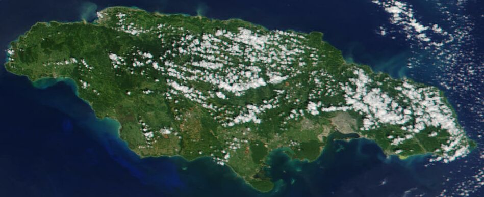
Satellite image of Jamaica in November 2001.Jacques Descloitres, MODIS Land Rapid Response Team, NASA/GSFC · Public domain · Commons
Jamaica is an island country in the Caribbean, covering 10,991 square kilometres (4,244 sq mi). It is the third-largest island in the Greater Antilles and the Caribbean, after Cuba and Hispaniola. Jamaica lies about 145 km (78 nmi) south of Cuba, 191 km (103 nmi) west of Hispaniola, and 215 km (116 nmi) southeast of the Cayman Islands. With 2.8 million people, Jamaica is the third-most populous Anglophone country in the Americas and the fourth-most populous country in the Caribbean. Kingston is the capital and largest city.
There is no archaeological evidence of any human presence on Jamaica until about 500 CE. A group known as the "Redware people" after their pottery arrived circa 600 CE, followed by the Taíno circa 800 CE, who most likely came from South America. They practised an agrarian and fishing economy and at their height are thought to have numbered some 60,000 people, grouped into around 200 villages headed by caciques (chiefs). The south coast was the most populated, especially around the area now known as Old Harbour.
The Jamaica Defence Force (JDF) is the small but professional military force of Jamaica. The JDF is based on the British military model with similar organisation, training, weapons and traditions. Once chosen, officer candidates are sent to one of several British or Canadian basic officer courses depending on the arm of service. Enlisted soldiers are given basic training at Up Park Camp or JDF Training Depot, Newcastle, both in St. Andrew. As with the British model, NCOs are given several levels of professional training as they rise up the ranks. Additional military schools are available for speciality training in Canada, the United States and the United Kingdom.
Read more
The JDF is directly descended from the British Army's West India Regiment, which was formed during the colonial era.
68.9% Christianity, 64.8% Protestantism, 4.1% other Christian, 21.3% no religion, 1.1% Rastafari, 6.5% other, 2.3% unanswered
Economy and Trade
Jamaica has a fully digital telephone communication system with a mobile penetration of over 95%.
Read more
The country's two mobile operators – FLOW Jamaica (formerly LIME, bMobile and Cable and Wireless Jamaica) and Digicel Jamaica have spent millions in network upgrades and expansion. The newest operator, Digicel was granted a licence in 2001 to operate mobile services in the newly liberalised telecom market that had once been the sole domain of the incumbent FLOW (then Cable and Wireless Jamaica) monopoly. Digicel opted for the more widely used GSM wireless system, while a past operator, Oceanic (which became Claro Jamaica and later merged with Digicel Jamaica in 2011) opted for the CDMA standard.
Kurzy měn - Jamajský dolar - JMDKurzycz, http://www.kurzy.cz · CC BY-SA 4.0 · Commons
Currency
Jamaican dollar, British West Indies dollar, Jamaican pound
Flag of JamaicaThe SVG code is valid. This vector image was created with Inkscape by SKopp, and then manually edited by Zscout370, Madden and others. · Public domain · Commons
Coat of arms of JamaicaWilliam Sancroft · Public domain · Commons
Achievements and Monuments
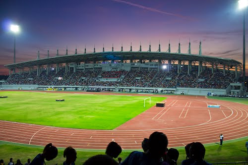
While the most popular local sport is cricket, on the international stage Jamaicans have tended to do particularly well at track and field athletics. A July 2024 analysis by The Economist ranked Jamaica number one in the world for Olympic medals won relative to GDP since 2000, highlighting the country's outsized impact in global athletics.
Read more
The country was one of the venues of 2007 Cricket World Cup and the West Indies cricket team is one of 12 ICC full member teams that participate in international Test cricket. The Jamaica national cricket team competes regionally, and also provides players for the West Indies team. Sabina Park is the only Test venue in the island, but the Greenfield Stadium is also used for cricket.
Since independence, Jamaica has consistently produced world-class athletes in track and field.
1963 CE – 2024 CE · Capital: Port of Spain · 6,177 km²
Pigeon Point beach, Tobago, Trinidad and Tobago, west Indies.Kp93 · CC BY-SA 3.0 · Commons
Trinidad and Tobago, officially the Republic of Trinidad and Tobago, is the southernmost archipelagic country in the Caribbean, comprising the main islands of Trinidad and Tobago, along with several smaller islets. The capital city is Port of Spain, while its largest and most populous municipality is Chaguanas. Trinidad and Tobago comprises the southernmost islands of the Caribbean eastern islands chain, and it is close to the continent of South America, being north to northeast of Venezuela and northwest of Guyana.
Trinidad and Tobago is a republic with a two-party system and a bicameral parliamentary system based on the Westminster System.
Read more
The head of state of Trinidad and Tobago is the president, a largely ceremonial role currently held by Christine Kangaloo. This position replaced that of the governor-general—who had represented the monarch of Trinidad and Tobago—when the country became a republic in 1976.
The head of government is the prime minister, currently Kamla Persad-Bissessar since May, 2025. On January 3, 2025, then-Prime Minister Keith Rowley announced his intention to demit office before the 2025 Trinidad and Tobago general election. He later confirmed on February 26 that he would officially resign on March 16. On January 6, 2025, Stuart Young was elected Prime Minister-designate by the Parliamentary Caucus of the People's National Movement to succeed Rowley.
The transport system in Trinidad and Tobago consists of a dense network of highways and roads across both major islands, ferries connecting Port of Spain with Scarborough and San Fernando, and international airports on both islands. The Uriah Butler Highway, Churchill Roosevelt Highway and the Sir Solomon Hochoy Highway links the island of Trinidad together, whereas the Claude Noel Highway is the only major highway in Tobago. Public transportation options on land are public buses, private taxis and minibuses. By sea, the options are inter-island ferries and inter-city water taxis.
Read more
The island of Trinidad is served by Piarco International Airport located in Piarco, which opened on 8 January 1931. Sitting at an elevation of 17.4 metres (57 ft) above sea level, it comprises an area of 680 hectares (1,700 acres) and has a runway of 3,200 metres (10,500 ft).
Trinidad and Tobago $1, $5, $10, $20, $50, and $100 banknotesCentral Bank of Trinidad and Tobago · Public domain · Commons
Currency
British West Indies dollar, Trinidad and Tobago dollar
Canadian Bank of Commerce, Trinidad, 1939, $5. ObverseMhryan7 · CC BY-SA 4.0 · Commons
Flag of Trinidad and TobagoSee File history, below, for details. · Public domain · Commons
Coat of arms of Trinidad and Tobago (2025)BaronJaguar · CC BY 4.0 · Commons
Achievements and Monuments
Diversity is also reflected the culinary culture, which bears witness to a variety of influences, including African, Indian, Chinese, Creole, European, Amerindian, Latin American, and North American. Street food is popular, and some examples are doubles, aloo pie, saheena, phoulourie, kachorie, baiganee, pies, accra, bake and shark, barbecue, souse, chow, black pudding, arepas, shawarma, and others.
Portrait of Elizabeth II (1926–2022)Donald McKague · Public domain · Commons
Antigua and Barbuda is an archipelagic country in the Caribbean composed of Antigua, Barbuda, and dozens of other small islands. Antigua and Barbuda has a total area of 440 km2 (170 sq mi), making it one of the smallest countries in the Caribbean. The country is mostly flat, with the highest points on Antigua being in the Shekerley Mountains and on Barbuda the Highlands. The country has a tropical savanna climate, with pockets of tropical monsoon in Antigua's southwest. Its most populated city is St. John's, followed by All Saints and Bolans. The sole settlement in Barbuda is Codrington.
Antigua and Barbuda is a unitary parliamentary democracy under a constitutional monarchy. The current Constitution of Antigua and Barbuda was adopted upon independence on 1 November 1981. This replaced the pre-independence constitution of the Associated State of Antigua, which did not thoroughly define the relationship between the two islands. The island of Barbuda maintains much autonomy, while the island of Antigua is directly governed by the national government.
Read more
The executive branch has two primary leaders. The Governor-General, currently Rodney Williams, exercises the functions of the Monarch of Antigua and Barbuda, in whom executive power is vested. The Governor-General serves at the pleasure of the Monarch, and usually serves a similar term to that of the Prime Minister.
Tourism dominates the economy, accounting for more than half of the gross domestic product (GDP). As a destination for the most affluent travelers, Antigua is well known for its extensive collection of five-star resorts. However, weaker tourist activity in lower and middle market segments since the beginning of the year 2000 has slowed the economy and put the government into a tight fiscal corner. Antigua and Barbuda has enacted policies to attract high-net-worth citizens and residents, such as abolishing personal income tax in 2016.
Read more
The provision of investment banking and financial services also constitutes a significant portion of the economy. Major international financial institutions such as the Royal Bank of Canada (RBC) and Scotiabank both maintain offices in Antigua.
1 cent of Eastern Caribbean StatesRobbie Sproule from Montreal, Canada · CC BY 2.0 · Commons
Currency
Eastern Caribbean dollar
Flag of Antigua and BarbudaOriginal: Sir Reginald Samuel Vector: David Benbennick · Public domain · Commons
Coat of arms of Antigua and BarbudaLadyofHats, based on a bitmap by Ralf Hartemink · Public domain · Commons
Achievements and Monuments
The music of Antigua and Barbuda has some African characteristics, with minimal influence from European music, but the music is distinct. Records of music in Antigua and Barbuda date back to Christopher Columbus' writings in 1493, when it was still home to Arawak and Carib people, still, very little research has been done on early music from the islands. African labourers are documented in history to have danced outside in the 1780s to the toombah (later tum tum), a drum adorned with tin and shell jingles, and the banjar (later bangoe, maybe related to the European banjo). Antigua's indigenous music, known as Benna, came into being after slavery was abolished. Benna uses a call-and-response format, and its audience is typically interested in obscene gossip and rumours.
Barbados is an island nation in the Caribbean Sea. It is part of the Lesser Antilles of the West Indies and is the southernmost and easternmost island of the Caribbean region. It lies on the boundary of the South American and Caribbean tectonic plates. Its capital and largest city is Bridgetown.
Inhabited by Kalinago people since the 13th century, and prior to that by other Indigenous peoples, the island was originally named Ichirouganaim.
Barbados has been an independent country since 30 November 1966. It functions as a parliamentary republic modelled on the British Westminster system. The head of state is the President of Barbados – presently Jeffrey Bostic – elected by the Parliament of Barbados for a term of four years, and advised on matters of the Barbadian state by the Prime Minister of Barbados, who is head of government. There are 30 representatives within the House of Assembly, the lower chamber of Parliament. In the Senate, the upper chamber of Parliament, there are 21 senators.
Read more
The Constitution of Barbados is the supreme law of the country. Legislation is passed by the Parliament of Barbados but does not have the force of law unless the President grants their assent to that law. The right to withhold assent is absolute and cannot be overridden by Parliament.
Although Barbados is about 34 km (21 mi) across at its widest point, a car journey from Six Cross Roads in St. Philip (south-east) to North Point in St. Lucy (north-central) can take one and a half hours or longer due to traffic. Barbados has half as many registered cars as citizens. In Barbados, drivers drive on the left side of the road.
Read more
Barbados is known for its many roundabouts. One famous roundabout is located east of Bridgetown and holds the Emancipation Statue of the slave Bussa.
Transport on the island is relatively convenient with "route taxis" called "ZRs" (pronounced "Zed-Rs") travelling to most points on the island. These small buses can at times be crowded, as passengers are generally never turned down regardless of the number. They will usually take the more scenic routes to destinations.
A Barbadian 100 Dollar bill with Barbadian coins on itGemini.skywalker · CC BY-SA 4.0 · Commons
Currency
Barbadian dollar
Kurzy měn - barbadoský dolar BBDKurzycz, http://www.kurzy.cz · CC BY-SA 4.0 · Commons
Flag of BarbadosUser:Denelson83 · Public domain · Commons
Coat of arms of Barbados (2)Neville C. Connell, director of the Barbados Museum · CC BY-SA 3.0 · Commons
Wars and Battles
Around the same time, fighting during the War of the Three Kingdoms and the Interregnum spilled over into Barbados and Barbadian territorial waters. The island was not involved in the war until after the execution of Charles I, when the island's government fell under the control of Royalists (ironically the Governor, Philip Bell, remaining loyal to Parliament while the Barbadian House of Assembly, under the influence of Humphrey Walrond, supported Charles II). To try to bring the recalcitrant colony to heel, the Commonwealth Parliament passed an act on 3 October 1650 prohibiting trade between England and Barbados, and because the island also traded with the Netherlands, further Navigation Acts were passed, prohibiting any but English vessels trading with Dutch colonies. These acts were a precursor to the First Anglo-Dutch War.
As in other Caribbean countries of British colonial heritage, cricket is very popular on the island. The West Indies cricket team usually includes several Barbadian players. In addition to several warm-up, group stage and few "Super Eight" matches, the country hosted the final of the 2007 Cricket World Cup and 2024 ICC Men's T20 World Cup.
Read more
In Track and Field, sprinter Obadele Thompson won a bronze medal in the 100m at the 2000 Summer Olympic Games. As of August 2022, he was the first Olympics medalist in the Barbados.
Basketball is an increasingly popular sport, played at school or college. The Barbados men's national team has additionally shown some international success, including a fifth-place finish in the 2006 Commonwealth Games.
Polo is very popular among the rich elite on the island and the "High-Goal" Apes Hill team is based at the St James's Club.
View from Sir Timothy's Hill, Saint Kitts. The Atlantic Ocean is to the left and the Caribbean Sea is to the right.Fred Hsu on en.wikipedia · CC BY-SA 3.0 · Commons
Saint Kitts, also known as Saint Christopher, is an island in the West Indies. The west side of the island borders the Caribbean Sea, and the eastern coast faces the Atlantic Ocean. Saint Kitts and the neighbouring island of Nevis constitute one country: the Federation of Saint Kitts and Nevis. Saint Kitts and Nevis are separated by a shallow 3-kilometre (2 mi) channel known as "The Narrows".
Saint Kitts became home to the first Caribbean British and French colonies in the mid-1620s.
Saint Kitts & Nevis uses the Eastern Caribbean dollar, which maintains a fixed exchange rate of 2.7-to-one with the United States dollar. The US dollar is almost as widely accepted on the island as the Eastern Caribbean dollar.
Read more
For hundreds of years, Saint Kitts operated as a sugar monoculture, but due to decreasing profitability, the government closed the industry in 2005. Tourism is a major and growing source of income to the island, although the number and density of resorts is less than on many other Caribbean islands. Transportation, non-sugar agriculture, manufacturing and construction are the other growing sectors of the economy.
Saint Kitts is dependent on tourism to drive its economy. Tourism has been increasing since 1978. In 2009, there were 587,479 arrivals to Saint Kitts compared to 379,473 in 2007, a growth of just under 40% in a two-year period.
View of the Lesser Antilles taken during ISS Expedition 6.Earth Science and Remote Sensing Unit, Lyndon B. Johnson Space Center · Public domain · Commons
Saint Vincent and the Grenadines, sometimes known simply as Saint Vincent, is an archipelagic country in the eastern Caribbean. It is located in the southeast Windward Islands of the Lesser Antilles, which lie in the West Indies, at the southern end of the eastern border between the Caribbean Sea and the Atlantic Ocean. To the north lies Saint Lucia, to the east is Barbados and Grenada lies to the south.
Spanning a land area of 389 km2 (150 sq mi), most of its territory consists of the northernmost island of Saint Vincent, which includes the capital and largest city, Kingstown.
Saint Vincent and the Grenadines is a parliamentary democracy and constitutional monarchy, with Charles III as King of Saint Vincent and the Grenadines. He does not reside in the islands and is represented as head of state in the country by the Governor-General of Saint Vincent and the Grenadines, currently Stanley John (since 5 January 2026).
Read more
The office of Governor-General has mostly ceremonial functions including the opening of the islands' House of Assembly and the appointment of various government officials. Control of the government rests with the elected Prime Minister and their cabinet. The current Prime Minister is Godwin Friday, elected in 2025.
The legislative branch of government is the unicameral House of Assembly of Saint Vincent and the Grenadines, seating 15 elected members representing single-member constituencies and six appointed members known as Senators.
Agriculture, dominated by banana production, is the most important sector of this lower-middle-income economy. The services sector, based mostly on a growing tourist industry, is also important. The government has been relatively unsuccessful at introducing new industries, and the unemployment rate remains high at 19.8% in the 1991 census to 15% in 2001. The continuing dependence on a single crop represents the biggest obstacle to the islands' development as tropical storms wiped out substantial portions of bananas in many years.
Read more
There is a small manufacturing sector and a small offshore financial sector serving international businesses; its secrecy laws have caused some international concern. There are increasing demands for international financial services like stock exchange and financial intermediaries financial activities in the country.
1 cent of Eastern Caribbean StatesRobbie Sproule from Montreal, Canada · CC BY 2.0 · Commons
Currency
Eastern Caribbean dollar
Flag of Saint Vincent and the GrenadinesNo machine-readable author provided. SKopp assumed (based on copyright claims). · Public domain · Commons
Coat of arms of Saint Vincent and the GrenadinesPrez001 · CC BY-SA 3.0 · Commons
Wars and Battles
The uneasy peace between the British and the Garifuna led to the Second Carib War, which lasted from 1795 to 1797. The Garifuna were led by paramount chief Joseph Chatoyer and supported by the French, notably Victor Hugues who was based on the island of Martinique. They were eventually defeated in 1797 by British forces under the command Sir Ralph Abercromby; a peace treaty agreement was made which resulted in almost 5,000 Garifuna being deported to Roatán, an island off the coast of Honduras, and to Belize and Baliceaux in the Grenadines.
Read more
The La Soufrière volcano erupted in 1812, resulting in considerable destruction.
The British abolished slavery in Saint Vincent (as well as in all other British West Indies colonies) in 1834, and an apprenticeship period followed which ended in 1838.
Cricket, association football, and athletics are most popular among men whereas netball is most popular among women. Basketball, volleyball, rugby and tennis are also very popular.
Read more
The country's prime football league is the NLA Premier League, which provides its national (association) football team with most players. A notable Vincentian footballer is Ezra Hendrickson, former national team captain who played at several Major League Soccer clubs in the United States and was head coach with the Chicago Fire FC from 2021–23.
The country regularly participates at the Caribbean Basketball Championship where a men's team and a women's team compete. Saint Vincent and the Grenadines also has its own national rugby union team which is ranked 84th in the world. Other notable sports played at the regional level include track and field.
Portrait of Elizabeth II (1926–2022)Donald McKague · Public domain · Commons
The Bahamas, officially the Commonwealth of The Bahamas, is an archipelagic country in the Caribbean located within the Lucayan Archipelago in the Atlantic Ocean. The country comprises 700 islands, and more than 2,500 cays in the Atlantic Ocean, located north of Cuba and north-west of the island of Hispaniola (split between the Dominican Republic and Haiti) and the Turks and Caicos Islands, southeast of the US state of Florida and east of the Florida Keys. The capital and largest city is Nassau on the island of New Providence.
The Bahamas is a parliamentary constitutional monarchy, with King Charles III, in his capacity as King of the Bahamas, as head of state represented locally by a governor-general. Political and legal traditions closely follow those of England and the Westminster system. Since gaining independence, the Bahamas has faced political challenges similar to those of other postcolonial island nations. Although the country has remained politically stable, it continues to address issues such as economic expansion, balancing party power, and improving government institutions. Researchers note that these trends are common across many small Caribbean island states. The Bahamas is a member of the Commonwealth of Nations and shares its head of state with the 14 other Commonwealth realms.
In terms of GDP per capita, the Bahamas is one of the wealthiest countries in the Americas. Its currency (the Bahamian dollar) is kept at a 1-to-1 peg with the US dollar. The International Monetary Fund's 2023 report states that the Bahamas has improved its financial stability since the pandemic. The country has increased its revenue and begun lowering its fiscal deficit, helped by the return of tourism and financial reforms. However, the report also warns that the Bahamas continues to face risks from global economic shifts, climate threats, and its dependence on imported goods.
Read more
The Bahamas relies heavily on tourism to generate most of its economic activity. Tourism as an industry accounts for about 70 per cent of the Bahamian GDP and provides jobs for about half of the country's workforce.
Flag of the BahamasGovernment of Bahamas · Public domain · Commons
Coat of arms of the BahamasAutor of SVG image: Ivangricenko · Public domain · Commons
Wars and Battles
Modern political development began after the Second World War. The first political parties were formed in the 1950s, split broadly along ethnic lines, with the United Bahamian Party (UBP) representing the English-descended Bahamians (known informally as the "Bay Street Boys") and the Progressive Liberal Party (PLP) representing the Black-Bahamian majority.
Read more
A new constitution granting the Bahamas internal autonomy went into effect on 7 January 1964, with Chief Minister Sir Roland Symonette of the UBP becoming the first premier. In 1967 Sir Lynden Pindling of the PLP became the first black premier of the Bahamian colony; in 1968 the title of the position was changed to prime minister. In 1968 Pindling announced that the Bahamas would seek full independence. A new constitution giving the Bahamas increased control over its own affairs was adopted in 1968.
Sport is a significant part of Bahamian culture. Sailing is the national sport and has been a part of the national culture for many years from its history of privateers and pirates to modern day yachting. Annually, there are about 35 annual sailing events in the Bahamas, divided into 18 senior regattas and 17 junior sailing competitions.
Read more
Cricket has been played in the Bahamas from 1846 and is the oldest sport played in the country today. The Bahamas Cricket Association was formed in 1936, and from the 1940s to the 1970s, cricket was played amongst many Bahamians. Bahamas is not a part of the West Indies Cricket Board, so players are not eligible to play for the West Indies cricket team.
1976 CE – 2024 CE · Capital: St. George's · 482 km²
Portrait of Elizabeth II (1926–2022)Donald McKague · Public domain · Commons
Grenada is an archipelagic country of the West Indies in the eastern Caribbean Sea. The southernmost of the Windward Islands, Grenada is directly south of Saint Vincent and the Grenadines and about 100 miles (160 km) north of Trinidad and the South American mainland.
Grenada consists of the island of Grenada itself, two smaller islands, Carriacou and Petite Martinique, and several small islands that lie to the north of the main island and are a part of the Grenadines. Its size is 344 square kilometres (133 sq mi), with an estimated population of 117,362 as of 2026.
Grenada is a unitary constitutional monarchy with Charles III as head of state, represented locally by a governor-general. Executive power lies with the head of government, the prime minister. The governor-general's role is mainly ceremonial, while the prime minister is usually the leader of the largest party in Parliament.
Read more
The Parliament of Grenada consists of a Senate (13 members) and a House of Representatives (15 members). The government and the opposition recommend appointments of senators to the governor-general, while the population elects representatives for five-year terms. Grenada operates a multi-party system, with the largest parties being the centre-right New National Party (NNP) and the centre-left National Democratic Congress (NDC).
In February 2013, the governing National Democratic Congress (NDC) lost the election.
96.6% Christianity, 48.8% Protestantism, 39.2% Catholicism, 8.6% other Christian, 1.3% Hinduism, 1.0% no religion, 0.7% Rastafari, 0.4% other
Economy and Trade
Grenada has a small economy in which tourism is the major foreign exchange earner. Major short-term concerns are the rising fiscal deficit and the deterioration in the external account balance. Grenada shares a common central bank and a common currency (the East Caribbean dollar) with seven other members of the Organisation of Eastern Caribbean States (OECS).
Read more
Grenada has suffered from a heavy external debt problem, with government debt service payments running at about 25% of total revenues in 2017; Grenada was listed as ninth from bottom in a study of 126 developing countries.
Island culture is heavily influenced by the African roots of most of the Grenadians, coupled with the country's long experience of colonial rule under the British. Although French influence on Grenadian culture is much less visible than in some other Caribbean islands, surnames and place names in French remain, and the everyday language is laced with French words and the local Creole or Patois. Stronger French influence is found in the well seasoned spicy food and styles of cooking similar to those found in New Orleans, and some French architecture has survived from the 1700s. Indian and Carib Amerindian influence is also seen, especially in the island's cuisine.
Read more
Oil down, a stew, is considered the national dish. The name refers to a dish cooked in coconut milk until all the milk is absorbed, leaving a bit of coconut oil in the bottom of the pot.
Island of Dominica in the Caribbean, taken from ISSNASA · Public domain · Commons
Dominica officially the Commonwealth of Dominica, is an island country in the Caribbean. It is part of the Windward Islands chain in the Lesser Antilles archipelago in the Caribbean Sea. The capital, Roseau, is located on the western side of the island. Dominica's closest neighbours are two constituent territories of the European Union, both overseas departments of France: Guadeloupe to the northwest and Martinique to the south-southeast. Dominica comprises a land area of 750 km2 (290 sq mi), and the highest point is Morne Diablotins, at 1,448 m (4,751 ft) in elevation.
Dominica is a parliamentary democracy within the Commonwealth of Nations. The capital is Roseau. Dominica is one of the Caribbean's few republics. The head of state is an indirectly elected president, while executive power rests with the cabinet, headed by the prime minister. The unicameral parliament consists of the 30-member House of Assembly, which consists of 21 directly elected members, and 9 senators who may either be appointed by the president or elected by the other members of the House of Assembly.
Read more
Unlike other former British colonies in the region, Dominica has never been a Commonwealth realm, having become a republic upon gaining its independence. Dominica is a full and participating member of the Caribbean Community (CARICOM) and the Organisation of Eastern Caribbean States (OECS).
Dominica offers an official and legally mandated economic citizenship to those seeking a valid second citizenship. The nationality law of Dominica authorises the government to waive the normal requirement of seven years of legal residence to acquire citizenship in exchange for an investment into their country's economy. The required contribution for a main applicant starts at US$100,000 through the Economic Diversification Fund. Alternatively, since 2014, applicants can make a US$200,000 minimum investment in pre-approved real estate from island exclusive resorts or global brands like Marriott, Kempinski or Hilton.
1 cent of Eastern Caribbean StatesRobbie Sproule from Montreal, Canada · CC BY 2.0 · Commons
Currency
Eastern Caribbean dollar
Flag of DominicaAlwin Bully · Public domain · Commons
Achievements and Monuments
Schooling in Dominica is mandatory up to secondary school. After pre-school, students attend primary school for six or seven years, and are admitted into secondary school on the basis of a Common Entrance Exam. After five years students take the Caribbean Secondary Education Certificate administered by the Caribbean Examination Council (a 15-member confederation of the Caribbean community (CARICOM)). The more advanced version of this examination, CAPE, can be taken upon completion of two years of community college. The island has its own Dominica State College, formerly named Clifton Dupigny Community College. Some Dominicans attend universities in Cuba on scholarships offered by its government; others go to the University of the West Indies or to universities in the UK, US or other countries.
Portrait of Elizabeth II (1926–2022)Donald McKague · Public domain · Commons
Saint Lucia (also written as St. Lucia) is an island country in the eastern and southern Caribbean. Part of the Windward Islands of the Lesser Antilles, it is located north/northeast of the island of Saint Vincent, northwest of Barbados and south of Martinique. It covers a land area of 617 km2 (238 sq mi) with an officially estimated population of over 184,100 people as of mid 2023. The nation's capital and largest city is Castries.
The first proven inhabitants of the island, the Arawaks, are believed to have been the first to settle on the island in 200–400 AD.
Like most Caribbean countries, Saint Lucia is a unitary state with a parliamentary system. It is a Commonwealth realm and a constitutional monarchy, with the current monarch being Charles III, who is represented on the island by a governor-general, currently Errol Charles. The prime minister (currently Philip J. Pierre) is the head of government, the head of the cabinet, and is normally the leader of the largest party in the House of Assembly. The house has 17 seats, with each member being elected via a plurality of votes in their constituency. The upper chamber of Parliament is the Senate which has 11 appointed members, the majority of which are appointed by the prime minister.
Saint Lucia is a Small Island Developing State, a designation similar to a developing country with a few substantial differences due to Saint Lucia's island nature. The service sector is the largest sector of the economy, accounting for 86.9% of GDP in 2020, followed by industrial and agricultural sectors at 10.9% and 2.2%, respectively.
Read more
Saint Lucia has been able to attract foreign business and investment due to its educated workforce and improvements in roads, communications, water supply, sewerage, and port facilities. Like most small islands, tourism and offshore banking are Saint Lucia's main sources of revenue. Agriculture, specifically the banana industry, was previously the largest sector of the economy, although its importance has declined significantly.
The culture of Saint Lucia has been influenced by African, East Indian, French, and English heritage. The main secondary language of the island is Saint Lucian Creole (Kwéyòl), a French-based creole spoken by most of the population. The island boasts the highest ratio of Nobel laureates produced with respect to the total population of any sovereign country in the world. Two winners have come from Saint Lucia: Sir Arthur Lewis, who won the Nobel Prize in Economics in 1979, and the poet Derek Walcott, who received the Nobel Prize in Literature in 1992.
Read more
Saint Lucia has two flower festivals, the La Rose festival, celebrated on 30 August, and the La Marguerite festival, celebrated on 17 October. Every summer, the island hosts a carnival as a way to present the country's culture and music. Annually, there are normally many festivals, most of them being music-related.
1983 CE – 2024 CE · Capital: Belmopan · 22,879 km²
Portrait of Elizabeth II (1926–2022)Donald McKague · Public domain · Commons
Belize is a country on the north-eastern coast of Central America. It is bordered by Mexico to the north, the Caribbean Sea to the east, and Guatemala to the west and south. It also shares a maritime boundary with Honduras to the southeast. Part of the Caribbean region, Belize is a member of the Caribbean Community (CARICOM) and the Commonwealth Caribbean, the historical British West Indies.
The Maya civilization spread into the area of Belize between 1500 BC and 300 AD and flourished until about 1200.
The Maya civilization emerged at least three millennia ago in the lowland area of the Yucatán Peninsula and the highlands to the south, in the area of present-day southeastern Mexico, Belize, Guatemala, and western Honduras. Many aspects of this culture persist in the area, despite nearly 500 years of European domination. Before about 2500 BC, some hunting and foraging bands settled in small farming villages; they domesticated crops such as corn, beans, squash, and chilli peppers.
Read more
A profusion of languages and subcultures developed within the Maya core culture. Between about 2500 BCE and 250 AD, the basic institutions of Maya civilization emerged.
Belize is a full participating member of the United Nations; the Commonwealth of Nations; the Organization of American States (OAS); the Central American Integration System (SICA); the Caribbean Community (CARICOM); the CARICOM Single Market and Economy (CSME); the Association of Caribbean States (ACS); and the Caribbean Court of Justice (CCJ), which currently serves as a final court of appeal for only Barbados, Belize, Dominica, Guyana and Saint Lucia. In 2001, the Caribbean Community heads of government voted on a measure declaring that the region should work towards replacing the UK's Judicial Committee of the Privy Council as final court of appeal with the Caribbean Court of Justice. It is still in the process of acceding to CARICOM treaties including the trade and single market treaties.
Belize has a small, mostly private enterprise economy that is based primarily on agriculture, agro-based industry, and merchandising, with tourism and construction recently assuming greater importance. The country is also a producer of industrial minerals, crude oil, and petroleum. As of 2017, oil production was 320 m3/d (2,000 bbl/d). In agriculture, sugar, like in colonial times, remains the chief crop, accounting for nearly half of exports, while the banana industry is the largest employer. In 2007 Belize became the world's third largest exporter of papaya.
Read more
The government of Belize faces important challenges to economic stability. Rapid action to improve tax collection has been promised, but a lack of progress in reining in spending could bring the exchange rate under pressure.
Belizean coins - reverseSzabó Mátyás (Egrian) · Public domain · Commons
Currency
Belize dollar
Flag of BelizeCaleb Moore · Public domain · Commons
Coat of arms of BelizeOriginal by Caleb Moore Extracted by Himasaram · Public domain · Commons
Achievements and Monuments
The major sports in Belize are football, basketball, volleyball and cycling, with smaller followings of boat racing, athletics, softball, cricket and rugby. Fishing is also popular in coastal areas of Belize.
Read more
The Cross Country Cycling Classic, also known as the "cross country" race or the Holy Saturday Cross Country Cycling Classic, is considered one of the most important Belize sports events. This one-day sports event is meant for amateur cyclists but has also gained worldwide popularity. The history of Cross Country Cycling Classic in Belize dates back to the period when Monrad Metzgen picked up the idea from a small village on the Northern Highway (now Phillip Goldson Highway). The people from this village used to cover long distances on their bicycles to attend the weekly game of cricket.
Modern States of Mesoamerica and the Caribbean: Frequently Asked Questions
Which states existed in Mesoamerica and the Caribbean in this period?
This page maps 33 states of Mesoamerica and the Caribbean founded between 1805 CE and 1983 CE: Empire of Haiti, Mexicans, First Mexican Empire, Federated Republic of Mexico, United Provinces of Central America, Centralist Mexico, Guatemala, Honduras, Los Altos, Republic of Costa Rica, Republic of El Salvador, Republic of Nicaragua and 21 more.
Which was the largest of the Modern States of Mesoamerica and the Caribbean?
First Mexican Empire had the largest mapped extent, about 3,628,049 km².
Which of the Modern States of Mesoamerica and the Caribbean lasted longest?
Guatemala lasted longest, 1840 CE – 2024 CE.
↑↓ to navigate↵ to open
12,754 Planetary Entities Indexed
We use Google Analytics cookies to understand which pages are useful. Necessary storage only keeps your theme and this choice on your device. Privacy policy