21 states of South America on one map, from 1811 CE to 2024 CE.The largest, Empire of Brazil, covered about 8,506,136 km²; the longest-lived, Paraguay, lasted 1811 CE – 2024 CE. Each has its own section below with its rulers, capitals, wars and pictures where the records hold them.
Felipe Restrepo Acosta · CC BY-SA 3.0 · CommonsAnonymousUnknown author · CC BY-SA 4.0 · CommonsJacques Descloitres, MODISRapid Response Team, NASA/GSFC · Public domain · Commonshttp://www.enciclopediadelecuador.com/historia-del-ecuador/batalla-camino-real/ &… · Public domain · Commons
Layers
HistoryChanges with the year
PlacesToday
Water
Land
1836 AD
Base map
An empire takes the map to its years and shows the borders.
Each state in its own colour. Move the timeline to see which existed in any year from 1811 to 2024; select a territory to read about it. Borders: Cliopatria / Seshat (CC BY 4.0).
Una hermosa vista de Bogotá en la nocheFelipe Restrepo Acosta · CC BY-SA 3.0 · Commons
The Viceroyalty of the New Kingdom of Granada (Spanish: Virreinato del Nuevo Reino de Granada [birejˈnato ðel ˈnweβo ˈrejno ðe ɣɾaˈnaða]), also called Viceroyalty of New Granada (Virreinato de la Nueva Granada) or Viceroyalty of Santa Fe, was the name given on 27 May 1717 to the jurisdiction of the Spanish Empire in northern South America, corresponding to modern Colombia, Ecuador, Panama and Venezuela.
Created in 1717 by King Felipe V, as part of a new territorial control policy, it was suspended in 1723 for financial problems.
In the 1778 census, New Granada had a population of around 1,280,000. Around 40% of the population were Indians, with around 500,000 people. The next largest group were free Mestizos and Africans, at around 400,000. Whites had close to 300,000. The smallest group, at around 70,000 people, were slaves. In the current territory of Colombia, it was estimated that the population was 826,550.
Paraguay, officially the Republic of Paraguay, is a landlocked country located in the central region of South America. It borders Bolivia to the northwest and north, Brazil to the northeast and east, and Argentina to the southeast, south, and west. Paraguay has access to the Atlantic Ocean via the Paraná–Paraguay Waterway, a system of navigable channels shared by five countries. The country is governed as a unitary presidential republic composed of a capital district and seventeen departments. Its capital and largest city is Asunción. It dates its independence from Spain to 1811.
The military of Paraguay consist of an army, navy (including naval aviation and marine corps) and air force. Paraguay's constitution establishes the president of Paraguay as commander-in-chief of the armed forces.
Read more
Paraguay has compulsory military service; all 18-year-old males, as well as 17-year-old males in the year of their 18th birthday, are liable for one year of active duty. The constitution allows for conscientious objection, a right regulated by Law N°4013/2010.
Paraguay has partnered with Argentina, Brazil, and the United States in regional anti-terrorism and anti-narcotics efforts.
For many years, the country's image was associated with the illicit trade in electronic products, weapons and drugs. However, this scenario began to change in the 2000s, with the rise of legalized businesses such as the production of soy, maize, beef, among others. Data from the Central Bank of Paraguay (BCP) showed that, in 2006, exports related to the triangulation trade (China-Paraguay-Brazil), treated by Brazil – in most cases – as smuggling and embezzlement, represented 22% of the country's GDP. In 2016, this percentage dropped to 12%. With higher tax collections through legalized employment, the country has been able to improve its infrastructure, which was precarious. Paraguay has an economic development policy based on exports and dependence on the Brazilian market prevails.
Hazte donante de médula (6558327347)Cristian Eslava from Sevilla, Spain · CC BY-SA 2.0 · Commons
Flag of ParaguayRepublica del Paraguay · Public domain · Commons
Coat of arms of ParaguayOriginal: User:Ysangkok · Public domain · Commons
Wars and Battles
On 12 October 1864, despite Paraguayan ultimatums, Brazil (allied with the Argentine Government under General Bartolomé Mitre and the rebellious Uruguayan colorados led by Gen. Venancio Flores) invaded the Republic of Uruguay in order to overthrow the government of that time (which was under the rule of the Blanco Party, an ally of López), The Paraguayans, in turn, led by the Marshal of the Republic Francisco Solano López, attacked Mato Grosso on 15 December 1864 and later declared war against Argentina on 23 March 1865. The Blanco Government was toppled and replaced by a Colorado government under General Venancio Flores on 22 February 1865. Afterward, the Argentine Republic, the Empire of Brazil and the Republic of Uruguay signed the secret Treaty of the Triple Alliance against the Paraguayan Government on 1 May 1865.
Paraguay's cultural heritage can be traced to the extensive intermarriage between the original male Spaniard settlers and indigenous Guaraní women. Modern historians, however, characterise this process as one shaped largely by sexual and economic coercion rather than voluntary union, rooted in the colonial practices of the cuñadazgo and the rancheadas. Their culture is highly influenced by various European countries, including Spain. Therefore, the Paraguayan culture is a fusion of two cultures and traditions: one European, the other, Southern Guaraní. More than 93% of Paraguayans are mestizos, making Paraguay one of the most homogeneous countries in Latin America. A characteristic of this cultural fusion is the extensive bilingualism present to this day: more than 80% of Paraguayans speak both Spanish and the indigenous language, Guaraní.
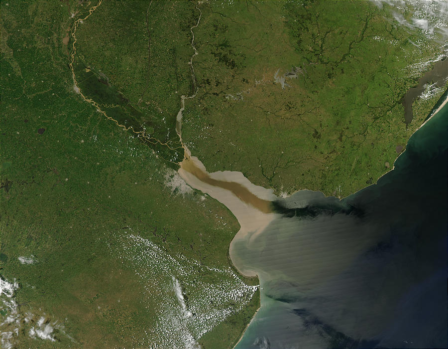
Satellite photo of the River PlateJacques Descloitres, MODISRapid Response Team, NASA/GSFC · Public domain · Commons
The Río de la Plata (Spanish pronunciation: [ˈri.o ðe la ˈplata]; lit. 'River of Silver'), also called the River Plate or La Plata River in English, is the estuary formed by the confluence of the Uruguay River and the Paraná River at Punta Gorda. It empties into the Atlantic Ocean and forms a funnel-shaped indentation on the southeastern coastline of South America. Depending on the geographer, the Río de la Plata may be considered a river, an estuary, a gulf, or a marginal sea. If considered a river, it is the widest in the world, with a maximum width of 220 kilometres (140 mi).
During the Cisplatine War, the Río de la Plata was blockaded by the Imperial Brazilian Navy, aiming to cripple Argentine finances and resupply their positions in Colonia del Sacramento and Montevideo. Squadrons of the newly independent United Provinces of the River Plate, led by the Irish-Argentine admiral William Brown attempted to break the blockade despite numerical inferiority.
Battle of Camino Reallabel QS:Les,"Batalla de Camino Real"label QS:Len,"Battle of Camino Real"http://www.enciclopediadelecuador.com/historia-del-ecuador/batalla-camino-real/ &… · Public domain · Commons
The Ecuadorian War of Independence, part of the Spanish American wars of independence of the early 19th century, was fought from 1809 to 1822 between Spain and several South American armies over control of the Real Audiencia of Quito, a Spanish colonial jurisdiction which later became the modern Republic of Ecuador. The war ended with the defeat of the Spanish forces at the Battle of Pichincha on May 24, 1822, which brought about the independence of all the lands of the Real Audiencia of Quito.
The military campaign for the independence of the territory now known as Ecuador began after nearly three hundred years of Spanish colonization. Ecuador's capital, Quito, was a city of around ten thousand inhabitants. There, on August 10, 1809, came one of the first calls in Latin America for independence from Spain, led by the city's criollos, including Carlos de Montúfar and Bishop José Cuero y Caicedo.
Read more
The short-lived State of Quito was suppressed by Juan de Sámano in the Battle of Ibarra (1812).
For the next 7 years, Ecuador remained firmly under Spanish control, until the wars of independence in South America turned decisively against them, when Simón Bolívar's victory at the Battle of Boyacá on August 7, 1819 sealed the independence of the former Viceroyalty of New Granada.
1812 CE – 2024 CE · Capital: Santiago · 817,411 km²
Amanece en el Macizo Paine. Parque Nacional Torres del Paine, Región de Magallanes, Chile.Natalia Reyes Escobar · CC BY-SA 4.0 · Commons
Chile, officially the Republic of Chile, is a country in the Southern Cone of southwestern South America. It is the southernmost country in the world and the closest to Antarctica, extending along a narrow strip of land between the Andes Mountains and the Pacific Ocean. According to the 2024 census, Chile had an enumerated population of 18.5 million. The country covers a territorial area of 756,102 square kilometers (291,933 sq mi), sharing borders with Peru to the north, Bolivia to the northeast, Argentina to the east, and the Drake Passage to the south.
Stone tool evidence indicates humans sporadically frequented the Monte Verde valley area as far back as 18,500 years ago. About 10,000 years ago, migrating Indigenous peoples settled in fertile valleys and coastal areas of what is present-day Chile. Settlement sites from very early human habitation include Monte Verde, Cueva del Milodón and the Pali-Aike Crater's lava tube.
Read more
The Incas briefly extended their empire into what is now northern Chile, but the Mapuche (or "Araucanians", as they were known by the Spaniards) successfully resisted many attempts by the Inca Empire to subjugate them, despite their lack of state organization, fighting against the Sapa Inca Topa Inca Yupanqui and his army; the result of the bloody three-day Battle of the Maule was that the Inca conquest of Chilean territory ended at the Maule river.
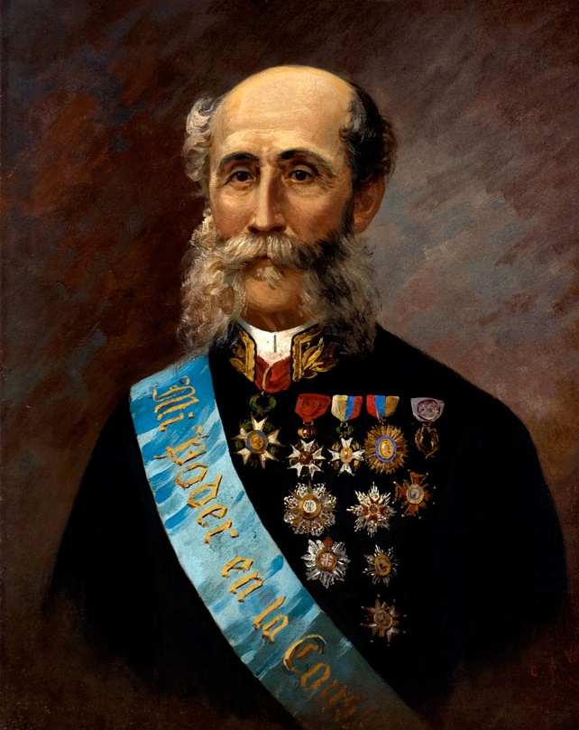
Federico Errázuriz Echaurren1896–1901 CEFederico_Errázuriz_Echaurren_asume_como_parlamentario.jpg: Biblioteca del Congreso Nacional de Chile derivative work: Rec79 (talk) · CC BY 3.0 cl · Commons
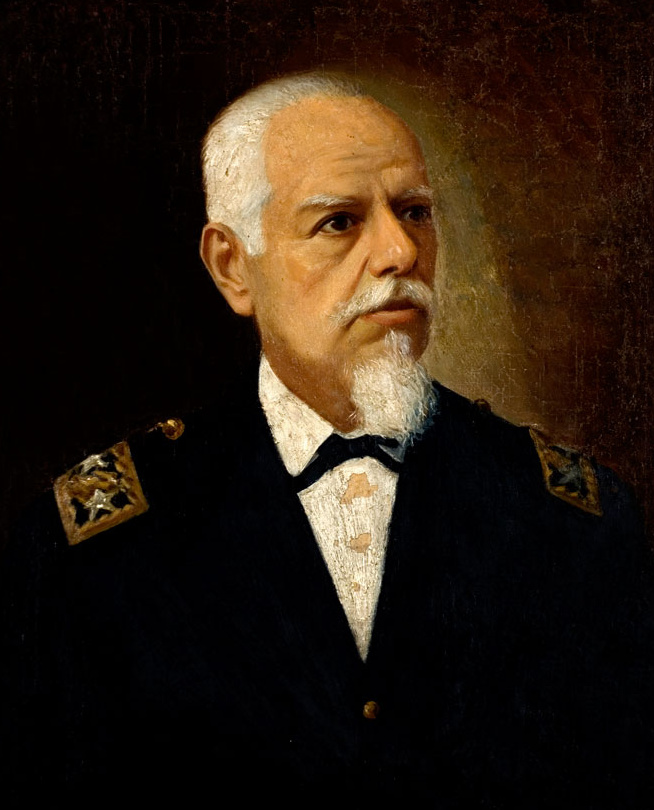
Germán Riesco1901–1906 CERetrato del pintor Cosme San Martin Lagunas (1850-1906). Colección del Museo Histórico Nacional. · Public domain · Commons
The current Constitution of Chile was drafted by Jaime Guzmán in 1980 and subsequently approved via a national plebiscite—regarded as "highly irregular" by some observers—in September of that year, under the military dictatorship of Augusto Pinochet. It entered into force in March 1981. After Pinochet's defeat in the 1988 plebiscite, the constitution was amended to ease provisions for future amendments to the Constitution. In September 2005, President Ricardo Lagos signed into law several constitutional amendments passed by Congress. These include eliminating the positions of appointed senators and senators for life, granting the President authority to remove the commanders-in-chief of the armed forces, and reducing the presidential term from six to four years.
The Central Bank of Chile in Santiago serves as the central bank for the country. The Chilean currency is the Chilean peso (CLP). Chile is one of South America's most stable and prosperous nations, leading Latin American nations in human development, competitiveness, globalization, economic freedom, and low perception of corruption. Since July 2013, Chile is considered by the World Bank as a "high-income economy".
Read more
The think tank The Heritage Foundation states that Chile has the highest degree of economic freedom in South America (ranking 22nd worldwide), owing to its independent and efficient judicial system and prudent public finance management. In May 2010 Chile became the first South American country to join the OECD. In 2006, Chile became the country with the highest nominal GDP per capita in Latin America.
Chile's most popular sport is association football. Chile has appeared in nine FIFA World Cups which includes hosting the 1962 FIFA World Cup where the national football team finished third. Other results achieved by the national football team include two Copa América titles (2015 and 2016), two runners-up positions, one silver and two bronze medals at the Pan American Games, a bronze medal at the 2000 Summer Olympics and two third places finishes in the FIFA under-17 and under-20 youth tournaments. The top league in the Chilean football league system is the Chilean Primera División, which is named by the IFFHS as the ninth strongest national football league in the world.
Read more
The main football clubs are Colo-Colo, Universidad de Chile and Universidad Católica.
Retrato oficial de José Antonio Kast Rist, en su calidad de presidente de la República de Chile para el período 2026–2030.Unknown authorUnknown author · CC BY 3.0 cl · Commons
Ended
2024 CE
Last recorded ruler
José Antonio Kast
Cundinamarca
1814 CE – 1814 CE · 223,335 km²
Cundinamarca is mapped in the atlas for 1814 CE – 1814 CE, with a peak mapped extent of about 223,335 km².
Federal League
1814 CE – 1819 CE · Capital: (provisory), Montevideo · 604,813 km²
The Federal League (Spanish: Liga Federal), also known as the League of the Free Peoples (Liga de los Pueblos Libres), was a short lived confederation of provinces located in South America. From 1815 to 1820 it tried to establish a confederal organization for the State that was emerging from the May Revolution in the war of independence against the Spanish Empire in part of what is now Uruguay, Argentina and Brazil.
The constant growth of influence and prestige of the Federal League frightened Buenos Aires (due to its federalism) and Portugal (because of its republicanism), and in August, 1816 the latter invaded the Eastern Province with the intention of destroying the protector Artigas and his revolution.
Read more
The Portuguese forces, led by Carlos Frederico Lecor, thanks to his numerical and material superiority, conquered the Eastern Province and took Montevideo on January 20, 1817, but the struggle continued for three long years in the countryside. Infuriated by Buenos Aires's passivity, Artigas declared war on the Supreme Directorship at the same time that he faced the Portuguese with armies that were being decimated by successive defeats. Without resources and without suitable men for the struggle, Artigas finally retreated to Entre Ríos Province, across the Uruguay River.
The Netherlands Antilles (Dutch: Nederlandse Antillen, pronounced [ˈneːdərlɑntsə ʔɑnˈtɪlə(n)]; Papiamento: Antias Hulandes), also known as the Dutch Antilles, was a constituent Caribbean country of the Kingdom of the Netherlands consisting of the islands of Saba, Sint Eustatius, and Sint Maarten in the Lesser Antilles, and Aruba, Bonaire, and Curaçao in the Leeward Antilles.
those islands that have the status of special municipality of the Netherlands alone, as distinct from the Kingdom in its entirety.
Read more
There are also several smaller islands, like Klein Curaçao and Klein Bonaire, that belong to one of the island countries or special municipalities.
There are three Caribbean islands that are countries (Dutch: landen) within the Kingdom of the Netherlands: Aruba, Curaçao, and Sint Maarten. (The Netherlands is the fourth constituent country in the Kingdom of the Netherlands.)
Sint Maarten covers approximately 40% of the island of Saint Martin; the remaining northern part of the island – the Collectivity of Saint Martin – is an overseas territory of France.
There are three Caribbean islands that are special municipalities of the Netherlands alone: Bonaire, Sint Eustatius, and Saba.
Tourism, petroleum transshipment and oil refinement (on Curaçao), as well as offshore finance were the mainstays of this small economy, which was closely tied to the outside world. The islands enjoyed a high per capita income and a well-developed infrastructure as compared with other countries in the region.
Read more
Almost all consumer and capital goods were imported, with Venezuela, the United States, and Mexico being the major suppliers, as well as the Dutch government which supports the islands with substantial development aid. Poor soils and inadequate water supplies hampered the development of agriculture. The Antillean guilder had a fixed exchange rate with the United States dollar of 1.79:1.
Flag of the Netherlands Antilles (1986–2010)Unknown author · Public domain · Commons
Coat of arms of the Netherlands Antilles (1986-2010)Thommy · Public domain · Commons
Achievements and Monuments
The origins of the population and location of the islands gave the Netherlands Antilles a mixed culture.
Read more
Tourism and overwhelming media presence from the United States increased the regional United States influence. On all the islands, the holiday of Carnival had become an important event after its importation from other Caribbean and Latin American countries in the 1960s. Festivities included "jump-up" parades with beautifully colored costumes, floats, and live bands as well as beauty contests and other competitions. Carnival on the islands also included a middle-of-the-night j'ouvert (juvé) parade that ended at sunrise with the burning of a straw King Momo, cleansing the island of sins and bad luck.
Of the five islands, Sint Maarten and Curaçao voted for status aparte, Saba and Bonaire voted for closer ties with the Netherlands, and Sint Eustatius voted to stay within the Netherlands Antilles.
Read more
On 26 November 2005, a Round Table Conference (RTC) was held between the governments of the Netherlands, Aruba, the Netherlands Antilles, and each island in the Netherlands Antilles. The final statement to emerge from the RTC stated that autonomy for Curaçao and Sint Maarten, plus a new status for Bonaire, Sint Eustatius, and Saba (BES) would come into effect by 1 July 2007. On 12 October 2006, the Netherlands reached an agreement with Bonaire, Sint Eustatius, and Saba: this agreement would make these islands special municipalities.
1822 CE – 1889 CE · Capital: Rio de Janeiro · 8,506,136 km²
Pedro I of Brazillabel QS:Len,"Pedro I of Brazil"label QS:Lpt,"D. Pedro I"Simplício Rodrigues de Sá · Public domain · Commons
The Empire of Brazil (Portuguese: Império do Brasil) was a 19th-century state that broadly comprised the territories which form modern Brazil and Uruguay until the latter achieved independence in 1828. The empire's government was a representative parliamentary constitutional monarchy under the rule of Emperors Pedro I and his son Pedro II.
The territory which would come to be known as Brazil was claimed by Portugal on 22 April 1500, when the navigator Pedro Álvares Cabral landed on its coast. Permanent settlement followed in 1532, and for the next 300 years the Portuguese slowly expanded westwards until they had reached nearly all of the borders of modern Brazil. In 1808, the army of French Emperor Napoleon I invaded Portugal, forcing the Portuguese royal family—the House of Braganza, a branch of the thousand-year-old Capetian dynasty—into exile. They re-established themselves in the Brazilian city of Rio de Janeiro, which became the unofficial seat of the Portuguese Empire.
Read more
In 1815, the Portuguese crown prince Dom John (later Dom John VI), acting as regent, created the United Kingdom of Portugal, Brazil and the Algarves, which raised the status of Brazil from colony to kingdom.
When enacted in 1824, the Imperial Constitution created the Conselho Geral de Província (Provincial General Council), the legislature of the provinces. This council was composed of either 21 or 13 elected members, depending on the size of a province's population. All "resolutions" (laws) created by the councils required approval by the General Assembly, with no right of appeal. Provincial Councils also had no authority to raise revenues, and their budgets had to be debated and ratified by the General Assembly. Provinces had no autonomy and were entirely subordinate to the national government as the country was a unitary state.
Read more
With the 1834 constitutional amendment known as the Additional Act, Provincial General Councils were supplanted by the Assembleias Legislativas Provinciais (Provincial Legislative Assemblies).
Brazil's international trade reached a total value of Rs 79.000:000$000 between 1834 and 1839. This continued to increase every year until it reached Rs 472.000:000$000 between 1886 and 1887: an annual growth rate of 3.88% since 1839. The absolute value of exports from the Empire in 1850 was the highest in Latin America, and triple that of Argentina which was in fourth place. Brazil would keep its high standing in exports and general economic growth until the end of the monarchy. Brazilian economic expansion, especially after 1850, compared well with that of the United States and European nations. The national tax revenue amounted to Rs 11.795:000$000 in 1831 and rose to Rs 160.840:000$000 in 1889. By 1858, national tax revenues ranked as the eighth-largest in the world. Imperial Brazil was, despite its progress, a country where wealth was very unequally distributed.
Cédula de 500 réis, emitida pela Casa da Moeda no Período Imperial. Acervo do Museu Paulista.Casa da Moeda · Public domain · Commons
Currency
Brazilian réis
80 Reismünze, Brasilien, 1826, mit Gegenstempel "20"; Schön/Cartier, Weltmünzkatalog 19. Jahrhundert, Brasilien Nr. 105HJunghans · CC BY-SA 3.0 · Commons
Flag of Brazil (1853-1889)This vector image includes elements that have been taken or adapted from this file: · Public domain · Commons
Coat of arms of the Empire of BrazilGusthavum · CC BY 3.0 · Commons
Wars and Battles
This period of calm came to an end in 1863, when the British consul in Rio de Janeiro nearly sparked a war by issuing an abusive ultimatum to Brazil in response to two minor incidents (see Christie Question). The Brazilian government refused to yield, and the consul issued orders for British warships to capture Brazilian merchant vessels as indemnity. Brazil prepared itself for the imminent conflict, and coastal defenses were given permission to fire upon any British warship that tried to capture Brazilian merchant ships. The Brazilian government then severed diplomatic ties with Britain in June 1863.
Read more
As war with the British Empire loomed, Brazil had to turn its attention to its southern frontiers. Another civil war had begun in Uruguay which pitted its political parties against one another.
In the first years after independence, Brazilian literature was still heavily influenced by Portuguese literature and its predominant Neoclassical style. In 1837, Gonçalves de Magalhães published the first work of Romanticism in Brazil, beginning a new era in the nation. The next year, 1838, saw the first play performed by Brazilians with a national theme, which marked the birth of Brazilian theater. Until then themes were often based on European works even if not performed by foreign actors. Romanticism at that time was regarded as the literary style that best fitted Brazilian literature, which could reveal its uniqueness when compared to foreign literature.
The nation enjoyed considerable international prestige during the final years of the Empire and had become an emerging power in the international arena. While Pedro II was receiving medical treatment in Europe, the parliament passed, and Princess Isabel signed on 13 May 1888, the Golden Law, which completely abolished slavery in Brazil. Predictions of economic and labor disruption caused by the abolition of slavery proved to be unfounded. Nonetheless, the end of slavery was the final blow to any remaining belief in the crown's neutrality, and this resulted in an explicit shift of support to Republicanism by the ultraconservatives—themselves backed by rich and powerful coffee farmers who held great political, economic and social power in the country.
1822 CE – 1833 CE · Capital: Bogotá · 4,322,815 km²
Posthumous portrait of Simón Bolívar by Colombian painter Ricardo Acevedo Bernal, 1922.Ricardo Acevedo Bernal · Public domain · Commons
Gran Colombia (Spanish pronunciation: [ˈɡɾaŋ koˈlombja], "Great Colombia"), also known as Greater Colombia and officially the Republic of Colombia (Spanish: República de Colombia), was the Colombian state that encompassed much of northern South America and parts of Central America from 1819 to 1831. It included present-day Colombia, mainland Ecuador, Panama, Venezuela, parts of northern Peru, northwestern Brazil, and claimed the Essequibo region.
Before a new constitution could be written by the 1821 Congress of Cúcuta, the 1819 Congress of Angostura appointed Bolívar and Santander president and vice president, respectively. Under the Constitution of Cúcuta, the country was divided into twelve departments, each governed by an intendant. Departments were further divided into thirty-six provinces, each headed by a governor, who had overlapping powers with the intendant. Military affairs at the department level were overseen by a commandant general, who could also be the intendant. The central government appointed all three offices. The central government, which temporarily was to reside in Bogotá, consisted of a presidency, a bicameral congress, and a high court (the Alta Corte).
Read more
The president was the head of the executive branch of both the central and local governments.
In 1821 Colombia was by then a republic and issued it's own "piece of eight" distictly different from the Spanish version of Spain's Ferdinand VII's issues of the same year.Jerry "Woody" from Edmonton, Canada · CC BY-SA 2.0 · Commons
On 3 June 1828, Bolívar declared war on Peru over Gran Colombian claims on the Peruvian territories of Jaén and Maynas. The war ended in the Treaty of Guayaquil, which was signed on 22 September 1829 and went into effect on 27 October 1829.
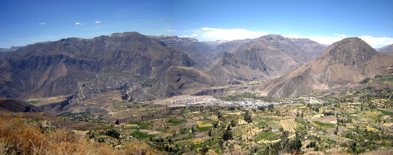
Cuarentena Lima (19 de marzo 2)Ministerio de Defensa del Perú · CC BY 2.0 · Commons
Peru, officially the Republic of Peru, is a country in western South America. It is bordered to the north by Ecuador and Colombia, to the east by Brazil, to the southeast by Bolivia, to the south by Chile, and to the south and west by the Pacific Ocean. Peru is a megadiverse country, with habitats ranging from the arid plains of the Pacific coastal region in the west, to the peaks of the Andes mountains extending from the north to the southeast of the country, to the tropical Amazon basin rainforest in the east with the Amazon River.
The earliest evidences of human presence in Peruvian territory have been dated to approximately 12,500 BCE in the Huaca Prieta settlement. Andean societies were based on agriculture, using techniques such as irrigation and terracing; camelid husbandry and fishing were also important. Organization relied on reciprocity and redistribution because these societies had no notion of market or money. The oldest known complex society in Peru, the Caral-Supe civilization, flourished along the coast of the Pacific Ocean between 3,000 and 1,800 BCE. These early developments were followed by archaeological cultures that developed mostly around the coastal and Andean regions throughout Peru. The Cupisnique culture which flourished from around 1000 to 200 BCE along what is now Peru's Pacific coast was an example of early pre-Inca culture.
Peru is a unitary semi-presidential republic with a multi-party system. The country has maintained a liberal democratic system under its 1993 constitution, which replaced a constitution that leaned the government to a federation to authorize more power to the president. It is also a unitary republic, in which the central government holds the most power and can create administrative divisions.
Read more
Judiciary: the Supreme Court of Peru, also known as the Royal Audencia of Lima, composed of 18 justices including a supreme justice, along with 28 superior courts, 195 trial courts, and 1,838 district courts.
Under its constitution, the president of Peru is both head of state and government and is elected to a five-year term without immediate reelection. The president appoints ministers who oversee the 18 ministries of the state, including the prime minister, into the Cabinet.
Peru's economy is the 46th largest in the world (ranked by Purchasing Power Parity (PPP)). The World Bank classifies its income level as upper middle. Peru was, as of 2011, one of the world's fastest-growing economies owing to an economic boom experienced since the 2000s. However, by 2026, following the conclusion of the commodity boom in 2014, Peru experienced a substantial deceleration in its per capita GDP growth. It has an above-average Human Development Index (HDI) of 0.794 (as of 2023), which has been steadily improving over the years. Historically, the country's economic performance has been tied to exports, which provide hard currency to finance imports and external debt payments. Although they have provided substantial revenue, self-sustained growth and a more egalitarian distribution of income have proven elusive.
Perú S/ 1 1995 - Centenario del Nacimiento de Véctor Raúl Haya del la TorreBennoBu · CC BY-SA 4.0 · Commons
Currency
Nuevo sol, Peruvian inti
BANCO CENTRAL DE RESERVA ACUÑÓ MONEDA CONMEMORATIVA POR 100 AÑOS DE JOSÉ ABELARDO QUIÑONES (13977985173)Galeria del Ministerio de Defensa del Perú · CC BY 2.0 · Commons
Flag of PeruDavid Benbennick · Public domain · Commons
Escudo nacional del PerúUnknown author · Public domain · Commons
Wars and Battles
Atahualpa (or Atahuallpa), the last Sapa Inca, became emperor when he defeated and executed his older half-brother Huáscar in a civil war sparked by the death of their father, Inca Huayna Capac. In December 1532, a party of conquistadors (supported by the Chankas, Huancas, Cañaris and Chachapoyas as Indian auxiliaries) led by Francisco Pizarro defeated and captured the Inca Emperor Atahualpa in the Battle of Cajamarca. After years of preliminary exploration and military conflicts, it was the first step in a long campaign that took decades of fighting but ended in Spanish victory and colonization of the region known as the Viceroyalty of Peru with its capital at Lima, which was then known as La Ciudad de los Reyes (The City of Kings).
The idea of sport dates back to the arrival of the Spanish in the 16th century, though many games and other native forms of entertainment predated the colonial era. More recently, the American ideology of physical education linked to commercialization has had widespread appeal. Sports in the country are divided into several sports federations (one for each sports practice) that are under the tutelage of the highest state entity to regulate their practice, the Peruvian Sports Institute (IPD). Most of the sports federations are based in the Villa Deportiva Nacional in Lima. Peru's largest stadium is Estadio Monumental "U" which has a capacity of over 80,000, making it the second largest stadium in South America. The country's national stadium is the Estadio Nacional.
Keiko Fujimori, septiembre de 2026Ministerio de la Producción · Public domain · Commons
Ended
2024 CE
Last recorded ruler
José María Balcázar
Bolivia
1825 CE – 2024 CE · Capital: Sucre · 1,815,659 km²
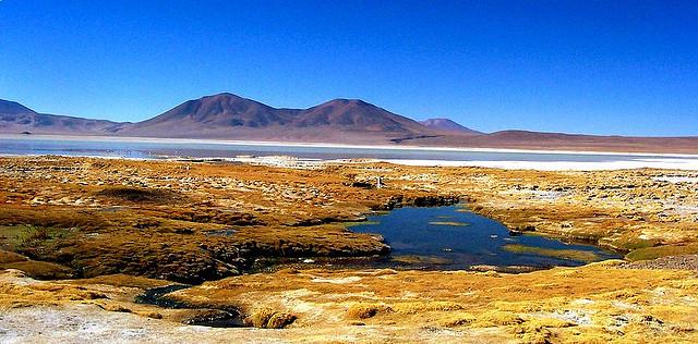
Laguna Chiar Khota, Cordillera Real, Bolivien 2013Albert Backer · CC BY-SA 3.0 · Commons
Bolivia, officially the Plurinational State of Bolivia, is a landlocked country located in central South America. Its geography primarily consists of an Andean region to the west and tropical lowlands to the east and north. The country has a diverse environment, including the vast Amazonian plain, the Gran Chaco, temperate valleys, the high-altitude Altiplano plateau, snow-capped peaks, and mountains, encompassing a wide range of climates and biomes across its regions and cities. It includes part of the Pantanal, the largest tropical wetland in the world, along its eastern border.
Bolivia has been governed by democratically elected governments since 1982; prior to that, it was governed by various dictatorships. Presidents Hernán Siles Zuazo (1982–1985) and Víctor Paz Estenssoro (1985–1989) began a tradition of ceding power peacefully which has continued, although three presidents have stepped down in the face of extraordinary circumstances: Gonzalo Sánchez de Lozada in 2003, Carlos Mesa in 2005, and Evo Morales in 2019.
Read more
Bolivia's multiparty democracy has seen a wide variety of parties in the presidency and parliament, although the Revolutionary Nationalist Movement, Nationalist Democratic Action, and the Revolutionary Left Movement predominated from 1985 to 2005. On 11 November 2019, all senior governmental positions were vacated following the resignation of Evo Morales and his government.
Spanish, Quechua, Aymara, Guarani, Other indigenous languages
Economy and Trade
Agriculture is less relevant in the GDP compared to the rest of Latin America. The country produces close to 10 million tons of sugarcane per year and is the 10th largest producer of soybean in the world. It also has considerable yields of maize, potato, sorghum, banana, rice, and wheat. The largest exports are based on soy (soybean meal and soybean oil). The culture of soy was brought by Brazilians to the country: in 2006, almost 50% of soy producers in Bolivia were people from Brazil or descendants of Brazilians. The first Brazilian producers began to arrive in the 1990s. Before that, there was a lot of land that was not used or where only subsistence agriculture was practiced. The most lucrative agricultural product continues to be coca, of which Bolivia is the world's third largest cultivator.
Kurzy měn - BOB bolivijský bolivianoKurzycz, http://www.kurzy.cz · CC BY-SA 4.0 · Commons
Flag of BoliviaSee file history' below for details. · Public domain · Commons
Escudo de BoliviaSee File history, below, for details. · Public domain · Commons
Wars and Battles
The struggle for independence started in Chuquisaca (present-day Sucre) on 25 May 1809, known as the first cry of freedom in Latin America, which was followed by the La Paz revolution on 16 July 1809. The La Paz revolution marked a complete split with the Spanish government, while the Chuquisaca Revolution established a local independent junta in the name of the Spanish king deposed by Napoleon Bonaparte. Both revolutions were short-lived and defeated by the Spanish authorities in the Viceroyalty of the Rio de La Plata, but the following year the Spanish American wars of independence raged across the continent.
Read more
Bolivia was captured and recaptured many times during the war by the royalists and patriots. Buenos Aires sent three military campaigns, all of which were defeated, and eventually limited itself to protecting the national borders at Salta.
Bolivian culture has been heavily influenced by the Spanish, the Aymara, and the Quechua, as well as the popular cultures of Latin America as a whole. The cultural development is divided into three distinct periods: precolumbian, colonial, and republican. Important archaeological ruins, gold and silver ornaments, stone monuments, ceramics, and weavings remain from several important pre-Columbian cultures. Major ruins include Tiwanaku, El Fuerte de Samaipata, Inkallaqta and Iskanwaya. The country abounds in other sites that are difficult to reach and have seen little archaeological exploration.
Read more
The Spanish brought their own tradition of religious art which, in the hands of local native, mestizo and some criollo builders and artisans, developed into a rich and distinctive style of architecture, painting, and sculpture known as Andean Baroque.
28.01.2026 - Presidente da República, Luiz Inácio Lula da Silva, durante reunião bilateral com o Presidente da Bolívia, Rodrigo Paz. Centro de Convenções do Panamá. Cidade do Panamá - Panamá Foto: Ricardo Stuckert / PRLula Oficial · CC BY-SA 4.0 · Commons
Uruguay, officially the Oriental Republic of Uruguay, is a country in southeastern South America. It shares borders with Argentina to its west and southwest and Brazil to its north and northeast, while bordering the Río de la Plata to the south and the Atlantic Ocean to the southeast. It is part of the Southern Cone region of South America. Uruguay covers an area of approximately 176,215 square kilometers (68,037 sq mi). It has a population of almost 3.5 million people, of whom nearly 2 million live in the metropolitan area of its capital and largest city, Montevideo.
Human presence in the region now known as Uruguay dates back approximately 13,000 years, with evidence of hunter-gatherer communities. It is estimated that at the time of the first contact with Europeans in the 16th century, there were about 9,000 Charrúa and 6,000 Chaná and some Guaraní island settlements.
Read more
There is an extensive archaeological collection of man-made tumuli known as "Cerritos de Indios" in the eastern part of the country, some of them dating back to 5,000 years ago. Very little is known about the people who built them as they left no written record, but evidence has been found in place of indigenous agriculture and of extinct indigenous woolly dogs.
Uruguay is a representative democratic republic with a presidential system. The Uruguayan Constitution establishes a separation of powers intended to provide a system of checks and balances and members of government are elected for a five-year term by a universal suffrage system. Uruguay is a unitary state: justice, education, health, security, foreign policy and defence are all administered nationwide.
Read more
The Executive branch is exercised by the president of the Republic who serves both as head of state and head of government, along with a Council of Ministers of 14 members. Together with the Vice President, the President is elected through a direct popular vote for a five-year term, with no possibility of immediate re-election. Each party presents a single presidential ticket—determined through primary elections—and the winning ticket must receive an absolute majority of votes.
None (de jure), Spanish, Uruguayan Sign Language (de facto)
Economy and Trade
In 1991, the country experienced an increase in strikes to obtain wage compensation to offset inflation and to oppose the privatizations desired by the government of Luis Alberto Lacalle. A general strike was called in 1992, and the privatization policy was widely rejected by the referendum. In 1994 and 1995, Uruguay faced economic difficulties caused by the liberalization of foreign trade, which increased the trade deficit. The Montevideo Gas Company and the Pluna airline were turned over to the private sector, but the pace of privatization slowed down in 1996. Uruguay experienced a major economic and financial crisis between 1999 and 2002, principally a spillover effect from the economic problems of Argentina. The economy contracted by 11%, and unemployment climbed to 14–21%.
Flag of UruguaySee File history below for details. · Public domain · Commons
Coat of arms of UruguayUnknown (original 1829 emblem)User:Tatoute (SVG file) · Public domain · Commons
Wars and Battles
President Jorge Pacheco declared a state of emergency in 1968, followed by a further suspension of civil liberties in 1972. In 1973, amid increasing economic and political turmoil, the armed forces, asked by President Juan María Bordaberry, disbanded Parliament and established a civilian-military regime. The CIA-backed campaign of political repression and state terror involving intelligence operations and assassination of opponents was called Operation Condor.
Read more
According to one source, around 180 Uruguayans are known to have been killed and disappeared, with thousands more illegally detained and tortured during the 12-year civil-military rule from 1973 to 1985. Most were killed in Argentina and other neighbouring countries, with 36 of them having been killed in Uruguay.
The folk and popular music of Uruguay shares its gaucho roots with Argentina and the tango. One of the most famous tangos, "La cumparsita" (1917), was written by the Uruguayan composer Gerardo Matos Rodríguez. The candombe is a folk dance performed at Carnival, especially Uruguayan Carnival, mainly by Uruguayans of African ancestry. The guitar is the preferred musical instrument, and in a popular traditional contest called the payada, two singers, each with a guitar, take turns improvising verses to the same tune. Folk music is called canto popular and includes some guitar players and singers such as Los Olimareños, and Numa Moraes.
Read more
There are numerous radio stations and musical events of rock music and the Caribbean genres.
President of Uruguay, Juan Idiarte Borda, posing for the camera.John Fitz-Patrick (1847-1928) · Public domain · Commons
Ended
2024 CE
Last recorded ruler
Yamandú Orsi
Argentine Confederation
1834 CE – 1929 CE · Capital: Buenos Aires, (1831–1853), Paraná, (1853–1861) · 2,793,124 km²
The Argentine Confederation (Spanish: Confederación Argentina) was the last predecessor state of modern Argentina; its name is still one of the official names of the country according to the Argentine Constitution, Article 35. It was the name of the country from 1831 to 1852, when the provinces were organized as a confederation without a head of state. The governor of Buenos Aires Province (Juan Manuel de Rosas during most of the period) managed foreign relations during this time.
The territory of modern Argentina was a subset (approx. 1/3) of the Viceroyalty of the Río de la Plata, a colony of Spain which also included present-day Bolivia, Uruguay, part of Chile and Peru and most of Paraguay. Argentina emerged as an independent state de facto on 25 May 1810 under the name of the United Provinces of the South. The May Revolution in Buenos Aires began the Argentine War of Independence, which it won. The country was renamed the United Provinces of the Río de la Plata. Modern Bolivia and Paraguay were lost during the conflict and became new states. Uruguay was invaded and annexed by Brazil in 1816, until the Thirty-Three Orientals led an insurrection to rejoin the United Provinces. This began the Cisplatine War, which ended with the Treaty of Montevideo that made Uruguay a new state.
1831–1853: Confederation, 1853–1861: Federal presidential republic
Languages
Spanish, Indigenous languages
Coins, Currency and Symbols
Currency
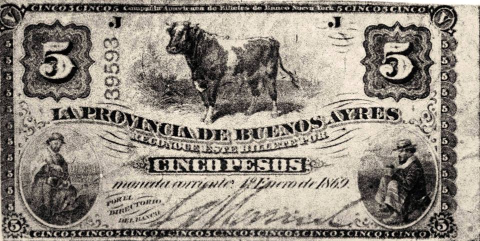
Peso moneda corriente
Flag of the Argentine ConfederationJuan Manuel de Rosas (1793–1877), according to La Gazeta website (vector graphics by Guilherme Paula) · Public domain · Commons
Escudo Confederación ArgentinaUnknown authorUnknown author · Public domain · Commons
Wars and Battles
In 1828, after Argentine forces returned to Buenos Aires from the war, federalist governor Manuel Dorrego was overthrown and executed by Juan Lavalle, of the Unitarian Party. The latter began a campaign against all federals, supported by José María Paz in Córdoba, who deposed Juan Bautista Bustos and took similar measures. The rancher Juan Manuel de Rosas, who joined parties pragmatically, organized the resistance against Lavalle. He allied with Estanislao López, caudillo and ruler of Santa Fe Province, and they defeated Lavalle at the Battle of Márquez Bridge in April 1829. When Rosas entered the city of Buenos Aires in November of that year, he was hailed both as a victorious military leader and as the head of the Federalists. Lavalle was forced out of government and the Legislature restored.
Quito, 20 de febrero 2020.- Fachada Asamblea Nacional. Fotos: Alexander Moya / Asamblea NacionalAsamblea Nacional del Ecuador · CC BY-SA 2.0 · Commons
Ecuador, officially the Republic of Ecuador, is a country in northwestern South America, bordered by Colombia on the north, Peru on the east and south, and the Pacific Ocean on the west. It also includes the Galápagos Province which contains the Galápagos Islands in the Pacific, about 1,000 kilometers (540 nmi; 620 mi) west of the mainland. The country's capital is Quito, and the largest city is Guayaquil.
The land that comprises modern-day Ecuador was once home to several groups of indigenous peoples that were gradually incorporated into the Inca Empire during the 15th century.
A 2003 Amnesty International report was critical that there were scarce few prosecutions for human rights violations committed by security forces, and those only in police courts, which are not considered impartial or independent. There are allegations that the security forces routinely torture prisoners. There are reports of prisoners having died while in police custody. Sometimes the legal process can be delayed until the suspect can be released after the time limit for detention without trial is exceeded. Prisons are overcrowded and conditions in detention centers are "abominable".
Read more
UN's Human Rights Council's Universal Periodic Review has treated the restrictions on freedom of expression and efforts to control NGOs and recommended that Ecuador should stop the criminal sanctions for the expression of opinions, and delay in implementing judicial reforms.
Ecuador has a developing economy that is highly dependent on commodities, namely petroleum and agricultural products. The country is classified as an upper-middle-income country. Ecuador's economy is the eighth largest in Latin America and experienced an average growth of 4.6% between 2000 and 2006. From 2007 to 2012, Ecuador's GDP grew at an annual average of 4.3 percent, above the average for Latin America and the Caribbean, which was 3.5%, according to the United Nations' Economic Commission for Latin American and the Caribbean (ECLAC). Ecuador was able to maintain relatively superior growth during the 2008 financial crisis. In January 2009, the Central Bank of Ecuador (BCE) put the 2010 growth forecast at 6.88%. In 2011, its GDP grew at 8% and ranked third highest in Latin America, behind Argentina (2nd) and Panama (1st).
United States dollar, Ecuadorian sucre, Ecuadorian peso
Dinero hacha de Ecuador (siglos X-XIV). Museo de Prehistoria de Valencia.Dorieo · CC BY-SA 3.0 · Commons
Flag of EcuadorPresident of the Republic of Ecuador, first uploaded by Denelson83 as Flag of Ecuador.svg, modifications by Husunqu, Zscout370 · Public domain · Commons
Coat of arms of EcuadorYsangkok and others · CC0 · Commons
Wars and Battles
In 1972, a "revolutionary and nationalist" military junta overthrew the government of Velasco Ibarra. The coup d'état was led by General Guillermo Rodríguez and executed by navy commander Jorge Queirolo G. The new president exiled José María Velasco to Argentina. He remained in power until 1976, when he was removed by another military government. That military junta was led by Admiral Alfredo Poveda, who was declared chairman of the Supreme Council. The Supreme Council included two other members: General Guillermo Durán Arcentales and General Luis Pintado. The civil society more and more insistently called for democratic elections. Colonel Richelieu Levoyer, Government Minister, proposed and implemented a Plan to return to the constitutional system through universal elections. This plan enabled the new democratically elected president to assume the duties of the executive office.
Early literature in colonial Ecuador, as in the rest of Spanish America, was influenced by the Spanish Golden Age. One of the earliest examples is Jacinto Collahuazo, an Amerindian chief of a northern village in today's Ibarra, born in the late 1600s. Despite the early repression and discrimination of the native people by the Spanish, Collahuazo learned to read and write in Castilian, but his work was written in Quechua. The use of Quipu was banned by the Spanish, and in order to preserve their work, many Inca poets had to resort to the use of the Latin alphabet to write in their native Quechua language. The history behind the Inca drama "Ollantay", the oldest literary piece in existence for any Amerindian language in America, shares some similarities with the work of Collahuazo. Collahuazo was imprisoned and all of his work burned.
1834 CE – 1858 CE · Capital: Santa Fé de Bogotá · 1,423,060 km²
Una hermosa vista de Bogotá en la nocheFelipe Restrepo Acosta · CC BY-SA 3.0 · Commons
The Republic of New Granada was a centralist unitary republic consisting primarily of present-day Colombia and Panama with smaller portions of today's Costa Rica, Ecuador, Venezuela, Peru and Brazil that existed from 1831 to 1858. The state was created after the dissolution of Gran Colombia in 1830 through the secession of Ecuador and Venezuela. In 1858, the state was renamed into the Granadine Confederation.
The national flag, with the Gran Colombian colours in Veles' arrangement, was adopted on 9 May 1834 and used until 26 November 1861.
The territory of the republic was divided into provinces. Each province was composed of one or more cantons, each canton was divided into several districts.
Read more
The Republic also included some territories in the peripheral regions of the country.
1836 CE – 1839 CE · Capital: Tacna · 3,195,637 km²
Vista frontal Catedral Nuestra Señora del Rosario de Tacna, PerúMarco Antonio Correa Flores · CC BY-SA 4.0 · Commons
The Peru–Bolivian Confederation (Spanish: Confederación Perú–Boliviana) was a short-lived state that existed in South America between 1836 and 1839. The country was a loose confederation made up of three states: North Peru, South Peru, and the Bolivian Republic. North Peru and South Peru had emerged from the division of the Peruvian Republic due to the Peruvian Civil War of 1834 and the Salaverry-Santa Cruz War of 1835–36.
The geographical limits of the Confederation varied over time, with Bolivia occupying and incorporating certain disputed territories in northern Argentina in 1838.
Provided, then, with all the legal elements granted by the assemblies of the three states, Santa Cruz decreed the establishment of the Peru–Bolivian Confederation, by decree given in Lima on 28 October 1836. A congress known today as the Congress of Tacna (Spanish: Congreso de Tacna) was ordered to meet in Tacna to establish the foundations of the confederation. A customs office was also opened in Arica, which employed both South Peruvians and Bolivians.
Read more
Initially, 24 January 1837, was chosen as the congress' date, but it had to be postponed. Santa Cruz decided to accompany the plenipotentiaries of the North-Peruvian State, for which reason he left Lima and embarked on the frigate Flora on 9 February, but instead of disembarking in Islay, he went to Arica, where he arrived on 27 February.
Argentina: after Bolivia occupied and annexed the disputed territory of Tarija, Argentina declared war on the Confederation on 19 May 1837. After the war ended, Argentina negotiated with the new Bolivian state over the territories, and Tarija ultimately remained in Bolivia.
Read more
Brazil: Brazilian diplomat Duarte da Ponte Ribeiro was appointed as the Brazilian chargé d'affaires to Peru in 1829, and continued his functions after the establishment of the Confederation in 1836. After the state's dissolution, he remained as the representative to Peru, signing a border treaty in 1841.
Central America: Morazán and Andrés de Santa Cruz never met, due to political circumstances.
Chile: relations soured quickly after the establishment of the Confederation as Chile wanted to maintain its hegemony over trade in the South Pacific.
Flag of the Peru-Bolivian ConfederationNo machine-readable author provided. Huhsunqu assumed (based on copyright claims). · CC BY-SA 2.5 · Commons
Emblem of the Peru-Bolivian ConfederationHuhsunqu (North and South Peruvian COA) y Fornax (Bolivian CoA) · CC BY 2.5 · Commons
Wars and Battles
Like Orbegoso, Santa Cruz also had many opponents and enemies born in the frequent caudillo clashes of the early years of Peru's republican history. Among those enemies were powerful characters such as Agustín Gamarra and Ramón Castilla, who at the time were exiled in Chile.
Read more
The rivalry that existed between the ports of Callao and Valparaíso worsened as a result of the establishment of the Confederation. A tariff war soon began between both states, and Orbegoso supported Ramón Freire's failed expedition against Diego Portales. The Congress of Chile approved the declaration of war on 26 December 1836, claiming that Santa Cruz's rule over Peru was illegitimate, and that his influence threatened the integrity of other South American nations, as seen by Orbegoso's support for the attempted invasion of Chile by Freire, specifically pointing out the attempt on Portales.
Around the same time, North Peru seceded from the Confederation on 30 July, but was nevertheless attacked and defeated by the United Restoration Army in the Battle of Portada de Guías of 21 August. Meanwhile, Confederate troops in Callao were besieged by the same army.
Read more
During this time, the Confederation's stability collapsed, as by September, Peru (i.e. North and South Peru) was under the de jure control of seven different presidents at one time: Santa Cruz, who was the Supreme Protector; Gamara, the restorationist president; Orbegoso, leader of the secessionist North Peruvian state; José de la Riva Agüero, who replaced Orbegoso, being appointed by Santa Cruz; Pío de Tristán, president of South Peru; Domingo Nieto, in the north; and Juan Francisco de Vidal in Huaylas.
The Riograndense Republic, often called the Piratini Republic (Portuguese: República Rio-Grandense or República do Piratini), was a de facto state that seceded from the Empire of Brazil and roughly coincided with the present state of Rio Grande do Sul. It was proclaimed on 11 September 1836 by general Antônio de Sousa Neto as a direct consequence of the victory obtained by gaúcho oligarchic forces at the Battle of Seival (1836) during the Ragamuffin War (1835–1845). It had a constitution adopted in 1843 and was recognised only by the United Kingdom, France, and Uruguay.
The economy of the then Province of São Pedro of Rio Grande do Sul of the Empire of Brazil was mainly focused on the production of jerky and leather. The province depended entirely on the domestic market, but the overvalued exchange rate and the tariff benefits then offered meant that imported beef was cheaper. Thus, the estancieiros of the region, among them the famous Bento Gonçalves, began a rebellion against the Imperial Government. After a meeting, it was decided that armed militias would be formed under the leadership of Gonçalves inside the province to take over the provincial government.
Read more
The initial objective to take over the province's government was successfully achieved, the rebels then planned to enter into negotiations with the imperial regent Diogo Antônio Feijó to demand a new provincial government acceptable to the regional elite.
The Imperial Brazilian Navy controlled the main communications media of the province, the Patos Lagoon, between Porto Alegre, Pelotas and Rio Grande, and most of the navigable rivers. In spite of this, it was constantly attacked by ragamuffins, when near the ravines of the rivers. On 1 February 1838, a troop of two thousand rags and a battery of artillery were able to attack two gunboats and a barge on the Caí River, killing almost all the sailors, imprisoning one of the commanders and capturing their ships, thus beginning the creation of the Riograndense Navy.
Read more
In 1838 Giuseppe Garibaldi had known Bento Gonçalves still in his prison, in Rio de Janeiro, and gave him a corso letter to imprison imperial ships. On 1 September 1838, Garibaldi was appointed captain-lieutenant, commander of the Riograndense navy.
Until the year 1840, the rebels were arguably in the ascent, with several victories in the military field. After this period, there was a decline their fortunes, beginning with the fall of Laguna. With the Imperials controlling the key cities, the rebels were limited to the interior, and soon internal quarrels began.
Read more
Bento Gonçalves, still in the year 1840, due to the failures, waved to the empire with the possibility of an agreement. Bento asked the imperials for safeguards so that his comrades could cross with impunity the places conquered by the empire, to settle with the imperial chiefs the details of a collective surrender of the ragamuffin rebels. They actually carried a letter of this design. But there was another oral message to be given to those leaders, which could not be written.
The Riograndense Republic is symbolically perennial in the flag and coat of arms of the state of Rio Grande do Sul, just as other Brazilian states maintained in their civic symbols evocations of relevant deeds. Its territory derived from the partial split of the Province of São Pedro do Rio Grande do Sul, which had its limits totally defined in relation to Uruguay only after the end of the Ragamuffin War (1835–45). After the proclamation of the Brazilian Republic (1889), the whole territory of the Province became one of the federal units of Brazil, the state of Rio Grande do Sul.
1853 CE – 1860 CE · Capital: Buenos Aires · 242,535 km²
Drone aerial view of Congress Square and its surroundings, Buenos Aires, Argentina.ProtoplasmaKid · CC BY-SA 4.0 · Commons
The State of Buenos Aires (Spanish: Estado de Buenos Aires) was a secessionist republic resulting from the overthrow of the Argentine Confederation government in the Province of Buenos Aires on 11 September 1852. The State of Buenos Aires was never explicitly recognized by the Confederation; it remained, however, independent under its own government and constitution. Buenos Aires rejoined the Argentine Confederation after the former's victory at the Battle of Pavón in 1861.
The central figure in the overthrow of Rosas, Entre Ríos Governor Justo José de Urquiza, was granted the power of a head of state by the Palermo Protocols of 6 April 1852. This provoked resistance in Buenos Aires, however, which then refused to ratify the San Nicolás Agreement of 31 May. The prospect of having the Argentine Congress headquartered in Santa Fe proved especially objectionable, and Urquiza's 12 June appointment of former President Vicente López y Planes failed to turn public opinion in Buenos Aires. Colonel Bartolomé Mitre rallied the Assembly against the San Nicolás Accords. The most contentious issue remained the Buenos Aires Customs, which remained under the control of the city government and was the chief source of public revenue.
1859 CE – 1862 CE · Capital: Santafé de Bogotá · 1,223,348 km²
Una hermosa vista de Bogotá en la nocheFelipe Restrepo Acosta · CC BY-SA 3.0 · Commons
The Granadine Confederation (Spanish: Confederación Granadina) was a short-lived federal republic established in 1858 as a result of a constitutional change replacing the Republic of New Granada. It consisted of the present-day nations of Colombia and Panama and parts of northwestern Brazil. In turn, the Granadine Confederation was replaced by the United States of Colombia after another constitutional change in 1863.
Even though the majority of the mid-century reforms came from the Liberal Party, their beginnings can be traced to the last two administrations of the 1840s decade. In this sense, the government of Pedro Alcántara Herrán (1841–1845) and the first mandate of Tomás Cipriano de Mosquera (1845–1849) stood out for their modernizing tone, which included among other measures the compilation of Granadine laws, the liberation of trade, the reduction of import and export customs duties, the formation of normal schools for the instruction of teachers, the promotion of the Panama railroad, the control of ecclesiastical jurisdiction and freedom of the press.
Read more
All these measures opened the way for the deeper transformations that formally began with the arrival to power of the liberal José Hilario López in 1849.
Montages of Tunja, ColombiaDr Brains + 18TUNJA CENTRO HISTORICO.jpg Ivan Tunja cc-by-sa-3.0 Casa del Fundador de Tunja.jpg Baiji GFDL + cc-by-sa-all Pasado Legendario I.jpg Harold Crick… · CC BY-SA 3.0 · Commons
The laws of 1859 resulted from the necessity that President Mariano Ospina Rodríguez identified of endowing the federal Government with the capacity to intervene effectively in the affairs of the states of the Confederation. With this objective in mind, the federal president used the conservative majorities in Congress to promote a series of laws and reforms to the Constitution of 1858, which from his perspective would allow the federal Executive to maintain order in the country. However, it would be the content of the reforms that would promote the liberal uprising of 1860, which in turn would lead to the overthrow, almost without real opportunity to oppose it, of the system that was intended to be defended through these measures.
In the first place, throughout the 19th century, the Colombian population continued being in essence rural, with self-sufficient spaces that were poorly interconnected among themselves and in sustained demographic growth despite the wars. In practice, during the period a national exchange market was not constituted that would dynamize production or represent a real source of accumulation for national producers. The only communication route that allowed some interregional exchange was the Magdalena River, which in essence focused on allowing the departure of products abroad and on facilitating the arrival of luxury goods toward the interior of the country.
Read more
In the first instance, through colonization and individual and family settlement in vacant or unexploited lands, the natural frontier zones were transformed making them productive.
Even though the Constitution of 1858 had legalized federalism, the politics of the president Mariano Ospina Rodríguez favored centralism. This conservativism clashed with the wishes of the states which wanted more power and autonomy.
Read more
This caused some leaders to consider the administrative base of the federation as a notion to underestimate the authority of the states, and led the national government to view the independent aspirations of the states as a threat to the overall nation.
The political tension came to its pinnacle in 1859 when Congress passed two controversial laws. On April 8, 1859, Congress passed a law giving the President the right to remove the duly appointed governors of the states and appoint one of his choosing. With this law, the president secured the power of the Conservative Party.
1863 CE – 1865 CE · Capital: Bogotá · 1,223,348 km²
Una hermosa vista de Bogotá en la nocheFelipe Restrepo Acosta · CC BY-SA 3.0 · Commons
The United States of Colombia (Spanish: Estados Unidos de Colombia) was the name adopted in 1863 by the Constitución de Rionegro for the Granadine Confederation, after years of civil war. Colombia became a federal state itself composed of nine "sovereign states." It comprised the present-day nations of Colombia and Panama and parts of northwestern Brazil. After several more years of intermittent civil wars, it was replaced by the more centralist Republic of Colombia in 1886, predecessor to modern Colombia.
Modern States of South America: Frequently Asked Questions
Which states existed in South America in this period?
This page maps 21 states of South America founded between 1811 CE and 1863 CE: New Granada, Paraguay, Río de la Plata, Guayaquil Junta, Republic of Chile, Cundinamarca, Federal League, Netherlands Antilles, Empire of Brazil, Gran Colombia, Republic of Peru, Bolivia and 9 more.
Which was the largest of the Modern States of South America?
Empire of Brazil had the largest mapped extent, about 8,506,136 km².
Which of the Modern States of South America lasted longest?
Paraguay lasted longest, 1811 CE – 2024 CE.
↑↓ to navigate↵ to open
12,754 Planetary Entities Indexed
We use Google Analytics cookies to understand which pages are useful. Necessary storage only keeps your theme and this choice on your device. Privacy policy