15 states of West Africa on one map, from 1805 CE to 2024 CE.The largest, Mali Federation, covered about 1,446,277 km²; the longest-lived, Republic of Liberia, lasted 1848 CE – 2024 CE. Each has its own section below with its rulers, capitals, wars and pictures where the records hold them.
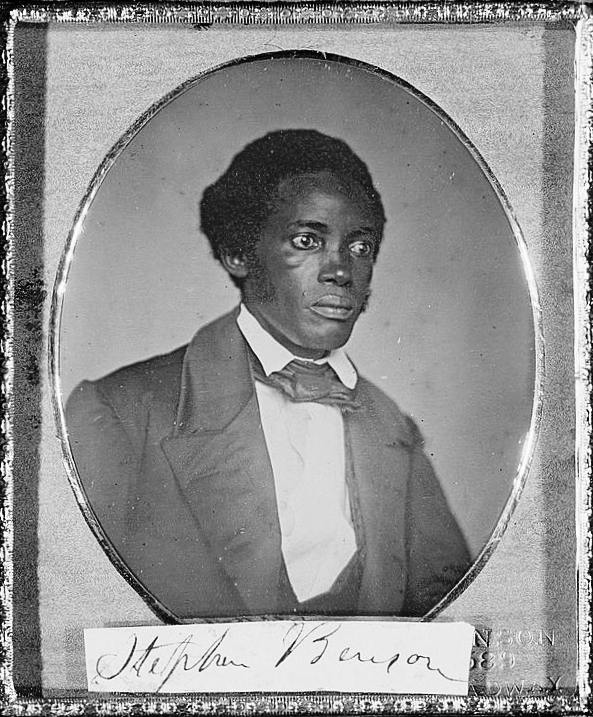
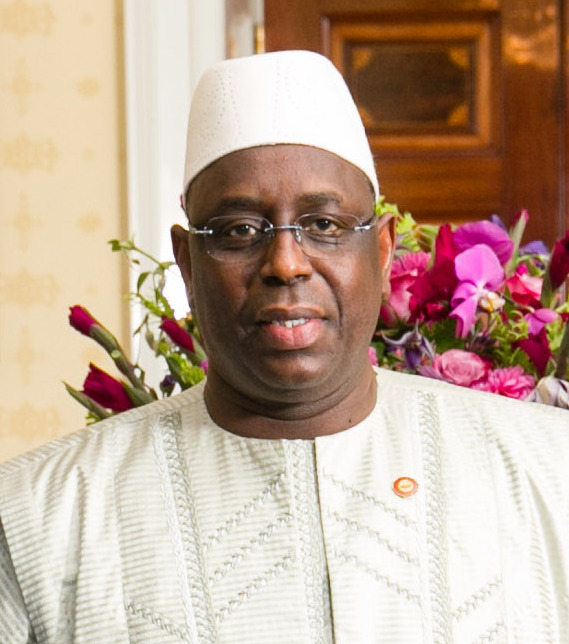
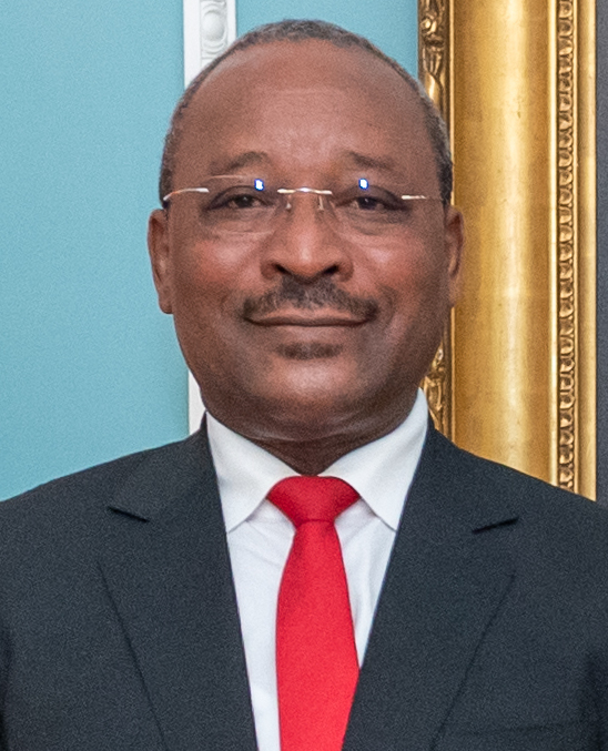
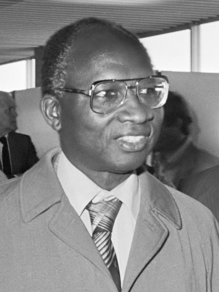
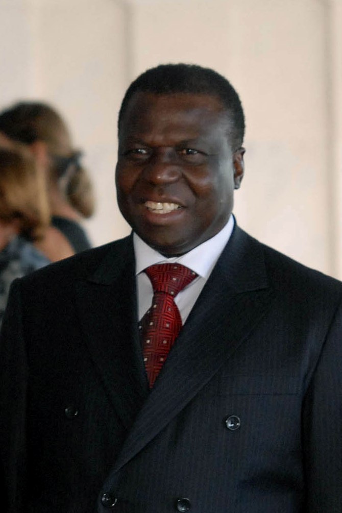
Monteil, P.-L. (Parfait-Louis) · Public domain · CommonsDavid Stanley · CC BY 2.0 · CommonsNoahalorwu · CC BY-SA 4.0 · CommonsRobert Knudsen. White House Photographs. John F. Kennedy Presidential Library and Museum, Boston · Public domain · Commons
Layers
HistoryChanges with the year
PlacesToday
Water
Land
1973 AD
Base map
An empire takes the map to its years and shows the borders.
Each state in its own colour. Move the timeline to see which existed in any year from 1805 to 2024; select a territory to read about it. Borders: Cliopatria / Seshat (CC BY 4.0).
View of Sokoto from its outskirts. From "De Saint-louis A Tripoli Par Le Lac Tchad: Voyage Au Travers Du Soudan Et Du Sahara Accompli Pendant Les Années 1890-91-92"Monteil, P.-L. (Parfait-Louis) · Public domain · Commons
The Sokoto Caliphate (Arabic: دولة الخلافة في بلاد السودان, literally: Caliphate in the Lands of Sudan), also known as the Sultanate of Sokoto, was a Sunni Muslim caliphate in West Africa. It was founded by Usman dan Fodio in 1804 during the Fulani jihads after defeating the Hausa Kingdoms in the Fulani War. The boundaries of the caliphate extended to parts of present-day Cameroon, Burkina Faso, Niger, and Nigeria. By 1837, the Caliphate had a population of 10–20 million people, becoming the most populous empire in West Africa.
The major power in the region in the 17th and 18th centuries had been the Bornu Empire. However, revolutions and the rise of new powers decreased the power of the Bornu empire and by 1759 its rulers had lost control over the oasis town of Bilma and access to the Trans-Saharan trade. Vassal cities of the empire gradually became autonomous, and the result by 1780 was a political array of independent states in the region.
Read more
The fall of the Songhai Empire in 1591 to Morocco also had freed much of the central Bilad as-Sudan, and a number of Hausa sultanates led by different Hausa aristocracies had grown to fill the void. Three of the most significant to develop were the sultanates of Gobir, Kebbi (both in the Rima River valley), and Zamfara, all in present-day Nigeria. These kingdoms engaged in regular warfare against each other, especially in conducting slave raids.
After the establishment of the Caliphate, there were decades of economic growth throughout the region, particularly after a wave of revolts in 1816–1817. They had significant trade over the trans-Saharan routes.
Read more
After the Fulani War, all land in the empire was declared waqf or owned by the entire community. However, the Sultan allocated land to individuals or families, as could an emir. Such land could be inherited by family members but could not be sold. Exchange was based largely on slaves, cowries or gold. Major crops produced included cotton, indigo, kola and shea nuts, grain, rice, tobacco, and onion.
Considerable numbers of scholars and the poor depended on the "great houses" for basic amenities like food and clothing. Food was prepared in the houses, which then acted like communal canteens.
The military, which was commanded by the Sarkin Yaki (war commander) the title still held by the descendants of Ali Jedo, at the time of the jihad was organized into a standing army and a cavalry. The standing army was composed of Hausa and Fulani warriors who were trained in warfare and were responsible for the Caliphate's defense and the expansion of its territories. The cavalry was an essential part of the military, as horses were the primary mode of transportation during this period. During the expansion, the Caliphate's military utilized a strategy of establishing emirates in conquered territories. These emirates were governed by emirs, who were either appointed by the Sultan or were local rulers who had submitted to the Caliphate's authority. This strategy helped in maintaining control over the vast territories of the Caliphate.
European attention had been focusing on the region for colonial expansion for much of the last part of the 19th century. The French in particular had sent multiple exploratory missions to the area to assess colonial opportunities after 1870.
Read more
French explorer Parfait-Louis Monteil visited Sokoto in 1891 and noted that the Caliphate was at war with the Emir of Argungu, defeating Argungu the next year. Monteil claimed that Fulani power was tottering because of the war and the accession of the unpopular Caliph Abderrahman dan Abi Bakar.
However, following the Berlin Conference, the British had expanded into Southern Nigeria, and by 1901 had begun to move into the Sokoto Caliphate while simultaneous German efforts occurred in Cameroon.
The 19th century was a period of significant Islamic reform and jihads in West Africa, and the Sokoto Caliphate was just one of several powerful states that emerged during this time. In present-day Mali, the Massina Empire and the Toucouleur Empire were examples of states established through similar processes of Islamic reform and military expansion. The Massina Empire, also known as the Diina of Hamdullahi, was an early 19th-century Fulani Jihad state centered in the Inner Niger Delta area of present-day Mali. This West African state was founded by Seku Amadu, also known as Sheikh Amadu Sheikh, who started a jihad movement among the Fulani people in the region. In the early 1800s, Seku Amadu, inspired by the teachings of Usman dan Fodio and the success of the Sokoto Caliphate, was authorized by Fodio to carry out jihad in the Massina region.
1820 CE – 1861 CE · Capital: Hamdullahi · 104,716 km²
The Caliphate of Hamdullahi was an early 19th-century Sunni Muslim caliphate in West Africa centered in the Inner Niger Delta of what is now the Mopti and Ségou Regions of Mali. It was founded by Seku Amadu in 1818 during the Fulani jihads after defeating the Bambara Empire and its allies at the Battle of Noukouma. By 1853, the empire had fallen into decline and was ultimately destroyed by Omar Saidou Tall of Toucouleur and his successors.
The Massina Empire was one of the most organized theocratic states of its time on the African continent and had its capital at Hamdullahi.
In the early 1800s, inspired by the recent Muslim uprisings of Usman dan Fodio in nearby Hausaland, preacher and social reformer Seku Amadu Lobbo began efforts at increasing religious revivals in his homeland, intending to restore genuine Islam rather than the contemporaneous infusion of Islam with traditional beliefs. Massina at this time was controlled by Muslim Fulani vassals of the Bambara Empire (whose government was animist). Amadu was born from a minor scholar family from one of the less important Fulani clans. He was both a religious and political outsider which increasingly led him to clash with the established elites as his influence in the region grew at their expense. He promised to free converted slaves and reverse market and cattle taxes for the merchants and Fula pastoralists respectfully.
The Massina Empire was governed by a 40-member Grand Council appointed by the Almami for their wisdom and creativity and 60 judges who were prominent marabouts. Two scholars were selected to consider state business before presenting it to the council. The Grand Council acted as the legislative, executive, and judicial branches of the empire and could make their own decisions based on strict observance of the Maliki interpretation of Sharia law. However, it was only the Almami who could demand a revision of a policy or decision or act as a lawyer on behalf of a plaintiff. If the Grand Council and the Almami ever came to a disagreement 40 of the 60 judges were selected randomly to make the final decision.
Read more
The Grand Council also possessed the authority to designate the succeeding Almami.
The ascension of Amadu III to the throne in 1853, following his election by the Grand Council over arguably more capable uncles, marked the beginning of the decline of the empire. Amadu III's reign was defined by controversy. He was said to be less valiant in war and was more lax when it came to the adherence to the religious tenets that governed the empire. Ahmadu III replaced prominent religious leaders with younger, more liberal men. Omar Saidou Tall of the nascent Tukulor Empire had wished to ally Massina against the animist Segou empire, however Ahmadu III saw the conversion of the territory as Massina's responsibility, compounded by tensions between Omar's Tijaniyyah and Massina's Qadiriyya orders regarding which was best at spreading Islam. Massina's Fulani, the Kunta, and the Bambara fought against Omar's forces, however in 1861 Segou had been conquered.
1848 CE – 2024 CE · Capital: Monrovia · 101,997 km²
Erected in 1957, the Capitol Building in Monrovia is the seat of Liberia's bicameral legislature.David Stanley · CC BY 2.0 · Commons
Liberia, officially the Republic of Liberia, is a country on the West African coast. It is bordered by Sierra Leone to its northwest, Guinea to its north, Ivory Coast to its east, and the Atlantic Ocean to its south and southwest. It has a population of around 5.5 million and covers an area of 43,000 square miles (111,369 km2). The official language is English, though over 20 indigenous languages are spoken, reflecting the country's ethnic and cultural diversity. The capital and largest city is Monrovia.
On July 26, 1847, the settlers issued a Declaration of Independence and promulgated a constitution. Based on the political principles of the United States Constitution, it established the independent Republic of Liberia. On August 24, Liberia adopted its 11-striped national flag. The United Kingdom was the first country to recognize Liberia's independence. The United States did not recognize Liberia until 1862, after the Southern states, which had strong political power in the American government, declared their secession and the formation of the Confederacy.
Read more
The leadership of the new nation consisted largely of the Americo-Liberians, who initially established political and economic dominance in the coastal areas that the ACS had purchased; they maintained relations with the United States and contacts in developing these areas and the resulting trade.
The government of Liberia, modeled on the government of the United States, is a unitary constitutional republic and representative democracy as established by the Constitution. The government has three co-equal branches of government: the executive, headed by the president; the legislative, consisting of the bicameral Legislature of Liberia; and the judicial, consisting of the Supreme Court and several lower courts.
Read more
The president serves as head of government, head of state, and the commander-in-chief of the Armed Forces of Liberia. Among the president's other duties are to sign or veto legislative bills, grant pardons, and appoint Cabinet members, judges, and other public officials. Together with the vice president, the president is elected to a six-year term by majority vote in a two-round system and can serve up to two terms in office.
85.1% Christianity, 76.3% Protestantism, 7.2% Catholicism, 1.6% other Christians
Economy and Trade
Between 1960 and 1980, iron ore mining was the mainstay of the Liberian economy, contributing to more than 60 percent of export earnings. This came after former United States president Harry S. Truman encouraged foreign investment, leading some foreign companies to invest in Liberia's mining sector. During this time, much of the mining done in Liberia was carried out by alluvial mining of small-scale operations, with estimates of over 100,000 artisanal miners in Liberia. However, with the onset of Liberia's first civil war, much of the country's productive infrastructure was destroyed and mining was brought to a virtual halt. The commencement of Liberia's second civil war aggravated this trend.
Read more
After the end of Liberia's second civil war, there was a sharp post-conflict increase in mining activities, rapid settlement expansion and increasing forest loss.
Flag of LiberiaGovernment of Liberia · Public domain · Commons
Coat of arms of LiberiaFXXX · Public domain · Commons
Wars and Battles
In the early 1900s, Liberia's export trade and merchant class largely collapsed. After the partition of Africa between the European powers in the 1800s, American businesses abandoned trade with Liberia and turned to other countries in the Americas for tropical commodities. This abrupt change coupled with Liberia's weak trading links between Britain and France caused Liberia to sink into 'economic insignificance.' Despite this, some trade relations remained between Liberia and Germany, largely due to Germany's lack of tropical colonies.
Read more
At the beginning of the 20th century Germany was the only major country with an interest in Liberian trade. By 1914, Germany owned one of the two banks in Liberia as these trade routes strengthened. At the beginning of the first World War, the British Navy cut off German trade with Liberia, effectively severing all Liberian trade.
The religious practices, social customs, and cultural standards of the Americo-Liberians had their roots in the antebellum American South. The settlers wore top hat and tails and modeled their homes on those of Southern slaveowners. Most Americo-Liberian men were members of the Masonic Order of Liberia, which became heavily involved in the nation's politics.
Read more
Liberia has a rich history in textile arts and quilting, as the settlers brought with them their sewing and quilting skills. Liberia hosted National Fairs in 1857 and 1858 in which prizes were awarded for various needle arts. One of the most well-known Liberian quilters was Martha Ann Ricks, who presented a quilt featuring the famed Liberian coffee tree to Queen Victoria in 1892. When President Ellen Johnson Sirleaf moved into the Executive Mansion, she reportedly had a Liberian-made quilt installed in her presidential office.
On August 20, 2025, Joseph Nyuma Boakai, President of the Republic of Liberia, meets with Shigeru Ishiba, Prime Minister of Japan, at the Pacifico Yokohama during TICAD 9.Cabinet Public Relations Office of the Cabinet Secretariat · CC BY 4.0 · Commons
Ended
2024 CE
Last recorded ruler
Joseph Boakai
British Gold Coast
1873 CE – 1960 CE · Capital: Cape Coast (1821–1877), Accra (1877–1957) · 1,195,294 km²
Ejisu roundabout having Yaa Asantewaa's monument.Noahalorwu · CC BY-SA 4.0 · Commons
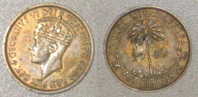
The Colony of the Gold Coast was a British Crown colony on the Gulf of Guinea in West Africa from 1821 until its independence as Ghana in 1957. The term Gold Coast may also refer collectively to the four separate jurisdictions administered by the Governor of the Gold Coast: the colony proper, Ashanti, the Northern Territories, and British Togoland. The name derives from the region's abundant gold resources, which attracted European traders, including the British.
The Gold Coast became a major centre of the Atlantic slave trade, with enslaved Africans exported to the Americas.
Beginning in 1850, the coastal regions increasingly came under control of the governor of the British fortresses, who was assisted by the Executive Council and the Legislative Council. The Executive Council was a small advisory body of European officials that recommended laws and voted taxes, subject to the governor's approval. The Legislative Council included the members of the Executive Council and unofficial members initially chosen from British commercial interests. After 1900 three chiefs and three other Africans were added to the Legislative Council, these being chosen from the Europeanized communities of Accra, Cape Coast, and Sekondi. The inclusion of Africans from Asante and the Northern Territories did not take place until much later. Prior to 1925, all members of the Legislative Council were appointed by the governor. Official members always outnumbered unofficial members.
Christianity, Islam, Traditional African religions
Economy and Trade
The years of British administration of the Gold Coast during the 20th century were an era of significant progress in social, economic, and educational development. Communications were greatly improved. For example, the Sekondi-Tarkwa railroad, begun in 1898, was extended until it connected most of the important commercial centres of the south, and by 1937, there were 9,700 kilometres of roads. Telecommunication and postal services were initiated as well.
Read more
New crops were also introduced and gained widespread acceptance. Cacao trees, introduced in 1878, brought the first cash crop to the farmers of the interior; it became the mainstay of the nation's economy in the 1920s when disease wiped out Brazil's trees. The production of cocoa was largely in the hands of Africans. The Cocoa Marketing Board was created in 1947 to assist farmers and to stabilise the production and sale of their crop.
1960 CE – 2024 CE · Capital: Conakry · 245,676 km²
Ahmed Sekou the first president of Guinea (1960-1984) at the White House with John F Kennedy.Robert Knudsen. White House Photographs. John F. Kennedy Presidential Library and Museum, Boston · Public domain · Commons
Guinea, officially the Republic of Guinea, is a coastal country located in West Africa. It borders the Atlantic Ocean to the west, Guinea-Bissau to the northwest, Senegal to the north, Mali to the northeast, Ivory Coast to the southeast, and Sierra Leone and Liberia to the south. It is sometimes referred to as Guinea-Conakry, after its capital Conakry, to distinguish it from other territories in the eponymous region, such as Guinea-Bissau and Equatorial Guinea.
Conté remained in power until his death on 23 December 2008. Several hours after his death, Moussa Dadis Camara seized control in a coup, declaring himself head of a military junta. Protests against the coup became violent, and 157 people were killed when, on 28 September 2009, the junta ordered its soldiers to attack people gathered to protest Camara's attempt to become president. The soldiers went on a rampage of rape, mutilation, and murder, which caused some foreign governments to withdraw their support for the new regime.
Read more
On 3 December 2009, an aide shot Camara during a dispute over the rampage in September. Camara went to Morocco for medical care. Vice-president (and defence minister) Sékouba Konaté flew from Lebanon to run the country.
Guinea possesses over 25 billion tonnes (metric tons) of bauxite—and perhaps up to one half of the world's reserves. Its mineral wealth includes more than 4-billion tonnes of high-grade iron ore, diamond and gold deposits, as well as uranium.
Read more
Joint venture bauxite mining and alumina operations in north-west Guinea historically provide about 80% of Guinea's foreign exchange reserves. Bauxite is refined into alumina, which is later smelted into aluminium. The Compagnie des Bauxites de Guinée (CBG) exports about 14 million tonnes of high-grade bauxite annually. CBG is a joint venture, 49% owned by the Guinean government and 51% by an international consortium known as Halco Mining, itself a joint venture controlled by aluminium producer Alcoa, global miner Rio Tinto and Dadco Investments. CBG has exclusive rights to bauxite reserves and resources in north-western Guinea, through 2038.
On 5 September 2021, after hours of gunfire near the presidential palace, Lieutenant Colonel Mamady Doumbouya seized control of state television and declared that President Alpha Conde's government had been dissolved and the nation's borders closed. By the evening, the putschists had declared control of all of Conakry and the country's armed forces. According to Guinée Matin, by 6 September, the military fully controlled the state administration and started to replace the civil administration with its military counterpart. The United Nations, European Union, African Union, ECOWAS (which suspended Guinea's membership), and La Francophonie denounced the coup, and called for President Condé's unconditional release.
Football is the "most popular sport" in the country of Guinea, alongside basketball. Football operations are run by the Guinean Football Federation. The association administers the national football team, and the national league. It was founded in 1960 and affiliated with FIFA since 1962 and with the Confederation of African Football since 1963. The Guinea national football team, nicknamed Syli nationale (National Elephants), have played international football since 1962. Their first opponent was East Germany. They have yet to reach World Cup finals, and were runners-up to Morocco in the Africa Cup of Nations in 1976.
Read more
Guinée Championnat National is the top division of Guinean football. Since it was established in 1965, 3 teams have dominated in winning the Guinée Coupe Nationale. Horoya AC has at least 16 titles and is the 2017–2018 champion.
1960 CE – 2024 CE · Capital: Dakar · 1,446,277 km²
Pointe des Almadies, the westernmost point of the African continent (mainland), located in the area of Dakar, Senegal. The point is within the vacation resort Club Med.Jeff Attaway · CC BY 2.0 · Commons
The Mali Federation (Arabic: اتحاد مالي) was a federation in West Africa that linked the French colonies of Senegal and the Sudanese Republic (also called French Sudan) for two months in 1960. It was founded on 4 April 1959 as a territory with self-rule within the French Community, and became independent after negotiations with France on 20 June 1960.
In late November 1958, French Sudan, Senegal, Upper Volta, and Dahomey all declared the intention to join the French Community and form a federation linking the four colonies together. French Sudan and Senegal, despite longstanding divisions between their main political parties, were the most enthusiastic pushers for the federation, while Dahomey and Upper Volta were more hesitant in their desire to join the federation. French Sudan called for representatives of each of the four countries (and Mauritania as an observer) to Bamako on 28 to 30 December to discuss the formation of the federation. French Sudan and Senegal were the leaders at the congress, with Modibo Keïta named the president of the meeting and Léopold Sédar Senghor of Senegal being the key leader on many issues, including the development of the name Mali Federation for the proposed union.
Tensions quickly arose within the Mali Federation as planning for the implementation of the federation began in 1959 and early 1960. Unlike some other areas of French West Africa, French Sudan and Senegal did not have significant amounts of migration or intercultural movement during the colonial period (although they were linked together in French economic policy and linked by a key railway). More serious than ethnic or linguistic differences, however, were some of the results of the design of the federation. While the parity principle allowed both countries to join together without fears of losing their sovereignty, it also resulted in political spillover, as political disputes moved from one arena to another.
Although the Mali Federation existed in name only in Bamako for another month, France and most other nations recognized the two colonies as separate independent countries on 12 September 1960. The Sudanese Union – African Democratic Rally party in French Sudan adopted the slogan "Le Mali Continue" and at a meeting on 22 September the party decided to rename the country Mali and to sever ties with the French Community. The admission to the United Nations for both countries was delayed until late September as a result of the Mali Federation dispute.
Read more
Senghor and Keïta both ruled their countries at the time of the split from the Mali Federation and for a number of years: Senghor was president of Senegal from 1960 until 1980 and Keïta from 1960 until 1968.
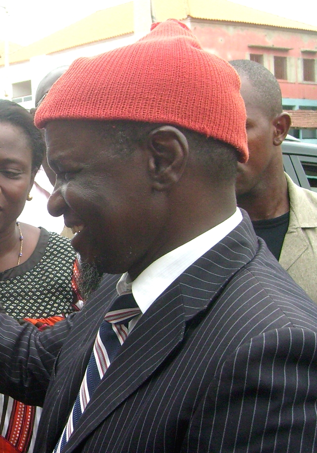
President Gnassingbe Eyadema of Togo departs after a state visit.SrA Felicia Wilson · Public domain · Commons
Togo, officially the Togolese Republic, is a country located in West Africa. It is bordered by Ghana to the west, Benin to the east and Burkina Faso to the north. It is one of the least developed countries in the world. It extends north from the Gulf of Guinea (where its capital, Lomé, is located) to the Burkina Faso–Togo border. It is a small, tropical country, spanning 57,000 square kilometres (22,000 square miles) with a population of approximately 8 million. It has a width of less than 115 km (71 mi) between Ghana and its eastern neighbour Benin.
The president is indirectly elected for a double term of four years, and is the commander-in-chief of the armed forces and has the right to initiate legislation and dissolve parliament. Executive power is exercised by the council of ministers and its president which is the head of government and is also a position that was formerly known as the prime minister. The president appoints the president of the Council of Ministers.
Read more
President Gnassingbé Eyadéma, who until 1993, ruled Togo under a one-party system, died of a heart attack on 5 February 2005. Under the Togolese Constitution, the President of the Parliament, Fambaré Ouattara Natchaba, should have become president of the country, pending a presidential election to be called within 60 days. Natchaba was out of the country, returning on an Air France plane from Paris.
Unitary parliamentary republic under an authoritarian dictatorship
Languages
French
Economy and Trade
The country possesses phosphate deposits and an export sector based on agricultural products such as coffee, cocoa bean, and peanuts (groundnuts), which together generate roughly 30% of export earnings. Cotton is a cash crop. The fertile land occupies 11.3% of the country, most of which is developed. Some crops are cassava, jasmine rice, maize and millet. Some other sectors are brewery and the textile industry. Low market prices for Togo's major export commodities coupled with the volatile political situation of the 1990s and 2000s had a negative effect on the economy.
Read more
It is listed in the least developed country group. It serves as a regional commercial and trade centre.
Togo's cultural life reflects traditions of its major groups: Ewe/Mina in the south and Kabye/Tem in the north, notably the regional use of Ewe and Kabiye as widely spoken languages, Ewe-Mina religious practices centred on the creator god Mawu and associated vodun, and among the Kabye the Evala wrestling initiation rite, while the Guin community (linked historically to the Mina on the southeast coast) marks the new year with the Epé-Ekpé "taking of the stone" ceremony at Glidji.
Read more
Weaving traditions are also prominent in Togo (e.g., the Bafilo weaving centre), with ceremonial garments produced by local artisans.
1961 CE – 2024 CE · Capital: Porto-Novo · 117,637 km²
Nicéphore Soglo, à l'inauguration du Mémorial de l'abolition de l'esclavage de Nantes, le 25 mars 2012.Jean-Marc Ayrault · CC BY 2.0 · Commons
Benin, officially the Republic of Benin, formerly known as Dahomey, is a country in West Africa. It is bordered by Togo to the west, Nigeria to the east, Burkina Faso to the northwest, and Niger to the northeast. The majority of its population lives on the southern coastline of the Bight of Benin, part of the Gulf of Guinea in the northernmost tropical portion of the Atlantic Ocean. The capital is Porto-Novo, and the seat of government is in Cotonou, the most populous city and economic capital.
Benin's politics take place in a framework of a presidential representative democratic republic in which the President of Benin is both head of state and head of government, within a multi-party system. Executive power is exercised by the government. Legislative power is vested in the government and the legislature being a bicameral parliament. The judiciary is officially independent of the executive and the legislature, while in practice its independence has been gradually hollowed out by former president Talon. The political system is derived from the 1990 Constitution of Benin and the subsequent transition to democracy in 1991 with its latest amendment in 2025.
Read more
It was ranked 18th out of 52 African countries and scored best in the categories of Safety & Rule of Law and Participation & Human Rights.
The economy is dependent on subsistence agriculture, cotton production, and regional trade. Cotton accounts for 40% of the GDP and roughly 80% of official export receipts.
Read more
Real GDP growth was estimated at 5.1% and 5.7% in 2008 and 2009, respectively. The main driver of growth is the agricultural sector, with cotton being the main export, while services continue to contribute the largest part of GDP mostly because of Benin's geographical location, enabling trade, transportation, transit and tourism activities with its neighboring states. Benin's overall macroeconomic conditions were "positive" in 2017, with a growth rate of around 5.6%. Economic growth was mostly driven by the cotton industry and other cash crops, the Port of Cotonou, and telecommunications. A source of revenue is the Port of Cotonou, and the government is seeking to expand its revenue base.
Beninese cuisine involves fresh meals served with a variety of key sauces. In southern Beninese cuisine, an ingredient is corn, which has been used to prepare dough that has been served with peanut- or tomato-based sauces. Fish and chicken, beef, goat, and bush rat are consumed. A staple in northern Benin is yams, which has been served with sauces mentioned above. The population in the northern provinces use beef and pork meat that is fried in palm or peanut oil or cooked in sauces. Cheese is used in some dishes. Couscous, rice, and beans are eaten, along with fruits such as mangoes, oranges, avocados, bananas, kiwi fruit, and pineapples.
Read more
Meals are said to be generally light on meat and generous on vegetable fat. Frying in palm or peanut oil is a meat preparation, and smoked fish is prepared in Benin.
1961 CE – 2024 CE · Capital: N'Djamena · 1,272,985 km²
President François Tombalbaye of Chad. Taken during a visit to Israel, October 1959.Moshe Pridan · Public domain · Commons
Chad, officially the Republic of Chad, is a landlocked country in Central Africa. It is bordered by Libya to the north, Sudan to the east, the Central African Republic to the south, Cameroon to the southwest, Nigeria to the southwest (at Lake Chad), and Niger to the west. Chad has a population of 20 million, of which 1.6 million live in the capital and largest city of N'Djamena. With a total area of around 1,300,000 km2 (500,000 sq mi), Chad is the fifth-largest country in Africa and the twentieth largest nation by area.
In the 7th millennium BC, ecological conditions in the northern half of Chadian territory favoured human settlement, and its population increased considerably. Some of the most important African archaeological sites are found in Chad, mainly in the Borkou-Ennedi-Tibesti Region; some date to earlier than 2000 BC.
Read more
Kanem's expansion peaked during the long reign of Mai Dunama Dabbalemi (c. 1221–1259), leaving the empire as the most powerful state in Central Africa by the time of his death. By the end of the 14th century, internal struggles and external attacks had torn Kanem apart. Finally, around 1396, the Bulala invaders forced Mai Umar Idrismi to relocate the imperial centre to Bornu.
Two other states in the region, the Sultanate of Bagirmi and the Wadai Sultanate, emerged in the 16th and 17th centuries.
Hissène Habré1982–1990 CESeries: Reagan White House Photographs, 1/20/1981 - 1/20/1989 Collection: White House Photographic Collection, 1/20/1981 - 1/20/1989 · Public domain · Commons
Under the constitution adopted following the 2023 Chadian constitutional referendum, Chad is a presidential republic with a strong executive branch headed by the president, who dominates the political system. The incumbent president is Mahamat Déby. The president has the power to appoint the prime minister and the cabinet and exercises considerable influence over appointments of judges, generals, provincial officials, and heads of para-statal firms. In cases of grave and immediate threat, the president, in consultation with the National Assembly, may declare a state of emergency. The president is directly elected by popular vote; constitutional term limits were adjusted under the 2023 constitution to allow a limit of two consecutive five-year terms.
The United Nations' Human Development Index ranks Chad as the seventh poorest country in the world, with 80% of the population living below the poverty line. The GDP (purchasing power parity) per capita was estimated as US$1,651 in 2009. Chad is part of the Bank of Central African States, the Customs and Economic Union of Central Africa and the Organization for the Harmonization of Business Law in Africa (OHADA).
Read more
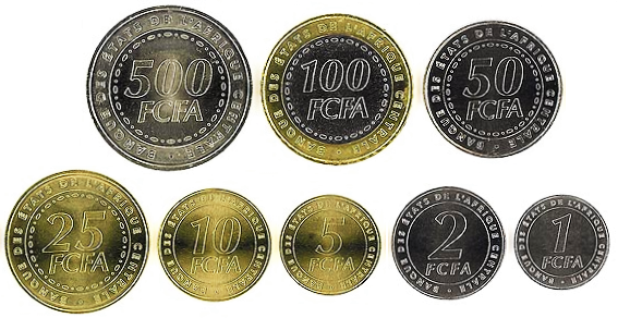
Currency is the CFA franc. In the 1960s, the mining industry of Chad produced sodium carbonate, or natron. There have also been reports of gold-bearing quartz in the Biltine Prefecture. However, years of civil war have scared away foreign investors; those who left Chad between 1979 and 1982 have only recently begun to regain confidence in the country's future. In 2000, major direct foreign investment in the oil sector began, boosting economic prospects.
Déby attempted to reconcile the rebel groups and reintroduced multiparty politics. A constitutional referendum led to the 1996 constitution, and Déby easily won the 1996 presidential election. He won a second term five years later. Oil exploitation began in 2003, bringing with it hopes that Chad would at last have some chances of peace and prosperity. Instead, internal dissent worsened, and a new civil war broke out. Déby unilaterally modified the constitution to remove the two-term limit on the presidency; this caused an uproar among the civil society and opposition parties.
Read more
In 2006 Déby won a third mandate in elections that the opposition boycotted. Ethnic violence in eastern Chad has increased; the United Nations High Commissioner for Refugees has warned that a genocide like the war in Darfur may occur in Chad.
Like many North African nations, the media industry has been stifled by chronic instability and government interference. Chad's television audience is limited to N'Djamena. The only television station is the state-owned Télé Tchad. Radio has a far greater reach, with 13 private radio stations. Newspapers are limited in quantity and distribution, and circulation figures are small because of transportation costs, low literacy rates, and poverty. While the constitution defends liberty of expression, the government has regularly restricted this right. In 2006 the government began to enact a system of censorship on the media.
Read more
The development of a Chadian film industry, which began with the short films of Edouard Sailly in the 1960s, was hampered by the civil wars and the lack of cinemas. Currently there is only one cinema in the country, reflecting the struggling media industry.
1961 CE – 2024 CE · Capital: Yamoussoukro · 321,727 km²
View of Le Plateau, the central business district of Abidjan, former official capital of Côte d'Ivoire and current economic and administrative capital.RyansWorld · CC BY-SA 3.0 · Commons
Ivory Coast, also known as Côte d'Ivoire and officially as the Republic of Côte d'Ivoire, is a country on the southern coast of West Africa. Its capital city of Yamoussoukro is located in the centre of the country, while its largest city and economic centre is the port city of Abidjan. It borders Guinea to the northwest, Liberia to the west, Mali to the north, Burkina Faso to the northeast, Ghana to the east, and the Atlantic Ocean's Gulf of Guinea to the south. With 33.2 million inhabitants in 2026, Ivory Coast is the third-most populous country in West Africa after Nigeria and Ghana.
Compared to neighbouring Ghana, Ivory Coast, though practising slavery and slave raiding, suffered little from the slave trade. European slave and merchant ships preferred other areas along the coast. The earliest recorded European voyage to West Africa was made by the Portuguese in 1482. The first West African French settlement, Saint-Louis, was founded in the mid-17th century in Senegal, while at about the same time, the Dutch ceded to the French a settlement at Gorée Island, off Dakar. A French mission was established in 1687 at Assinie near the border with the Gold Coast (now Ghana). The Europeans suppressed the local practice of slavery at this time and forbade the trade to their merchants.
Read more
Assinie's survival was precarious, however; the French were not firmly established in Ivory Coast until the mid-19th century.
In Africa, Ivorian diplomacy favours step-by-step economic and political cooperation. In 1959, Ivory Coast formed the Council of the Entente with Dahomey (Benin), Upper Volta (Burkina Faso), Niger, and Togo; in 1965, the African and Malagasy Common Organization (OCAM); in 1972, the Economic Community of West Africa (CEAO). The latter organisation changed to the Economic Community of West African States (ECOWAS) in 1975. A founding member of the Organization of African Unity (OAU) in 1963 and then of the African Union in 2000, Ivory Coast defends respect for state sovereignty and peaceful cooperation between African countries.
Read more
Worldwide, Ivorian diplomacy is committed to fair economic and trade relations, including the fair trade of agricultural products and the promotion of peaceful relations with all countries.
Ivory Coast has, for the region, a relatively high income per capita (US$1,662 in 2017) and plays a key role in transit trade for neighbouring landlocked countries. As of the most recent survey in 2016, 46.1% of the population continues to be affected by multidimensional poverty. The country is the largest economy in the West African Economic and Monetary Union, constituting 40% of the monetary union's total GDP. Ivory Coast is the fourth-largest exporter of general goods in sub-Saharan Africa (following South Africa, Nigeria, and Angola).
Read more
The country is the world's largest exporter of cocoa beans. In 2009, cocoa-bean farmers earned $2.53 billion for cocoa exports and were projected to produce 630,000 metric tons in 2013. Ivory Coast also has 100,000 rubber farmers who earned a total of $105 million in 2012.
Flag of Côte d'IvoireSee File history below for details. · Public domain · Commons
Coat of arms of Ivory Coast (2)Republic of Côte d'Ivoirevectored byFOX 52 · CC BY-SA 4.0 · Commons
Wars and Battles
A presidential election was held in October 2000 in which Laurent Gbagbo vied with Guéï, but it was not peaceful. The lead-up to the election was marked by military and civil unrest. Following a public uprising that resulted in around 180 deaths, Guéï was swiftly replaced by Gbagbo. Ouattara was disqualified by the country's Supreme Court because of his alleged Burkinabé nationality. The constitution did not allow noncitizens to run for the presidency. This sparked violent protests in which his supporters, mainly from the country's north, battled riot police in the capital, Yamoussoukro.
Read more
In the early hours of 19 September 2002, while Gbagbo was in Italy, an armed uprising occurred. Troops who were to be demobilised mutinied, launching attacks in several cities.
The most popular sport is association football. The men's national football team has played in the World Cup four times, in Germany 2006, in South Africa 2010, Brazil in 2014, U.S.A.-Canada-Mexico in 2026 and has won three times in the Africa Cup of Nations, most recently in the 2023 edition, when they were the host nation. Ivory Coast has produced many well-known footballers like Didier Drogba and Yaya Touré. The women's football team played in the 2015 Women's World Cup in Canada. The country has been the host of several major African sporting events, with the most recent being the 2013 African Basketball Championship. In the past, the country hosted the 1984 African Cup of Nations, in which the Ivory Coast finished fifth, and the 1985 African Basketball Championship, where the national basketball team won the gold medal.
Pointe des Almadies, the westernmost point of the African continent (mainland), located in the area of Dakar, Senegal. The point is within the vacation resort Club Med.Jeff Attaway · CC BY 2.0 · Commons
Senegal, officially the Republic of Senegal, is the westernmost country of mainland West Africa, situated along the Atlantic Ocean coast. It borders Mauritania to the north, Mali to the east, Guinea to the southeast and Guinea-Bissau to the southwest. Senegal nearly surrounds the Gambia, a country occupying a narrow strip of land along the banks of the Gambia River, which separates Senegal's southern region of Casamance from the rest of the country. It also shares a maritime border with Cape Verde. The capital and largest city of Senegal is Dakar.
Senegal has a quasi-democratic political culture, one of the more successful post-colonial democratic transitions in Africa. Local administrators are appointed and held accountable by the president. Marabouts, religious leaders of the various Muslim brotherhoods of Senegal, have also exerted strong political influence in the country, especially during Wade's presidency. In 2009, Freedom House downgraded Senegal's status from "Free" to "Partially Free" due to increased centralisation of power in the executive. By 2014, it had recovered its Free status.
Read more
In 2008, Senegal finished in 12th position on the Ibrahim Index of African Governance, which reflects the success with which governments deliver essential political goods to their citizens.
The main industries include food processing, mining, cement, artificial fertilizer, chemicals, textiles, refining imported petroleum, and tourism. Exports include fish, chemicals, cotton, fabrics, groundnuts, and calcium phosphate. The largest export markets as of 2020 are Mali (20.4%), Switzerland (12.2%), and India (8.3%).
Read more
As a member of the West African Economic and Monetary Union (WAEMU), Senegal is working toward greater regional integration with a unified external tariff. Senegal is also a member of the Organization for the Harmonization of Business Law in Africa.
Senegal achieved full Internet connectivity in 1996, creating a mini-boom in information technology-based services. Private activity now accounts for 82 percent of its GDP. On the negative side, Senegal faces deep-seated urban problems of chronic high unemployment.
Senegalese play many sports. Wrestling and football are the most popular sports in the country. Senegal will host the 2026 Summer Youth Olympics in Dakar, making Senegal the first African country to host an Olympic event.
Read more
Senegalese wrestling is the country's most popular sport and has become a national obsession. It traditionally serves many young men to escape poverty. It is the only sport recognized as developed independently of Western culture.
Football is a popular sport in Senegal. In 2022, the national team beat Egypt to win the Africa Cup of Nations for the first time. They were runners-up in 2002, 2019 and 2025. They became one of only four African teams to ever reach the quarter-finals of the FIFA World Cup, after Cameroon in 1990 and before Ghana in 2010, defeating holders France in their first game in 2002.
1961 CE – 2024 CE · Capital: Niamey · 1,178,830 km²
Photographie d'identité en noir et blanc de Hamani Diori. Dossier des Renseignements généraux. Archives nationales, cote 20050137/2Archives nationales DJI · CC0 · Commons
Niger, officially the Republic of the Niger, is a landlocked country in West Africa. It is a unitary state bordered by Libya to the northeast, Chad to the east, Nigeria to the south, Benin and Burkina Faso to the southwest, Mali to the west and Algeria to the northwest. It covers a land area of almost 1.27 million km2 (490,000 mi2), making it the sixth-largest country in Africa and the second-largest landlocked nation in Africa behind Chad. Over 80% of its land area lies in the Sahara.
Stone tools, some dating as far back as 280,000 years before present (BP), have been found in Adrar Bous, Bilma and Djado in the northern Agadez Region. Some of these finds have been linked with the Aterian and Mousterian tool cultures of the Middle Paleolithic period, which flourished in northern Africa circa 90,000 BP. It is thought that these humans lived a hunter-gatherer lifestyle. During the prehistoric African humid period, the climate of the Sahara was wetter and more fertile, a phenomenon archaeologists refer to as the "Green Sahara" which provided "favourable" conditions for hunting and later agriculture and livestock herding.
Read more
The Neolithic era, beginning circa 10,000 BP, saw a number of changes such as the introduction of pottery (as evidenced at Tagalagal, Temet and Tin Ouffadene), the spread of cattle husbandry, and the burying of the dead in stone tumuli.
Government finance is derived from revenue exports (mining, oil and agricultural exports) as well as various forms of taxes collected by the government. In the past, foreign aid has contributed to large percentages of the budget. In 2013, the government adopted a zero-deficit budget of 1.279 trillion CFA francs ($2.53 billion) which claimed to balance revenues and expenditures by an 11% reduction in the budget from the previous year. The 2014 budget was 1.867 trillion CFA which is distributed as follows according to: public debt (76,703,692,000 CFA), personnel expenditures (210,979,633,960 CFA), operating expenditures (128,988,777,711 CFA); subsidies and transfers (308,379,641,366 CFA) and investment (1,142,513,658,712 CFA).
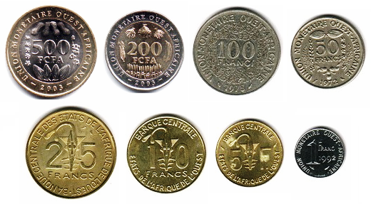
The economy of Niger centers on subsistence crops, livestock, and some of the world's largest uranium deposits. In 2021, Niger was the main supplier of uranium to the EU. Drought cycles, desertification, a 2.9% population growth rate—as well as a drop in world demand for uranium—have undercut the economy. Niger shares a common currency, the CFA franc, and a common central bank, the Central Bank of West African States, with seven other members of the West African Monetary Union.
Read more
In December 2000, Niger qualified for enhanced debt relief under the International Monetary Fund program for Heavily Indebted Poor Countries (HIPC) and concluded an agreement with the Fund for Poverty Reduction and Growth Facility.
The coup had been masterminded by Colonel Seyni Kountché and a military group under the name of the Conseil Militaire Supreme, with Kountché going on to rule the country until his death in 1987. The first action of the military government was to address the food crisis. Whilst political prisoners of the Diori regime were released after the coup, political and individual freedoms in general deteriorated during this period. There were attempted coups (in 1975, 1976 and 1984) which were thwarted, their instigators being punished.
Read more
Kountché sought to create a "development society", funded mostly by the uranium mines in Agadez Region. Parastatal companies were created, infrastructure (building and new roads, schools, health centres) constructed, and there was corruption in government agencies, which Kountché did not hesitate to punish.
Nigerien culture is marked by variation, evidence of the cultural crossroads which French colonialism formed into a unified state from the beginning of the 20th century. Niger was created from four distinct cultural areas in the pre-colonial era: the Zarma and Songhai dominated the Niger River valley in the south-west; the northern periphery of Hausaland, made mostly of those states which had resisted the Sokoto Caliphate, and ranged along the long southern border with Nigeria; the Lake Chad basin and Kaouar in the far east, populated by Kanuri farmers and Toubou pastoralists who had once been part of the Kanem–Bornu Empire; and the Tuareg nomads of the Aïr Mountains and the Sahara in the vast north.
Read more
Each of these communities, along with smaller ethnic groups, brought their own cultural traditions.
1961 CE – 2024 CE · Capital: Freetown · 74,220 km²
Siaka Stevens, President of Sierra Leone, made an official visit to the CEC. This visit represents the first visit by a Head of State of Sierra Leone to CCE.European Communities, 1979 / EC - Audiovisual Service · CC BY 4.0 · Commons
Sierra Leone, officially the Republic of Sierra Leone, is a country on the west coast of West Africa. It is bordered to the southeast by Liberia and to the north by Guinea. Sierra Leone's land area is 73,252 km2 (28,283 sq mi). It has a tropical climate and environments ranging from savannahs to rainforests. As of the 2023 census, Sierra Leone had a population of 8,460,512. Freetown is its capital and largest city.
Sierra Leone is a presidential republic, with a unicameral parliament and a directly elected president. It is a secular state.
Sierra Leone's history is marked by continuous human habitation for at least 2,500 years, influenced by migrations from across Africa. Iron technology had been adopted by the 9th century and agriculture established by 1000 AD along the coast. Climate shifts over centuries altered the ecological zones, influencing migration and conquest dynamics.
Read more
The region's dense tropical rainforest and swamps, coupled with the presence of the tsetse fly which carried a disease fatal to horses and the zebu cattle used by the Mandé people, provided natural defences against invasions by the Mandinka Empire and other African empires, and limited influence by the Mali Empire. The introduction of Islam by Susu traders, merchants and migrants in the 18th century further enriched the culture, eventually establishing a strong foothold in the north.
Sierra Leone is a constitutional republic with a directly elected president and a unicameral legislature. The current system of the Government of Sierra Leone is based on the 1991 Sierra Leone Constitution. Sierra Leone has a dominant unitary central government and a weak local government. The executive branch, headed by the president of Sierra Leone has extensive powers and influence. The president is the most powerful government official in Sierra Leone.
Read more
The president is the head of state, the head of government, and the commander-in-chief of the Sierra Leone Armed Forces. The president appoints and heads a cabinet of ministers, which must be approved by the Parliament. The president is elected by popular vote to a maximum of two five-year terms. To be elected president of Sierra Leone, a candidate must gain at least 55% of the vote.
As of 2016, about 12% of the population of Sierra Leone had access to electricity. Of that 12%, 10% was in Freetown, and the remaining 90% of the country used 2% of the nation's electricity. The majority of the population relies on biomass fuels, with firewood and coal used most prevalently. The burning of these sources has been reported to have adverse health effects on women and children. The use of coal and firewood has also posed environmental concerns as they are both in conflict with the push for more sustainable sources of energy. As a result, the commercialisation of firewood and coal has been a point of contention with aid donors and government agencies. There have been strong pushes for both solar and hydropower to become the dominant sources of energy.
Un billet de 1 nouveau leone de 2022.Flosegura · CC0 · Commons
Flag of Sierra LeoneZscout370 · Public domain · Commons
Coat of arms of Sierra LeoneLion héraldique.svg - Bluebear2 Heraldique meuble lion passant.svg - Rinaldum, S@m, Zigeuner Coat of arms of Haiti (1964-1986).svg - Thommy9 derivative work: Yu · CC BY-SA 3.0 · Commons
Wars and Battles
The brutal civil war significantly impacted Sierra Leone, with internal and external factors contributing to widespread violence. International interventions, notably by the United Kingdom and the United Nations, were crucial in restoring peace.
Read more
In October 1990, owing to mounting pressure from both within and outside the country for political and economic reforms, Momoh set up a constitutional review commission to assess the 1978 one-party constitution. Based on the commission's recommendations, a constitution reestablishing a multi-party system was approved by the exclusive APC Parliament by a 60% majority vote, becoming effective on 1 October 1991. It was widely suspected that Momoh was not serious about political reform, as APC rule was increasingly marked by abuses of power.
Media in Sierra Leone began with the introduction of the first printing press in Africa at the start of the 19th century. A strong free journalistic tradition developed with the creation of several newspapers. In the 1860s, the country became a journalist hub for Africa. At the end of the 19th century, the industry went into decline, and when radio was introduced in the 1930s, it became the primary communication medium in the country.
Read more
The Sierra Leone Broadcasting Service (SLBS) was created by the colonial government in 1934 making it the earliest English-language radio broadcaster service in West Africa. The service began broadcasting television in 1963, with coverage extended to all the districts in the country in 1978.
Following the 1995 National Consultative Conference at the Bintumani Hotel in Freetown, dubbed "Bintumani I", a Strasser-led initiative, the Bio administration initiated another National Consultative Conference at the same hotel, dubbed "Bintumani II". It involved both national and international stakeholders, in an effort to find a viable solution to the issues plaguing the country. "Peace before Elections vs Elections before Peace" became a key debate topic and this quickly became a point of national discussion. The discussions eventually concluded with key stakeholders, including Bio's administration and the UN, agreeing that while efforts in finding a peaceful solution to ending the war should continue, a general election should be held as soon as possible. Bio handed power over to Ahmad Tejan Kabbah of the SLPP, after the conclusion of elections in early 1996 which Kabbah won.
Map drawing of the Republic of The GambiaGinevrajocosa88 · CC BY-SA 4.0 · Commons
The Gambia, officially the Republic of The Gambia, is a country in West Africa. Geographically, the Gambia is the smallest country in continental Africa; it is bounded by Senegal on all sides except for the western part, which is bordered by the Atlantic Ocean.
Its territory is on both sides of the lower reaches of the Gambia River, which flows through the center of the country and empties into the Atlantic.
The Gambia achieved independence on 18 February 1965, as a constitutional monarchy within the Commonwealth, with Elizabeth II as Queen of The Gambia, represented by the Governor-General. Shortly thereafter, the national government held a referendum proposing that the country become a republic. This referendum failed to receive the two-thirds majority required to amend the constitution, but the results won widespread attention abroad as testimony to the Gambia's observance of secret balloting, honest elections, civil rights, and liberties.
Read more
On 24 April 1970, the Gambia became a Republic within the Commonwealth, following a second referendum. Prime Minister Sir Dawda Kairaba Jawara assumed the office of President, an Executive Post, combining the offices of head of state and head of government which he held since 1962. President Sir Dawda Jawara was re-elected five times.
During the Jawara era, there were initially four political parties, the PPP, the United Party (UP), the Democratic Party (DP), and I.M. Garba-Jahumpa's Muslim Congress Party (MCP). The 1960 constitution had established a House of Representatives, and in the 1960 election no party won a majority of seats. However, in 1961, the British Governor chose UP leader Pierre Sarr N'Jie to serve as the country's first head of government, in the form of a Chief Minister. This was an unpopular decision, and the 1962 election was notable as parties were able to appeal to ethnic and religious differences across the Gambia. The PPP won a majority, and formed a coalition with the Democratic Congress Alliance (DCA; a merger of the DP and MCP). They invited the UP to the coalition in 1963, but it left in 1965.
Read more
The UP was seen as the main opposition party, but it lost power from 1965 to 1970.
The Gambia has a liberal, market-based economy characterised by traditional subsistence agriculture, a historic reliance on groundnuts (peanuts) for export earnings, a re-export trade built up around its ocean port, low import duties, minimal administrative procedures, a fluctuating exchange rate with no exchange controls, and a significant tourism industry.
Read more
The World Bank pegged Gambian gross domestic product (GDP) for 2018 at US$1,624 million; the International Monetary Fund put it at US$977 million for 2011. From 2006 to 2012, the Gambian economy grew annually at a rate of 5–6% of GDP.
Agriculture accounts for roughly 30% of GDP and employs about 70% of the labour force. Within agriculture, peanut production accounts for 6.9% of GDP, other crops 8.3%, livestock 5.3%, fishing 1.8%, and forestry 0.5%. Industry accounts for about 8% of GDP and services around 58%.
Exemple de bitllet de 25 dalasi per davant i darrera, i monedes de dalasi i bututs (borr) (act) 12:59 23 abr, 2005 . . Jolle (396810 octets)ca:Usuari:Jolle http://ca.wikipedia.org/ · CC BY-SA 3.0 · Commons
Currency
dalasi, Gambian pound
Gambia dalasi 5JahreUnknown author · Public domain · Commons
Flag of The GambiaVzb83 iThe source code of the previous SVG was invalid due to 39 errors. · Public domain · Commons
Coat of arms of The GambiaOriginal design by Nicholas Potin, vectorised by user:Fenn-O-maniC · CC BY-SA 3.0 · Commons
Achievements and Monuments
Although the Gambia is the smallest country on mainland Africa, its culture is the product of very diverse influences. The national borders outline a narrow strip on either side of the River Gambia, a body of water that has played a vital part in the nation's destiny and is known locally simply as "the River". Without natural barriers, the Gambia has become home to most of the ethnic groups that are present throughout western Africa, especially those in Senegal.
Read more
Europeans also figure prominently in Gambian history because the River Gambia is navigable deep into the continent, a geographic feature that made this area one of the most profitable sites for the slave trade from the 15th through the 17th centuries. (It also made it strategic to the halt of this trade once it was outlawed in the 19th century.)
In 1994, the Armed Forces Provisional Ruling Council (AFPRC) deposed the Jawara government and banned opposition political activity. Lieutenant Yahya Jammeh, chairman of the AFPRC, became head of state. Jammeh was just 29 years old at the time of the coup. The AFPRC announced a transition plan to return to a democratic civilian government.
Read more
The Provisional Independent Electoral Commission (PIEC) was established in December 1995 to conduct national elections and it supervised a referendum on a revised Constitution, the elections for president and the National Assembly by early January 1997. In 1997 the Independent Electoral Commission – IEC- The Gambia was established to replace the PIEC, responsible for the registration of voters and for the conduct of elections and referendums.
Arab traders provided the first written accounts of the Gambia area in the ninth and tenth centuries. During the tenth century, Muslim merchants and scholars established communities in several West African commercial centres. Both groups established trans-Saharan trade routes. They carried out a large export trade of local people taken captive in raids and sold as slaves. Gold and ivory were also exported, and the trade routes were used to import manufactured goods to these areas.
Read more
By the 11th or 12th century, the rulers of kingdoms such as Takrur (a monarchy centred on the Senegal River just to the north), ancient Ghana and Gao had converted to Islam. They had appointed to their courts Muslims who were literate in the Arabic language. At the beginning of the 14th century, most of what is today called the Gambia was part of the Mali Empire.
The Monumento aos Heróis da Independência at Praça dos Herois Nacionais in Bissau, Guinea-Bissaujbdodane · CC BY 2.0 · Commons
Guinea-Bissau, officially the Republic of Guinea-Bissau, is a country in West Africa that covers 36,125 square kilometres (13,948 sq mi) with an estimated population of 2,080,000. It borders Senegal to its north and Guinea to its southeast.
Guinea-Bissau was once part of the kingdom of Kaabu, as well as part of the Mali Empire. Parts of this kingdom persisted until the 18th century, while a few others had been under some rule by the Portuguese Empire since the 16th century. In the 19th century, it was colonised as Portuguese Guinea.
Guinea-Bissau is a republic. In the past, the government had been highly centralized. Multi-party governance was not established until mid-1991. The president is the head of state and the prime minister is the head of government under the country's semi-presidential system. From independence in 1974, until Jose Mario Vaz ended his five-year term as president on 24 June 2019, no president successfully served a full five-year term.
Read more
At the legislative level, a unicameral Assembleia Nacional Popular (National People's Assembly) is made up of 100 members. They are popularly elected from multi-member constituencies to serve a four-year term. The judicial system is headed by a Tribunal Supremo da Justiça (Supreme Court), made up of nine justices appointed by the president; they serve at the pleasure of the president.
Guinea-Bissau's GDP per capita and Human Development Index are among the lowest in the world. More than two-thirds of the population lives below the poverty line. The economy depends mainly on agriculture; fish, cashew nuts, and ground nuts are its major exports.
Read more
A long period of political instability has resulted in depressed economic activity, deteriorating social conditions, and increased macroeconomic imbalances. It takes longer on average to register a new business in Guinea-Bissau (233 days or about 33 weeks) than in any other country in the world except Suriname.
Guinea-Bissau has started to show some economic advances after a pact of stability was signed by the main political parties of the country, leading to an IMF-backed structural reform program.
The music of Guinea-Bissau is usually associated with the polyrhythmic gumbe genre, the country's primary musical export. However, civil unrest and other factors have combined over the years to keep gumbe, and other genres, out of mainstream audiences, even in generally syncretist African countries.
Read more
The calabash is the primary musical instrument of Guinea-Bissau, and is used in extremely swift and rhythmically complex dance music. Lyrics are almost always in Guinea-Bissau Creole, a Portuguese-based creole language, and are often humorous and topical, revolving around current events and controversies.
The word gumbe is sometimes used generically, to refer to any music of the country, although it most specifically refers to a unique style that fuses about ten of the country's folk music traditions.
Modern States of West Africa: Frequently Asked Questions
Which states existed in West Africa in this period?
This page maps 15 states of West Africa founded between 1805 CE and 1973 CE: Sokoto Caliphate, Massina Empire, Republic of Liberia, British Gold Coast, Guinea, Mali Federation, Togo, Republic of Benin, Republic of Chad, Republic of Côte d'Ivoire, Republic of Senegal, Republic of the Niger and 3 more.
Which was the largest of the Modern States of West Africa?
Mali Federation had the largest mapped extent, about 1,446,277 km².
Which of the Modern States of West Africa lasted longest?
Republic of Liberia lasted longest, 1848 CE – 2024 CE.
↑↓ to navigate↵ to open
12,754 Planetary Entities Indexed
We use Google Analytics cookies to understand which pages are useful. Necessary storage only keeps your theme and this choice on your device. Privacy policy