Medieval States of France and the Low Countries: Map & History
39 states of France and the Low Countries on one map, from 462 CE to 1790 CE.The largest, Kingdom of the Franks, covered about 1,317,417 km²; the longest-lived, Duchy of Brittany, lasted 947 CE – 1491 CE. Each has its own section below with its rulers, capitals, wars and pictures where the records hold them.
Each state in its own colour. Move the timeline to see which existed in any year from 462 AD to 1790; select a territory to read about it. Borders: Cliopatria / Seshat (CC BY 4.0).
The Medieval States of France and the Low Countries Compared
La Tour Eiffel vue de la Tour Saint-Jacques, Paris.Yann Caradec from Paris, France · CC BY-SA 2.0 · Commons
The Kingdom of the Franks (Latin: Regnum Francorum), also known as the Frankish Kingdom or Francia, was the largest post-Roman kingdom in Western Europe. It was established by the Franks, one of the Germanic peoples. Its founder was King Clovis I who united Frankish tribes and expanded the Frankish realm into Roman Gaul. During the Early Middle Ages, the kingdom was ruled by the Merovingian and Carolingian dynasties. In 800, it evolved into the Carolingian Empire, thus becoming the longest lasting Germanic kingdom from the era of Great Migrations.
The different Frankish tribes—such as the Salians, Ripuarii, and Chamavi—had different legal traditions which were only later codified, largely under Charlemagne. The Leges Salica, Ribuaria, and Chamavorum were Carolingian creations, their basis in earlier Frankish reality being difficult for scholars to discern at the present distance. Under Charlemagne codifications were also made of the Saxon law and the Frisian law.
Read more
It was also under Frankish hegemony that the other Germanic societies east of the Rhine began to codify their tribal law, in such compilations as the Lex Alamannorum and Lex Baiuvariorum for the Alemanni and Bavarii respectively. Throughout the Frankish kingdoms there continued to be Gallo-Romans subject to Roman law and clergy subject to canon law.
La Tour Eiffel vue de la Tour Saint-Jacques, Paris.Yann Caradec from Paris, France · CC BY-SA 2.0 · Commons
The Kingdom of the Franks (Latin: Regnum Francorum), also known as the Frankish Kingdom or Francia, was the largest post-Roman kingdom in Western Europe. It was established by the Franks, one of the Germanic peoples. Its founder was King Clovis I who united Frankish tribes and expanded the Frankish realm into Roman Gaul. During the Early Middle Ages, the kingdom was ruled by the Merovingian and Carolingian dynasties. In 800, it evolved into the Carolingian Empire, thus becoming the longest lasting Germanic kingdom from the era of Great Migrations.
The different Frankish tribes—such as the Salians, Ripuarii, and Chamavi—had different legal traditions which were only later codified, largely under Charlemagne. The Leges Salica, Ribuaria, and Chamavorum were Carolingian creations, their basis in earlier Frankish reality being difficult for scholars to discern at the present distance. Under Charlemagne codifications were also made of the Saxon law and the Frisian law.
Read more
It was also under Frankish hegemony that the other Germanic societies east of the Rhine began to codify their tribal law, in such compilations as the Lex Alamannorum and Lex Baiuvariorum for the Alemanni and Bavarii respectively. Throughout the Frankish kingdoms there continued to be Gallo-Romans subject to Roman law and clergy subject to canon law.
Soissons (France):Abtei Saint-Jean des Vignes and Monument for the war of 1870/71,bodoklecksel · CC BY-SA 3.0 · Commons
The Kingdom of Soissons is the name given by modern scholars to the fifth-century "kingdom" of Romans ruled by Syagrius, which was based in Soissons in what is now northern France. There is disagreement among scholars as to both its extent, how long it existed, and whether it was considered a kingdom by contemporaries. In one of the only mentions of him, Syagrius was referred to as "king of the Romans" (Latin: rex Romanorum) by the 6th-century historian Gregory of Tours, and both he and the population he ruled are generally understood to have been Gallo-Roman.
Hoard of Roman silver coins from CichobórzGabinet Numizmatyczny D. Marciniak · CC BY 3.0 · Commons
Currency
Roman currency
Wars and Battles
When Aegidius was appointed magister militum of Gaul by Emperor Majorian, he took control of the remaining Roman troops in Gaul. According to Eastern Roman writer Priscus, Aegidius and Syagrius both commanded a "large force". At one point, Aegidius and/or Syagrius even threatened the Western Roman Empire with an invasion of Italy if the empire did not grant their requests. Their forces also offered effective resistance to the power of the Visigoth Kingdom, to the south and west of Soissons. MacGeorge (2002) estimates that Syagrius had around 6,000 troops at his disposal as of 486.
Bretonka v kroji, prodavačka krajek, před katedrálou na nám. Sv. Corentina v QuimperuAkramgad · CC BY-SA 4.0 · Commons
The Bretons (Breton: Bretoned or Vretoned, Breton pronunciation: [breˈtɔ̃nɛt]) are a Celtic ethnic group native to Brittany, north-western France. Originally, the demonym designated groups of Brittonic speakers who emigrated from southwestern Great Britain, particularly Cornwall and Devon, mostly during the Anglo-Saxon settlement of Britain. They migrated in waves from the 3rd to 9th century (most heavily from 450 to 600) to the west of Armorica. That western part of Armorica was subsequently named after them, as were the inhabitants.
Bretons were the most prominent of the non-Norman forces in the Norman conquest of England. A number of Breton families were of the highest rank in the new society and were tied to the Normans by marriage.
Read more
The Scottish Clan Stewart and the royal House of Stuart have Breton origins. Alan Rufus, also known as Alan the Red, was both a cousin and knight in the retinue of William the Conqueror. Following his service at Hastings, he was rewarded with large estates in Yorkshire. At the time of his death, he was by far the richest noble in England. His manorial holding at Richmond ensured a Breton presence in northern England. The Earldom of Richmond later became an appanage of the Dukes of Brittany.
There are four main Breton dialects: Gwenedeg (Vannes), Kerneveg (Cornouaille), Leoneg (Leon) and Tregerieg (Trégor), which have varying degrees of mutual intelligibility. In 1908, a standard orthography was devised. The fourth dialect, Gwenedeg, was not included in this reform, but was included in the later orthographic reform of 1941.
Read more
The Breton language is a very important part of Breton identity. Breton itself is one of the Brittonic languages and is closely related to Cornish and more distantly to Welsh. Breton is thus an Insular Celtic language and is more distantly related to the long-extinct Continental Celtic languages, such as Gaulish, that were formerly spoken on the European mainland, including the areas colonised by the ancestors of the Bretons.
In eastern Brittany, a regional langue d'oïl, Gallo, developed.
602 CE – 771 CE · Capital: Dorestad, Traiectum (Utrecht) · 21,799 km²
The Frisian Kingdom (West Frisian: Fryske Keninkryk) is a modern name for the post-Roman Frisian realm in Western Europe in the period when it was at its largest (650–734). This dominion was ruled by kings and emerged in the mid-7th century and probably ended with the Battle of the Boarn in 734 when the Frisians were defeated by the Frankish Empire. It lay mainly in what is now the Netherlands and – according to some 19th century authors – extended from the Zwin near Bruges in Belgium to the Weser in Germany. The center of power was the city of Utrecht.
The earliest Frisian records name four social classes, the ethelings (nobiles in Latin documents) and frilings, who together made up the "Free Frisians" who might bring suit at court, and the laten or liten with the slaves, who were absorbed into the laten during the Early Middle Ages, as slavery was not so much formally abolished, as evaporated. The laten were tenants of lands they did not own and might be tied to it in the manner of serfs, but in later times might buy their freedom.
In 680, Aldgisl died and was succeeded by his son Redbad, King of the Frisians. While Aldgisl had welcomed Christianity into his realm, Redbad attempted to extirpate the religion and free the Frisians from subjugation to the Merovingian kingdom of the Franks. In 689, however, Redbad was defeated by Pepin of Herstal in the battle of Dorestad and compelled to cede Frisia Citerior (Nearer Frisia) to the Franks.
Read more
The battle of Dorestad took place around 690 by the capital city of the Frisians close to the Rhine. The Franks were victorious in the battle under the Austrasian mayor of the palace, Pepin of Herstal. Dorestad and Utrecht fell into the hands of Pepin, this gave the Franks control of important trade routes on the Rhine to the North Sea. Following this defeat, Redbad retreated to the island of Heligoland.
Aquitaine (UK:, US:; French: [akitɛn]; Occitan: Aquitània [akiˈtanjɔ]; Basque: Akitania; Poitevin-Saintongeais: Aguiéne), archaic Guyenne or Guienne (Occitan: Guiana), is a historical region of southwestern France and a former administrative region. Since 1 January 2016 it has been part of the administrative region of Nouvelle-Aquitaine. It is situated in the southwest corner of metropolitan France, along the Atlantic Ocean and the Pyrenees mountain range on the border with Spain. It is composed of five departments: Dordogne, Lot-et-Garonne, Pyrénées-Atlantiques, Landes, and Gironde.
Despite the early conquest of southern Gaul by the Franks after the Battle of Vouillé in 507, the Frankish element was feeble south of the Loire, where Gothic and Gallo-Roman Law prevailed and a small Frankish settlement took place. However scarce, some Frankish population and nobles settled down in regions like Albigeois, Carcassonne (on the fringes of Septimania), Toulouse, and Provence and Lower Rhone (the last two not in Aquitaine). After the death of the king Dagobert I, the Merovingian tenure south of the Loire became largely nominal, with the actual power being in the hands of autonomous regional leaders and counts. The Franks may have become largely assimilated to the preponderant Gallo-Roman culture by the 8th century, but their names were well in use by the ruling class, like Odo.
Blason de l'Aquitaine et de la GuyenneYou may select the license of your choice. · CC BY 2.5 · Commons
Wars and Battles
The region served as a stronghold for the Protestant Huguenots during the 16th and 17th centuries, who suffered persecution at the hands of the French Catholics. The Huguenots called upon the English crown for assistance against forces led by Cardinal Richelieu.
Read more
From the 13th century until the French Revolution, Aquitaine was usually known as Guyenne.
French is the official language of the region. Many residents also have some knowledge of Basque, of a variety of Occitan (Gascon, Limousin, or Languedocien), or of the Poitevin-Saintongeais dialect of French.
Read more
In 2005, 78,000 children were learning Occitan as a second language in state schools and 2,000 were enrolled in Occitan-medium private schools.
La Tour Eiffel vue de la Tour Saint-Jacques, Paris.Yann Caradec from Paris, France · CC BY-SA 2.0 · Commons
In medieval historiography, West Francia (Medieval Latin: Francia occidentalis) or the Kingdom of the West Franks (Latin: regnum Francorum occidentalium) constitutes the initial stage of the Kingdom of France and extends from the Treaty of Verdun in 843 to 987, the beginning of the Capetian dynasty. It was created from the division of the Carolingian Empire following the death of Louis the Pious, with its neighbor East Francia eventually evolving into the Kingdom of Germany.
West Francia extended further north and south than modern metropolitan France, but it did not extend as far east.
In August 843, after three years of civil war following the death of Louis the Pious, the Treaty of Verdun was signed by his three sons and heirs. The youngest, Charles the Bald, received western Francia. The contemporary West Frankish Annales Bertiniani describes Charles arriving at Verdun, "where the distribution of portions" took place. After describing the portions of his brothers, Lothair the Emperor (Middle Francia) and Louis the German (East Francia), he notes that "the rest as far as Spain they ceded to Charles". The Annales Fuldenses of East Francia describe Charles as holding the western part after the kingdom was "divided in three".
Read more
Since the death of King Pippin I of Aquitaine in 838, his son had been recognised by the Aquitainian nobility as King Pippin II of Aquitaine, although the succession had not been recognised by the emperor.
Louis the Stammerer877–879 CEMaître du couronnement de Charles VI. Enlumineur ; Maître du Livre du sacre de Charles V. Enlumineur ; Maître de la Bible de Jean de Sy. Enlumineur ; · Public domain · Commons
Denarius van Antoninus Pius in zilver, 140 tot 143 NC, vindplaats: Onbekend, collectie Gallo-Romeins Museum Tongeren, S-175http://exploratorium.galloromeinsmuseum.be/Default.aspx?query=search=deeplink%7C/record/uniqid=obj_46165&showtype=record · Public domain · Commons
Soissons (France):Abtei Saint-Jean des Vignes and Monument for the war of 1870/71,bodoklecksel · CC BY-SA 3.0 · Commons
Neustria was the western part of the Kingdom of the Franks during the Early Middle Ages, in contrast to the eastern Frankish sub-kingdom, Austrasia. It initially included land between the Loire and the Silva Carbonaria, in the north of present-day France, with Paris, Orléans, Tours, Soissons as its main cities.
The same term later referred to a smaller region between the Seine and the Loire rivers known as the regnum Neustriae, a constituent subkingdom of the Carolingian Empire and then West Francia.
Frisia is a cross-border cultural region in Northwestern Europe. Stretching along the Wadden Sea, it encompasses the north of the Netherlands and parts of northwestern Germany. Wider definitions of "Frisia" may include the island of Rømø and the other Danish Wadden Sea Islands. The region is traditionally inhabited by the Frisians, a West Germanic ethnic group.
A half-million Frisians in the province of Friesland in the Netherlands speak West Frisian. Several thousand people in Nordfriesland and Heligoland in Germany speak a collection of North Frisian dialects. A small number of Saterland Frisian language speakers live in four villages in Lower Saxony, in the Saterland region of Cloppenburg county, just beyond the boundaries of traditional East Frisia. Many Frisians speak Low Saxon dialects which have a Frisian substratum known as Friso-Saxon, especially in East Frisia, where the local dialects are called Oostfräisk ("East Frisian") or Oostfräisk Plat (East Frisian Low Saxon). In the provinces of Friesland and Groningen, and in North Frisia, there are also areas where Friso-Saxon dialects are predominantly spoken, such as Gronings. In West Frisia, there are West Frisian-influenced dialects of Dutch such as West Frisian Dutch and Stadsfries.
The Frisians (FREEZH-ənz) are an ethnic group indigenous to Northwestern Europe on the coastal regions of northern Netherlands, north-western Germany and southwestern Denmark. They inhabit an area known as Frisia and are concentrated in the Dutch province of Friesland and, in Germany, East Frisia and North Frisia (which was a part of Denmark until 1864).
The language of the Roman-era Frisii is uncertain, but the early medieval Frisians the related culture of the Anglo-Saxons in Britain used a very similar language, together forming the Anglo-Frisian family of West Germanic. Old Frisian is the most closely related language to Old English The modern Frisian dialects are still the closest related languages to contemporary English that do not themselves derive from Old English, even though modern Frisian and English are not mutually intelligible, and modern Frisian has been strongly influenced by Dutch and other neighbouring languages.
Read more
North Frisian, spoken in the German region of North Frisia (within the Kreis of Nordfriesland) on the west coast of Jutland.
Of these three languages both Saterland Frisian (2,000 speakers) and North Frisian (10,000 speakers) are endangered.
Frisian languages, Low Saxon (Friso-Saxon dialects), Dutch (West Frisian Dutch and Stadsfries), German (Missingsch), Danish (Sønderjysk and Southern Schleswig Danish)
Religion
Protestant majority (Calvinists and Lutherans), Catholic minority
Noménoë (Tenniel)John Tenniel / Joseph Swain · Public domain · Commons
The Kingdom of Brittany (Breton: Rouantelezh Breizh) was a short-lived vassal-state of the Frankish Empire that emerged during the Norse invasions. Its history begins in 851 with Erispoe's claim to kingship. In 856, Erispoe was murdered and succeeded by his cousin Salomon.
The kingdom fell into a period of turmoil caused by Norse invasions and a succession dispute between Salomon's murderers: Gurvand and Pascweten. Pascweten's brother, Alan, called the Great, was the third and last to be recognized as King of Brittany. After his death, Brittany fell under Norse occupation.
In 383, Magnus Maximus was proclaimed emperor by his soldiers in Britain. He promptly invaded Gaul and deposed Emperor Gratian. During the invasion, he instructed some of his soldiers to occupy the western part of the Armorican peninsula and expel soldiers loyal to Gratian. The House of Ingelger confirm this event in their origin story.
Read more
At the end of the Antiquity period, additional Celtic Britons, fleeing the Anglo-Saxon settlement of Britain (5th-7th centuries), settled in the same region. At some stage, it was renamed Brittany ("little Britain").
As a result of these settlements, Celtic culture was revived in Gallo-Roman Armorica and independent petty kingdoms arose in this region, namely Cornouaille, Domnonée and Broërec.
Seeking revenge, Charles the Bald invaded Brittany with an army drawn from both the western and eastern parts of the Frankish empire. Erispoe, Nominoe's son and successor, intercepted Charles at the Battle of Jengland (851). At the Treaty of Angers signed the same year, the Pays de Retz entered Erispoe's realm. As the Bretons decisively defeated the Franks, Brittany became effectively independent of the Frankish Empire, making Erispoe the first king of Brittany. In 856, the Kingdom of Brittany and the Frankish Empire allied themselves to counter the Norman invasions. But Erispoe was murdered the same year by his cousin Salomon who took the throne of Brittany and allied himself with the Normans to capture the Frankish city of Le Mans.
Alan died in 907 and was succeeded, after a disputed succession, by Gourmaëlon who did not claim the title of king. Little is known about his reign because Norse raids increased dramatically, destabilizing the region further. It was probably during one of these attacks that Gourmaëlon died in 913.
Aachen, Germany: Aachen Cathedral with Palatine ChapelCEphoto, Uwe Aranas · CC BY-SA 3.0 · Commons
Lotharingia was a historical region and an early medieval polity that existed during the late Carolingian and early Ottonian era, from the middle of the 9th to the middle of the 10th century. It was established in 855 by the Treaty of Prüm as a distinct kingdom within the Carolingian Empire, but abolished already in 869–870 when it was divided by the Treaty of Meerssen. It was territorially reunited in 880 by the Treaty of Ribemont, and reestablished as a kingdom from 895 to 900.
Under the duke Bruno, who was also the Archbishop of Cologne, the Lotharingian duchy was administratively reorganized. That process was initiated in 959, by subdividing ducal governance into two distinctive jurisdictions, one for the Upper Lotharingia (Latin: Lotharingia superior), also known as the Southern Lotharingia, and the other for the Lower Lotharingia (Latin: Lotharingia inferior), also known as the Northern Lotharingia. Since Bruno continued to exercise ducal authority until his death in 965, the exact chronology of division and the nature of offices initially held by his deputies, duke Frederick I (in Upper Lotharingia), and duke Godfrey I (in Lower Lotharingia), are debated among modern scholars.
Read more
In 978, king Lothair of West Francia invaded the region and captured Aachen, but Otto II, Holy Roman Emperor, counterattacked and reached the walls of Paris.
La Tour Eiffel vue de la Tour Saint-Jacques, Paris.Yann Caradec from Paris, France · CC BY-SA 2.0 · Commons
In medieval historiography, West Francia (Medieval Latin: Francia occidentalis) or the Kingdom of the West Franks (Latin: regnum Francorum occidentalium) constitutes the initial stage of the Kingdom of France and extends from the Treaty of Verdun in 843 to 987, the beginning of the Capetian dynasty. It was created from the division of the Carolingian Empire following the death of Louis the Pious, with its neighbor East Francia eventually evolving into the Kingdom of Germany.
West Francia extended further north and south than modern metropolitan France, but it did not extend as far east.
In August 843, after three years of civil war following the death of Louis the Pious, the Treaty of Verdun was signed by his three sons and heirs. The youngest, Charles the Bald, received western Francia. The contemporary West Frankish Annales Bertiniani describes Charles arriving at Verdun, "where the distribution of portions" took place. After describing the portions of his brothers, Lothair the Emperor (Middle Francia) and Louis the German (East Francia), he notes that "the rest as far as Spain they ceded to Charles". The Annales Fuldenses of East Francia describe Charles as holding the western part after the kingdom was "divided in three".
Read more
Since the death of King Pippin I of Aquitaine in 838, his son had been recognised by the Aquitainian nobility as King Pippin II of Aquitaine, although the succession had not been recognised by the emperor.
Louis the Stammerer877–879 CEMaître du couronnement de Charles VI. Enlumineur ; Maître du Livre du sacre de Charles V. Enlumineur ; Maître de la Bible de Jean de Sy. Enlumineur ; · Public domain · Commons
Denarius van Antoninus Pius in zilver, 140 tot 143 NC, vindplaats: Onbekend, collectie Gallo-Romeins Museum Tongeren, S-175http://exploratorium.galloromeinsmuseum.be/Default.aspx?query=search=deeplink%7C/record/uniqid=obj_46165&showtype=record · Public domain · Commons
Lower Burgundy (Latin: Burgundia inferior; French: Bourgogne inférieure) was a historical region in the early medieval Burgundy, and a distinctive realm known as the Kingdom of Lower Burgundy, that existed from 879 to 933, when it was incorporated into the reunited Kingdom of Burgundy. During that period, Lower Burgundy was encompassing the entire Cisjuran Burgundy (fr. Bourgogne cisjurane), centered on the region of Vienne (fr. Bourgogne viennoise), and also the entire southern region around Arles (fr. Bourgogne arlésienne), centered on Provence.
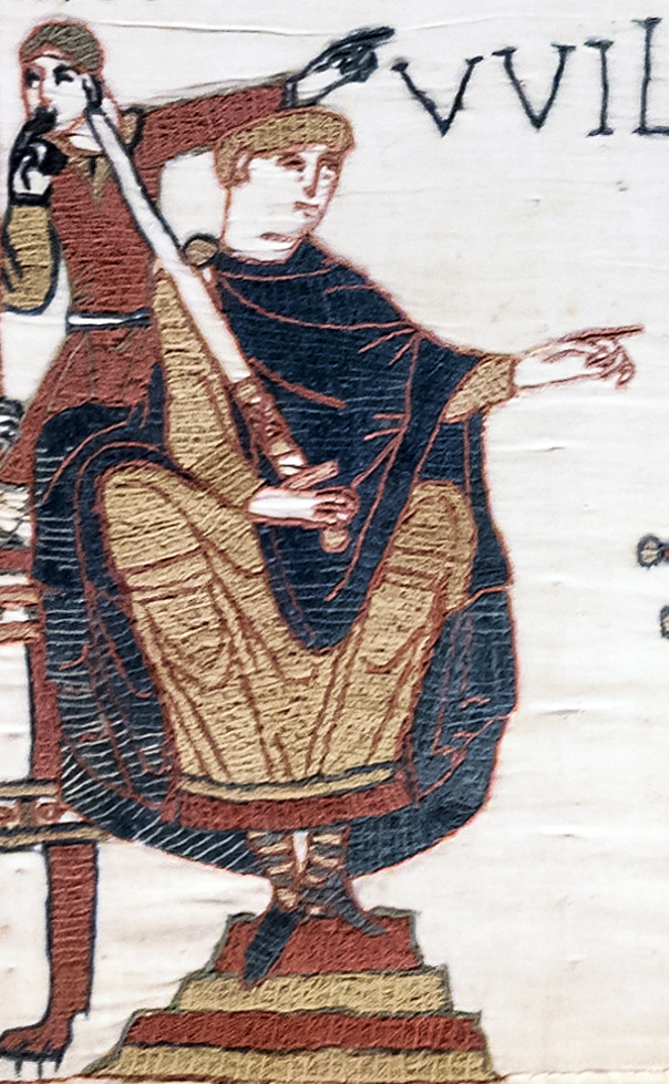
Rollon, premier duc de Normandie de 911 à 927 (ou 933). Monument représentant Guillaume le Conquérant et les six ducs de Normandie l'ayant précédé, Falaise (Calvados, Basse-Normandie).Pradigue · CC BY-SA 3.0 · Commons
The Duchy of Normandy grew out of the 911 Treaty of Saint-Clair-sur-Epte between King Charles III of West Francia and the Viking leader Rollo. The duchy was named for its inhabitants, the Normans.
From 1066 until 1204, as a result of the Norman Conquest of England, the dukes of Normandy were usually also kings of England, the only exceptions being Dukes Robert Curthose (1087–1106), Geoffrey Plantagenet (1144–1150), and Henry II (1150–1152), who became king of England in 1154.
The Norman polity had to contend with the Frankish and Breton systems of power that already existed in Normandy. In the early 10th century, Normandy was not a political or monetary unit. According to many academics, "the formation of a new aristocracy, monastic reform, episcopal revival, written bureaucracy, saints’ cults – with necessarily different timelines" were as important if not more than the ducal narrative espoused by Dudo. The formation of the Norman state also coincided with the creation of an origin myth for the Norman ducal family through Dudo, such as Rollo being compared to a "good pagan" like the Trojan hero Aeneas. Through this narrative, the Normans were assimilated closer to the Frankish core as they moved away from their pagan Scandinavian origins.
Read more
The Norman dukes created the most powerful, consolidated duchy in Western Europe between the years 980 and 1050.
There were two distinct patterns of Scandinavian settlement in the duchy. In the Danish area in the Roumois and the Caux, settlers intermingled with the indigenous Gallo-Romance-speaking population. Rollo shared out the large estates with his companions and gave agricultural land to his other followers. Danish settlers cleared their own land to farm it, and there was no segregation of populations. In the northern Cotentin the population was Norwegian and resisted Christianisation, including a pagan rebellion against Longsword's rule and Scandinavian derived place names indicate a constant use of Old Norse for four or five generations.
Read more
Within a few generations of the founding of Normandy in 911, however, the Scandinavian settlers had intermarried with the natives and adopted much of their culture. But in 911, Normandy was not a political nor monetary unit.
947 CE – 1491 CE · Capital: Nantes, Rennes, Vannes, and other cities · 37,409 km²
Jousting Buckingham+BretagneIllustrator of Chroniques (by Jean Froissart) Royal MS 18 E I · Public domain · Commons
The Duchy of Brittany (Breton: Dugelezh Breizh [dyˈɡɛːlɛs ˈbrɛjs]; French: Duché de Bretagne) was a medieval feudal state that existed between approximately 939 and 1547. Its territory covered the northwestern peninsula of France, bordered by the Bay of Biscay to the west, and the English Channel to the north. It was also less definitively bordered by the river Loire to the south, and Normandy, and other French provinces, to the east. The duchy was established after the expulsion of Viking armies from the region around 939.
The Duchy of Brittany that emerged in the early 10th century was influenced by several earlier polities. Prior to the expansion of the Roman Empire into the region, Gallic tribes had occupied the Armorican peninsula, dividing it into five regions that then formed the basis for the Roman administration of the area, and which survived into the period of the Duchy. These Gallic tribes – termed the Armorici in Latin – had close relationships with the Britonnes tribes in Roman Britain. Between the late 4th and the early 7th centuries, many of these Britonnes migrated to the Armorican peninsula, blending with the local people to form the later Britons, who eventually became the Bretons. The reasons for these migrations remain uncertain. These migrations from Britain contributed to Brittany's name.
Read more
Brittany fragmented into small, warring regna, kingdoms, each competing for resources.
General view of the place du parlement de Bretagne in Rennes (France), from its south-western corner.Édouard Hue (User:EdouardHue) · CC BY-SA 3.0 · Commons
The Estates of Brittany were founded by Arthur II who was considered completely independent of the Kingdom of France. He convoked the first Estates of Brittany in 1309. In addition to creating a parliamentary body, Arthur II added the innovation of including the Third Estate.
Read more
These parliamentary bodies figured prominently in the Breton War of Succession and helped to resolve the Ducal Claims of the House of Penthièvre in favor of the House of Montfort. The Estates of Brittany acted during the reign of Francis II, of the House of Montfort, to nullify provisions of the Treaty of Guerande and to confirm that Anne was Francis II's sole and legal Ducal heir. The action in favor of Anne, Duchess of Brittany effectively ended the Ducal claims of the House of Penthièvre.
The Parlement of Rennes was founded in 1485 by Francis II and first met in Vannes.
Drapeau de la province de Bretagne (1532)This image has been made by GwenofGwened and released under the licenses stated below. You are free to use it for any purpose as long as you credit me as author · CC BY-SA 4.0 · Commons
Armoiries Bretagne - Arms of BrittanyUnknown author · Public domain · Commons
Cordeliere and RegentUnknown, photo from Mary Rose Trust · Public domain · Commons
Ended
1491 CE
Last recorded ruler
Arthur I
Legacy in the Modern World
There is no modern-day Duchy of Brittany. The Duchy of Brittany and the sovereign title and role of the Duke of Brittany no longer exist in the modern 5th Republic of France. The Breton Parlement no longer exists. Its seat was in Rennes. It was disbanded by Louis XIV but the Parlement voted to ignore the King's order of dissolution upon the claim it alone had the authority to dissolve this legislative and judicial body. Since 1956, there does exist the administrative Region of Brittany – which, however, includes only 80 percent of the former Duchy of Brittany. The remaining 20 percent of the former Duchy is the Loire-Atlantique department which now lies inside the Pays de la Loire region, whose capital, Nantes, was the historical capital of the Duchy of Brittany.
The County of Anjou (UK:, US:; French: [ɑ̃ʒu]; Latin: Andegavia) was a French county that was the predecessor to the Duchy of Anjou. Its capital was Angers, and its area was roughly co-extensive with the diocese of Angers. Anjou was bordered by Brittany to the west, Maine to the north, Touraine to the east and Poitou to the south. Its 12th-century Count Geoffrey created the nucleus of what became the Angevin Empire. The adjectival form is Angevin, and inhabitants of Anjou are known as Angevins. In 1360, the county was raised into the Duchy of Anjou within the Kingdom of France.
John, King of EnglandThis file has been provided by the British Library from its digital collections. Links to the British Library's website may be broken as the library recovers… · CC0 · Commons
At first Anjou was included in the gouvernement (or military command) of Orléanais, but in the 17th century was made into a separate one. Saumur, however, and the Saumurois, for which King Henry IV had in 1589 created an independent military governor-generalship in favour of Duplessis-Mornay, continued till the Revolution to form a separate gouvernement, which included, besides Anjou, portions of Poitou and Mirebalais. Attached to the généralité (administrative circumscription) of Tours, Anjou on the eve of the Revolution comprised five êlections (judicial districts):--Angers, Baugé, Saumur, Château-Gontier, Montreuil-Bellay and part of the êlections of La Flèche and Richelieu.
Die Kathedrale Saint-Lous (Cathédrale Saint-Luis) ist ein Bischofskirche in der französischen Stadt Blois. Die Kathedrale wurde zwischen 1680 und 1700 errichtet. Sie steht unter Denkmalschutz.W. Bulach · CC BY-SA 4.0 · Commons
The County of Blois was a feudal principality centred on Blois, south of Paris, France. It was created just after king Clovis I conquered Roman Gaul around AD 500. Between the 8th and the 13th centuries, it was amongst the most powerful vassal counties within the Kingdom of France, after having succeeded in surrounding the Capetian dynasty's lands of France since Blois annexed the Champagne.
Since its creation up to 1498, the county was directed by counts, often with various more or less prestigious titles of nobility, or sometimes delegating their task to viscounts.
Troyes historic quarterKBWEi at German Wikipedia (Original text: KBWEi 21:50, 14. Okt. 2007 (CEST)) · Public domain · Commons
The County of Champagne (Latin: Comitatus Campaniensis; Old French: Conté de Champaigne) was a medieval territory and feudal principality in the Kingdom of France. It developed on the rich plains between Paris and the border of the Holy Roman Empire in the 12th century. It became an economic hub of northern France and an international trade center in part due to the trade fairs instituted by Count Theobald II, and steady land clearing led to economic and urban growth. Count Henry the Liberal established the city of Troyes as the county's capital and expanded the state.
The organization of the county was based on castellanies, which became the principal administrative unit under Henry the Liberal. There were about 30 castellanies in Champagne. Each castellany was centered on a castle or a castle town and encompassed lands of the count's domain as well as those of his vassals. At its head was the viscount or castellan, who had charge over the knights who guarded the castle and the roads travelled by merchants.
Read more
The count's villages were represented by mayors, who answered to the castellany's provost. The provost held courts and collected rents, tailles, and taxes from the comital domain. The castellanies themselves were administered by the comital officials in Troyes. The count's sergeants within collected information about the fiefs and obligations of the count's fiefholders within each castellany.
The economy of the county steadily expanded through persistent land clearing and urban growth. The Champagne trade fairs, initiated under Theobald II and protected and regulated by the subsequent counts, made the county the center of international trade and finance through most of the 1100s and 1200s. They principally attracted merchants and travelers from the neighboring County of Flanders and the Rhine Valley as well as from the states of Italy and England, but they also came from as far as the Mediterranean and the Baltic.
The intellectual and literary interests of Count Henry and Countess Marie transformed the county's capital, Troyes, into a cultural center as well. Numerous authors were active in the county and appeared at the court. Nicholas of Clairvaux, who was associated with the county's Clairvaux Abbey and the bishopric of Troyes, dedicated two collections of his literary works to Count Henry. Peter of Celle, who came from a Champenois noble family, is described by historian John F. Benton as "one of the finest spiritual writers of the twelfth century".
Read more
The most scholarly person at Henry's court, according to Benton, was Stephen of Alinerre, but his works have not survived. Further authors, such as Chrétien de Troyes, Evrat, Gace Brulé, Gautier d'Arras, and Simon Chèvre d'Or acknowledged the influence of the count and countess of Champagne.
Vue depuis les jardins pierre de ronsard, au premier plan l'escalier "des ponts neufs" puis le palais des comtes du Maine, et enfin se dessine la silhouette de la Cathédrale.Le Mans · CC BY 3.0 · Commons
Maine (French: [mɛːn]) is one of the traditional provinces of France. It corresponds to the former County of Maine, whose capital was also the city of Le Mans. The area, now divided into the departments of Sarthe and Mayenne, has about 857,000 inhabitants.
Hugh IV's son Herbert II fled to the Norman court (though some historians say he was under Angevin control for a few years first) and his death in 1062 precipitated a succession crisis.
Read more
Herbert died childless in 1062 after declaring William the Bastard, then Duke of Normandy, his heir. His sister Marguerite was engaged to William's eldest son, Robert Curthose and Herbert had taken refuge at William's court in 1056 when Geoffrey Martel, Duke of Anjou, invaded Le Mans.
While the county was in Angevin hands, Anjou had its own succession problem. Duke William of Normandy claimed the county on their behalf of Herbert's young sister Margaret, betrothed to his son Robert Curthose. The other claimant was Herbert's aunt Biota, a sister of Hugh IV, and her husband Walter, Count of the Vexin.
View of Rodez from bell tower of the cathedral of Our Lady of Rodez, Aveyron, FranceKrzysztof Golik · CC BY-SA 4.0 · Commons
Rouergue (French: [ʁwɛʁɡ]; Occitan: Roergue [ruˈeɾɣe]) is a former province of France, corresponding roughly with the modern department of Aveyron. Its historical capital is Rodez. It is bounded on the north by Auvergne, on the south and southwest by Languedoc, on the east by Gévaudan and on the west by Quercy.
During the Middle Ages Rouergue changed hands a number of times; its rulers included England (due to the Treaty of Brétigny in 1360), Armagnac and Languedoc.
Rouergue became a department in 1790, and was renamed Aveyron after the principal river flowing through it.
Toulouse (Haute-Garonne, France), view on Saint-Sernin basilica.Tonio94 (talk · contribs) · CC BY-SA 2.5 · Commons
The County of Toulouse (Occitan: Comtat de Tolosa, Latin: Comitatus Tolosanus, Middle French: Conté de Thoulouse) was a territory in present-day southern France consisting of the city of Toulouse and its environs, ruled by the Count of Toulouse from the late 9th century until the late 13th century.
After Pippin the Short conquered Septimania, his successor Charlemagne imposed an administration where Frankish counts were established in key cities such as Toulouse.
The Roman province of Gallia Narbonensis fell to the Visigothic Kingdom in the 5th century. Septimania, the Visigothic province roughly corresponding to the later county of Toulouse, fell briefly to the Emirate of Córdoba in the 750s before it was conquered into Francia by Pippin the Short in 759 following the Siege of Narbonne. Septimania within the Frankish realm would become known as Gothia or Marca Gothica by the end of the 9th century.
Read more
Pippin died in 768 and was followed by his sons Charlemagne and Carloman I. Because of this event, Hunald II, son of the late Duke Waifer, raised an insurrection against Frankish power in Aquitaine. Charlemagne soon intervened and defeated him. In 771, Carloman died and Charlemagne was left as the only ruler of the Frankish realm. In 778, Charlemagne led his army into Spain against the Arabs.
As a successor state of the Visigothic Kingdom and the Duchy of Aquitaine, Toulouse, along with the Aquitaine region and Languedoc (but not Gascony), inherited Visigothic Law and Roman Law which had combined to allow women more rights than their contemporaries would enjoy until the 20th century. Particularly with the Liber Judiciorum as codified in 642/643 and expanded on in the Code of Recceswinth in 653, women could inherit land and title and manage it independently from their husbands or male relations, dispose of their property in legal wills if they had no heirs, and women could represent themselves and bear witness in court by age 14 and arrange for their own marriages by age 20. As a consequence, male-preference primogeniture was the practiced succession law for the nobility.
Denarius van Antoninus Pius in zilver, 140 tot 143 NC, vindplaats: Onbekend, collectie Gallo-Romeins Museum Tongeren, S-175http://exploratorium.galloromeinsmuseum.be/Default.aspx?query=search=deeplink%7C/record/uniqid=obj_46165&showtype=record · Public domain · Commons
Currency
denarius, solidus
LICINIUS I SOLIDUS - 83000381Classical Numismatic Group · CC BY-SA 2.5 · Commons
Banner of OccitaniaNimlar (original); bayo (derivative work) · Public domain · Commons
C'est un vestige d'une ancienne église située place de l'hôtel de ville à Saint-Quentin 02100 France, mais placée aujourd'hui dans le jardin d'Horticulture de la même ville.Occultus · Public domain · Commons
Vermandois (French pronunciation: [vɛʁmɑ̃dwa]) was a French county that appeared in the Merovingian period. Its name derives from that of an ancient tribe, the Viromandui. In the 10th century, it was organised around two castellan domains: St Quentin (Aisne) and Péronne (Somme). In today's times, the Vermandois county would fall in the Picardy region of northern France.
Pepin I of Vermandois, the earliest of its hereditary counts, was descended in direct male line from the emperor Charlemagne.
Vexin (French pronunciation: [vɛksɛ̃]) is a historical county of northern France. It covers a verdant plateau on the right bank (north) of the Seine running roughly east to west between Pontoise and Romilly-sur-Andelle (about 20 km from Rouen), and north to south between Auneuil and the Seine near Vernon. The plateau is crossed by the Epte and the Andelle river valleys.
Given the less defined northern boundaries in the Oise, the French Vexin encompasses 167 communes. These span two regions and three departments: in Île-de-France, the Yvelines (31 communes) and Val-d'Oise (88 communes), and in Hauts-de-France, the Oise (47 communes).
Read more
Administratively, the territory overlaps four arrondissements: the Arrondissement of Pontoise (Val-d'Oise), the Arrondissement of Mantes-la-Jolie (Yvelines), the Arrondissement of Saint-Germain-en-Laye (Yvelines), and the Arrondissement of Beauvais (Oise).
Most rural communes of the French Vexin united in 1995 to form the French Vexin Regional Natural Park, headquartered in Théméricourt. It includes 94 communes (77 in Val-d’Oise and 17 in Yvelines) plus six gateway towns, covering 680 square kilometres (260 sq mi) with 79,000 inhabitants.
Read more
The Picardy communes in the Oise remained outside the park, as managing a park across two regions (Île-de-France and Picardy) seemed too complex at the time (despite precedents like the Normandy-Maine Regional Natural Park, established in 1975). In Val-d’Oise, two communes (Ambleville and La Chapelle-en-Vexin) initially declined to join but did so in 2008, alongside three Yvelines communes (Évecquemont, Vaux-sur-Seine, and Juziers).
In 2004, the park's territory recorded 13,497 jobs in the private sector, including 11,056 in Val-d’Oise and 2,441 in Yvelines.
During the liberation of Vexin, German troops in the forests of Marainville, Montgison, and Longues carried out a surprise attack against the American defenders in attempt to reoccupy the village of Fontenay-Saint-Père. Beginning 20 August 1944, fighting broke out, with about 30,000 troops engaged in total; in the nine days of fighting, multiple offensives and counter-offensives were carried out across the city. This eventually ended when a reinforced American army managed to defeat the German battalion.
Read more
In total, there were about 50 casualties on the American side, and several hundred on the German side. However, most of the casualties came from the inhabitants of the area, with an estimated loss of 2,500 civilians.
990 CE – 1439 CE · Capital: Toulouse · 141,605 km²
Queen EleanorFrederick Sandys · Public domain · Commons
The Duchy of Aquitaine (Occitan: Ducat d'Aquitània, IPA: [dyˈkad dakiˈtanjɔ]; French: Duché d'Aquitaine, IPA: [dyʃe dakitɛn]) was a historical fiefdom located in the western, central, and southern areas of present-day France, south of the river Loire. The full extent of the duchy, as well as its name, fluctuated greatly over the centuries and at times comprised much of what is now southwestern (including Gascony) and central France.
Gallia Aquitania fell under Visigothic rule in the 5th century. It was conquered by the Franks under Clovis I in 507, as a result of the Battle of Vouillé. During the 6th and early 7th century, it was under direct rule of Frankish kings, divided between the realms of Childebert II and Guntram in the Treaty of Andelot of 587. Under Chlothar II, Aquitaine was again an integral part of Francia, but after Chlothar's death in 629, his heir Dagobert I granted a subkingdom in southern Aquitaine to his younger brother Charibert II. This subkingdom, consisting of Gascony and the southern fringe of Aquitaine proper, is conventionally known as "Aquitaine" and forms the historical basis for the later duchy.
Blason de l'Aquitaine et de la GuyenneYou may select the license of your choice. · CC BY 2.5 · Commons
Wars and Battles
In 1337, King Philip VI of France reclaimed the fief of Aquitaine (essentially corresponding to Gascony) from Eleanor's descendant, Edward III of England. Edward in turn claimed the entire Kingdom of France as the only grandson of King Philip IV of France. This triggered the Hundred Years' War, in which both the Plantagenets and the House of Valois claimed supremacy over Aquitaine. In 1360, both sides signed the Treaty of Brétigny, in which Edward renounced his claim to the French crown but remained sovereign lord of Aquitaine (rather than merely duke). However, when the treaty was broken in 1369, both these English claims and the war resumed. In 1362, Edward III, as Lord of Aquitaine, made his eldest son Edward the Black Prince, Prince of Aquitaine. In 1390, King Richard II, son of Edward the Black Prince, appointed his uncle John of Gaunt as Duke of Aquitaine.
Nevers LoirebréckOriginal: Jochen Jahnke at German Wikipedia Modifications: Cornischong at Luxembourgish Wikipedia · CC BY-SA 3.0 · Commons
The County of Nevers (French: Comté de Nevers) was a county in central France. Its principal town was Nevers. It roughly corresponds to the later province of Nivernais and the modern of department of Nièvre.
The county itself dates from approximately the beginning of the 10th century. The county has frequently been associated with the neighboring Duchy of Burgundy; it was included among the lands and titles held by Duke Henry I of Burgundy. Beginning with Renauld I, the county was held jointly with that of the County of Auxerre.
Blason maison fr de NeversUnknown author · Public domain · Commons
Angevins
1126 CE – 1146 CE · 26,690 km²
Enamel effigy of Geoffrey Plantagenet, Count of Anjou on his tomb, formerly at Le Mans Cathedral, now in the Museum of Archeology and History in Le Mans.Original creater of enamel unknown. · Public domain · Commons
The House of Plantagenet was a royal house which originated in the French county of Anjou. The family held the English throne from 1154, with the accession of Henry II, until 1485, when Richard III died in battle. The first three Plantagenet kings of England ruled extensive territories in France and are sometimes called the Angevins to distinguish them from their successors (although the term Angevin is sometimes used to refer to the entire dynasty). After the deposing of Richard II in 1399, two cadet branches of the Plantagenets ruled England: the houses of Lancaster and York.
Eleanor – wife of William Marshal's son (also named William), and later the English rebel Simon de Montfort.
Read more
John also had illegitimate children with several mistresses. These children probably included nine sons called Richard, Oliver, Henry, Osbert Gifford, Geoffrey, John FitzJohn or Courcy, Odo or Eudes FitzRoy, Ivo, Henry, Richard the constable of Wallingford Castle and three daughters called Joan, Matilda the abbess of Barking and Isabella la Blanche. Joan was the best known of these, since she married Prince Llewelyn the Great of Wales.
William Marshal, 1st Earl of Pembroke, was appointed regent for the nine-year-old King Henry on King John's death. Thereafter, support for Louis declined, and he renounced his claims in the Treaty of Lambeth after Marshal's victories at the battles of Lincoln and Sandwich in 1217.
In 1328, Charles IV of France died without a male heir. Queen Isabella made a claim to the throne of France on behalf of her son Edward, on the grounds that he was a matrilineal grandson of Philip IV of France. However, the precedents set by Philip V's succession over his niece Joan II of Navarre and Charles IV's succession over his nieces meant that the senior grandson of Philip III in the male line, Phillip of Valois, became king. Not yet in power, Edward paid homage to Phillip as Duke of Aquitaine.
Read more
In 1337, Phillip confiscated Aquitaine and Ponthieu from Edward, alleging he was harbouring Phillip's fugitive cousin and enemy, Robert of Artois. In response, Edward proclaimed himself king of France to encourage the Flemish to rise in open rebellion against the French king.
Richard's failure to provide an heir caused a succession crisis and conflict between supporters of the claim of his nephew, Arthur, and John. Guillaume des Roches led the magnates of Anjou, Maine, and Touraine declaring for Arthur. Once again Philip II of France attempted to disturb the Plantagenet territories on the European mainland by supporting his vassal Arthur's claim to the English crown. John won a significant victory while preventing Arthur's forces from capturing his mother, seizing the entire rebel leadership at the Battle of Mirebeau and his sister Eleanor, Fair Maid of Brittany.
Read more
John disregarded his allies' opinions on the fate of the prisoners, many of them their neighbours and kinsmen.
1206 CE – 1249 CE · Capital: Poitiers · 23,634 km²
Picture by Mario Vercellotti (www.vermario.com)Vermario at English Wikipedia · Public domain · Commons
The County of Poitou (Latin comitatus Pictavensis) was a historical region of France, consisting of the three sub-regions of Vendée, Deux-Sèvres and Vienne. Its name is derived from the ancient Gaul tribe of Pictones. The county was bounded on the north by the Duchy of Brittany, the counties of Anjou and Touraine, on the east by the County of La Marche and on the south by the County of Angoulême. The seat of the county was at Poitiers.
Poitou was ruled by the count of Poitou, a continuous line of which can be traced back to an appointment of Charlemagne in 778.
Touraine (US:; French: [tuʁɛn]) is one of the traditional provinces of France. Its capital was Tours. During the political reorganisation of French territory in 1790 amid the French Revolution, Touraine formed the bulk of the Indre-et-Loire department as well as parts of the new departments of Loir-et-Cher, Indre and Vienne.
Le château de Foix vu de l'EspinetPatrick Castay · CC BY 3.0 · Commons
The County of Foix (French: Comté de Foix, pronounced [fwa]; Occitan: Comtat de Fois, pronounced [fujs] locally [fujʃ]; Catalan: Comtat de Foix, pronounced [foʃ]) was a medieval fief in southern France, and later a province of France, whose territory corresponded roughly the eastern part of the modern département of Ariège (the western part of Ariège being Couserans).
During the Middle Ages, the county of Foix was ruled by the counts of Foix, whose castle overlooks the town of Foix.
The County of Artois (French: comté d'Artois, Dutch: graafschap Artesië, Picard: Comté d'Artoé) was a historic province of the Kingdom of France, held by the Dukes of Burgundy from 1384 until 1477/82, and a state of the Holy Roman Empire from 1493 until 1659.
Present-day Artois lies in northern France, near the border with Belgium. Its territory has an area of around 4,000 square kilometres (1,500 sq mi) and a population of about one million.
The Capetian House of Anjou, or House of Anjou-Sicily, was a royal house and cadet branch of the Capetian dynasty. It is one of three separate royal houses referred to as Angevin, meaning "from Anjou" in France. Founded by Charles I of Anjou, the youngest son of Louis VIII of France, the Capetian king first ruled the Kingdom of Sicily during the 13th century. The War of the Sicilian Vespers later forced him out of the island of Sicily, leaving him with the southern half of the Italian Peninsula, known as the Kingdom of Naples.
Charles d'Anjou, façade du Palais Royal de Naples.Louis de Lauban · CC0 · Commons
A younger son of the House of Capet king Louis VIII of France the Lion, Charles was first given a noble title by his brother, Louis IX of France who succeeded to the French throne in 1226. Charles was named Count of Anjou and Maine; the feudal County of Anjou was a western vassal state of the Kingdom of France, which the Capetians had wrested from the House of Plantagenet only a few decades earlier. Charles married an heiress of the County of Provence named Beatrice of Provence. She was a member of the House of Barcelona; this meant Charles' holdings were growing as Count of Provence. After fighting in the Seventh Crusade, Charles was offered the Kingdom of Sicily by Pope Clement IV. At the time this included not only the island of Sicily but also the southern half of the Italian Peninsula.
Eastern ridge of the Vercors, seen from le Grand Veymont. Below these cliffs starts the Triève.Johan N · CC BY-SA 3.0 · Commons
The Dauphiné (UK:, US:, French: [dofine]; Occitan: Daufinat or Dalfinat; Arpitan: Dôfenât or Darfenât), traditionally known in English as Dauphiny, is a former province in southeastern France during the Ancien régime, whose area roughly corresponded to that of the present-day departments of Isère, Drôme and Hautes-Alpes. The Dauphiné was originally the Dauphiné of Viennois.
In the 12th century, the local ruler Count Guigues IV of Albon (c. 1095–1142) bore a dolphin on his coat of arms and was nicknamed le Dauphin (French for 'dolphin').
The conflicts were over, but Dauphiné was destroyed and its people exhausted. The enactment of the Edict of Nantes (1598) restored some civil rights to the Huguenots and brought peace for a short time, but the wars resumed soon afterward.
Read more
Lesdiguières defeated the army of Savoy several times and helped the reconstruction of the region. His most famous construction is the Palace of Vizille, built for his personal use.
The last meeting of the Estates of Dauphiné took place in 1628. It symbolizes the end of the liberty of the province. From that time, the important decisions were taken by the representatives of the king. It shows the progress of Absolutism.
A view of central Orange from the west.Jeanlouiszimmermann · CC BY-SA 3.0 · Commons
The Principality of Orange (French: Principauté d'Orange; Occitan: Principat d'Aurenja) was, from 1163 to 1713, a feudal state in Provence, in the south of modern-day France, on the east bank of the river Rhone, north of the city of Avignon, and surrounded by the independent papal state of Comtat Venaissin.
It was constituted in 1163, when Holy Roman Emperor Frederick I elevated the Burgundian County of Orange (consisting of the city of Orange and the land surrounding it) to a sovereign principality within the Empire.
1272 CE – 1790 CE · Capital: Carpentras · 2,437 km²
Passage Boyer, rue commerçante couverte à CarpentrasVi..Cult... · CC BY-SA 3.0 · Commons
The Comtat Venaissin (French pronunciation: [kɔ̃ta vənɛsɛ̃]; Occitan: lo Comtat Venaicin; 'County of Venaissin'), often called the Comtat for short, was a part of the Papal States from 1274 to 1791, in what is now the Provence-Alpes-Côte d'Azur region of Southern France.
Under the Counts of Toulouse, the chief officer of the Comtat Venaissin was the Seneschal.
Read more
From 1294 to 1791 the chief administrator of the Comtat Venaissin was the Rector, who was appointed directly by the Pope. Most of the incumbents were in fact prelates, either Archbishops or Bishops, and the Rector therefore had the right to wear a purple garb, similar to that of an Apostolic Chamberlain. His official residence was in Carpentras. He had no authority over Avignon, however, which was administered by a Cardinal Legate or a Vice-Legate, also appointed directly by the Pope. Gradually, however, the power of the Vice-Legate encroached on that of the Rector, until the Cardinal virtually held the position of a governor, and the Rector had the functions of a judge. In both cases their tenure was for a period of three years, renewable.
Flag of Comtat VenaissinOriginal file: User at openclipart.org, File:Flag of Comtat Venaissin.svg (Open Clip Art).svg Modified: User:Superbenjamin · CC0 · Commons
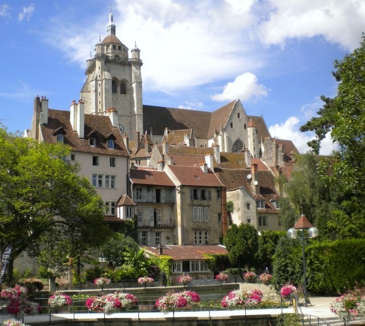
Photographie du quartier des tanneurs et de la collégiale Notre-Dame de Dole, prise en 2012, depuis la Rue du Prélot.Cjulien21 · CC BY-SA 3.0 · Commons
The Free County of Burgundy (Latin: Comitatus Burgundiae); French: Franche Comté de Bourgogne; German: Freigrafschaft Burgund) was a medieval and early modern feudal polity ruled by a count from 982 to 1678. It became known as Franche-Comté (the Free County) and was located in the modern region of Franche-Comté. It belonged to the wider historical region of Upper Burgundy, and bordered the Duchy of Burgundy to the west.
Its territory had initially been part of the Kingdom of Upper Burgundy (888–933) and then the united Kingdom of Burgundy, later known as the Kingdom of Arles.
The area previously formed part of the Kingdom of the Burgundians, which had been annexed by the Franks in 534 and incorporated into the Kingdom of the Franks. The Frankish Empire was partitioned in 843 by the Treaty of Verdun, with the area west of the Saône river being allotted to West Francia, and later formed the Duchy of Burgundy, while the southern and eastern parts of the former Burgundian kingdom fell to Middle Francia under Emperor Lothair I. This Middle Frankish part became the two independent entities of southern Lower Burgundy in 879 and northern Upper Burgundy in 888. The region that would later become the Free County of Burgundy was then included in Upper Burgundy, centred around the city of Besançon.
Coat of arms palatine counts of BurgundyUnknown author · CC BY-SA 4.0 · Commons
Wars and Battles
The County was captured by France in 1668, during the War of Devolution. Multiple cities surrendered to the French after little fighting, but later in the same year the County was returned to the Spanish Habsburgs under the Treaty of Aix-la-Chapelle.
Read more
During the Franco-Dutch War, the County was invaded again in 1674, and overrun by French forces without much resistance. The Treaties of Nijmegen ended the war in 1678; as part of the third treaty (between France and Spain), the county was transferred to France in exchange for the return of French-occupied territory in the Spanish Netherlands.
The territory of the County, known as the Franche-Comté has remained part of France uninterrupted ever since; it now forms part of the administrative region Bourgogne-Franche-Comté.
The House of Bourbon (English:, also UK:; French: [buʁbɔ̃]) is a dynasty that originated in the Kingdom of France as a branch of the Capetian dynasty, the royal House of France. Bourbon kings first ruled France and Navarre in the 16th century. A branch descended from the French Bourbons came to rule Spain in the 18th century and is the current Spanish royal family. Other branches, descended from the Spanish Bourbons, held thrones in Naples, Sicily, and Parma. Today, Spain and Luxembourg have monarchs from the House of Bourbon.
The pre-Capetian House of Bourbon was a noble family, dating at least from the beginning of the 13th century, when the estate of Bourbon was ruled by the Sire de Bourbon who was a vassal of the King of France. The term House of Bourbon ("Maison de Bourbon") is sometimes used to refer to this first house and the House of Bourbon-Dampierre, the second family to rule the seigneury.
Read more
In 1272, Robert, Count of Clermont, sixth and youngest son of King Louis IX of France, married Beatrix of Bourbon, heiress to the lordship of Bourbon and member of the House of Bourbon-Dampierre. Their son Louis was made Duke of Bourbon in 1327. His descendant, the Constable of France Charles de Bourbon, was the last of the senior Bourbon line when he died in 1527.
The House of Valois-Anjou (French: Maison de Valois-Anjou, Italian: Casa Valois-Angiò) was a noble French family and a cadet branch of the House of Valois. Members of the house served as rulers of the Duchy of Anjou in the Kingdom of France, the County of Provence in the Holy Roman Empire, and also as monarchs of the Kingdom of Naples, as well as lords of several other territories.
Blason duche fr Anjou (moderne)Syryatsu · Public domain · Commons
Duchy of Lorraine
1431 CE – 1768 CE · Capital: Nancy · 17,637 km²
Herzog Franz (I.) Stephan von Lothringen (1708-1765), in reichem Hofkleid, KniestückMartin van Meytens · Public domain · Commons
The Duchy of Lorraine, initially also known as the Duchy of Upper Lorraine, was a duchy of the Holy Roman Empire which existed from the 10th century until 1766, when it was annexed by the Kingdom of France. It gave its name to the present-day region of Lorraine in northeastern France. Its capital was Nancy.
It was founded in 959–965, following the division of the old Stem Duchy of Lotharingia into two separate duchies: Upper and Lower Lorraine, the westernmost parts of the Holy Roman Empire.
Lorraine Franconian, known as francique or platt (lorrain) in French, is a West Central German dialect spoken by a minority in the northern part of the region. This is distinct from the neighbouring Alsatian language, although the two are often confused. Neither has any form of official recognition.
Read more
Lorrain is a Romance dialect spoken by a minority in the southern part of the region.
The duchy produced a number of important painters, including Claude Lorrain, Georges de La Tour and Jean LeClerc.
Like most of France's regional languages (such as Breton, Franco-Provençal, Occitan, Alsatian, Catalan, Basque and Flemish), Lorrain and Lorraine Franconian were largely replaced by French with the advent of mandatory public schooling in the 19th and 20th centuries.
Medieval States of France and the Low Countries: Frequently Asked Questions
Which states existed in France and the Low Countries in this period?
This page maps 39 states of France and the Low Countries founded between 462 CE and 1431 CE: Kingdom of the Franks, Merovingian Empire, Kingdom of Soissons, Breton Kingdoms, Magna Frisia, Aquitaine, Carolingian Empire, Kingdom of Neustria, Frisia, Frisians, Kingdom of Brittany, Middle Franks and 27 more.
Which was the largest of the Medieval States of France and the Low Countries?
Kingdom of the Franks had the largest mapped extent, about 1,317,417 km².
Which of the Medieval States of France and the Low Countries lasted longest?
Duchy of Brittany lasted longest, 947 CE – 1491 CE.
↑↓ to navigate↵ to open
12,754 Planetary Entities Indexed
We use Google Analytics cookies to understand which pages are useful. Necessary storage only keeps your theme and this choice on your device. Privacy policy


 Dagobert IRita1234 · CC BY-SA 3.0 · Commons
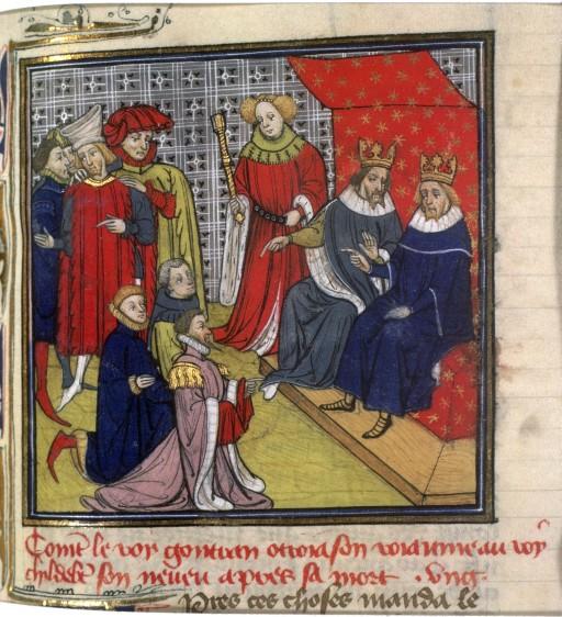
 Pepin the Hunchbacksconosciuto · Public domain · Commons
 TheudemeresArtiste inconnu · Public domain · Commons


 Bamberg, Staatsbibliothek, Msc.Med. 1Mönche des Kloster Lorsch · Public domain · Commons