Medieval States of the Balkans and Greece, 1236 CE – 1395 CE: Map & History
20 states of the Balkans and Greece on one map, from 1236 CE to 1858 CE.The largest, Principality of Moldavia, covered about 256,733 km²; the longest-lived, Principality of Wallachia, lasted 1314 CE – 1858 CE. Each has its own section below with its rulers, capitals, wars and pictures where the records hold them.
Each state in its own colour. Move the timeline to see which existed in any year from 1236 AD to 1858; select a territory to read about it. Borders: Cliopatria / Seshat (CC BY 4.0).
The Medieval States of the Balkans and Greece, 1236 CE – 1395 CE Compared
1236 CE – 1249 CE · Capital: Thessalonica · 22,045 km²
ThessalonicaSilentResident (compilation, sources to attribute see above; if any of the sources used in the Montage are removed from Wikimedia Commons, or better ones are… · CC BY-SA 3.0 · Commons
The Empire of Thessalonica is a historiographic term used by some modern scholars to refer to the short-lived Greek state centred on the city of Thessalonica between 1224 and 1246 (sensu stricto until 1242) and ruled by the Komnenodoukas dynasty of the Despotate of Epirus.
After the Fourth Crusade captured Constantinople in April 1204, the Byzantine Empire dissolved and was divided between the Crusader leaders and the Republic of Venice. The Latin Empire was set up in Constantinople itself, while most of northern and eastern mainland Greece went to the Kingdom of Thessalonica under Boniface of Montferrat. At the same time, two major native Byzantine Greek states emerged to challenge the Latins and claim the Byzantine inheritance, the so-called Empire of Nicaea under Theodore I Laskaris in Asia Minor, and the so-called Despotate of Epirus in western Greece under Michael I Komnenos Doukas, while a third state, the so-called Empire of Trebizond, established a separate existence on the remote shores of the Pontus. Michael I Komnenos Doukas soon extended his state into Thessaly, and his successor Theodore Komnenos Doukas captured Thessalonica in 1224.
The capture of Thessalonica, traditionally the second city of the Byzantine Empire after Constantinople, allowed Theodore to challenge the Nicaean claims on the Byzantine imperial title. With the support of the bishops of his domains, he was crowned emperor at Thessalonica by the Archbishop of Ohrid, Demetrios Chomatenos. The date is unknown, but has been placed either in 1225 or in 1227/8. Having openly declared his imperial ambitions, Theodore turned his gaze onto Constantinople. Only the Nicaean emperor John III Doukas Vatatzes, and the Bulgarian emperor Ivan II Asen were strong enough to challenge him. In a bid to preempt Theodore, the Nicaeans seized Adrianople from the Latins in 1225, but Theodore quickly marched into Thrace and forced the Nicaeans to leave their European possessions to him. Theodore was free to assault Constantinople, but for unknown reasons delayed this attack.
The Patriarchate of Aquileia was an episcopal see and ecclesiastical province in northeastern Italy, originally centered in the ancient city of Aquileia, situated near the northern coast of the Adriatic Sea. It emerged in the 4th century as a metropolitan province, with jurisdiction over the Italian region of Venetia et Histria. In the second half of the 6th century, metropolitan bishops of Aquileia started to use the patriarchal title. Their residence was moved to Grado in 568, after the Lombard conquest of Aquileia.
In 1451, the Patriarchate of Grado (new Aquileia) was suppressed, and replaced by the Patriarchate of Venice, that kept Aquileian historical claims and traditions of Grado.
Read more
In the same time, Patriarchs of old Aquileia, deprived of their previous temporal powers, continued to exercise their ecclesiastical jurisdiction. Under Domenico Grimani (cardinal since 1497), Austrian parts of Friuli were added to the territory of the patriarchate whose jurisdiction thus extended over some Austrian dioceses. In 1623 provost of Aquileia Albert Pessler, on behalf of Ferdinand II, Holy Roman Emperor, requested establishment of the Bishopric of Gorizia and removing the Austrian dioceses from jurisdiction of the Patriarchate of Aquileia.
The Capetian House of Anjou, or House of Anjou-Sicily, was a royal house and cadet branch of the Capetian dynasty. It is one of three separate royal houses referred to as Angevin, meaning "from Anjou" in France. Founded by Charles I of Anjou, the youngest son of Louis VIII of France, the Capetian king first ruled the Kingdom of Sicily during the 13th century. The War of the Sicilian Vespers later forced him out of the island of Sicily, leaving him with the southern half of the Italian Peninsula, known as the Kingdom of Naples.
Charles d'Anjou, façade du Palais Royal de Naples.Louis de Lauban · CC0 · Commons
A younger son of the House of Capet king Louis VIII of France the Lion, Charles was first given a noble title by his brother, Louis IX of France who succeeded to the French throne in 1226. Charles was named Count of Anjou and Maine; the feudal County of Anjou was a western vassal state of the Kingdom of France, which the Capetians had wrested from the House of Plantagenet only a few decades earlier. Charles married an heiress of the County of Provence named Beatrice of Provence. She was a member of the House of Barcelona; this meant Charles' holdings were growing as Count of Provence. After fighting in the Seventh Crusade, Charles was offered the Kingdom of Sicily by Pope Clement IV. At the time this included not only the island of Sicily but also the southern half of the Italian Peninsula.
View on the plain of Thessaly including river Pinios, GreeceEvgeni Dinev · CC BY 2.0 · Commons
Thessaly (Greek: Θεσσαλία, romanized: Thessalía) is a traditional geographic and modern administrative region of Greece, comprising most of the ancient region of the same name. Before the Greek Dark Ages, Thessaly was known as Aeolia (Ancient Greek: Αἰολία, Aiolía), and appears in Homer's Odyssey.
Thessaly became part of the modern Greek state in 1881, after four and a half centuries of Ottoman rule. Since 1987 it has formed one of the country's 13 regions and is further (since the Kallikratis reform of 2011) sub-divided into five regional units and 25 municipalities.
Although the historical region of Thessaly extended south into Phthiotis and at times north into West Macedonia, today the term 'Thessaly' is identified with the modern Administrative Region which was established in the 1987 administrative reform. With the 2010 Kallikratis plan, the powers and authority of the region were redefined and extended.
Read more
Along with Central Greece, it is supervised by the Decentralized Administration of Thessaly and Central Greece, based at Larissa. The region of Thessaly is divided into five regional units (four were pre-Kallikratis prefectures), Karditsa, Larissa, Magnesia, the Sporades and Trikala, which are further subdivided into twenty-five municipalities.
The regional governor is Dimitris Kouretas, who was elected in the second round of the 2023 regional election and took office on 1 January 2024.
The alluvial soils of the Pineios Basin and its tributaries make Thessaly a vital agricultural area, particularly for the production of grain, cattle, and sheep. Modernization of agricultural practices in the mid-20th century has controlled the chronic flooding that had restricted agricultural expansion and diversification in the low-lying plains. Thessaly is the leading cattle-raising area of Greece, and Aromanian shepherds move large flocks of sheep and goats seasonally between higher and lower elevations.
Read more
In the last few decades, there has been a rise in the cultivation of dried nuts such as almonds, pistachios, and walnuts, especially in the region of Almyros. An increase in the number of olive oil trees has been also observed. The nearly landlocked Gulf of Pagasai provides a natural harbor at Volos for shipping agricultural products from the plains and chromium from the mountains.
In the game, Hades II (the sequel to Hades), "The Rift of Thessaly" is a massive water rift made on Thessaly by the sea-god, Poseidon (Melinoë, the Protagonist's, paternal uncle), in an (unsuccessful) attempt to prevent the Titan of Time, Chronos's, forces from laying siege upon Mount Olympus. Here, the 'Helpful-Hand' character for Melinoë while on her quest is her fellow sorceress, Lady Circe, stationed up on her private isle of "Aiaia" prior by Lady Hecate to be her eyes and ears there.
Read more
Thessaly appears in Tom Clancy's EndWar as the European Union's southernmost missile defense uplinks.
1285 CE – 1325 CE · Capital: Sremska Mitrovica · 24,036 km²
River Studva along Soljanka forest.Sauly at Croatian Wikipedia · CC BY-SA 3.0 · Commons
Syrmia (Serbian: Срем, Srem; Croatian: Srijem; Pannonian Rusyn: Срим, romanized: Srim) is a historical region of the southern Pannonian Basin, between the Danube and Sava rivers, and is divided between Croatia and Serbia. Most of the region is flat, with the exception of the Fruška Gora low mountain range stretching along the Danube in its northern part.
According to the 2022 census in Serbia, the territory of the Serbian part of Syrmia had a population of 339,881 inhabitants, composed of 83.5% of Serbs, 2.2% of Croats, 2.1% of Slovaks, 2% of Roma, and 1.1% of Hungarians.
Read more
According to the 2021 census in Croatia, the territory of the Croatian part of Syrmia (the Vukovar-Srijem county), had a population of 143,113 inhabitants, composed of 81.6% of Croats and 13.5% of Serbs.
Entrada de Roger de Flor en ConstantinoplaJosé Moreno Carbonero · Public domain · Commons
The Catalan Company or the Great Catalan Company (Catalan: Gran Companyia Catalana; Societas exercitus catalanorum, Societas cathalanorum, or Magna Societas Catalanorum) was a company of mercenaries led by Roger de Flor in the early 14th century and hired by Byzantine Emperor Andronikos II Palaiologos to combat the increasing power of the Anatolian beyliks. It was formed by almogavar veterans of the War of the Sicilian Vespers, who had remained unemployed after the signing in 1302 of the Peace of Caltabellotta between the Crown of Aragon and the French dynasty of the Angevins.
The military demands of the Reconquista stimulated the formation of the elite light infantry known as the almogavars on the Iberian peninsula during the 13th century. These troops were used quite effectively by the Crown of Aragon for other imperial ventures in the Mediterranean, particularly the War of the Sicilian Vespers. They were typically organised in companies (societates) of 20 to 50 men, following a chief of recognized military skill. The signing of the Peace of Caltabellotta in 1302 terminated that struggle in Sicily, leaving the almogavars without immediate employment.
Read more
James II of Aragon and his brother Frederick III of Sicily saw the threat posed to civil order. While Frederick would have liked to retain some of them for the defence of Sicily, they could not, by custom, be forced to do so.
In July 1304, the Company began to march through the regions of Caria and Lycaonia and linked up with the road that the Crusaders had followed two centuries earlier on their way to the Holy Land. Finally, the Company reached the Cilician Gates at the foot of the Taurus Mountains, which separated the region of Cilicia from the Christian Kingdom of Little Armenia.
Read more
As the cavalry advanced to reconnoitre the land, they discovered in a valley a large contingent of Turkish troops (20,000 infantry and 10,000 cavalry), who were remnants of previous defeats and were regrouped and ready to ambush the company. Once discovered, the Turks descended to the plain and both armies prepared for a great battle, the Battle of Kibistra, in the open field at Kibistra on August 15, 1304.
In a short space of time, the Company not only assumed the control of the Duchy of Athens but extended its dominions to the city of Thebes and the region of Thessaly, converting the latter into the Duchy of Neopatras, where they established themselves as feudal lords. In 1312, they accepted the overlordship of the Aragonese crown of Sicily and adopted a new seal bearing the head of St George. As a consequence of their taking possession of the duchies in the name of the Crown of Aragon and refusing to return them to their legitimate heirs, the Pope demanded the Company return the territory and excommunicated its members in 1318 after they declined.
1314 CE – 1858 CE · Capital: Câmpulung · 74,680 km²
Curtea de Argeş Monastery, Romania: exterior.Alexandru Baboş Albabos · CC BY 3.0 · Commons
Wallachia is a geographical region of modern-day Romania, as well as one of the two historical Romanian principalities that laid the foundation for the establishment of the modern Romanian state. It is situated north of the Lower Danube and south of the Southern Carpathians. Wallachia was traditionally divided into two sections, Muntenia (Greater Wallachia) and Oltenia (Lesser Wallachia). Dobruja could sometimes be considered a third section due to its proximity and brief rule over it.
Throughout the 13th century, numerous records of Vlach political entities on both sides of the Carpathians had begun to emerge. One of the first written pieces of evidence in correlation to local Vlach voivodes concerns the ruler Litovoi, who was first mentioned in the Diploma of the Joannites in 1247. Litvoi ruled over the Țara Litua, corresponding to modern day northern Oltenia. By 1272, Litvoi had gained control over more land on each side of the Carpathians, specifically further along the northern Wallachian Plain and Hațeg Country in Transylvania. Litvoi refused to pay tribute to King Ladislaus IV of Hungary, and in 1277 war broke out with the Hungarians, where he died in battle before 1280. His successor was his brother Bărbat, who ruled until 1288.
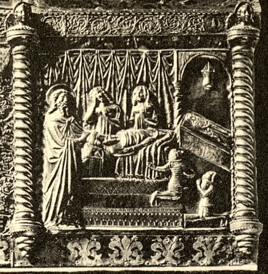
Stephen II, Ban of BosniaDenkmäler der Kunst in Dalmatien, Herausgegeben von Georg Kowalczyk, mit einer Einleitung von Cornelius Gurlitt. Autor Georg Kowalczyk 1909 · Public domain · Commons
Slavery (Romanian: robie) was part of the social order from before the founding of the Principality of Wallachia, until it was abolished in stages during the 1840s and 1850s. Most of the slaves were of Roma (Gypsy) ethnicity. The very first document attesting the presence of Roma people in Wallachia dates back to 1385, and refers to the group as ațigani (from the Greek athinganoi, the origin of the Romanian term țigani, which is synonymous with "Gypsy").
Grosh, denarii, aspri, ducat, florin, leeuwendaalder, Austrian florin and others
Wars and Battles
Wallachia became a target for Habsburg incursions during the last stages of the Great Turkish War around 1690, when the ruler Constantin Brâncoveanu secretly and unsuccessfully negotiated an anti-Ottoman coalition. Brâncoveanu's reign (1688–1714), noted for its late Renaissance cultural achievements (see Brâncovenesc style), also coincided with the rise of Imperial Russia under Tsar Peter the Great—he was approached by the latter during the Russo-Turkish War of 1710–1713, and lost his throne and life sometime after sultan Ahmed III caught news of the negotiations. Despite his denunciation of Brâncoveanu's policies, Ștefan Cantacuzino attached himself to Habsburg projects and opened the country to the armies of Prince Eugene of Savoy; he was himself deposed and executed in 1716.
1333 CE – 1374 CE · Capital: Valona (Vlorë, Albania) · 774 km²
The Principality of Valona and Kanina, also known as the Despotate of Valona and Kanina, Principality of Valona or Principality of Vlorë (1346–1417) was a medieval principality in Albania, roughly encompassing the territories of the modern counties of Vlorë (Valona), Fier, and Berat. Initially a vassal of the Serbian Empire, it became an independent lordship after 1355, although de facto under Venetian influence, and remained as such until it was conquered by the Ottoman Turks in 1417.
ThessalonicaSilentResident (compilation, sources to attribute see above; if any of the sources used in the Montage are removed from Wikimedia Commons, or better ones are… · CC BY-SA 3.0 · Commons
Thessaloniki (Greek: Θεσσαλονίκη [θesaloˈnici]; also known by various spellings and names) is the capital and largest city of the administrative region of Central Macedonia, and the second-largest city in Greece. It is the largest city of Northern Greece, with over 300,000 in the city proper and slightly over one million inhabitants in its metropolitan area, the capital of the geographic region of Macedonia, and the Decentralized Administration of Macedonia and Thrace.
According to the Kallikratis reform, as of 1 January 2011 the Thessaloniki Urban Area (Greek: Πολεοδομικό Συγκρότημα Θεσσαλονίκης) which makes up the "City of Thessaloniki", is made up of six self-governing municipalities (Greek: Δήμοι) and one municipal unit (Greek: Δημοτική ενότητα). The municipalities that are included in the Thessaloniki Urban Area are those of Thessaloniki (the city centre and largest in population size), Kalamaria, Neapoli-Sykies, Pavlos Melas, Kordelio-Evosmos, Ampelokipoi-Menemeni, and the municipal units of Pylaia and Panorama, part of the municipality of Pylaia-Chortiatis. Prior to the Kallikratis reform, the Thessaloniki Urban Area was made up of twice as many municipalities, considerably smaller in size, which created bureaucratic problems.
Thessaloniki rose to economic prominence as a major economic hub in the Balkans during the years of the Roman Empire. The Pax Romana and the city's strategic position allowed for the facilitation of trade between Rome and Byzantium (later Constantinople and now Istanbul) through Thessaloniki by means of the Via Egnatia. The Via Egnatia also functioned as an important line of communication between the Roman Empire and the nations of Asia, particularly in relation to the Silk Road.
Read more
With the partition of the Roman Empire into East (Byzantine) and West, Thessaloniki became the second-largest city of the Eastern Roman Empire after New Rome (Constantinople) in terms of economic might. Under the Empire, Thessaloniki was the largest port in the Balkans. As the city passed from Byzantium to the Republic of Venice in 1423, it was subsequently conquered by the Ottoman Empire.
In 1915, during World War I, a large Allied expeditionary force established a base at Thessaloniki for operations against pro-German Bulgaria. This culminated in the establishment of the Macedonian Front, also known as the Salonika front, and a temporary hospital run by the Scottish Women's Hospitals for Foreign Service being set up in a disused factory.
Because of the city's rich and diverse history, Thessaloniki houses many museums dealing with many different eras in history. Two of the city's most famous museums include the National Archaeological Museum of Thessaloniki and the Byzantine Culture Museum of Thessaloniki.
Read more
The Archaeological Museum of Thessaloniki, situated in Manolis Andronikos Street–ad honorem of the famous archaeologist that excavated Royal Palaces of the Macedonian Kingdom specifically King Phillip II's tomb, was established in 1962 and houses some of the most important ancient Macedonian artifacts, including an extensive collection of golden artwork from the royal palaces of Aigai and Pella. It also houses exhibits from Macedon's prehistoric past, dating from the Neolithic to the Bronze Age.
The Museum of Byzantine Culture is one of the city's most famous museums, showcasing the city's glorious Byzantine past.
1352 CE – 1458 CE · Capital: Prizren, Skopje, Serres · 186,880 km²
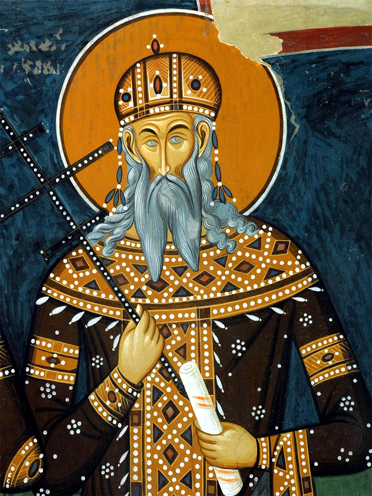
The fresco of king Volkašin Mrnjavčević, Psača monastery, MacedoniaUnknown authorUnknown author · Public domain · Commons
The Serbian Empire (Serbian: Српско царство / Srpsko carstvo, pronounced [sr̩̂pskoː tsâːrstʋo]) was a medieval Serbian state that emerged from the Kingdom of Serbia. It was established in 1346 by Dušan the Mighty, who significantly expanded the state.
During Dušan's rule, Serbia was one of the most powerful European states and the most powerful in Southeast Europe. It was an Eastern Orthodox multi-ethnic and multi-lingual empire that stretched from the Danube in the north to the Gulf of Corinth in the south, with its capital in Skopje.
Stefan Dušan was the son of the Serbian king Stefan Dečanski (r. 1322–1331). After his father's accession to the throne, Dušan was awarded with the title of "young king". Although this title bore significant power in medieval Serbia, Stefan wanted his younger son, Simeon Uroš, to inherit him instead of Dušan. However, Dušan had significant support from the major part of the Serbian nobility, including the Serbian archbishop Danilo, and some of the king's most trusted generals, such as Jovan Oliver Grčinić. Tensions slowly rose between the king and his son, especially after the battle of Velbužd, where Dušan showed his military capabilities, and they seem to have culminated when king Stefan raided Zeta, a province in Serbia where Dušan ruled autonomously, being a tradition of Serbian heirs to rule this province.
After finishing most of his conquests, Stefan Dušan dedicated himself to supervising the administration of the empire. One key objective was to create a written legal code, an effort his predecessors had only begun. An assembly of bishops, nobles, and provincial governors was charged with creating a code of laws, bringing together the customs of the Slav countries.
Read more
Dušan's Code was enacted in two state assemblies, the first on May 21, 1349, in Skopje, and the second in 1354 in Serres. The law regulated all social spheres, thus it is considered a medieval constitution. The Code included 201 articles, based on Roman-Byzantine law. The legal transplanting is notable with the articles 172 and 174 of Dušan's Code, which regulated juridical independence. They were taken from the Byzantine code Basilika (book VII, 1, 16–17).
Serbian military tactics consisted of wedge-shaped heavy cavalry attacks with horse archers on the flanks. Many foreign mercenaries were in the Serbian army, mostly Germans as cavalry and Spaniards as infantry. The army also had personal mercenary guards for the emperor, mainly German knights. A German nobleman, Palman, became the commander of the Serbian "Alemannic Guard" in 1331 upon crossing Serbia on the way to Jerusalem; he became leader of all mercenaries in the Serbian Army. The main strength of the Serbian army were the heavily armoured knights feared for their ferocious charge and fighting skills, as well as hussars, versatile light cavalry formations armed mainly with spears and crossbows, ideal for scouting, raiding and skirmishing.
Influenced by the clergy, Dušan showed extreme severity towards Roman Catholicism. Those who integrated into the Latin Church were condemned to work in mines, and people who propagated it were threatened with death. The Papacy grew concerned about this and the increasing power of Dušan and aroused the old rivalry of the Catholic Hungarians against the Orthodox Serbs. Once again Dušan overcame his enemies from whom he seized Bosnia and Herzegovina, which marked the height of the Serbian Empire in Middle Ages. However, the most serious menace came from the East, from the Turks. Entrenched on the shores of the Dardanelles, the Turks were the common enemies of Christendom. It was against them that the question of uniting and directing all forces in the Balkans to save Europe from the invasion arose.
The crumbling Serbian Empire under Uroš the Weak offered little resistance to the powerful Ottomans. In the wake of internal conflicts and decentralization of the state, the Ottomans defeated the Serbs under Vukašin at the Battle of Maritsa in 1371, making vassals of the southern governors; soon thereafter, the Emperor died. As Uroš was childless and the nobility could not agree on a rightful heir, the Empire continued to be ruled by semi-independent provincial lords, who often were in feud with each other. The most powerful of these, Lazar Hrebeljanović, a Duke of present-day central Serbia (which had not yet come under Ottoman rule), stood against the Ottomans at the Battle of Kosovo in 1389. The result was indecisive, but it led to the subsequent fall of Serbia. Stefan Lazarević, the son of Lazar, succeeded as ruler, but by 1394 he had become an Ottoman vassal.
1363 CE – 1394 CE · Capital: Karvuna (Balchik) · 21,689 km²
Aerial photo from the Black Sea of Kavarna, BulgariaBoby Dimitrov from Sofia, Bulgaria · CC BY-SA 2.0 · Commons
The Despotate of Dobruja or Principality of Karvuna (Bulgarian: Добруджанско деспотство or Карвунско княжество; Romanian: Despotatul Dobrogei or Țara Cărvunei) was a 14th-century quasi-independent Bulgarian polity in the region of modern Dobruja, that split off from the Second Bulgarian Empire under the influence of the Byzantine Empire. The Despotate of Dobruja existed from 1356 to 1411.
The Tsardom of Vidin (Bulgarian: Видинско Царство, romanized: Vidinsko Tsarstvo) was a medieval Bulgarian state centred in the city of Vidin from 1369–1396.
In 1257, Rostislav Mikhailovich attacked the Bulgarian capital of Tarnovo, but failed to take it, so he retreated to Vidin where he established himself, claiming the title of Tsar of Bulgaria, and the Hungarians recognized him with this title.
Read more
Since the middle of the 13th century, the area of Vidin had been autonomous under ineffective Bulgarian overlordship, and was ruled successively by Yakov Svetoslav (died 1276), Shishman (died between 1308 and 1313), and then his son Michael Shishman, who received the high courtly title of despotēs from his cousin, Theodore Svetoslav, and was referred to in a contemporary Venetian source as a Despot of Bulgaria and Lord of Vidin.
Jacob Svetoslav was the ruler of a widely autonomous domain of the Second Bulgarian Empire most likely located around Sofia.
Flag of Bulgaria (14th century)TRAJAN 117 This W3C-unspecified vector image was created with Inkscape . · CC BY-SA 3.0 · Commons
Coat of Arms of the Emperor of Bulgaria (by Conrad Grünenberg)Пакко · CC BY-SA 3.0 · Commons
House of Tocco
1363 CE – 1414 CE · Capital: Castle of Saint George (near Peratata) · 2,210 km²
The County Palatine of Cephalonia and Zakynthos existed from 1185 to 1479 as part of the Kingdom of Sicily. The title and the right to rule the Ionian islands of Cephalonia and Zakynthos was originally given to Margaritus of Brindisi for his services to William II, King of Sicily, in 1185.
Following Margaritus, the county passed on to a branch of the Orsini family until 1325, when it passed briefly to Angevins and then, from 1357, to the Tocco family.
Fentről lefelé, jobbról balra: a Trei Ierarhi-templom, a kultúrpalota, a Nemzeti Színház, a francia nagykövetség épülete és a Mihai Eminescu Egyetem könyvtárának épületeSNRTZ · CC BY-SA 4.0 · Commons
Moldavia (Romanian: Moldova, pronounced [molˈdova] or Țara Moldovei lit. 'The land of Moldova'; in Romanian Cyrillic: Мѡлдѡва or Цара Мѡлдѡвєй) is a historical region and former principality in Eastern Europe, corresponding to the territory between the Eastern Carpathians and the Dniester River.
Slavery (Romanian: robie) was part of the social order from before the founding of the Principality of Moldavia, until it was abolished in stages during the 1840s and 1850s. Most of the slaves were of Roma (Gypsy) ethnicity. There were also slaves of Tatar ethnicity, probably prisoners captured from the wars. The institution of slavery was first attested in a 1470 Moldavian document, through which Prince Stephen the Great frees Oană, a Tatar slave who had fled to Jagiellon Poland.
Read more
The exact origins of slavery are not known, as it was a common practice in medieval Europe. As in the Byzantine Empire, the Roma were held as slaves of the state, of the boyars or of the monasteries.
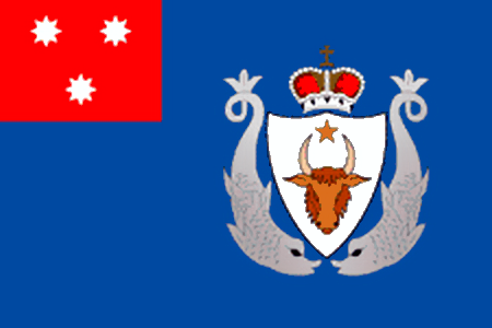
Civil ensign of the Principality of Moldavia (1834-1861)Mario Fabretto · Public domain · Commons
COA of Moldavia 1855Лобачев Владимир. Base: File:Прінціпатꙋл Молдовеі. Пасапорт. COA.jpg, File:Kingdom of Romania - Big CoA.svg · CC BY-SA 4.0 · Commons
Wars and Battles
Under the reign of Stephen the Great, all farmers and villagers had to bear arms. Stephen justified this by saying that "every man has a duty to defend his fatherland"; according to Polish chronicler Jan Długosz, if someone was found without carrying a weapon, he was sentenced to death. Stephen reformed the army by promoting men from the landed free peasantry răzeși (i.e. something akin to freeholding yeomen) to infantry (voinici) and light cavalry (hânsari), reducing his dependence on the boyars, and introduced guns. The Small Host (Oastea Mică) consisted of around 10,000 to 12,000 men. The Large Host (Oastea Mare), which could reach up to 40,000, was recruited from all the free peasantry older than 14 and strong enough to carry a sword or use a bow. This seldom happened, for such a levée en masse was devastating for both economy and population growth.
In 1562, the so-called Schola Latina (a Latin Academic College) was founded in Cotnari, near Iași, a school which marked the beginnings of the organized humanistic education institutions in Moldavia.
Read more
The first institute of higher learning that functioned on the territory of Romania was Academia Vasiliană (1640), founded by Prince Vasile Lupu as a Higher School for Latin and Slavonic Languages, followed by the Princely Academy, in 1707. The first high education structure in Romanian was established in the autumn of 1813, when Gheorghe Asachi laid the foundations of a class of engineers, its activities taking place within the Greek Princely Academy.
After 1813, other moments marked the development of higher education in Romanian, regarding both humanities and the technical science.
Portrait of the Great Ban of Oltenia, Radu Golescu-Știrbei (a scion of the Știrbei family and re-founder of the Golescu family).Anonymous (writer)Unknown author · Public domain · Commons
The term Albanian Principalities refers to a number of principalities (although they functioned more like a series of kingdoms) created in the Middle Ages in Albania and the surrounding regions in the western Balkans that were ruled by Albanian nobility. The 12th century marked the first Albanian principality, the Principality of Arbanon. It was later, however, in the 2nd half of the 14th century that these principalities became stronger, especially with the fall of the Serbian Empire after 1355.
The Despotate of Arta (Albanian: Despotati i Artës; Greek: Δεσποτάτο της Άρτας) was a despotate established by Albanian rulers during the 14th century, after the defeat of the local Despot of Epirus, Nikephoros II Orsini, by Albanian tribesmen in the Battle of Achelous in 1359. The Despotate ceased to exist in 1416, when it passed to Carlo I Tocco.
After the death of Gjin Bua Shpata in 1399, the Despotate of Arta weakened continuously, and the Shpata family was involved in civil war. Among the animosities with the rulers of Ioannina Gjin's successor, Muriq Shpata, had to deal with the intentions of the Venetians and of Count Carlo I Tocco of Cefalonia. Meanwhile, Ottoman incursions were intensified as they were occasionally called by despot Esau de' Buondelmonti of the Despotate of Epirus. After the death of de' Buondelmonti in 1411, the throne was offered to his nephew, Carlo I Tocco. Even though his gain was accompanied by a great loss that the forces of Gjon Zenebishi's inflicted upon his army, he would later subject the leaders of southern Albania. In spite of Muriq's victory over Carlo in 1412, the Albanians failed to take Ioannina. On the contrary, not long after killing Muriq in battle in 1414–1415, Carlo advanced on Arta.
The city of Arta was relatively unknown during the period of the Albanian rule (1358–1416). Albanian leaders acquired legally Byzantine titles and tried to adopt Byzantine state structure. Although no architectural activity has been reported for this period, little seems to have changed in Arta and the Albanian and Greek population coexisted peacefully in the city.
The Serbian Despotate (Serbian: Српска деспотовина / Srpska despotovina) was a medieval Serbian state in the first half of the 15th century. Although the Battle of Kosovo in 1389 is mistakenly considered the end of medieval Serbia, the Despotate, a successor of the Serbian Empire and Moravian Serbia, lasted for another 70 years, experiencing a cultural, economic, and political renaissance, especially during the reign of Despot Stefan Lazarević.
After Prince Lazar Hrebeljanović was killed in the Battle of Kosovo on June 28, 1389, his young son Stefan Lazarević succeeded him. Stefan's mother, Princess Milica, ruled as his regent until he reached adulthood. A wise and diplomatic woman, she managed to allay the Ottoman threat by marrying her daughter, Olivera, to Sultan Bayezid I.
Read more
After the Battle of Kosovo, in 1390 or 1391, Serbia became a vassal Ottoman state, and Stefan Lazarević was obligated to support the Ottoman Empire in battle. He did so in the 1395 Battle of Rovine against the Wallachian prince Mircea I and the 1396 Battle of Nicopolis against the Hungarian king Sigismund. Sultan Bayezid awarded Stefan with the majority of Vuk Branković's lands, as Branković sided with the Hungarian king at Nicopolis.
In the Serbian Despotate, there were several noble offices with important duties and roles in the state's central administration, under the Despot as the monarch and chief authority.
Read more
Grand Logothete (Велики Логотет/Veliki Logotet): a title originally used by the Byzantine Empire, adopted by the old Kingdom of Serbia, and retained by the Despotate. The Grand Logothete was the head of the Despot's chancellery, responsible for overseeing the central administration. The Grand Logothete was also the only person, other than the Despot and the Serbian Patriarch, to have certain jurisdictions over church matters.
Grand Voivode (Велики Војвода/Veliki Vojvoda): the second highest-ranking military commander in the state, under the Despot himself but with more power and prestige than ordinary Voivodes.
Apart from political stability as a result of Stefan's ability to keep a distance from both the Ottoman Empire and the Kingdom of Hungary, the Serbian economy was also helped by the very rich silver mines, Srebrenica and Novo Brdo, some of the wealthiest in Europe at that time. Belgrade became one of the largest cities in Europe, numbering over 100,000 people. The rule and deeds of despot Stefan Lazarević were described by his contemporary, the learned writer Constantine of Kostenets, who wrote the "Life of Despot Stefan Lazarević" (c. 1430).
Stephen Tomašević of Bosnia lost two countries to the Ottomans: Serbia in 1459 and Bosnia in 1463. His appointment as the new despot was highly unpopular but pushed hard by his father, King Stephen Tomašević of Bosnia. By this time, Serbia was reduced to only a strip of land along the Danube. Sultan Mehmed II decided to conquer Serbia completely and arrived at Smederevo; the new ruler did not even try to defend the city. After negotiations, Bosnians were allowed to leave the city and Serbia was officially conquered by the Turks on June 20, 1459.
1385 CE – 1481 CE · Capital: Visoko, Jajce, Bobovac · 52,419 km²
French: Portrait de Louis XIV en costume de sacre Portrait of Louis XIVtitle QS:P1476,fr:"Portrait de Louis XIV en costume de sacre "label QS:Lfr,"Portrait de Louis XIV en costume de sacre "label QS:Les,"Retrato de Luis…Hyacinthe Rigaud · Public domain · Commons
The Kingdom of Bosnia (Serbo-Croatian: Kraljevina Bosna / Краљевина Босна), or Bosnian Kingdom (Bosansko kraljevstvo / Босанско краљевство), was a medieval kingdom that lasted for nearly a century, from 1377 to 1463, and evolved out of the Banate of Bosnia, which itself lasted from at least 1154.
King Tvrtko I (r. 1353–91) acquired portions of western Serbia and most of the Adriatic coast south of the Neretva River. During the late part of his reign, Bosnia became one of the strongest states in the Balkan Peninsula.
The Banate of Bosnia was a medieval state comprising, at its peak, most of what is today Bosnia and Herzegovina, as well as parts of Dalmatia (in Croatia), Serbia, and Montenegro. Although nominally belonging to the Kingdom of Hungary crown lands, it was a de facto independent state. After the reign of Ban Kulin, rulers of Bosnia enjoyed virtual independence from Hungary, and although they formally held a vassal position for much of this time, in reality they managed to maintain independent functions and even expand their rule in Serbia, Croatia, and Dalmatia.
Important mining towns like Fojnica, Kreševo, Olovo, Srebrenica, Dusina, Kamenica, and Deževice began to be mentioned in contemporary sources during Tvrtko I's reign. Srebrenica was a very lucrative possession with its silver mines. Caravan trade was frequent between the Republic of Ragusa and Bosnia, and Ragusan merchants had trading colonies in Podvisoki, Fojnica, Srebrenica, Kreševo and others. Economic activity allowed for the creation of new župas like Nenavište in Posavina and Trebotić in Podrinje. Via Narenta and Via Drine were economically crucial as they provided access to Drijeva and Dubrovnik, which in turn provided access to the Adriatic Sea. In 1382 Tvrtko built a new fortress in the Bay of Kotor on the Adriatic coast to form the basis of a new salt trading centre. Initially named after Saint Stephen, the city came to be known as Novi (meaning "new").
Anillos iberorromanos, lingote, estátera escita (siglo I a. C.), dinar indio (325-345) e histamenon bizantino (1059-1067). Exposición permante de la Historia del dinero. Museo de Prehistoria de ValenciaDorieo · CC BY-SA 4.0 · Commons
Radivoj styled himself as King of Bosnia for the remainder of Tvrtko's reign. He was nominally supported by the Ottomans and by Stjepan Vukčić Kosača. This alliance could have easily deposed Tvrtko II in Radivoj's favor if they wished, but it appears that their only goal was to weaken and divide Bosnia for their own future benefit.
Read more
Notwithstanding, King Tvrtko II maintained himself on the Bosnian throne longer than any of the monarchs who followed Tvrtko I. He also did more to restore royal dignity and centralize the state than any other, leaving a strong mark on Bosnia's politics, economy, and culture. King Tvrtko II died in September 1443. childless, having expressed a wish to be succeeded by his politically inactive and until then rather obscure cousin Stephen Thomas, Radivoj's younger brother and likewise an illegitimate son of Ostoja.
The territory of Bosnia and today's Herzegovina is littered with medieval gravestones called stećak, which first appeared in the middle of the 12th century. They were a tradition among Bosnian, Catholic and Orthodox Church followers alike. While Bosnia had many architecturally impressive stone fortresses, its medieval churches were small, especially compared to Catholic churches along the coast and Orthodox monasteries in neighboring Serbia, possibly because of the indifference of Bosnian nobles towards formal religion.
Read more
Medieval Bosnia and Herzegovina had three Christian faiths: Catholic and Orthodox Christians, and some who simply called themselves Bosnians, belonging to the so-called Bosnian Church. Most information about this church comes from outside sources and its exact nature is a subject of debate, particularly around its possible dualist teachings.
While Bosnia retained its standing among neighboring states in the immediate aftermath of Tvrtko's death, during Dabiša's reign conditions within the state started deteriorating. He successfully resisted his sovereigns from Hungary, Naples, and even Ottoman Turks. In the first years of his reign, Dabiša successfully maintained the integrity of the Kingdom.
Read more
The latter part of his reign, however, saw the ascent of magnates and considerable loss of territories and influence. The nobility grew stronger and for the first time acted independently of the king, starting with the Zachlumian Sanković noble family. Dabiša curbed the Sanković power, but the trend was irreversible and eventually led to the weakening of the royal authority. Hrvoje Vukčić Hrvatinić, the kingdom's leading magnate, came into agreement with Sigismund and Mary but remained loyal to Dabiša.
The first Ottoman troops attacked Bosnia in May 1414; in August they also brought the deposed monarch, Tvrtko, and set him up as anti-king. His alliance with the Ottomans may have been due to their mutual hostility towards Sigismund. Pavle Radenović immediately declared for Tvrtko, but no other major nobleman appears to have followed his example – not even Hrvoje. While Tvrtko hoped for an Ottoman victory, Ostoja expected that a Hungarian triumph would rid him of Ottoman raiders and secure his position against both his rival and his ambitious magnates. The Battle of Doboj in August 1415 saw the disastrous defeat of Sigismund's army. Contrary to expectations, however, the Ottomans recognized Ostoja as the legitimate king. Tvrtko lost his ground, while the united Bosnians for the first time shifted their allegiance from the Hungarian crown to the Ottoman Sultanate.
Painting of Ragusa from 1667, kept today in Dubrovnik archives; arms in upper corner.Unknown authorUnknown author · Public domain · Commons
The Republic of Ragusa was an aristocratic maritime republic centered on the city of Dubrovnik (Ragusa in Italian and Latin; Raguxa in Venetian) in South Dalmatia (today in southernmost Croatia) in Southern Europe. It carried that name from 1358 until 1808, reaching its commercial peak in the 15th and 16th centuries. The republic was conquered by Napoleon's French Empire in 1806 and formally annexed by the Napoleonic Kingdom of Italy in 1808. By then it had a population of about 30,000 people, of whom 5,000 lived within the city walls.
During its first centuries the city was under the rule of the Byzantine Empire. The Saracens laid siege to the city in 866–867; it lasted for fifteen months and was raised due to the intervention of Byzantine Emperor Basil I, who sent a fleet under Niketas Ooryphas in relief. Ooryphas' "showing of the flag" had swift results, as the Slavic tribes sent envoys to the Emperor, once more acknowledging his suzerainty. Basil dispatched officials, agents and missionaries to the region, restoring Byzantine rule over the coastal cities and regions in the form of the new theme of Dalmatia, while leaving the Slavic tribal principalities of the hinterland largely autonomous under their own rulers. With the weakening of Byzantium, Venice began to see Ragusa as a rival that needed to be brought under its control, but an attempt to conquer the city in 948 failed.
The Republican Constitution of Ragusa was strictly aristocratic. The population was divided into three classes: nobility, citizens, and plebeians, who were mainly artisans and farmers (serfs, coloni and freemen). All effective power was concentrated in the hands of the aristocracy. The citizens were permitted to hold only minor offices, while plebeians had no voice in government. Marriage between members of different classes of the society was forbidden.
Read more
The organization of the government was based on the Venetian model: the administrative bodies were the Major Council (Consilium maius, Maggior Consiglio, Velje vijeće), the Minor Council (Consilium minus, Minor Consiglio, Malo vijeće) (from 1238) and the Senate (Consilium rogatorum, Consiglio dei Pregadi, Vijeće umoljenih) from 1253. The head of the state was the Rector.
One of the trades practiced by the Republic of Ragusa aside from the trade in spices, salt, wax and minerals, was the slave trade. For a period of time, the slave trade was an important part of the economy.
Read more
Ragusa had a close trade relationship with the Republic of Venice, who used Ragusa as an important transshipment point between the Balkans and the Mediterranean world; not only for the import of Balkan metal, but also of slave laborers.
The Republic of Venice used Ragusa as an important base and middleman in the ancient Balkan slave trade, in which Slavs from the Balkans were trafficked to the ports of the Adriatic coast and sold to Venetian merchants.
Originally, Latin was used in official documents of the Republic. Italian came into use in the 1420s. Both languages were used in official correspondence by the Republic. The Republic was influenced by the Venetian language and the Tuscan dialect. Old Ragusan, a variant of Dalmatian, which was spoken on the Dalmatian coast following the end of the Roman Empire, with elements of old Slavic vernacular, commonly referred to as ilirski (Illyrian), and Italian, were among the common languages. Since it was mainly used in speech, it is poorly documented. Its use started declining in the 15th century.
Read more
The use of Croatian in everyday speech increased in the late 13th century, and in literary works in the mid-15th century. At the end of the 14th century, inhabitants of the republic were mostly native speakers of Slavic language, referred to by them as Slavic, Ilyrian and Croatian at the time.
Around 1800, the Republic had a highly organized network of consulates and consular offices in more than eighty cities and ports around the world. In 1808, Marshal Marmont issued a proclamation abolishing the Republic of Ragusa and amalgamating its territory into the Napoleonic Kingdom of Italy, himself claiming the newly created title of "Duke of Ragusa" (Duc de Raguse). In 1810, Ragusa, together with Dalmatia and Istria, went to the newly created French Illyrian Provinces. Later, in the 1814 Battle of Paris, Marmont abandoned Napoleon and was branded a traitor. Since he was known as the "Duke of Ragusa", the word ragusade was coined in French to signify treason and raguser meant a cheat.
1395 CE – 1421 CE · Capital: Valona (Vlorë, Albania) · 6,060 km²
The Principality of Valona and Kanina, also known as the Despotate of Valona and Kanina, Principality of Valona or Principality of Vlorë (1346–1417) was a medieval principality in Albania, roughly encompassing the territories of the modern counties of Vlorë (Valona), Fier, and Berat. Initially a vassal of the Serbian Empire, it became an independent lordship after 1355, although de facto under Venetian influence, and remained as such until it was conquered by the Ottoman Turks in 1417.
Medieval States of the Balkans and Greece, 1236 CE – 1395 CE: Frequently Asked Questions
Which states existed in the Balkans and Greece in this period?
This page maps 20 states of the Balkans and Greece founded between 1236 CE and 1395 CE: Empire of Thessalonica, Patriarchate of Aquileia, House of Anjou-Sicily, Thessaly, Kingdom of Syrmia, Catalan Company, Principality of Wallachia, Principality of Valona, Commune of the Zealots, Serbian Empire, Despotate of Dobruja, Despotate of Vidin and 8 more.
Which was the largest of the Medieval States of the Balkans and Greece, 1236 CE – 1395 CE?
Principality of Moldavia had the largest mapped extent, about 256,733 km².
Which of the Medieval States of the Balkans and Greece, 1236 CE – 1395 CE lasted longest?
Principality of Wallachia lasted longest, 1314 CE – 1858 CE.
↑↓ to navigate↵ to open
12,754 Planetary Entities Indexed
We use Google Analytics cookies to understand which pages are useful. Necessary storage only keeps your theme and this choice on your device. Privacy policy