13 states of Arabia on one map, from 1814 CE to 2024 CE.The largest, Kingdom of Hejaz and Nejd, covered about 1,653,414 km²; the longest-lived, Emirate of Nejd, lasted 1824 CE – 1925 CE. Each has its own section below with its rulers, capitals, wars and pictures where the records hold them.
Each state in its own colour. Move the timeline to see which existed in any year from 1814 to 2024; select a territory to read about it. Borders: Cliopatria / Seshat (CC BY 4.0).
The Imams of Yemen, later also titled the Kings of Yemen, were religiously consecrated leaders (imams) belonging to the Zaydi branch of Shia Islam. They established a blend of religious and temporal-political rule in parts of Yemen from 897. Their imamate endured under varying circumstances until the end of the North Yemen civil war in 1970, following the republican revolution in 1962. Zaydi theology differs from Isma'ilism and Twelver Shi'ism by stressing the presence of an active and visible imam as leader.
The imams based their legitimacy on descent from the Islamic prophet Muhammad, mostly via al-Qasim ar-Rassi (d. 860). After him, the medieval imams are sometimes known as the Rassids. The first of the ruling line, his grandson al-Hadi ila'l-Haqq Yahya, was born in Medina. His fame as an intellectual as well as a leader of note, led to his invitation to Yemen. He was summoned to govern the highland tribes in 893 and again in 896–897. Al-Hadi introduced a multitude of policies and practices that evolved into the particular Yemenite Zaydiyyah brand. The efforts of al-Hadi eventually became the basic guidelines for the religious as well as political characteristics of Yemeni Zaydism. Al-Hadi, however, was not able to consolidate his rule in all of Yemen. He could not even create an enduring state in the highlands, due to the strong localism persisting in the region.
1820 CE – 1894 CE · Capital: Abu Dhabi · 73,472 km²
The Trucial States, also known as the Trucial Coast, or the Trucial Sheikhdoms, or Trucial Oman, were a group of tribal confederations in southeastern Arabia along the Persian Gulf whose leaders had signed protective treaties with the British Empire between 1820 and 1892.
The Trucial States remained an informal British protectorate until the treaties were revoked on 1 December 1971. The following day, six of the sheikhdoms—Dubai, Abu Dhabi, Sharjah, Ajman, Umm Al Quwain and Fujairah—formed the United Arab Emirates; the seventh, Ras Al Khaimah, joined on 10 February 1972.
1824 CE – 1925 CE · Capital: Riyadh · 1,116,421 km²
Riyadh Skyline is growing. Dated February 2018B.alotaby · CC BY-SA 4.0 · Commons
The second Saudi state (Arabic: الدَّوْلَةُ السُّعُودِيَّةُ الثَّانِيَةُ, romanized: ad-Dawla as-Suʿūdiyya ath-Thāniyya), officially known as the Emirate of Najd, was a state that existed between 1824 and 1891 in the Najd region of what is now Saudi Arabia. Saudi rule was restored to central (Najd) and Eastern Arabia after the first Saudi state having previously been brought down by the Ottoman Empire's Egypt Eyalet in the Ottoman–Wahhabi War.
The Emirate of Jabal Shammar (Arabic: إِمَارَة جَبَل شَمَّر, romanized: Imārah Jabal Shammar), also known as the Emirate of Haʾil (إِمَارَة حَائِل) or the Rashidi Emirate (إِمَارَة آل رَشِيْد), was a state in the northern part of the Arabian Peninsula, including Najd, existing from the mid-nineteenth century to 1921. Shammar had been a confederation in the Arabian Peninsula. Jabal Shammar in English is translated as the "Mountain of Shammar". Jabal Shammar's capital was Ha'il. It was led by the monarchy of the Rashidi dynasty. It included parts of modern-day Saudi Arabia, Iraq, and Jordan.
Muscat and Oman (Arabic: مسقط و عُمان), officially known as the Sultanate of Muscat and Oman (Arabic: سلطنة مسقط وعُمان, romanized: Salṭanat Masqaṭ wa-‘Umān), also known briefly as the State of Muscat and Oman (Arabic: دولة مسقط وعُمان, romanized: Dawlat Masqaṭ wa-‘Umān) during the rule of Taimur bin Faisal, was a state that was under de facto British protection which existed in the second half of the 19th century and 20th century. It encompassed the present-day Sultanate of Oman and parts of present-day United Arab Emirates and Pakistan.
Although there was a Portuguese presence in the region, the Yaruba imams expelled them in the 17th century. The imams later expanded their own maritime empire to the Persian Gulf and Zanzibar, expelling the Portuguese from the wider region, before falling to the Persians. Persian hegemony in Muscat and Oman was ended in 1749 by a defeat at the hands of the elected Imam Ahmad bin Said. The British Empire was keen to dominate southeast Arabia to curb the influence of other European powers and to weaken the Omani Empire in the 18th century. The British empire thus backed the Albusaidi Sultans of Muscat that came to power in the second half of the 18th century. The British empire established a series of treaties with the Sultans with the objective of increasing British political and economic influence over Muscat.
Omani Arabic, Balochi, Persian, Ottoman Turkish, English
Religion
Islam (official)
Coins, Currency and Symbols
Currency
Gulf rupee, Said rial
Flag of MuscatUnknown author · Public domain · Commons
Decline and Fall
In the early 1820s, the Sultanate lost most of its territories in the Persian Gulf, which became the Trucial States under British protection. The fifth Sultan of the Al Said dynasty, Said bin Sultan, consolidated the Sultanate's territorial holdings and economic interests and Oman prospered. However, the Omani fleet was unable to compete with the more technically advanced European fleets and the Sultanate lost much of the trade with South Asia. Pressure by the British to abandon the slave trade further led to the loss of political and economic clout of the Sultanate.
Read more
On 4 June 1856, Said bin Sultan died without appointing an heir to the throne and members of the Al Said dynasty could not agree on a ruler. Through British mediation, two rulers were appointed from the Al Said clan; the third son of the Sultan, Thuwaini bin Said became ruler of the mainland.
The Imamate of Oman (Arabic: إِمَامَة عُمَان, romanised: Imāmat ʿUmān), officially the Imamate State of Oman (Arabic: دولة إمامة عُمان), was several succession of states within the Oman proper (Arabic: عُمَان ٱلْوُسْطَى, romanised: ʿUmān al-Wusṭā, lit. 'Central Oman') in the Hajar Mountains, part of the present-day Sultanate of Oman. The capital of the Imamate alternated historically between Rustaq and Nizwa. The Imamate's territory extended north to Ibri and south to the Alsharqiyah region and the Sharqiya Sands.
The Imamate of Oman, similar to the Sultanate of Muscat, was ruled by the Ibadi sect. Imams exercised spiritual and temporal representation over the region.
Read more
The Imamate was a 1,200-year-old system of government pioneered by the Ibadi religious leaders of Oman, and was based upon the Islamic sharia. The Imamate holds that the ruler should be elected. The imam is considered as the head of the community but tribalism that is part of the Omani society encouraged a decentralised form of governance that would help sustain political unity among the Omanis. The Imamate set out a government system wherein the ruler should not have absolute political nor military power; rather power should be shared with local governors. To prevent local or external threats to the Imamate, the imam had to gather the support of the local communities and tribes to raise a force to fight for a certain cause.
Asir, officially the Aseer Province, is a province of Saudi Arabia in southern Arabia. It has an area of 76,693 square kilometres (29,611 sq mi), and an estimated population of 2,024,285 (in 2022). Abha is its seat and second-largest city, after Khamis Mushait. Asir is bounded by the Mecca Province to the north and west, Al-Baha Province to the northwest, Riyadh Province to the northeast, Najran Province to the southeast, and Jazan Province and the Saada Governorate of Yemen to the south.
Historically, Asir was known for producing coffee, wheat, alfalfa, barley, senna, and frankincense. Wheat was grown in the summer and sesame has been grown in wetter areas of the region. Straw was used to make mats, hats, and baskets while tribes in the area also wove tents from straw.
The Asir Province is served by several institutions of higher education, the most prominent being King Khalid University (KKU). Established in 1998 through a royal decree that merged the satellite campuses of Imam Muhammad ibn Saud Islamic University and King Saud University, The main campus is located in Abha, with satellite campuses in cities such as Khamis Mushait, Muhayil, and Bisha. The university offers a wide range of undergraduate and graduate programs across fields like medicine, engineering, computer science, humanities, Islamic studies, and business. It enrolls both male and female students.
Read more
Primary and secondary education in the province is overseen by the Ministry of Education, which operates a comprehensive network of public schools.
1919 CE – 1989 CE · Capital: Sanaa (1918–1948, 1962–1990), Taiz · 181,353 km²
North Yemen (Arabic: اليمن الشمالي, romanized: al-Yaman al-šamāliyya) is a term used to describe the Kingdom of Yemen (1918–1962), the Yemen Arab Republic (1962–1990), and the regimes that preceded them and exercised sovereignty over that region of Yemen. Its capital was Sanaa from 1918 to 1948 and again from 1962 to 1990. Located in the southwestern part of the Arabian Peninsula, the area of the region (Upper Yemen) is approximately 136,000 square kilometers, and it used to have a population of about thirteen million people prior to the Yemeni unification.
North Yemen was a republic governed nominally under a constitution adopted in 1970, suspended in 1974, and largely restored between 1978 and the late 1980s. Although a succession of bodies carried out some of the functions of a legislature, they exercised little real power until the late 1980s. During that period, policy making remained in the hands of a relatively progressive military elite that worked closely with a variety of civilians that included a large and growing group of technocrats, the major tribal leaders, and other traditional conservative notables. Although political parties were formally banned, several parties did exist and operated with varying degrees of influence during and between elections.
Mutawakkilite Kingdom of Yemen (1918–1970), Yemen Arab Republic (1962–1990)
Languages
Arabic
Religion
Islam (official)
Coins, Currency and Symbols
Currency
North Yemeni rial
Kingdom of Hejaz and Nejd
1926 CE – 1935 CE · Capital: Riyadh · 1,653,414 km²
Riyadh Skyline is growing. Dated February 2018B.alotaby · CC BY-SA 4.0 · Commons
The third Saudi state is the current Saudi state and successor to the two earlier states: the first and the second, founded by Abdul Aziz bin Abdul Rahman (also known as "Ibn Saud"), who managed to capture the city of Riyadh on January 13, 1902. A long series of conflicts and conquests ultimately led to the establishment of the modern and contemporary Saudi state, the Kingdom of Saudi Arabia.
The third Saudi state was known at the beginning of its reign as "the Emirate of Riyadh" (1902–1913) and "the Emirate of Nejd and Hasa" (1913–1921).
Old city of Doha in Qatar by Hermann Burchardt, January 1904.Hermann Burchardt · Public domain · Commons
The history of Qatar spans from its first duration of human occupation to its formation as a modern state. Human occupation of Qatar dates back 50,000 years, and Stone Age encampments and tools have been unearthed in the Arabian Peninsula. Mesopotamia was the first civilization to have a presence in the area during the Neolithic period, evidenced by the discovery of potsherds originating from the Ubaid period near coastal encampments.
The peninsula fell under the domain of several different empires during its early years of settlement, including the Seleucid, the Parthians and the Sasanians.
The Qatari Peninsula was close enough to the Dilmun civilization in Bahrain to have felt its influence. Barbar pottery was excavated in two sites by the Qatar Archaeology Project, suggesting Qatar's involvement in Dilmun's trade network. When the people of Dilmun began engaging in maritime activities around 2100 to 1700 BC, the inhabitants of Qatar started diving for pearls in the Persian Gulf. The Qataris were engaged in the trading of pearls and date palms during this era.
Read more
It has been argued that the remains of Dilmun settlements found in Qatar do not represent major evidence of long-term human habitation. Qatar remained largely uninhabited during this period due to regular migration by nomadic Arab tribes searching for untapped food and water sources.
In a move which angered Mohammed bin Khalifa, Faisal bin Turki provided a safe haven for Abdullah bin Ahmed's sons in Dammam in 1852. Consequently, the Bahrainis attempted to drive away residents of Al Bidda and Doha who were suspected of being loyal to the Wahhabi by imposing an economic blockade on the inhabitants, which prevented them from engaging in pearl hunting. The blockade continued until the end of the year. In February 1853, the Wahhabi began marching from Al-Hasa to Al Khor. After Bahrain received assurance from Qatar that they would not cooperate with the Wahhabi forces if they crossed their borders, they sent Ali bin Khalifa to the mainland to act as a collaborator with the local resistance. A British-mediated peace agreement was reached between the two parties in 1853.
In June 1867, Ali bin Khalifa, the Bahraini representative in Qatar and brother of Muhammad bin Khalifa, seized a Bedouin from Al Wakrah and deported him to Bahrain. Mohammed bin Thani demanded his release, but Ali bin Khalifa refused. This prompted Mohammed bin Thani to expel him from Al Wakrah. Upon receiving news of this, Muhammad bin Khalifa released the Bedouin prisoner and expressed his desire for renewed peace talks. Jassim bin Mohammed Al Thani, the son of Mohammed bin Thani, traveled to Bahrain to negotiate on his behalf. He was imprisoned upon arrival, and a large number of ships and troops were soon sent to punish the people of Al Wakrah and Al Bidda. Abu Dhabi joined on Bahrain's behalf due to the conception that Al Wakrah served as a refuge for fugitives from Oman.
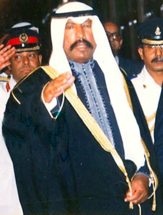
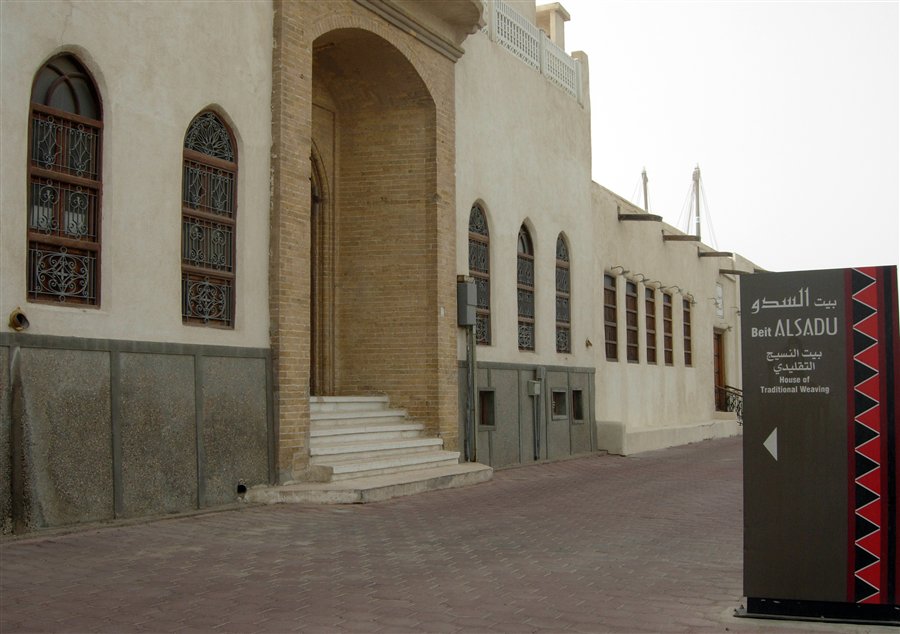
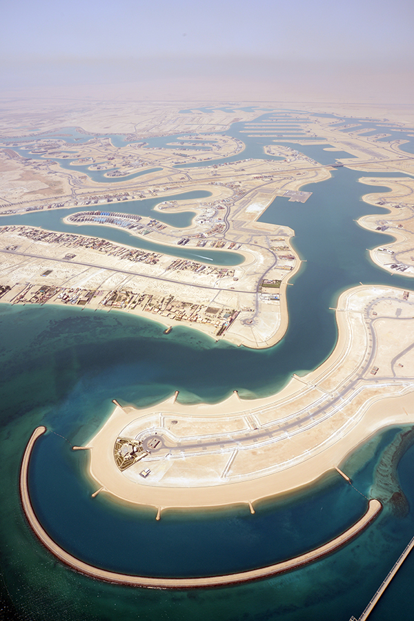
Kuwait, officially the State of Kuwait, is a country in West Asia. With a coastline of approximately 500 km (311 mi), it is situated at the head of the Persian Gulf in the northeastern edge of the Arabian Peninsula, bordering Iraq to the north and Saudi Arabia to the south. Kuwait is geographically the second closest Gulf country to mainland Iran (separated only by a small Iraqi coastline) after Iraq. The country is a small city-state; most of the population reside in the urban agglomeration of Kuwait City, the capital and largest city.
Human rights in Kuwait has been the subject of significant criticism, particularly regarding the Bedoon (stateless people). The Kuwaiti government's handling of the stateless Bedoon crisis has come under criticism from many human rights organisations and even the United Nations. According to Human Rights Watch in 1995, Kuwait has produced 300,000 stateless Bedoon. Kuwait has the largest number of stateless people in the entire region. Since 1986, the Kuwaiti government has refused to grant any form of documentation to the Bedoon including birth certificates, death certificates, identity cards, marriage certificates, and driving licences. According to several human rights organizations, Kuwait is committing ethnic cleansing and genocide against the stateless Bedoon.
Read more
On the other hand, human rights organizations have criticized Kuwait for the human rights abuses toward foreign nationals.
~74-75% Islam (official), ~18% Christianity, ~7% other
Economy and Trade
The biggest non-oil industry is steel manufacturing. United Steel Industrial Company (KWT Steel) is Kuwait's main steel manufacturing company, which caters to all of Kuwait's domestic market demands (particularly construction). Kuwait is self-sufficient in steel.
Read more
In 2016, Kuwait's food self-sufficiency ratio was 49.5% in vegetables, 38.7% in meat, 12.4% in dairy, 24.9% in fruits, and 0.4% in cereals. 8.5% of Kuwait's entire territory consists of agricultural land, although arable land constitutes 0.6% of Kuwait's entire territory. Historically, Jahra was a predominantly agricultural area. There are currently various farms in Jahra.
Kuwait was ranked 73rd in the Global Innovation Index in 2025. According to the United States Patent and Trademark Office, Kuwait registered 448 patents as of 31 December 2015.
Average Exchange Rate of Kuwait Dinar Against U.S. Dollar (Fils) Based On Central Bank Of Kuwait WebsiteKWD_against_USD.PNG: MOseQar derivative work: Bassem (talk) · CC BY-SA 3.0 · Commons
Currency
Kuwaiti dinar, Gulf rupee
Flag of KuwaitUnknown author · Public domain · Commons
Emblem of the State of KuwaitAK Alrabah · CC0 · Commons
Wars and Battles
In the early 1990s, Kuwait deported nearly 400,000 Palestinians. Kuwait's policy was a form of collective punishment, in response to the alignment of the PLO with Saddam Hussein. Kuwait also deported thousands of Iraqis and Yemenis after the Gulf War. Hundreds of thousands of stateless Bedoon, also spelled Bidoon in UN documents, were also expelled from Kuwait in the early-to-mid 1990s. At the House of Commons of the United Kingdom in 1995, it was revealed that the Al Sabah ruling family deported 150,000 stateless Bedoon to refugee camps in the Kuwaiti desert near the Iraqi border with minimal water, insufficient food, and no basic shelter. Many of the stateless Bedoon fled to Iraq where they remain stateless people even today.
Read more
In March 2003, Kuwait became the springboard for the US-led invasion of Iraq. In 2005, women won the right to vote and run in elections.
Kuwait has the oldest performing arts industry in the Arabian Peninsula. Kuwait's television drama industry is the largest and most active Gulf Arab drama industry and annually produces a minimum of fifteen serials. Kuwait is the main production center of the Gulf television drama and comedy scene. Most Gulf television drama and comedy productions are filmed in Kuwait. Kuwaiti soap operas are the most-watched soap operas from the Gulf region. Soap operas are most popular during the time of Ramadan, when families gather to break their fast. Although usually performed in the Kuwaiti dialect, they have been shown with success as far away as Tunisia. Kuwait is frequently dubbed the "Hollywood of the Gulf" due to the popularity of its television soap operas and theatre.
Read more
Kuwait is the main centre of scenographic and performing arts education in the GCC region.
The old town of Aden, Yemen, situated in the crater of an extinct volcanoJialiang Gao www.peace-on-earth.org · CC BY-SA 3.0 · Commons
South Yemen, officially the People's Democratic Republic of Yemen (PDRY), abbreviated to Democratic Yemen, was a country in South Arabia that existed in what is now southeast Yemen from 1967 until its unification with the Yemen Arab Republic in 1990. The sole communist state in the Middle East and the Arab world, it comprised the southern and eastern governorates of the present-day Republic of Yemen, including the islands of Perim, Kamaran, and the Socotra Archipelago.
The National Liberation Front, now rebranded as the National Front, had approximately 26,000 members, a small number of university-educated leaders, and all of them, without exception, had no experience in government. The front was divided into two right-wing and left-wing sections. The right-wingers and their popular leader, Qahtan, did not want to make major changes in the prevailing social and economic structure and took a conservative stance toward "liberating all Arab lands from colonialism, supporting the resistance of the Palestinian people, and supporting socialist regimes around the world to resist imperialism and colonial forces in the Third World." The leftist faction of the National Front was also promoting and opposing the establishment of popular forces and proposals to nationalise lands, and they were not preoccupied with the struggle of social classes.
Members of the Yemeni Socialist Party and the Government, especially Abdul Fattah Ismail, drafted the state's constitution. Egyptian and East German advisors provided technical assistance. Promulgated on 30 November 1970, seventeen months after the Corrective Move, it was later amended on 31 October 1978 to formalise the replacement of the National Front by the Yemeni Socialist Party (YSP).
Read more
The document was organised into six main parts. Part I outlined the state's political, economic, and cultural foundations across 32 articles, committing the state to Yemeni unity, anti-imperialism, and scientific socialism under YSP leadership, while establishing a centrally planned mixed economy, agrarian land reform, a state monopoly on foreign trade, and recognising Islam as the state religion under Article 46.
A few months after the civil war of 1986, the PDRY had discovered oil after more than 6 decades of unsuccessful exploration, the Soviet Union discovered oil in the Shabwah Governorate in late 1986, marking a turning point for the resource-scarce nation. Decades of unsuccessful exploration efforts, hampered by the harsh desert environment and political instability, had left South Yemen heavily reliant on foreign aid, primarily from the Soviet Union, and remittances from its citizens working abroad, estimated to be around half of government revenue by the mid-1980s. The discovery, made by the Soviet oil company Technoexport, emerged amidst the Cold War, with the Soviet Union playing a crucial role in the exploration and discovery process.
Flag of South YemenNational Front - الجبهة القومية · Public domain · Commons
Coat of arms of South Yemen (1970-1990)Mohammed Qays, Mohammed al-Aidaroos Older version by User:AnonMoos based on File:Coat of arms of South Yemen (1967-1970).svg by User:Thommy9, which in turn is b · Public domain · Commons
Wars and Battles
On 13 January 1986, a violent struggle began in Aden between Ali Nasir's supporters and supporters of the returned Ismail, who wanted power back. This conflict, known as the South Yemen Civil War, lasted for more than a month and resulted in thousands of casualties, Ali Nasir's ouster, and Ismail's disappearance and presumed death. Some 60,000 people, including the deposed Ali Nasir, fled to the YAR. Ali Salem al-Beidh, an ally of Ismail who had succeeded in escaping the attack on pro-Ismail members of the Politburo, then became General Secretary of the Yemeni Socialist Party.
According to journalist Bilal Zenab Ahmed, nostalgia remains strong in parts of southern Yemen for the PDRY. Ahmed compared nostalgia for South Yemen to nostalgia for the Soviet Union, noting their shared emphasis on cultural memory and ongoing impact on modern-day nationalism. Ahmed asserted that nostalgia for the perceived stability, social benefits, and low unemployment of South Yemen have played a strong role in support for modern-day South Yemeni separatism. The Southern Movement in particular drew much of its initial support from elements of the southern Yemeni population nostalgic for the former Marxist government, and socialist nostalgia features subtly in much of its messaging, propaganda, and symbolism.
Yemen, officially the Republic of Yemen, is a country in West Asia. Located in southern Arabia, the country includes the Socotra Archipelago and borders Saudi Arabia to the north, Oman to the northeast, the Arabian Sea to the east, the Gulf of Aden to the south, and the Red Sea to the west. It also shares maritime borders with Djibouti, Eritrea, and Somalia across the Horn of Africa. Covering 455,503 square kilometres (175,871 sq mi), with a coastline of approximately 2,000 kilometres (1,200 mi), Yemen is the second-largest country on the Arabian Peninsula by both area and population.
Yemen is a unitary semi-presidential republic with a bicameral legislature. Under the 1991 constitution, an elected president, an elected 301-seat Assembly of Representatives, and an appointed 111-member Shura Council share power. The president is the head of state, and the prime minister is the head of government. In Sanaa, a Supreme Political Council (not recognised internationally) forms a government for Houthi-controlled territory of Yemen.
Read more
The 1991 constitution provides that the president be elected by popular vote from at least two candidates endorsed by at least 15 members of the Parliament. The prime minister, in turn, is appointed by the president and must be approved by two-thirds of the Parliament. The presidential term of office is seven years, and the parliamentary term of elected office is six years.
Unitary semi-presidential republic under a provisional government
Languages
Arabic
Religion
~99.1% Islam (official), 65% Sunni Islam, 35% Shia Islam, ~0.9% other
Economy and Trade
A key challenge is severe water scarcity, especially in the Highlands, prompting The Times, in 2009, to write "Yemen could become first nation to run out of water." A second key challenge is a high level of poverty, making it difficult to recover the costs of service provision. Access to water supply sanitation is low. Yemen is both the poorest country and the most water-scarce country in the Arab world. Third, the capacity of sector institutions to plan, build, operate and maintain infrastructure remains limited. Last but not least the security situation makes it even more difficult to improve or even maintain existing levels of service.
Read more
The average Yemeni has access to only 140 cubic metres of water per year (101 gallons per day) for all uses, while the Middle Eastern average is 1,000 m3/yr, and the internationally defined threshold for water stress is 1,700 cubic metres per year.
Football is the most popular sport. The Yemen Football Association is a member of FIFA and AFC. The Yemeni national football team participates internationally. The country also hosts many football clubs. They compete in the national and international leagues.
Read more
Yemen's mountains provide many opportunities for outdoor sports, such as biking, rock climbing, trekking, hiking, and other more challenging sports, including mountain climbing. Mountain climbing and hiking tours to the Sarawat Mountains, including peaks of 3,000 m (9,800 ft) and above, particularly that of An-Nabi Shu'ayb, are seasonally organised by local and international alpine agencies. The coastal areas and Socotra provide many opportunities for water sports, such as surfing, bodyboarding, sailing, swimming, and scuba diving. Socotra is home to some of the best surfing destinations in the world.
Modern States of Arabia: Frequently Asked Questions
Which states existed in Arabia in this period?
This page maps 13 states of Arabia founded between 1814 CE and 1990 CE: Imamate of Yemen, Trucial States, Emirate of Nejd, Emirate of Jabal Shammar, Sultanate of Muscat and Oman, Imamate of Oman, Asir, North Yemen, Kingdom of Hejaz and Nejd, Qatar Protectorate, State of Kuwait, People's Democratic Republic of Yemen and 1 more.
Which was the largest of the Modern States of Arabia?
Kingdom of Hejaz and Nejd had the largest mapped extent, about 1,653,414 km².
Which of the Modern States of Arabia lasted longest?
Emirate of Nejd lasted longest, 1824 CE – 1925 CE.
↑↓ to navigate↵ to open
12,754 Planetary Entities Indexed
We use Google Analytics cookies to understand which pages are useful. Necessary storage only keeps your theme and this choice on your device. Privacy policy