29 states of Iberia on one map, from 724 CE to 1808 CE.The largest, Caliphate of Córdoba, covered about 564,714 km²; the longest-lived, County of Urgell, lasted 870 CE – 1808 CE. Each has its own section below with its rulers, capitals, wars and pictures where the records hold them.
Each state in its own colour. Move the timeline to see which existed in any year from 724 AD to 1808; select a territory to read about it. Borders: Cliopatria / Seshat (CC BY 4.0).
724 CE – 925 CE · Capital: Cangas de Onís, San Martín del Rey Aurelio, Pravia, Oviedo · 128,718 km²
King Pelagius of Asturias.Juan Serra (lithograph) Casals (print) · Public domain · Commons
The Kingdom of Asturias was a medieval monarchy in the Iberian Peninsula founded by the nobleman Pelagius. It was the first Christian political entity to be established in the Iberian Peninsula after the Umayyad conquest of Visigothic Hispania in 711–720s. In the summer of 722, Pelagius defeated an Umayyad army at the Battle of Covadonga, in what is retroactively regarded as the beginning of the Christian Reconquista.
The Asturian kings would occasionally make peace with the Muslims, particularly at times when they needed to pursue their other enemies, mainly rebel Basques and Galicians.
King Pelagius of AsturiasAfernand74 · Public domain · Commons
Classical geographers give conflicting views of the ethnic description of the above-mentioned peoples. Ptolemy says that the Astures extended along the central area of current Asturias, between the Navia and Sella rivers, fixing the latter river as the boundary with the Cantabrian territory. However, other geographers placed the frontier between the Astures and the Cantabri further to the east: Julius Honorius stated in his Cosmographia that the springs of the river Ebro were located in the land of the Astures (sub asturibus). In any case, ethnic borders in the Cantabrian Mountains were not so important after that time, as the clan divisions that permeated the pre-Roman societies of all the peoples of Northern Iberia faded under similar political administrative culture imposed on them by the Romans.
Written sources are concise concerning the reigns of Aurelio, Silo, Mauregatus and Bermudo I. Generally this period, with a duration of twenty-three years (768–791), has been considered as a long stage of obscurity and retreat of the kingdom of Asturias. This version, defended by some historians, who even named this historical phase as that of the "lazy kings", derived from the fact that, during it, there were apparently no important military actions against al-Andalus. However, there were relevant and decisive internal transformations, which provided a foundation for the strengthening and the expansion of Asturias.
Read more
First, the first internal rebellion, led by Mauregato (783–788), occurred during those years. The rebellion removed Alfonso II from the throne (although he became king again later, from 791 to 842).
Latin, Vulgar Latin (Old Leonese, Old Spanish, Old Galician-Portuguese), East Germanic varieties (minority speakers of Gothic and Vandalic), As well as Possible dialects of Vasconic
This kingdom is the birthplace of an influential European medieval architectural style: Asturian pre-Romanesque. This style of architecture was founded during the reign of Ramiro I.
Read more
This small kingdom was a milestone in the fight against the adoptionist heresy, with Beatus of Liébana as a major figure. In the time of Alfonso II, the shrine of Santiago de Compostela was founded. The pilgrimage to Santiago, Camiño de Santiago, was a major nexus within Europe, and many pilgrims (and their money) passed through Asturias on their way to Santiago de Compostela.
The Emirate of Nekor or Salihid Emirate (Arabic: إمارة بني صالح, romanized: ʾImārat Banī Ṣāliḥ) was an emirate centered in the Rif area of present-day Morocco. Its capital was initially located at Temsamane, and then moved to Nekor. The ruling dynasty has been described as either of Himyarite Arab descent or of Nafza Berber descent. The emirate was founded in 710 CE by Salih I ibn Mansur through a Caliphate grant.
Statue of Abd ar-Rahman I, Plaza San Cristóbal (streetcam), Almuñécar, Spain.NoelWalley at English Wikipedia · CC BY-SA 3.0 · Commons
The Emirate of Córdoba, and from 929, the Caliphate of Córdoba, was an Arab Islamic state ruled by the Umayyad dynasty from 756 to 1031. Its territory comprised most of the Iberian Peninsula (known to Muslims as al-Andalus), the Balearic Islands, and parts of North Africa, with its capital in Córdoba (at the time Qurṭubah). From 756 it was ruled as an independent emirate until Abd al-Rahman III proclaimed himself as caliph in 929.
The state was founded by Abd al-Rahman I, an Umayyad prince who fled the defeat and persecution of the Umayyad clan in Syria following the Abbasid revolution.
The death of Al-Hakam II in 976 marked the beginning of the end of Caliphal power. Al-Hakam was succeeded by his only son, Hisham II. Al-Hakam's top advisor, Almanzor, pronounced the 10-year-old boy caliph and swore an oath of obedience to him.
Read more
Almanzor had great influence over Subh, the mother and regent of Hisham II. Almanzor isolated Hisham in Córdoba, eradicated opposition, and allowed Berbers from Africa to migrate to al-Andalus to increase his base of support. While Hisham II was caliph, he was merely a figurehead.
In 996, Almanzor sent an invasion force to Morocco. After three months of struggle, his forces retreated to Tangier. Almanzor then sent out a powerful reinforcement under his son Abd al-Malik, whose armies clashed near Tangier. The Umayyads entered Fes on 13 October 998 once the gates of the city were opened.
The economy of al-Andalus had been monetized by the end of the 8th century, but it wasn't until the 10th century that both gold and silver coins were minted, thanks in large part to the flow of gold from trans-Saharan trade. A new mint was established at Madinat al-Zahra circa 947 CE (336 AH), though it was moved back to Córdoba circa 975–976 CE (365 AH).
Read more
The state also benefited greatly from trade with the rest of the Islamic world to the east. In addition to exporting crafted goods (primarily silk cloth), it provided raw materials to North Africa and the Middle East, regions that were poorer in natural resources than al-Andalus. This trade advantage promoted a higher standard of living, which in turn attracted more skilled labour to the country. Córdoba also drew revenues from tributes collected from the Christian kingdoms to the north, which provided silver and slaves.
Córdoba was the cultural and intellectual center of al-Andalus, with translations of ancient Greek texts into Arabic, Latin and Hebrew. The emir Abd al-Rahman II sent emissaries to the Abbasid and Byzantine courts to bring back books on subjects such as Islamic religious scholarship, Arabic grammar, poetry, astrology, medicine, and other sciences. Abbas ibn Firnas was among the most notable polymaths of this period who brought back technical and scientific knowledge back with him from the east.
Read more
In the 10th century, Córdoba became one of the centers of culture and high society in the Islamic world. Al-Andalus's prosperity and the caliph's patronage attracted travelers, diplomats and scholars. Advances in science, history, geography, philosophy, and language also occurred during the Caliphate.
Place de la Bourse Bordeaux Gironde FrancePatrick Despoix · CC BY-SA 4.0 · Commons
The Duchy of Gascony or Duchy of Vasconia was a duchy located in present-day southwestern France and northeastern Spain, an area encompassing the modern region of Gascony. The Duchy of Gascony, then known as Vasconia, was originally a Frankish march formed to hold sway over the Basques. However, the duchy went through different periods, from its early years with its distinctively Basque element to the merger in personal union with the Duchy of Aquitaine to the later period as a dependency of the Plantagenet kings of England.
Gascony was the core territory of Roman Gallia Aquitania. By the 2nd century this province was extended to include much of western Roman Gaul as far north as the Loire river. Thus, the name of the Aquitani came to be transferred to the territory of central-western France later known as the Duchy of Aquitaine. In 293, Diocletian re-created the original province of Caesar's Aquitania under the name of Novempopulania or Aquitania Tertia.
Read more
The Vascones were an Iberian people originally inhabiting a region between the Ebro and the southwestern Pyrenees during the Roman period, but by the end of the 6th century the Vascones defined a confederacy of native tribes with similar language and traditions on both sides of the Pyrenees who had not been culturally Romanized. The name 'Vascone' is the etymological origin of 'Gascon' and 'Basque'.
Unlike neighbouring regions, counts did not play a role in Vasconia's power share. Moreover, they were absent, and dukes are mentioned as the main figures of the Basques, immediately followed on the hierarchy by tribal chiefs and families, at least until the rise of the Carolingian dynasty.As for the judicial system, neither the Visigoth law nor Roman law seem to have been in use in the Duchy of Vasconia, and a native order may have prevailed at least until the Carolingian takeover in 768-769.
Read more
As of 778, Charlemagne started appointing counts (Bordeaux, Toulouse, Fezensac) on the bordering lands of Vasconia along the banks of the river Garonne, undermining the grip on power of the dukes of Vasconia.
Iruñea Nafarroa hiriburuko aireko ikuspegia, 2021. urtekoaNafarroako Gobernua · CC BY 4.0 · Commons
The Kingdom of Navarre (nə-VAR), originally the Kingdom of Pamplona, was a historical Iberian polity which occupied lands on both sides of the western Pyrenees, with its northernmost areas originally reaching the Atlantic Ocean (Bay of Biscay), between present-day Spain and France.
The medieval state took form around the city of Pamplona during the first centuries of the Iberian Reconquista. The kingdom had its origins in the conflict in the buffer region between the Carolingian Empire and the Umayyad Emirate of Córdoba that controlled most of the Iberian Peninsula.
The kingdom originated in the southern side of the western Pyrenees, in the flatlands around the city of Pamplona. According to Roman geographers such as Pliny the Elder and Livy, these regions were inhabited by the Vascones and other related Vasconic-Aquitanian tribes, a pre-Indo-European group of peoples who inhabited the southern slopes of the western Pyrenees and part of the shore of the Bay of Biscay. These tribes spoke an archaic version of the Basque language, usually known by linguistics as Proto-Basque, as well as some other related languages, such as the Aquitanian language. The Romans took full control of the area by 74 BC, but unlike their northern neighbors, the Aquitanians, and other tribes from the Iberian Peninsula, the Vascones negotiated their status within the Roman Empire.
In spite of the treaties, Ferdinand the Catholic did not relinquish his long-cherished designs on Navarre. In 1506, the 53-year-old widower remarried, to Germaine of Foix (aged 16), daughter of Catherine's uncle John of Foix, who had attempted to claim Navarre over his under-age nephew and niece. However, their infant son died shortly after birth, ending hopes of a possible inheritance of Navarre. Ferdinand kept intervening directly or indirectly in the internal affairs of Navarre by means of the Beaumont party. In 1508, the Navarrese royal troops finally suppressed a rebellion of the count of Lerín after a long standoff. In a letter to the rebellious count, the king of Aragon insisted that while he may take over one stronghold or another, he should use "theft, deceit and bargain" instead of violence (23 July 1509).
García Sánchez III (1035–1054) soon found himself struggling for supremacy against his ambitious brothers, especially Ferdinand. García had supported the armed conflict between Ferdinand and his brother-in-law Bermudo III of León, who was ultimately killed in the Battle of Tamarón (1037). This allowed Ferdinand to unite his Castilian county with the new-won crown of León as king Ferdinand I. For several years a mutual collaboration between the two kingdoms took place. The relationship between García and his step-brother Ramiro was better. The latter had acquired all of Aragon, Ribagorza and Sobrarbe on the sudden death of his brother Gonzalo, forming what would become the Kingdom of Aragon. García and Ramiro's alliance with Ramon Berenguer, the Count of Barcelona, was effective to keep the Muslim Taifa of Zaragoza at bay.
Garcia Jiménez, 1º Rei de SobrarbeAnonymousUnknown author · CC BY-SA 4.0 · Commons
The Kingdom of Sobrarbe was the legendary predecessor to the Kingdom of Aragon and the modern region of Sobrarbe (from Latin super Arbem, on mount Arbe). According to the late medieval legend, the kingdom, with its capital at Aínsa, was a product of the Reconquista. The legend is based in part on the historical origins of the Kingdom of Pamplona.
Retrato imaginario de García Aznar († 922), V conde de Aragón e hijo del conde Aznar II Galíndez, a quien sucedió como conde de Aragón.Eduardo Rosales · Public domain · Commons
The County of Aragon (Aragonese: Condato d'Aragón) or County of Jaca (Aragonese: Condato de Chaca) was a small Frankish marcher county in the central Pyrenean valley of the Aragon river, comprising Ansó, Echo, and Canfranc and centered on the small town of Jaca (Iacca in Latin and Chaca in Aragonese), an area now part of Spain. It was created by the Carolingians late in the 8th or early in the 9th century, but soon fell into the orbit of the Kingdom of Navarre, into which it was absorbed in 922. It would later form the core of the 11th century Kingdom of Aragon.
The County of Ribagorza or Ribagorça (Aragonese: Condato de Ribagorza; Catalan: Comtat de Ribagorça; Latin: Comitatus Ripacurtiae) was a medieval county on the southern side of the Pyrenees, including the northeast of modern Aragón and part of the northwest of modern Catalonia, both in Spain. It was originally the independent creation of a local dynasty, later absorbed into the Kingdom of Navarre and then into the Crown of Aragon. It had a strong historical connection with the neighboring counties of Sobrarbe (to the west) and Pallars (to the east).
870 CE – 1808 CE · Capital: La Seu d'Urgell · 15,405 km²
Vista de La Seu d'Urgell des de la Torre de Solsona.Vilarrubla · CC BY-SA 3.0 · Commons
The County of Urgell (Catalan: Comtat d'Urgell, IPA: [komˈtad duɾˈdʒeʎ]; Latin: Comitatus Urgellensis) is one of the historical Catalan counties, bordering on the counties of Pallars and Cerdanya.
Façana oriental de Sort (Pallars Sobirà)Gustau Erill i Pinyot · CC BY-SA 3.0 · Commons
The County of Pallars or Pallás (Catalan: Comtat de Pallars, IPA: [kumˈtad də pəˈʎas]; Latin: Comitatus Pallariensis) was a de facto independent petty state, nominally within the Carolingian Empire and then West Francia during the ninth and tenth centuries, perhaps one of the Catalan counties, originally part of the Marca Hispanica in the ninth century.
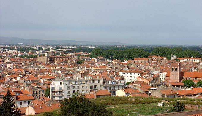
This image was copied from wikipedia:fr. The original description was: Perpignan vu depuis le Palais des Rois de Majorque Photo Jean Tosti Libre de droitsJean Tosti · Public domain · Commons
Roussillon (UK: ROO-see-yon, US: ROO-see-YOHN, French: [ʁusijɔ̃]; Catalan: Rosselló [rusəˈʎo], locally [rusiˈʎu]; Occitan: Rosselhon [ruseˈʎu]) was a historical province of France that largely corresponded to the County of Roussillon and part of the County of Cerdagne of the former Principality of Catalonia.
General view of the city of Girona, Catalonia, SpainPatronat de Turisme Costa Brava Pirineu de Girona · CC BY-SA 3.0 · Commons
Girona, also known in Spanish as Gerona, is the capital city of the Province of Girona in the autonomous community of Catalonia, Spain, at the confluence of the Ter, Onyar, Galligants, and Güell rivers. The city had an official population of 106,476 in 2024, but the population of the Girona–Salt urban area is estimated to be about 156,400 (2020). Girona is also capital of the comarca of the Gironès and the vegueria of Girona. Since much of the old quarter of this ancient city has been preserved, Girona is a popular tourist destination. The city is located 99 km (62 mi) northeast of Barcelona.
The town's airport, Girona-Costa Brava, is 10 kilometres (6 miles) south of the town centre. It grew tremendously principally as a result of Ryanair choosing it as one of their European hubs, but then shrank again after they relocated most of the flights to Barcelona El Prat.
Read more
Girona Airport is approximately a 30-minute bus ride from the bus terminal and train station in Girona city, and an hour from Barcelona centre, 92 km (57 mi) to the south. The bus stops in the centre of Barcelona, at the Estació d'Autobusos Barcelona Nord, Barcelona's main bus terminal.
Most low-cost airlines mention "Barcelona" in their descriptions of Girona airport.
Escut de GironaUnknown author · Public domain · Commons
Achievements and Monuments
During the professional cycling season, various non-European pro cyclists have called Girona home, as illustrated in the book by Michael Barry, written during his time with the US Postal Service cycling team. Between races, cyclists do their training rides outside the city, which provides excellent training terrain.
Read more
In the spring of 1997, Marty Jemison, Tyler Hamilton and George Hincapie moved to Girona as teammates on the US Postal Service Professional Cycling Team. This was the first year that American cyclists started living in Girona and meeting for training rides at the Pont de Pedra. Later, other well-known professional cyclists such as Lance Armstrong came to live in the city.
Football is also widely popular. The local club is Girona FC, who were promoted to La Liga in 2017.
The historic Jewish quarter or Call has been the centre of archaeological and restoration work in recent decades. In 1492, at the culmination of a period of increasing repression, the remaining Jewish community in Girona was forced to choose between conversion and expulsion. After the expulsion of the Jews, the neighbourhood was sealed off and new houses were built over the old ones. When the dictator Francisco Franco died in November 1975, interest in the region's cultural history was revived. Some of the old buildings were excavated leading to the discovery of the home of Nahmanides, which was sold to the city in 1987.
Read more
A rectangular indentation that once held a mezuzah can be seen at the entrance of a number of buildings in the Call, such as the doorway of an old building on Carrer de Sant Llorenç.
Berga (Catalan pronunciation: [ˈbeɾɣə]) is the capital of the comarca (county) of Berguedà, in the province of Barcelona, Catalonia, Spain. It is bordered by the municipalities of Cercs, Olvan, Avià, Capolat and Castellar del Riu.
The Portal de Santa Magdalena is the only surviving late-medieval gate of Berga´s former walled enclosure. It stands on the town´s north-eastern side and historically connected Berga with the royal road to Bagà and Ripoll.
Sarcòfag del comte Oliba Cabreta a Sta. Maria de Serrateix (Bergadà)Jordiipa · CC BY-SA 3.0 · Commons
The County of Besalú (Catalan: Comtat de Besalú, IPA: [kumˈtad də βəzəˈlu]; Latin: Comitatus Bisuldunensis) was one of the landlocked medieval Catalan counties near the Mediterranean coastline. It was roughly coterminous with the modern comarca of Garrotxa and at various times extended as far north as Corbières, Aude, now in France. Its capital was the village of Besalú. Throughout most of its history it was attached to one of the other more powerful counties, but it experienced a century of independence before it was finally and irrevocably annexed to the County of Barcelona.
Besalú was reconquered from the Moors by 785. It was originally a pagus of the County of Girona in the Marca Hispanica. The original pagus comprised the territories of Garrotxa and those neighbouring Montgrony and Setcases in the comarca of Ripollès as far as Agullana and Figueres (in Alt Empordà) and Banyoles in Pla de l'Estany.
Read more
In the Ordinatio Imperii of 817, Louis the Pious made it a part of Aquitaine and ruled it directly along with the other maritime counties of the Marca: Roussillon, Girona, Barcelona, and Empúries. Besalú, along with Barcelona and Girona were placed under Count Bera, a Visigoth. Under Louis the Pious Gothia saw a reinvigorated monasticism spread first in Pallars and then eastward into Roussillon, Empúries, and Besalú. Under Louis and his successors, a system of aprisiones was established in Besalú, largely held by native Goths and immigrant Gascons.
911 CE – 1125 CE · Capital: Santiago de Compostela1 · 90,286 km²
O rei Ariamiro (ou Teodomiro), rei da Gallaecia, xunto aos bispos André, Lucrecio e Martiño.Unknown authorUnknown author · Public domain · Commons
The Kingdom of Galicia was a political entity located in southwestern Europe, which, at its territorial zenith, occupied the entire northwest of the Iberian Peninsula. In the early 10th century, the Kingdom of Galicia was formed following the division of the Kingdom of Asturias after the death of Alfonso III in 910. His sons split the kingdom, with Ordoño II inheriting Galicia. While Galicia became a distinct political entity, it remained closely tied to the Leonese and Asturian realms through dynastic connections.
The origin of the kingdom lies in the 5th century, when the Suebi settled permanently in the former Roman province of Gallaecia. Their king, Hermeric, probably signed a foedus, or pact, with the Roman Emperor Honorius, which conceded them lands in Galicia. The Suebi set their capital in the former Bracara Augusta and set the foundations of a kingdom, which was first acknowledged as Regnum Suevorum (Kingdom of the Suebi) but later as Regnum Galliciense (Kingdom of Galicia).
Read more
A century later, the differences between Gallaeci and Suebi people had faded, which led to the systematic use of terms like Galliciense Regnum (Galician Kingdom), Regem Galliciae (King of Galicia), Rege Suevorum (King of Suebi), and Galleciae totius provinciae rex (king of all Galician provinces), while bishops, such as Martin of Braga, were recognized as episcopi Gallaecia (Bishop of Galicia).
During the Iron Age, and later during Roman and Germanic rule, Southern Gallaecia—today north Portugal and south Galicia—was the more dynamic, urbanized, and richest area of Gallaecia. This role was assumed by the rural north during the Early and High Middle Ages, as a consequence not only of the Islamic invasion, but as the final result of a continent-wide urban crisis.
Read more
The old bishoprics of Braga, Ourense, Tui, Lamego, and others, were either discontinued, or re-established in the north, under the protection of Lugo—which was now a stronghold due to its Roman walls—and Iria Flavia. Dumio was re-established by the Bay of Biscay in Mondoñedo, Lugo assumed the role of Braga, and the bishops of Lamego and Tui sought refuge in Iria, where they received generous territorial grants.
Latin, Vulgar Latin, Galician-Portuguese, Astur-Leonese, Old Spanish, A few speakers of Brittonic, Visigothic, Vandalic and Suebic
Religion
Roman Catholicism (official)
Coins, Currency and Symbols
BandeirareinogalizaLe Galicien · Public domain · Commons
Coat of Arms of Galicia (Spain), 16th CenturyHeralder · CC BY-SA 3.0 · Commons
Wars and Battles
During the 15th century, a time of social and economic crisis in Europe, a series of insurrections roiled the Kingdom, the result the brutal behavior of the bishops and the noblemen toward the churchmen, artisans and peasants. The insurgents were generally organized in irmandades ('brotherhoods'), groups of men who, in exceptional circumstances, and allegedly with the king's approval, armed themselves to act as policemen in defence of peace and justice.
Read more
One of these brotherhoods, established in Compostela in 1418, took advantage of the temporary absence of the archbishop, and violently overthrew the city council in 1422. Another one, called Fusquenlla or 'The Mad Brotherhood', rose up in the north of the kingdom against the House of Andrade.
García I, rey de León[2] · Public domain · Commons
The Kingdom of León was a medieval state situated in the northwest region of the Iberian Peninsula. It was founded in 910, when the Christian princes of Asturias along the northern coast of the peninsula shifted their capital from Oviedo to the city of León. The kings of León fought civil wars, wars against neighbouring kingdoms, and invasions by the Moors and the Vikings, to sustain their kingdom through a turbulent age.
García is the first of the kings described by the charters as reigning in León.
The city of León was founded by the Legio VII Gemina ("twin seventh legion") of the Roman Empire. It was the headquarters of that legion in the Late Roman Empire and was a centre for trade in gold, which was mined at Las Médulas nearby. In 569, the city was conquered by the Arian Visigothic king Liuvigild, who did not harass the already well-established Catholic population. In 717, León fell again, this time to the Moors. However, León was one of the first cities retaken during the Reconquista and became part of the Kingdom of Asturias in 742.
Read more
León was a small town during this time, but one of the few former Roman cities in the Kingdom of Asturias which still held significance (the surviving Roman walls bear the medieval walling upon them).
The culture of the Kingdom of León was notable for its richness and diversity, reflecting its position as a political and religious center of Christianity in the Iberian Peninsula. Key Latin literary works such as the Codex Vigilanus and the Historia Legionense documented the kingdom's history and helped consolidate its legacy. The Fueros de León (1017), promulgated by Alfonso V, established a legal framework that was advanced for its time, while texts like the Glosas Emilianenses marked a significant step in the transition from Latin to Romance languages. Among the earliest proto-Romance texts produced in the Iberian Peninsula was the Nodicia de kesos.
Interior of the Mosque-Cathedral of CordobaHolger Uwe Schmitt · CC BY-SA 4.0 · Commons
The Emirate of Córdoba, and from 929, the Caliphate of Córdoba, was an Arab Islamic state ruled by the Umayyad dynasty from 756 to 1031. Its territory comprised most of the Iberian Peninsula (known to Muslims as al-Andalus), the Balearic Islands, and parts of North Africa, with its capital in Córdoba (at the time Qurṭubah). From 756 it was ruled as an independent emirate until Abd al-Rahman III proclaimed himself as caliph in 929.
The state was founded by Abd al-Rahman I, an Umayyad prince who fled the defeat and persecution of the Umayyad clan in Syria following the Abbasid revolution.
The death of Al-Hakam II in 976 marked the beginning of the end of Caliphal power. Al-Hakam was succeeded by his only son, Hisham II. Al-Hakam's top advisor, Almanzor, pronounced the 10-year-old boy caliph and swore an oath of obedience to him.
Read more
Almanzor had great influence over Subh, the mother and regent of Hisham II. Almanzor isolated Hisham in Córdoba, eradicated opposition, and allowed Berbers from Africa to migrate to al-Andalus to increase his base of support. While Hisham II was caliph, he was merely a figurehead.
In 996, Almanzor sent an invasion force to Morocco. After three months of struggle, his forces retreated to Tangier. Almanzor then sent out a powerful reinforcement under his son Abd al-Malik, whose armies clashed near Tangier. The Umayyads entered Fes on 13 October 998 once the gates of the city were opened.
The economy of al-Andalus had been monetized by the end of the 8th century, but it wasn't until the 10th century that both gold and silver coins were minted, thanks in large part to the flow of gold from trans-Saharan trade. A new mint was established at Madinat al-Zahra circa 947 CE (336 AH), though it was moved back to Córdoba circa 975–976 CE (365 AH).
Read more
The state also benefited greatly from trade with the rest of the Islamic world to the east. In addition to exporting crafted goods (primarily silk cloth), it provided raw materials to North Africa and the Middle East, regions that were poorer in natural resources than al-Andalus. This trade advantage promoted a higher standard of living, which in turn attracted more skilled labour to the country. Córdoba also drew revenues from tributes collected from the Christian kingdoms to the north, which provided silver and slaves.
Córdoba was the cultural and intellectual center of al-Andalus, with translations of ancient Greek texts into Arabic, Latin and Hebrew. The emir Abd al-Rahman II sent emissaries to the Abbasid and Byzantine courts to bring back books on subjects such as Islamic religious scholarship, Arabic grammar, poetry, astrology, medicine, and other sciences. Abbas ibn Firnas was among the most notable polymaths of this period who brought back technical and scientific knowledge back with him from the east.
Read more
In the 10th century, Córdoba became one of the centers of culture and high society in the Islamic world. Al-Andalus's prosperity and the caliph's patronage attracted travelers, diplomats and scholars. Advances in science, history, geography, philosophy, and language also occurred during the Caliphate.
961 CE – 1235 CE · Capital: No settled capital · 257,218 km²
View of Burgos from the castle facing south east, photo taken early June 2011Jardoz · CC BY-SA 3.0 · Commons
The Kingdom of Castile was a polity in the Iberian Peninsula during the Middle Ages. It traces its origins to the 9th-century County of Castile, as an eastern frontier lordship of the Kingdom of León. During the 10th century, the Castilian counts increased their autonomy, but it was not until 1065 that it was separated from the Kingdom of León and became a kingdom in its own right. Between 1072 and 1157, it was again united with León, and after 1230, the union became permanent.
According to the chronicles of Alfonso III of Asturias, the first reference to the name "Castile" (Castilla) can be found in a document written during AD 800. In the Al-Andalus chronicles from the Cordoban Caliphate, the oldest sources refer to it as Al-Qila, or "the castled" high plains past the territory of Alava, further south than it and the first encountered in their expeditions from Zaragoza. The name reflects its origin as a march on the eastern frontier of the Kingdom of Asturias, protected by castles, towers, or castra, in a territory formerly called Bardulia.
Read more
The County of Castile, bordered in the south by the northern reaches of the Spanish Sistema Central mountain system, was just north of modern-day Madrid province. It was re-populated by inhabitants of Cantabria, Asturias, Vasconia and Visigothic and Mozarab origins. It had its own Romance dialect and customary laws.
As with all medieval kingdoms, supreme power was understood to reside in the monarch "by the grace of God", as the legal formula explained. Nevertheless, rural and urban communities began to form assemblies to issue regulations to deal with everyday problems. Over time, these assemblies evolved into municipal councils, known as variously as ayuntamientos or cabildos, in which some of the inhabitants, the property-owning heads of households (vecinos), represented the rest. By the 14th century these councils had gained more powers, such as the right to elect municipal magistrates and officers (alcaldes, speakers, clerks, etc.) and representatives to the parliaments (Cortes).
Read more
Due to the increasing power of the municipal councils and the need for communication between these and the King, cortes were established in the Kingdom of León in 1188, and in Castile in 1250.
Photo of the Main square of Vic, county Osona, Catalonia, Spain.Espencat · Public domain · Commons
The County of Osona, also Ausona (Catalan: Comtat d'Osona, IPA: [kumˈtad duˈzonə]; Latin: Comitatus Ausonae), was one of the Catalan counties of the Marca Hispanica in the Early and High Middle Ages. It was based around the capital city of Vic (Vicus) and the corresponding diocese, whose territory was roughly the current comarca of Osona.
The ancient diocese of Osona was sacked by the Arabs in the mid eighth century (c. 750–755).
1000 CE – 1414 CE · Capital: Sant Martí d'Empúries, later Castelló d'Empúries · 928 km²
Hug IV d'Empúries i Pero MaçaGeorg-hessen · Public domain · Commons
The County of Empúries (Catalan: Comtat d'Empúries, IPA: [kumˈtad dəmˈpuɾiəs]), also known as the County of Ampurias (Spanish: Condado de Ampurias), was a medieval county centred on the town of Empúries and enclosing the Catalan region of Peralada. It corresponds to the historic comarca of Empordà.
After the Franks conquered the regions in 785, Empúries and Peralada came under the authority of the County of Girona. Around 813, Empúries, with Peralada, became a separate county under Ermenguer. He and the other early counts were probably of Visigothic origin.
La Noguera Pallaresa sortint de Collegats.Gustau Erill i Pinyot · CC BY-SA 3.0 · Commons
Pallars Jussà (Western Catalan: [paˈʎa(ɾ)z ʒuˈsa]) is a comarca (county) in Alt Pirineu, Catalonia, Spain. It was established as a comarca in 1936, out of the old county of Pallars. The name is an archaism meaning "Lower Pallars"; to the northeast and into the mountains is Pallars Sobirà. Its capital and largest municipality is Tremp.
Pallars Sobirà (Western Catalan: [paˈʎa(ɾ)s soβiˈɾa]) is a comarca (county) in the northwest region of Alt Pirineu, in Catalonia, Spain. The name means "Upper Pallars", distinguishing it from the more populous (and less mountainous) Pallars Jussà to its southwest. Its capital and largest municipality is Sort.
Located in the central Pyrenees, Pallars Sobirà stretches from south to north, starting at the gorge of Collegats to the village of Alós d'Isil, following the course of the river Noguera Pallaresa.
Escut del Pallars SobiràHansenBCN · Public domain · Commons
County of Portugal
1139 CE – 1146 CE · Capital: Guimarães (868–1131), Coimbra (1131–1139) · 46,123 km²
Largo do Toural, após a reabilitação concluída em 2012. Constitui-se como a ágora da cidade por excelência.PauloPinto65 · CC BY-SA 4.0 · Commons
The County of Portugal (Galician-Portuguese: Condado de Portugal; referred to as Portugalia in contemporary documents) refers to two successive medieval counties in the region around Guimarães and Porto, today corresponding to litoral northern Portugal, within which the identity of the Portuguese people formed. The first county existed from the mid-ninth to the mid-eleventh centuries as a vassalage of the Kingdom of Asturias and the Kingdom of Galicia and also a part of the Kingdom of León, before being abolished as a result of rebellion.
1139 CE – 1428 CE · Capital: Pamplona · 22,185 km²
Iruñea Nafarroa hiriburuko aireko ikuspegia, 2021. urtekoaNafarroako Gobernua · CC BY 4.0 · Commons
The Kingdom of Navarre (nə-VAR), originally the Kingdom of Pamplona, was a historical Iberian polity which occupied lands on both sides of the western Pyrenees, with its northernmost areas originally reaching the Atlantic Ocean (Bay of Biscay), between present-day Spain and France.
The medieval state took form around the city of Pamplona during the first centuries of the Iberian Reconquista. The kingdom had its origins in the conflict in the buffer region between the Carolingian Empire and the Umayyad Emirate of Córdoba that controlled most of the Iberian Peninsula.
The kingdom originated in the southern side of the western Pyrenees, in the flatlands around the city of Pamplona. According to Roman geographers such as Pliny the Elder and Livy, these regions were inhabited by the Vascones and other related Vasconic-Aquitanian tribes, a pre-Indo-European group of peoples who inhabited the southern slopes of the western Pyrenees and part of the shore of the Bay of Biscay. These tribes spoke an archaic version of the Basque language, usually known by linguistics as Proto-Basque, as well as some other related languages, such as the Aquitanian language. The Romans took full control of the area by 74 BC, but unlike their northern neighbors, the Aquitanians, and other tribes from the Iberian Peninsula, the Vascones negotiated their status within the Roman Empire.
In spite of the treaties, Ferdinand the Catholic did not relinquish his long-cherished designs on Navarre. In 1506, the 53-year-old widower remarried, to Germaine of Foix (aged 16), daughter of Catherine's uncle John of Foix, who had attempted to claim Navarre over his under-age nephew and niece. However, their infant son died shortly after birth, ending hopes of a possible inheritance of Navarre. Ferdinand kept intervening directly or indirectly in the internal affairs of Navarre by means of the Beaumont party. In 1508, the Navarrese royal troops finally suppressed a rebellion of the count of Lerín after a long standoff. In a letter to the rebellious count, the king of Aragon insisted that while he may take over one stronghold or another, he should use "theft, deceit and bargain" instead of violence (23 July 1509).
García Sánchez III (1035–1054) soon found himself struggling for supremacy against his ambitious brothers, especially Ferdinand. García had supported the armed conflict between Ferdinand and his brother-in-law Bermudo III of León, who was ultimately killed in the Battle of Tamarón (1037). This allowed Ferdinand to unite his Castilian county with the new-won crown of León as king Ferdinand I. For several years a mutual collaboration between the two kingdoms took place. The relationship between García and his step-brother Ramiro was better. The latter had acquired all of Aragon, Ribagorza and Sobrarbe on the sudden death of his brother Gonzalo, forming what would become the Kingdom of Aragon. García and Ramiro's alliance with Ramon Berenguer, the Count of Barcelona, was effective to keep the Muslim Taifa of Zaragoza at bay.
Tour d'Armagnac et cathédrale Sainte-Marie vus depuis les quas de Gers.Duch · CC BY 4.0 · Commons
The County of Armagnac (US:, French: [aʁmaɲak]; Gascon: Armanhac), situated between the Adour and Garonne rivers in the lower foothills of the Pyrenees, was a historic county of the Duchy of Gascony, established in 601 in Aquitaine (now France). In 960, the title of 'Count of Armagnac' was established, and thus the County of Armagnac was created. In 1751, following the death of childless Charles de Lorraine, Comte d'Armagnac, the title of the county was absorbed into the Crown lands of France and the King, then Louis XV took the title of 'Count of Armagnac' (Comte d'Armagnac).
In 1473, following the control of the county by Louis XI, the Seneschalcy of Armagnac was created. This allowed a seneschal to be stationed in the county, acting as a court of appeal and agent of the crown. The county was placed under the legal supervision of the Parliament of Toulouse. Administration and taxation were performed by the Generalité of Montauban and the Cour des Aides of Cahors. By the mid-17th century, the seneschalcy was transferred to Auch, and Lectoure lost its status as capital city.
Read more
The Wars of Religion saw considerable damage inflicted on the county by Catholics and Protestants alike. Large sections of the nobility and the bourgeoisie had become Calvinists, including in the capital Lectoure. Some towns had become entirely Protestant.
Auvergne (French: [ovɛʁɲ]; Occitan: Auvèrnhe or Auvèrnha) is a cultural region in central France. It is now largely part of the Auvergne-Rhône-Alpes administrative region.
Auvergne is generally regarded as conterminous with the land area of the historical Province of Auvergne, which was dissolved in 1790, and with the now-defunct administrative region of Auvergne, which existed from 1956 to 2015.
The region is home to a chain of volcanoes known collectively as the "chaîne des Puys".
Auvergne is an underpopulated area with an aging population. Auvergne is one of the least populated regions in southern Europe, and lies at the heart of the empty diagonal, a swath of sparsely populated territory running from northeastern to southwestern France.
Read more
The main communes in Auvergne are (2019 census, municipal population): Clermont-Ferrand (147,865), Montluçon (34,361), Aurillac (25,593), and Vichy (24,980).
The region is predominantly agricultural, with tourism slowly growing. Both beef and dairy cattle are plentiful, and there are several well-known cheeses: Bleu d'Auvergne, Cantal, Fourme d'Ambert and Saint-Nectaire.
Read more
Despite its small local market, the Auvergne region has developed many national and international companies, such as Michelin, Limagrain, the Centre France-La Montagne group, Volvic mineral water and numerous dynamic SMEs around the two universities and high schools (engineering, medical and business) of its capital, Clermont-Ferrand.
Auvergne is also a relatively industrial region: the share of the working population in industry is 22% (110,000 jobs), compared to the national average of 18%. The main industry is the tyre industry, represented by Michelin, with its headquarters and history located in Clermont-Ferrand, and Dunlop, based in Montluçon.
The County of Périgord was a historical region of France. The name Périgord derived from the Gaul tribe of the Petrocorii, who resisted the Roman conquest. It was preserved in the early Middle Ages as the Petragoric land (Latin: pagus Petragoricus). Périgord was a fief of the Duchy of Aquitaine, consisting of the three subregions of Périgieux, Bergerac, and Sarlat. The Seneschal of Périgord was responsible for the affairs of the county, ruled as a fief by the Counts of Périgord. The county was bounded on the north by Poitou, on the northeast by Limousin, on the southeast by Quercy.
The Capitulation of Granadalabel QS:Len,"The Capitulation of Granada"label QS:Les,"La rendición de Granada"Francisco Pradilla y Ortiz · Public domain · Commons
The Emirate of Granada, also known as the Nasrid Kingdom of Granada, was an Islamic polity in the southern Iberian Peninsula during the Late Middle Ages, ruled by the Arab Nasrid dynasty. It was the last independent Muslim state in Western Europe.
Muslims had been present in the Iberian Peninsula, which they called Al-Andalus, since 711. By the late 12th century, following the expansion of Christian kingdoms in the north, the area of Muslim control had been reduced to the southern parts of the peninsula governed by the Almohad Caliphate.
Muhammad I Granada cropped CSM 185 (187)Attributed to Alfonso X of Castile, 13th century · Public domain · Commons
One of Ibn Hud's foremost military commanders had been a man called Muhammad ibn Yusuf ibn Nasr, commonly known as Ibn al-Ahmar, who was born in Arjona. His position in the army reportedly aroused the envy of others who accused him of planning a coup against Ibn Hud, forcing him to flee to Arjona. Ibn al-Ahmar's origins were likely modest, but he seems to have acquired a reputation for piety and as a successful military leader. With Ibn Hud's position weakened by his defeats, the inhabitants of the Arjona area declared Ibn al-Ahmar as their emir after Friday prayers on 16 July 1232 (26 Ramadan 629 AH).
Read more
Ibn al-Ahmar was related to the Nasrids on his father's side and to the Banu Ashqilula on his mother's side. These two families thus formed the initial core of his small army, along with other volunteers and Andalusi soldiers who had previously served the Almohads.
Muhammad V died in 1391, bringing an end to the Nasrid dynasty's golden years. Until its fall in the late 15th century, the dynasty became embroiled in succession disputes, rivalries, and assassinations. Internal conflicts often revolved around the Banu Sarraj family (known in Spanish sources as the Abencerrajes) and their rivals, who ruthlessly pursued their own interests at the expense of the emirate's stability. Externally, the emirate remained at peace during some periods thanks mainly to the fact that Castile continued to struggle with its own internal problems as well.
Read more
War with Castile did break out between 1405 and 1410, followed by a period of peace until 1428. External wars and internal disputes continued through the 1430s and 1440s. During the early reign of Henry IV (r. 1454–1474), Castile resumed a more ambitious crusading military policy against Granada.
Official language: Classical Arabic, Vernacular languages: Andalusi Arabic, Berber
Religion
Minorities: Judaism, Christianity (Catholicism)
Economy and Trade
The emirate's economy was mostly agricultural. The rural population of the countryside was organized primarily into traditional alquerías (small farming communities), which were usually occupied by free peasants who owned the land and cultivated it mostly for subsistence. Larger farming estates, which could be owned by Nasrid family members or other members of the ruling class, were typically found on the edge of urban centers. Cultivation was intensive, diversified, and usually required sophisticated irrigation strategies, which in turn required well-organized management at a collective or community level, reflecting already-established traditions in al-Andalus. Dry farming was also known and was more common in the emirate's frontier areas, where animal husbandry was also a common activity.
Constantly under threat by both the Christian kingdoms to the north and the Muslim Marinid Sultanate to the south, the population of the Emirate of Granada developed a "siege mentality". The country consequently maintained a strong military. Its border territories were dotted with castles maintained by frontier warriors (thagri) led by armoured elite warriors who were influenced by and comparable to the Christian knights. However, the core of the emirate's army consisted of highly mobile light cavalry as well as light infantry.
Read more
The Granadan army was ethnically and culturally mixed. A large part were recruited locally through the jund system in which families with military obligations were registered and conscripted for service. In addition, the Granadan rulers encouraged North African warriors to migrate to the country and serve as ghazi.
The architecture of Nasrid Granada embraced extensive surface decoration in wood, stucco, and zillij tiling, as well as making use of elaborate muqarnas sculpting in many buildings. The Nasrids' most famous architectural legacy is the Alhambra, a hilltop palace district protected by heavy fortifications and containing some of the most famous and best-preserved palaces of western Islamic architecture, including what is known today as the Comares Palace and the Court of the Lions. The palace complex was developed throughout the period but some of the most important contributions were generally made during the rule of Yusuf I and Muhammad V during the 14th century.
Read more
The summer palace and gardens known as the Generalife were also created nearby.
In the mid-15th century, Castile was preoccupied with several civil conflicts and disputes over succession. Henry IV had only one child, Isabella, who in 1468 married Ferdinand, the son of John II of Aragon. By 1479, both Henry IV and John II had died, leaving Isabella and Ferdinand as rulers of a united Castile and Aragon. This was a pivotal turning point, as Granada could no longer play the two kingdoms against each other to ensure its own survival. The new royal couple, known as the Catholic Monarchs, were also united in their intention to conquer the emirate.
Read more
The war against Granada offered an opportunity for Ferdinand and Isabella to harness the restless Castilian nobility against a common enemy and instill subjects with a sense of loyalty to the crown.
Béarn (US:; French: [beaʁn]; Occitan: Bearn [beˈaɾ] or Biarn; Basque: Bearno or Biarno; Latin: Benearnia or Bearnia) is one of the traditional provinces of France, located in the Pyrenees mountains and in the plain at their feet, in Southwestern France. Along with the three Basque provinces of Soule, Lower Navarre and Labourd, the Principality of Bidache, as well as small parts of Gascony, it forms the current Pyrénées-Atlantiques department.
Agriculture and metallurgy were first practiced in the region around 4,000 years ago. Many dolmens, tumuli and megaliths have been found in Béarn dating to this era, suggesting that ancestor worship was an important religious activity in Neolithic Béarn. Construction of cromlêhs in Béarn continued into the Bronze Age.
Read more
Fortified villages were also constructed in Neolithic Béarn, and remains of these have been found near Asson, Bougarber and Lacq.
The culture of Béarn is characterised by a strong regional identity shaped by history, the Pyrenean environment and Occitan heritage. Béarnais is the customary local name for the langue d’oc spoken across much of the region. It remains an important component of identity in the area, particularly among speakers and communities in the Haut-Béarn, the Ossau Valley and the Béarn des Gaves. Béarn architecture and history is dominant throughout the region, with monuments such as the Château de Pau highlighting the region’s medieval and royal history, including the period before Béarn and Navarre were formally united with the French Crown in 1620.
Medieval States of Iberia: Frequently Asked Questions
Which states existed in Iberia in this period?
This page maps 29 states of Iberia founded between 724 CE and 1385 CE: Kingdom of Asturias, Emirate of Nekor, Emirate of Córdoba, Duchy of Gascony, Kingdom of Pamplona, Kingdom of Sobrarbe, County of Aragon, County of Ribagorza, County of Urgell, County of Pallars, County of Rosellón, County of Barcelona and 17 more.
Which was the largest of the Medieval States of Iberia?
Caliphate of Córdoba had the largest mapped extent, about 564,714 km².
Which of the Medieval States of Iberia lasted longest?
County of Urgell lasted longest, 870 CE – 1808 CE.
↑↓ to navigate↵ to open
12,754 Planetary Entities Indexed
We use Google Analytics cookies to understand which pages are useful. Necessary storage only keeps your theme and this choice on your device. Privacy policy