
Lakes That Dried Up
Some of the biggest lakes in history are gone. A few, such as the Aral Sea and Owens Lake, were drained within living memory. Others, such as Lake Bonneville and Lake Agassiz, vanished when the last Ice Age ended. For the lakes that went in the last twenty-five years, a slideshow of NASA satellite pictures, one a year, lets you watch the water go; for the older ones there are maps and photographs of the old shores.
A pin marks where each lake lay, and a remnant that is mapped, such as the Great Salt Lake, is outlined. Old shorelines are described in the text and shown in the pictures below, not drawn on the map.
Watch the Aral Sea disappear, 2000 to 2026
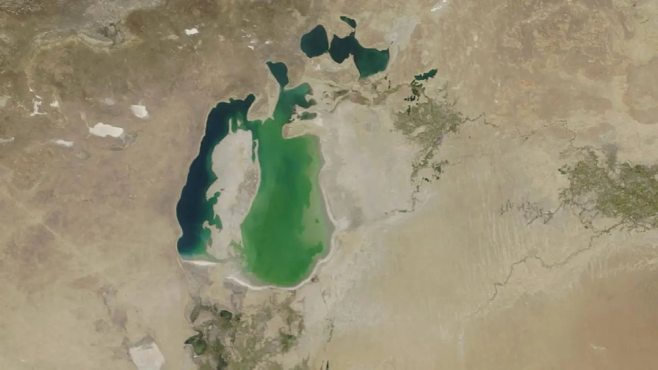
2000September 7, 2000
The sea has already split into a small North Aral at the top and a much larger South Aral. In 1960 it was one lake of about 68,000 km², the fourth largest on Earth.
Pictures: NASA Terra satellite, MODIS instrument, via NASA GIBS (public domain), the clearest day we found each year; clouds or gaps are the satellite’s. See today’s lake on the map.

Lakes that vanished in a year or two
Most lakes shrink slowly. These emptied, or came back, within a year or two, some in a matter of hours.
Went from a lake to a dry bed in about two years, 2013 to 2015.
Came back in a few weeks in 2023 after record snowmelt and storms.
Drained in a few hours, then refilled within about two days.
Fills each spring and empties within days in most summers.
Each flood drained the lake in a matter of days.
Lakes lost in recent centuries
Drained or starved by people, with the effects still felt today.
Aral Sea
Kazakhstan and Uzbekistan · Full in 1960; shrinking since the 1960s
Year-by-year satellite pictures
In 1960 the Aral Sea was the fourth-largest lake on Earth, about 68,000 km² of salty water with fishing ports on its shore. From the 1960s the Soviet Union diverted the two rivers that fed it, the Amu Darya and the Syr Darya, to irrigate cotton and other crops in the desert. The water that reached the lake fell to a trickle, and it split into a northern and a southern part and kept shrinking.
By 2014 NASA satellite images showed the eastern part of the southern basin completely dry. The towns left far from the water, such as Moynaq in Uzbekistan, still have rusting ships standing in sand. Dust from the salty lake bed blows across the region. In the north, a dam finished at Kokaral in 2005 helped the smaller North Aral Sea refill and fish return, while the southern part was left to dry.
More pictures
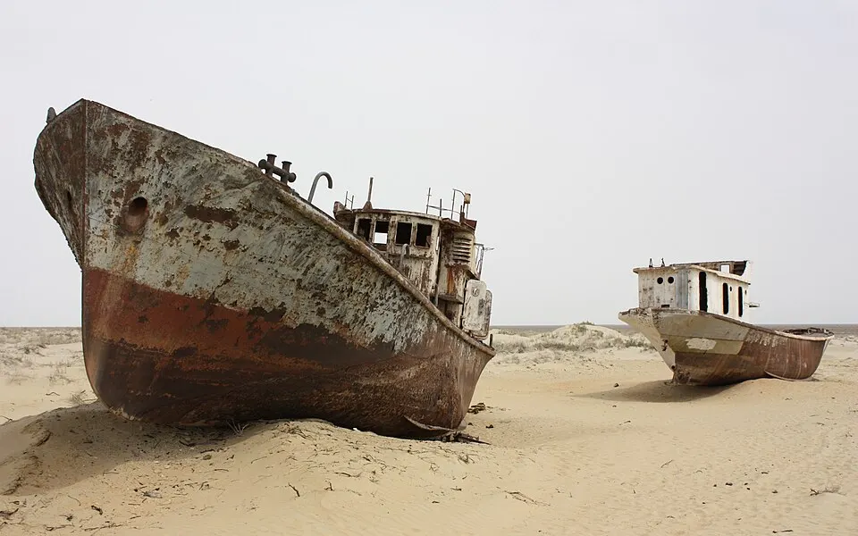
Fishing ships left at Moynaq, Uzbekistan, on what was once the bed of the Aral Sea.
Picture: Arian Zwegers · CC BY 2.0 · Wikimedia Commons


Owens Lake
Owens Valley, California, USA · Dried by 1926
Owens Lake was a salty lake of about 280 km² at the foot of the Sierra Nevada, with steamboats on it in the 1870s. In 1913 the Los Angeles Aqueduct opened and took the Owens River, which fed the lake, to supply the city of Los Angeles about 375 km away. By the mid 1920s the lake was dry.
The bed is coated with alkali salts, and for decades wind lifted them as dust that became one of the biggest dust sources in the United States. Since the 1990s the city has had to spread water, gravel and plants over parts of the bed to hold the dust down.
Pictures
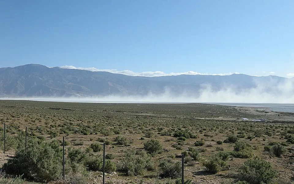
Alkali dust blowing off the dry bed of Owens Lake, California.
Picture: Eeekster (Richard Ellis) · CC BY 3.0 · Wikimedia Commons


Lake Poopó
The Altiplano of Bolivia · Declared dry at the end of 2015
Went from a lake to a dry bed in about two years, 2013 to 2015Year-by-year satellite pictures
Lake Poopó was Bolivia’s second-largest lake, but very shallow: a few metres deep over a wide area, so small changes in rainfall changed its size a great deal. In December 2015 the Bolivian government said it had evaporated. Drought, a strong El Niño, water taken from its feeder river for farming and mining, and a warming climate all played a part, and researchers still argue about how much each one counted.
Fishing families lost their living and many left. In wet years the bed has taken on some water again, but not the lake it was.
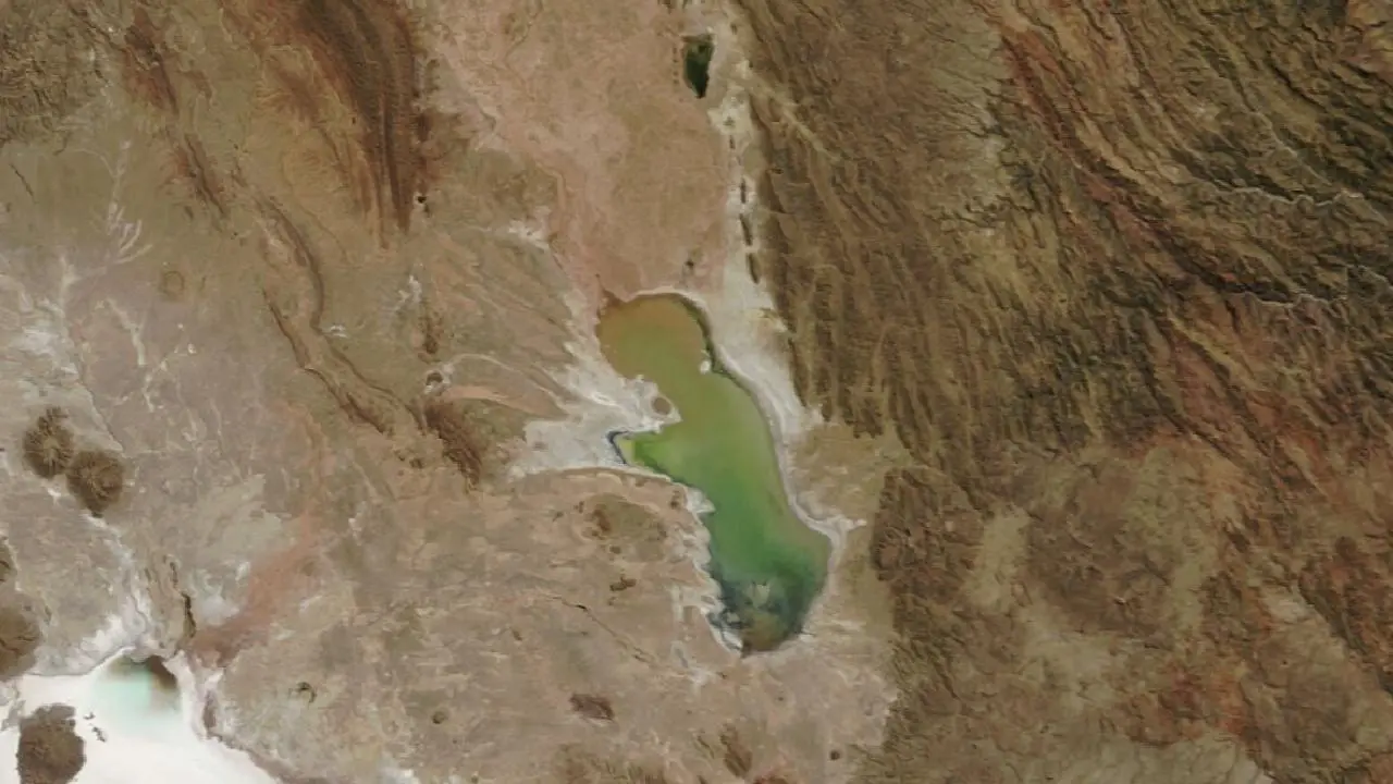
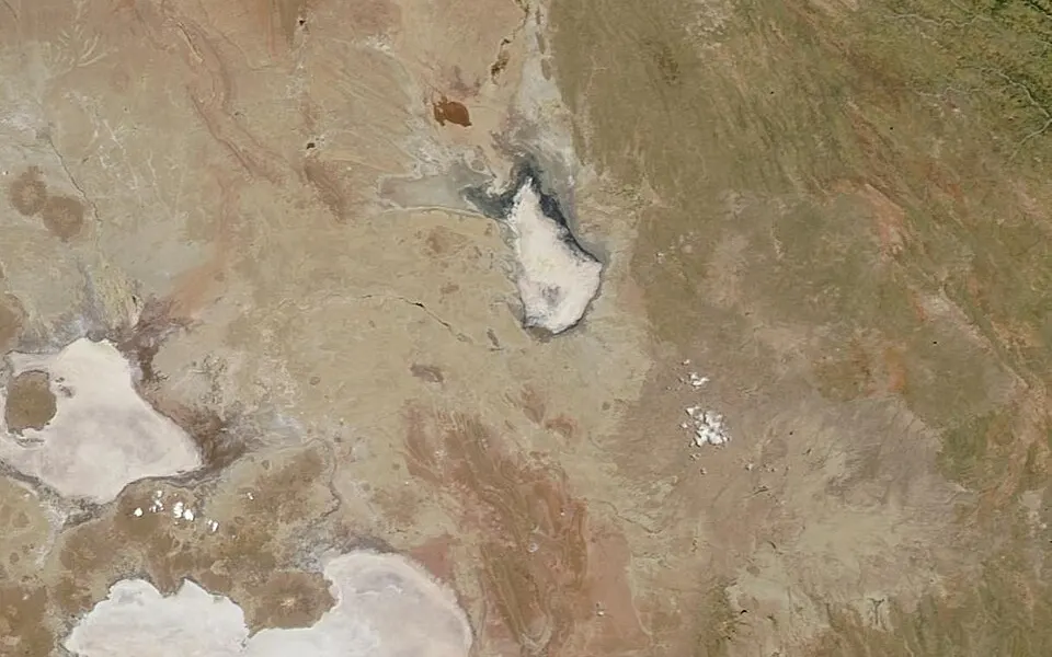
2000May 23, 2000
A shallow lake about 90 km long on the Bolivian Altiplano. It is only a few metres deep, so its size swings with the rains.
Pictures: NASA Terra satellite, MODIS instrument, via NASA GIBS (public domain), the clearest day we found each year; clouds or gaps are the satellite’s.

More pictures
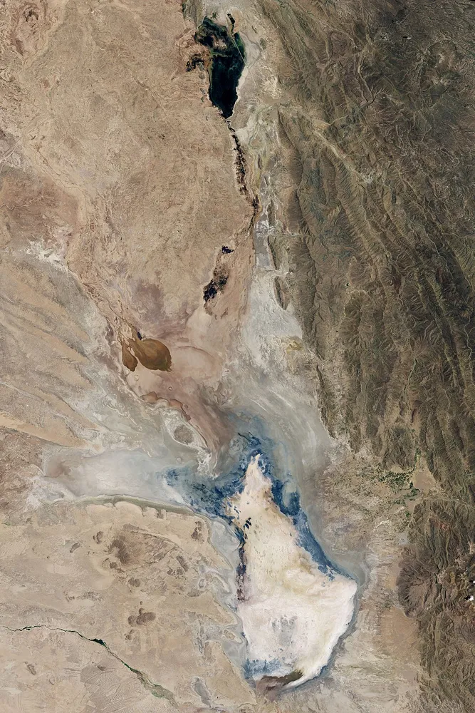
Lake Poopó on 15 January 2016 from NASA’s Landsat 8: a dry salt bed.
Picture: NASA Earth Observatory (Jesse Allen, Landsat data) · Public domain · Wikimedia Commons
Lake Texcoco
The Valley of Mexico, where Mexico City stands · Drained from the 1600s onwards
The Aztec capital Tenochtitlán was built from about 1325 on an island in this shallow, salty lake, with causeways to the shore and farmland on floating gardens. After the Spanish conquered it in 1521 the new rulers, who feared floods, began draining the basin; the Huehuetoca drainage works of the early 1600s took water out of the valley for good.
Over the next centuries the lake shrank to marshes and then to almost nothing, and Mexico City grew over its bed. The clay under the city is soft and full of water, and as groundwater is pumped out the ground sinks, in places by tens of centimetres a year. Only a few canals, such as those at Xochimilco, are left of the old lakes.
Eastern Aral Sea basin
Uzbekistan and Kazakhstan · Dried completely in 2014
Year-by-year satellite pictures
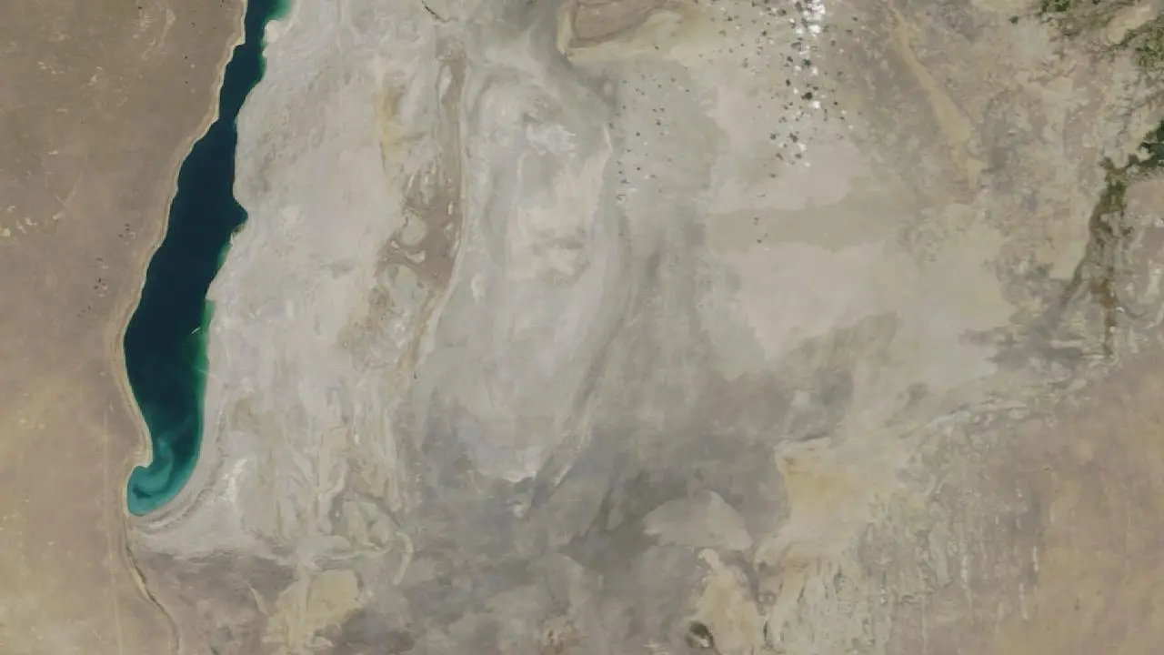
The southern Aral Sea split in two, and its eastern half was shallow. After years of low flow in the Amu Darya and a drought, this eastern basin shrank very fast from about 2009. In August 2014 NASA satellite pictures showed it completely dry for the first time in modern history.
Drag the slider below from 2009 to 2014 and the lake all but disappears. Since then the eastern bed has taken on some water in wet years, but it is mostly a salt desert, now called the Aralkum.
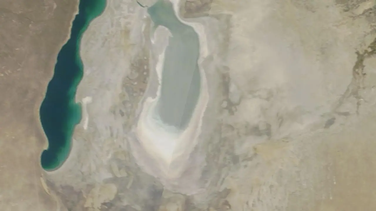
2008September 13, 2008
The eastern part of the South Aral is a narrow lake ringed by white salt, with the deeper western part on the left.
Pictures: NASA Terra satellite, MODIS instrument, via NASA GIBS (public domain), the clearest day we found each year; clouds or gaps are the satellite’s.
Lake Urmia
North-west Iran · Shrinking since the 1990s
Year-by-year satellite pictures
Lake Urmia was one of the largest salt lakes in the world. Since the 1990s dams on its rivers, water taken for farming and a run of dry years have taken most of its water, leaving a white salt flat where the shallow lake used to be.
Scientists argue about how much each cause counts, but the pattern is plain on satellite pictures: drag the slider below from 2000 and watch the shoreline pull back. The Iranian government has run a recovery programme since the 2010s, and the level has risen in wetter years.
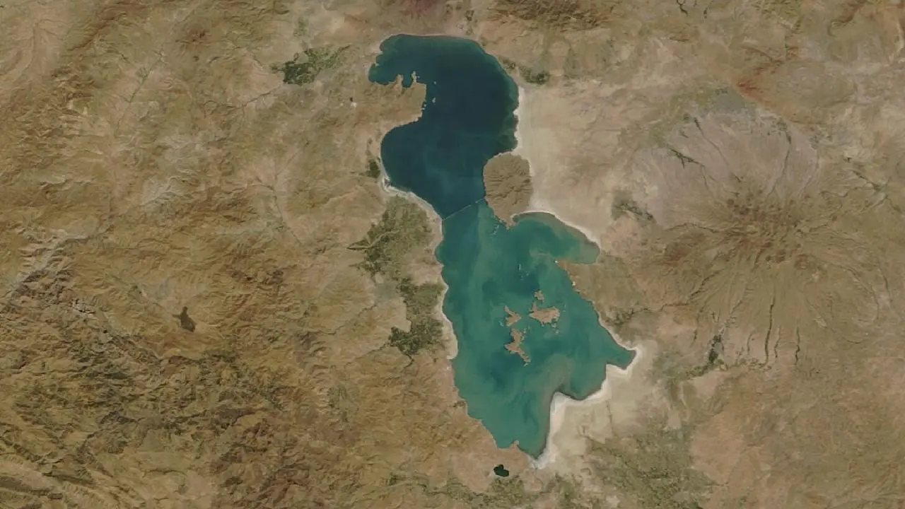
2000September 14, 2000
One of the largest salt lakes in the world, about 130 km long, deep blue-green.
Pictures: NASA Terra satellite, MODIS instrument, via NASA GIBS (public domain), the clearest day we found each year; clouds or gaps are the satellite’s.

More pictures
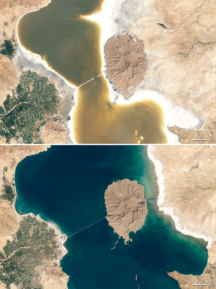
Lake Urmia, Iran, from NASA’s Earth Observatory: the shallow lake pulled back from its old shore.
Picture: NASA Earth Observatory · Public domain · Wikimedia Commons
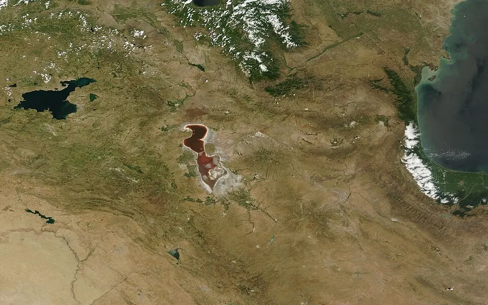

Tulare Lake
The San Joaquin Valley, California, USA · Drained by farming by the early 1900s; came back in 2023
Came back in a few weeks in 2023 after record snowmelt and stormsYear-by-year satellite pictures
Tulare Lake was once the largest freshwater lake west of the Mississippi, fed by the Kings, Kaweah, Tule and Kern rivers. From the 1850s settlers dammed and diverted those rivers to irrigate crops, and by the early 1900s the lake bed was dry farmland.
In the winter and spring of 2023, a series of storms and a very large snowpack in the Sierra Nevada sent water back into the old basin, and a shallow lake covered farmland and roads for months. Slide to 2023 below to see it return, then watch it fade away.
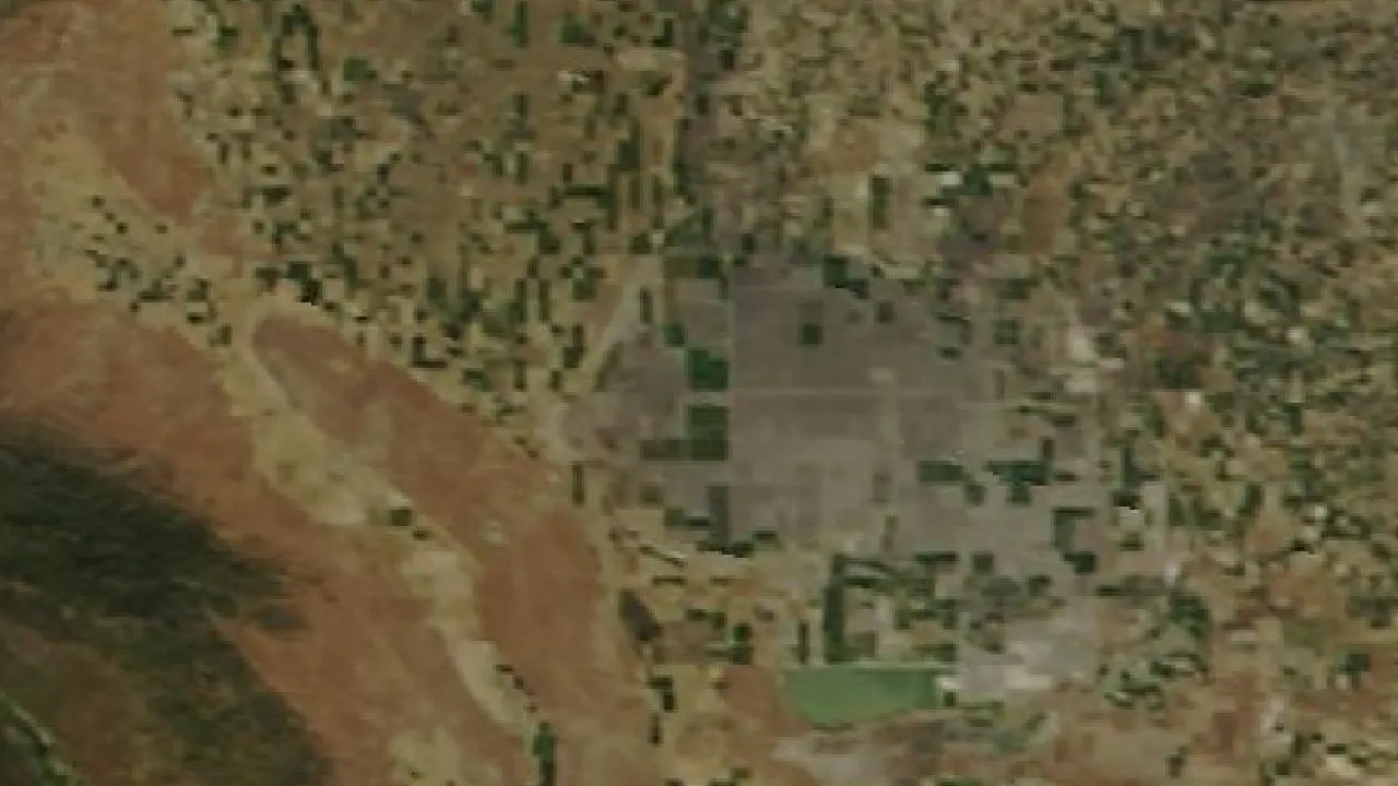
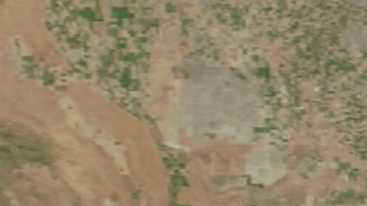
2000May 4, 2000
The old Tulare Lake basin is farmland: the pale squares in the middle are fields on the dry lake bed.
Pictures: NASA Terra satellite, MODIS instrument, via NASA GIBS (public domain), the clearest day we found each year; clouds or gaps are the satellite’s.
More pictures
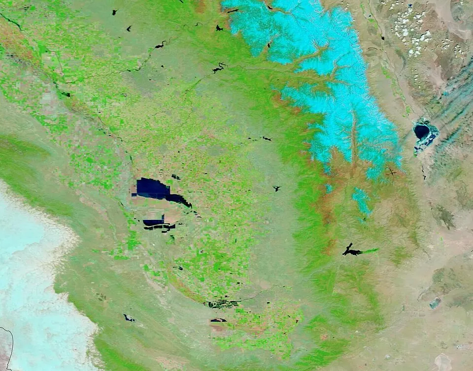
Tulare Lake on 24 May 2023 and 6 June 2022, in NASA Terra false colour (water dark): a lake where there had been farmland.
Picture: MODIS Land Rapid Response Team, NASA GSFC · Public domain · Wikimedia Commons

Lake Peigneur
Louisiana, USA · 20 November 1980
Drained in a few hours, then refilled within about two days
Lake Peigneur was a shallow freshwater lake above a salt mine. On 20 November 1980 an oil drilling rig on the lake punctured the roof of the mine, and the lake began to pour down into the mine workings. Whirlpools swallowed the rig, boats and part of the shore.
The canal that normally let water out of the lake ran backwards for hours while the mine filled, and when the water level came back the lake had become deeper and saltier than before. People were not killed, but it is one of the best-known cases of a lake emptying in hours.
Lake Merzbacher
The Inylchek glacier, Tien Shan, Kyrgyzstan · Empties most summers
Fills each spring and empties within days in most summers
Lake Merzbacher is held in a valley by the ice of the Inylchek glacier. It fills each spring and early summer, and then, usually in July or August, water finds a way under the ice and the lake drains in a few days, sending a flood down the valley.
Glacial lakes that drain in this way are found in many mountain ranges, and as glaciers thin and shift, some drain differently from year to year.
Lakes lost long ago
Lakes that filled when the climate was wetter and vanished as it changed, thousands to hundreds of thousands of years ago.
Mega-Chad and Lake Chad
Chad, Niger, Nigeria and Cameroon · Huge until about 5,000 years ago; small and changing since
Year-by-year satellite pictures
Between about 11,000 and 5,000 years ago the Sahara was green: monsoon rains reached far north, and a vast lake, called Mega-Chad, covered a region of roughly 350,000 km² or more across today’s Chad and Niger, larger than any lake on Earth today. Rock art in the Sahara shows people herding cattle and living beside water.
As the rains moved south the lake shrank. Today’s Lake Chad is what is left, a shallow lake whose size swings from year to year with the rains and the water drawn from its rivers, and it was far larger in the 1960s than it is now. The dry bed of the old lake in the Bodélé Depression is the biggest single source of dust blown from the Sahara.
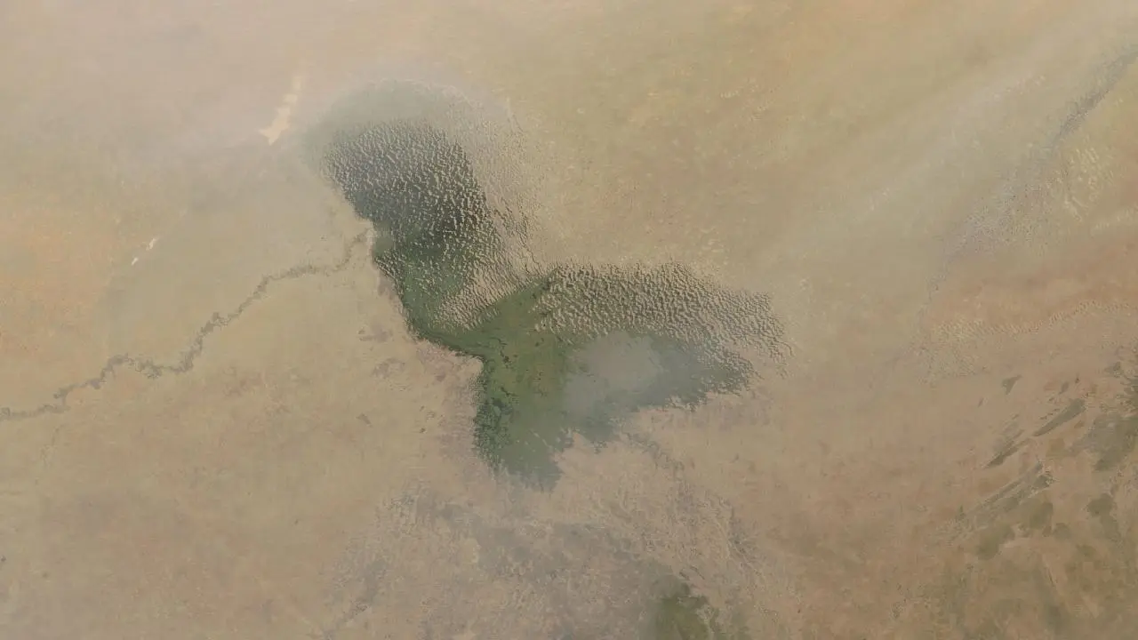
2000February 28, 2000
The northern pool (top left) and the southern pool (middle) of Lake Chad, ringed by marsh and reeds. In the early 1960s the lake covered about 25,000 km²; the open water now is a small part of that.
Pictures: NASA Terra satellite, MODIS instrument, via NASA GIBS (public domain), the clearest day we found each year; clouds or gaps are the satellite’s.

More pictures
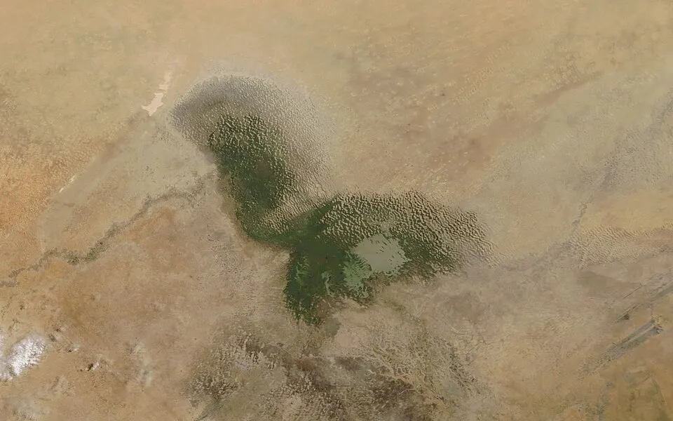
Lake Chad in 2018, seen from space: a small remnant of a lake that once covered hundreds of thousands of square kilometres.
Picture: Jeff Schmaltz, MODIS Land Rapid Response Team, NASA GSFC · Public domain · Wikimedia Commons


Lake Bonneville
Utah, with parts of Nevada and Idaho, USA · About 30,000 to 13,000 years ago
As the Ice Age ended, rain and melting ice filled the closed basin of the Great Basin until a lake of around 50,000 km² and up to about 300 metres deep lay over most of western Utah. You can still see its old shorelines as horizontal terraces on the mountainsides above Salt Lake City.
Near the end the lake broke through a barrier at Red Rock Pass in Idaho and a huge flood poured into the Snake River, dropping the level by more than 100 metres; the date is debated, somewhere between about 18,000 and 15,000 years ago. A warmer, drier climate then evaporated the rest. The Great Salt Lake, Utah Lake and the Bonneville Salt Flats, where land-speed records are set, are remnants, and the Great Salt Lake has itself shrunk sharply in recent dry years.
Pictures
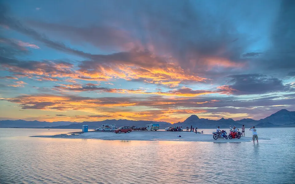
The Bonneville Salt Flats, Utah, on the floor of the ancient Lake Bonneville.
Picture: Bureau of Land Management · Public domain · Wikimedia Commons


Lake Lahontan
Nevada, with parts of California and Oregon, USA · About 30,000 to 12,000 years ago
Lake Lahontan filled many connected valleys of northern Nevada with a lake of more than 20,000 km² and over 200 metres deep at its greatest, a sister to Lake Bonneville to the east. Its old beaches and terraces climb the sides of the valleys today, and ancient shells and tufa towers stand where the water was.
As the climate warmed and dried it fell into separate basins. Pyramid Lake, famous for its tufa pinnacles, Walker Lake and the Carson Sink are what remain, and several are shrinking again where rivers are drawn off for farms.
Pictures
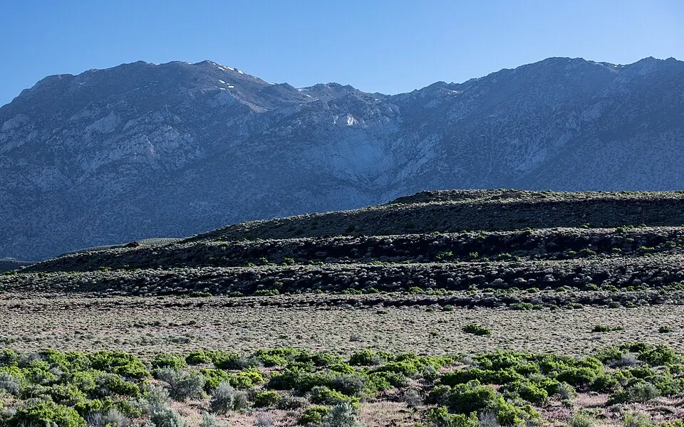
Old shoreline terraces of Lake Lahontan in Nevada.
Picture: blmcalifornia · Public domain · Wikimedia Commons


Lake Agassiz
Manitoba, Saskatchewan, Ontario, Minnesota and North Dakota · About 13,000 to 8,400 years ago
Lake Agassiz was the biggest lake of the last Ice Age in North America, formed in front of the retreating ice sheet as meltwater had nowhere to go. At its largest it covered roughly 440,000 km², more than any lake on Earth today, and was named after the Swiss-American scientist Louis Agassiz.
As the ice melted, the lake drained in stages, in part north into Hudson Bay. Some scientists link one big drainage, about 8,200 years ago, to a cold spell in the North Atlantic, though the details are debated. The flat, rich lake bed is now the Red River Valley, one of the most productive farmlands of North America; Lake Winnipeg, Lake Manitoba and Lake of the Woods are what is left of the water.
Pictures
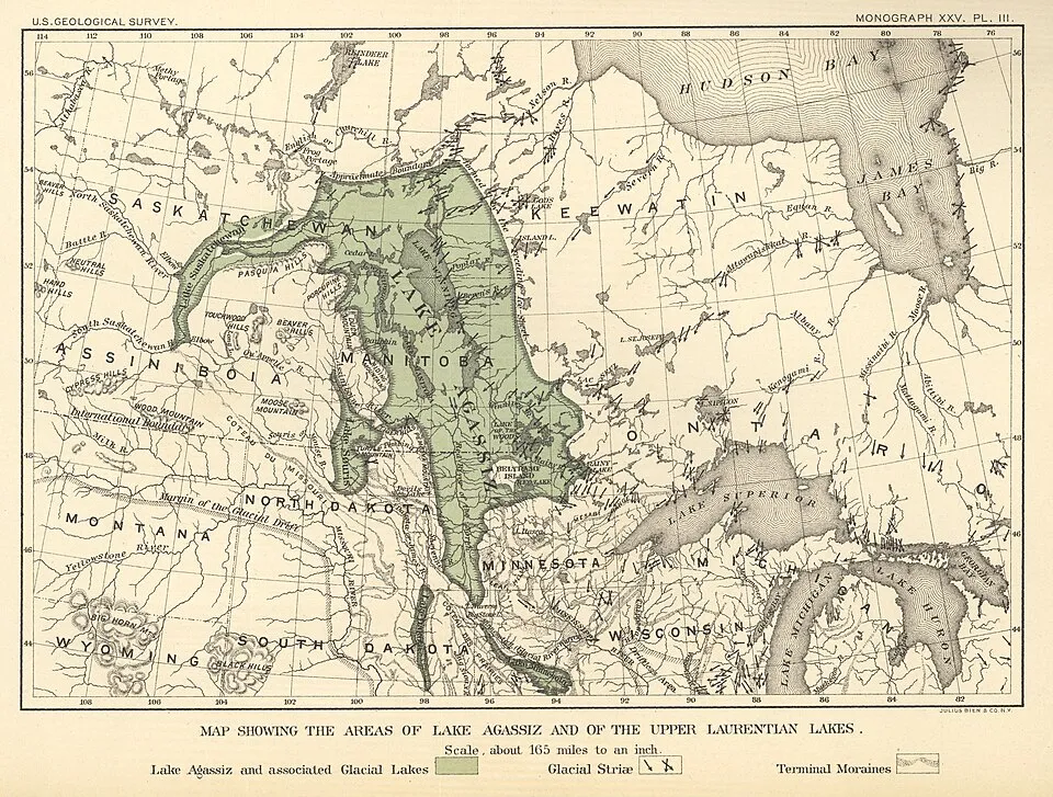
Warren Upham’s 1895 map of Lake Agassiz and the upper Great Lakes, from a U.S. Geological Survey monograph.
Picture: Warren Upham, U.S. Geological Survey (1895) · Public domain · Wikimedia Commons

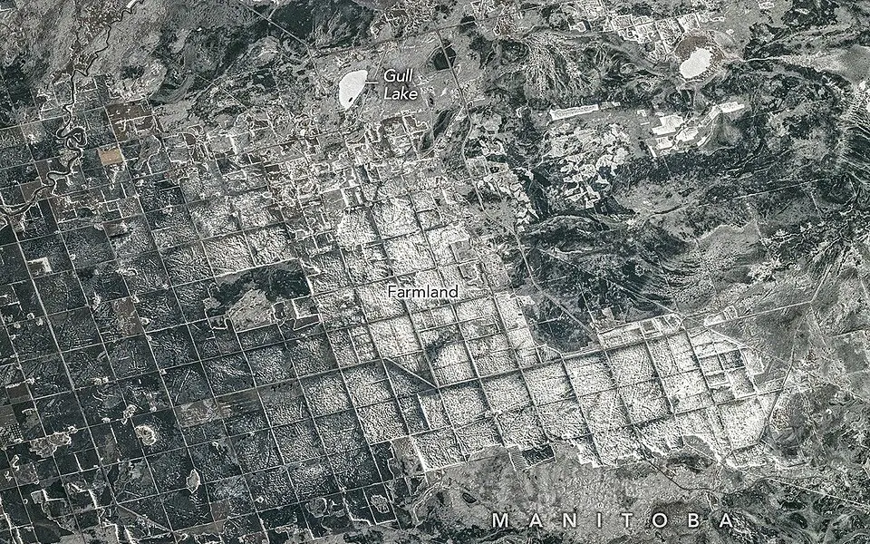
Glacial Lake Missoula
Western Montana, USA · About 15,000 to 13,000 years ago, again and again
Each flood drained the lake in a matter of days
When a lobe of the Cordilleran ice sheet blocked the valley of the Clark Fork river, a lake as large as Lake Erie and Lake Ontario put together (by one common estimate) built up behind the ice dam over the mountains of western Montana. The dam floated and failed, and the water rushed out across eastern Washington towards the Columbia River.
It happened many times. The floods stripped soil from the plateau and cut huge channels and cliffs in the basalt, a landscape called the Channeled Scablands, with Dry Falls, a cliff about 5.5 km wide, as its best-known sight. It took geologist J Harlen Bretz decades to convince others that a flood, not slow erosion, had done it.
Pictures
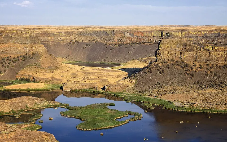
Dry Falls, Washington, a cliff carved by the Missoula floods.
Picture: Steven Pavlov · CC BY-SA 3.0 · Wikimedia Commons


Lake Manly
Death Valley, California, USA · Deepest 186,000 to 120,000 years ago; smaller lakes until about 10,000 years ago
Death Valley, the hottest and driest place in North America, once held a lake more than 100 metres deep and about 150 km long, fed by rivers from the wetter Ice Age Sierra Nevada. It is named after William Lewis Manly, a pioneer who helped lead survivors out of the valley in 1849.
The lake dried over thousands of years and left the salt flats at Badwater, the lowest point in North America at 86 metres below sea level. After heavy rain in 2023 a thin, shallow lake formed there again for a few months, a reminder of what the valley once held.
Pictures
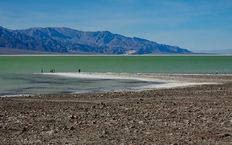
Lake Manly at Badwater, Death Valley, December 2023: a thin shallow lake that formed again after heavy rain.
Picture: Nomdeploom · CC0 · Wikimedia Commons

Lake Tauca
The Altiplano of Bolivia and Peru · About 18,500 to 14,500 years ago
High in the Andes, at about 3,700 metres, wetter weather at the end of the last Ice Age filled the Altiplano basin with a lake that covered tens of thousands of square kilometres. Today the biggest flat in the world, the Salar de Uyuni, lies on its floor, and Incahuasi, a cactus-covered island in the salt, was an island of the lake.
When the climate dried, the lake fell and broke into the pieces we see now: Lake Titicaca in the north, the shallow Lake Poopó and the great salt flats of Uyuni and Coipasa in the south. The Uyuni flat holds a large share of the world’s known lithium.
Pictures
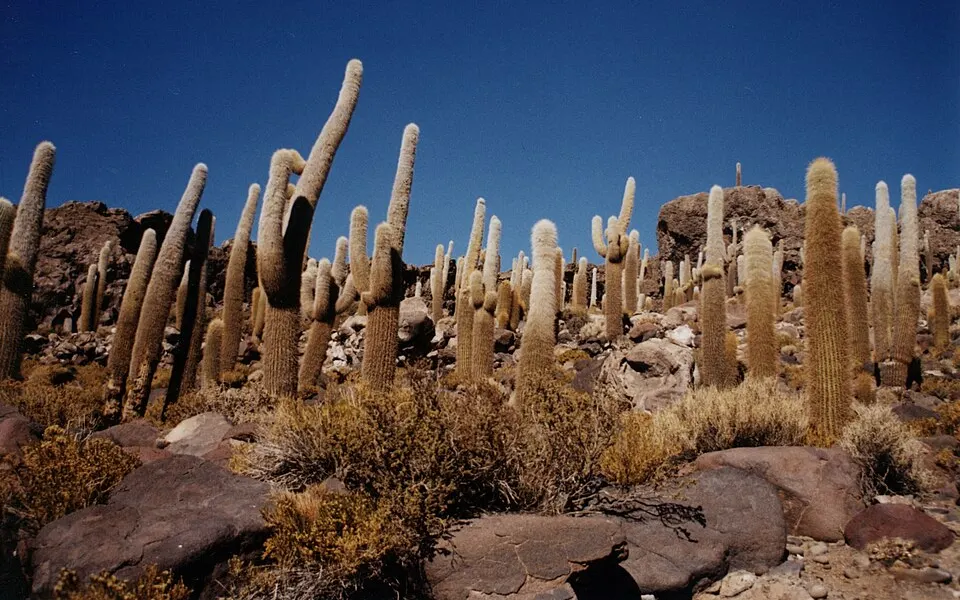
Incahuasi island in the Salar de Uyuni, Bolivia, the dry bed of the ancient Lake Tauca.
Picture: Unknown author · CC BY-SA 3.0 · Wikimedia Commons
Lake Lisan
The Jordan Rift: Israel, Jordan and the West Bank · About 70,000 to 14,000 years ago
Lake Lisan filled the Jordan Rift valley from near the Sea of Galilee to south of the present Dead Sea, standing more than 200 metres higher than the Dead Sea does today. It is named after the Lisan Peninsula, a tongue of land that sticks out into the Dead Sea.
Its pale beds of chalk-like sediment, the Lisan Formation, still lie in banks along the valley, and layers in them record past rainfall. As the climate dried the lake fell to the Dead Sea, whose shore is the lowest dry land on Earth, about 430 metres below sea level, and is still dropping.
Pictures
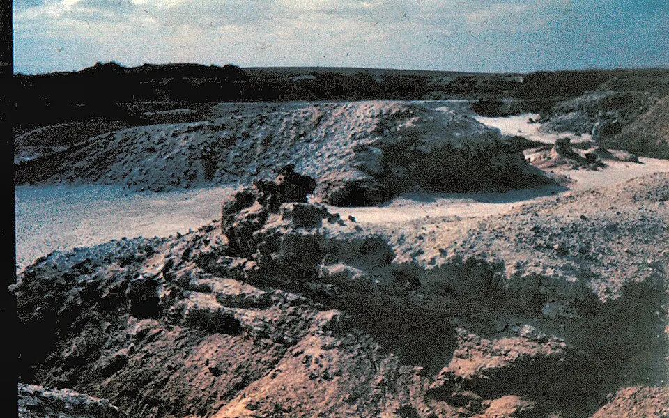
Pale bands of the Lisan Formation, laid down on the floor of Lake Lisan, near the Dead Sea.
Picture: Daniel Ventura · CC BY-SA 3.0 · Wikimedia Commons
Lake Cahuilla
The Salton Sink, southern California, USA · Filled and dried many times; last dried several centuries ago
Lake Cahuilla formed whenever the Colorado River changed course and flowed north into the Salton Sink instead of south to the Gulf of California. It filled to a depth of about 100 metres and dried again each time the river turned back, and the Cahuilla people lived and fished along its shore.
In 1905 a flood broke through an irrigation canal and the river poured into the basin for about two years, making the Salton Sea. It is fed now by farm runoff and is shrinking, which is exposing dusty lake bed again.
Pictures
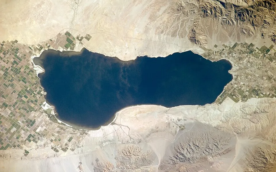
The Salton Sea, made by a flood in 1905 in the basin of old Lake Cahuilla, from the International Space Station.
Picture: NASA · Public domain · Wikimedia Commons

Dried-up lakes at a glance
| Lake | Where | When | What is left |
|---|---|---|---|
| Aral Sea | Kazakhstan and Uzbekistan | Full in 1960; shrinking since the 1960s | The southern part is almost gone; a smaller northern lake has partly recovered |
| Owens Lake | Owens Valley, California, USA | Dried by 1926 | A dry, alkali lake bed, now partly covered to keep the dust down |
| Lake Poopó | The Altiplano of Bolivia | Declared dry at the end of 2015 | A salt flat that refills only partly in wet years |
| Lake Texcoco | The Valley of Mexico, where Mexico City stands | Drained from the 1600s onwards | Almost all gone; Mexico City is built on its bed |
| Eastern Aral Sea basin | Uzbekistan and Kazakhstan | Dried completely in 2014 | A salt desert, which has taken on some water in wet years |
| Lake Urmia | North-west Iran | Shrinking since the 1990s | Far smaller than it was; its bed is a salt flat in dry years |
| Tulare Lake | The San Joaquin Valley, California, USA | Drained by farming by the early 1900s; came back in 2023 | Farmland that floods in very wet years |
| Lake Peigneur | Louisiana, USA | 20 November 1980 | A deeper, salty lake, refilled by a canal |
| Lake Merzbacher | The Inylchek glacier, Tien Shan, Kyrgyzstan | Empties most summers | Fills in spring and empties in days, through channels under the glacier |
| Mega-Chad and Lake Chad | Chad, Niger, Nigeria and Cameroon | Huge until about 5,000 years ago; small and changing since | A remnant that rises and falls with the rains |
| Lake Bonneville | Utah, with parts of Nevada and Idaho, USA | About 30,000 to 13,000 years ago | Great Salt Lake and the Bonneville Salt Flats are what remain |
| Lake Lahontan | Nevada, with parts of California and Oregon, USA | About 30,000 to 12,000 years ago | Pyramid Lake, Walker Lake and the Carson Sink are what remain |
| Lake Agassiz | Manitoba, Saskatchewan, Ontario, Minnesota and North Dakota | About 13,000 to 8,400 years ago | Lake Winnipeg, Lake Manitoba and Lake of the Woods are what remain |
| Glacial Lake Missoula | Western Montana, USA | About 15,000 to 13,000 years ago, again and again | Gone; its floods carved the Channeled Scablands of Washington |
| Lake Manly | Death Valley, California, USA | Deepest 186,000 to 120,000 years ago; smaller lakes until about 10,000 years ago | A salt flat that holds a thin lake after a very wet spell |
| Lake Tauca | The Altiplano of Bolivia and Peru | About 18,500 to 14,500 years ago | Lake Titicaca, Lake Poopó and the Uyuni and Coipasa salt flats are what remain |
| Lake Lisan | The Jordan Rift: Israel, Jordan and the West Bank | About 70,000 to 14,000 years ago | The Dead Sea, the lowest dry land on Earth, is what remains |
| Lake Cahuilla | The Salton Sink, southern California, USA | Filled and dried many times; last dried several centuries ago | The Salton Sea, which was made by accident in 1905, lies in its basin |
Questions
- Which lakes have dried up?
- In recent history, the Aral Sea in Central Asia, Owens Lake in California, Lake Poopó in Bolivia and Lake Texcoco in Mexico have dried up or nearly so. Since the last Ice Age, much bigger lakes have vanished, such as Lake Bonneville in Utah, Lake Agassiz in Canada and Mega-Chad in the Sahara.
- Why did the Aral Sea dry up?
- Soviet planners diverted the two rivers that fed it, the Amu Darya and the Syr Darya, to irrigate cotton and other crops from the 1960s. Less water reached the lake than evaporated from it, so it shrank year after year. In 1960 it covered about 68,000 km² and was the fourth-largest lake on Earth.
- Which lakes dried up in a year or two?
- Lake Poopó in Bolivia went from a shallow lake to a dry bed between about 2013 and 2015. Lake Peigneur in Louisiana drained in a few hours in 1980 when a drilling rig broke into a salt mine below it. Lake Merzbacher in Kyrgyzstan empties within days in most summers, and the Ice Age Lake Missoula emptied in days in each of its floods. Tulare Lake in California came back within weeks in 2023.
- Can I watch a lake dry up?
- Yes. The Aral Sea has its own year-by-year slideshow near the top of this page, with one NASA satellite picture of the same view for each year from 2000 to 2026. 5 other lakes, including Lake Poopó, Lake Urmia, Lake Chad and Tulare Lake, have one too: drag the slider or press play and the water pulls back or returns.
- Is Lake Chad drying up?
- It is much smaller than in the 1960s, but its size swings with the rains and with the water drawn from its rivers. Thousands of years ago the lake was far larger still: Mega-Chad covered roughly 350,000 km² when the Sahara was green, and shrank as the rains moved south.
- What was Lake Bonneville?
- A huge Ice Age lake of about 50,000 km² over western Utah and parts of Nevada and Idaho, up to about 300 metres deep. It dried as the climate warmed. The Great Salt Lake and the Bonneville Salt Flats are what remain of it.
- Can a dried-up lake come back?
- Sometimes, for a while. Lake Manly in Death Valley formed a thin lake again after heavy rain in 2023, and Lake Poopó has taken on some water in wet years. A lake that was drained or starved by people, like Owens Lake or the Aral Sea, returns only if the water is given back.
- How are the old lakes shown?
- For lakes that dried up since 2000, with NASA satellite pictures taken once a year from the same view. For older lakes, no satellite saw them, so each has maps and photographs: historical survey maps such as the 1895 map of Lake Agassiz, pictures of the old shorelines and of the lake beds today. The map above marks where each lay; no open outlines of the Ice Age shorelines exist, so their extents are described in words and not drawn.
See also
Satellite pictures: NASA EOSDIS GIBS, MODIS Terra (public domain), saved once and shown as pictures. Lakes layer: Natural Earth (public domain). Maps and photographs: Wikimedia Commons and U.S. government sources, each credited under the picture. Dates and sizes are long-established round figures; where sources differ the text says “about”. See data sources.