
Last Ice Age, until about 7,000 years ago
Doggerland
At the end of the last Ice Age, Britain was not an island. A low plain of hills, rivers and marshes joined it to the Netherlands, Germany and Denmark across what is now the southern North Sea. As the ice melted, the sea rose and drowned it, between about 10,000 and 7,000 years ago. Lower the sea on the map to bring it back.
Sea level over today’s sea floor; it leaves out the land’s rise and fall since, and sand moved by the sea. Map data: Ice-age ice sheets: PaleoMIST (Gowan et al. 2021), CC BY 4.0 · Heights: Terrain Tiles (SRTM, GMTED2010, ETOPO1 and others), Open licences, per source.
A land between Britain and Europe
During the last Ice Age so much water was held in ice sheets that the sea stood about 120 metres lower than today. The southern North Sea was dry land, and rivers such as the Rhine and the Thames flowed across it. As the ice melted, the plain shrank to a scatter of low islands and then disappeared under the water.
The name Doggerland comes from the Dogger Bank, a sandbank in the middle of the North Sea that was once its higher ground. The archaeologist Bryony Coles gave the name to the lost land in the 1990s.
People lived there
Doggerland was home to hunter-gatherers of the Mesolithic. In 1931 a trawler dragged up a lump of peat holding a barbed antler point from the sea floor some 40 km east of Norfolk. It dates from between 10,000 and 4,000 BCE, when the spot was land. Since then fishing boats and wind-farm surveys have brought up bones of mammoths and other animals, flint tools and human remains.
About 8,000 years ago a huge undersea landslide off Norway, the Storegga Slide, sent a tsunami across the North Sea. Researchers still debate how much of Doggerland was left above water by then and what the wave did to it.
What the map shows
This page uses the main map’s sea-level layer, not the ancient-seas coastlines: Doggerland is too recent for them. It lowers the sea over today’s sea floor, so it leaves out how the land has risen and sunk since, and the sand and mud the sea has moved. Read the levels as a guide to the shape of the lost land, not an exact coastline of a given year.
Doggerland on maps
Maps drawn by geologists and archaeologists. Use the arrows or swipe to move through them.
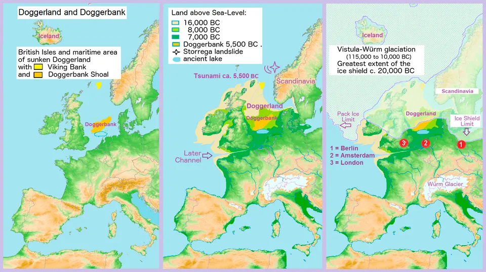
Doggerland in three stages as the sea rose, between Britain and the mainland.
Picture: Francis Lima · CC BY-SA 4.0 · Wikimedia Commons


Finds from the lost land
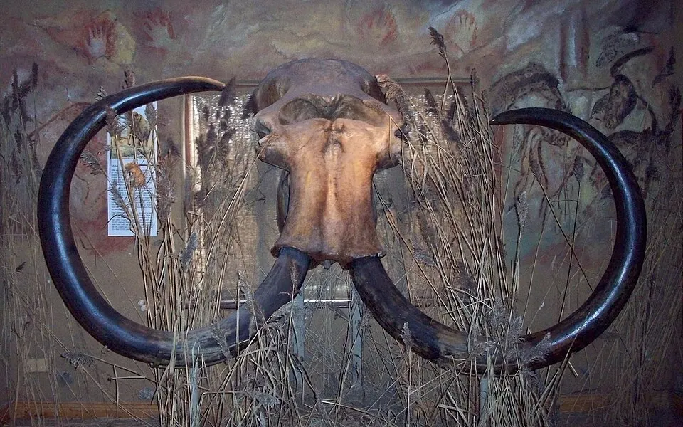
Skull of “Millie”, a woolly mammoth fishermen dredged from the North Sea off Hook of Holland in 1999.Photo: Ogmios · CC BY-SA 3.0 · Wikimedia Commons 
Barbed antler points from Star Carr, Yorkshire, made while Doggerland was still dry land.Photo: Jonathan Cardy · CC BY-SA 3.0 · Wikimedia Commons 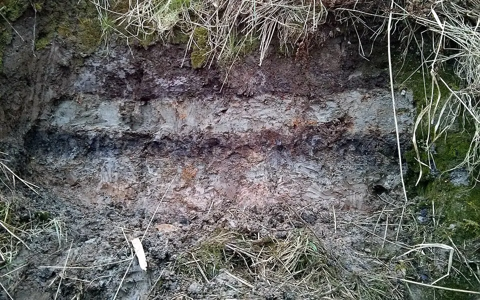
A pale band of sand from the Storegga tsunami between layers of peat, Montrose Basin, Scotland.Photo: Stozy10 · CC BY-SA 3.0 · Wikimedia Commons
Questions
- What was Doggerland?
- Land that joined Britain to mainland Europe across the southern North Sea during and after the last Ice Age, when the sea was much lower. It was drowned by the rising sea between about 10,000 and 7,000 years ago.
- When did Britain become an island?
- As the sea rose after the Ice Age, Doggerland flooded between about 10,000 and 7,000 years ago, first into low islands and then completely. Britain has been an island since, with dates for the final break varying between studies.
- Did people live on Doggerland?
- Yes. Hunter-gatherers lived there, and fishing boats have dredged up their flint tools, a carved antler point and human bones from the North Sea floor.
- Where is the Dogger Bank?
- In the middle of the North Sea, about 100 km off the coast of north-east England. It is a large sandbank, once the high ground of Doggerland, and gave the lost land its name.
See also
Sea levels: Ice-age ice sheets: PaleoMIST (Gowan et al. 2021), CC BY 4.0 · Heights: Terrain Tiles (SRTM, GMTED2010, ETOPO1 and others), Open licences, per source. See data sources.