
Countries and Places Below Sea Level
Around a quarter of the Netherlands lies below the sea. So do parts of New Orleans, Tokyo and Jakarta, and rice fields in southern India. Some of these places are held dry by walls and pumps, some sank by accident, and some are natural hollows that the sea can’t reach.
Below sea level, held dryNatural dry basinSinking cityThe shapes are traced from national laser surveys where they exist and satellite heights elsewhere, in chosen areas only. Treat their edges as approximate; other low ground exists. Georgetown and Jakarta have a marker but almost no shape, because satellite heights cannot see land this low through buildings and trees.
Interactive 3D Engineering Simulator
How Megacities Hold Back the Rising Sea
More than a quarter of the Netherlands lies below sea level, yet millions live and work there safely. Explore the kinetic 3D mechanics of the world’s most ambitious civil defense megaprojects: from Dutch boulder-clay dikes and floating storm surge gates to subterranean diversion cathedrals.
The Dutch Dike & Polder Engine
1,000 Years of Ground Compaction
When medieval farmers dug drainage ditches, the peat soil was exposed to oxygen. Bacteria oxidized organic material into CO2, and dried soil compressed under its own weight, causing the land to sink from +1m down to -4.5m below sea level.
Real-Time Hydraulic State
How people keep the water out
Dikes and levees
Banks of earth or concrete that hold water back. They have to be raised over time as land sinks and the sea rises.
Netherlands, New Orleans, Sacramento Delta
Pumps
Rain and seepage keep arriving, so low land must be pumped for as long as people want it dry. Windmills, then steam and electric pumps, did this work.
Netherlands, the Fens, Kuttanad, Hachirōgata
Storm surge barriers
Gates across a river mouth or estuary that stay open to the tide and close when a storm comes.
Netherlands, Tokyo Bay
Tide sluices
Gates that let water out at low tide and shut at high tide. They are cheap and need no power, but they only work when the tide allows.
Georgetown
Stopping the pumping
When a city pumps out its groundwater, the ground compacts and sinks. Limits on pumping can stop this, though the lost height never returns.
Tokyo
Held dry by people
People built these. The sea or a river stands higher than the land, and the land stays dry only as long as the walls hold and the pumps run.
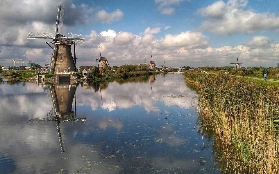
The Kinderdijk windmills, which drained the polders. Photo: Travelinho · CC BY-SA 4.0 · Wikimedia Commons
The Netherlands
Netherlands · About 7 m below, at the Zuidplaspolder
- Dikes and dunes
- Pumping stations
- Storm surge barriers
- Reclaimed polders
About 26% of the Netherlands lies below sea level, according to the Dutch government’s environmental assessment agency, PBL. A wider 59% could flood from the sea or rivers without its defences. The often-quoted “55% below sea level” was a mistake in a 2007 IPCC report, which PBL corrected: that figure was the area at risk of flooding, not the area below the sea.
A polder is a piece of low ground ringed by a dike and kept dry by pumping. Water seeps in and rain falls in, so the pumping never stops. Much of the low land is also sinking, which makes the job harder over time.
Two floods shaped today’s defences. After the flood of 1916, the country adopted Cornelis Lely’s plan to close off the Zuiderzee, an arm of the North Sea. The Afsluitdijk dam shut the last gap on 28 May 1932, and the sea behind it became the IJsselmeer, a lake. New land followed inside it: the Wieringermeer, the Noordoostpolder and the two Flevoland polders, about 165,000 hectares in all.
Then, on the night of 31 January 1953, a spring tide and a northwesterly storm broke dikes across the southwest and killed 1,836 people in the Netherlands. Within weeks a committee was at work on the Delta Works, which closed off the estuaries of the Rhine, Meuse and Scheldt. Its centrepiece, the Oosterscheldekering, is a barrier that stays open to the tide and closes only for severe storms.
Sources: PBL: correction on flood risks in the IPCC report · Rijkswaterstaat: 100 years of the Zuiderzee Act · Britannica: Delta Works · Watersnoodmuseum: history of the Delta Works
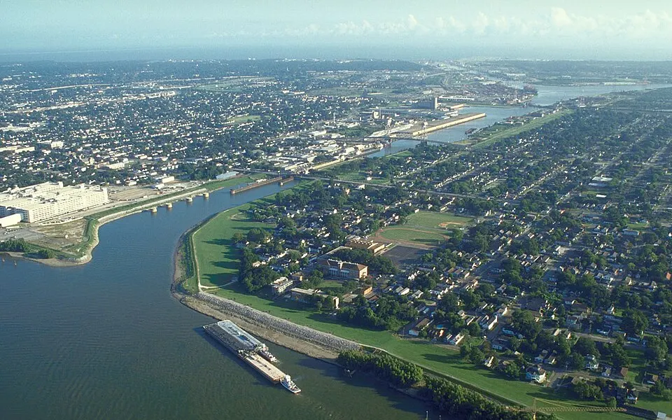
The Industrial Canal and its floodwalls. Photo: Michael Maples, U.S. Army Corps of Engineers · Public domain · Wikimedia Commons
New Orleans
United States · About 3 m below, in the lowest districts
- Levees and floodwalls
- Floodgates
- Pumping stations
Much of New Orleans lies below sea level and has no natural drainage, so canals and pumps carry away even ordinary rain. Figures vary with how the city is measured, but the usual estimate is about half of the metro area.
After the levees failed in Hurricane Katrina in 2005, the US Army Corps of Engineers built the Hurricane and Storm Damage Risk Reduction System: 133 miles of levees, floodwalls, gates and pumps, at about $14.5 billion. It is designed for a 100-year storm, which means it is not designed to stop everything.
The land keeps settling. The Corps itself has warned that without further raising of the levees to offset settling, sinking land and sea-level rise, the risk will grow.
Sources: Congressional Research Service: New Orleans levees and floodwalls · Scientific American: after a $14-billion upgrade, the levees are sinking · WTTW: New Orleans risk reduction system · US Army Corps of Engineers: HSDRRS brief (2012)
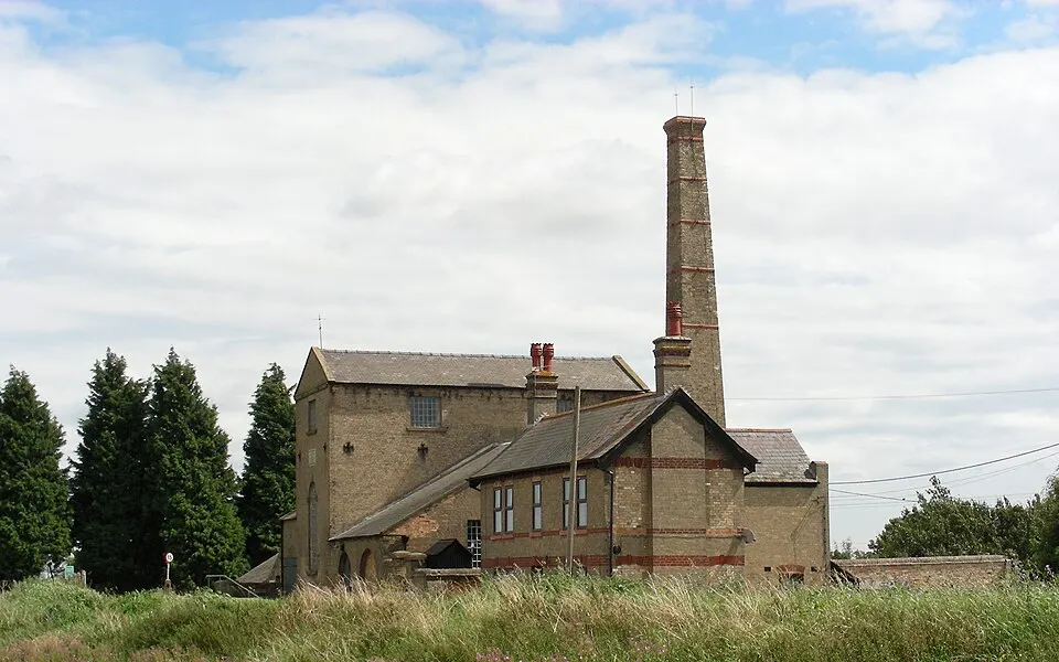
Stretham Old Engine, a steam pump that drained the Fens. Photo: William M. Connolley at English Wikipedia · CC BY-SA 3.0 · Wikimedia Commons
The Fens
England, United Kingdom · About 3 to 4 m below, near Holme Fen (sources differ)
- Drainage channels
- Pumping stations
- Embankments
The Dutch engineer Cornelius Vermuyden drained this marsh in eastern England for the Bedford Level scheme, contracted in 1630 and finished in 1637. It worked, and then it caused its own problem: drained peat dries, shrinks and blows away, so the fields sank below the rivers meant to drain them.
Gravity could no longer do the job. Only with the steam pumps from about 1820 did the Fens properly dry out.
The Holme Fen post shows how far the ground has dropped. An iron post was sunk to the clay in 1852 with its top level with the ground. It now stands about 4 m clear of it.
Sources: Britannica: Sir Cornelius Vermuyden · Great Fen: the Holme Fen posts · Stretham Old Engine: history of fen drainage · Discovering Britain: Holme Fen trail
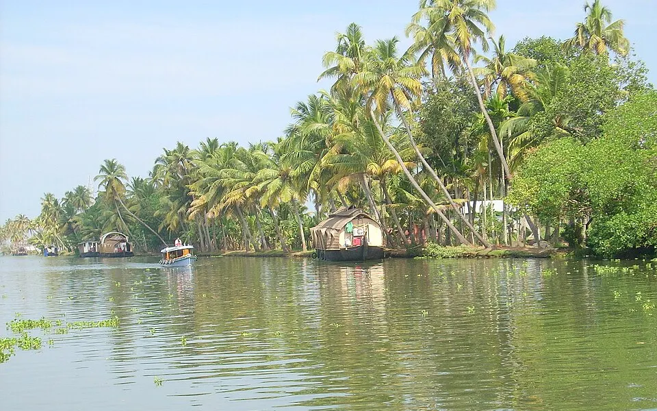
A Kuttanad backwater, where the water stands above the fields. Photo: Sourav Niyogi · CC BY-SA 3.0 · Wikimedia Commons
Kuttanad
Kerala, India · About 1.2 to 3 m below
- Earth bunds
- Pumping
- Rice, fish and ducks together
In Kuttanad, farmers grow rice below sea level on land reclaimed from Vembanad Lake. They built earth bunds to hold back the salt water, bailed the fields out, and now pump them with engines and electric motors.
The UN’s Food and Agriculture Organization listed it in 2013 as a Globally Important Agricultural Heritage System. Fish live alongside the rice, and after harvest ducks are brought in to feed on the fields and manure them.
Rising salinity is now a threat to the crop.
Sources: FAO: Kuttanad below-sea-level farming system · Kerala Tourism: heritage status for Kuttanad
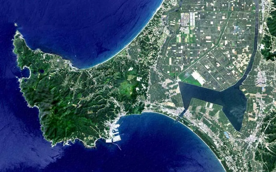
Satellite view of Hachirōgata, the polder on the old lake bed. Photo: user:っ · Public domain · Wikimedia Commons
Hachirōgata
Akita, Japan · About 4.5 m below, on the polder floor
- Reclaimed lagoon
- Pumping stations
- Tidal gate
Japan drained this large coastal lagoon with Dutch advice: two Dutch reclamation experts were invited in 1954. Work began in 1957, and by 1977 it had become 17,203 hectares of farmland, with a new village, Ōgata, founded in 1964 as a model of mechanised rice farming.
The polder floor lies about 4.5 m below sea level. A tidal gate, a central drain and two pumping stations, each moving 40 tonnes of water a second, keep it dry.
Sources: TU Delft: the Hachirogata polder site visit · World Lake Database: Hachiro-gata
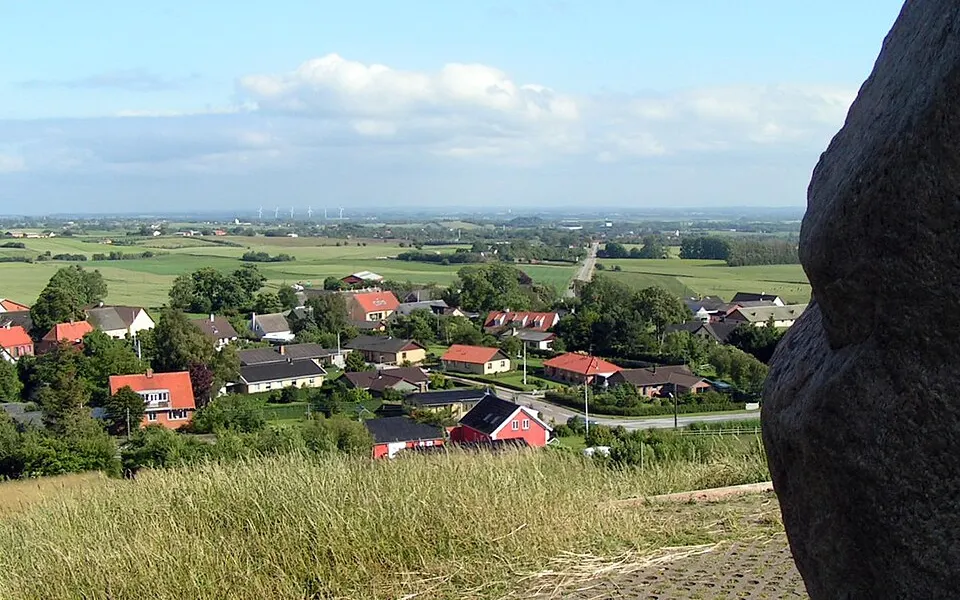
The Lammefjord, drained land, seen from Esterhøj. Photo: Digitalnu · Public domain · Wikimedia Commons
Lammefjord
Denmark · About 7 m below
- Dike across a fjord
- Pumping
Denmark closed off the inner part of this fjord and pumped it dry in 1873–1875. Its floor, about 7 m below sea level, ranks with the Netherlands’ Zuidplaspolder as the lowest land in the European Union. Only the Caspian shores, in Russia, lie lower in Europe.
Sources: Batavialand: polders in Denmark · Flevolands Geheugen: the Lammefjord and Zuidplas polders
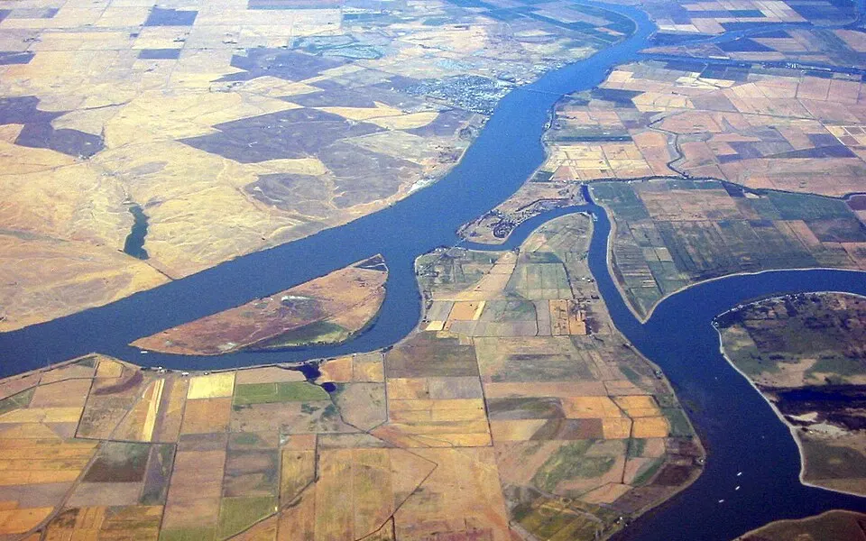
Delta islands, farmed below the level of the channels. Photo: worldislandinfo.com · CC BY 2.0 · Wikimedia Commons
Sacramento–San Joaquin Delta
California, United States · Up to about 9 m below, on the lowest islands
- Levees
- Drainage ditches
From the late 1800s, more than 60 islands in this delta were cleared and drained for farming. Once dry, the peat soil began to break down into the air. The USGS names this decay as the main cause of the sinking.
Islands that began near sea level now have large areas over 15 feet (about 4.5 m) below it, and they are shaped like saucers. Ditches hold the water table a few feet down, and the levees hold back the rivers. The deeper the islands sink, the more those levees have to bear.
Sources: USGS: decomposition of organic soils in the Delta · USGS: Delta subsidence fact sheet · Proc. IAHS (2020): Delta island subsidence
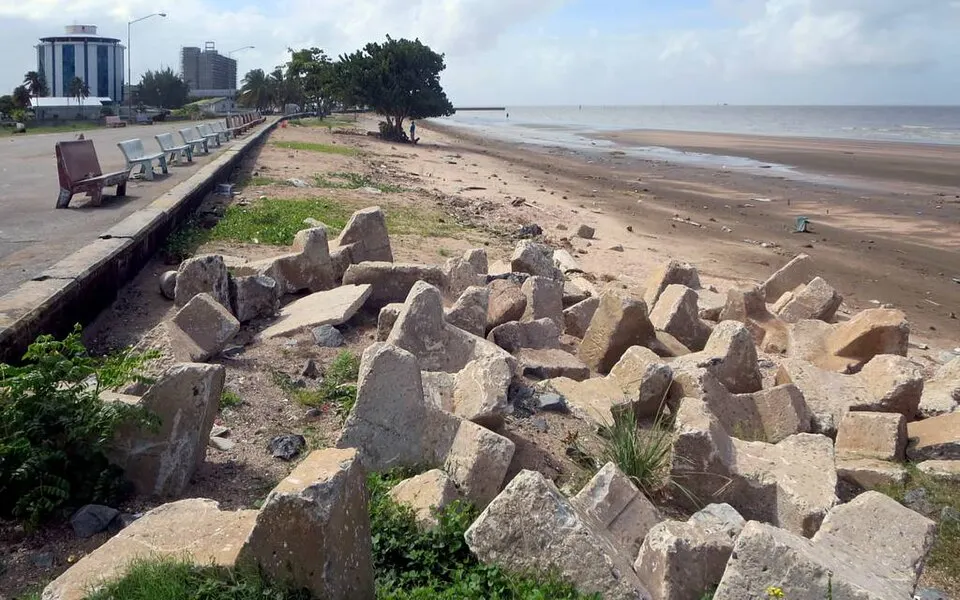
The Georgetown seawall. Photo: David Stanley from Nanaimo, Canada · CC BY 2.0 · Wikimedia Commons
Georgetown
Guyana · Up to about 2 m below high tide
- Sea wall
- Kokers (tide sluices)
- Drainage canals
Guyana’s capital sits as much as 2 m below high tide, behind a sea wall. Its canals and polders date back to Dutch rule. Rain drains out through kokers, sluice gates that keepers open when the tide is low and close when it is high.
This makes the timing tight: heavy rain at high tide has nowhere to go. In November 2022 rain left knee-deep floods because the kokers could not open, and in 2013 a high tide smashed a koker door at Kingston.
Sources: Wikipedia: Georgetown, Guyana · Climate Tracker Caribbean: will Georgetown sink? · Stabroek News: rain floods parts of the capital (2022) · Stabroek News: tide smashes Kingston koker door (2013)
Cities that sank
These cities were not built low. They sank, mostly because people pumped out the water beneath them.
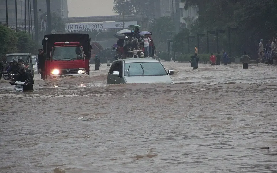
A flooded street in Jakarta, January 2013. Photo: VOA Indonesian Service · Public domain · Wikimedia Commons
Jakarta
Indonesia · About 40% of the city is below sea level
- Sea walls
- A giant sea wall, planned
- Limits on groundwater
About 40% of Jakarta now lies below sea level, mostly in the north. Northern districts have dropped as much as 4 m over four decades, and parts of the coast are reported to sink up to 14 cm a year. The main cause is people pumping out deep groundwater, along with the weight of the city above it.
The planned answer is a giant sea wall across Jakarta Bay. Critics point out that a wall does not stop the sinking, which only ends when the pumping does.
Sources: Viet Nam News: Jakarta sinks deeper (2026) · Reuters: Indonesia’s capital builds giant sea wall · RRI: how the Giant Sea Wall could change Jakarta
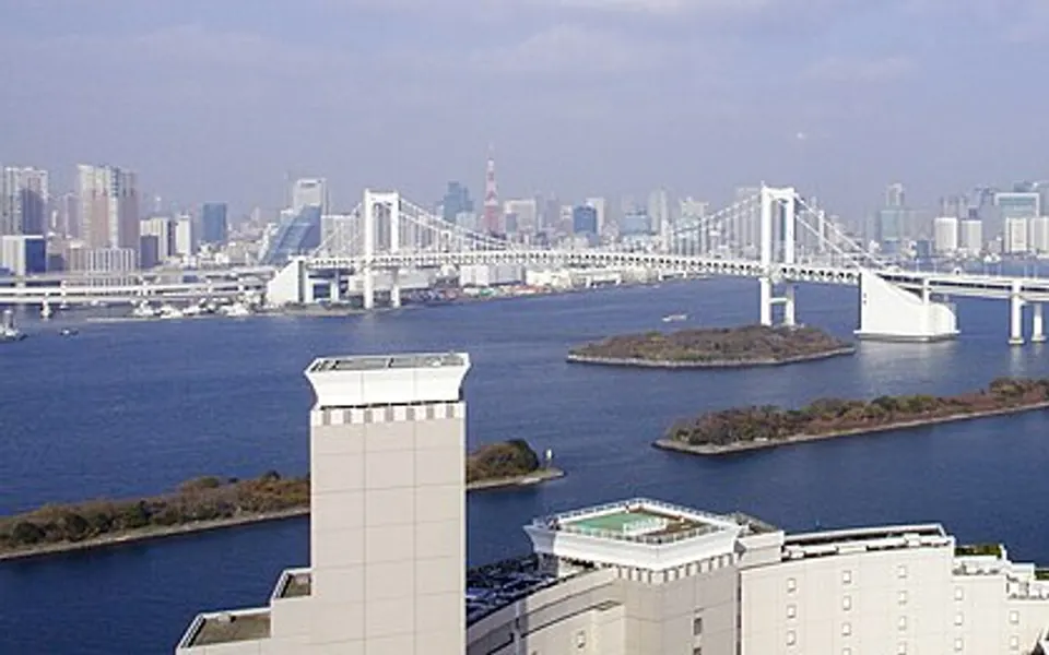
Tokyo Bay, with Rainbow Bridge, from Odaiba. Photo: Javachan · CC BY-SA 3.0 · Wikimedia Commons
Tokyo’s zero-metre zone
Japan · Below sea level at high tide
- Floodgates
- Seawalls
- Pumps
- Groundwater limits
From about 1910, factories in Tokyo’s Koto district pumped so much groundwater that the ground sank. Laws from 1961 and 1963 and tighter limits in the 1970s slowed it, which makes Tokyo the example of how to stop sinking.
The ground did not come back. About 124 square kilometres, home to some 1.5 million people, still lies below sea level at high tide. Typhoons flooded the area in 1947 and 1958, and it now sits behind 15 floodgates, 21 embankments and about 60 km of seawall on Tokyo Bay.
Sources: Tokyo Metropolitan Government: protecting Tokyo against flood damage · Sato et al., IGES: land subsidence in Tokyo
Natural dry basins
These are natural hollows, cut off from the ocean by higher ground. Nothing has to hold the sea back, so the challenge is usually finding fresh water.
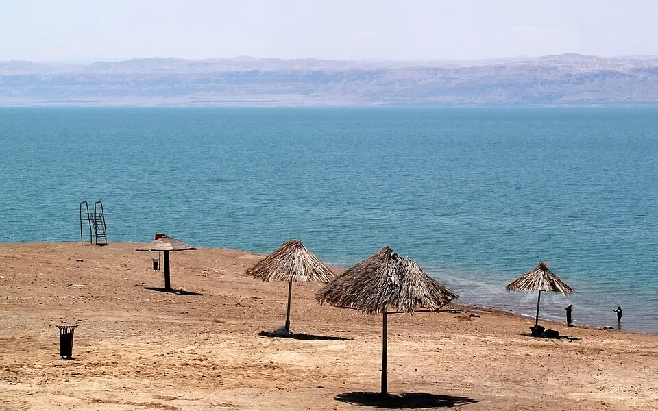
The Dead Sea shore, the lowest dry land on Earth. Photo: لا روسا · CC BY-SA 4.0 · Wikimedia Commons
The Dead Sea
Israel, Jordan and the West Bank · About 440 m below, and falling
- A rift valley with no path to the sea
The shore of the Dead Sea is the lowest dry land on Earth, at about 440 m below sea level in 2025. It keeps getting lower, by about a metre a year, as the Jordan River that feeds the lake is taken for farms and towns before it arrives.
High ground separates this rift valley from the sea, so no dike is needed. It could only flood if the sea climbed over the rim, which is why this map keeps it dry.
Sources: Wikipedia: Dead Sea
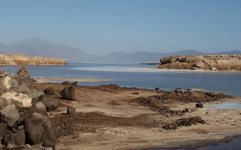
Lake Assal
Djibouti · About 155 m below (153 to 157 m in sources)
- A rift valley with no path to the sea
A crater lake in central Djibouti, Lake Assal is the lowest point on land in Africa. Sources put it between 153 m and 157 m below sea level.
Sources: ESA: Lake Assal, Djibouti · Britannica: Lake Assal
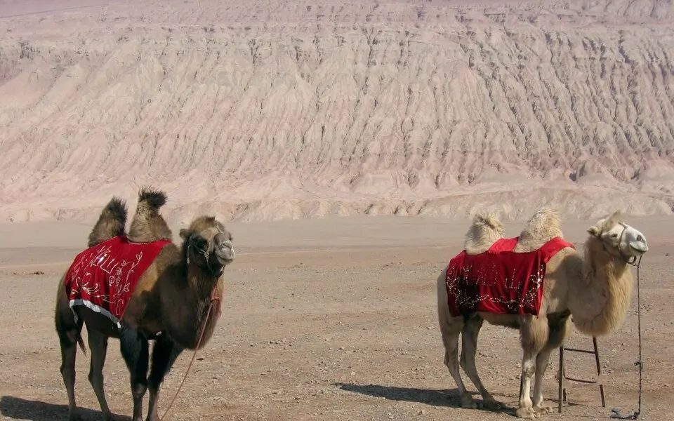
Camels in the Turpan basin, below the Flaming Mountains. Photo: Colegota · CC BY-SA 2.5 es · Wikimedia Commons
Turpan Depression
Xinjiang, China · About 154 m below, at Aydingkol
- Karez water tunnels bring in snowmelt
The Turpan Depression’s lowest point, the mostly dry lakebed of Aydingkol, is about 154 m below sea level and the lowest ground in China. The sea is no concern here. The problem is water, in one of the driest and hottest places in the country.
Its answer is the karez: tunnels dug by hand that carry meltwater by gravity from the foot of the Tian Shan. Being underground, the water barely evaporates. A 2003 count found about 5,272 km of these channels in Xinjiang, nearly all around Turpan and Hami. The Karez wells have been on China’s tentative list for World Heritage status since 2008.
Sources: Middle East Institute: the karez system in Xinjiang · UNESCO tentative list: Karez Wells · Wikipedia: Turpan Depression
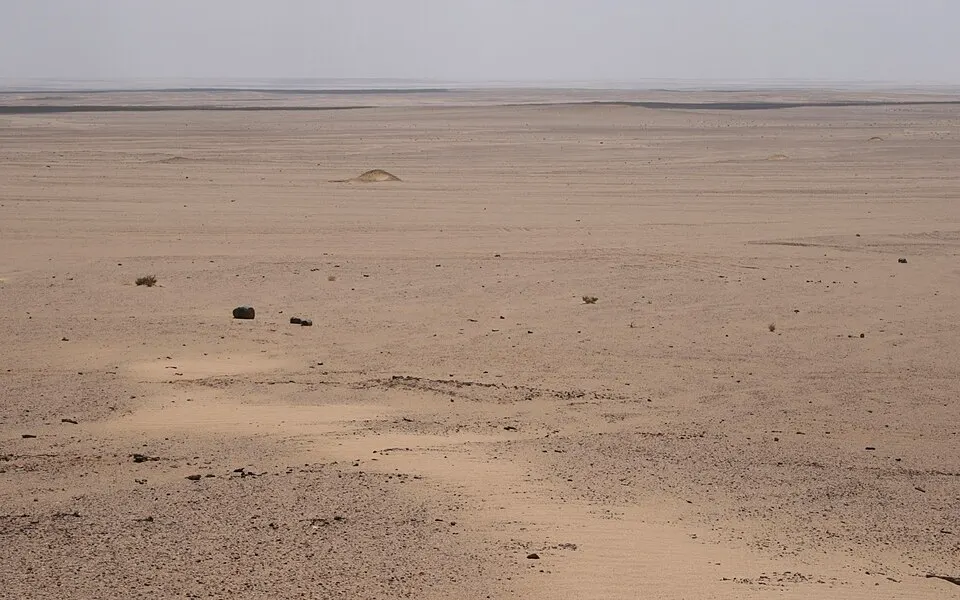
Qattara Depression
Egypt · About 133 m below
- Desert ground holds back the Mediterranean
At about 133 m below sea level, the Qattara Depression is Africa’s second-lowest point. It lies in Egypt’s Western Desert, with no settlements inside it. A band of higher desert ground keeps the Mediterranean out.
Sources: Britannica: Qattara Depression · Wikipedia: Qattara Depression
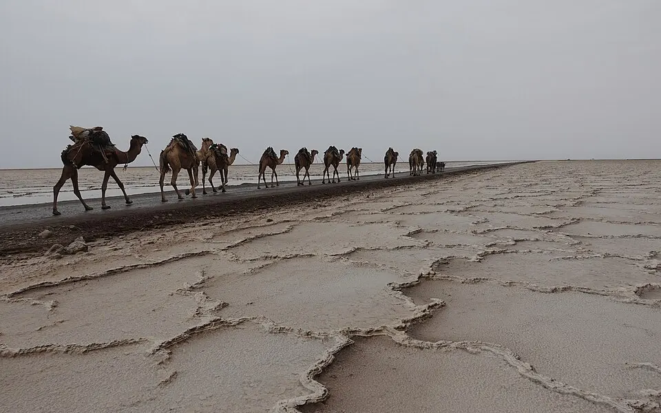
A salt caravan crossing the Danakil salt plain. Photo: Val Rime · CC BY-SA 4.0 · Wikimedia Commons
Danakil Depression
Ethiopia and Eritrea · About 125 m below
- A rift valley with no path to the sea
The Danakil Depression in Ethiopia reaches about 125 m below sea level, and its Eritrean part about 75 m below, according to the CIA World Factbook. Workers still mine salt on its floor.
Sources: Wikipedia: places below sea level · Al Jazeera: salt mining in the Danakil
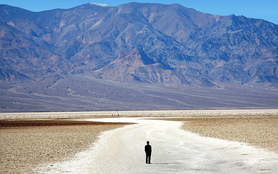
Badwater Basin, Death Valley. Photo: Photographersnature · CC BY-SA 3.0 · Wikimedia Commons
Death Valley
California, United States · About 86 m below, at Badwater Basin
- Mountains on every side
Badwater Basin, in Death Valley, is the lowest point in North America, about 86 m (282 ft) below sea level. Mountains on every side keep the ocean far away.
Sources: Wikipedia: places below sea level · Geology.com: below sea level
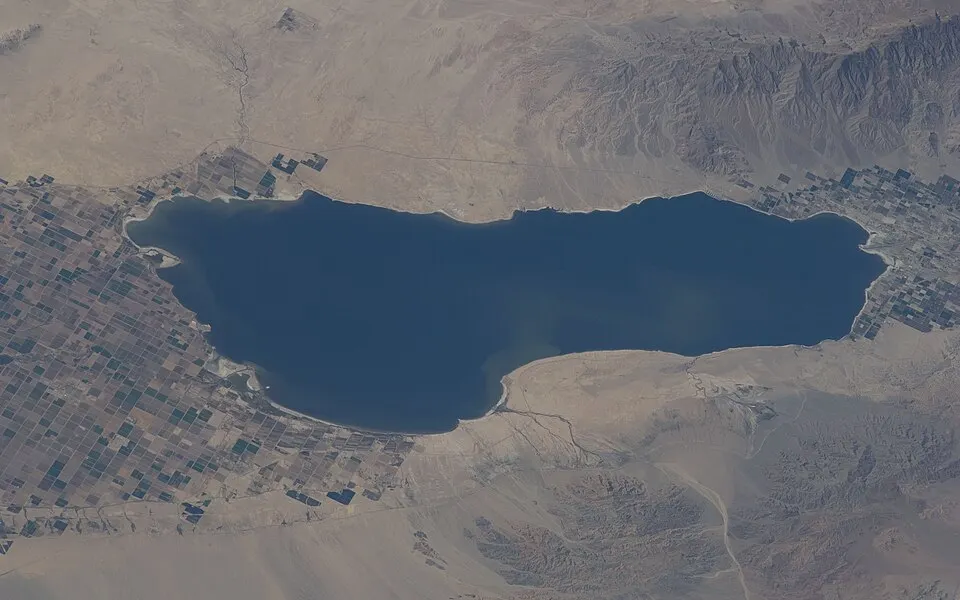
The Salton Sea from orbit. Photo: Earth Science and Remote Sensing Unit, Lyndon B. Johnson Space Center · Public domain · Wikimedia Commons
Salton Sink
California, United States · About 69 m below, at the Salton Sea
- Canals bring in Colorado River water
The Salton Sink is a desert basin in southern California. In 1905 an irrigation canal breached, and the Colorado River poured in for nearly two years, creating the Salton Sea by accident. Towns such as Calipatria and Brawley lie well below sea level around it.
Sources: Wikipedia: places below sea level · Geology.com: below sea level
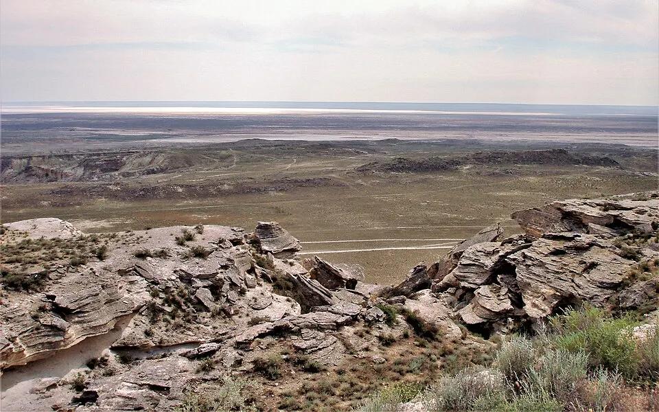
The Karagiye Depression, Kazakhstan. Photo: Thermokarst · CC BY-SA 3.0 · Wikimedia Commons
Caspian Sea and its shores
Russia, Kazakhstan, Azerbaijan, Iran and Turkmenistan · About 28 m below
- No outlet to the ocean
The Caspian has no outlet, and its surface lies about 28 m below the ocean. Whole cities live below sea level here, among them Baku, the capital of Azerbaijan. The low ground around it, the Caspian Depression, covers about 200,000 square kilometres.
Sources: Wikipedia: places below sea level · Geology.com: below sea level
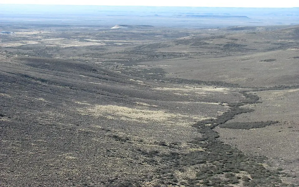
The Gran Bajo San Julián, in Patagonia. Photo: Santiago matamoro · CC BY-SA 3.0 · Wikimedia Commons
Laguna del Carbón
Argentina · About 105 m below
- Ground rises between it and the Atlantic
At about 105 m below sea level, this salt lagoon in Santa Cruz province is lower than anywhere in North America, and the lowest point in the Americas.
Sources: Wikipedia: places below sea level
Countries whose lowest point is below sea level
34 countries, from the CIA World Factbook, with the Dead Sea figure updated. A country can have low ground without appearing here: the Factbook lists only each country’s single lowest point, and it gives 0 m for India, even though Kuttanad’s farms lie lower. Where a lake’s surface is the low point, the level changes from year to year.
| Country | Lowest point | Height |
|---|---|---|
| Israel | Dead Sea | −440 m |
| Jordan | Dead Sea | −440 m |
| Djibouti | Lac Assal | −155 m |
| China | Turpan Pendi | −154 m |
| Egypt | Qattara Depression | −133 m |
| Kazakhstan | Qauyndy Oyysy | −132 m |
| Ethiopia | Danakil Depression | −125 m |
| Argentina | Laguna del Carbón | −105 m |
| United States | Death Valley | −86 m |
| Turkmenistan | Vpadina Akchanaya | −81 m |
| Eritrea | near Kulul within the Danakil Depression | −75 m |
| Syria | Yarmuk River | −66 m |
| Morocco | Sebkha Tah | −59 m |
| Western Sahara | Sebjet Tah | −55 m |
| Libya | Sabkhat Ghuzayyil | −47 m |
| Dominican Republic | Lago Enriquillo | −46 m |
| Algeria | Chott Melrhir | −40 m |
| Azerbaijan | Caspian Sea | −28 m |
| Iran | Caspian Sea | −28 m |
| Russia | Caspian Sea | −28 m |
| Tunisia | Shatt al Gharsah | −17 m |
| Australia | Lake Eyre | −15 m |
| Uzbekistan | Sariqamish Kuli | −12 m |
| Mexico | Laguna Salada | −10 m |
| Denmark | Lammefjord | −7 m |
| Netherlands | Zuidplaspolder | −7 m |
| Mauritania | Sebkhet Te-n-Dghamcha | −5 m |
| Japan | Hachiro-gata | −4 m |
| United Kingdom | The Fens | −4 m |
| Germany | Neuendorf bei Wilster | −3.5 m |
| Sweden | reclaimed bay of Lake Hammarsjon, near Kristianstad | −2.4 m |
| France | Rhone River delta | −2 m |
| Poland | near Raczki Elblaskie | −2 m |
| Suriname | unnamed location in the coastal plain | −2 m |
Source: CIA World Factbook (public domain).
Frequently Asked Questions
Which country is most below sea level?
By share of the country, the Netherlands: about 26% of its land lies below sea level, according to the Dutch environmental assessment agency, PBL. By depth, the lowest dry land is the Dead Sea shore, shared by Israel, Jordan and the West Bank, at about 440 m below sea level.
How much of the Netherlands is below sea level?
About 26%. A wider 59% is at risk of flooding from the sea or rivers without its defences. The “55% below sea level” often quoted comes from an error in a 2007 IPCC report, which the Dutch agency PBL corrected.
How does the Netherlands stay dry?
With dunes and dikes to hold back the sea and rivers, pumps to remove rain and seepage from low polders, and storm surge barriers that close the estuaries during severe storms. Much of the current system came after the floods of 1916 and 1953.
What is a polder?
A piece of low-lying land enclosed by a dike, with its water level controlled by drains and pumps. Some were lakes or sea, like Flevoland in the Netherlands and Hachirōgata in Japan. Others were marshes.
Is New Orleans below sea level?
Roughly half of the metro area is, with the lowest districts about 3 m below. It relies on levees, floodwalls, gates and pumps, rebuilt after Hurricane Katrina in 2005.
What is the lowest point on Earth?
The lowest dry land is the Dead Sea shore, at about 440 m below sea level in 2025 and falling. The lowest land anywhere is under the ice: a trough beneath Antarctica’s Denman Glacier, about 3,500 m below sea level. The deepest point on the sea floor is the Challenger Deep, more than 10,900 m down.
Why doesn’t the sea flood places like Death Valley?
Higher ground stands between them and the ocean. Being below sea level only matters if water has a path in. Death Valley and the Qattara Depression have none, so they stay dry without any defences.