
Ancient Seas Map
Much of the land we live on was once sea floor. This map shades today’s land that was under the sea, from 535 to 5 million years ago, with the marine fossils that prove it. Move the slider through time, or tap your town to see every age it spent under the water.
Light blue: shallow sea. Dark blue: deep ocean. Grey: crust the plate model does not carry back that far. Orange dots: marine fossil sites of the age. Map data: Ancient seas: PaleoCoastlines v7 (Kocsis & Scotese 2021), CC BY 4.0 · Fossils: Paleobiology Database.
Named seas
No one has drawn open outlines of these seas, so the map shades what the coastline maps show and the names are ours to place. Press “Show on map” to jump there.
Zechstein Sea
Late Permian (Lopingian) · The North Sea, northern Germany, the Netherlands, Denmark and Poland
A landlocked sea over today’s North Sea, Germany and Poland. It dried out again and again, leaving thick salt that now seals in North Sea gas.
Tethys Ocean
Permian to Miocene · Southern Europe, North Africa, the Middle East, Iran, the Himalaya and South-East Asia
The ocean between the northern and southern continents. As Africa, Arabia and India moved north it closed, raising the Alps and the Himalaya; the Mediterranean is what is left of it.
Sundance Sea
Middle and Late Jurassic · Wyoming, Montana, the Dakotas, Utah and Alberta
An arm of the sea that reached south from the Arctic into Wyoming, Montana and the Dakotas, before the dinosaur plains of the Morrison Formation.
Turgai Strait
Jurassic to Oligocene, on and off · Western Siberia and Kazakhstan, east of the Urals
A sea east of the Ural Mountains that linked the Arctic to the Tethys and kept Europe apart from Asia for animals that could not swim. The coastline maps under-draw it, so it shows smaller than it was.
Eromanga Sea
Early Cretaceous · Inland Queensland, South Australia and New South Wales
A shallow, cold inland sea over much of eastern Australia. Marine reptiles such as Kronosaurus hunted in it, and its fossils are found across outback Queensland.
Western Interior Seaway
Late Cretaceous · The Great Plains of the United States and Canada, from the Gulf of Mexico to the Arctic
A shallow sea that split North America in two, from the Arctic to the Gulf of Mexico. The chalk of western Kansas formed on its floor.
Trans-Saharan Seaway
Late Cretaceous to Eocene · Niger, Mali, Nigeria and Algeria
A shallow sea that crossed the Sahara from the Gulf of Guinea to the Tethys. Rocks it laid down in Mali hold fossils of giant sea snakes and large catfish. The coastline maps under-draw it, so it shows smaller than it was.
Paratethys
Oligocene to Pliocene · From Vienna and the Hungarian plain to the Black Sea, the Caspian and the Aral Sea (the Aral Sea itself is a modern lake, now mostly dried)
A great inland sea north of the Alps and the Caucasus, cut off from the Tethys as the mountains rose. The Black, Caspian and Aral seas are what remain of it.
Sauk Sea
Cambrian to Early Ordovician (approximate) · The centre of North America: the Great Plains, the Midwest and the Great Lakes
The first great flood over North America’s interior, named after the Sauk sequence of rock layers. Its sandstones and limestones lie under much of the Midwest, and trilobites were its best-known animals.
Tippecanoe Sea
Middle Ordovician to Early Devonian (approximate) · The centre and east of North America: Ohio, Indiana, Kentucky, Tennessee and the Great Lakes
The second flood over North America’s interior, named after the Tippecanoe sequence of rock layers. The limestone around Cincinnati, packed with brachiopods and corals, formed in it.
Kaskaskia Sea
Devonian to Mississippian (approximate) · Much of the United States and southern Canada
The third flood over North America’s interior, named after the Kaskaskia sequence of rock layers. Its warm, shallow water built reefs of coral and left the limestones of Indiana and Kentucky.
Mississippi Embayment
Late Cretaceous to Eocene · The lower Mississippi valley, from the Gulf of Mexico north to southern Illinois
A long bay of the Gulf of Mexico that reached up the Mississippi valley. It left the sands and clays under Mississippi, Arkansas and Tennessee.
Pannonian Sea
Late Miocene · The Hungarian plain, with Vienna, Budapest and Belgrade on its edges
A great brackish lake-sea, also called Lake Pannon, left behind when the Paratethys was cut off. It filled the Pannonian Basin until rivers filled it with sediment.
Doggerland
Last Ice Age, until about 7,000 years ago · The southern North Sea, between Britain, the Netherlands and Denmark
Not a sea but land under one: the low plain that joined Britain to Europe until the rising sea drowned it after the Ice Age.
Lakes that dried up
Seas are not the only water that has vanished. The Aral Sea was drained within living memory, and Ice Age lakes bigger than any today covered Utah, Nevada and Canada. For the lakes that went since 2000, “Watch year by year” opens a slideshow of NASA satellite pictures, one a year; the older ones have maps and photographs. See all 18 on their own page.
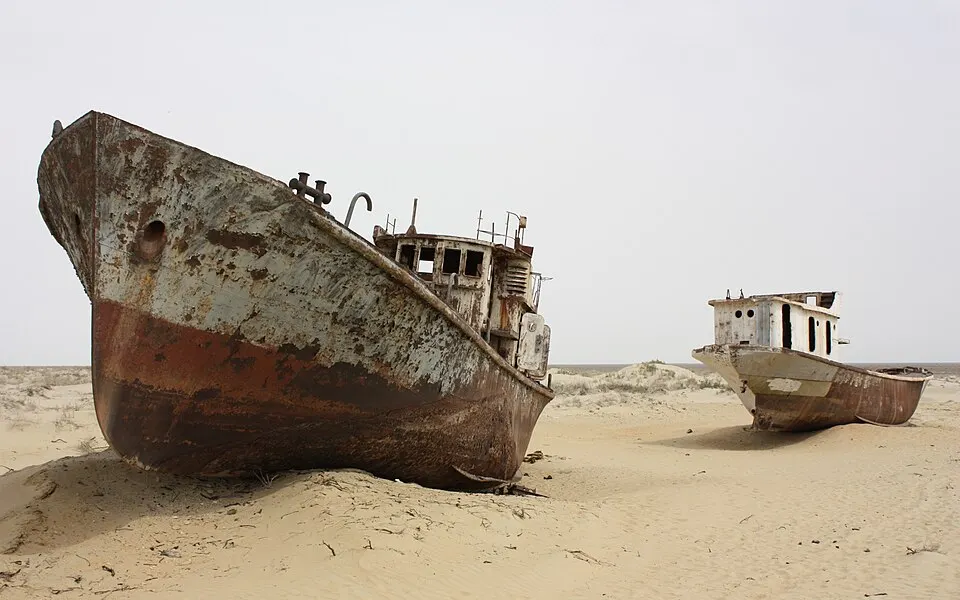
Aral Sea
Full in 1960; shrinking since the 1960s · Kazakhstan and Uzbekistan
Year-by-year satellite pictures
In 1960 the Aral Sea was the fourth-largest lake on Earth, about 68,000 km² of salty water with fishing ports on its shore.
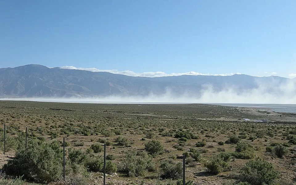
Owens Lake
Dried by 1926 · Owens Valley, California, USA
Owens Lake was a salty lake of about 280 km² at the foot of the Sierra Nevada, with steamboats on it in the 1870s.
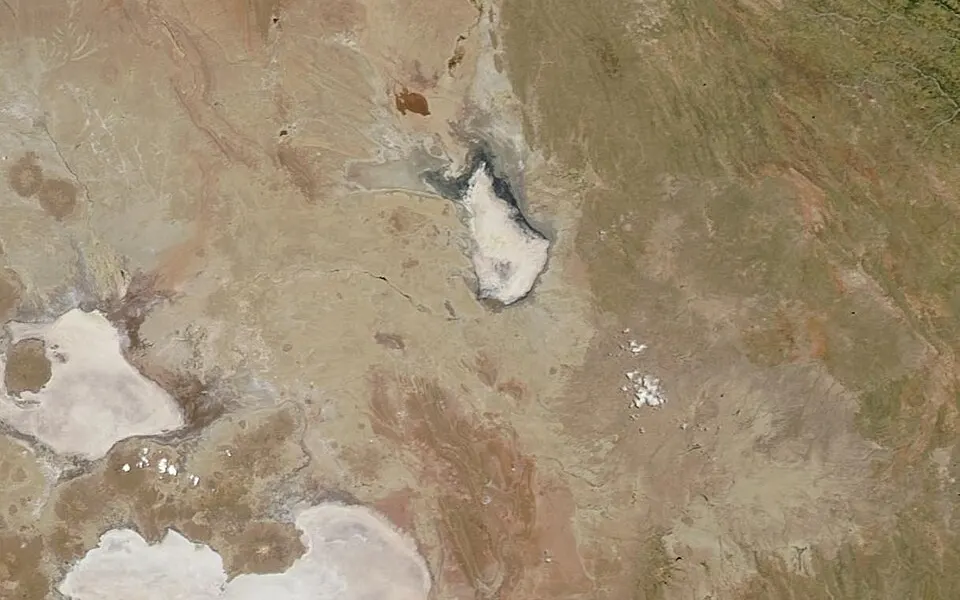
Lake Poopó
Declared dry at the end of 2015 · The Altiplano of Bolivia
Went from a lake to a dry bed in about two years, 2013 to 2015Year-by-year satellite pictures
Lake Poopó was Bolivia’s second-largest lake, but very shallow: a few metres deep over a wide area, so small changes in rainfall changed its size a great deal.
Lake Texcoco
Drained from the 1600s onwards · The Valley of Mexico, where Mexico City stands
The Aztec capital Tenochtitlán was built from about 1325 on an island in this shallow, salty lake, with causeways to the shore and farmland on floating gardens.
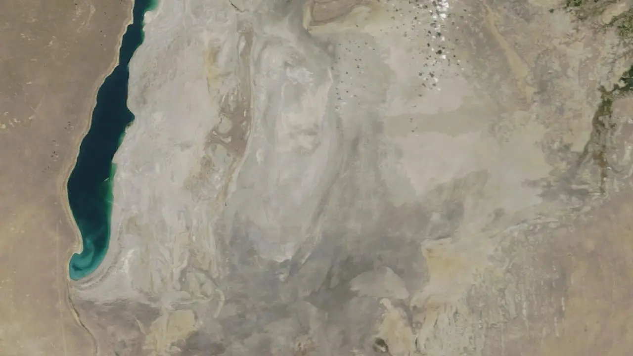
Eastern Aral Sea basin
Dried completely in 2014 · Uzbekistan and Kazakhstan
Year-by-year satellite pictures
The southern Aral Sea split in two, and its eastern half was shallow.
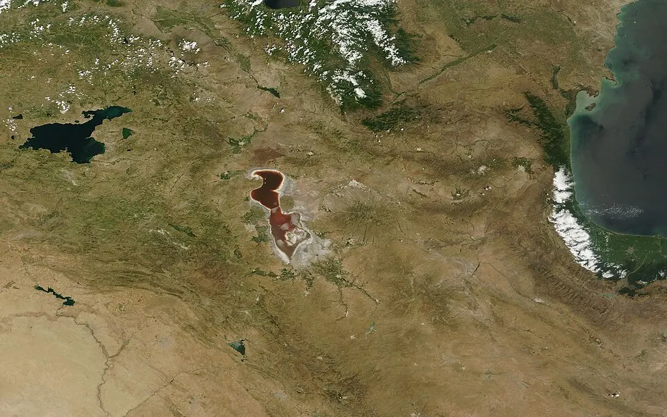
Lake Urmia
Shrinking since the 1990s · North-west Iran
Year-by-year satellite pictures
Lake Urmia was one of the largest salt lakes in the world.
Tulare Lake
Drained by farming by the early 1900s; came back in 2023 · The San Joaquin Valley, California, USA
Came back in a few weeks in 2023 after record snowmelt and stormsYear-by-year satellite pictures
Tulare Lake was once the largest freshwater lake west of the Mississippi, fed by the Kings, Kaweah, Tule and Kern rivers.
Lake Peigneur
20 November 1980 · Louisiana, USA
Drained in a few hours, then refilled within about two days
Lake Peigneur was a shallow freshwater lake above a salt mine.
Lake Merzbacher
Empties most summers · The Inylchek glacier, Tien Shan, Kyrgyzstan
Fills each spring and empties within days in most summers
Lake Merzbacher is held in a valley by the ice of the Inylchek glacier.
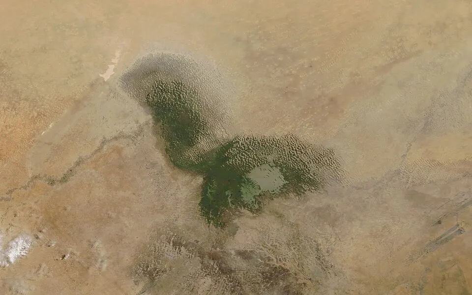
Mega-Chad and Lake Chad
Huge until about 5,000 years ago; small and changing since · Chad, Niger, Nigeria and Cameroon
Year-by-year satellite pictures
Between about 11,000 and 5,000 years ago the Sahara was green: monsoon rains reached far north, and a vast lake, called Mega-Chad, covered a region of roughly 350,000 km² or more across today’s Chad and Niger, larger than any lake on Earth today.
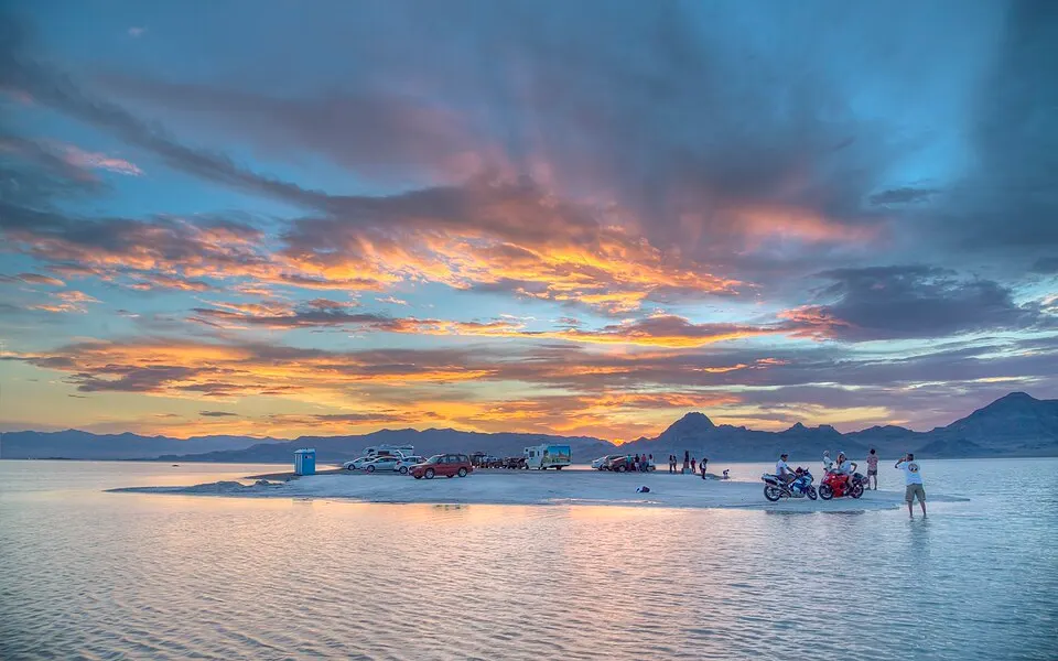
Lake Bonneville
About 30,000 to 13,000 years ago · Utah, with parts of Nevada and Idaho, USA
As the Ice Age ended, rain and melting ice filled the closed basin of the Great Basin until a lake of around 50,000 km² and up to about 300 metres deep lay over most of western Utah.
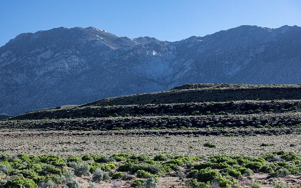
Lake Lahontan
About 30,000 to 12,000 years ago · Nevada, with parts of California and Oregon, USA
Lake Lahontan filled many connected valleys of northern Nevada with a lake of more than 20,000 km² and over 200 metres deep at its greatest, a sister to Lake Bonneville to the east.
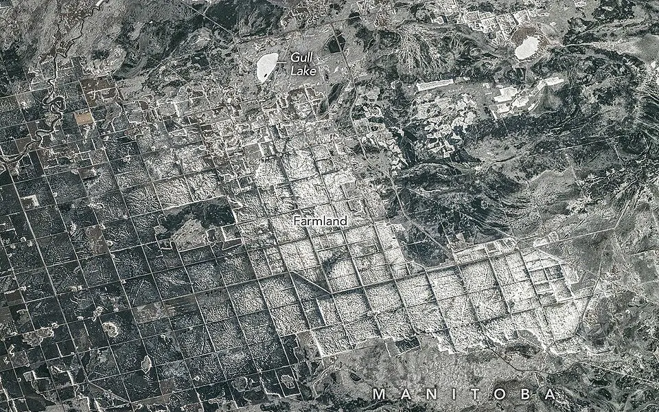
Lake Agassiz
About 13,000 to 8,400 years ago · Manitoba, Saskatchewan, Ontario, Minnesota and North Dakota
Lake Agassiz was the biggest lake of the last Ice Age in North America, formed in front of the retreating ice sheet as meltwater had nowhere to go.
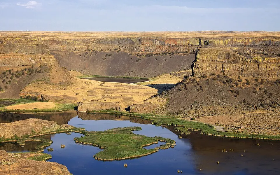
Glacial Lake Missoula
About 15,000 to 13,000 years ago, again and again · Western Montana, USA
Each flood drained the lake in a matter of days
When a lobe of the Cordilleran ice sheet blocked the valley of the Clark Fork river, a lake as large as Lake Erie and Lake Ontario put together (by one common estimate) built up behind the ice dam over the mountains of western Montana.
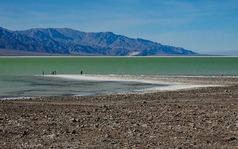
Lake Manly
Deepest 186,000 to 120,000 years ago; smaller lakes until about 10,000 years ago · Death Valley, California, USA
Death Valley, the hottest and driest place in North America, once held a lake more than 100 metres deep and about 150 km long, fed by rivers from the wetter Ice Age Sierra Nevada.
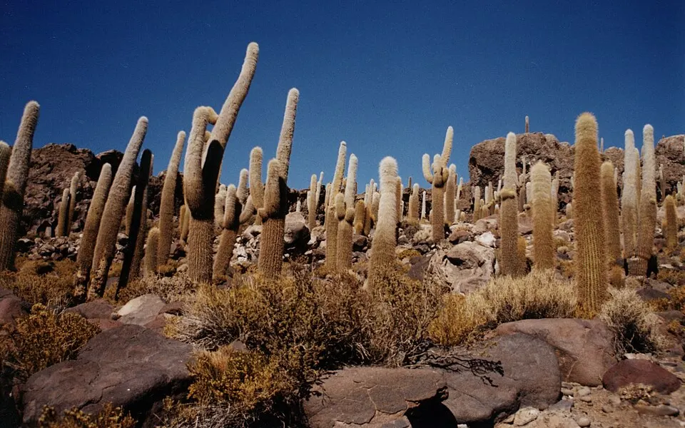
Lake Tauca
About 18,500 to 14,500 years ago · The Altiplano of Bolivia and Peru
High in the Andes, at about 3,700 metres, wetter weather at the end of the last Ice Age filled the Altiplano basin with a lake that covered tens of thousands of square kilometres.
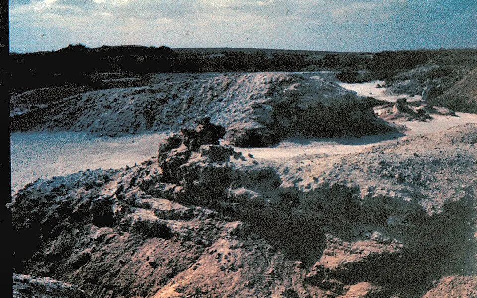
Lake Lisan
About 70,000 to 14,000 years ago · The Jordan Rift: Israel, Jordan and the West Bank
Lake Lisan filled the Jordan Rift valley from near the Sea of Galilee to south of the present Dead Sea, standing more than 200 metres higher than the Dead Sea does today.
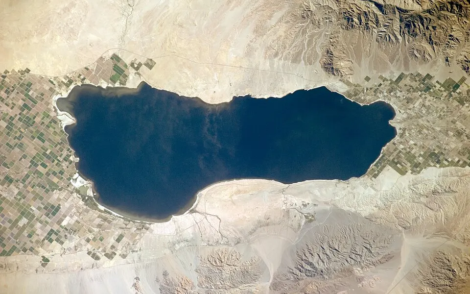
Lake Cahuilla
Filled and dried many times; last dried several centuries ago · The Salton Sink, southern California, USA
Lake Cahuilla formed whenever the Colorado River changed course and flowed north into the Salton Sink instead of south to the Gulf of California.
What the ancient seas left behind
Chalk, fossils and mountain tops that were once sea floor, and one sea floor that was once land.
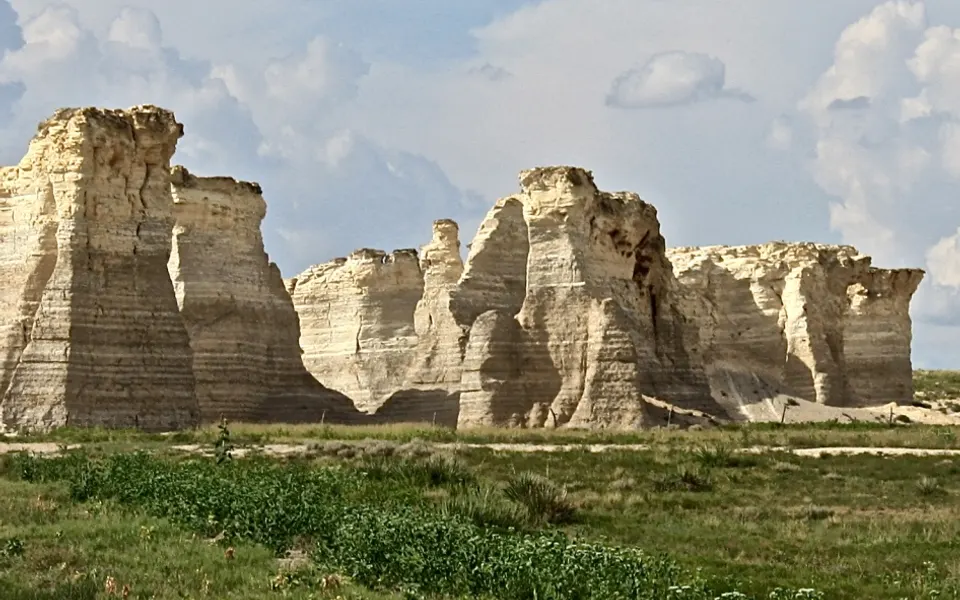
Monument Rocks, western Kansas: chalk that formed on the floor of the Western Interior Seaway. The Western Interior Seaway →Photo: Russ Decker · CC BY-SA 4.0 · Wikimedia Commons 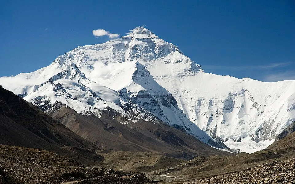
The north face of Mount Everest. The rock at the summit is limestone laid down on a Tethys sea floor. The Tethys Ocean →Photo: Luca Galuzzi (Lucag) · CC BY-SA 2.5 · Wikimedia Commons 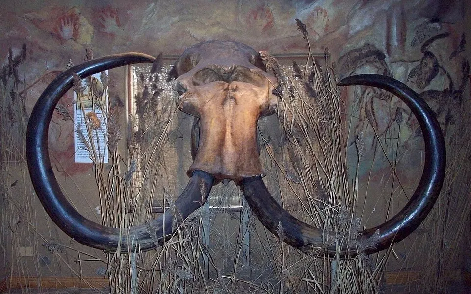
Skull of “Millie”, a woolly mammoth fishermen dredged from the North Sea off Hook of Holland in 1999. Doggerland →Photo: Ogmios · CC BY-SA 3.0 · Wikimedia Commons 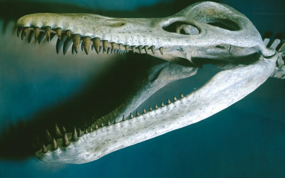
Skull of Kronosaurus, a giant marine reptile of the Eromanga Sea, at the Harvard Museum of Natural History. The Eromanga Sea →Photo: Smart Destinations from Boston, USA · CC BY-SA 2.0 · Wikimedia Commons 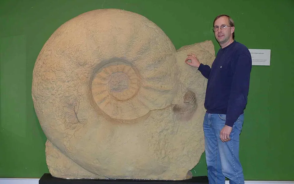
Parapuzosia seppenradensis, the largest ammonite known, about 1.8 m across, from the Late Cretaceous of Germany.Photo: Gunnar Ries · CC BY-SA 3.0 · Wikimedia Commons 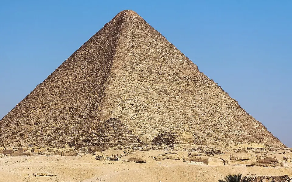
The Great Pyramid of Giza, built largely of limestone packed with nummulites. The Tethys Ocean →Photo: Douwe C. van der Zee · CC BY-SA 4.0 · Wikimedia Commons
Was it under the sea? 48 cities
How many of the maps that reach each city show it under the sea. Tap a row to open the map there.
| City | Under the sea | Most recently |
|---|---|---|
| Budapest, Hungary | 11 of 12 maps | 10 million years ago |
| Tehran, Iran | 66 of 80 maps | 65 million years ago |
| Baku, Azerbaijan | 14 of 17 maps | 5 million years ago |
| Rome, Italy | 60 of 80 maps | 5 million years ago |
| Bangkok, Thailand | 53 of 80 maps | 50 million years ago |
| Calgary, Canada | 53 of 80 maps | 80 million years ago |
| Cairo, Egypt | 47 of 80 maps | 5 million years ago |
| Salt Lake City, United States | 47 of 80 maps | 165 million years ago |
| Mexico City, Mexico | 45 of 80 maps | 70 million years ago |
| Paris, France | 42 of 80 maps | 30 million years ago |
| Delhi, India | 40 of 80 maps | 45 million years ago |
| Bismarck, United States | 39 of 80 maps | 65 million years ago |
| Hannover, Germany | 39 of 80 maps | 25 million years ago |
| Vienna, Austria | 39 of 80 maps | 10 million years ago |
| Warsaw, Poland | 39 of 80 maps | 65 million years ago |
| Dallas, United States | 38 of 80 maps | 65 million years ago |
| Kathmandu, Nepal | 38 of 80 maps | 80 million years ago |
| Casper, Wyoming, United States | 36 of 80 maps | 80 million years ago |
| Regina, Canada | 36 of 80 maps | 80 million years ago |
| Kansas City, United States | 34 of 80 maps | 80 million years ago |
| Berlin, Germany | 33 of 80 maps | 30 million years ago |
| London, United Kingdom | 33 of 80 maps | 50 million years ago |
| Denver, United States | 31 of 80 maps | 80 million years ago |
| Chicago, United States | 30 of 80 maps | 300 million years ago |
| Hays, Kansas, United States | 29 of 80 maps | 80 million years ago |
| Moscow, Russia | 29 of 80 maps | 85 million years ago |
| Madrid, Spain | 27 of 80 maps | 70 million years ago |
| Riyadh, Saudi Arabia | 26 of 80 maps | 80 million years ago |
| Winnipeg, Canada | 25 of 80 maps | 80 million years ago |
| Novosibirsk, Russia | 24 of 80 maps | 140 million years ago |
| Montgomery, Alabama, United States | 18 of 80 maps | 50 million years ago |
| Richmond, Queensland, Australia | 18 of 80 maps | 105 million years ago |
| New York, United States | 17 of 80 maps | 50 million years ago |
| Perth, Australia | 17 of 80 maps | 5 million years ago |
| Beijing, China | 15 of 80 maps | 50 million years ago |
| Alice Springs, Australia | 14 of 80 maps | 445 million years ago |
| Johannesburg, South Africa | 7 of 80 maps | 285 million years ago |
| Almaty, Kazakhstan | 3 of 60 maps | 250 million years ago |
| São Paulo, Brazil | 3 of 80 maps | 285 million years ago |
| Timbuktu, Mali | 2 of 80 maps | 415 million years ago |
| Nairobi, Kenya | 1 of 80 maps | 20 million years ago |
| Amsterdam, Netherlands | Not modelled | Never, in these maps |
| Buenos Aires, Argentina | Not modelled | Never, in these maps |
| Istanbul, Türkiye | Not modelled | Never, in these maps |
| Lagos, Nigeria | Not modelled | Never, in these maps |
| Lima, Peru | Not modelled | Never, in these maps |
| Niamey, Niger | 0 of 80 maps | Never, in these maps |
| Sydney, Australia | Not modelled | Never, in these maps |
How much land was under the sea, age by age
The share of today’s land under the sea in each map, and how many dated marine fossil sites on today’s land fall in its sea. The most was 50% at 385 million years ago; the least 2% at 10.
| Age | Stage | Land under the sea | Fossil check |
|---|---|---|---|
| 535 Ma | Early Cambrian | 33% | 99% |
| 525 Ma | Early Cambrian | 37% | 100% |
| 515 Ma | early Middle Cambrian | 39% | 84% |
| 510 Ma | early Middle Cambrian | 39% | 98% |
| 505 Ma | late Middle Cambrian | 39% | 99% |
| 500 Ma | late Middle Cambrian | 39% | 99% |
| 495 Ma | Late Cambrian | 39% | 95% |
| 490 Ma | Late Cambrian | 38% | 96% |
| 485 Ma | Cambro-Ordovician Boundary | 38% | 94% |
| 480 Ma | Early Ordovician | 42% | 99% |
| 475 Ma | Early Ordovician | 45% | 100% |
| 470 Ma | Early Ordovician | 39% | 96% |
| 465 Ma | Middle Ordovician | 41% | 99% |
| 455 Ma | Late Ordovician | 38% | 98% |
| 450 Ma | Late Ordovician | 41% | 99% |
| 445 Ma | Late Ordovician | 38% | 97% |
| 440 Ma | Early Silurian | 35% | 96% |
| 435 Ma | Early Silurian | 37% | 97% |
| 430 Ma | Middle Silurian | 45% | 93% |
| 425 Ma | Late Silurian | 45% | 97% |
| 420 Ma | Late Silurian | 47% | 96% |
| 415 Ma | Early Devonian | 45% | 98% |
| 410 Ma | Early Devonian | 42% | 91% |
| 400 Ma | Early Devonian | 46% | 99% |
| 390 Ma | Middle Devonian | 43% | 95% |
| 385 Ma | Middle Devonian | 50% | 99% |
| 375 Ma | Late Devonian | 47% | 99% |
| 365 Ma | Late Devonian | 41% | 68% |
| 355 Ma | Early Mississippian | 39% | 95% |
| 340 Ma | Middle Mississippian | 36% | 99% |
| 325 Ma | Late Mississippian | 30% | 95% |
| 320 Ma | Early Pennsylvanian | 26% | 89% |
| 310 Ma | Middle Pennsylvanian | 22% | 89% |
| 305 Ma | Late Pennsylvanian | 27% | 96% |
| 300 Ma | Late Pennsylvanian | 30% | 94% |
| 295 Ma | Early Permian | 28% | 99% |
| 285 Ma | Early Permian | 26% | 87% |
| 275 Ma | Early Permian | 24% | 83% |
| 270 Ma | Middle Permian | 24% | 81% |
| 265 Ma | Middle Permian | 23% | 83% |
| 260 Ma | Middle Permian | 24% | 94% |
| 255 Ma | Late Permian | 19% | 88% |
| 250 Ma | Permo-Triassic Boundary | 18% | 97% |
| 245 Ma | Middle Triassic | 21% | 98% |
| 240 Ma | Middle Triassic | 20% | 97% |
| 230 Ma | Late Triassic | 23% | 97% |
| 220 Ma | Late Triassic | 22% | 99% |
| 205 Ma | Late Triassic | 20% | 84% |
| 200 Ma | Late Triassic | 22% | 94% |
| 195 Ma | Early Jurassic | 16% | 96% |
| 185 Ma | Early Jurassic | 13% | 94% |
| 180 Ma | Early Jurassic | 12% | 88% |
| 170 Ma | Middle Jurassic | 16% | 79% |
| 165 Ma | Middle Jurassic | 20% | 95% |
| 160 Ma | Late Jurassic | 20% | 91% |
| 155 Ma | Late Jurassic | 14% | 68% |
| 150 Ma | Late Jurassic | 12% | 64% |
| 140 Ma | Early Cretaceous | 14% | 80% |
| 135 Ma | Early Cretaceous | 13% | 91% |
| 130 Ma | Early Cretaceous | 14% | 86% |
| 125 Ma | Early Cretaceous | 16% | 69% |
| 120 Ma | Early Cretaceous | 20% | 87% |
| 105 Ma | Early Cretaceous | 19% | 94% |
| 95 Ma | Mid-Cretaceous | 26% | 93% |
| 90 Ma | Mid-Cretaceous | 30% | 90% |
| 85 Ma | Late Cretaceous | 28% | 87% |
| 80 Ma | Late Cretaceous | 33% | 91% |
| 70 Ma | Late Cretaceous | 17% | 89% |
| 65 Ma | KT Boundary | 17% | 90% |
| 60 Ma | Paleocene | 13% | 66% |
| 50 Ma | Early Eocene | 16% | 90% |
| 45 Ma | early Middle Eocene | 8% | 85% |
| 40 Ma | late Middle Eocene | 7% | 88% |
| 35 Ma | Late Eocene | 7% | 85% |
| 30 Ma | Early Oligocene | 4% | 71% |
| 25 Ma | Late Oligocene | 4% | 67% |
| 20 Ma | Early Miocene | 4% | 86% |
| 15 Ma | Middle Miocene | 5% | 83% |
| 10 Ma | middle Late Miocene | 2% | 81% |
| 5 Ma | Pliocene | 5% | 80% |
How the map is made
The coastlines come from PaleoCoastlines, by Ádám Kocsis and Christopher Scotese: maps of land and sea for each stage of the rock record, drawn on Scotese’s PALEOMAP reconstructions of where the continents were and adjusted to match where marine fossils have been found. They are in ancient positions, so this site carries every 0.1° square of today’s map back to its ancient position with the same plate model, and reads whether it was land, shallow sea or deep ocean.
Three limits are worth knowing. Each map shows the greatest flooding of its stage, which can span several million years, so it shows more sea than any single moment had. The coastlines were adjusted with the same fossil database the map checks itself against, so the fossil scores flatter it somewhat. And some crust, such as island arcs and slivers that joined the continents later, is not carried back at all; it shows grey.
For the last Ice Age and the land the sea has taken since, such as Doggerland, the sea level map moves the sea instead. To see the whole Earth in its ancient positions, use the 3D globe of Earth through time.
Questions
- Was my town ever under the sea?
- Quite possibly: 41 of the 48 well-known cities in the table below were under the sea in at least one map. Across the 80 maps here, from 535 to 5 million years ago, between 2% and 50% of today’s land was under the sea. Turn on the map above and tap your town to see each age.
- When was the most land under the sea?
- In these maps, 385 million years ago (Middle Devonian), when about 50% of today’s land was under water. Sea levels in the Paleozoic and the Cretaceous were far higher than today.
- Why is there sea in the middle of continents?
- Sea level has risen and fallen by hundreds of metres over Earth’s history, and continents have sunk and risen. When the sea stood high, it flooded low continental ground and left shallow inland seas such as the Western Interior Seaway of North America and the Zechstein Sea of northern Europe.
- How accurate is this map?
- It follows PaleoCoastlines (Kocsis and Scotese), the coastlines of each geological stage drawn to fit marine fossil finds. In 63 of the 80 maps, 85% or more of dated marine fossil sites on today’s land fall in the shaded sea. Each map shows the greatest flooding of its stage, so it floods more than any single moment did.
- Is the Aral Sea an ancient sea?
- No. It is a modern lake that was drained from the 1960s. It lies where the ancient Paratethys sea once was, and is one of the lakes on our dried-up lakes page, with Lake Bonneville, Lake Agassiz and others.
- What are the orange dots?
- Places where marine fossils of that age have been found, from the Paleobiology Database. A dot means sea animals lived there or their shells were washed there, which is the evidence behind the shading.
Coastlines: Kocsis, Á. T. & Scotese, C. R. (2021), PaleoMAP PaleoCoastlines, doi:10.5281/zenodo.7994000, CC BY 4.0. Plate model: PALEOMAP (Scotese). Fossil sites: Paleobiology Database. See data sources.