
Late Cretaceous
Western Interior Seaway
For much of the Late Cretaceous, a shallow sea ran through the middle of North America, from the Arctic Ocean to the Gulf of Mexico. It split the continent into two land masses and laid down the chalk and shale of the Great Plains. Move the map through time and tap a town to see whether it was under the water.
Blue: today’s land under the sea at some point in that stage (light: shallow, dark: deep). Orange dots: marine fossil sites of the age. Grey: crust the plate model does not carry back that far. Map data: Ancient seas: PaleoCoastlines v7 (Kocsis & Scotese 2021), CC BY 4.0 · Fossils: Paleobiology Database.
Western Interior Seaway in numbers
5.6 million km²
of today’s land in this region under the sea 90 million years ago, the most of any map
4,268
marine fossil sites from its time in the Paleobiology Database, with 27,025 finds
5
maps on this site cover its time, 95 to 70 million years ago
The animals found most often at those sites: Baculites, Inoceramus, Anomia, Turritella, Ptychodus, Squalicorax. By group, the most common finds are clams and oysters, ammonites and other cephalopods, marine reptiles.
Two continents: Laramidia and Appalachia
Sea levels in the Cretaceous were far higher than today, and the ground in front of mountains rising to the west was sinking under their weight. The water spread into that low ground from the north and the south until the two arms met. West of the sea lay a long, narrow land called Laramidia; east of it lay Appalachia.
The two lands kept their animals apart for millions of years. Many of the best-known dinosaurs of the time, such as Tyrannosaurus and Triceratops, come from Laramidia’s side, in today’s Montana, the Dakotas, Wyoming and Alberta.
What lived in it
The seaway was warm and full of life. Mosasaurs, marine lizards that grew to the size of a bus, hunted in it alongside long-necked plesiosaurs, sharks and large bony fish such as Xiphactinus. Pteranodon flew over it. On the sea floor lived giant flat clams (Inoceramus), and coiled and straight-shelled ammonites drifted in the water above.
Many of these fossils come from the Smoky Hill Chalk of western Kansas, which formed from the shells of tiny plankton settling on the sea floor. Its badlands, such as Monument Rocks, are among the richest places on Earth for Cretaceous sea reptiles.
From an old shoreline to cotton fields
At the southern end, the Late Cretaceous sea also covered what is now central Alabama and Mississippi. The chalk it left there weathered into a band of dark, rich soil known as the Black Belt. In the 1800s that soil made the region prime cotton land, worked by enslaved people on large plantations, and the population that history left behind still shapes the area today.
A map linking the old shoreline to modern election results is often shared. The match is a visual one: it reflects that chain of soil, crops and history, not anything the sea did directly, and no study measures it as a single cause.
How it drained away
Towards the end of the Cretaceous the mountains of the west were rising, the land of the interior lifted, and the sea level fell. The seaway shrank and drained southwards, and by around the end of the age of dinosaurs, 66 million years ago, it was almost gone. The maps here show it retreating between 80 and 70 million years ago.
The seaway on maps through time
Maps drawn by geologists and archaeologists. Use the arrows or swipe to move through them.
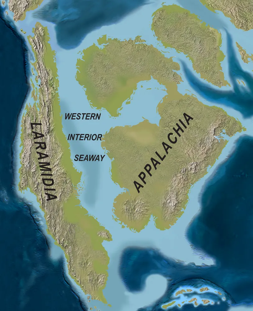
The Western Interior Seaway in the Campanian, about 75 million years ago, with Laramidia to the west.
Picture: Scott D. Sampson, Mark A. Loewen and others · CC BY 4.0 · Wikimedia Commons


What the Western Interior Seaway left behind
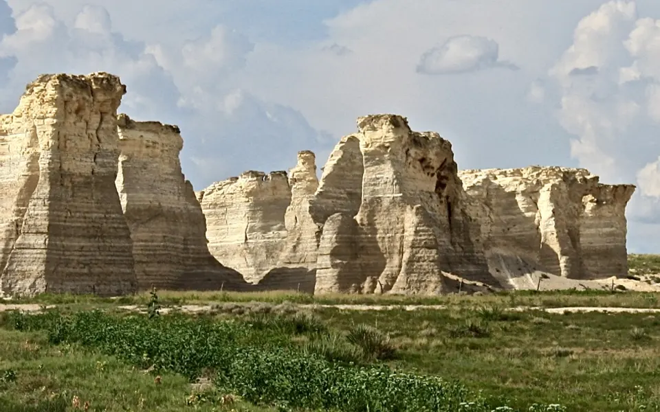
Monument Rocks, western Kansas: chalk that formed on the floor of the Western Interior Seaway.Photo: Russ Decker · CC BY-SA 4.0 · Wikimedia Commons 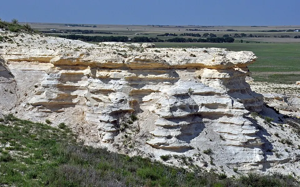
Niobrara chalk badlands near Castle Rock, Gove County, Kansas.Photo: James St. John · CC BY 2.0 · Wikimedia Commons 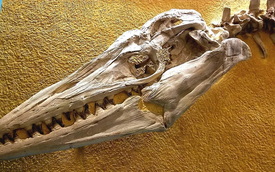
Skull of the mosasaur Tylosaurus proriger at the Sternberg Museum, Kansas.Photo: PeerJ Community · CC BY 4.0 · Wikimedia Commons 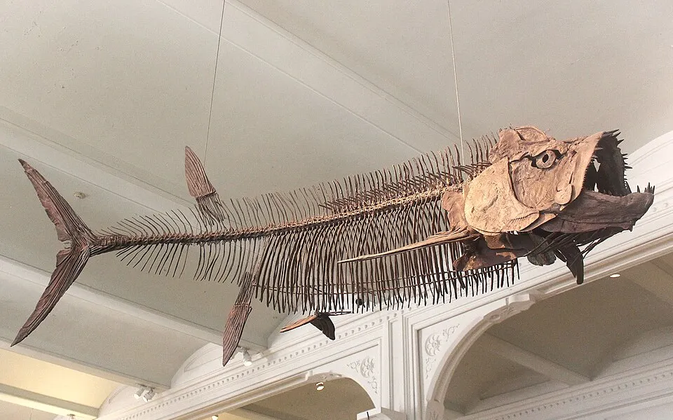
Xiphactinus audax, a big predatory fish of the seaway, at the American Museum of Natural History.Photo: Jonathan Chen · CC BY-SA 4.0 · Wikimedia Commons 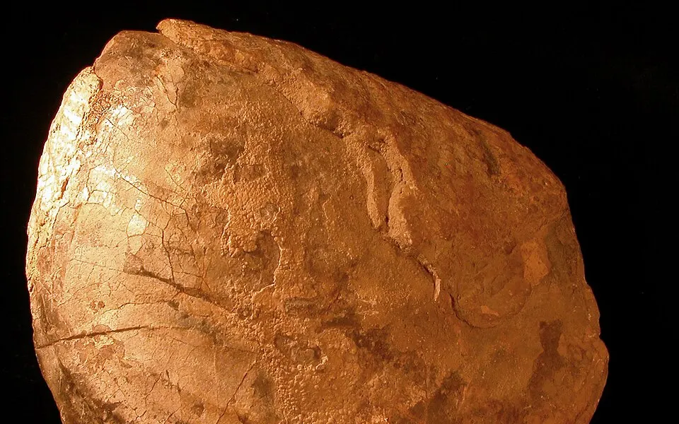
A giant Inoceramus clam from the Cretaceous of South Dakota.Photo: Wilson44691 · Public domain · Wikimedia Commons
Which cities were under it?
Each cell opens the map at that age, with the city tapped.
| City | 95 Ma | 90 Ma | 85 Ma | 80 Ma | 70 Ma |
|---|---|---|---|---|---|
| Bismarck | Sea | Sea | Sea | Sea | Sea |
| Dallas | Sea | Sea | Sea | Sea | Sea |
| Calgary | Sea | Sea | Sea | Sea | Land |
| Casper, Wyoming | Sea | Sea | Sea | Sea | Land |
| Denver | Sea | Sea | Sea | Sea | Land |
| Hays, Kansas | Sea | Sea | Sea | Sea | Land |
| Kansas City | Sea | Sea | Sea | Sea | Land |
| Regina | Sea | Sea | Sea | Sea | Land |
| Winnipeg | Sea | Sea | Sea | Sea | Land |
| Montgomery, Alabama | Land | Land | Sea | Sea | Sea |
| Chicago | Land | Land | Land | Land | Land |
| Salt Lake City | Land | Land | Land | Land | Land |
Questions
- What was the Western Interior Seaway?
- A shallow sea that ran through the middle of North America in the Late Cretaceous, from the Arctic Ocean to the Gulf of Mexico, splitting the continent into two land masses called Laramidia and Appalachia.
- When did the Western Interior Seaway exist?
- Through most of the Late Cretaceous, from roughly 100 million years ago until close to the end of the age of dinosaurs 66 million years ago. Its size changed many times as the sea rose and fell.
- Was Kansas under the sea?
- Yes. Western Kansas lay under the seaway for millions of years, which is why its chalk holds fossils of mosasaurs, plesiosaurs, giant fish and Pteranodon. Tap Kansas on the map above to see each age.
- How deep was the Western Interior Seaway?
- It was a shallow sea: estimates for its deepest parts run to several hundred metres, and much of it was far shallower. On the map it shows in light blue, as a sea on the continental shelf.
See also
Coastlines: PaleoCoastlines v7 by Á. T. Kocsis and C. R. Scotese (CC BY 4.0), carried to today’s map with the PALEOMAP plate model. Fossil sites: Paleobiology Database. See data sources.