
Permian to Miocene
Tethys Ocean
For more than 200 million years an ocean lay between the northern and southern continents, where southern Europe, the Middle East and the Himalaya stand today. As Africa, Arabia and India moved north, it closed, and its sea floor was pushed up into mountains. The Mediterranean is what is left of it.
Blue: today’s land under the sea at some point in that stage (light: shallow, dark: deep). Orange dots: marine fossil sites of the age. Grey: crust the plate model does not carry back that far. Map data: Ancient seas: PaleoCoastlines v7 (Kocsis & Scotese 2021), CC BY 4.0 · Fossils: Paleobiology Database.
Tethys Ocean in numbers
15.6 million km²
of today’s land in this region under the sea 80 million years ago, the most of any map
31,913
marine fossil sites from its time in the Paleobiology Database, with 170,156 finds
39
maps on this site cover its time, 270 to 20 million years ago
The animals found most often at those sites: Lytoceras, Lobothyris, Hildoceras, Bairdia, Gibbirhynchia, Phylloceras. By group, the most common finds are ammonites and other cephalopods, clams and oysters, brachiopods.
Two Tethys oceans
The Austrian geologist Eduard Suess named the Tethys in 1893, after a sea goddess of Greek myth, from the marine rocks he found right across the mountains of Europe and Asia.
Geologists now speak of two. The older Paleo-Tethys opened in the Paleozoic. A string of small continents then broke off the southern supercontinent, Gondwana, and drifted north across it; the ocean that opened behind them is the Neo-Tethys, usually what “Tethys” means. The Paleo-Tethys closed as those pieces reached Asia, in the Triassic and Jurassic.
How it closed
From the Cretaceous on, Africa, Arabia and India moved north towards Eurasia. The Tethys sea floor between them sank into the mantle, and where the continents finally met, their edges crumpled into a belt of mountains: the Alps, the Zagros, the Himalaya and the Tibetan Plateau.
The Mediterranean is the largest remnant left in the west. Around 6 million years ago it was cut off from the Atlantic and largely dried out, leaving thick salt beneath its floor, before the ocean broke back in through the Strait of Gibraltar.
What it left behind
The limestone at the summit of Mount Everest is old sea floor with marine fossils in it, laid down long before the mountain rose. The pyramids of Giza are built largely of limestone packed with coin-shaped fossils called nummulites, single-celled sea creatures of the Tethys.
Much of the oil and gas of the Middle East formed from life that settled on the floors of Tethys seas and was later buried.
The Tethys on maps through time
Maps drawn by geologists and archaeologists. Use the arrows or swipe to move through them.
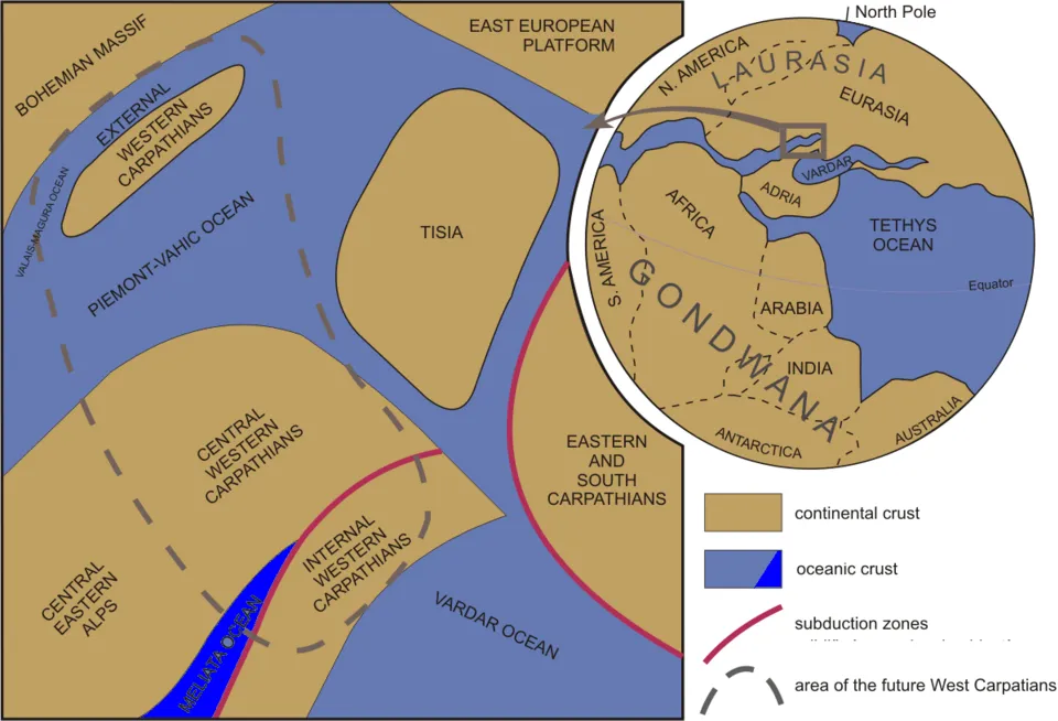
The Northern Hemisphere in the Late Jurassic, about 150 million years ago, with the Tethys Ocean between the continents.
Picture: Ondrej Pelech · CC BY-SA 4.0 · Wikimedia Commons


Where to see the Tethys today
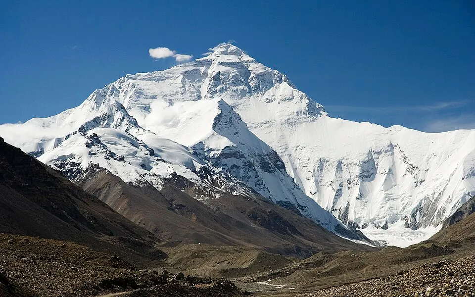
The north face of Mount Everest. The rock at the summit is limestone laid down on a Tethys sea floor.Photo: Luca Galuzzi (Lucag) · CC BY-SA 2.5 · Wikimedia Commons 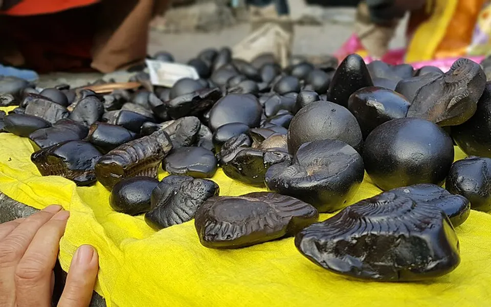
Shaligram stones from the Kali Gandaki, Nepal: ammonite fossils from the Tethys, now high in the Himalaya.Photo: Prajina Khatiwada · CC BY-SA 4.0 · Wikimedia Commons 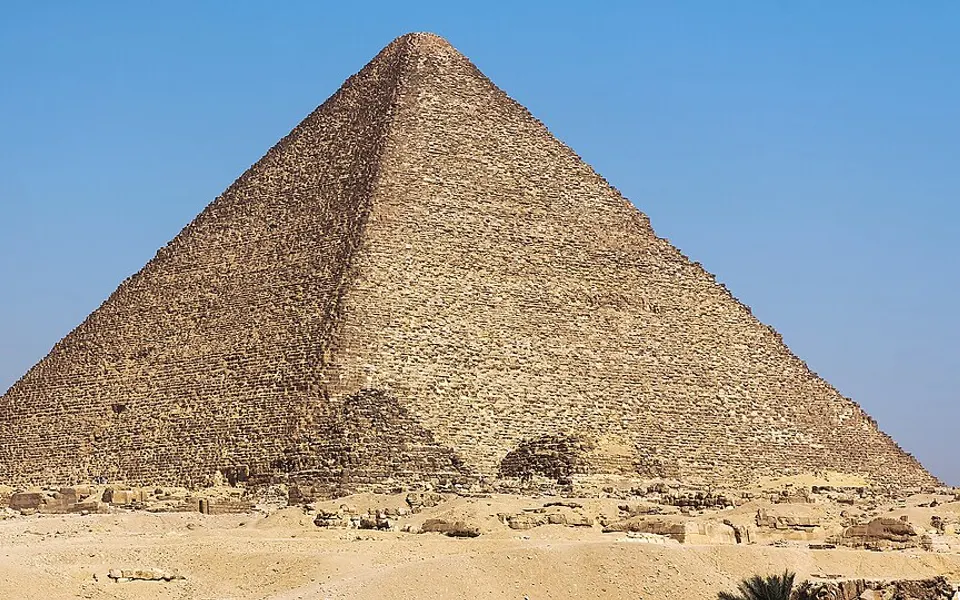
The Great Pyramid of Giza, built largely of limestone packed with nummulites.Photo: Douwe C. van der Zee · CC BY-SA 4.0 · Wikimedia Commons 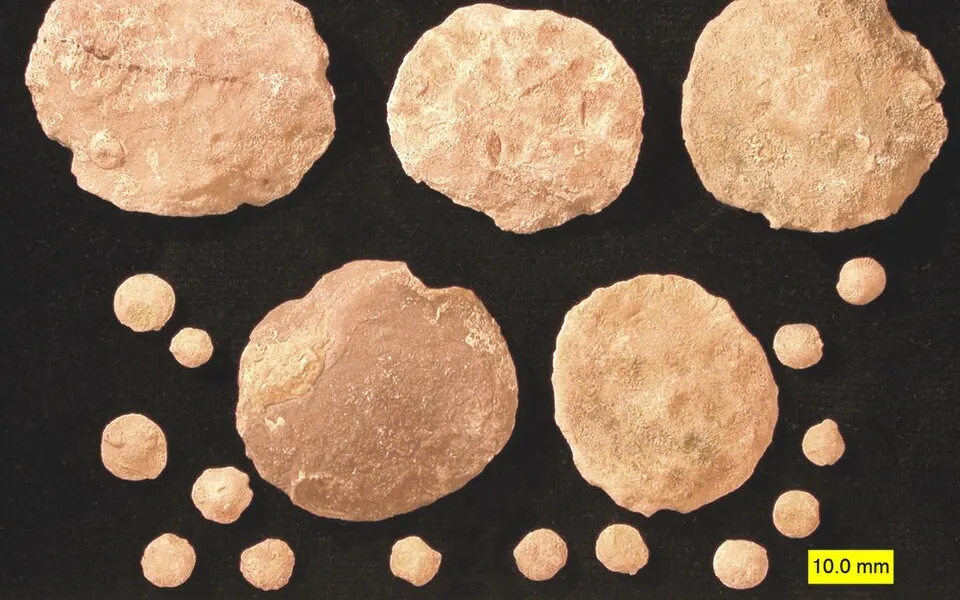
Nummulite fossils from the Eocene, near Al Ain in the United Arab Emirates.Photo: Wilson44691 · Public domain · Wikimedia Commons 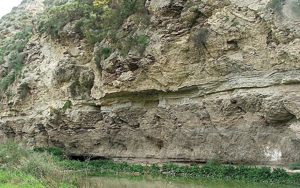
Gypsum in the Sorbas basin, Spain, left when the Mediterranean dried out about 6 million years ago.Photo: Verisimilus · CC BY 3.0 · Wikimedia Commons
Which cities were under it?
Each cell opens the map at that age, with the city tapped.
| City | 255 Ma | 200 Ma | 160 Ma | 90 Ma | 50 Ma | 20 Ma |
|---|---|---|---|---|---|---|
| Berlin | Sea | Sea | Sea | Sea | Sea | Land |
| Cairo | Sea | Sea | Land | Sea | Sea | Sea |
| Hannover | Sea | Sea | Sea | Sea | Sea | Land |
| Rome | Sea | Sea | Sea | Sea | Land | Sea |
| London | Land | Sea | Sea | Sea | Sea | Land |
| Riyadh | Sea | Sea | Sea | Sea | Land | Land |
| Tehran | Sea | Sea | Sea | Sea | Land | Land |
| Baku | – | – | – | Sea | Sea | Sea |
| Delhi | Land | Sea | Sea | Sea | Land | Land |
| Kathmandu | Land | Sea | Sea | Sea | Land | Land |
| Vienna | Land | Land | Sea | Sea | Land | Sea |
| Warsaw | Sea | Land | Sea | Sea | Land | Land |
| Budapest | – | – | – | – | Sea | Sea |
| Paris | Land | Sea | Land | Sea | Land | Land |
| Almaty | Sea | Land | Land | Land | Land | Land |
| Madrid | Land | Land | Sea | Land | Land | Land |
| Amsterdam | – | – | – | – | – | – |
| Istanbul | – | – | – | – | – | – |
| Niamey | Land | Land | Land | Land | Land | Land |
| Timbuktu | Land | Land | Land | Land | Land | Land |
Questions
- What was the Tethys Ocean?
- An ocean that lay between the northern continents (Laurasia) and the southern ones (Gondwana) for much of the last 250 million years, where southern Europe, the Middle East and the Himalaya are today.
- Where is the Tethys Ocean now?
- It closed as Africa, Arabia and India moved north into Eurasia. Its sea floor was pushed into mountains such as the Alps and the Himalaya, and the Mediterranean Sea is its largest remnant.
- Why are there sea fossils on Mount Everest?
- The rock at the summit formed as limestone on an ancient sea floor. When India collided with Asia, that rock was pushed up more than 8 kilometres.
- Who named the Tethys Ocean?
- The Austrian geologist Eduard Suess, in 1893, after Tethys, a sea goddess in Greek myth.
See also
Coastlines: PaleoCoastlines v7 by Á. T. Kocsis and C. R. Scotese (CC BY 4.0), carried to today’s map with the PALEOMAP plate model. Fossil sites: Paleobiology Database. See data sources.