Ancient and Medieval States of Central Europe: Map & History
29 states of Central Europe on one map, from 154 CE to 1546 CE.The largest, House of Habsburg, covered about 561,190 km²; the longest-lived, Kingdom of Hungary, lasted 1000 CE – 1546 CE. Each has its own section below with its rulers, capitals, wars and pictures where the records hold them.
Each state in its own colour. Move the timeline to see which existed in any year from 154 AD to 1546; select a territory to read about it. Borders: Cliopatria / Seshat (CC BY 4.0).
The Ancient and Medieval States of Central Europe Compared
The Burgundians (Latin: Burgundiones or less commonly Burgundii) were a Germanic people of the Roman imperial era, who established the powerful Kingdom of the Burgundians within the Roman empire in what is now western Switzerland and south-eastern France. Burgundian rule of the kingdom ended when it was incorporated into the Frankish empire in 534, but they are the source of later names related to the nearby region now known as Burgundy, including medieval entities such as the Duchy of Burgundy.
Another clause in the Burgundian legal code voids all unresolved Burgundian legal cases before the "Battle of the Mauriac Plains" (also known as the Battle of the Catalaunian Plains) in 451. This battle was a decisive turning point for the Burgundians, as it was also for the Visigoths. During the battle, Burgundians and other barbarian kingdoms from Gaul fought for Rome under Aetius, and put Attila the Hun and his allies to flight. However, the Visigothic king Theodoric I was killed during the battle, and Thorismund his son followed the advice of Aetius not to pursue the Huns. Near contemporary Sidonius Apollinaris reported that other Burgundians also fought on the Hun side, and these may have been Burgundians living east of the Rhine outside Roman control.
The Lombards, Longobards or Langobards (Latin: Langobardi) were a Germanic people who conquered most of the Italian Peninsula between 568 and 774 AD. They had previously settled in the Middle Danube in the 5th century, near what is now Austria, Slovenia and Hungary. Still earlier they lived further north, near present day Hamburg. Roman-era historians in the 1st and 2nd centuries AD mention the Lombards as one of the Suebian peoples, and report them living on the Lower Elbe in the early 1st century. Their legacy is apparent in Lombardy, northern Italy, the region deriving its name from them.
All three of the legendary accounts state that the Langobards were originally called Winnili, and they begin with the Winnili being ruled by two brothers, Ibor and Aio (or Agio), whose mother and advisor is named Gambara.
Read more
The Origo and the History of Paul the Deacon have them first living on an island in the far north which the various manuscripts of these works spell in different ways: Scadan, Scandanan, Scadanan, or Scadinavia. This appears to be an imitation of the 6th-century origin of the Goths written by Jordanes. The 7th-century writer Fredegar similarly says that the Langobardi came from Scathanavia, but only says this is "between the Danube and the Ocean" without calling it an island.
The Codex Gothanus was written later than the other two records, but it appears to preserve some older material.
The diminished Beneventan principality soon lost its independence to the papacy and declined in importance until it fell in the Norman conquest of southern Italy. The Normans, first called in by the Lombards to fight the Byzantines for control of Apulia and Calabria (under the likes of Melus of Bari and Arduin, among others), had become rivals for hegemony in the south. The Salernitan principality experienced a golden age under Guaimar III and Guaimar IV, but under Gisulf II, the principality shrank to insignificance and fell in 1078 to Robert Guiscard, who had married Gisulf's sister Sichelgaita. The Capua principality was hotly contested during the reign of the hated Pandulf IV, the Wolf of the Abruzzi, and, under his son, it fell, almost without contest, to the Norman Richard Drengot (1058).
Unless Cimbrian and Mòcheno represent surviving dialects, the Lombardic language is extinct. It declined beginning in the seventh century, but may have been in scattered use until as late as about the year 1000. Only fragments of the language have survived, the main evidence being individual words quoted in Latin texts. In the absence of Lombardic texts, it is not possible to draw any conclusions about the language's morphology and syntax. The genetic classification of the language depends entirely on phonology. Since there is evidence that Lombardic participated in, and indeed shows some of the earliest evidence for, the High German consonant shift, it is usually classified as an Upper German dialect descended from Elbe Germanic.
Read more
Lombardic fragments are preserved in runic inscriptions.
view from the Devín castle on the village of Devín, Slovakia selftaken on August, 24th, 2003No machine-readable author provided. Murli assumed (based on copyright claims). · CC BY-SA 3.0 · Commons
Samo (c. 600 – c. 658) was the founder and sole ruler of the first recorded unified tribal polity of Slavs, later known as Samo's realm, ruling from 623 until his death in 658. According to Fredegar—the earliest source about Samo and the one from which all later ones derive—he was a Frankish merchant from Sens.
Samo initially established his rule by unifying several Slavic tribes against robber raiders from the nearby Avar polity and initiating an uprising against Avar rule.
814 CE – 910 CE · Capital: Veligrad (possibly Mikulčice, Czech Republic) · 282,459 km²
Great Moravia, or simply Moravia, was the first major state that was predominantly West Slavic to emerge in the area of Central Europe, possibly including territories which are today part of the Czech Republic, Slovakia, Hungary, Austria, Germany, Poland, Romania, Croatia, Serbia, Ukraine and Slovenia. The formations preceding it in these territories were Samo's tribal union (631–658) and the Pannonian Avar state (567–822).
Centered on the Morava River – which gave the realm its name – the core encompassed today’s Moravia in the eastern Czech Republic and adjacent western Slovakia.
The earliest possible reference to Slavic tribes living in the valley of the northern Morava river was made by the Byzantine historian Procopius. He wrote of a group of Germanic Heruli who "passed through the territory of all of the Sclavenes" while moving towards Denmark in 512. Archaeological sites have yielded hand-made ceramics, and closely analogous objects in southern Poland and western Ukraine appeared at the confluence of the northern Morava River and the Middle Danube, dated to around 550.
Read more
Large territories in the Pannonian Basin were conquered after 568 by the nomadic Avars who had arrived from the Eurasian Steppes. The Slavs were forced to pay tribute to the Avars and to participate in their raids against the Byzantine Empire, the Franks and the Lombards.
The nuclei of the Great Moravian settlement structure were well-defended fortified settlements built by the local Slavs both on elevated positions and lowland areas like marshes and river islands. Most Great Moravian castles were rather large hill forts, fortified by wooden palisades, stone walls and in some cases, moats. The typical Great Moravian ramparts combined an outer drystone wall with an internal timber structure filled with earth.The fortifications usually formed several contiguous enclosures, with the elite buildings concentrated in the centre and crafts in the outer enclosures. Most buildings were made of timber, but ecclesiastical buildings and residential dwellings were made of stone. In many cases, prehistoric fortifications were also integrated.
Late Common Slavic (spoken), Old Church Slavonic (liturgical), Latin (religious)
Religion
Orthodox Christianity, Latin Christianity, Slavic paganism
Economy and Trade
The large 9th-century fortresses unearthed at Mikulčice and other places were located in the wider region of the confluence of the rivers Morava and Danube. Two important trade routes crossed this region in this period, the Danube and the ancient Amber Road, implying that these settlements, all lying on rivers, were important centres of commerce. Finds of tools, raw materials and semi-manufactured goods show that quarters inhabited by craftsmen also existed in these settlements. The large fortresses were surrounded by a number of small villages where the locals were engaged in agriculture. They cultivated wheat, barley, millet and other cereals, and farmed cattle, pigs, sheep and horse. Their animals were relatively small: for instance, their horses were not larger than modern Przewalski horses.
The impact of the mission of Cyril and Methodius extended beyond the religious and political spheres. Old Church Slavonic became the fourth liturgical language of the Christian world. However, after Methodius's death (885) all his followers were expelled from Great Moravia; accordingly, the use of Slavic liturgy in Great Moravia lasted only about 22 years. Its late form remains the liturgical language of the Ukrainian, Russian, Bulgarian, Macedonian, Serbian and Polish Orthodox Churches. Cyril also invented the Glagolitic alphabet, suitable for Slavic languages, and first translated the Bible into a Slavic language, along with Methodius, who later completed the project.
Read more
Methodius wrote the first Slavic legal code, combining local customary law with advanced Byzantine law.
Svatopluk—"a man most prudent among his people and very cunning by nature", according to Regino of Prüm—died in the summer of 894. He was succeeded by his son, Mojmir II, but his empire shortly disintegrated, because the tribes subjugated to Svatopluk's rule by force started to get rid of Moravian supremacy. For instance, the Bohemian dukes (based in the Prague region) accepted King Arnulf's suzerainty in June 895, and Mojmír II attempted to restore his supremacy over them without success in the next two years. On the other hand, he succeeded in restoring the Church organization in Moravia by persuading Pope John IX (r. 898–900) to send his legates to Moravia in 898. The legates in short order installed an archbishop and "three bishops as his suffragans" in Moravia.
Great Moravian centres (e.g., Bratislava (Pozsony, Pressburg), Nitra (Nyitra), Tekov (Bars) and Zemplín (Zemplén)) retained their functions after the fall of Great Moravia, although the identification of Bratislava, Tekov and Zemplín as Great Moravian castles are not generally accepted. Several sources suggest that Hungarian rulers followed the contemporary German or Bulgar patents when they established the new administrative system in their kingdom, or they introduced a new system.
Read more
Social differentiation in Great Moravia reached the state of early feudalism, creating the social basis for development of later medieval states in the region. The question what happened to Great Moravian noble families after 907 is still under debate.
The Principality of Nitra (Slovak: Nitrianske kniežatstvo, Nitriansko, Nitrava, lit. 'Duchy of Nitra, Nitravia, Nitrava') also known as the Duchy of Nitra, was a West Slavic polity encompassing a group of settlements that developed in the 9th century around Nitra, in present-day Slovakia. Its history remains uncertain because of a lack of contemporary sources.
Modern-day Slovakia was dominated for centuries by Germanic peoples, including the Quadi and the Longobards, who were there until the middle of the 6th century. A new material culture characterized by handmade pottery, cremation burials and small, square, sunken huts that typically featured a corner stone oven appeared in the plains along the Middle Danube around that time. The new culture, with its "spartan and egalitarian" nature, sharply differed from the earlier archaeological cultures of Central Europe. According to Barford, a report by the Byzantine historian Procopius is the first certain reference to Early Slav groups inhabiting parts of present-day Slovakia. Procopius wrote that an exiled Lombard prince named Hildigis mustered an army, "taking with him not only those of the Lombards who had followed him, but also many of the Sclaveni" in the 540s.
Vratislaus I of BohemiaUnknown authorUnknown author · Public domain · Commons
The Duchy of Bohemia, also later referred to in English as the Czech Duchy, (Old Czech: Češské kniežěstvie) was a monarchy and a principality of the Holy Roman Empire in Central Europe during the Early and High Middle Ages. It was formed around 870 by Czechs as part of the Great Moravian realm. Bohemia separated from disintegrating Great Moravia after Duke Spytihněv swore fealty to the East Frankish king Arnulf in 895.
The Duchy earned a significant income from the Prague slave trade, trafficking Pagan Slavs, termed as saqaliba, to slavery in al-Andalus in the 10th and 11th centuries.
Read more
Mining of tin and silver began in the Ore mountains in the early 12th century.
Nitra (Slovak pronunciation: [ˈɲitra]; also known by other alternative names) (Hungarian: Nyitra) is a city in southwestern Slovakia, situated at the foot of the Zobor Mountain in the Nitra River Valley about 90 km (56 mi) northeast of the country's capital, Bratislava. With a population of about 78,353, it is the fifth-largest city in Slovakia. Nitra stands on varied terrain, which features both rolling hills and vast plains, particularly to the south. Nitra is one of the oldest cities in Slovakia. It was the center of the Principality of Nitra, a duchy of great historic significance.
The city is governed by mayor (Slovak: primátor) and the city council (Slovak: mestské zastupiteľstvo). The mayor is the head of the city and its chief executive. The term of office is four years. The current mayor is Marek Hattas. The city council is the legislative body, with 31 council members.
Read more
The city is divided into 13 urban districts (boroughs): Dolné Krškany, Horné Krškany, Staré Mesto, Čermáň, Klokočina, Diely, Párovské Háje, Kynek, Mlynárce, Zobor, Dražovce, Chrenová, and Janíkovce.
GDP per capita in 2008 for the whole Nitra region was €10,508, which was below Slovakia's average (€12,395).
Read more
Nitra's enterprises were a brewery, a grain mill, food processing plants, and other food-related industries. In the new free trade economy after 1989, and after entering the European Union and the Euro currency club, only the wine bottling plant is left. Out of the factories started under the communist regime, 1948–1989, the plastic processing plant is still doing well. The most prevalent industries are electronics and car parts, concentrated in the new business park.
The flight operator Aero Slovakia has its head office on the grounds of Nitra Airport.
Coat of Arms of NitraUnknown author · Public domain · Commons
Achievements and Monuments
Nitra is home to several museums and galleries. The Museum of the Nitra Region supervises a collection of objects in several fields (Archaeology, Ethnography, Numismatics, Geology, and Zoology). Since 1993, it has also had an exhibition of the most precious artifacts discovered by the Archeological Institute in Nitra. The exhibition contains more than 2,200 gold, silver, and other objects, among them golden-plated plaques from (pre-)Great Moravian hillfort Bojná. The Diocesan Museum of the Nitra Diocese on the Nitra Castle exhibits the facsimile of documents and archaeological discoveries closely connected to the origin of Christianity in Slovakia, including the oldest manuscript from the territory of Slovakia (the Nitra Gospel Book, 1083). Open-air museum "Osada Lupka" is a reconstruction of a Slavic village from the early Middle Ages.
The Grand Principality of Hungary or Duchy of Hungary (Hungarian: Magyar Nagyfejedelemség: "Hungarian Grand Principality", Byzantine Greek: Τουρκία (Tourkia)) was the earliest documented Hungarian state in the Carpathian Basin, established around 895, following the 9th century Magyar invasion of the Carpathian Basin. The Hungarians took possession of the Carpathian Basin in a pre-planned manner, with a long move-in between 862–895.
On the eve of the arrival of the Hungarians (Magyars), around 895, East Francia, the First Bulgarian Empire and Great Moravia ruled the territory of the Carpathian Basin. The Hungarians had much knowledge about this region because they were frequently hired as mercenaries by the surrounding polities and had led their own campaigns in this area for decades. This area had been sparsely populated since Charlemagne's destruction of the Avar state in 803, and the Magyars were able to move in peacefully and virtually unopposed during the 9th century. The first mention of them living in the region dates back to 862. The conquest proper started from 894, when armed conflicts opened with the Bulgarians and Moravians after the requests for help from Arnulf, Frankish king and Leo VI, Byzantine emperor.
Until 907 (or 904), the Hungarian state was under joint rule (perhaps adopted from the Khazars). The kingship had been divided between the sacral king (some sources report the titles "prince" or "khan"), or Kende, and the military leader, or gyula. It is not known which of the two roles were assigned to Árpád and which to Kurszán. Possibly, after the Kende Kurszán's death, this division ceased and Árpád became the sole ruler of the principality. The Byzantine Constantine Porphyrogennetos called Árpád "ho megas Tourkias archon" (the great prince of Tourkia), and all of the 10th-century princes who ruled the country held this title. According to the Agnatic seniority the oldest members of the ruling clan inherited the principality.
Coat of Arms of Hungary (895-1000)Oppashi · CC0 · Commons
Wars and Battles
The principality as a warrior state, with a new-found military might, conducted vigorous raids ranging widely from Constantinople to central Spain. Three major Frankish imperial armies were defeated decisively by the Hungarians between 907 and 910.
Read more
The Hungarians succeeded in extending the de jure Bavarian-Hungarian border to the River Enns (until 955), after the Battle of Pressburg in 907, a western army did not attack Hungary for more than 100 years until 1030. The intermittent Hungarian campaigns lasted until 970, but two military defeats in 955 (Lechfeld) and 970 (Arcadiopolis) marked a shift in the evolution of the Hungarian principality.
962 CE – 1449 CE · Capital: Gniezno (until 1038) Kraków (until 1793) Warsaw (until 1795) · 424,991 km²
Władysław I ŁokietekJan Matejko · Public domain · Commons
The Kingdom of Poland (Polish: Królestwo Polskie; Latin: Regnum Poloniae) was a state in Central Europe during the medieval and early modern periods from 1025 until 1795.
In 1025, Bolesław I the Brave of the Piast dynasty was crowned the first King of Poland at Gniezno Cathedral, elevating Poland from a duchy to a kingdom with the approval of Pope John XIX. Following the death of Bolesław, his son Mieszko II Lambert inherited the crown and a vast territory after his father, which included Greater Poland (with Mazovia), Lesser Poland, Silesia, Pomerania, Lusatia, Moravia, Red Ruthenia, and Upper Hungary. However, in 1031, he was forced to renounce the title and flee the country when a series of peasant uprisings broke out in what became known as the pagan reaction, and Yaroslav I the Wise, the Grand Prince of Kiev, invaded the country from the east while Mieszko II was in Lusatia fighting the Holy Roman Emperor, Conrad II. Yaroslav I installed his ally, the half-brother of Mieszko II, Duke Bezprym, as the ruler of Poland.
1000 CE – 1546 CE · Capital: Budapest, Historical capitals: · 466,309 km²
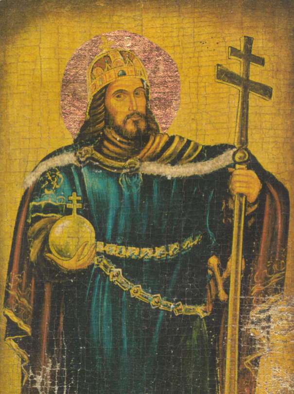
Saint StefanUnknown authorUnknown author · Public domain · Commons
The Kingdom of Hungary was a monarchy in Central Europe that existed for nearly a millennium, from 1000 to 1946. The Catholic kingdom emerged as a continuation of the Grand Principality of Hungary upon the coronation of the first king Stephen I at Esztergom around 1000; his family (the Árpád dynasty) led the monarchy for 300 years. By the 12th century, the kingdom had become a European power.
The Hungarians, led by Árpád (who might have been either their sacred ruler known as a kende or their military leader known as a gyula), settled the Carpathian Basin in 895 and established the Principality of Hungary (896–1000). The Hungarians led several successful incursions to Western Europe, until they were stopped by Otto I, Holy Roman Emperor in Battle of Lechfeld.
Flag of the Habsburg MonarchyThrashedParanoid and Peregrine981. · Public domain · Commons
Coat of arms of Hungary (1915-1918, 1919-1946; angels)József Sebestyén · Public domain · Commons
Wars and Battles
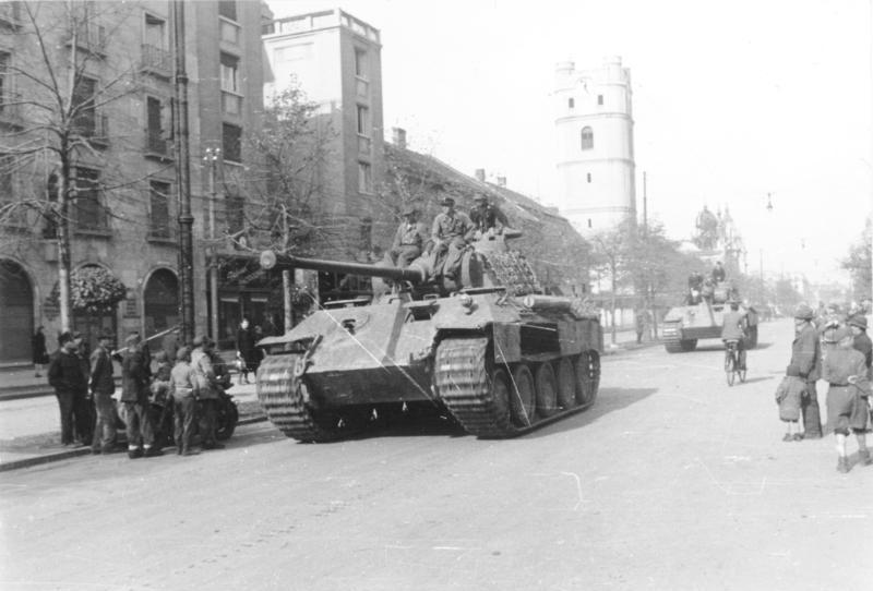
After being granted part of southern Czechoslovakia and Subcarpathia by the Germans and Italians in the First Vienna Award of 1938, and then northern Transylvania in the Second Vienna Award of 1940, Hungary participated in their first military maneuvers on the side of the Axis powers in 1941. Thus, the Hungarian army was part of the invasion of Yugoslavia, gaining some more territory and joining the Axis powers in the process. On 22 June 1941, Germany invaded the Soviet Union in Operation Barbarossa. Hungary joined the German effort and declared war on the Soviet Union on 26 June, and entered World War II on the side of the Axis. In late 1941, the Hungarian troops on the Eastern Front experienced success at the Battle of Uman.
The last will and testament of the Piast duke Bolesław III Wrymouth of Poland, established rules for governance of the Polish kingdom by his four surviving sons after his death. By issuing it, Bolesław planned to guarantee that his heirs would not fight among themselves, and would preserve the unity of his lands under the Piast dynasty. However, soon after his death his sons fought each other, and Poland entered a period of fragmentation lasting about 200 years.
Widok na Ratusz i Stare Miasto w Poznaniu z nietypowej perspektywy.Stanisław Szewczyk · CC BY 3.0 · Commons
The Duchy of Greater Poland was a district principality that encompassed much of the historical region of Greater Poland, with a territory roughly corresponding to the present-day Greater Poland Voivodeship in west-central Poland. It emerged in the 12th century following the 1138 testament of Bolesław III Wrymouth, which divided the previously unified Kingdom of Poland into several hereditary duchies, initiating a period of feudal fragmentation. Although nominally part of the Polish realm, the duchy functioned as a semi-autonomous Piast principality, governed independently by its own dukes.
Łęczyca Voivodeship (Polish: Województwo łęczyckie) was a unit of administrative division and local government in Poland from the 14th century until the partitions of Poland in 1772–1795. It was part of Greater Poland Province, and its capital was in Łęczyca. The voivodeship had the area of 4,080 square kilometers, divided into three counties. Local sejmiks took place at Łęczyca. The city of Łódź, which until the 19th century was a small town, for centuries belonged to Łęczyca Voivodeship.
POL województwo łęczyckie IRP COAOriginal: Unknown Vector: vector version – Bastianow (Bastian) · Public domain · Commons
Duchy of Masovia
1139 CE – 1351 CE · Capital: Płock, Czersk (from 1262), Warsaw (from 1413) · 166,473 km²
Widok na Wzgórze Tumskie, Stare Miasto i rzekę Wisłę w PłockuAquarius 24 · CC BY-SA 4.0 · Commons
The Duchy of Masovia was a district principality and a fiefdom of the Kingdom of Poland, existing during the Middle Ages. The state was centered in Mazovia in the northeastern Kingdom of Poland, and during its existence, its capital was located in Płock, Czersk and Warsaw. It was formed in 1138 from the territories of the Kingdom of Poland, following its fragmentation, that was started by the testament of Bolesław III Wrymouth.
The Duchy of Sandomierz was a district principality and a fiefdom of the Kingdom of Poland. It was formed in 1138 from the territories of the Kingdom of Poland, following its fragmentation, that was started by the testament of Bolesław III Wrymouth. The Duchy existed until 1320 when it was incorporated into the Kingdom of Poland. Its capital was the city of Sandomierz. The territory was centred around Sandomierz Land in the southeastern corner of Poland, between the rivers of Pilica, Vistula, San, and Dunajec.
1139 CE – 1304 CE · Capital: Wrocław · 121,796 km²
Sil0new testament01Free Library of Philadelphia · Public domain · Commons
The Duchy of Silesia (Polish: Księstwo Śląskie, German: Herzogtum Schlesien, Czech: Slezské knížectví, Silesian: Ślōnski firsztyntōm) with its capital at Wrocław was a medieval provincial duchy of Poland located in the region of Silesia.
Soon after it was formed under the Piast dynasty in 1138, it fragmented into various Silesian duchies. In 1327, the remaining Duchy of Wrocław as well as most other duchies ruled by the Silesian Piasts passed under the suzerainty of the Kingdom of Bohemia as the Duchies of Silesia.
1139 CE – 1187 CE · Capital: in Poland: Gdańsk, Szczecin, in Germany: Greifswald, Stralsund · 29,329 km²
Bay of Puck in the evening, view from pier in Puck, westwards, Baltic Sea, Poland, summer of 2006 Zatoka Pucka wieczorem, zdjęcie z molo w Pucku, po prawej widać elektrownie wiatrowe, lato 2006 Autor: KrzysztofNo machine-readable author provided. Krzysztof assumed (based on copyright claims). · CC BY-SA 3.0 · Commons
Pomerania (Polish: Pomorze [pɔˈmɔʐɛ]; German: Pommern [ˈpɔmɐn]; Kashubian: Pòmòrskô; Swedish: Pommern) is a historical region on the southern shore of the Baltic Sea in Central Europe, split between Poland and Germany. The central and eastern part belongs to the West Pomeranian, Pomeranian and Kuyavian-Pomeranian voivodeships of Poland, while the western part belongs to the German states of Mecklenburg-Western Pomerania and Brandenburg.
Settlement in the area called Pomerania for the last 1,000 years started by the end of the Vistula Glacial Stage, some 13,000 years ago. Archeological traces have been found of various cultures during the Stone and Bronze Age, Baltic peoples, Germanic peoples and Veneti during the Iron Age and, in the Dark Ages, West Slavic tribes and Vikings. Starting in the 10th century, early Polish rulers subdued the region, successfully integrating the eastern part with Poland, while the western part fell under the suzerainty of Denmark and the Holy Roman Empire in the late 12th century. Gdańsk, established during the reign of Mieszko I of Poland, has since become Poland's main port (apart from periods of Poland losing control over the region).
The German part of Western Pomerania is inhabited by German Pomeranians. In other parts, Poles are the dominant ethnic group since the territorial changes of Poland after World War II, and the resulting Polonization. Kashubians, descendants of the medieval West Slavic Pomeranians, are numerous in rural Pomerelia.
Read more
German Hither Pomerania had a population of about 470,000 in 2012 (districts of Vorpommern-Rügen and Vorpommern-Greifswald combined) – while the Polish districts of Hither Pomerania had a population of about 580,000 in 2012 (Szczecin and Świnoujście cities with powiat rights, Police County, as well as Goleniów Wolin and Międzyzdroje gminas combined). So overall, about 1.15 million people live in the historical region of Hither Pomerania today, while the Szczecin metropolitan area reaches even further.
Agriculture primarily consists of raising livestock, forestry, fishery, and the cultivation of cereals, sugar beets, and potatoes. Industrial food processing is increasingly relevant in the region. Key producing industries are shipyards, mechanical engineering facilities (i.e. renewable energy components), and sugar refineries, along with paper and wood fabricators. Service industries today are an important economical factor in Pomerania, most notably with logistics, information technology, life science, biotechnology, health care, and other high-tech branches often clustering around research facilities of the Pomeranian universities.
Read more
Since the late 19th century, tourism has been an important sector of the economy, primarily in the numerous seaside resorts along the coast.
Wappen PommernUnknown author · Public domain · Commons
Wars and Battles
In September 1939, Germany invaded Poland starting World War II. The first battle of the war, at Westerplatte, was fought in the region. Afterwards the Polish part of Pomerania was annexed by Germany, and made part of the Reichsgau Danzig-West Prussia. The Nazis deported the Pomeranian Jews to a reservation near Lublin. The Polish population suffered heavily during the Nazi oppression; more than 40,000 died in executions, death camps, prisons and forced labour, primarily those who were teachers, businessmen, priests, politicians, former army officers, and civil servants. Thousands of Poles and Kashubians suffered expulsion, their homes taken over by the German military and civil servants, as well as some Baltic Germans resettled there between 1940 and 1943 in accordance with the Lebensraum policy. The Stutthof concentration camp with numerous subcamps was located in the region.
Polish is the dominating language in the Polish part of Pomerania. Kashubian dialects are also spoken by the Kashubians in Pomerelia.
Read more
In the German part of Pomerania, Standard German dominates. The historical German dialects of Pomerania are, however, Low German. The Pomeranian dialects were all part of the East Low German subgroup: Mecklenburgisch-Vorpommersch in the west, Central Pomeranian (Mittelpommersch) in Central Pomerania around Szczecin (then Stettin), and East Pomeranian in the east. The regions east of the Piaśnica river are not considered Pomeranian according to German terminology, but either West Prussian or Pomerelian. Danzig German was hence classified as Low Prussian, like the dialects of East Prussia (Königsberg).
Those parts of Pomerania that remained German after 1945 are almost entirely located in the Mecklenburgisch-Vorpommersch area.
Sil0new testament01Free Library of Philadelphia · Public domain · Commons
The Duchy of Silesia (Polish: Księstwo Śląskie, German: Herzogtum Schlesien, Czech: Slezské knížectví, Silesian: Ślōnski firsztyntōm) with its capital at Wrocław was a medieval provincial duchy of Poland located in the region of Silesia.
Soon after it was formed under the Piast dynasty in 1138, it fragmented into various Silesian duchies. In 1327, the remaining Duchy of Wrocław as well as most other duchies ruled by the Silesian Piasts passed under the suzerainty of the Kingdom of Bohemia as the Duchies of Silesia.
Opole, Układ urbanistyczny w ramach założenia średniowiecznegoSuperGlob · CC BY 3.0 · Commons
The Duchy of Opole (Polish: Księstwo opolskie; Czech: Opolské knížectví; German: Herzogtum Oppeln) was one of the duchies of Silesia ruled by the branch of Polish Piast dynasty, formed during the medieval fragmentation of Poland into provincial duchies. Its capital was Opole in Upper Silesia.
The Duchy of Kuyavia was a district principality in Central Europe, created in the course of the 13th century in the region of modern-day Kuyavia after the inheritance of the Kingdom of Poland in 1138 into partial duchies through the will and testament of Duke Bolesław III Wrymouth.
The Kingdom of Bohemia (Czech: České království), sometimes referenced in English literature as the Czech Kingdom, was a medieval and early modern monarchy in Central Europe. It was the predecessor state of the modern Czech Republic.
The Kingdom of Bohemia was an Imperial State in the Holy Roman Empire. The Bohemian king was a prince-elector of the empire. The kings of Bohemia, besides the region of Bohemia itself, also ruled other lands belonging to the Bohemian Crown, which at various times included Moravia, Silesia, Lusatia, and parts of Saxony, Brandenburg, and Bavaria.
Bohemia was among the first countries in Europe to become industrialized. Mining of tin and silver began in Ore mountains in early 12th century. The German hospes had a major role in the industrial development of the Czech Kingdom. In the late 12th and in the 13th century the Přemyslid rulers promoted the colonisation of certain areas of their lands by German settlers from the adjacent lands of Bavaria, Franconia, Upper Saxony and Austria during the Ostsiedlung migration. The new settlers not only brought their customs and language with them, but also new technical skills and equipment that were adapted within a few decades, especially in agriculture and crafts.
Fernando de Austria, emperador del Sacro Imperio Romano-Germánico.Hans Bocksberger the Elder · Public domain · Commons
In 1740 the Prussian Army conquered Bohemian Silesia in the Silesian Wars and forced Maria Theresa in 1742 to cede the majority of Silesia, except the southernmost area with the duchies of Cieszyn, Krnov and Opava, to Prussia. In 1756 Prussian King Frederick II faced an enemy coalition led by Austria, when Maria Theresa was preparing for war with Prussia to reclaim Silesia. The Prussian army conquered Saxony and in 1757 invaded Bohemia. In the Battle of Prague (1757) they defeated the Habsburgs and subsequently occupied Prague. More than one quarter of Prague was destroyed and the St. Vitus Cathedral suffered heavy damage. In the Battle of Kolín, however, Frederick lost and had to vacate Prague and retreat from Bohemia.
The Duchy of Kalisz was a feudal district duchy in Greater Poland, with its territorial and administrative core in the Kalisz Land — the region surrounding the city of Kalisz. Its capital was Kalisz. The duchy was established in 1177, following the partition of the Duchy of Greater Poland after a rebellion against Mieszko III. Duke Casimir II the Just of the Piast dynasty became its first ruler.
The Duchy of Głogów (Polish: Księstwo głogowskie, Czech: Hlohovské knížectví) or Duchy of Glogau (German: Herzogtum Glogau) was one of the Duchies of Silesia, formed in course of the medieval fragmentation of Poland into smaller provincial duchies. Its capital was Głogów in Lower Silesia. It existed in 1177–1185 and 1251–1506 and was ruled by the Silesian Piasts, followed by John Corvinus and the Jagiellonian dynasty.
Guntram the Richhttp://dl.ub.uni-freiburg.de/diglit/hs497-1/0001/thumbs?sid=d3ea2ba32a9811608d1546e6daad0cf2#current_page · Public domain · Commons
The House of Habsburg (German: Haus Habsburg, lit. 'House of the Hawk's Fortress' [haʊs ˈhaːbsbʊrɡ]), also known as the House of Austria, was one of the most powerful dynasties in the history of Western civilization. They were best known for ruling vast realms throughout Europe and the Americas during the Middle Ages and early modern period, including the Holy Roman Empire, the Habsburg monarchy and Spain.
The house takes its name from Habsburg Castle, a Swabian fortress built in the 1020s in present-day Switzerland by Radbot of Klettgau, who named his fortress Habsburg.
Duchy of Jawor (Polish: Księstwo Jaworskie, German: Herzogtum Jauer, Czech: Javorské knížectví) was one of the duchies of Silesia and medieval Poland established in 1274 as a subdivision of the Duchy of Legnica. It was ruled by the Silesian Piasts, with its capital at Jawor in Lower Silesia.
It was the southwesternmost duchy of Poland at the time, with the exception of the 1281–1286 period, when the more southwestern was the temporarily split off Duchy of Lwówek.
Historische Kommission für Schlesien (Hrsg.): Geschichte Schlesiens, Bd. 1. Sigmaringen 1988, ISBN 3-7995-6341-5, p. 146, 150, 172f., 185f., 211, 221f. and 289.
Read more
Hugo Weczerka: Handbuch der historischen Stätten: Schlesien. Stuttgart, 1977, ISBN 3-520-31601-3, p. 206–210 and 491–496, genealogy on p. 593.
Žáček, Rudolf (2004). Dějiny Slezska v datech [History of Silesia in Dates] (in Czech). Prague: Libri. pp. 420, 446–448. ISBN 80-7277-172-8.
Henry the BeardedJan Matejko · Public domain · Commons
The Duchy of Legnica (Polish: Księstwo Legnickie, Czech: Lehnické knížectví) or Duchy of Liegnitz (German: Herzogtum Liegnitz) was one of the Duchies of Silesia, formed during the fragmentation of Poland into smaller provincial duchies, ruled by a local line of the Piast dynasty between 1248 and 1675. Its capital was Legnica in Lower Silesia.
Legnica Castle had become a residence of the Silesian dukes in 1163 and from 1248 was the seat of a principality in its own right, ruled by the Silesian branch of the Piast dynasty until the extinction of the line in 1675.
After Henry's death his eldest son Bolesław II the Bald followed him as ruler of Lower Silesia until in 1248 his younger brother Henry III the White came of age and claimed his rights of succession. Backed by the nobility of Wrocław, Henry III forced the duke to cede central parts of Lower Silesia to him, while Bolesław himself retired to Legnica. Furthermore, he came into conflict with his younger brother Konrad, who, originally predestined for an ecclesiastical career as Bishop of Passau, also demanded his distributive share and had to be paid off by Bolesław with the newly created Duchy of Głogów in 1251.
Read more
In 1277, the towns of Środa Śląska and Strzegom passed from the Duchy of Wrocław to the Duchy of Legnica.
POL księstwo legnickie COAPoznaniak, orzeł Image:Coat of arms of the Czech Republic.svg · Public domain · Commons
Grand Duchy of Kraków
1279 CE – 1293 CE · Capital: Kraków · 26,864 km²
Panoramic view of Wawel This is a photo of a monument in Poland identified by the ID: A-7 z 28.03.1931.XEvansGambitx · CC BY-SA 4.0 · Commons
The Grand Duchy of Kraków (German: Großherzogtum Krakau; Polish: Wielkie Księstwo Krakowskie) was created after the incorporation of the Free City of Cracow into Austria on 16 November 1846. From 1846 to 1918 the title, Grand Duke of Kraków, was part of the official titulary of the Emperor of Austria.
The Duchy of Bytom (Polish: Księstwo Bytomskie, Czech: Bytomské knížectví, German: Herzogtum Beuthen) was a duchy in Upper Silesia, one of the Silesian duchies of fragmented Piast-ruled Poland. It was established in Upper Silesia about 1281 during the division of the Duchy of Opole and Racibórz among the sons of Duke Władysław Opolski. The duchy's capital was Bytom, formerly part of Lesser Poland until in 1177 the Polish High Duke Casimir II the Just had attached it to the Silesian Duchy of Racibórz.
1285 CE – 1304 CE · Capital: Racibórz (Ratibor) · 3,384 km²
Bei meinem Besuch in Ratibor (August 2004) habe ich auf dem Rynek (Marktplatz) dieses Bild geschossen. Es zeigt die Mariensäule, im Hintergrund die historischen Häuser. GemeinfreiPoppei at German Wikipedia · Public domain · Commons
Duchy of Racibórz (Polish: Księstwo raciborskie, Czech: Ratibořské knížectví, German: Herzogtum Ratibor) was one of the duchies of Silesia, formed during the medieval fragmentation of Poland into provincial duchies. Its capital was Racibórz in Upper Silesia.
POL księstwo raciborskie COAPoznaniak · Public domain · Commons
Ancient and Medieval States of Central Europe: Frequently Asked Questions
Which states existed in Central Europe in this period?
This page maps 29 states of Central Europe founded between 154 CE and 1285 CE: Burgundians, Lombards, Samo's Empire, Great Moravia, Principality of Nitra, Duchy of Bohemia, Nitra, Principality of Hungary, Kingdom of Poland, Kingdom of Hungary, Duchies of Poland, Duchy of Greater Poland and 17 more.
Which was the largest of the Ancient and Medieval States of Central Europe?
House of Habsburg had the largest mapped extent, about 561,190 km².
Which of the Ancient and Medieval States of Central Europe lasted longest?
Kingdom of Hungary lasted longest, 1000 CE – 1546 CE.
↑↓ to navigate↵ to open
12,754 Planetary Entities Indexed
We use Google Analytics cookies to understand which pages are useful. Necessary storage only keeps your theme and this choice on your device. Privacy policy